Mission Catalog
Sfc. Wind Anal.
Syn. Surveillance
Re-Anal. Proj.
Basin-Wide Data
Data Formats
OAR
NOAA Aircraft Operations Center
Site Map
Staff
Data Center
Kontakt
Information
Research Divisions
Paloma 2008 radar data
Airborne radar data
Doppler wind analyses
CAUTION : CLICK LINK BELOW
Important information on Doppler radar data
N43RF by flight leg
tar'd JPEG plots of Doppler winds from .5 km
tar'd JPEG plots of Doppler winds from 3 km
tar'd JPEG plots of vertical profiles of radar data
tar'd ASCII 3D Doppler analyses
zip'd Doppler radials TEXT files
November 07, 2008
N43RF #1
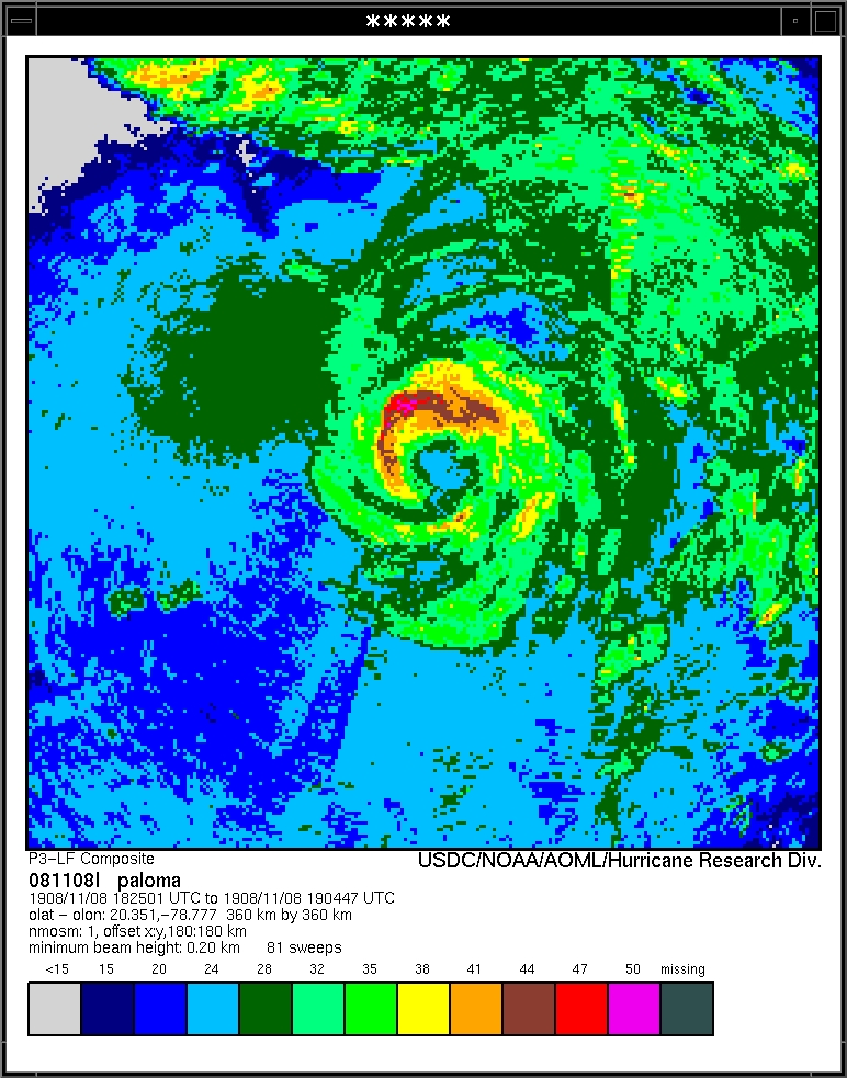
Composite of all legs and dropsondes
Gridded radar data
GrADS control file radar data
Gridded dropsonde data
GrADS control file dropsonde data
GrADS map of dropsonde data
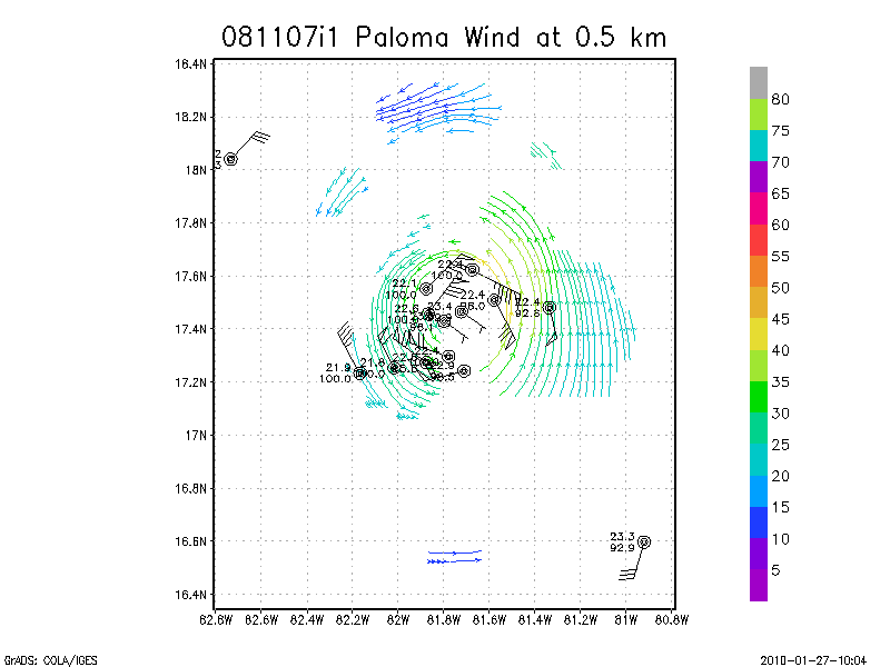
Winds at :
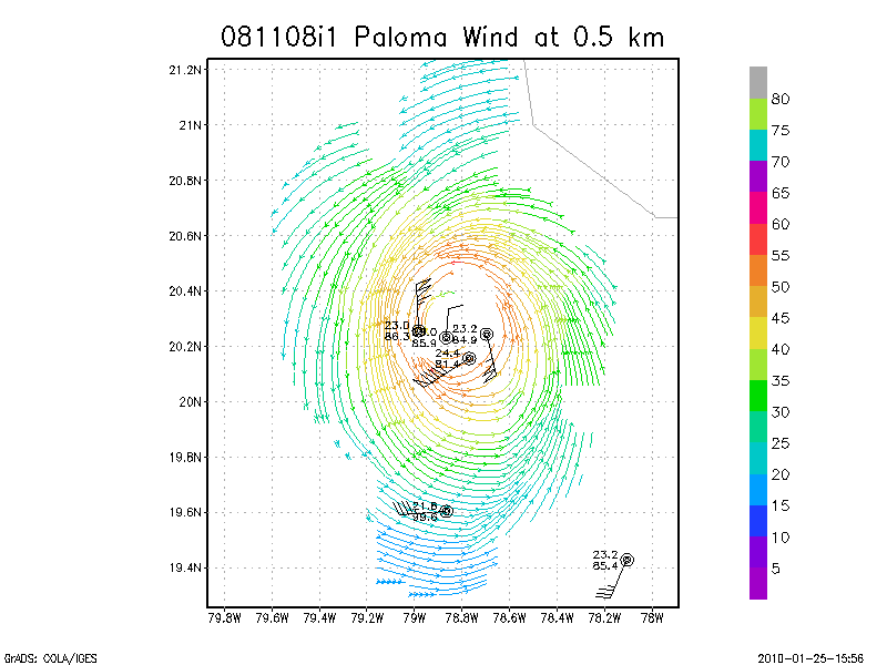
.5 km
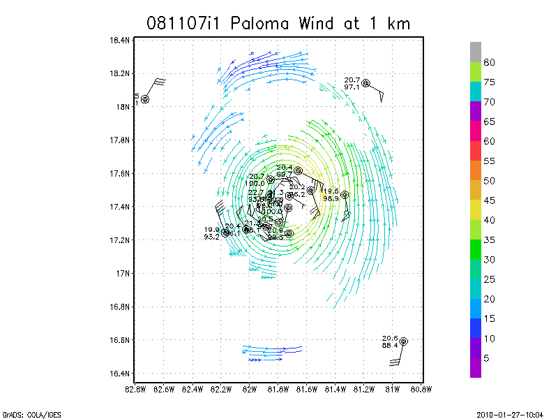
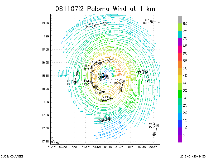
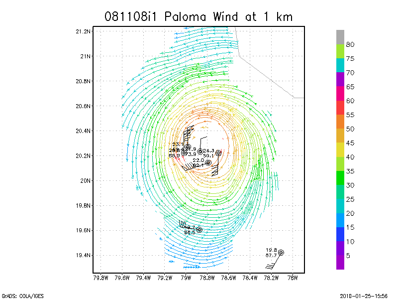
1.0 km
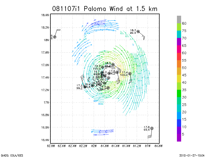
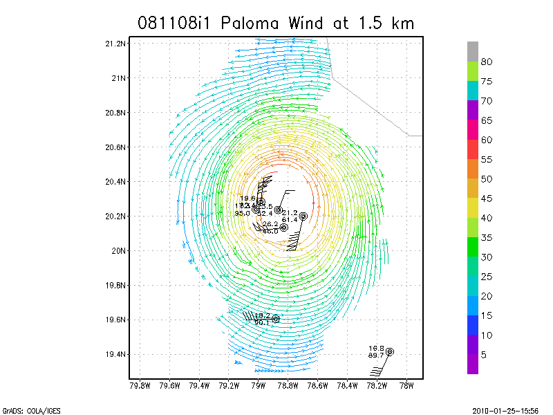
1.5 km
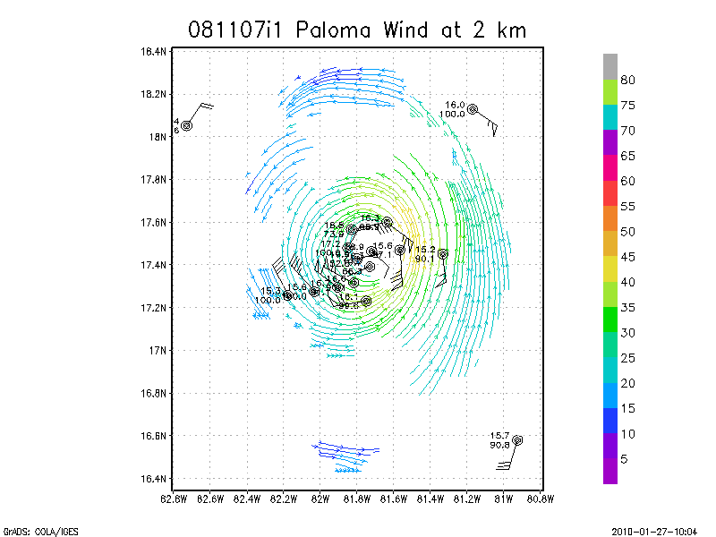
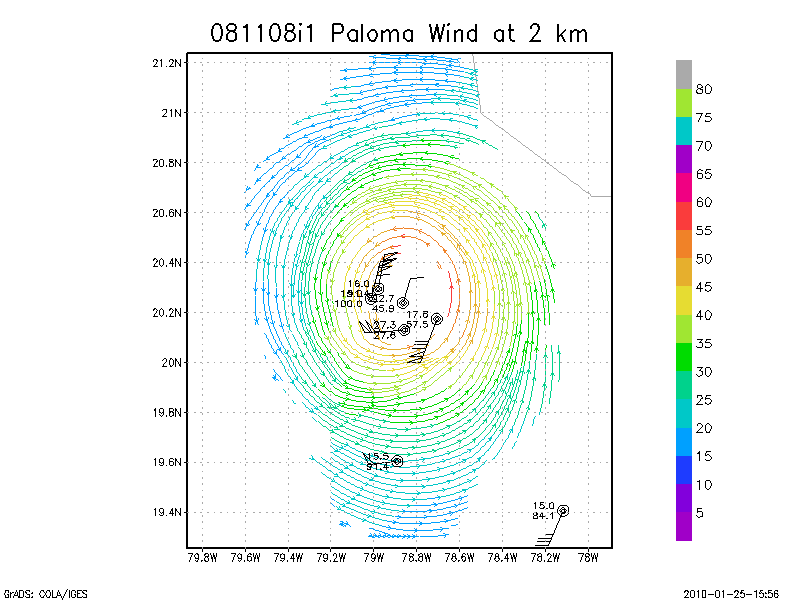
2.0 km
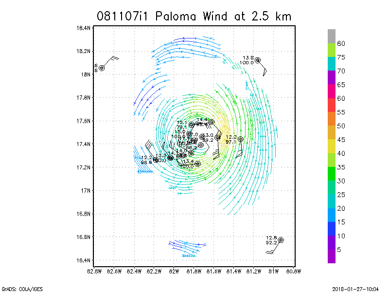
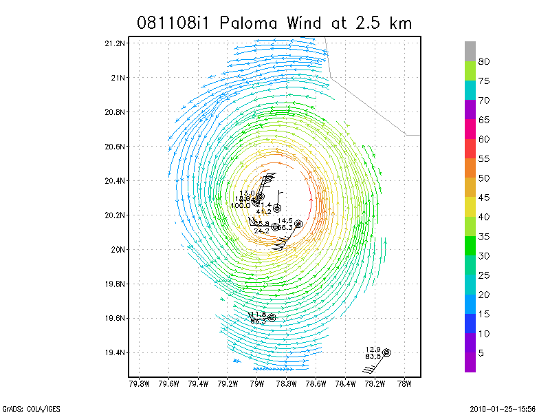
2.5 km
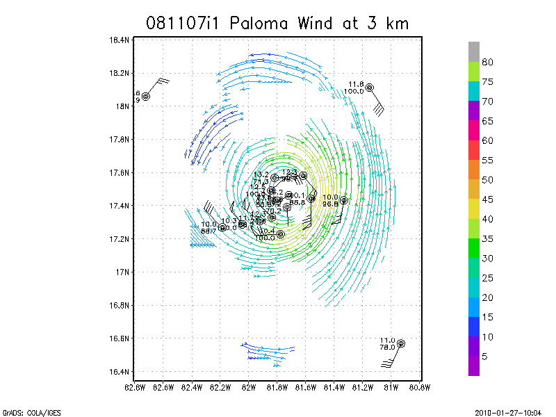
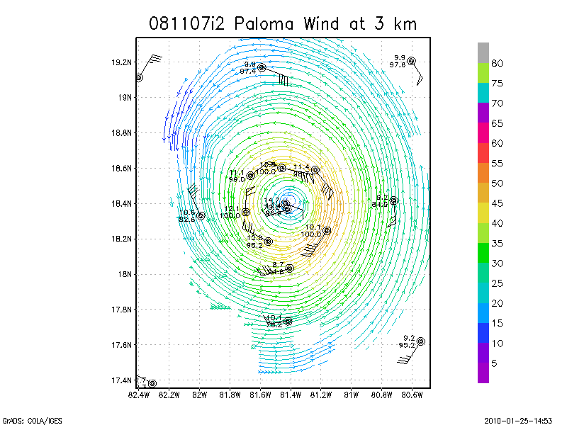
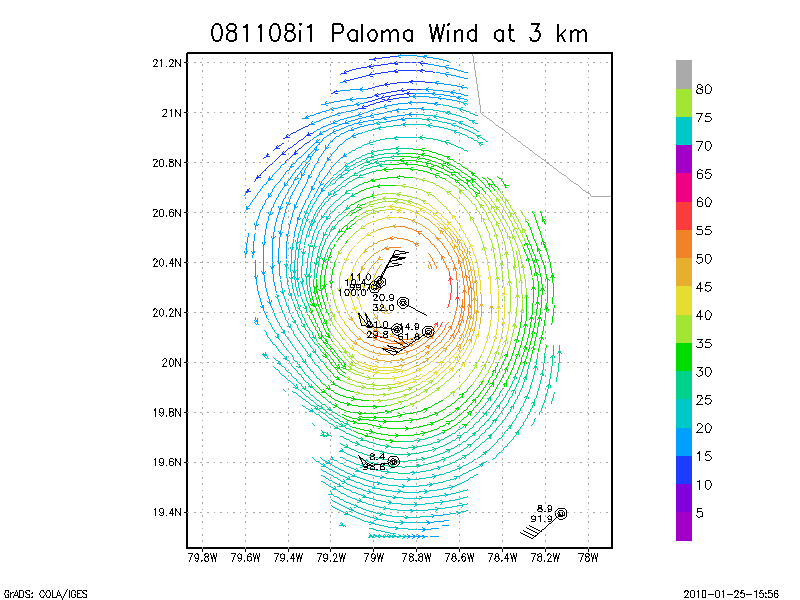
3.0 km
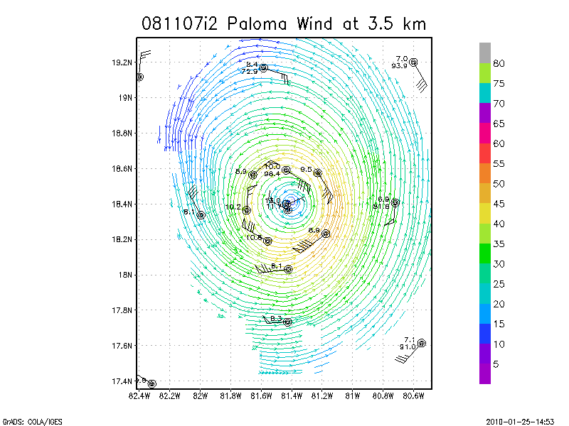
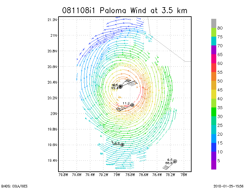
3.5 km
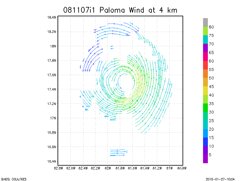
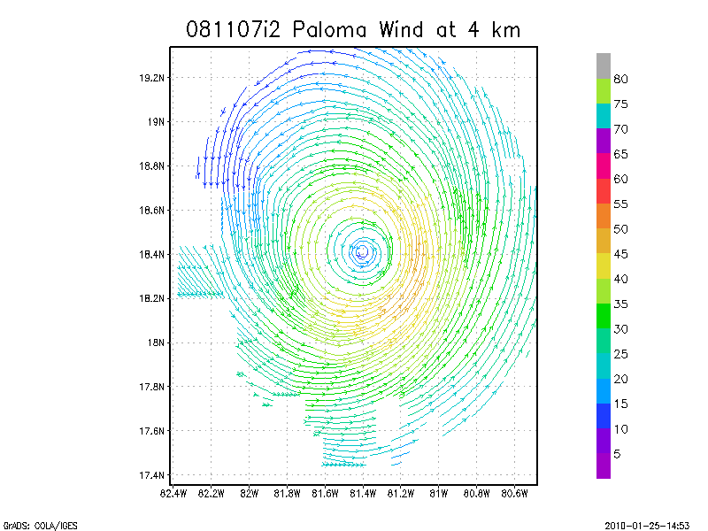
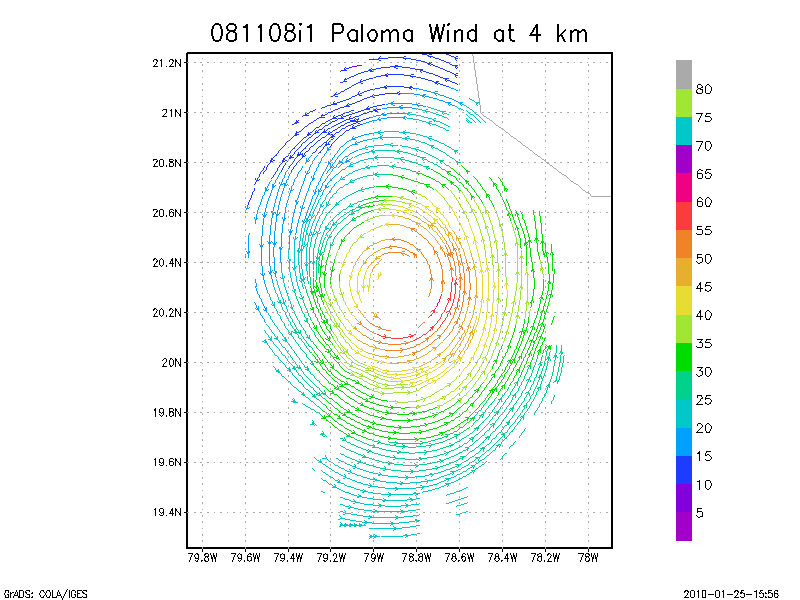
4.0 km
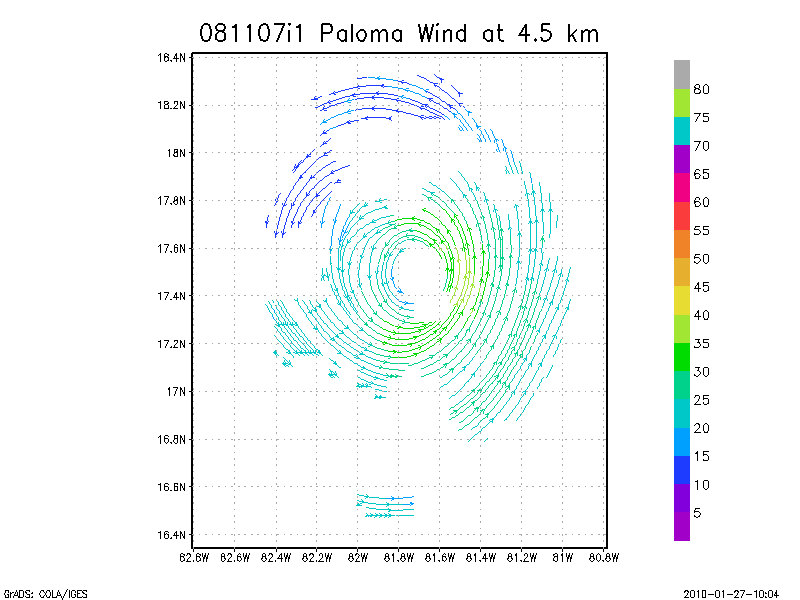
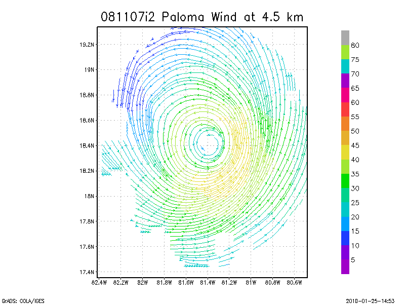
4.5 km
Winds at :
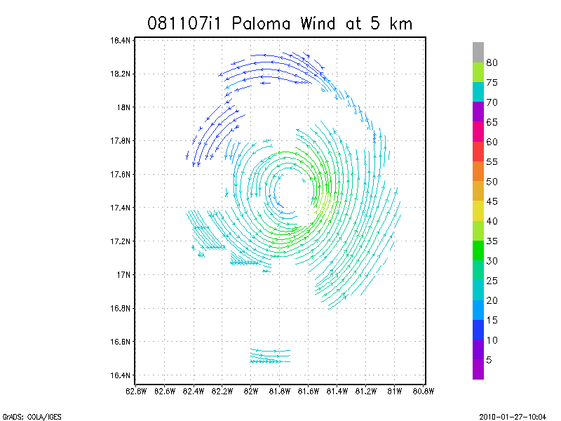
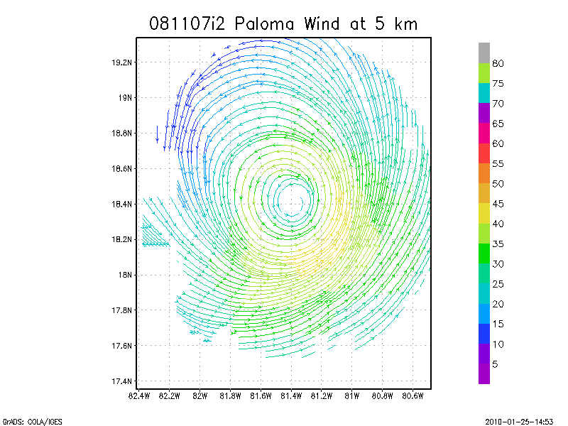
5.0 km
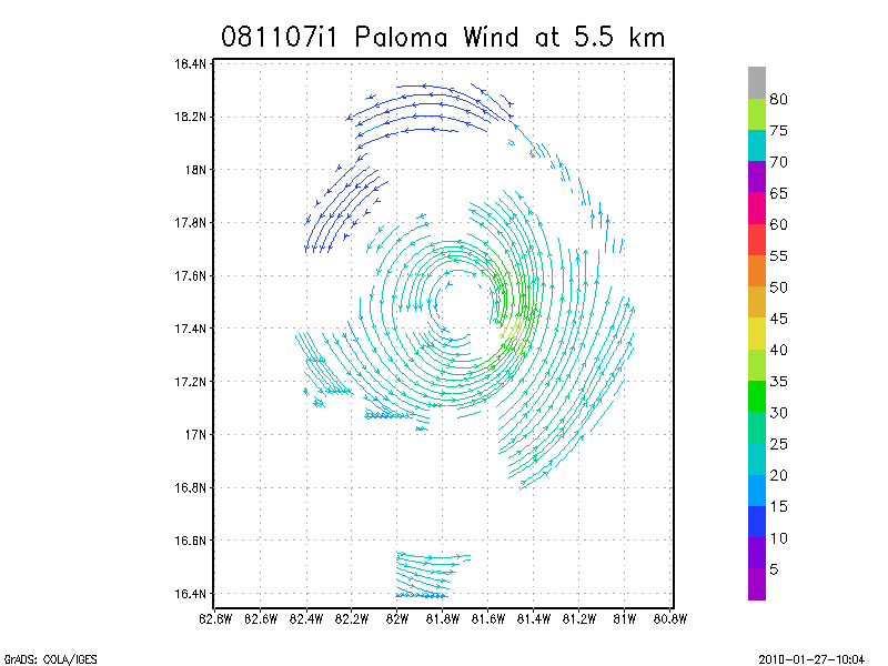
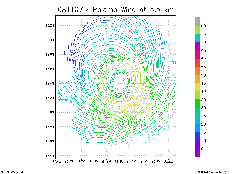
5.5 km
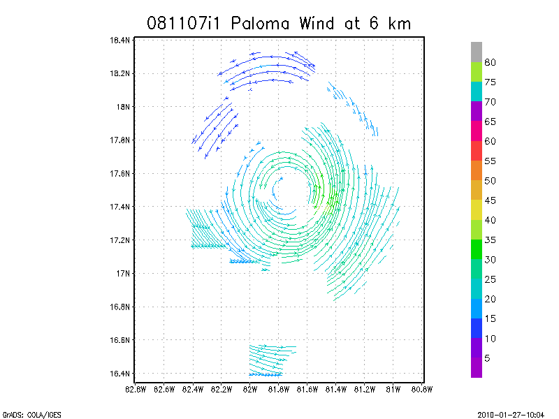
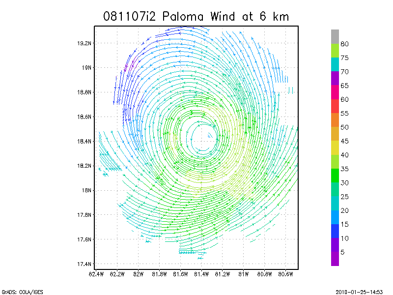
6.0 km
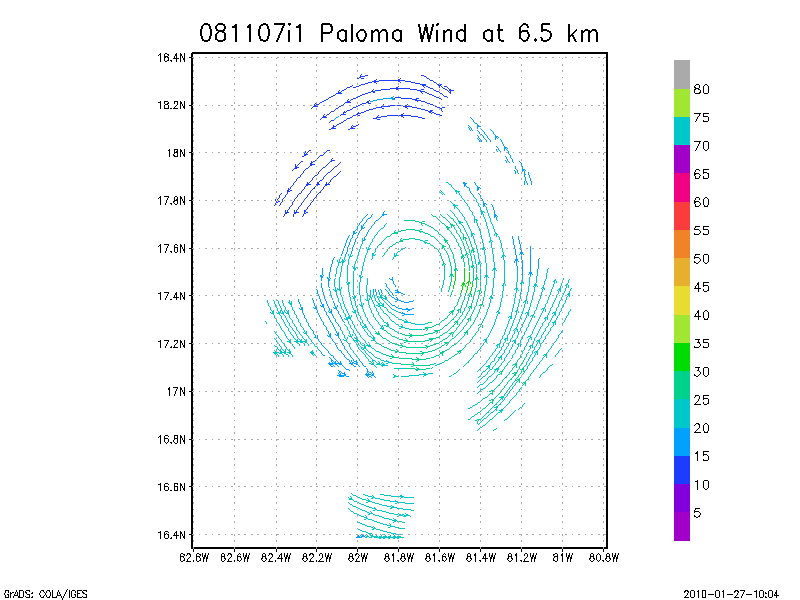
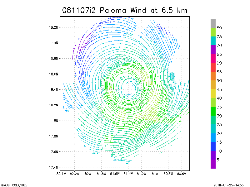
6.5 km
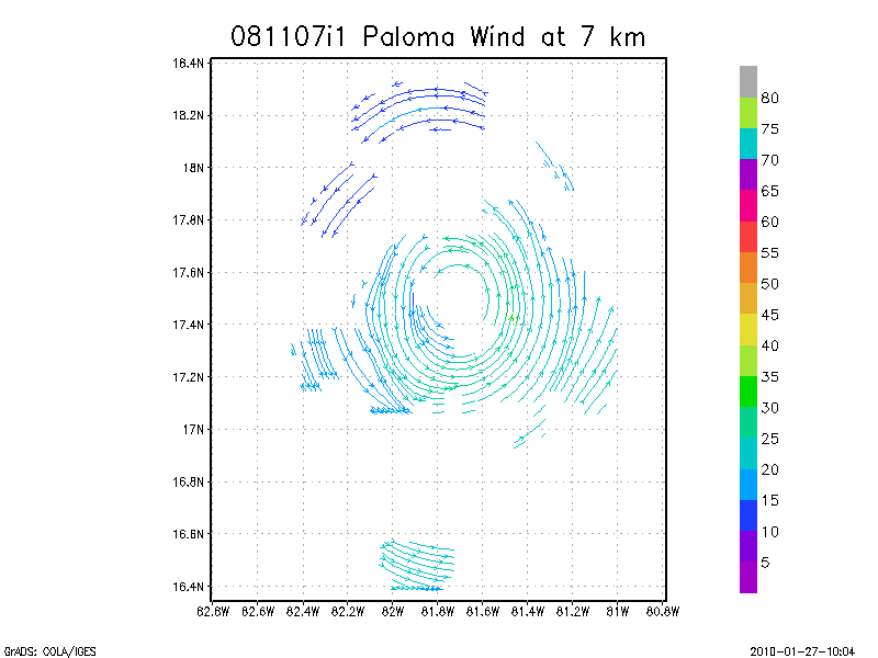
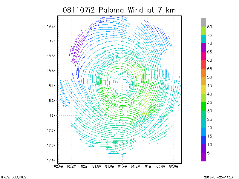
7.0 km
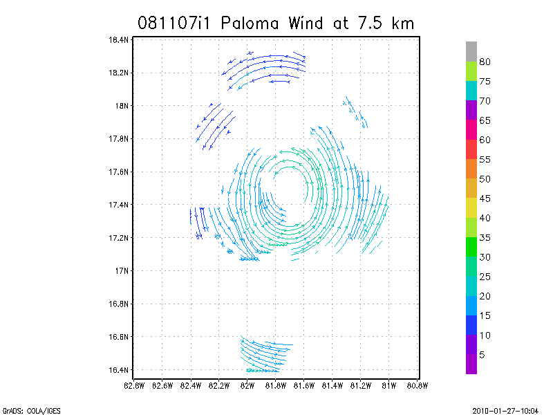
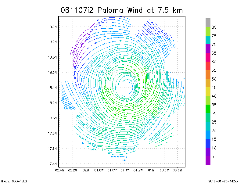
7.5 km
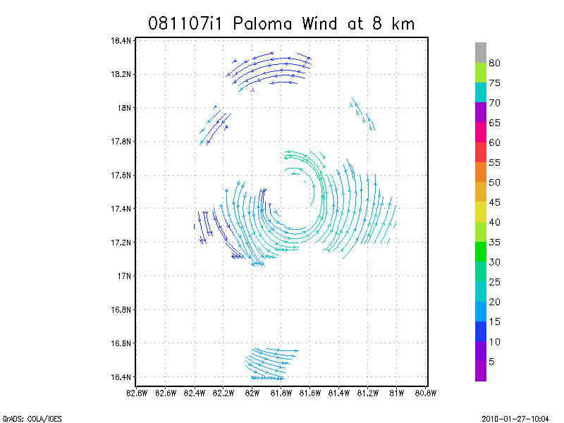
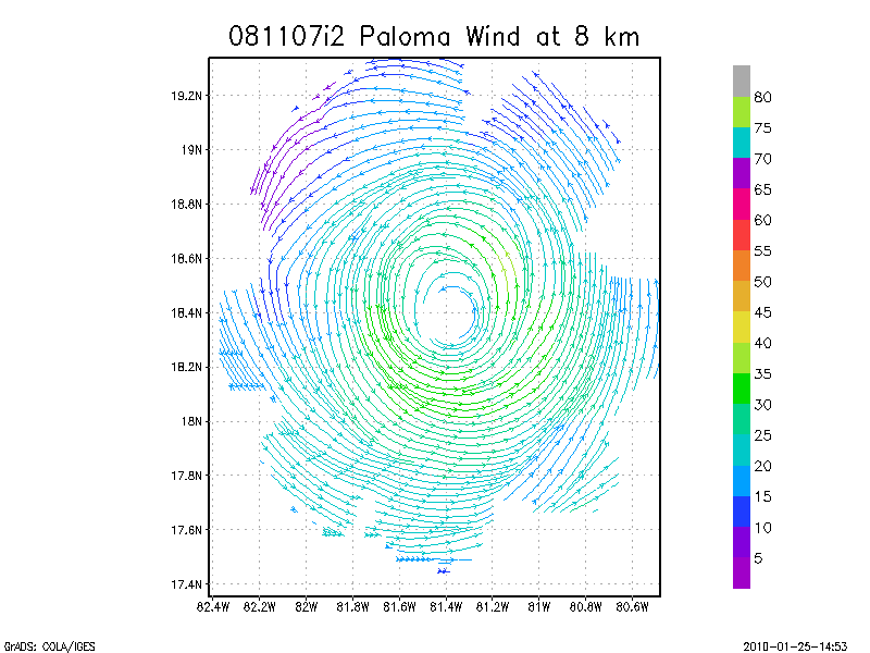
8.0 km
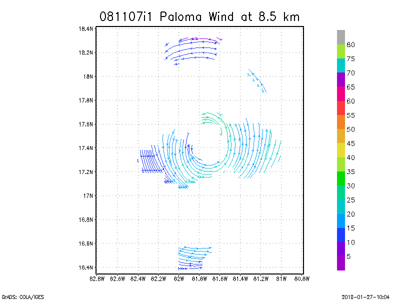
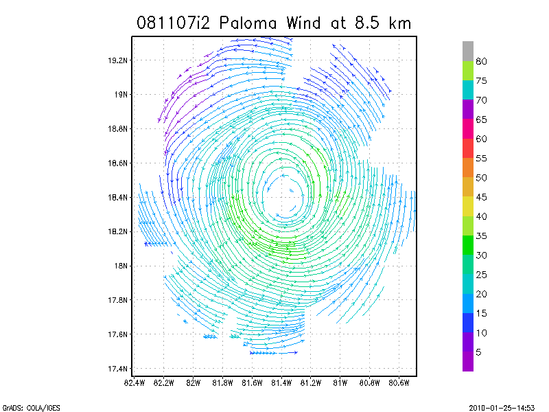
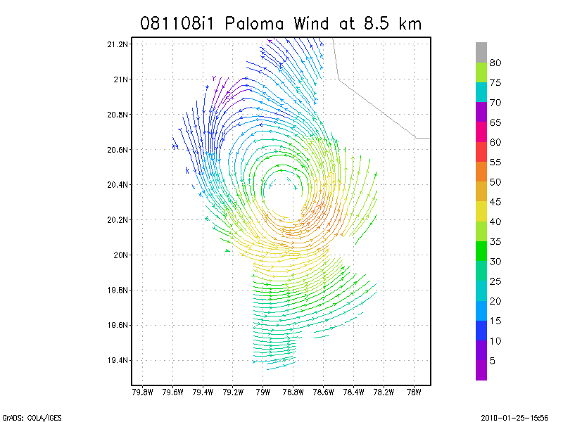
8.5 km
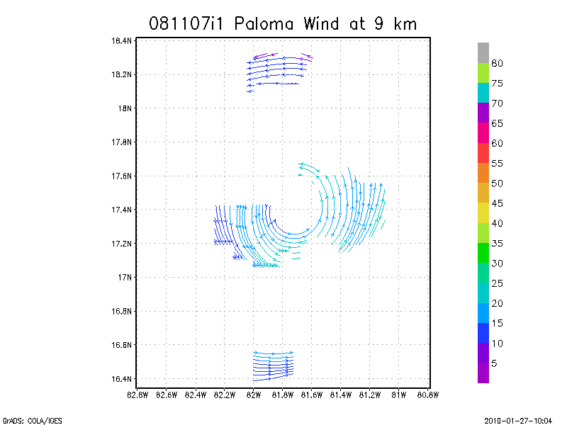
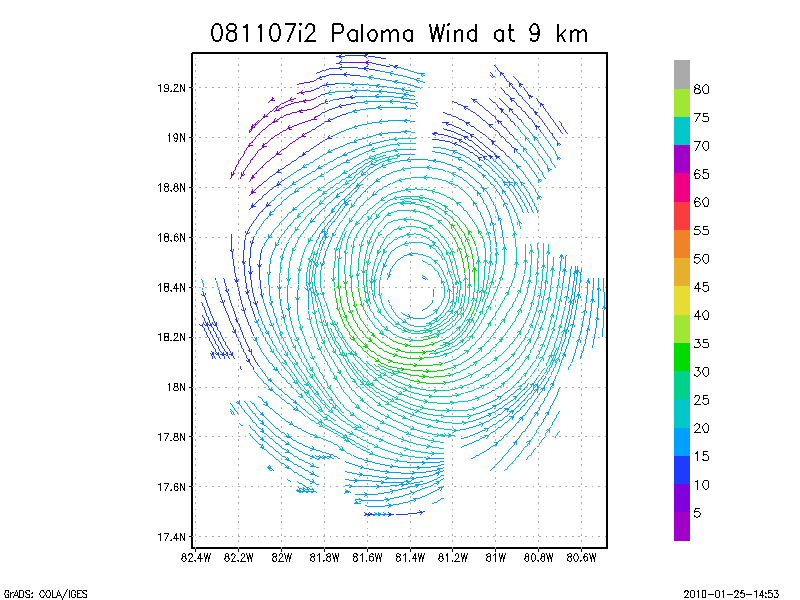
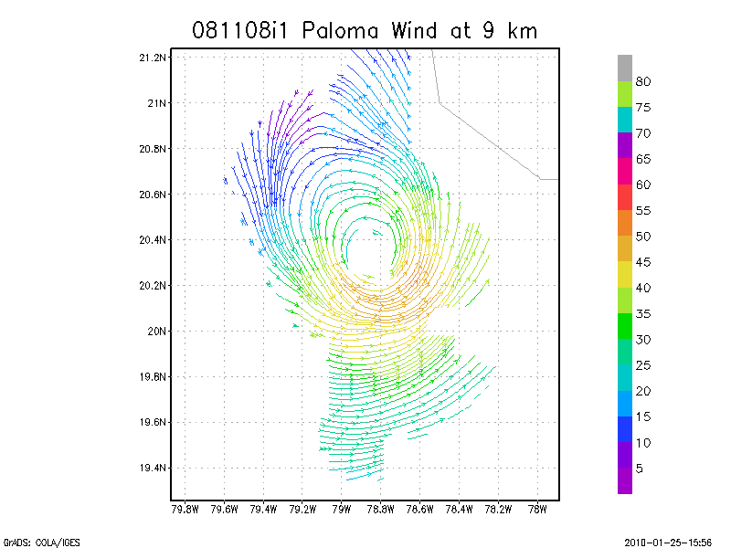
9.0 km
Winds at :
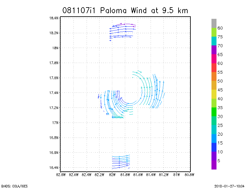
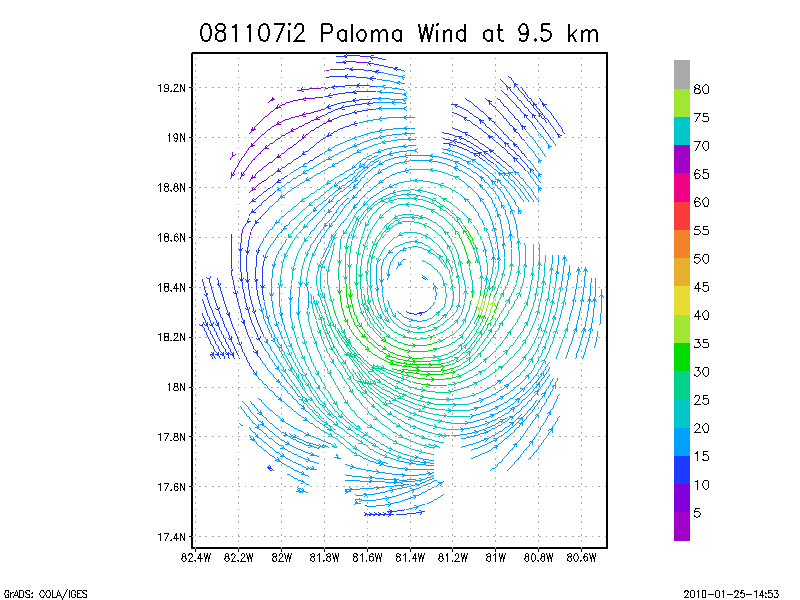
9.5 km
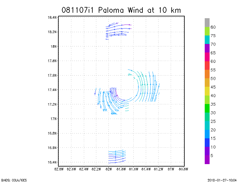
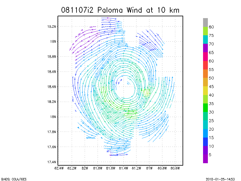
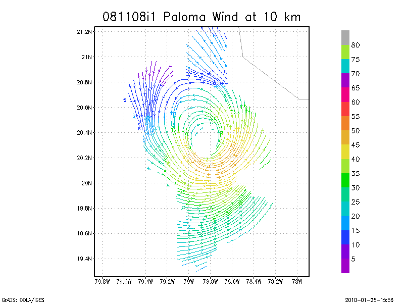
10.0 km
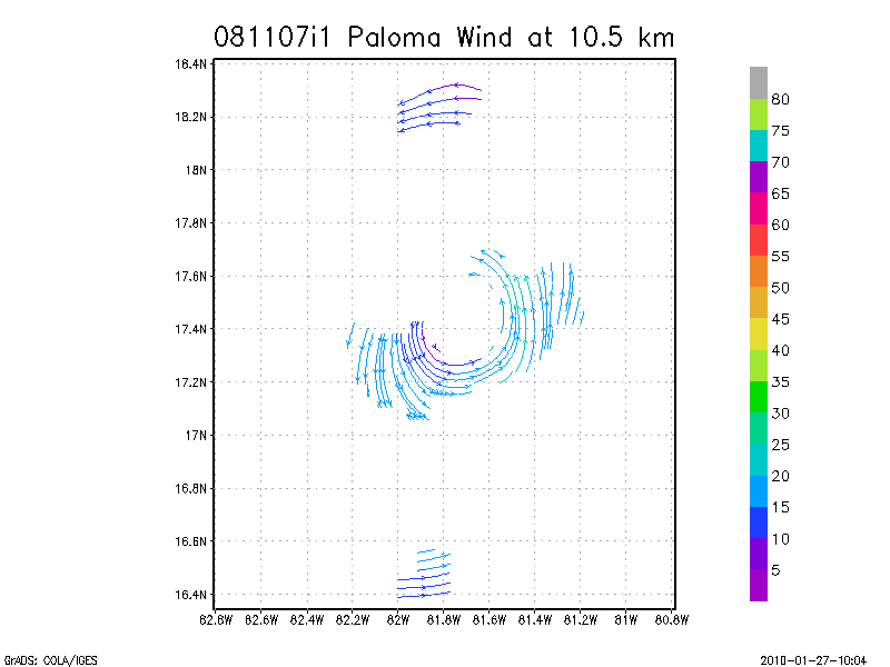
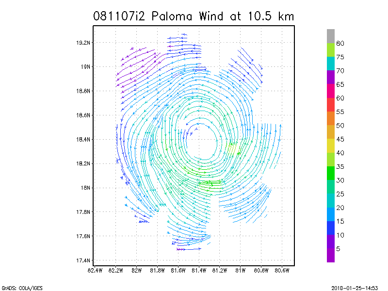
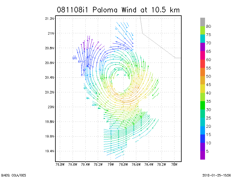
10.5 km
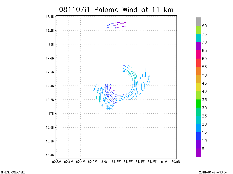
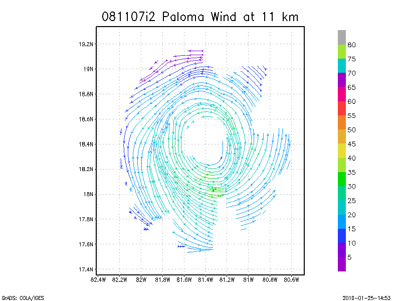
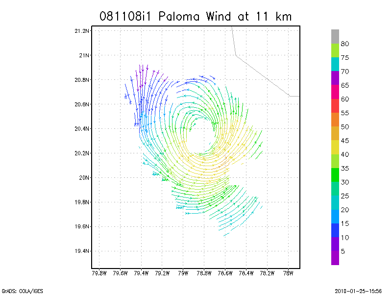
11.0 km
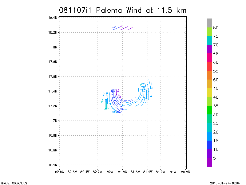
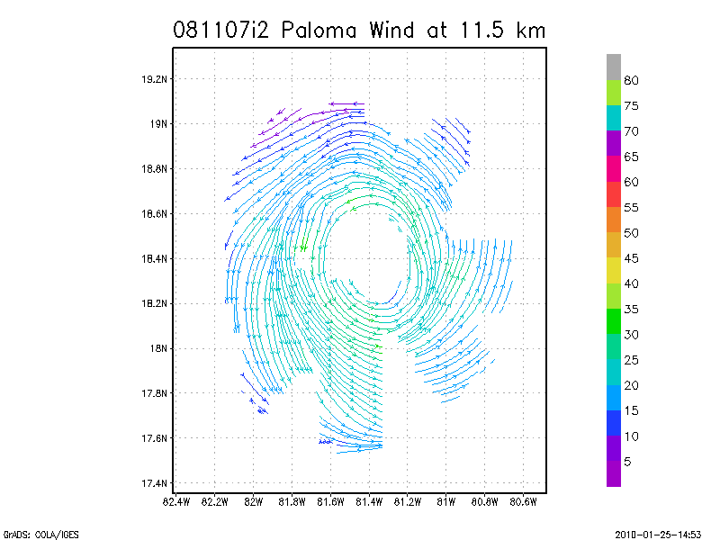
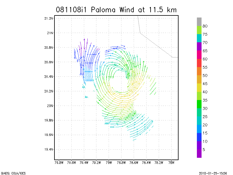
11.5 km
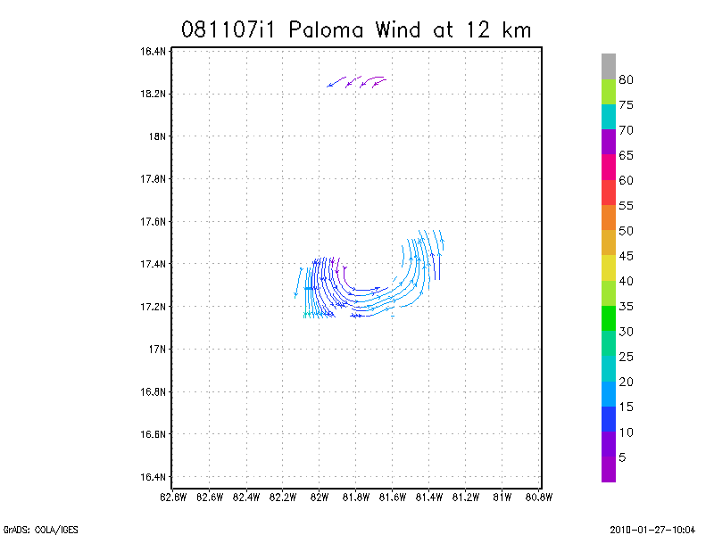
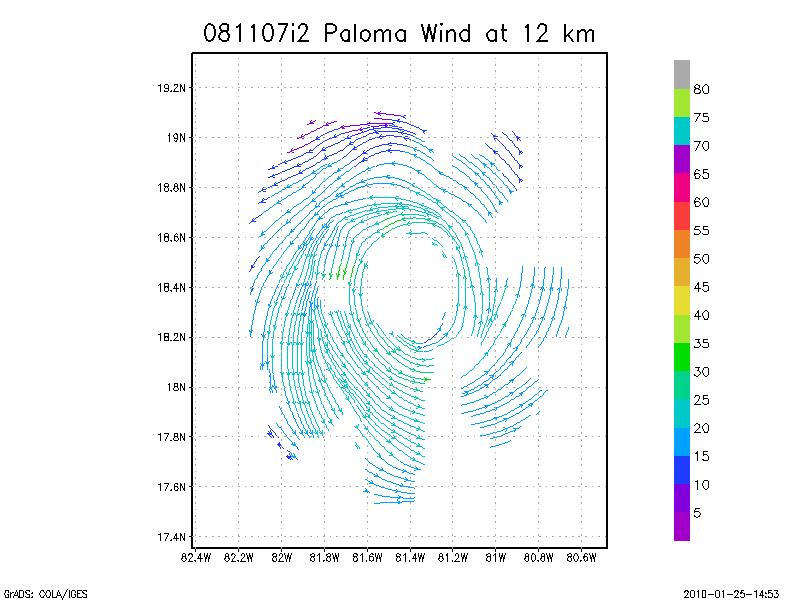
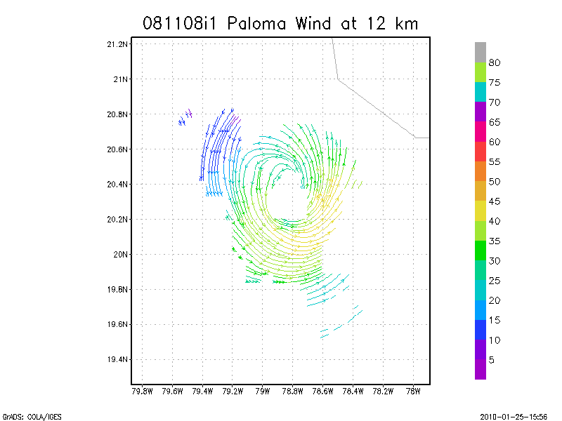
12.0 km
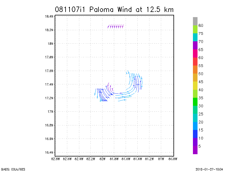
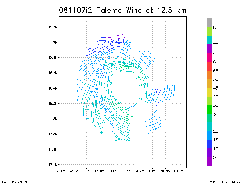
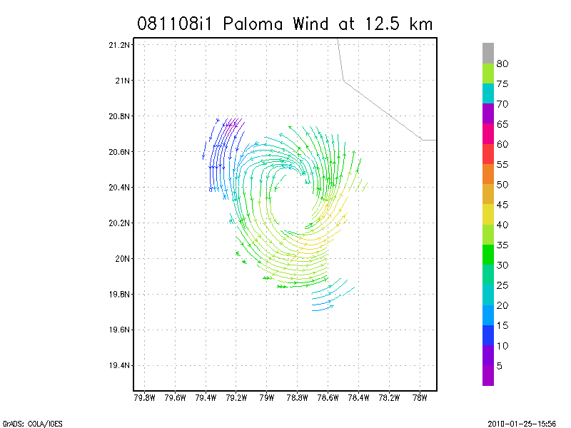
12.5 km
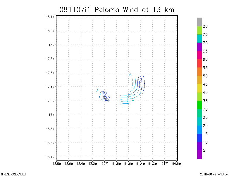
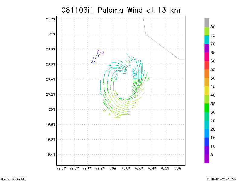
13.0 km
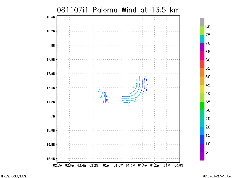
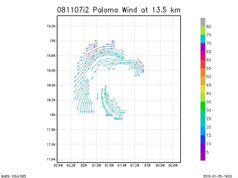
13.5 km
Winds at :
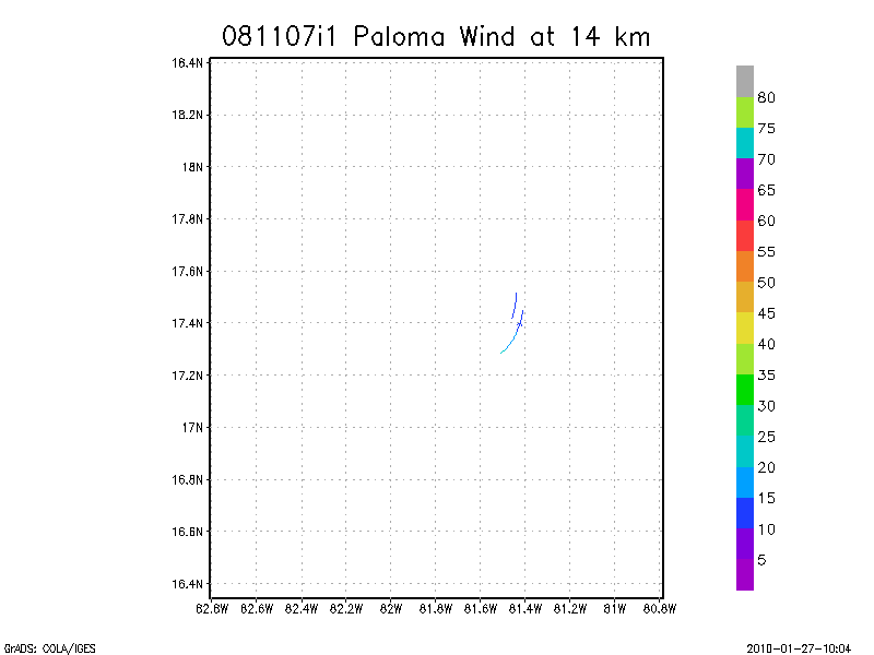
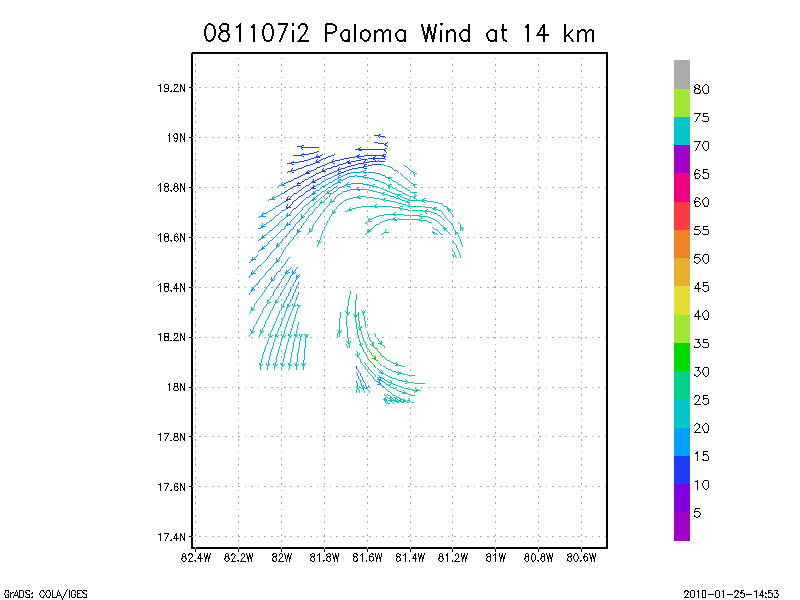
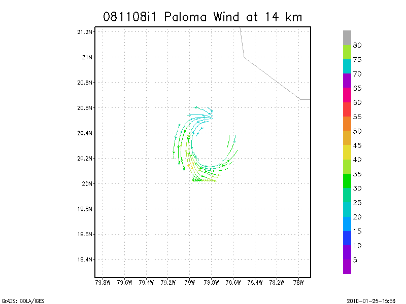
14.0 km
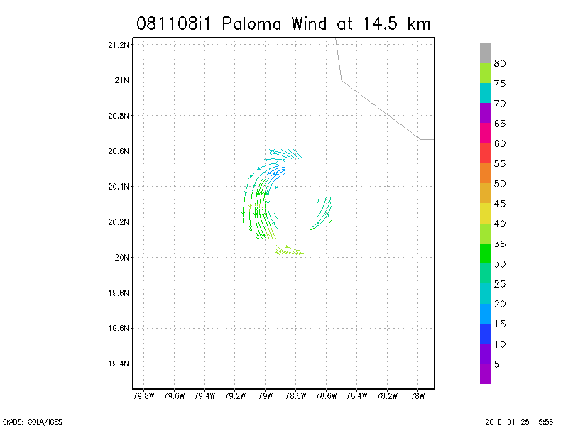
14.5 km
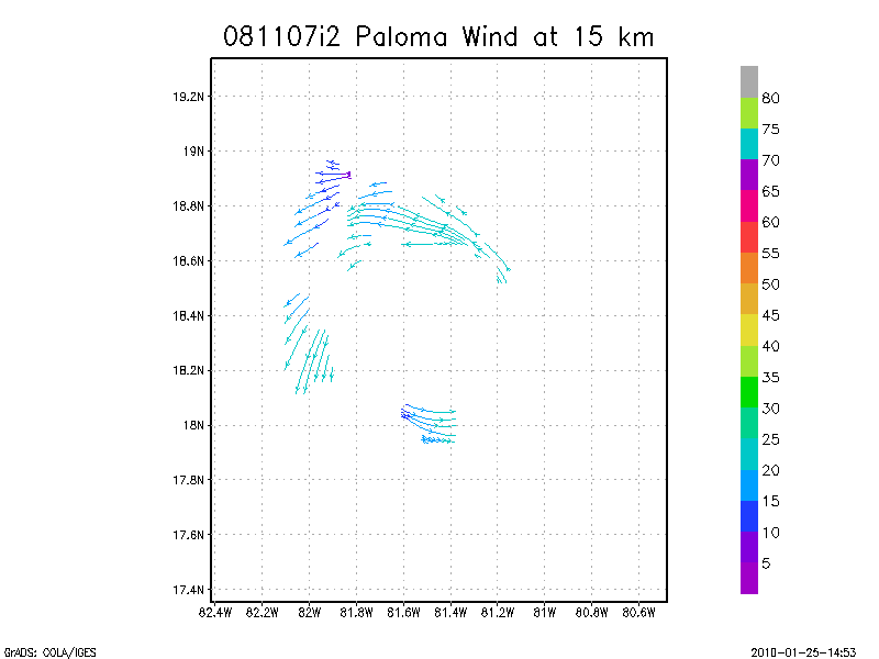
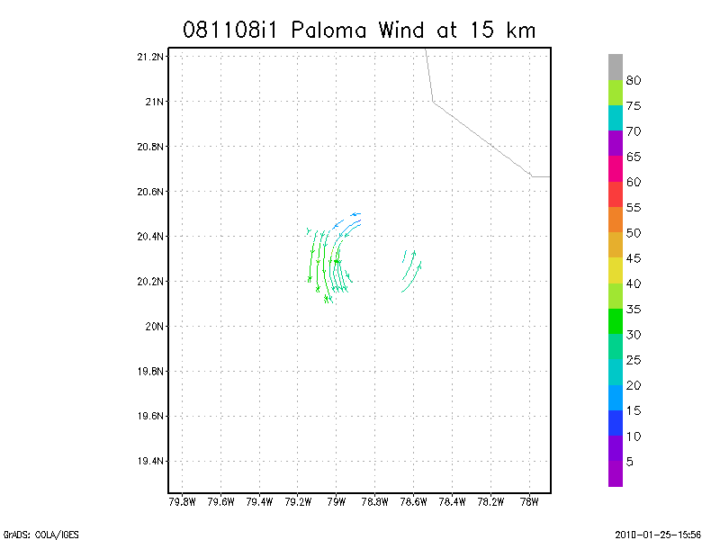
15.0 km
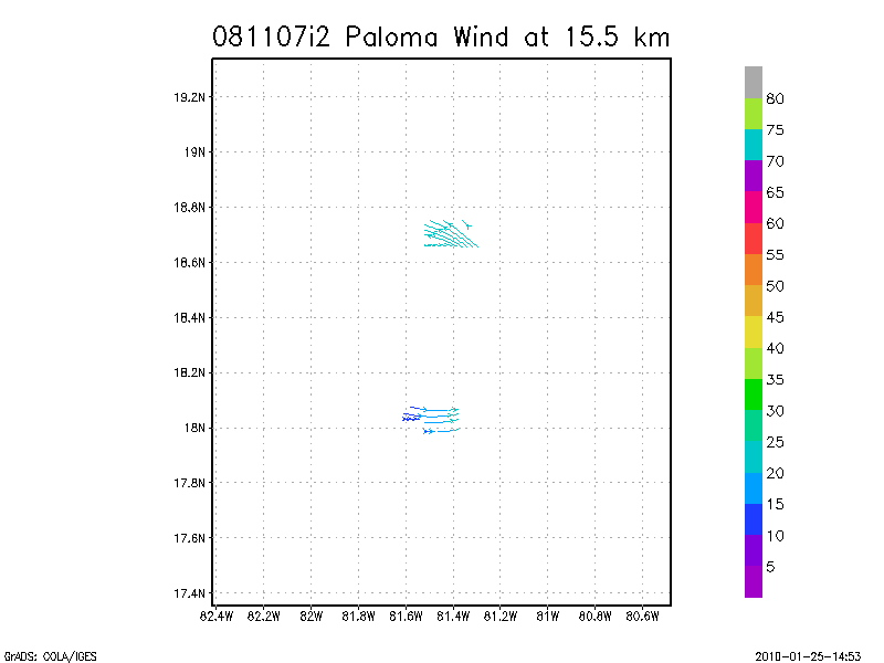
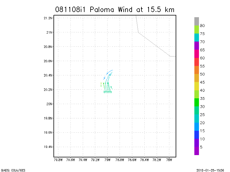
15.5 km
16.0 km
16.5 km
17.0 km
17.5 km
18.0 km
Individual sweeps
(aircraft relative)
Animated radar
tar'd and gzipped single frame GIFs
tar'd and gzipped sweep data
Individual sweeps
(storm relative)
Animated radar
tar'd and gzipped single frame GIFs
tar'd and gzipped sweep data
Individual sweeps
(storm relative)
660 x 660 km
Animated radar
tar'd and gzipped single frame GIFs
tar'd and gzipped sweep data
November 07, 2008
N43RF #2
Composite of all legs and dropsondes
Gridded radar data
GrADS control file radar data
Gridded dropsonde data
GrADS control file dropsonde data
GrADS map of dropsonde data
Winds at :
.5 km
1.0 km
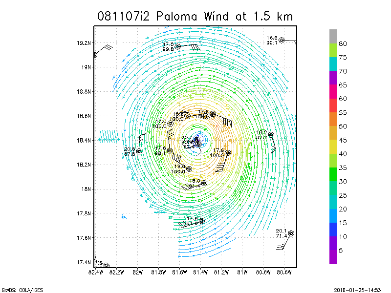
1.5 km
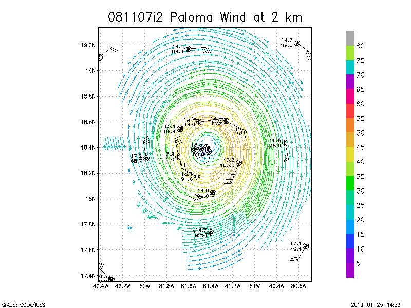
2.0 km
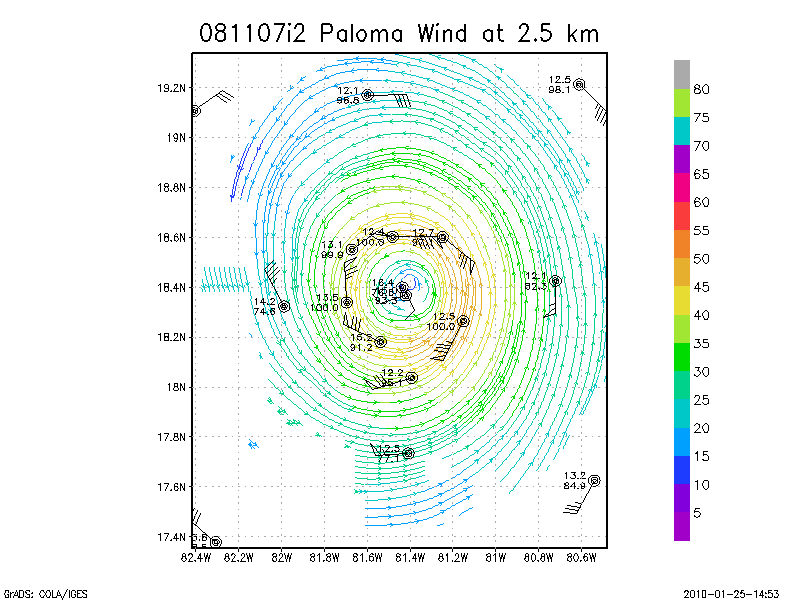
2.5 km
3.0 km
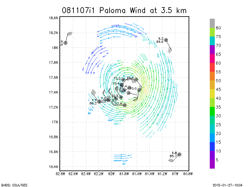
3.5 km
4.0 km
4.5 km
Winds at :
5.0 km
5.5 km
6.0 km
6.5 km
7.0 km
7.5 km
8.0 km
8.5 km
9.0 km
Winds at :
9.5 km
10.0 km
10.5 km
11.0 km
11.5 km
12.0 km
12.5 km
13.0 km
13.5 km
Winds at :
14.0 km
14.5 km
15.0 km
15.5 km
16.0 km
16.5 km
17.0 km
17.5 km
18.0 km
Individual sweeps
(aircraft relative)
Animated radar
tar'd and gzipped single frame GIFs
tar'd and gzipped sweep data
Individual sweeps
(storm relative)
Animated radar
tar'd and gzipped single frame GIFs
tar'd and gzipped sweep data
Individual sweeps
(storm relative)
660 x 660 km
Animated radar
tar'd and gzipped single frame GIFs
tar'd and gzipped sweep data
November 08, 2008
N43RF
Composite of all legs and dropsondes
Gridded radar data
GrADS control file radar data
Gridded dropsonde data
GrADS control file dropsonde data
GrADS map of dropsonde data
Winds at :
.5 km
1.0 km
1.5 km
2.0 km
2.5 km
3.0 km
3.5 km
4.0 km
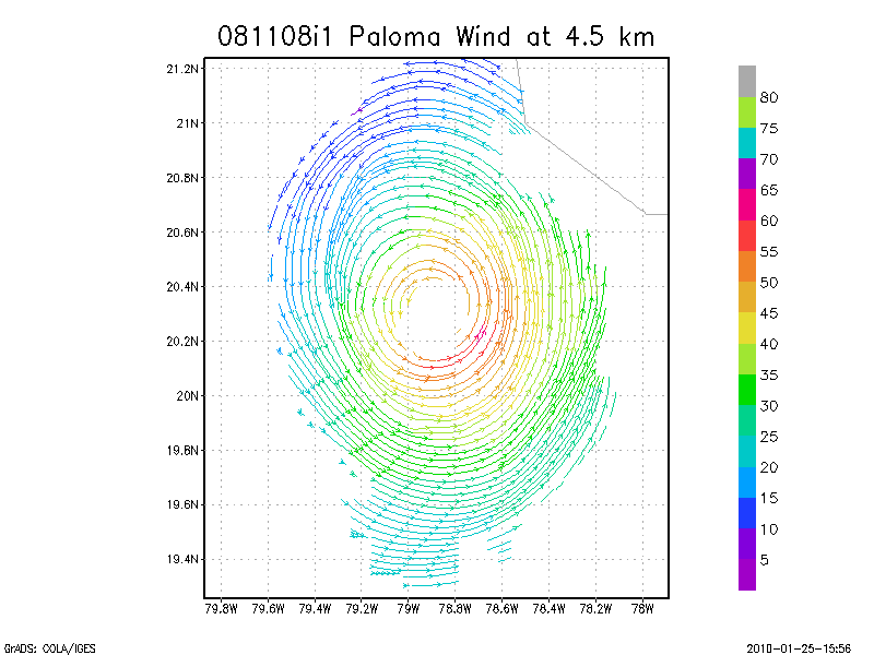
4.5 km
Winds at :
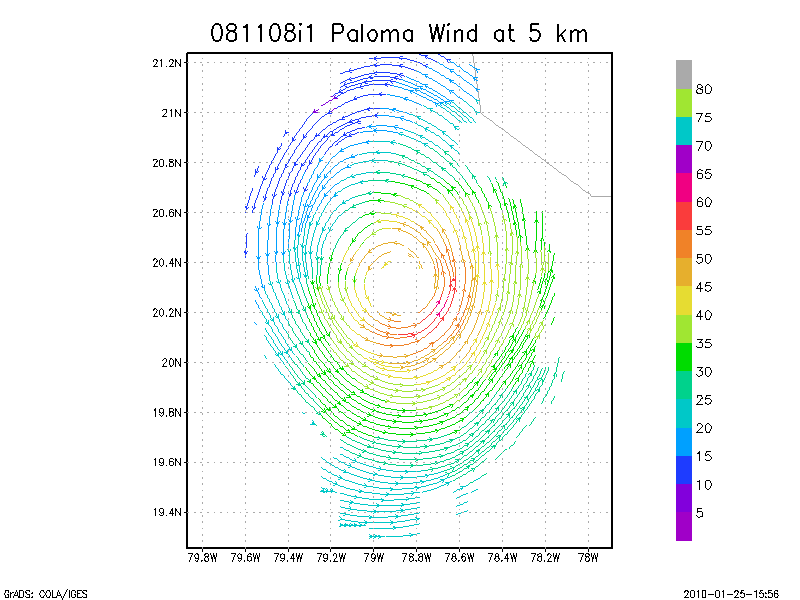
5.0 km
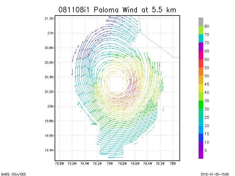
5.5 km
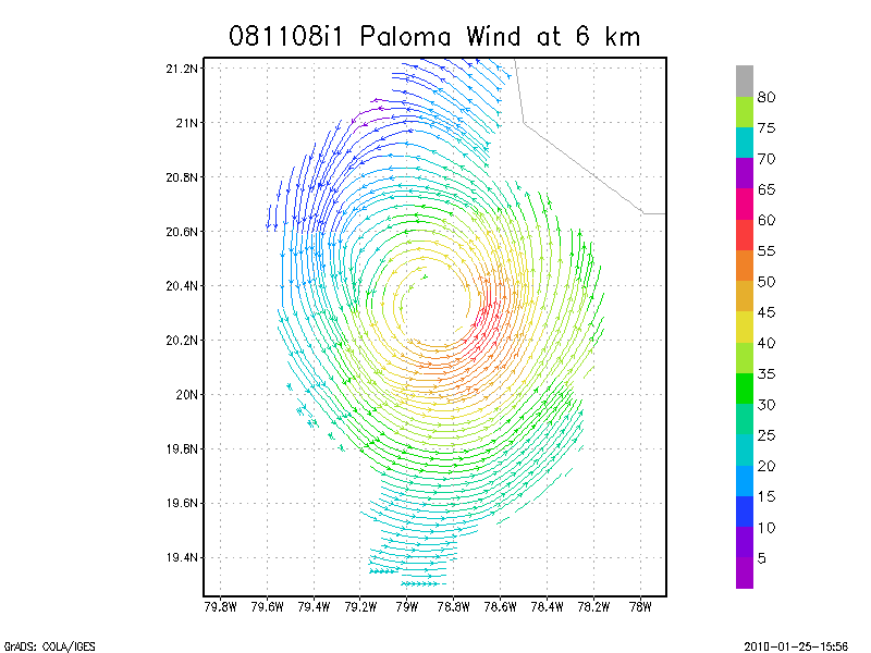
6.0 km
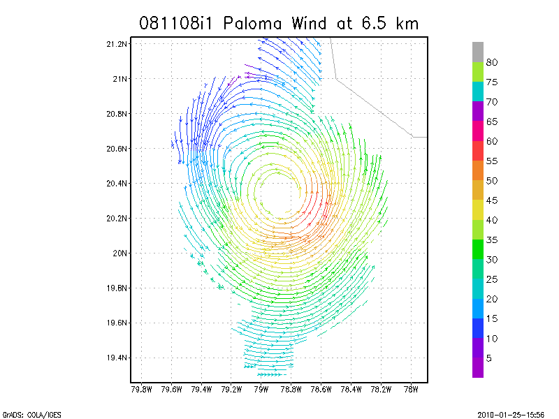
6.5 km
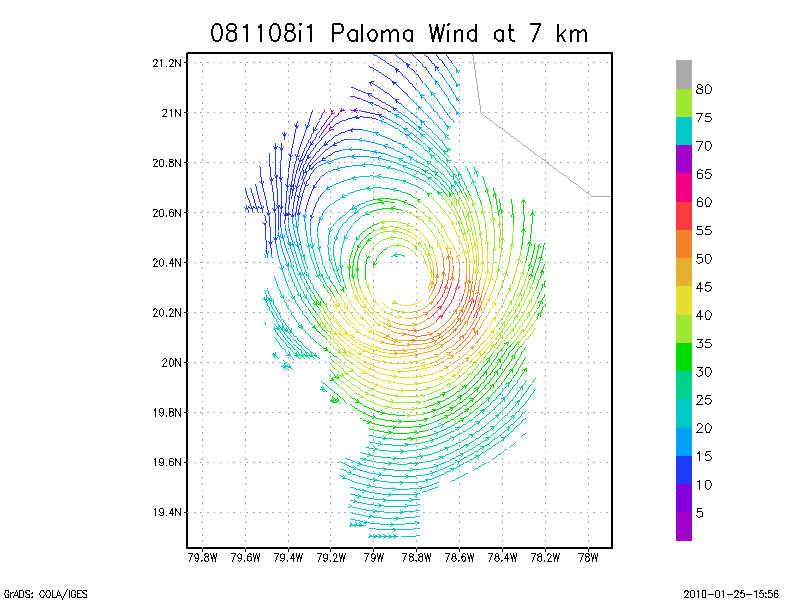
7.0 km
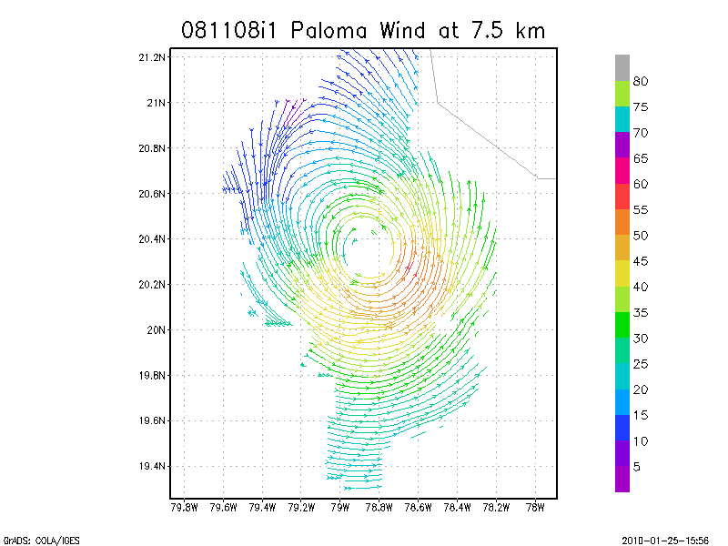
7.5 km
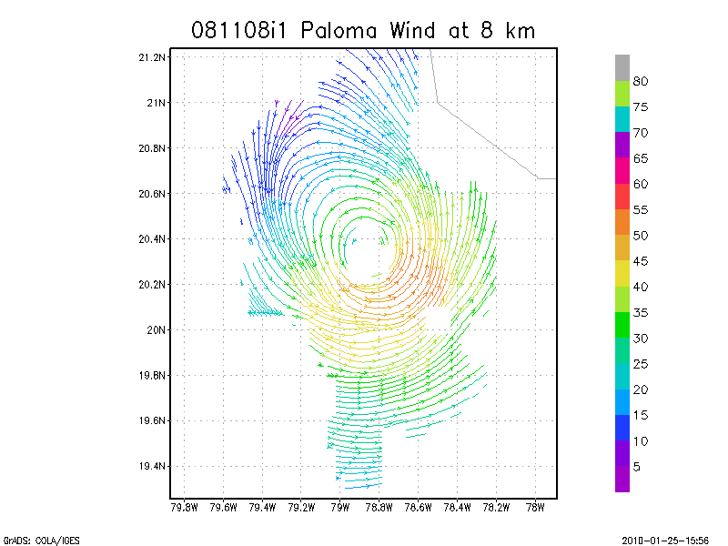
8.0 km
8.5 km
9.0 km
Winds at :
9.5 km
10.0 km
10.5 km
11.0 km
11.5 km
12.0 km
12.5 km
13.0 km
13.5 km
Winds at :
14.0 km
14.5 km
15.0 km
15.5 km
16.0 km
16.5 km
17.0 km
17.5 km
18.0 km
Individual sweeps
(aircraft relative)
Animated radar
tar'd and gzipped single frame GIFs
tar'd and gzipped sweep data
Individual sweeps
(storm relative)
Animated radar
tar'd and gzipped single frame GIFs
tar'd and gzipped sweep data
Individual sweeps
(storm relative)
660 x 660 km
Animated radar
tar'd and gzipped single frame GIFs
tar'd and gzipped sweep data
Research Composites
18:25 - 19:05 Z
Return to Paloma Page.
Disclaimer
|
Datenschutzbestimmungen
DOC
/
NOAA
/
AOML
/
HRD
[email protected]


![[OAR/DOC/NOAA Logos]](../../oar_noaa_doc_logos3.jpg)