Category:Ashen, Essex
English: Ashen is a village and civil parish in Essex, England. It is located about 8 km (5 miles) east-southeast of Haverhill and is 36 km (22 miles) north from the county town of Chelmsford. The village lies to the south of the River Stour, which here forms the county boundary with Suffolk. The village is in the district of Braintree and the parliamentary constituency of Saffron Walden. The parish is part of the Bumpsteads and Upper Colne parish cluster.

village and civil parish in Essex, United Kingdom  | |||||
| Upload media | |||||
| Instance of | |||||
|---|---|---|---|---|---|
| Standort | Braintree, Essex, East of England, England | ||||
| Population |
| ||||
| Said to be the same as | Ashen (Wikimedia duplicated page, civil parish) | ||||
 | |||||
Subcategories
This category has the following 3 subcategories, out of 3 total.
Media in category "Ashen, Essex"
The following 74 files are in this category, out of 74 total.
-
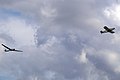 Aero Tow from Ridgewell - geograph.org.uk - 270662.jpg 640 × 426; 51 KB
-

-
 Ashden Road - geograph.org.uk - 2670844.jpg 768 × 1,024; 218 KB
-
 Ashen - geograph.org.uk - 2866314.jpg 1,024 × 768; 247 KB
-
 Ashen churchyard gate - geograph.org.uk - 6495758.jpg 1,600 × 1,066; 797 KB
-
 Ashen Old Rectory - geograph.org.uk - 6495585.jpg 2,400 × 1,600; 1.84 MB
-
 Ashen Road - geograph.org.uk - 5399610.jpg 640 × 480; 75 KB
-
 Ashen Road - geograph.org.uk - 5399633.jpg 640 × 480; 63 KB
-
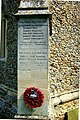 Ashen war memorial - geograph.org.uk - 4941365.jpg 1,004 × 1,500; 906 KB
-
 Barns, Stours - geograph.org.uk - 5399621.jpg 640 × 480; 55 KB
-
 Bradley Hill (road) - geograph.org.uk - 6407545.jpg 1,024 × 684; 236 KB
-
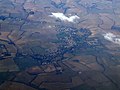 Clare from the air - geograph.org.uk - 3367336.jpg 640 × 480; 117 KB
-
 Close up, Edward VII postbox on Ashen Road, Clare - geograph.org.uk - 5401708.jpg 1,140 × 2,130; 480 KB
-
 Country Road - geograph.org.uk - 2866274.jpg 1,024 × 768; 284 KB
-
 Crop field near Mill Farm - geograph.org.uk - 5399628.jpg 640 × 480; 58 KB
-
 Crop field near Mill Farm - geograph.org.uk - 5399630.jpg 640 × 480; 58 KB
-
 Crop field off Ashen Road - geograph.org.uk - 5399609.jpg 640 × 480; 61 KB
-
 Crop field off Ashen Road - geograph.org.uk - 5399636.jpg 640 × 480; 71 KB
-
 Crop field off Lower Stoke Road - geograph.org.uk - 5399617.jpg 640 × 480; 58 KB
-
 Crop field, Stours - geograph.org.uk - 5399619.jpg 640 × 480; 60 KB
-
 Doctor's Lane - geograph.org.uk - 5399615.jpg 640 × 480; 142 KB
-
 Doctor's Lane meets Lower Stoke Road - geograph.org.uk - 5447466.jpg 640 × 480; 171 KB
-
 Edward VII postbox on Ashen Road, Clare - geograph.org.uk - 5401705.jpg 2,848 × 2,136; 1.48 MB
-
 Entering Ashen - geograph.org.uk - 5399612.jpg 640 × 480; 64 KB
-
 Entering Ashen - geograph.org.uk - 5447463.jpg 640 × 480; 179 KB
-
 Essex Gliding Club - geograph.org.uk - 4358340.jpg 4,320 × 3,240; 4.58 MB
-
 Farmland near Bradley Hill Farm - geograph.org.uk - 1972080.jpg 640 × 427; 99 KB
-

-
 Finger Post - geograph.org.uk - 2866270.jpg 768 × 1,024; 242 KB
-

-
 Footpath - geograph.org.uk - 2670856.jpg 1,024 × 768; 214 KB
-
 Footpath - geograph.org.uk - 2803604.jpg 768 × 1,024; 171 KB
-
 Footpath - geograph.org.uk - 2866285.jpg 1,024 × 768; 243 KB
-
 Footpath to Ashen - geograph.org.uk - 2050918.jpg 640 × 427; 95 KB
-
 Footpath to Baythorne Park - geograph.org.uk - 2263288.jpg 427 × 640; 79 KB
-
 Footpath to Long Lane - geograph.org.uk - 1972076.jpg 640 × 427; 102 KB
-
 Green Lane - geograph.org.uk - 2866321.jpg 1,024 × 768; 314 KB
-
 Hedge - geograph.org.uk - 2670851.jpg 1,024 × 768; 356 KB
-
 Hollow Road - geograph.org.uk - 2801930.jpg 1,024 × 768; 153 KB
-
 Homestead Moat - geograph.org.uk - 6495606.jpg 1,067 × 1,600; 841 KB
-
 House on The Street, Ashen - geograph.org.uk - 5399611.jpg 640 × 480; 54 KB
-
 Houses on Ashen Road - geograph.org.uk - 5399631.jpg 640 × 480; 63 KB
-
 Long Lane - geograph.org.uk - 2670869.jpg 768 × 1,024; 446 KB
-
 Lower Stoke Road - geograph.org.uk - 5399618.jpg 640 × 480; 76 KB
-
 Memorial at (former) RAF Ridgewell - geograph.org.uk - 4358329.jpg 4,320 × 3,240; 4.51 MB
-
 Minor Road - geograph.org.uk - 2801947.jpg 1,024 × 768; 232 KB
-
 Muddy Track - geograph.org.uk - 2866325.jpg 768 × 1,024; 248 KB
-
 New Stile - geograph.org.uk - 2866292.jpg 1,024 × 768; 363 KB
-
 Oak Tree - geograph.org.uk - 2670863.jpg 1,024 × 768; 241 KB
-
 Old Pump - geograph.org.uk - 2866296.jpg 1,024 × 768; 415 KB
-
 Pump at Ashen - geograph.org.uk - 6495561.jpg 1,067 × 1,600; 749 KB
-
 Raised Walkway - geograph.org.uk - 2670838.jpg 1,024 × 768; 287 KB
-
 Ridgewell Airfield - geograph.org.uk - 246871.jpg 640 × 432; 102 KB
-

-
 Road Junction - geograph.org.uk - 2801934.jpg 1,024 × 768; 151 KB
-
 Road Junction - geograph.org.uk - 2801952.jpg 1,024 × 768; 255 KB
-
 Road junction near Stours - geograph.org.uk - 5399624.jpg 640 × 480; 61 KB
-
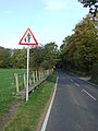
 Road sign - geograph.org.uk - 2801963.jpg 768 × 1,024; 210 KB
-
 Road to Hickford Hill, Ashen - geograph.org.uk - 3972423.jpg 3,648 × 2,736; 3.51 MB
-
 Snow covered - geograph.org.uk - 2801927.jpg 1,024 × 768; 129 KB
-
 Telephone Box and Ashen Postbox - geograph.org.uk - 2866300.jpg 768 × 1,024; 311 KB
-
 Thatched cottages - geograph.org.uk - 4941385.jpg 1,500 × 1,004; 704 KB
-
 The Ashen Madonna ^ Child - geograph.org.uk - 4941350.jpg 1,000 × 1,500; 719 KB
-
 The Churching Stool - geograph.org.uk - 4941335.jpg 1,500 × 1,000; 816 KB
-
 The Street, Ashen - geograph.org.uk - 4356335.jpg 4,320 × 3,240; 3.4 MB
-
 Tracks in crop field - geograph.org.uk - 5399627.jpg 640 × 480; 53 KB
-
 Upper Farm - geograph.org.uk - 2866319.jpg 768 × 1,024; 309 KB
-
 Upper Farm Road - geograph.org.uk - 2866317.jpg 768 × 1,024; 290 KB
-
 View north-west over Stour Valley - geograph.org.uk - 5447476.jpg 640 × 480; 127 KB
-
 West tower of St Augustine's Church - geograph.org.uk - 6495762.jpg 1,607 × 2,400; 1.9 MB
-
 Where's the footpath^ - geograph.org.uk - 2263301.jpg 640 × 427; 78 KB
-
 Ashen village - geograph.org.uk - 1175.jpg 640 × 427; 146 KB
-
 Autumn colour - geograph.org.uk - 598969.jpg 640 × 414; 97 KB
-
 Ridgewell Peri Track - geograph.org.uk - 246888.jpg 640 × 426; 100 KB


_-_geograph.org.uk_-_6407545.jpg)


_RAF_Ridgewell_-_geograph.org.uk_-_4358329.jpg)


