Uploads by Mdf
Jump to navigation
Jump to search
This special page shows all uploaded files that have not been deleted; for those see the upload log.
| Date | Name | Thumbnail | Size | Description |
|---|---|---|---|---|
| 20:33, 16 December 2005 | Coragyps-atratus-002.jpg (file) |  |
543 KB | Black Vulture -- Farallon, Panama -- 2005 December {{GFDL}} |
| 23:12, 29 December 2005 | Cyanocitta-cristata-004.jpg (file) |  |
1.27 MB | Blue Jay -- Algonquin Provincial Park, Canada -- 2005 December {{GFDL}} |
| 23:34, 29 December 2005 | Poecile-atricapilla-001.jpg (file) |  |
386 KB | Black-capped Chickadee -- Algonquin Provincial Park, Canada -- 2005 December {{GFDL}} |
| 23:46, 29 December 2005 | Poecile atricapillus 5.jpg (file) |  |
524 KB | Black-capped Chickadee -- Algonquin Provincial Park, Canada -- 2005 December {{GFDL}} |
| 19:16, 4 January 2006 | Picoides-villosus-001.jpg (file) |  |
692 KB | Hairy Woodpecker -- Whitby, Ontario, Canada -- 2006 January {{GFDL}} The red on the back of the head identifies this as a male. |
| 22:04, 20 February 2006 | Larus-glaucoides-001.jpg (file) |  |
289 KB | Iceland Gull -- Bluffer's Park, Toronto, Canada -- 2006 February A first winter individual, taking a bath. Note the pale colour and lack of black near tips of wings. |
| 22:13, 20 February 2006 | Larus-glaucoides-002.jpg (file) |  |
345 KB | Iceland Gull -- Bluffer's Park, Toronto, Canada -- 2006 February {{GFDL}} Probably a first winter individual. |
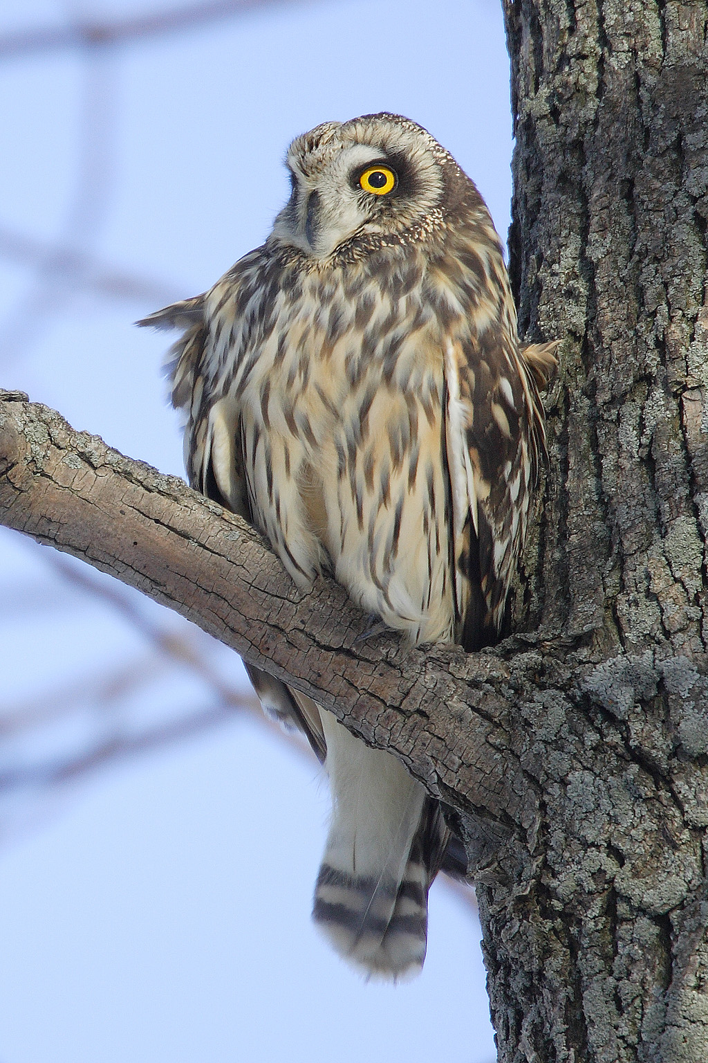
| 03:35, 28 February 2006 | Asio-flammeus-001.jpg (file) |  |
683 KB | Short-eared Owl -- Amherst Island, Ontario, Canada -- 2006 February {{GFDL}} A windy day. |
| 19:39, 6 March 2006 | Fulica-americana-003.jpg (file) |  |
393 KB | American Coot -- Humber Bay Park (East), Toronto, Canada -- 2006 March {{GFDL}} |
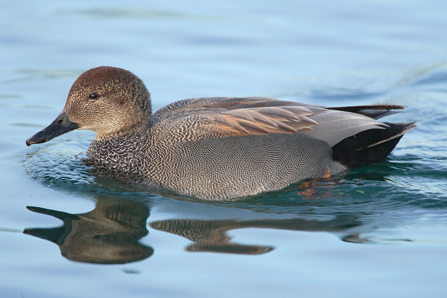
| 00:26, 7 March 2006 | Anas-strepera-001.jpg (file) |  |
457 KB | Gadwall -- Humber Bay Park (East), Toronto, Canada -- 2006 March {{GFDL}} Male. |
| 18:44, 24 March 2006 | Sun-earth-moon-ecliptic.png (file) |  |
9 KB | This is a graph of the Moon's "orbit" about the Sun in the ecliptic plane. Also included is the Earth -- as you can see, it's hard to tell them apart at this resolution. Further plots are the "centre of curvature" for the trajectory of the Moon and Eart |
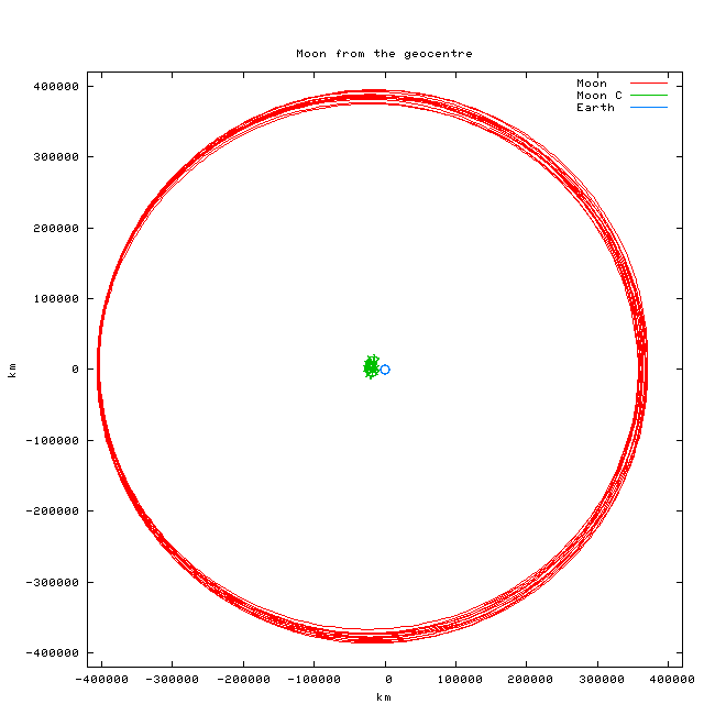
| 18:54, 24 March 2006 | Earth-moon-ecliptic.png (file) |  |
7 KB | A projection of the orbit of the Moon onto the ecliptic plane, as seen from the geocentre. Also plotted is the "centre of curvature" of the trajectory -- it's the large splotch near the centre -- and the Earth itself, that small circle nearby. Data for |
| 01:21, 30 March 2006 | Aythya-collaris-001.jpg (file) |  |
160 KB | Ring-necked Duck -- Humber Bay Park (East), Toronto, Canada -- 2006 March {{GFDL}} |
| 01:54, 30 March 2006 | Anas-americana-004.jpg (file) |  |
448 KB | American Widgeon -- Humber Bay Park (East), Toronto, Canada -- 2006 March {{GFDL}} Female. |
| 01:56, 30 March 2006 | Anas-americana-003.jpg (file) |  |
476 KB | American Widgeon -- Humber Bay Park (East), Toronto, Canada -- 2006 March {{GFDL}} |
| 20:41, 17 April 2006 | Agelaius-phoeniceus-001.ogg (file) | 331 KB | Male Red-Winged Blackbird -- Bluffer's Park, Toronto, Canada -- 2006 April {{GFDL}} The classic "CONG-A-LEEEEEEEE!" call. | |
| 20:57, 17 April 2006 | Pseudacris-crucifer-002.ogg (file) | 378 KB | Spring Peeper -- Presquile Provincial Park, Ontario, Canada -- 2006 April {{GFDL}} | |
| 21:03, 17 April 2006 | Pseudacris-crucifer-003.ogg (file) | 2.07 MB | A pond of Spring Peeper's and Wood Frog's -- Presquile Provincial Park, Ontario, Canada -- 2006 April {{GFDL}} Probably a few hundred or so individuals in a pond 50m x 30m near Owen Point in the park. The recording was made about one hour after sunset o | |
| 15:35, 11 May 2006 | Certhia-americana-001.jpg (file) |  |
325 KB | Brown Creeper -- Humber Bay Park, Toronto, Canada -- 2006 April {{GFDL}} |
| 13:38, 24 May 2006 | Calidris-alpina-001.jpg (file) |  |
864 KB | Dunlin -- Hillman Marsh (near Point Pelee), Canada -- 2006 May {{GFDL}} |
| 14:00, 24 May 2006 | Dendroica-coronata-001.jpg (file) |  |
858 KB | Yellow-rumped Warbler -- Rondeau Provincial Park, Canada -- 2006 May {{GFDL}} |
| 14:36, 24 May 2006 | Empidonax-minimus-001.jpg (file) |  |
498 KB | Least Flycatcher -- Hillman Marsh (near Point Pelee), Canada -- 2006 May {{GFDL}} |
| 16:43, 19 June 2006 | Archilochus-alexandri-002.jpg (file) |  |
708 KB | Black-chinned Hummingbird -- Moab, Utah, USA -- 2006 June {{GFDL}} Female. |
| 16:45, 19 June 2006 | Archilochus-alexandri-003.jpg (file) |  |
679 KB | Black-chinned Hummingbird -- Moab, Utah, USA -- 2006 June {{GFDL}} Male, with partial gorget illumination. |
| 19:55, 21 June 2006 | Calypte-anna-002.jpg (file) |  |
569 KB | Anna's Hummingbird -- Mrs. Paton's feeders, Patagonia, Arizona, USA -- 2005 April {{GFDL}} Male. |
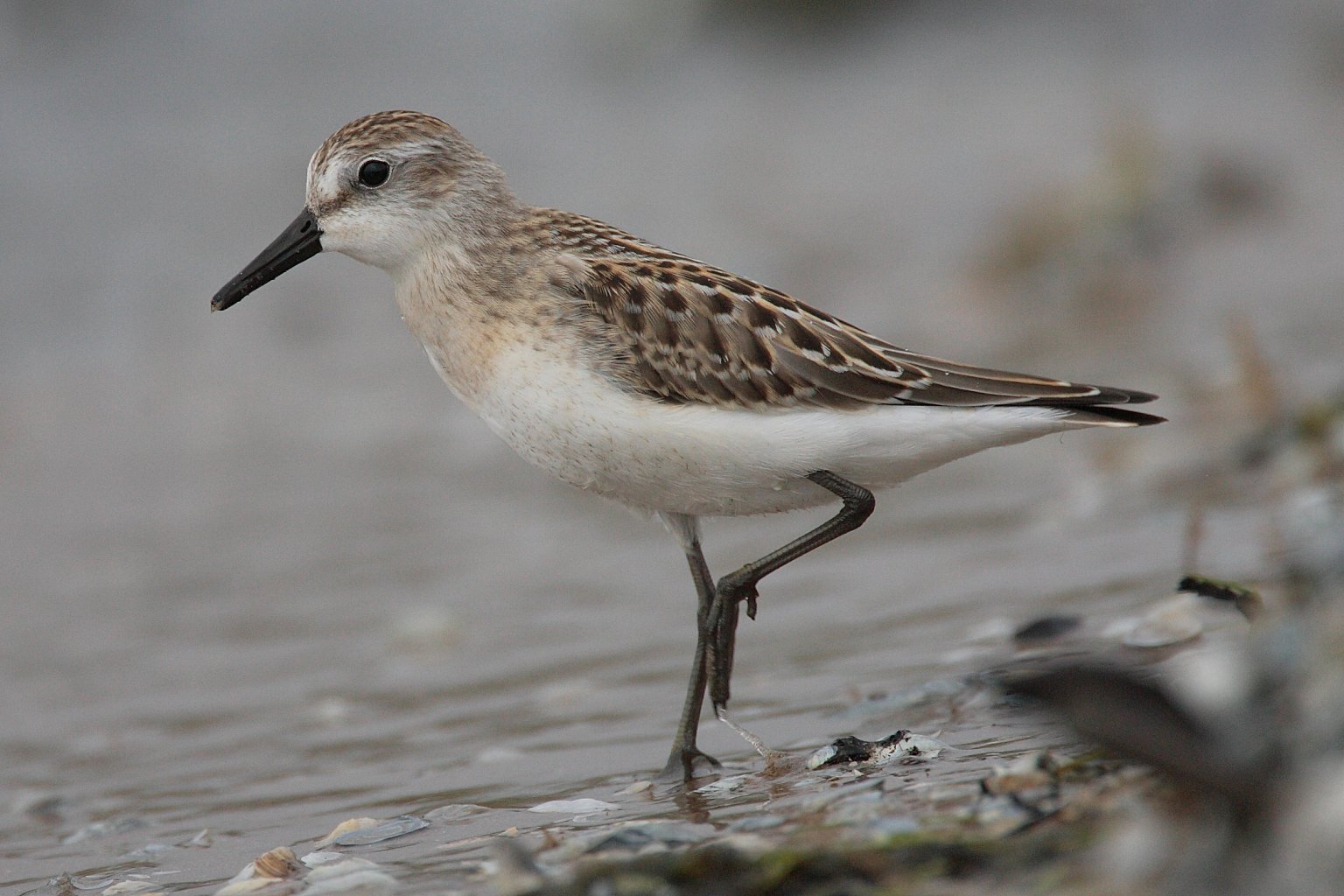
| 13:59, 28 August 2006 | Calidris-pusilla-001.jpg (file) |  |
206 KB | Semipalmated Sandpiper -- Cobourg, Ontario, Canada -- 2006 August {{GFDL}} |
| 18:51, 27 September 2006 | Algonquin-winter.jpg (file) |  |
6.68 MB | Along the Hemlock Bluff trail -- Algonquin Provincial Park, Canada -- 2005 December {{GFDL}} |
| 13:00, 3 October 2006 | Tamias-rufus-001.jpg (file) |  |
1.09 MB | Hopi Chipmunk -- Dead Horse State Park, Utah -- 2006 June {{GFDL}} |
| 13:50, 3 October 2006 | Accipiter-cooperii-01.jpg (file) |  |
158 KB | Cooper's Hawk -- backyard, Toronto, Canada -- 2004 November {{GFDL}} Not the finest of images (note foreground and background clutter), but highly remarkable in that the subject was about 5m away and not particularly perturbed by the presence of the phot |
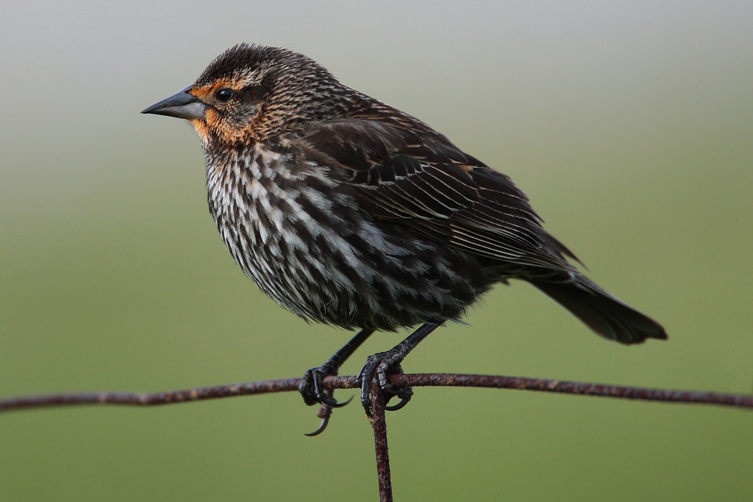
| 18:33, 3 October 2006 | Agelaius-phoeniceus-008.jpg (file) |  |
629 KB | Red-Winged Blackbird (female) -- Hillman Marsh (near Point Pelee), Canada -- 2006 May {{GFDL}} |
| 16:21, 6 October 2006 | Craig-retroazimuthal.jpg (file) |  |
942 KB | The Craig Retroazimuthal (aka "Mecca") projection. Centred on Makkah, you can measure the great-circle azimuth '''to''' Makkah from any other point on the map by measuring the angle from the vertical. {{PD-self}} The template is a Visible Earth imag |
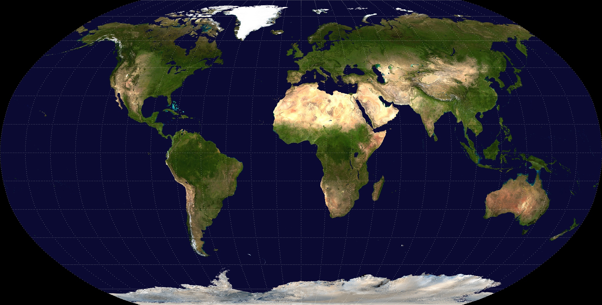
| 17:08, 6 October 2006 | Robinson-projection.jpg (file) |  |
849 KB | A Robinson projection of a Visible Earth image collected by the Earth Observatory experiment of the U.S. Government's NASA space agency. The reticle is 15 degrees in latitude and longitude. {{PD-self}} |
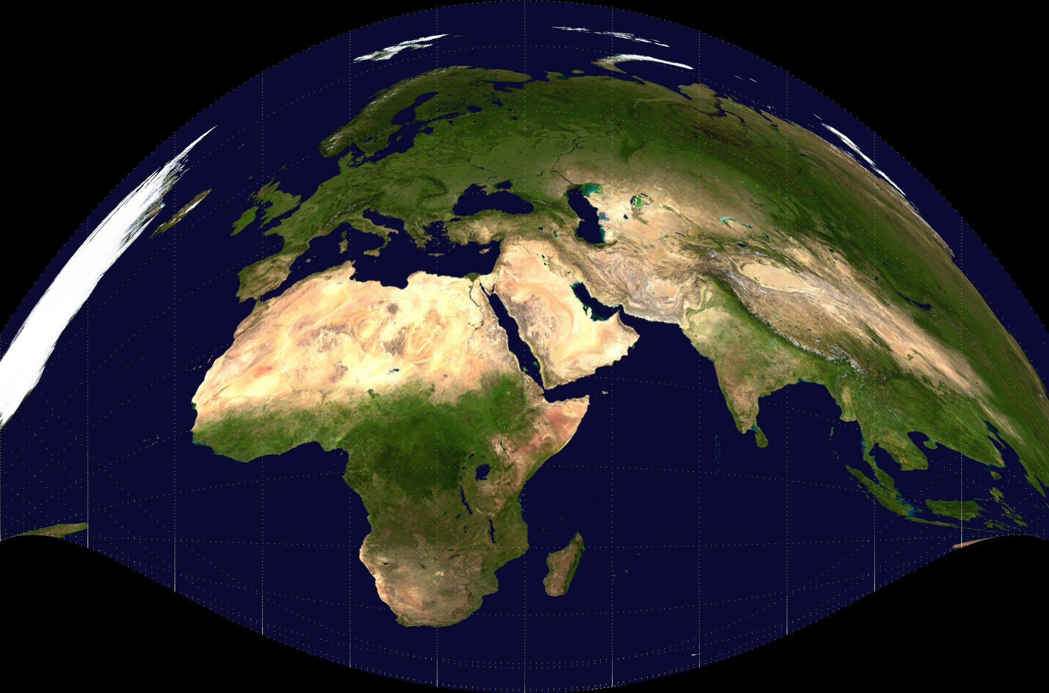
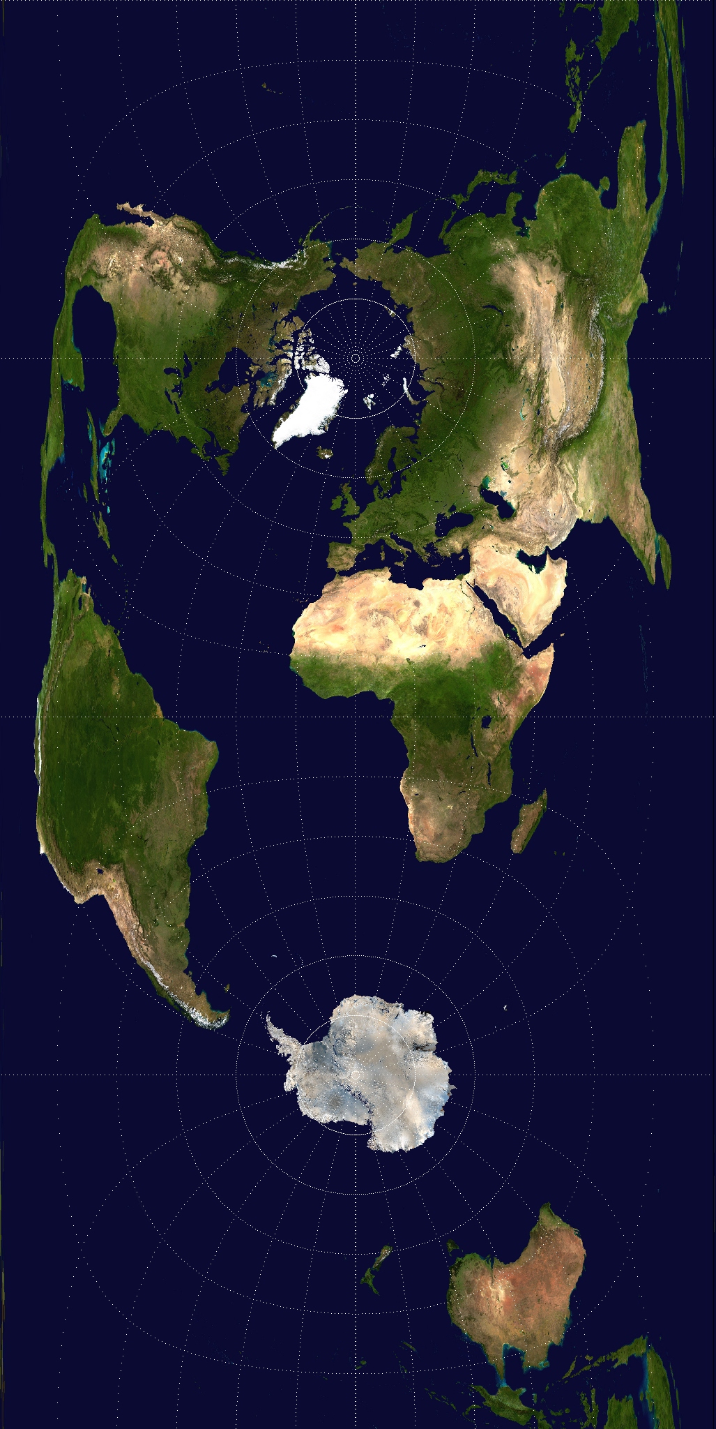
| 17:08, 6 October 2006 | Azimuthal-equidistant.jpg (file) |  |
984 KB | An azimuthal equidistant projection of a Visible Earth image collected by the Earth Observatory experiment of the U.S. Government's NASA space agency. The reticle is 15 degrees in latitude and longitude. {{PD-self}} |
| 17:10, 6 October 2006 | Lambert-azimuthal-equal-area.jpg (file) |  |
1.26 MB | A Lambert azimuthal equal area projection of a Visible Earth image collected by the Earth Observatory experiment of the U.S. Government's NASA space agency. The reticle is 15 degrees in latitude and longitude. {{PD-self}} |
| 14:24, 10 October 2006 | Euphagus-carolinus-001.jpg (file) |  |
165 KB | Rusty Blackbird -- Algonquin Provincial Park, Canada -- 2006 October {{GFDL}} |
| 14:48, 16 October 2006 | Miller-projection.jpg (file) |  |
1.26 MB | A Miller projection of a Visible Earth image collected by the Earth Observatory experiment of the U.S. Government's NASA space agency. The reticle is 15 degrees in latitude and longitude. {{PD-self}} |
| 15:05, 16 October 2006 | Polyconic-projection.jpg (file) |  |
928 KB | A Polyconic projection of a Visible Earth image collected by the Earth Observatory experiment of the U.S. Government's NASA space agency. The reticle is 15 degrees in latitude and longitude. {{PD-self}} |
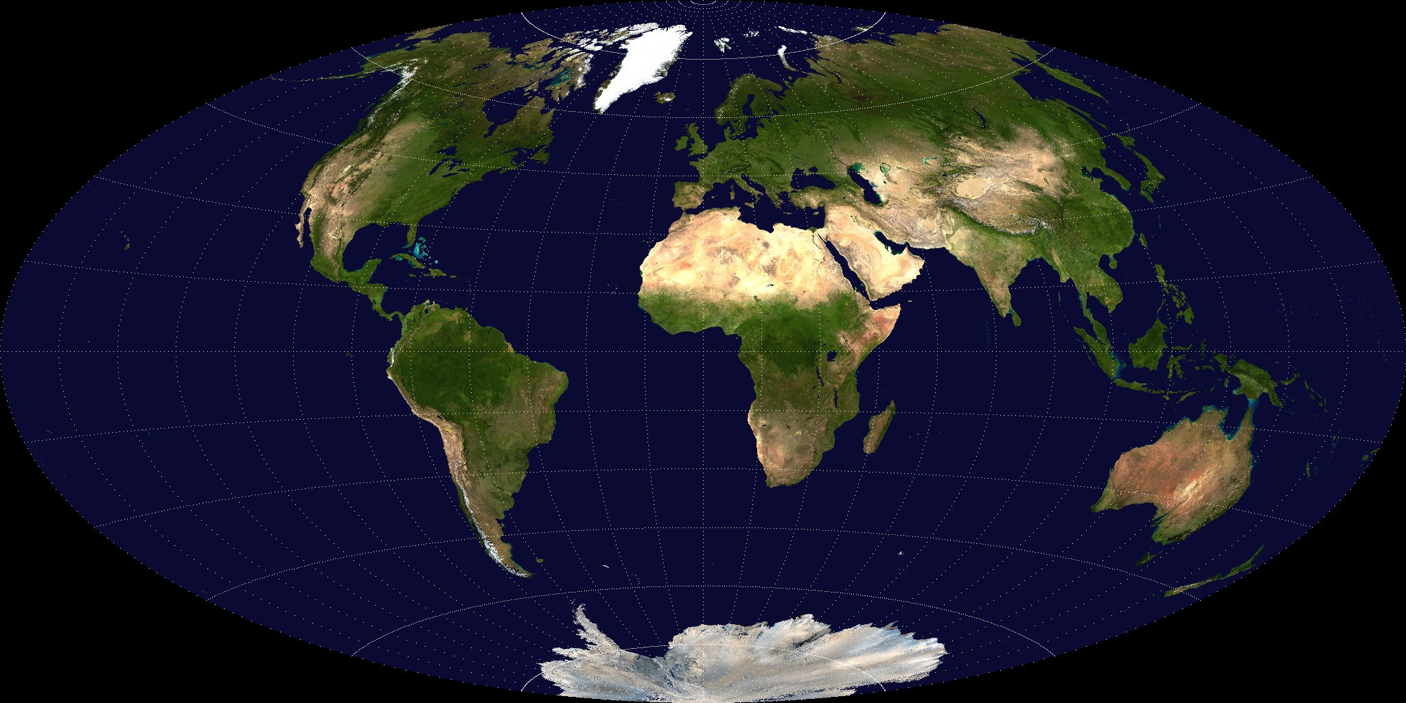
| 18:36, 16 October 2006 | Mollweide-projection.jpg (file) |  |
766 KB | A Mollweide projection of a Visible Earth image collected by the Earth Observatory experiment of the U.S. Government's NASA space agency. The reticle is 15 degrees in latitude and longitude. {{PD-self}} |
| 20:26, 16 October 2006 | Bruce-trail-blaze.jpg (file) |  |
137 KB | A blaze on the Bruce Trail -- Mono Cliffs Provincial Park, Ontario, Canada -- 2006 October {{PD-self}} |
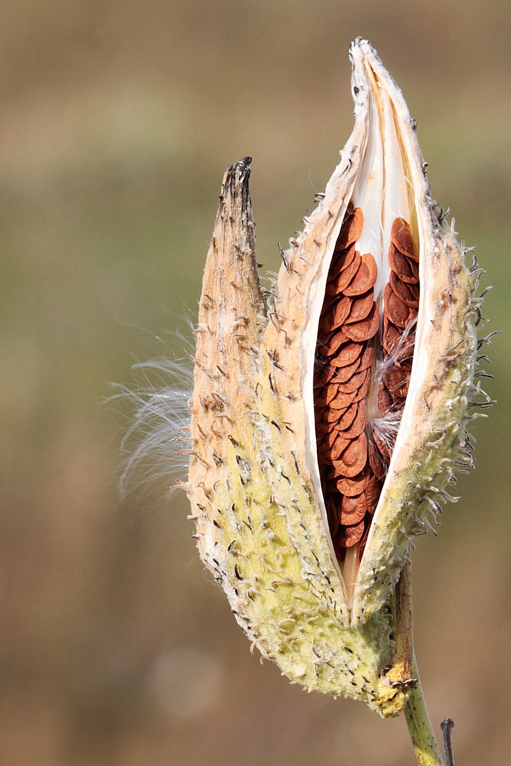
| 20:48, 16 October 2006 | Milkweed-in-seed.jpg (file) |  |
267 KB | A milkweed, gone to seed -- Forks of the Credit Provincial Park, Ontario, Canada -- 2006 October {{GFDL}} |
| 20:54, 16 October 2006 | Milkweed-in-seed2.jpg (file) |  |
238 KB | A milkweed, gone to seed -- Forks of the Credit Provincial Park, Ontario, Canada -- 2006 October {{GFDL}} |
| 15:13, 17 October 2006 | Aitoff-projection.jpg (file) |  |
757 KB | An Aitoff projection of a Visible Earth image collected by the Earth Observatory experiment of the U.S. Government's NASA space agency. The reticle is 15 degrees in latitude and longitude. {{PD-self}} |
| 18:57, 17 October 2006 | Hammer-projection.jpg (file) |  |
767 KB | A Hammer projection of a Visible Earth image collected by the Earth Observatory experiment of the U.S. Government's NASA space agency. The reticle is 15 degrees in latitude and longitude. {{PD-self}} |
| 15:06, 18 October 2006 | Equirectangular-projection.jpg (file) |  |
937 KB | An equirectangular projection, with the equator as the standard parallel, of a Visible Earth image collected by the Earth Observatory experiment of the U.S. Government's NASA space agency. The reticle is 15 degrees in latitude and longitude. |
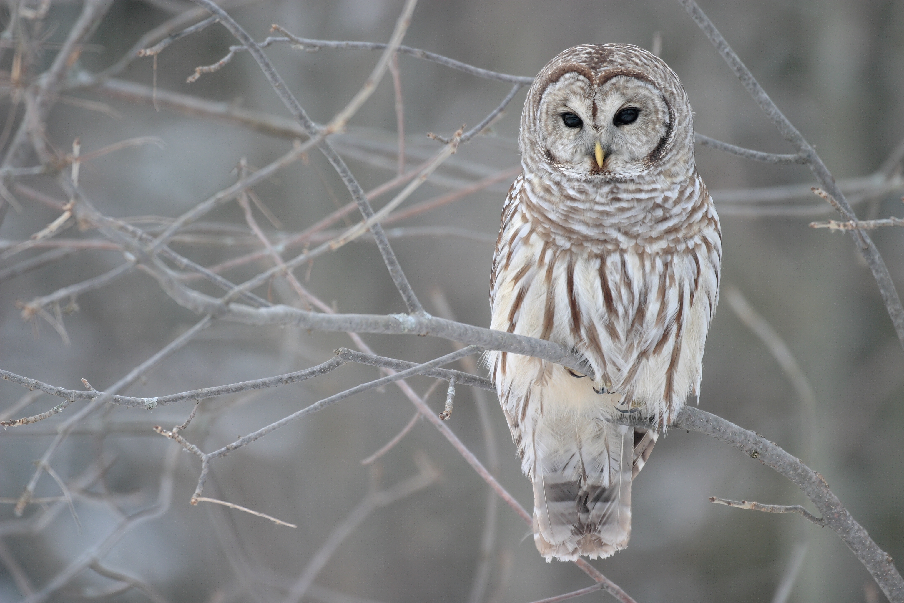
| 20:33, 18 October 2006 | Strix-varia-005.jpg (file) |  |
4.42 MB | Barred Owl -- Whitby, Ontario, Canada -- 2005 January {{GFDL}} |
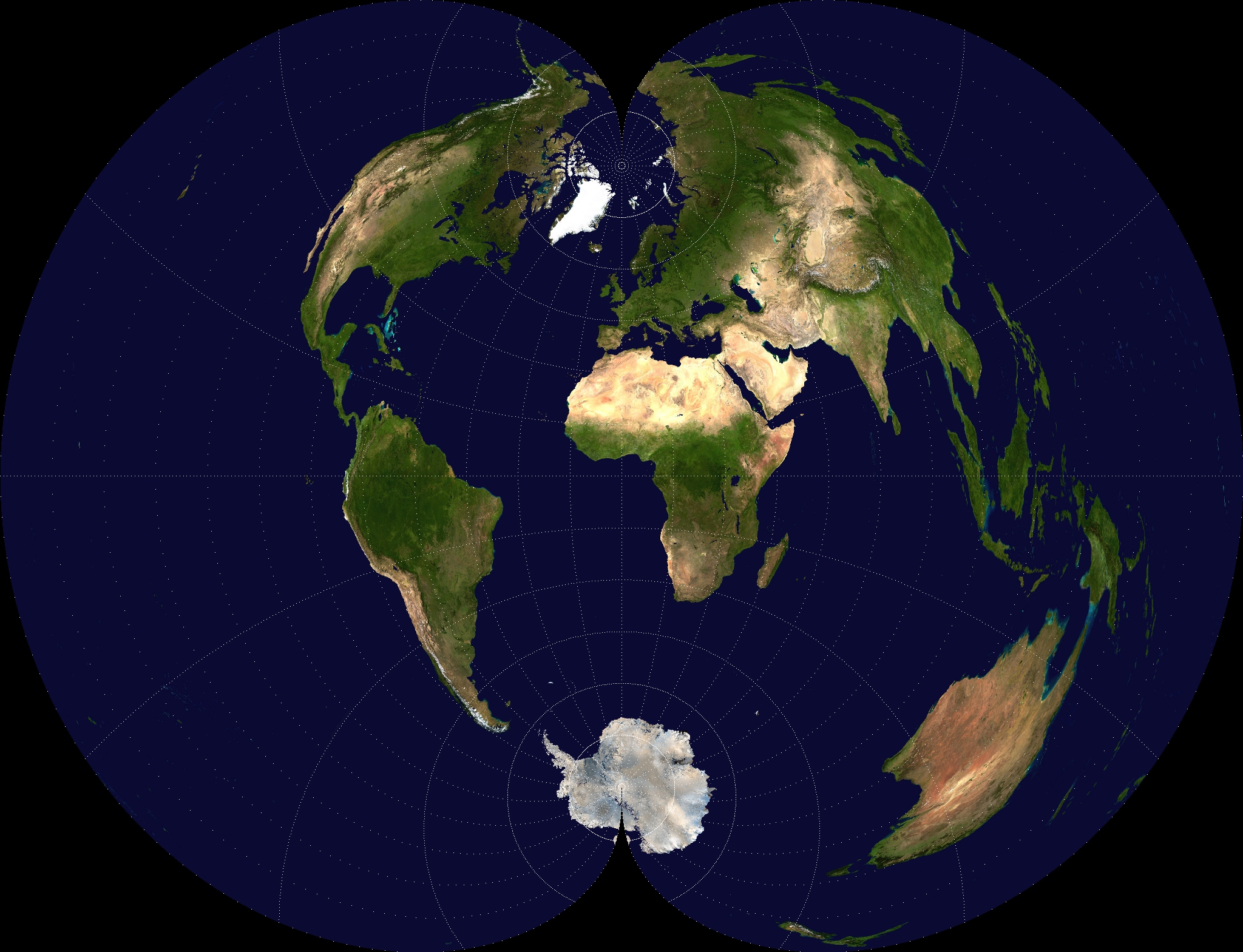
| 14:11, 30 October 2006 | Peirce-quincuncial-projection.jpg (file) |  |
1.19 MB | A Peirce quincuncial projection of a Visible Earth image collected by the Earth Observatory experiment of the U.S. Government's NASA space agency. The reticle is 15 degrees in latitude and longitude. {{PD-self}} |
| 14:24, 30 October 2006 | Winkel-tripel-projection.jpg (file) |  |
940 KB | A Winkel Tripel projection of a Visible Earth image collected by the Earth Observatory experiment of the U.S. Government's NASA space agency. The reticle is 15 degrees in latitude and longitude. {{PD-self}} |
| 14:00, 31 October 2006 | Cassini-projection.jpg (file) |  |
882 KB | A Cassini projection of a Visible Earth image collected by the Earth Observatory experiment of the U.S. Government's NASA space agency. The reticle is 15 degrees in latitude and longitude. {{PD-self}} |
| 14:12, 3 November 2006 | Two-point-equidistant-asia.jpg (file) |  |
1.37 MB | A Two Point Equidistant projection of Asia. The control points are at 35N 40E and 35N 140E. The source image is a product of NASA's Blue Marble project. {{PD-self}} |
| 14:38, 11 January 2007 | Harpia-harpyja-001.jpg (file) |  |
370 KB | Harpy Eagle -- Camino del Oleoducto, Parque Nacionale Soberania, Panama -- 2006 December {{GFDL-self}} |