Category:Cranford, London: Difference between revisions
Jump to navigation
Jump to search
Content deleted Content added
No edit summary |
No edit summary |
||
| Line 1: | Line 1: | ||
{{mainw|Cranford, London}} |
{{mainw|Cranford, London}} |
||
{{Wikidata Infobox}} |
|||
[[Category:Districts of London]] |
[[Category:Districts of London]] |
||
Latest revision as of 16:12, 8 June 2018
Main Wikipedia article: Cranford, London.
area in the London Borough of Hounslow, in the United Kingdom  | |||||
| Upload media | |||||
| Instance of | |||||
|---|---|---|---|---|---|
| Standort | London Borough of Hounslow, Greater London, London, England | ||||
| Located in or next to body of water | |||||
| Area |
| ||||
 | |||||
Subcategories
This category has the following 2 subcategories, out of 2 total.
D
Q
- The Queens Head, Cranford (3 F)
Media in category "Cranford, London"
The following 58 files are in this category, out of 58 total.
-
 A312 - geograph.org.uk - 6021695.jpg 1,024 × 681; 117 KB
-
 A4 Bath Road - geograph.org.uk - 1584161.jpg 640 × 480; 49 KB
-
 A4 Bath Road, Cranford - geograph.org.uk - 2649403.jpg 4,320 × 3,240; 3.67 MB
-
 A4 Bath Road, Cranford - geograph.org.uk - 2649417.jpg 4,320 × 3,240; 3.94 MB
-
 A4 eastbound, Cranford - geograph.org.uk - 2221006.jpg 1,600 × 1,200; 583 KB
-
 A4 westbound, Cranford - geograph.org.uk - 2221003.jpg 1,600 × 1,200; 581 KB
-
 Bath Road from the air - geograph.org.uk - 5074408.jpg 640 × 480; 191 KB
-
 Bath Road from the air - geograph.org.uk - 5085082.jpg 640 × 480; 206 KB
-
 Burnham Gardens - geograph.org.uk - 2603248.jpg 640 × 430; 57 KB
-

-
 Cranford - Byron Close - geograph.org.uk - 5085684.jpg 3,264 × 2,448; 2.56 MB
-
-
 Cranford Community College - geograph.org.uk - 5252441.jpg 544 × 248; 27 KB
-
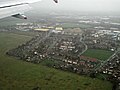
 Cranford from the air - geograph.org.uk - 3785589.jpg 640 × 480; 141 KB
-
 Cranford from the air - geograph.org.uk - 3994352.jpg 640 × 382; 169 KB
-
 Cranford High Street passes Cranford Community College - geograph.org.uk - 2899159.jpg 3,648 × 2,736; 2.11 MB
-
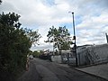
 Cranford Lane, Cranford - geograph.org.uk - 3697212.jpg 2,560 × 1,920; 1.98 MB
-
 Cranford Park - geograph.org.uk - 1219761.jpg 640 × 445; 143 KB
-
 Cranford Park - geograph.org.uk - 207177.jpg 640 × 480; 108 KB
-
 Cranford Park Open Space - geograph.org.uk - 76699.jpg 640 × 425; 122 KB
-
 Cranford Park, Cranford - geograph.org.uk - 1013357.jpg 640 × 426; 108 KB
-
 Cranford, A312 The Parkway - geograph.org.uk - 1163198.jpg 640 × 455; 69 KB
-
 Crossroads on the A312 - geograph.org.uk - 3144575.jpg 640 × 480; 116 KB
-
 Derelict building at Cranford Park - geograph.org.uk - 1012710.jpg 640 × 426; 139 KB
-

-

-
 Fields by the A4 from the air. - geograph.org.uk - 3786128.jpg 640 × 480; 117 KB
-
 Fields near the A4 from above - geograph.org.uk - 3512697.jpg 2,859 × 2,057; 1.27 MB
-
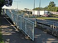 Footbridge across the A312 in Cranford - geograph.org.uk - 4639445.jpg 800 × 602; 165 KB
-
 Ha-ha in Cranford Park - geograph.org.uk - 1012673.jpg 640 × 426; 117 KB
-
 High Street, Cranford - geograph.org.uk - 2649401.jpg 4,320 × 3,240; 3.79 MB
-
 High Street, Cranford - geograph.org.uk - 2649411.jpg 4,320 × 3,240; 4.21 MB
-
 High Street, Cranford - geograph.org.uk - 2649413.jpg 4,320 × 3,240; 3.79 MB
-
 Hounslow - Bleriot Road - geograph.org.uk - 5085499.jpg 3,264 × 2,448; 2.51 MB
-
 Hounslow West from the air - geograph.org.uk - 5892267.jpg 1,600 × 1,068; 754 KB
-
 Houses on Cranford Lane - geograph.org.uk - 3697508.jpg 2,560 × 1,920; 2.24 MB
-

-
 Jolly Waggoner, Cranford, TW5 (13579290385).jpg 3,678 × 2,113; 2.43 MB
-
 Mornington Crescent from the air - geograph.org.uk - 5085081.jpg 640 × 480; 212 KB
-
 Park Bench, Cranford Park - geograph.org.uk - 2709032.jpg 1,600 × 1,200; 620 KB
-
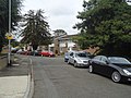
 Park Lane, Cranford - geograph.org.uk - 3972115.jpg 2,560 × 1,920; 2 MB
-
 Pedestrian crossing, A4, Cranford - geograph.org.uk - 2603251.jpg 640 × 430; 73 KB
-
 Pegg Road from Cranford Lane - geograph.org.uk - 3697556.jpg 2,560 × 1,920; 1.75 MB
-
 River Crane at Cranford - geograph.org.uk - 78484.jpg 640 × 425; 151 KB
-
 River Crane in Cranford Park - geograph.org.uk - 207182.jpg 640 × 480; 163 KB
-
 Sandringham Gardens, Cranford - geograph.org.uk - 2649406.jpg 4,320 × 3,240; 4.71 MB
-
 Sheepcote Close, Cranford - geograph.org.uk - 2649399.jpg 4,320 × 3,240; 4.11 MB
-
 Sheepcote Close, Cranford - geograph.org.uk - 3697035.jpg 2,560 × 1,920; 2.03 MB
-
 Site of Cranford House, Cranford Park - geograph.org.uk - 1012634.jpg 640 × 411; 142 KB
-
 South Cranford, East of Heathrow - geograph.org.uk - 5253470.jpg 463 × 365; 35 KB
-
 Stripy pole Mornington Crescent, Cranford - geograph.org.uk - 2277526.jpg 1,200 × 1,600; 375 KB
-
 The Ramada and Berkeley Arms Hotel in Cranford Hounslow - panoramio.jpg 3,566 × 2,622; 3.69 MB
-

-
 Victorian Overnight Prison Cell in Cranford Middlesex - panoramio.jpg 2,788 × 2,120; 1.5 MB
-
 Waye Avenue, Cranford - geograph.org.uk - 1215703.jpg 640 × 427; 53 KB
-
 Waye Avenue, Cranford - geograph.org.uk - 2710247.jpg 1,600 × 1,179; 443 KB
-
 Waye Avenue, near Heathrow - geograph.org.uk - 2708816.jpg 1,600 × 1,119; 385 KB
-
 Waye Avenue, near Heathrow 2 - geograph.org.uk - 2708825.jpg 1,600 × 1,166; 407 KB


.jpg)


