Category:Acle
Jump to navigation
Jump to search
English: Category:Broadland
Nederlands: Acle is een plaats in het bestuurlijke gebied Broadland, in het Engelse graafschap Norfolk. De plaats telt 2732 inwoners.
Polski: Acle - miasteczko w Anglii (Wielka Brytania), w regionie East of England, w hrabstwie Norfolk. W 2001 roku miasto to na powierzchni 9,46 km² zamieszkiwało 2 732 osób. Miasto położone jest nad rzeką Bure.
town and civil parish in Broadland, Norfolk, UK  | |||||
| Upload media | |||||
| Instance of | |||||
|---|---|---|---|---|---|
| Location | Broadland, Norfolk, East of England, England | ||||
| Population |
| ||||
| Area |
| ||||
 | |||||
Subcategories
This category has the following 8 subcategories, out of 8 total.
Media in category "Acle"
The following 179 files are in this category, out of 379 total.
(previous page) (next page)-
 Old Road (A1064) - geograph.org.uk - 4934796.jpg 640 × 480; 52 KB
-
 Old Road, Acle - geograph.org.uk - 4934588.jpg 640 × 480; 64 KB
-

-

-
 Open Field System (plaque) - geograph.org.uk - 4778995.jpg 640 × 542; 545 KB
-

-
 Pastures in the Damgate Marshes - geograph.org.uk - 1480043.jpg 640 × 475; 97 KB
-

-
 Path beside the railway line - geograph.org.uk - 1477874.jpg 640 × 480; 90 KB
-
 Path from Acle Dyke to the A47 road - geograph.org.uk - 3439911.jpg 640 × 480; 312 KB
-
 Path in Jubilee Wood - geograph.org.uk - 4779057.jpg 640 × 360; 355 KB
-
 Path through Damgate Wood - geograph.org.uk - 1477823.jpg 480 × 640; 146 KB
-
 Path through Damgate Wood - geograph.org.uk - 1477839.jpg 640 × 480; 155 KB
-
 Path through Farrow's Wood - geograph.org.uk - 4778979.jpg 640 × 360; 286 KB
-
 Path through Jubilee Wood - geograph.org.uk - 4779061.jpg 640 × 360; 290 KB
-
 Path to Acle - geograph.org.uk - 1066290.jpg 640 × 427; 85 KB
-
 Path to Reedham Road - geograph.org.uk - 1477828.jpg 480 × 640; 135 KB
-
 Path to the sun dial in Jubilee Wood - geograph.org.uk - 4779068.jpg 640 × 360; 329 KB
-
 Path traversing Farrow's Wood - geograph.org.uk - 4778990.jpg 640 × 360; 397 KB
-
 Plough, with followers - geograph.org.uk - 6063168.jpg 3,264 × 2,448; 1.7 MB
-

-
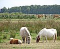
 Pony grazing marsh pasture - geograph.org.uk - 1480042.jpg 600 × 555; 106 KB
-
 Portrait of a donkey - geograph.org.uk - 1477916.jpg 381 × 525; 72 KB
-
 Post Office on Priory Close, Acle - geograph.org.uk - 6310649.jpg 5,456 × 3,632; 1.17 MB
-
 Postbox on The Street, Acle - geograph.org.uk - 6310652.jpg 3,632 × 5,456; 1.24 MB
-
 Prince Albert at Acle Dyke - geograph.org.uk - 3439952.jpg 640 × 480; 208 KB
-
 Private moorings at Acle Dyke - geograph.org.uk - 3439941.jpg 640 × 480; 178 KB
-
 Private moorings by the River Bure, Acle - geograph.org.uk - 3440039.jpg 640 × 480; 245 KB
-

-

-
 Public road goes private - geograph.org.uk - 910272.jpg 480 × 640; 184 KB
-
 Puddles on the track to Mill Lane, Acle - geograph.org.uk - 4779038.jpg 640 × 360; 340 KB
-
 Pump house and sluice at Acle Dyke - geograph.org.uk - 3439896.jpg 640 × 449; 162 KB
-
 Pump house at Acle Dyke - geograph.org.uk - 3439897.jpg 640 × 470; 177 KB
-
 Pump house by the River Bure, Acle - geograph.org.uk - 3440036.jpg 640 × 544; 228 KB
-
 Pump house in Damgate Wood - geograph.org.uk - 4779115.jpg 640 × 360; 348 KB
-
 Pumping station by the River Bure - geograph.org.uk - 2232029.jpg 640 × 458; 83 KB
-
 Pumping station by the River Bure - geograph.org.uk - 2232031.jpg 640 × 480; 88 KB
-
 Pumping station by the River Bure - geograph.org.uk - 2232036.jpg 640 × 480; 97 KB
-
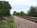 Railway line - geograph.org.uk - 822144.jpg 640 × 480; 173 KB
-

-

-

-
 Reeds beside the River Bure, Acle - geograph.org.uk - 3439987.jpg 640 × 480; 205 KB
-
 River Bure - geograph.org.uk - 48104.jpg 640 × 480; 77 KB
-
 River Bure - Norfolk Broads - geograph.org.uk - 451995.jpg 640 × 480; 90 KB
-
 River Bure at Stokesby - geograph.org.uk - 6309672.jpg 5,456 × 3,632; 1.21 MB
-

-

-
 River Bure, Stokesby - geograph.org.uk - 2281704.jpg 640 × 480; 41 KB
-
 Riverside commercial buildings near Acle Bridge - geograph.org.uk - 2551803.jpg 3,888 × 2,592; 4.09 MB
-
 Roadside pond near Acle - geograph.org.uk - 2239349.jpg 640 × 480; 276 KB
-
 Roll of Honour, St Edmund's Church, Acle - geograph.org.uk - 6310800.jpg 2,468 × 3,463; 619 KB
-
 Rosehips beside the path - geograph.org.uk - 1477872.jpg 640 × 480; 122 KB
-
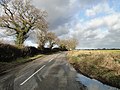
 Roundabout on Reedham Road - geograph.org.uk - 1477787.jpg 640 × 480; 80 KB
-
 Say it with flowers - geograph.org.uk - 4145584.jpg 640 × 480; 151 KB
-
 Shelter in marsh pasture - geograph.org.uk - 1477895.jpg 640 × 480; 129 KB
-
 Shelter in pasture by Broad Farm, Acle - geograph.org.uk - 3439926.jpg 640 × 480; 214 KB
-
-
 Small brick structure beside farm track - geograph.org.uk - 4779023.jpg 640 × 360; 371 KB
-
 Small brick structure beside farm track - geograph.org.uk - 4779025.jpg 640 × 449; 504 KB
-
 Small pond beside Jolly's Lane, Acle - geograph.org.uk - 3784248.jpg 640 × 480; 256 KB
-
 Small pond in field west of The Windle - geograph.org.uk - 2193988.jpg 640 × 480; 105 KB
-
 South Walsham Road, Acle - geograph.org.uk - 4934745.jpg 640 × 480; 68 KB
-
 St Edmund's Church, Acle - geograph.org.uk - 6310686.jpg 5,456 × 3,632; 1.57 MB
-
 St Edmund's Church, Acle - geograph.org.uk - 6310796.jpg 3,632 × 5,456; 1.28 MB
-
 St Edmund's Church, Acle - geograph.org.uk - 6310838.jpg 5,456 × 3,632; 1.05 MB
-
 St Edmund's Church, Acle - geograph.org.uk - 6310840.jpg 3,632 × 5,456; 1.27 MB
-
 St Edmund's Church, Acle - geograph.org.uk - 6310845.jpg 3,632 × 5,456; 977 KB
-
 St Edmund's Church, Acle - geograph.org.uk - 6310847.jpg 2,218 × 3,333; 850 KB
-
 St Edmund's Church, Acle - geograph.org.uk - 6310850.jpg 5,456 × 3,632; 1.04 MB
-
 St Edmund's Church, Acle - geograph.org.uk - 6310852.jpg 3,632 × 5,456; 1.3 MB
-
 St Edmund's Church, Acle - geograph.org.uk - 6310855.jpg 2,944 × 3,649; 1.05 MB
-
 St Edmund's Church, Acle - geograph.org.uk - 6310865.jpg 5,456 × 3,632; 1.3 MB
-
 St Edmund's Church, Acle - geograph.org.uk - 6390023.jpg 1,200 × 802; 1.15 MB
-
 St Edmund's, Acle - geograph.org.uk - 4208580.jpg 1,600 × 1,074; 617 KB
-
 St Edmund's, Acle - geograph.org.uk - 4208584.jpg 1,600 × 1,074; 622 KB
-
 Stacks of straw bales by White's Farm - geograph.org.uk - 2193989.jpg 640 × 523; 136 KB
-
 Stubble field west of The Windle - geograph.org.uk - 2193979.jpg 640 × 480; 140 KB
-
 Sugar beet crop beside Reedham Road - geograph.org.uk - 3784252.jpg 640 × 480; 191 KB
-
 Sundial in Farrow's Wood - geograph.org.uk - 4778981.jpg 640 × 360; 329 KB
-
 Sundial in Farrow's Wood - geograph.org.uk - 4778982.jpg 640 × 583; 529 KB
-
 Sundial in Farrow's Wood - geograph.org.uk - 4778984.jpg 640 × 397; 398 KB
-
 Tanks at Anglian Water treatment works - geograph.org.uk - 1480007.jpg 533 × 640; 109 KB
-

-
 The bier from Acle church - geograph.org.uk - 2264752.jpg 640 × 480; 203 KB
-
 The Bridge Inn - geograph.org.uk - 4934801.jpg 3,648 × 2,736; 1.5 MB
-
 The Bridge Inn, Acle - geograph.org.uk - 2194049.jpg 640 × 504; 116 KB
-
 The Bridge Inn, Acle - geograph.org.uk - 2194052.jpg 640 × 476; 118 KB
-
 The Bridge Inn, Acle - geograph.org.uk - 2194053.jpg 640 × 499; 116 KB
-
 The Bridge Inn, Acle - geograph.org.uk - 2551794.jpg 3,888 × 2,592; 4.4 MB
-
 The Bridge Inn, Acle - geograph.org.uk - 2551809.jpg 3,888 × 2,592; 3.91 MB
-
 The eastern edge of Jubilee Wood - geograph.org.uk - 4786693.jpg 360 × 640; 422 KB
-
 The edge of Jubilee Wood - geograph.org.uk - 4779043.jpg 640 × 360; 344 KB
-

-
 The Green, Acle - geograph.org.uk - 2940818.jpg 1,600 × 802; 305 KB
-
 The Kings Head, Acle - geograph.org.uk - 6310001.jpg 3,594 × 2,712; 643 KB
-
 The Kings Head, Acle - geograph.org.uk - 6310005.jpg 2,349 × 3,235; 245 KB
-
 The northern edge of Jubilee Wood - geograph.org.uk - 4779044.jpg 640 × 360; 284 KB
-
 The River Bure and the Ferry Inn - geograph.org.uk - 5014708.jpg 2,000 × 1,500; 263 KB
-
 The River Bure near Acle Bridge - geograph.org.uk - 2551812.jpg 3,888 × 2,592; 4.4 MB
-
 The River Bure past Acle Dyke - geograph.org.uk - 3439958.jpg 640 × 480; 192 KB
-
 The River Bure past Stokesby village - geograph.org.uk - 2239592.jpg 640 × 480; 103 KB
-
 The River Bure, Stokesby - geograph.org.uk - 1863101.jpg 1,280 × 915; 315 KB
-
 The sign says it all - geograph.org.uk - 1051431.jpg 640 × 480; 160 KB
-
 The village of Stokesby - geograph.org.uk - 2239379.jpg 640 × 480; 130 KB
-
 The Weavers Way approaching Mill House Farm - geograph.org.uk - 5294514.jpg 3,648 × 2,736; 3.79 MB
-

-

-
 This way to Norwich Road - geograph.org.uk - 1477801.jpg 640 × 480; 91 KB
-
 This way to Reedham Road - geograph.org.uk - 1477803.jpg 640 × 480; 72 KB
-
 To Acle on Reedham Road - geograph.org.uk - 3784256.jpg 640 × 480; 218 KB
-
 To Acle on the A47 road - geograph.org.uk - 3439931.jpg 640 × 480; 211 KB
-
 Track in Damgate Wood - geograph.org.uk - 4779126.jpg 640 × 360; 392 KB
-
 Track into fields west of Reedham Road - geograph.org.uk - 3784255.jpg 640 × 431; 174 KB
-
 Track leading to St Mary's Church, Fishley - geograph.org.uk - 6310866.jpg 4,788 × 3,327; 823 KB
-
 Track to Damgate Lane - geograph.org.uk - 1480029.jpg 640 × 434; 99 KB
-
 Track to Mill Lane, Acle - geograph.org.uk - 4779021.jpg 640 × 360; 310 KB
-
 Track to railway line - geograph.org.uk - 1480025.jpg 640 × 480; 109 KB
-
 Track to the River Bure by Acle Bridge - geograph.org.uk - 3440034.jpg 640 × 480; 196 KB
-
 Track to The Windle - geograph.org.uk - 4779012.jpg 640 × 360; 383 KB
-

-
 Train passing Damgate Wood - geograph.org.uk - 4779135.jpg 640 × 360; 400 KB
-

-
 Tree-lined road near Wood Farm, Beighton - geograph.org.uk - 2239353.jpg 640 × 480; 180 KB
-

-
 Trees growing alongside The Windle - geograph.org.uk - 2193976.jpg 640 × 480; 120 KB
-
 Trees in frozen pond - geograph.org.uk - 2193992.jpg 640 × 480; 179 KB
-
 Trees on a field boundary - geograph.org.uk - 4779003.jpg 640 × 360; 252 KB
-
 Unadopted road - geograph.org.uk - 910149.jpg 640 × 449; 134 KB
-
 Uphill to Windle Farm - geograph.org.uk - 4779032.jpg 640 × 360; 369 KB
-

-
 View across fields towards Fishley - geograph.org.uk - 4779027.jpg 640 × 360; 259 KB
-

-
 View across the River Bure, Acle - geograph.org.uk - 3439996.jpg 640 × 436; 171 KB
-
 View along the Acle Straight (A47 road) - geograph.org.uk - 3439933.jpg 640 × 480; 205 KB
-
 View along the River Bure by Acle Dyke - geograph.org.uk - 3439961.jpg 640 × 438; 155 KB
-
 View east along Damgate Lane - geograph.org.uk - 1480009.jpg 640 × 480; 122 KB
-

-

-

-
 View into pasture beside the Weavers Way - geograph.org.uk - 1480022.jpg 640 × 507; 158 KB
-
 View north along the Weavers Way - geograph.org.uk - 1477904.jpg 640 × 480; 128 KB
-

-
 View south along the Weavers Way - geograph.org.uk - 1477912.jpg 480 × 640; 137 KB
-
 View towards Acle Academy - geograph.org.uk - 4779028.jpg 640 × 500; 384 KB
-
 View towards Acle Academy - geograph.org.uk - 4779081.jpg 640 × 360; 305 KB
-
 View towards Acle from Jubilee Wood - geograph.org.uk - 4779087.jpg 640 × 360; 280 KB
-
 View towards White's Farm - geograph.org.uk - 4779002.jpg 640 × 612; 421 KB
-
 View towards Windle Farm - geograph.org.uk - 4766880.jpg 640 × 464; 358 KB
-
 War Memorial, Acle - geograph.org.uk - 6310794.jpg 3,632 × 5,456; 2.2 MB
-
 Water management installation - geograph.org.uk - 2232024.jpg 480 × 640; 95 KB
-
 Water trough in pasture by Acle Dyke - geograph.org.uk - 3439908.jpg 640 × 480; 235 KB
-
 Watercress in Coleman's Drain - geograph.org.uk - 4779120.jpg 640 × 360; 414 KB
-
 Weak bridge on Damgate Lane - geograph.org.uk - 1480019.jpg 522 × 640; 146 KB
-
 Whites Farm, Acle - geograph.org.uk - 6063179.jpg 3,264 × 2,448; 1.74 MB
-

-
 Wood Farm - geograph.org.uk - 473780.jpg 640 × 480; 120 KB
-

-
 WWII Pillbox - geograph.org.uk - 1759489.jpg 1,600 × 1,200; 608 KB
-
 Young and old oaks - geograph.org.uk - 4779099.jpg 441 × 640; 462 KB
-
 Young pedunculate oak in Jubilee Wood - geograph.org.uk - 4779096.jpg 640 × 360; 420 KB
-
 Young trees in Farrow's Wood - geograph.org.uk - 4778978.jpg 640 × 360; 359 KB
-
 Young trees in Jubilee Wood - geograph.org.uk - 4779085.jpg 640 × 360; 313 KB
-
 A barn conversion by Decoy Carr - geograph.org.uk - 1480279.jpg 640 × 462; 92 KB
-
 A colourful verge - geograph.org.uk - 910157.jpg 640 × 460; 146 KB
-
 A crop of sugar beet west of Muck Fleet - geograph.org.uk - 1496476.jpg 640 × 436; 127 KB
-

-
 Acle Dyke - geograph.org.uk - 802857.jpg 640 × 426; 76 KB
-
 Acle Dyke - geograph.org.uk - 802864.jpg 640 × 426; 81 KB
-
 Approaching the Weavers Way - geograph.org.uk - 1480017.jpg 640 × 480; 143 KB
-
 Beighton Road - geograph.org.uk - 346458.jpg 640 × 480; 165 KB
-
 Bridge on track to Damgate - geograph.org.uk - 1477908.jpg 640 × 480; 130 KB
-
 Field alongside the railwayline - geograph.org.uk - 346521.jpg 640 × 480; 155 KB
-
 Junction beyond Moulton St Mary - geograph.org.uk - 346494.jpg 640 × 480; 99 KB
-
 Looking towards Acle - geograph.org.uk - 264015.jpg 640 × 481; 80 KB
-
 Old and New in Acle - geograph.org.uk - 36267.jpg 640 × 480; 114 KB
-
 Ripening barley by Windle Farm - geograph.org.uk - 473804.jpg 640 × 480; 122 KB
-
 Rotten Marsh - geograph.org.uk - 473782.jpg 640 × 480; 106 KB
_-_geograph.org.uk_-_4934796.jpg)


_-_geograph.org.uk_-_4778995.jpg)


_-_geograph.org.uk_-_2193970.jpg)


_-_geograph.org.uk_-_3439933.jpg)


