Category:Brunnthal
Jump to navigation
Jump to search
municipality of Germany    | |||||
| Upload media | |||||
| Instance of |
| ||||
|---|---|---|---|---|---|
| Part of |
| ||||
| Standort | Munich, Upper Bavaria, Bavaria, Germany | ||||
| Head of government |
| ||||
| Population |
| ||||
| Area |
| ||||
| Elevation above sea level |
| ||||
| Different from | |||||
| official website | |||||
 | |||||
Subcategories
This category has the following 12 subcategories, out of 12 total.
B
C
D
E
G
- Geography of Brunnthal (2 F)
H
- History of Brunnthal (2 F)
M
N
S
- Sealing stamps of Brunnthal (1 F)
Media in category "Brunnthal"
The following 7 files are in this category, out of 7 total.
-
 Wappen Brunnthal.svg 777 × 774; 91 KB
-
 Wappen von Brunnthal.png 150 × 160; 13 KB
-
 Brunnthal - Lage im Landkreis.png 157 × 185; 25 KB
-
 Brunnthallkrm.svg 593 × 711; 120 KB
-
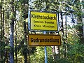 Gudrunsiedlung, zu Kirchstockach (Gde. Brunnthal, Lkr. München) (2).jpg 4,608 × 3,456; 5.66 MB
-
 Karte der Herrschaft Breuberg.jpg 5,042 × 3,832; 24.19 MB
-
 Wildschutzflaeche Brunnthal-1.jpg 3,563 × 4,459; 2.89 MB


_(2).jpg)

