Category:County Monaghan
Aller à la navigation
Aller à la recherche
Comtés de la République d’Irlande : Carlow · Cavan · Clare · Cork(1) · Donegal · Dún Laoghaire-Rathdown(2) · Fingal(2) · Galway(3) · Kerry · Kildare · Kilkenny · Laois · Leitrim · Limerick · Longford · Louth · Mayo · Meath · Monaghan · Offaly · Roscommon · Sligo · South Dublin(2) · Tipperary(4) · Waterford · Westmeath · Wexford · Wicklow – Villes séparées : Cork(1) · Dublin(2) · Galway(3) – Anciens comtés : Dublin(2) · South Tipperary(4) Anciens comtés d’Irlande du Nord : Antrim · Armagh · Down · Fermanagh · Londonderry · Tyrone
comté d'Irlande    | |||||
| Téléverser des médias | |||||
| Nature de l’élément | |||||
|---|---|---|---|---|---|
| Lieu |
| ||||
| Capitale | |||||
| Assemblée délibérante |
| ||||
| Exécutif |
| ||||
| Population |
| ||||
| Superficie |
| ||||
| site officiel | |||||
 | |||||
Sous-catégories
Cette catégorie comprend 17 sous-catégories, dont les 17 ci-dessous.
A
C
E
- Education in County Monaghan (4 F)
G
H
M
- Monaghan GAA (4 F)
- Museums in County Monaghan (2 F)
N
P
R
S
T
Pages dans la catégorie « County Monaghan »
Cette catégorie comprend seulement la page ci-dessous.
Média dans la catégorie « County Monaghan »
Cette catégorie comprend 974 fichiers, dont les 200 ci-dessous.
(page précédente) (page suivante)-
 "Our Time" 10ft Sculpture - geograph.org.uk - 4255324.jpg 2 000 × 3 008 ; 659 kio
-
 "The Monaghan Way" - geograph.org.uk - 3192697.jpg 640 × 480 ; 101 kio
-
 "The Monaghan Way", Doocharn - geograph.org.uk - 3191412.jpg 640 × 480 ; 47 kio
-
 "Welcome to County Monaghan" sign - geograph.org.uk - 4188994.jpg 640 × 480 ; 154 kio
-
 11kv power lines crossing a hay field at Lisnafeddaly - geograph.org.uk - 5040632.jpg 2 667 × 1 977 ; 1,78 Mio
-
 A beautiful playground – The Dromore river at Cootehill - geograph.org.uk - 3216763.jpg 4 000 × 3 000 ; 2,7 Mio
-

-
-
-
 A County Monaghan Farm overlooking the Border - geograph.org.uk - 6291186.jpg 3 748 × 1 738 ; 3,08 Mio
-
 A crannog on St Peter's Lough - geograph.org.uk - 4163829.jpg 1 024 × 768 ; 179 kio
-
 A drumlin - geograph.org.uk - 3250826.jpg 640 × 360 ; 212 kio
-
 A drumlin between the L3700 and Lough Muckno - geograph.org.uk - 4192316.jpg 1 024 × 768 ; 198 kio
-
 A friendly ass near Lough Clare - geograph.org.uk - 4167788.jpg 1 024 × 768 ; 288 kio
-
 A large farm house on the L3700 - geograph.org.uk - 4192294.jpg 1 024 × 768 ; 191 kio
-
 A lone tree, Drumgrole - geograph.org.uk - 3165599.jpg 640 × 480 ; 71 kio
-
-
 A low hill, Ahaderry - geograph.org.uk - 4188954.jpg 640 × 480 ; 176 kio
-
 A low hill, Castle Leslie - geograph.org.uk - 4042788.jpg 640 × 480 ; 144 kio
-
 A muddy field, Garradevlin - geograph.org.uk - 3165779.jpg 640 × 480 ; 80 kio
-
 A ploughed field, Coolartragh - geograph.org.uk - 3133480.jpg 640 × 480 ; 70 kio
-
-
 A shaded lane, Drumgrole - geograph.org.uk - 3165595.jpg 640 × 480 ; 97 kio
-

-
 A stretch of wetland alongside the L3700 - geograph.org.uk - 4176768.jpg 1 024 × 768 ; 159 kio
-
 A transmission mast overlooking the Ireland-United Kingdom border - geograph.org.uk - 5257050.jpg 4 000 × 3 000 ; 3,26 Mio
-
 A wooded section of the R162 north of Bawn - geograph.org.uk - 3746635.jpg 1 024 × 679 ; 228 kio
-
 Abandoned farm - geograph.org.uk - 4530632.jpg 4 320 × 3 240 ; 4,88 Mio
-
 Abandoned farm - geograph.org.uk - 4530644.jpg 4 320 × 3 240 ; 4,88 Mio
-
 Abandoned farm with gate - geograph.org.uk - 4530679.jpg 4 320 × 3 240 ; 5,02 Mio
-
 Access road off the N12 (Armagh Road) - geograph.org.uk - 5174116.jpg 2 800 × 2 100 ; 1,42 Mio
-
 Achabh Na hAbhla (Scotshouse) - geograph.org.uk - 2047617.jpg 640 × 480 ; 42 kio
-
 Aghaderry Townland - geograph.org.uk - 4188938.jpg 640 × 480 ; 166 kio
-
 Aghnagap Townland - geograph.org.uk - 3116640.jpg 640 × 480 ; 56 kio
-
 Alina Lough - a borderland lake - geograph.org.uk - 4167747.jpg 1 024 × 755 ; 156 kio
-
 All Saints RC Church, Doohamlet - geograph.org.uk - 3012249.jpg 640 × 480 ; 42 kio
-
 Along the Mountain Water River - geograph.org.uk - 2680531.jpg 640 × 480 ; 75 kio
-
 An inlet of Muckno Lough - geograph.org.uk - 4191956.jpg 1 024 × 768 ; 159 kio
-
 An inlet on the eastern shore of Muckno Lough - geograph.org.uk - 4165098.jpg 1 024 × 768 ; 253 kio
-
 An old loco (1) - geograph.org.uk - 4528147.jpg 4 320 × 3 240 ; 4,68 Mio
-
 An old loco (2) - geograph.org.uk - 4528149.jpg 3 240 × 4 320 ; 2,02 Mio
-
 Anglers on the eastern shore of Lough Muckno - geograph.org.uk - 4177831.jpg 1 024 × 767 ; 167 kio
-
 Anglers on the eastern shores of Muckno Lough - geograph.org.uk - 4167759.jpg 1 024 × 699 ; 179 kio
-
 Angling on the Mountain Water, Emyvale - geograph.org.uk - 2680453.jpg 640 × 480 ; 96 kio
-
 Animal fold alongside the L3700 at Longfield - geograph.org.uk - 4176779.jpg 1 024 × 768 ; 193 kio
-
 Annaghroe Bridge - geograph.org.uk - 3528650.jpg 3 264 × 2 448 ; 3,27 Mio
-
 Another "visit to the South" - geograph.org.uk - 6183914.jpg 4 000 × 3 000 ; 2,87 Mio
-
-
 Approaching Shantonagh Cross Roads on the R181 - geograph.org.uk - 3174667.jpg 1 024 × 636 ; 95 kio
-
 Approaching Shantonagh from the west along the L4040 - geograph.org.uk - 3512897.jpg 1 024 × 593 ; 168 kio
-
 Approaching the Border from the Republic south of Tullynawood Lake - geograph.org.uk - 5251520.jpg 2 584 × 1 658 ; 1,01 Mio
-
 Approaching the Connelly's Hotel, Doohamlat on the R183 - geograph.org.uk - 3745424.jpg 1 024 × 769 ; 140 kio
-
 Approaching the Keenoge Border Crossing on the Drumboy Road - geograph.org.uk - 6259565.jpg 4 000 × 3 000 ; 2,89 Mio
-

-
 Approaching the Mullaghduff Bridge from the Co Monaghan side - geograph.org.uk - 6290248.jpg 3 183 × 1 998 ; 4,01 Mio
-
 Approaching the N2 junction - geograph.org.uk - 2516480.jpg 666 × 864 ; 181 kio
-
 Baraghy Lough - geograph.org.uk - 3151068.jpg 640 × 480 ; 78 kio
-
 Bellatrain Lough - geograph.org.uk - 3181005.jpg 640 × 480 ; 46 kio
-
 Bellatrain Lough near Shantonagh - geograph.org.uk - 3082618.jpg 1 024 × 532 ; 57 kio
-
 Bend on the narrow Corragarry Road - geograph.org.uk - 3770391.jpg 1 024 × 768 ; 180 kio
-
 Bends in the Corragarry Road - geograph.org.uk - 3770938.jpg 1 024 × 776 ; 157 kio
-
 Beside Inner Lough on the old Dartrey estate - geograph.org.uk - 4024865.jpg 800 × 600 ; 390 kio
-
 Biblical text, Corragilta National School - geograph.org.uk - 3071302.jpg 640 × 480 ; 62 kio
-
 Black Island, Castleblayney - geograph.org.uk - 3192770.jpg 640 × 480 ; 101 kio
-
 Black Lough - geograph.org.uk - 3150969.jpg 640 × 480 ; 55 kio
-
 Black Lough, Fastry - geograph.org.uk - 3055027.jpg 640 × 480 ; 53 kio
-
 Bluebell Walk, Castleblayney - geograph.org.uk - 3192776.jpg 640 × 480 ; 98 kio
-
 Blues and Twos on an Irish Country Road - geograph.org.uk - 2485620.jpg 1 024 × 793 ; 113 kio
-
 Boat, Mullinary Lough - geograph.org.uk - 3150806.jpg 640 × 480 ; 73 kio
-
 Bocage landscape at Fartagorman - geograph.org.uk - 5039225.jpg 3 404 × 1 766 ; 2,24 Mio
-
 Bog land along side the R178 near Corvally Presbyterian Church - geograph.org.uk - 5039070.jpg 3 882 × 2 838 ; 4,32 Mio
-
 Bog land extending towards Moynalty Lough - geograph.org.uk - 5021148.jpg 3 826 × 1 900 ; 2,98 Mio
-
 Bog land on the north side of the R178 - geograph.org.uk - 5012446.jpg 2 851 × 1 999 ; 1,91 Mio
-
 Bog land on the south side of the R178 east of Shercock - geograph.org.uk - 5038971.jpg 2 093 × 1 192 ; 874 kio
-
 Bog near Tassan - geograph.org.uk - 3133660.jpg 640 × 480 ; 67 kio
-
-
 Bogland on the Border - geograph.org.uk - 5251529.jpg 3 398 × 1 274 ; 887 kio
-
 Bogland on the western shore of Mullanary Lough - geograph.org.uk - 3266607.jpg 1 024 × 591 ; 68 kio
-
 Border Country drumlins - geograph.org.uk - 6291309.jpg 3 403 × 2 079 ; 3,86 Mio
-
 Border lake - Drumboy Lough - geograph.org.uk - 6269047.jpg 4 000 × 3 000 ; 2,86 Mio
-
 Border sheugh - geograph.org.uk - 5251610.jpg 2 770 × 1 681 ; 1,17 Mio
-
 Breakfast time - geograph.org.uk - 2509651.jpg 640 × 480 ; 92 kio
-
 Bridge and Anglican church at Killeevan - geograph.org.uk - 3267485.jpg 1 024 × 884 ; 190 kio
-
 Bridge and engine - geograph.org.uk - 4527610.jpg 4 320 × 3 240 ; 4,43 Mio
-
 Bridge at Lislanly, Castleblayney, Co. Monaghan - geograph.org.uk - 2453422.jpg 640 × 427 ; 103 kio
-
 Bridge over the Cassagh River on the R193 - geograph.org.uk - 3067819.jpg 1 024 × 593 ; 79 kio
-
 Bridge over the River Fane - geograph.org.uk - 4560049.jpg 4 320 × 3 240 ; 4,66 Mio
-
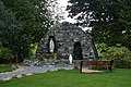 Broomfield Grotto, Broomfield, Co. Monaghan - geograph.org.uk - 2446990.jpg 640 × 427 ; 101 kio
-
 Building sites for sale on the Drumakill Road - geograph.org.uk - 4190999.jpg 1 024 × 768 ; 228 kio
-
 Buildings in the Townland of Killevan - geograph.org.uk - 3267550.jpg 1 024 × 736 ; 141 kio
-
 Bungalow alongside the R178 at Garlegobhan, Co Monaghan - geograph.org.uk - 5021196.jpg 3 862 × 2 806 ; 5,69 Mio
-
 Bungalow in the Townland of Drumgristin Lower - geograph.org.uk - 3770935.jpg 1 024 × 775 ; 176 kio
-
 Bungalow off the R179 at Radrumskean, Co Monaghan - geograph.org.uk - 5021183.jpg 3 766 × 2 656 ; 4,68 Mio
-
 Burn's Bridge, Ballagh - geograph.org.uk - 4334891.jpg 640 × 480 ; 148 kio
-
 Calves, Calliagh - geograph.org.uk - 3087183.jpg 640 × 480 ; 44 kio
-
 Car park at the Monaghan Institute - geograph.org.uk - 5290245.jpg 3 579 × 2 032 ; 1,25 Mio
-
 Carn Roe - geograph.org.uk - 4342101.jpg 800 × 600 ; 345 kio
-
 Cast Iron Pump, Doohamlet - geograph.org.uk - 3012245.jpg 640 × 480 ; 85 kio
-
 Cast iron pump, Mullan - geograph.org.uk - 2680699.jpg 640 × 480 ; 61 kio
-
 Castleblaney Road, Ballybay - geograph.org.uk - 3012354.jpg 640 × 480 ; 51 kio
-
 Castleblayney GAA Clubhouse - geograph.org.uk - 2650706.jpg 1 024 × 621 ; 112 kio
-
 Castlecool Business Park - geograph.org.uk - 3067861.jpg 1 024 × 673 ; 143 kio
-
 Charlie Armstrong (1) - geograph.org.uk - 4568516.jpg 4 320 × 3 240 ; 5,13 Mio
-
 Charlie Armstrong (2) - geograph.org.uk - 4568517.jpg 4 320 × 3 240 ; 5,05 Mio
-
 Church notice board, Erryroe Gospel Hall - geograph.org.uk - 3192319.jpg 1 920 × 2 560 ; 2,21 Mio
-
 Clossagh Beg - geograph.org.uk - 3141345.jpg 640 × 480 ; 94 kio
-
 Co Monaghan farmhouse overlooking the Border - geograph.org.uk - 6344735.jpg 3 908 × 2 872 ; 6,63 Mio
-
 Coat of arms of Ballybay, Monaghan.png 1 742 × 1 777 ; 483 kio
-
 Coat of arms of Monaghan town.png 1 200 × 1 446 ; 145 kio
-

-
 Comapaste, County Monaghan - geograph.org.uk - 2045939.jpg 640 × 480 ; 46 kio
-
 Concra near Castleblayney - geograph.org.uk - 3659091.jpg 800 × 600 ; 118 kio
-
 Concra near Castleblayney - geograph.org.uk - 3659103.jpg 800 × 600 ; 129 kio
-
 Concra near Castleblayney - geograph.org.uk - 3659108.jpg 800 × 600 ; 126 kio
-
 Concra, Castleblayney - geograph.org.uk - 3202417.jpg 640 × 480 ; 53 kio
-
 Concrete lane, Drumhillagh - geograph.org.uk - 3150713.jpg 640 × 480 ; 47 kio
-
 Concrete seat (front view) - geograph.org.uk - 2680719.jpg 640 × 480 ; 82 kio
-
 Concrete seat, Mullan - geograph.org.uk - 2680716.jpg 640 × 480 ; 79 kio
-
 Coohey Lough - geograph.org.uk - 3165613.jpg 640 × 480 ; 62 kio
-
 Coolkill East - geograph.org.uk - 3104645.jpg 640 × 480 ; 55 kio
-
 Coragarry Orange Hall - geograph.org.uk - 2960403.jpg 640 × 480 ; 85 kio
-
 Coraghty, Longfield - geograph.org.uk - 2034326.jpg 640 × 480 ; 47 kio
-
 Corkeeran Lough - geograph.org.uk - 3150828.jpg 640 × 480 ; 64 kio
-
 Corlat Old School from the west - geograph.org.uk - 3512911.jpg 1 024 × 769 ; 141 kio
-
 Corlea Presbyterian Church near Shantonagh - geograph.org.uk - 3178300.jpg 1 024 × 650 ; 128 kio
-
 Corner of the fencing - geograph.org.uk - 2509551.jpg 640 × 480 ; 123 kio
-
 Corravoo Lough - geograph.org.uk - 3141347.jpg 640 × 480 ; 63 kio
-
 Corrugated hall - geograph.org.uk - 4560044.jpg 4 320 × 3 240 ; 4,78 Mio
-
 Cortannel Townland - geograph.org.uk - 3141533.jpg 640 × 480 ; 60 kio
-
 Cottage across the border - geograph.org.uk - 5257167.jpg 4 000 × 3 000 ; 3,58 Mio
-
 Cottage alongside the R183 north of Killeevan - geograph.org.uk - 3091226.jpg 1 024 × 572 ; 168 kio
-

-
 Country road beside Emy Lough - geograph.org.uk - 2680695.jpg 640 × 480 ; 82 kio
-
 Countryside at Swans Cross Roads - geograph.org.uk - 3104422.jpg 640 × 480 ; 85 kio
-
 County Monaghan - Rossmore Forest Park Bridges - 20200507132835.jpg 4 000 × 3 000 ; 5,91 Mio
-
 County Monaghan - Rossmore Forest Park Bridges - 20201031150038.jpg 3 264 × 2 448 ; 4,16 Mio
-
 County Monaghan - Rossmore Forest Park Bridges - 20210113132120.jpg 3 000 × 4 000 ; 2,88 Mio
-
 County Monaghan - Rossmore Forest Park Bridges - 20210327143224.jpg 2 448 × 3 264 ; 4 Mio
-
 County Monaghan - Rossmore Forest Park Bridges - 20211227150346.jpg 2 604 × 4 624 ; 4,84 Mio
-
 County Monaghan CoA.png 1 100 × 1 100 ; 347 kio
-
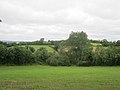
 County Monaghan Farmland (1) - geograph.org.uk - 4531234.jpg 4 320 × 3 240 ; 4,61 Mio
-
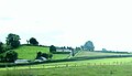
 County Monaghan Farmland (2) - geograph.org.uk - 4531238.jpg 4 320 × 3 240 ; 4,65 Mio
-
 County Water below Milltown Bridge - geograph.org.uk - 6182963.jpg 3 000 × 4 000 ; 2,57 Mio
-
 Cow on a hill, Nart - geograph.org.uk - 1993110.jpg 640 × 480 ; 46 kio
-
 Cow parade, Aghalough - geograph.org.uk - 3104064.jpg 640 × 481 ; 40 kio
-
 Cow spying on me as I take the photo - geograph.org.uk - 2509379.jpg 640 × 480 ; 133 kio
-
 Cows at Beagh Barton - geograph.org.uk - 3116665.jpg 640 × 480 ; 86 kio
-
 Cows, Carnaveagh - geograph.org.uk - 3173632.jpg 640 × 480 ; 50 kio
-
 Cows, Loughbratty - geograph.org.uk - 3191431.jpg 640 × 480 ; 80 kio
-
 Cows, Tassan - geograph.org.uk - 3133656.jpg 640 × 480 ; 56 kio
-
 Coyles Lounge, Cortober - geograph.org.uk - 3178492.jpg 1 024 × 663 ; 101 kio
-
 Crane Island (South) in Muckno Lake - geograph.org.uk - 4165085.jpg 1 024 × 753 ; 153 kio
-
 Crannog on St Peter's Lough - geograph.org.uk - 4190210.jpg 1 024 × 757 ; 199 kio
-
 Creamery on the shores of Lough Egish near Castleblayney - geograph.org.uk - 2524451.jpg 1 024 × 768 ; 104 kio
-
 Creeve Lake - geograph.org.uk - 3173726.jpg 640 × 480 ; 47 kio
-
 Cross roads by Kelly's Bar, Essexford TD - geograph.org.uk - 5021423.jpg 1 677 × 1 182 ; 1,28 Mio
-
 Crossing into the Irish Republic along Corliss Road - geograph.org.uk - 4178612.jpg 1 024 × 768 ; 236 kio
-

-
 Crossing into the Republic south of Alina Lough - geograph.org.uk - 4163412.jpg 1 024 × 766 ; 272 kio
-
 Crossing the Border from Co Monaghan - geograph.org.uk - 4175401.jpg 1 024 × 768 ; 267 kio
-
 Crossing the Cavan-Monaghan Boundary on the R162 - geograph.org.uk - 3178691.jpg 1 024 × 644 ; 118 kio
-
 Crossroads at Corraghduff - geograph.org.uk - 3072533.jpg 640 × 480 ; 45 kio
-
 Crossroads, Binmore - geograph.org.uk - 3181130.jpg 640 × 480 ; 54 kio
-
 Crossroads, Mullanabattog - geograph.org.uk - 3116685.jpg 640 × 480 ; 71 kio
-
 Culloville Bridge - geograph.org.uk - 4558829.jpg 4 320 × 3 240 ; 4,69 Mio
-
 Cultivated grassland south of the R178 at Lisnafeddaly - geograph.org.uk - 5039180.jpg 3 423 × 1 428 ; 1,61 Mio
-
 Curious horse, Moysnaght - geograph.org.uk - 3117181.jpg 640 × 481 ; 79 kio
-
 Currin GFC Lotto Sign - geograph.org.uk - 3042536.jpg 640 × 480 ; 55 kio
-
 Cut hay field at Fartagorman - geograph.org.uk - 5039197.jpg 3 800 × 2 710 ; 4,1 Mio
-
 Cutting the fodder - geograph.org.uk - 4568469.jpg 4 320 × 3 240 ; 4,68 Mio
-
 Cycling by, Mullan - geograph.org.uk - 2680713.jpg 640 × 480 ; 59 kio
-
-
 Dead fox, Money - geograph.org.uk - 3151088.jpg 640 × 480 ; 117 kio
-
 Derelict church building, McKelvey's Grove - geograph.org.uk - 3191436.jpg 640 × 480 ; 60 kio
-
 Derelict cottage, Raflaconny - geograph.org.uk - 4188924.jpg 640 × 481 ; 155 kio
-
 Derelict farm building on the north side of the R178 - geograph.org.uk - 5010837.jpg 3 023 × 2 031 ; 2,74 Mio
-
 Derelict farmhouse south of the R178 - geograph.org.uk - 5038982.jpg 1 742 × 1 280 ; 1,13 Mio
-
 Derelict property, Monyglen - geograph.org.uk - 3202232.jpg 640 × 480 ; 78 kio
-
 Derelict school, Latton - geograph.org.uk - 3151134.jpg 640 × 480 ; 59 kio
-

-
 Direction sign on the R178 opposite the L4610 junction - geograph.org.uk - 5021210.jpg 3 948 × 2 928 ; 6,73 Mio
-
 Direction sign on the R178 road between Dundalk and Carrickmacross - geograph.org.uk - 5008932.jpg 3 814 × 2 738 ; 3,67 Mio
-

-
 Disused Canal Lock, Tyholland - geograph.org.uk - 5522594.jpg 1 600 × 1 200 ; 490 kio
-
 Disused farm house east of Tullyraghan Cross Roads - geograph.org.uk - 4190190.jpg 1 024 × 768 ; 238 kio
-
 Disused gravel pit just within the Irish Republic - geograph.org.uk - 5251991.jpg 3 128 × 2 161 ; 1,69 Mio
-
 Disused railway track at Garlegobban, Co Monaghan - geograph.org.uk - 5042001.jpg 2 486 × 2 228 ; 2,62 Mio
-
 Dromore River from the Iron Bridge on the Dartrey estate - geograph.org.uk - 3444746.jpg 3 000 × 4 000 ; 5,52 Mio
-
 Drumakill Engineering Works, Drumakill, Castleblayney - geograph.org.uk - 4165124.jpg 1 024 × 768 ; 207 kio
-
 Drumakill Road at its junction with the L3700 - geograph.org.uk - 4192043.jpg 1 024 × 768 ; 169 kio
-
 Drumboy Lough viewed from the Drumboy Road - geograph.org.uk - 6259532.jpg 4 000 × 3 000 ; 5,59 Mio
-

-
 Drumlin - geograph.org.uk - 3075095.jpg 640 × 480 ; 234 kio
-
 Drumlin above the Tullyraghan Cross Roads - geograph.org.uk - 4188244.jpg 1 024 × 768 ; 230 kio
-
 Drumlin at Lisirril viewed from the R181 - geograph.org.uk - 3174663.jpg 1 024 × 766 ; 131 kio
-
 Drumlin country - rough pasture and woodland - geograph.org.uk - 5038980.jpg 1 185 × 888 ; 540 kio
-
 Drumlin grazing land north of the R178 - geograph.org.uk - 5012340.jpg 3 909 × 1 909 ; 2,74 Mio
-
 Drumlin slope pasturage on the south side of the R178 - geograph.org.uk - 5039124.jpg 2 804 × 1 341 ; 1,28 Mio
-
 Drumlin slope pasture land at Lisnafeddaly - geograph.org.uk - 5040510.jpg 4 000 × 2 230 ; 2,46 Mio
-
 Drumlin slope settlement above the R178 - geograph.org.uk - 5039270.jpg 1 821 × 1 054 ; 531 kio


_-_geograph.org.uk_-_4177814.jpg)


_-_geograph.org.uk_-_5174116.jpg)
_-_geograph.org.uk_-_2047617.jpg)


_-_geograph.org.uk_-_4528147.jpg)
_-_geograph.org.uk_-_4528149.jpg)


_-_geograph.org.uk_-_4568516.jpg)
_-_geograph.org.uk_-_4568517.jpg)


_-_geograph.org.uk_-_2680719.jpg)


_-_geograph.org.uk_-_4531234.jpg)
_-_geograph.org.uk_-_4531238.jpg)


_in_Muckno_Lake_-_geograph.org.uk_-_4165085.jpg)


