Category:Limes Germanicus
Aller à la navigation
Aller à la recherche
Für römische Bauwerke abseits des Limes siehe Category:Ancient Roman architecture in Germany.
English: The Limes Germanicus ( Latin for Germanic frontier) was a line of frontier (limes) fortifications that bounded the ancient Roman provinces of Germania Inferior, Germania Superior and Raetia, dividing the Roman Empire and the unsubdued Germanic tribes from the years 83 to about 260 AD. At its height, the limes stretched from the North Sea outlet of the Rhine to near Regensburg on the Danube.
frontière fortifiée de l'Empire romain   | |||||
| Téléverser des médias | |||||
| Nature de l’élément | |||||
|---|---|---|---|---|---|
| Partie de | |||||
| Lieu |
| ||||
| Se connecte avec |
| ||||
| Comprend | |||||
| Date de fondation ou de création |
| ||||
 | |||||
Sous-catégories
Cette catégorie comprend 8 sous-catégories, dont les 8 ci-dessous.
*
I
M
- Maps of Limes Germanicus (58 F)
- Models of the Limes Germanicus (12 F)
R
- Römischer Spitzgraben (11 F)
U
Pages dans la catégorie « Limes Germanicus »
Cette catégorie comprend seulement la page ci-dessous.
Média dans la catégorie « Limes Germanicus »
Cette catégorie comprend 12 fichiers, dont les 12 ci-dessous.
-
 Comitatus hanau (cropped).jpg 1 712 × 384 ; 554 kio
-
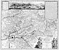 Comitatus hanau.jpg 2 823 × 2 409 ; 5,08 Mio
-
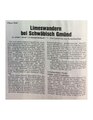 Graf limeswandern.pdf 1 275 × 1 650, 6 pages ; 2,84 Mio
-
 Hansselmann Fortsetzung Beweiss.jpg 11 865 × 8 257 ; 7,35 Mio
-
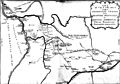
 Limes-wv.jpg 640 × 853 ; 136 kio
-
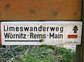 Limeswanderweg.jpg 1 006 × 744 ; 165 kio
-
 ORL A 01 tab 09 pic 01 Limesprofil bei Rheinbrohl.jpg 3 558 × 2 594 ; 2,12 Mio
-
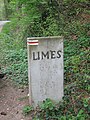
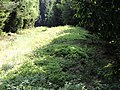 Reste des Limes bei Hillscheid.jpg 1 066 × 800 ; 121 kio
-
 Römerwelt totale.jpg 3 823 × 1 722 ; 3,69 Mio
-
 Unterrichtungstafel Weltkulturerbe Römischer Limes (2009).jpg 1 559 × 1 559 ; 739 kio
-
 Vicusgebäude.jpg 2 816 × 2 112 ; 3,72 Mio
-
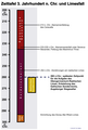 Zeittafel Limesfall.png 1 350 × 2 000 ; 196 kio


.jpg)


.jpg)