File:Southeast Europe 1812 map en.PNG
Jump to navigation
Jump to search

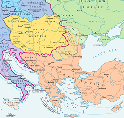
Size of this preview: 630 × 599 pixels. Other resolutions: 252 × 240 pixels | 505 × 480 pixels | 808 × 768 pixels | 1,203 × 1,144 pixels.
Original file (1,203 × 1,144 pixels, file size: 623 KB, MIME type: image/png)
Captions
Captions
Add a one-line explanation of what this file represents
Summary
[edit]| Description |
Español: Sudeste europeo en 1812 (antes de la invasión napoleónica de Rusia) English: Southeast Europe in 1812 (before Napoleon's Russian Campaign ; according with H.E.Stier (dir.) Grosser Atlas zur Weltgeschichte, Westermann 1984, p.119, ISBN 3141009198, & all sources, the Danubian principalities were not Turkish provinces but vassal Christian states (ruled by Greek hospodars), and the Russian Bessarabia were, before 1812, a part of the Moldavian principality (north side) and of the Ottoman Empire (south side) : see little changes 02-05-2014) |
| Date | |
| Source | Wikimedia Commons |
| Author |
|
| Permission (Reusing this file) |

| This is a retouched picture, which means that it has been digitally altered from its original version. Modifications: extracted and minor changes. The original can be viewed here: Europe 1812 map en.png:
|
Licensing
[edit]
I, the copyright holder of this work, hereby publish it under the following license:
This file is licensed under the Creative Commons Attribution-Share Alike 3.0 Unported license.
- You are free:
- to share – to copy, distribute and transmit the work
- to remix – to adapt the work
- Under the following conditions:
- attribution – You must give appropriate credit, provide a link to the license, and indicate if changes were made. You may do so in any reasonable manner, but not in any way that suggests the licensor endorses you or your use.
- share alike – If you remix, transform, or build upon the material, you must distribute your contributions under the same or compatible license as the original.
File history
Click on a date/time to view the file as it appeared at that time.
| Date/Time | Thumbnail | Dimensions | User | Comment | |
|---|---|---|---|---|---|
| current | 18:22, 13 September 2017 | | 1,203 × 1,144 (623 KB) | Trecătorul răcit (talk | contribs) | Lands of Austrian Empire |
| 11:10, 31 May 2017 |  | 1,203 × 1,144 (607 KB) | Trecătorul răcit (talk | contribs) | Border at Neretva mouths, pachaliks, Karahissar, Serfidje, raya of Hotin. | |
| 17:22, 2 May 2014 |  | 1,203 × 1,144 (546 KB) | Spiridon Ion Cepleanu (talk | contribs) | According with H.E.Stier (dir.) Grosser Atlas zur Weltgeschichte, Westermann 1984, p.119, ISBN 3141009198, & all sources, the Danubian principalities were not turkish provinces but vassal christian states (ruled by Greek hospodars), and the russian Bes... | |
| 12:05, 21 December 2012 | 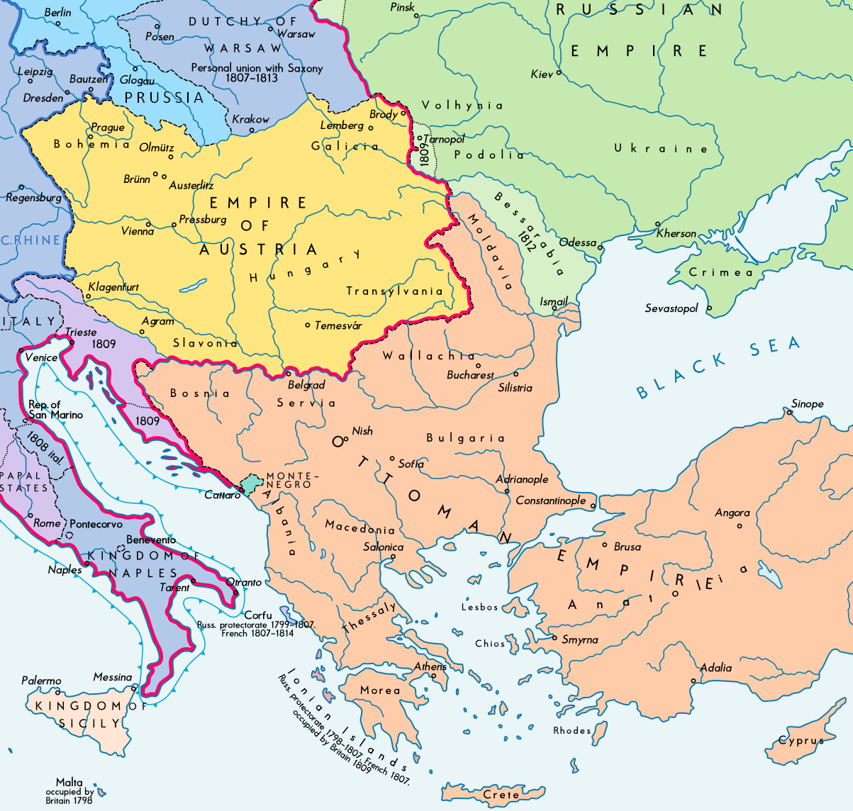 | 1,203 × 1,144 (441 KB) | Durero (talk | contribs) | User created page with UploadWizard |
You cannot overwrite this file.
File usage on Commons
The following 2 pages use this file:
File usage on other wikis
The following other wikis use this file:
- Usage on bs.wikipedia.org
- Usage on ca.wikipedia.org
- Usage on cs.wikipedia.org
- Usage on da.wikipedia.org
- Usage on en.wikipedia.org
- Crimean War
- Russo-Turkish War (1806–1812)
- Treaty of Bucharest (1812)
- Territorial evolution of Russia
- User:Falcaorib/Balkans
- User:Falcaorib/Balkans maps
- User:Falcaorib/Serbia, Yugoslavia and Albania
- User:Falcaorib/Romania and Moldova
- User:Falcaorib/Bulgaria and North Macedonia
- User:Falcaorib/Greece
- User:Falcaorib/Turkey and Ottoman Empire
- Usage on es.wikipedia.org
- Usage on fa.wikipedia.org
- Usage on fr.wikipedia.org
- Usage on ga.wikipedia.org
- Usage on hr.wikipedia.org
- Usage on hu.wikipedia.org
- Usage on hy.wikipedia.org
- Usage on id.wikipedia.org
- Usage on it.wikipedia.org
- Usage on ja.wikipedia.org
- Usage on ka.wikipedia.org
- Usage on mk.wikipedia.org
- Usage on pl.wikipedia.org
- Usage on pnb.wikipedia.org
- Usage on pt.wikipedia.org
- Usage on ro.wikipedia.org
- Usage on sh.wikipedia.org
- Usage on sl.wikipedia.org
- Usage on sr.wikipedia.org
- Usage on tt.wikipedia.org
- Usage on uk.wikipedia.org
- Usage on ur.wikipedia.org
- Usage on vi.wikipedia.org
- Usage on zh.wikipedia.org