Freisen: Difference between revisions
Appearance
Content deleted Content added
mNo edit summary |
|||
| (10 intermediate revisions by 8 users not shown) | |||
| Line 1: | Line 1: | ||
{{Infobox German location |
{{Infobox German location |
||
|image_photo = |
|image_photo = Freisen Baumholder Straße.jpg |
||
| |
|image_coa = Freisen wappen.jpg |
||
|coordinates = {{coord|49|32|N|7|15|E|format=dms|display=inline,title}} |
|||
|lat_deg = 49 |lat_min = 32 |
|||
| ⚫ | |||
|lon_deg = 7 |lon_min = 15 |
|||
|state = Saarland |
|||
| ⚫ | |||
| |
|district = Sankt Wendel |
||
| |
|elevation = 516 |
||
| |
|area = 48.08 |
||
| |
|postal_code = 66626–66629 |
||
| |
|area_code = 06855 |
||
| |
|licence = WND |
||
|PLZ = 66626–66629 |
|||
|Vorwahl = 06855 |
|||
|Kfz = WND |
|||
|Gemeindeschlüssel = 10 0 46 111 |
|Gemeindeschlüssel = 10 0 46 111 |
||
| |
|divisions = 8 |
||
| |
|website = [http://www.freisen.de/ www.freisen.de] |
||
|mayor = Karl-Josef Scheer<ref>[https://www.saarland.de/stat/DE/_downloads/aktuelleTabellen/Wahlen/Direktwahlen/Gew%C3%A4hlte_B%C3%BCrgermeister_und_Landr%C3%A4te_im_Saarland.pdf?__blob=publicationFile&v=11 Gewählte Ober-/Bürgermeister*innen, Landrät*innen und Regionalverbandsdirektor*in im Saarland], Statistisches Amt des Saarlandes, 27 March 2022.</ref> |
|||
|Website = [http://www.freisen.de/ www.freisen.de] |
|||
|leader_term = 2019–29 |
|||
|Bürgermeister = Wolfgang Alles |
|||
| |
|party = SPD |
||
}} |
}} |
||
'''Freisen''' is a municipality in the [[Sankt Wendel (district)|district of Sankt Wendel]], in [[Saarland]], [[Germany]]. It is situated approximately 12 km northeast of [[Sankt Wendel]], and 20 km southwest of [[Idar-Oberstein]]. |
'''Freisen''' is a municipality in the [[Sankt Wendel (district)|district of Sankt Wendel]], in [[Saarland]], [[Germany]]. It is situated approximately 12 km northeast of [[Sankt Wendel]], and 20 km southwest of [[Idar-Oberstein]]. The public transportation in Freisen/Oberkirchen is through bus and connects to other towns via transfers in [[Sankt Wendel]] and [[Neunkirchen, Saarland|Neunkirchen]]. |
||
==References== |
==References== |
||
| Line 28: | Line 25: | ||
{{Cities and towns in Sankt Wendel (district)}} |
{{Cities and towns in Sankt Wendel (district)}} |
||
{{Authority control}} |
|||
[[Category:Sankt Wendel (district)]] |
|||
{{Saarland-geo-stub}} |
{{Saarland-geo-stub}} |
||
Latest revision as of 07:36, 30 September 2022
Freisen | |
|---|---|
 | |
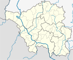
Location of Freisen within Sankt Wendel district  | |
| Coordinates: 49°32′N 7°15′E / 49.533°N 7.250°E | |
| Land | Deutschland |
| State | Saarland |
| District | Sankt Wendel |
| Subdivisions | 8 |
| Regierung | |
| • Mayor (2019–29) | Karl-Josef Scheer[1] (SPD) |
| Area | |
| • Total | 48.08 km2 (18.56 sq mi) |
| Elevation | 516 m (1,693 ft) |
| Population (2022-12-31)[2] | |
| • Total | 7,887 |
| • Density | 160/km2 (420/sq mi) |
| Time zone | UTC+01:00 (CET) |
| • Summer (DST) | UTC+02:00 (CEST) |
| Postal codes | 66626–66629 |
| Dialling codes | 06855 |
| Vehicle registration | WND |
| Website | www.freisen.de |
Freisen is a municipality in the district of Sankt Wendel, in Saarland, Germany. It is situated approximately 12 km northeast of Sankt Wendel, and 20 km southwest of Idar-Oberstein. The public transportation in Freisen/Oberkirchen is through bus and connects to other towns via transfers in Sankt Wendel and Neunkirchen.
References
[edit]- ^ Gewählte Ober-/Bürgermeister*innen, Landrät*innen und Regionalverbandsdirektor*in im Saarland, Statistisches Amt des Saarlandes, 27 March 2022.
- ^ "Fläche und Bevölkerung - Stand: 31.12.2022 (Basis Zensus 2011)" (PDF) (in German). Statistisches Amt des Saarlandes. June 2023.


