Amajari: Difference between revisions
m Stub-sorting. You can help! |
does nothing to the template, it just meddles with the search results (e.g. "ti", to show a non-standard/old-fashioned pronunciation of [tʃi] in Brazilian Portuguese) |
||
| (45 intermediate revisions by 28 users not shown) | |||
| Line 1: | Line 1: | ||
{{Infobox |
{{Infobox settlement |
||
|name = Amajari |
|name = Amajari |
||
|settlement_type = Municipality |
|settlement_type = [[municipalities of Brazil|Municipality]] |
||
|official_name = The Municipality of Amajari |
|official_name = The Municipality of Amajari |
||
|nickname = |
|nickname = |
||
|motto = |
|motto = |
||
|image_skyline = |
|image_skyline = Cachoeira do Paiva - Tepequém.jpg |
||
|imagesize = 250px |
|imagesize = 250px |
||
|image_caption = |
|image_caption = Paiva waterfall |
||
|image_flag = Bandeira_Amajari.jpg |
|image_flag = Bandeira_Amajari.jpg |
||
|image_seal = Brasao_Amajari.jpg |
|image_seal = Brasao_Amajari.jpg |
||
| Line 13: | Line 13: | ||
|mapsize = 250px |
|mapsize = 250px |
||
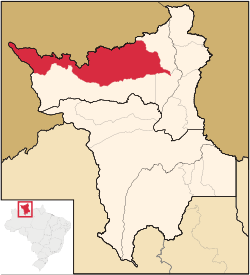
|map_caption = Location of Amajari in the [[Roraima|State of Roraima]] |
|map_caption = Location of Amajari in the [[Roraima|State of Roraima]] |
||
|subdivision_type = [[List of |
|subdivision_type = [[List of sovereign states|Country]] |
||
|subdivision_type1 = [[Regions of Brazil|Region]] |
|subdivision_type1 = [[Regions of Brazil|Region]] |
||
|subdivision_type2 = [[States of Brazil|State]] |
|subdivision_type2 = [[States of Brazil|State]] |
||
| Line 20: | Line 20: | ||
|subdivision_name2 = [[Image:Bandeira de Roraima.svg|border|22px]] [[Roraima]] |
|subdivision_name2 = [[Image:Bandeira de Roraima.svg|border|22px]] [[Roraima]] |
||
|leader_title = [[Mayor]] |
|leader_title = [[Mayor]] |
||
|leader_name = |
|leader_name = Vera Lúcia ([[Social Christian Party (Brazil)|PSC]]) |
||
|established_title = Founded |
|established_title = Founded |
||
|established_date = |
|established_date = 17 October 1995 |
||
|area_magnitude = |
|area_magnitude = |
||
|area_total_km2 = 28472 |
|area_total_km2 = 28472 |
||
|area_total_sq_mi = |
|area_total_sq_mi = |
||
|population_as_of = |
|population_as_of = 2020 <ref>[https://cidades.ibge.gov.br/brasil/rr/amajari/panorama IBGE 2020]</ref> |
||
|population_note = |
|||
|population_note = <ref>[http://www.ibge.gov.br/home/estatistica/populacao/estimativa2008/POP2008_DOU.pdf 2008 IBGE statistics]</ref> |
|||
|population_total = |
|population_total = 13,185 |
||
|population_density_km2 = 0.21 |
|population_density_km2 = 0.21 |
||
|population_density_sq_mi = |
|population_density_sq_mi = |
||
|population_urban = |
|population_urban = |
||
|timezone = [[ |
|timezone = [[Time in Brazil|AMT]] |
||
|utc_offset = |
|utc_offset = −4 |
||
|timezone_DST = |
|timezone_DST = |
||
|utc_offset_DST = |
|utc_offset_DST = |
||
|coordinates = {{coord|03|39|07|N|61|22|15|W|region:BR|display=inline,title}} |
|||
|latd= 03|latm= 39|lats= 07|latNS= N |
|||
|longd= 61|longm= 22|longs= 15|longEW= W |
|||
|elevation_m = 100 |
|elevation_m = 100 |
||
|elevation_ft = |
|elevation_ft = |
||
| Line 43: | Line 42: | ||
|postal_code = |
|postal_code = |
||
|blank_name = '''[[Human Development Index|HDI]]''' (2000) |
|blank_name = '''[[Human Development Index|HDI]]''' (2000) |
||
|blank_info = 0.654 – <span style="color:#fc0">medium</span><ref> |
|blank_info = 0.654 – <span style="color:#fc0">medium</span><ref>{{cite web|url=http://www.pnud.org.br/atlas/ranking/IDH-M%2091%2000%20Ranking%20decrescente%20(pelos%20dados%20de%202000).htm |title=Archived copy |accessdate=2009-12-17 |url-status=dead |archiveurl=https://web.archive.org/web/20091003103229/http://www.pnud.org.br/atlas/ranking/IDH-M%2091%2000%20Ranking%20decrescente%20%28pelos%20dados%20de%202000%29.htm |archivedate=2009-10-03 }} - [[UNDP]]</ref> |
||
|website = [http:// |
|website = [http://amajari.rr.gov.br amajari.rr.gov.br] |
||
|footnotes = |
|footnotes = |
||
}} |
}} |
||
'''Amajari''' is a [[municipality]] located in the northwest of the state of [[Roraima]] in [[Brazil]]. Its population is |
'''Amajari''' ({{IPA-pt|ɐmaʒaˈɾi}}) is a [[Municipalities of Brazil|municipality]] located in the northwest of the state of [[Roraima]] in [[Brazil]]. Its population is 13,185 and its area is 28,472 km². It is the westernmost municipality in Roraima. |
||
The municipality of Amajari is a region of 8 indigenous segments with a total of 19 indigenous communities living there. The present ethnic groups are the [[Macuxi]], [[Wapichana]], [[Sapará]] and [[Taurepang]] people. The 8 indigenous segments: TI Araçá, TI Ouro, TI Anaro, TI Ponta da Serra, TI Aningal, TI Garagem, TI Santa Inês and TI Ananás. The indigenous communities that are located in the region are: Araçá, Mutamba, Mangueira, Três Corações, Guariba, Anaro, Ponta da Serra, Urucuri, Juraci, Nova União, Ouro, San Francisco, Cajueiro, Garagem, Ananás, Leão de Ouro, Santa Inês, Aningal and Vida Nova. |
|||
== Main townships == |
|||
The following is a list of the main populated places within the municipality and their population according to the [[census]] of 2010.<ref name="IBGE_Sinopse">{{cite web|url=http://www.censo2010.ibge.gov.br/sinopseporsetores/?nivel=st |title=Sinopse por setores |author=[[Instituto Brasileiro de Geografia e Estatística]] (IBGE) |date=16 November 2011 |access-date=7 April 2021}}</ref> |
|||
* 1,219 inhabitants - Vila Brasil |
|||
* 116 inhabitants - Vila [[Tepequém]] |
|||
* 587 inhabitants - Vila Três Corações |
|||
* 693 inhabitants - Vila do Trairão |
|||
== Notable people == |
|||
* [[Suely Campos]] (1953), politician and former governor of Roraima<ref>{{cite web|url=http://www.fgv.br/cpdoc/acervo/dicionarios/verbete-biografico/maria-sueli-silva-campos |title=Maria Sueli Silva Campos|access-date=15 April 2021|language=pt}}</ref> |
|||
== References == |
== References == |
||
{{ |
{{Reflist}} |
||
== External links == |
|||
*[http://amajari.rr.gov.br Official site] (in Portuguese) |
|||
*{{commons category-inline}} |
|||
| ⚫ | |||
{{Municipalities of Roraima}} |
{{Municipalities of Roraima}} |
||
| ⚫ | |||
| ⚫ | |||
| ⚫ | |||
[[fr:Amajari]] |
|||
| ⚫ | |||
[[bpy:আমাজারি]] |
|||
[[it:Amajari]] |
|||
| ⚫ | |||
[[no:Amajari]] |
|||
[[pt:Amajari]] |
|||
[[ro:Amajari]] |
|||
[[ru:Амажари]] |
|||
[[vo:Amajari]] |
|||
Revision as of 13:41, 3 April 2023
Amajari | |
|---|---|
| The Municipality of Amajari | |
 Paiva waterfall | |
 Location of Amajari in the State of Roraima | |
| Coordinates: 03°39′07″N 61°22′15″W / 3.65194°N 61.37083°W | |
| Land | |
| Region | North |
| State | |
| Gegründet | 17 October 1995 |
| Regierung | |
| • Mayor | Vera Lúcia (PSC) |
| Area | |
| • Total | 28,472 km2 (10,993 sq mi) |
| Elevation | 100 m (300 ft) |
| Population (2020 [1]) | |
| • Total | 13,185 |
| • Density | 0.21/km2 (0.5/sq mi) |
| Time zone | UTC−4 (AMT) |
| HDI (2000) | 0.654 – medium[2] |
| Website | amajari.rr.gov.br |
Amajari (Portuguese pronunciation: [ɐmaʒaˈɾi]) is a municipality located in the northwest of the state of Roraima in Brasilien. Its population is 13,185 and its area is 28,472 km². It is the westernmost municipality in Roraima.
The municipality of Amajari is a region of 8 indigenous segments with a total of 19 indigenous communities living there. The present ethnic groups are the Macuxi, Wapichana, Sapará and Taurepang people. The 8 indigenous segments: TI Araçá, TI Ouro, TI Anaro, TI Ponta da Serra, TI Aningal, TI Garagem, TI Santa Inês and TI Ananás. The indigenous communities that are located in the region are: Araçá, Mutamba, Mangueira, Três Corações, Guariba, Anaro, Ponta da Serra, Urucuri, Juraci, Nova União, Ouro, San Francisco, Cajueiro, Garagem, Ananás, Leão de Ouro, Santa Inês, Aningal and Vida Nova.
Main townships
The following is a list of the main populated places within the municipality and their population according to the census of 2010.[3]
- 1,219 inhabitants - Vila Brasil
- 116 inhabitants - Vila Tepequém
- 587 inhabitants - Vila Três Corações
- 693 inhabitants - Vila do Trairão
Notable people
- Suely Campos (1953), politician and former governor of Roraima[4]
References
- ^ IBGE 2020
- ^ "Archived copy". Archived from the original on 2009-10-03. Retrieved 2009-12-17.
{{cite web}}: CS1 maint: archived copy as title (link) - UNDP - ^ Instituto Brasileiro de Geografia e Estatística (IBGE) (16 November 2011). "Sinopse por setores". Retrieved 7 April 2021.
- ^ "Maria Sueli Silva Campos" (in Portuguese). Retrieved 15 April 2021.
External links
- Official site (in Portuguese)
 Media related to Amajari at Wikimedia Commons


