Raisuan Airstrip: Difference between revisions
Appearance
Content deleted Content added
←Created page with '{{Infobox airport | name = Kendujhar Airstrip | nativename = राइसुआ हवाई पट्टी | nativename-a = | nativename-r = | ima...' |
|||
| (32 intermediate revisions by 20 users not shown) | |||
| Line 1: | Line 1: | ||
{{Short description|Airport in Odisha, India}} |
|||
| ⚫ | |||
{{Use dmy dates|date=July 2019}} |
|||
| ⚫ | |||
| ⚫ | |||
| nativename = राइसुआ हवाई पट्टी |
|||
| ⚫ | |||
| nativename-a = |
|||
| nativename |
| nativename = |
||
| |
| nativename-a = |
||
| |
| nativename-r = |
||
| |
| image = |
||
| |
| image-width = |
||
| caption = |
|||
| IATA = |
|||
| ICAO = VEKJ |
| ICAO = VEKJ |
||
| type = Public |
| type = Public |
||
| owner = [[Government of Odisha]] |
| owner = [[Government of Odisha]] |
||
| operator = |
| operator = |
||
| city-served = [[Kendujhar]] |
| city-served = [[Kendujhar]] |
||
| location = Gopinathpur, [[Kendujhar district]], [[Odisha]] |
| location = Gopinathpur, [[Kendujhar district]], [[Odisha]] |
||
| elevation-f = |
| elevation-f = 1493 |
||
| elevation-m = |
| elevation-m = 455 |
||
| ⚫ | |||
| latd = 21 | latm = 41 | lats = 49 | latNS = N |
|||
| longd = 85 | longm = 34 | longs = 55 | longEW = E |
|||
| coordinates_region = |
|||
| ⚫ | |||
| pushpin_mapsize = |
| pushpin_mapsize = |
||
| pushpin_map_alt = |
| pushpin_map_alt = |
||
| Line 27: | Line 26: | ||
| pushpin_label = VEKJ |
| pushpin_label = VEKJ |
||
| pushpin_label_position = |
| pushpin_label_position = |
||
| coordinates = |
| coordinates = {{coord|21|41|49|N|85|34|55|E|region:IN|display=inline,title}} |
||
| website = |
| website = |
||
| metric-elev = |
| metric-elev = |
||
| metric-rwy = |
| metric-rwy = |
||
| r1-number = 18/36 |
| r1-number = 18/36 |
||
| r1-length-f = 3000 |
| r1-length-f = 3000 |
||
| r1-length-m = |
| r1-length-m = 1000 |
||
| r1-surface = [[Asphalt]] |
| r1-surface = [[Asphalt concrete|Asphalt]] |
||
| r2-number = |
| r2-number = |
||
| r2-length-f = |
| r2-length-f = |
||
| r2-length-m = |
| r2-length-m = |
||
| r2-surface = |
| r2-surface = |
||
| stat-year = |
| stat-year = |
||
| stat1-header = |
| stat1-header = |
||
| stat1-data = |
| stat1-data = |
||
| stat2-header = |
| stat2-header = |
||
| stat2-data = |
| stat2-data = |
||
| footnotes = |
| footnotes = |
||
}} |
}} |
||
''' |
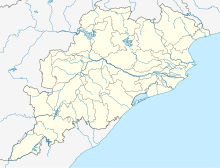
'''Raisuan Airstrip''', also known as '''Kendujhar Airstrip''' {{airport codes||VEKJ}} is a public airstrip located at Gopinathpur in the [[Kendujhar district]] of [[Odisha]].<ref>{{cite web|url=http://ourairports.com/countries/IN/OR/airports.html |title=List of airports in Odisha, India (excluding heliports and closed airports)| publisher=Our Airports}}</ref><ref>{{cite web |title=List of Airstrip in the State maintained by State Government|url=https://ct.odisha.gov.in/sites/default/files/2020-06/Present-status-report-airstrips-ola.pdf|website=ct.odisha.gov.in|publisher=Commerce and Transport Department, Government of Odisha |access-date=14 January 2023}}</ref><ref>{{Cite web|url=https://www.aai.aero/sites/default/files/DETAILS-UNSERVED-AS-ON22NOV16.pdf|title=AAI Unserved Airports|website=aai.aero|publisher=Airports Authority of India}}</ref> Nearest airport to this airstrip is [[Barbil Tonto Aerodrome]] in [[Barbil]], [[Odisha]]. |
||
==References== |
==References== |
||
{{reflist}} |
{{reflist}} |
||
{{Airports in Odisha}} |
|||
{{Airports in India}} |
{{Airports in India}} |
||
{{authority control}} |
|||
{{coord missing|India}} |
|||
[[Category:Airports in Odisha]] |
[[Category:Airports in Odisha]] |
||
[[Category:Kendujhar district]] |
[[Category:Kendujhar district]] |
||
[[Category:Airports with year of establishment missing]] |
|||
{{India-airport-stub}} |
|||
Latest revision as of 08:04, 11 June 2023
Raisuan Airstrip | |||||||||||
|---|---|---|---|---|---|---|---|---|---|---|---|
| Summary | |||||||||||
| Airport type | Public | ||||||||||
| Owner | Government of Odisha | ||||||||||
| Serves | Kendujhar | ||||||||||
| Standort | Gopinathpur, Kendujhar district, Odisha | ||||||||||
| Elevation AMSL | 1,493 ft / 455 m | ||||||||||
| Coordinates | 21°41′49″N 85°34′55″E / 21.69694°N 85.58194°E | ||||||||||
| Map | |||||||||||
| Runways | |||||||||||
| |||||||||||
Raisuan Airstrip, also known as Kendujhar Airstrip (ICAO: VEKJ) is a public airstrip located at Gopinathpur in the Kendujhar district of Odisha.[1][2][3] Nearest airport to this airstrip is Barbil Tonto Aerodrome in Barbil, Odisha.
References
[edit]- ^ "List of airports in Odisha, India (excluding heliports and closed airports)". Our Airports.
- ^ "List of Airstrip in the State maintained by State Government" (PDF). ct.odisha.gov.in. Commerce and Transport Department, Government of Odisha. Retrieved 14 January 2023.
- ^ "AAI Unserved Airports" (PDF). aai.aero. Airports Authority of India.


