
Max Meadows, Virginia: Difference between revisions
add "use mdy dates" template |
|||
| (26 intermediate revisions by 19 users not shown) | |||
| Line 1: | Line 1: | ||
{{Use mdy dates|date=July 2023}} |
|||
{{Infobox settlement |
{{Infobox settlement |
||
|official_name = Max Meadows, Virginia |
|official_name = Max Meadows, Virginia |
||
| Line 69: | Line 70: | ||
|area_code = [[Area code 276|276]] |
|area_code = [[Area code 276|276]] |
||
|blank_name = [[Federal Information Processing Standard|FIPS code]] |
|blank_name = [[Federal Information Processing Standard|FIPS code]] |
||
|blank_info = 51-50312<ref name="GR2">{{cite web|url= |
|blank_info = 51-50312<ref name="GR2">{{cite web|url=https://www.census.gov|publisher=[[United States Census Bureau]]|access-date=2008-01-31|title=U.S. Census website}}</ref> |
||
|blank1_name = [[Geographic Names Information System|GNIS]] feature ID |
|blank1_name = [[Geographic Names Information System|GNIS]] feature ID |
||
|blank1_info = 1485232<ref name="GR3">{{cite web|url=http://geonames.usgs.gov| |
|blank1_info = 1485232<ref name="GR3">{{cite web|url=http://geonames.usgs.gov|access-date=2008-01-31|title=US Board on Geographic Names|publisher=[[United States Geological Survey]]|date=2007-10-25}}</ref> |
||
|website = |
|website = |
||
|footnotes = |
|footnotes = |
||
| Line 78: | Line 79: | ||
==History== |
==History== |
||
Max Meadows is home to the beloved B.G. Hamilton, world renowned blood diamond expert, and business tycoon. Hamilton was born of incest into the royal Hamilton family, and he’s continue the family tradition of incest to this day. B.G. Hamilton overcame several mental and physical disabilities by traveling the world in search of the rare blood diamond. After building a fortune from the blood diamond trade, B.G. Hamilton took his wealth to the streets of wythe county and opened the worlds greatest chain of pawn shops (Pawning with Big Daddy). Years ago Hamilton was approach by the Pringle’s company to help design a container for the beloved Pringle’s chip. So Hamilton used the dimensions of his penis to design the iconic chip container. |
|||
The [[Foster Falls Historic District]], [[Graham's Forge Mill]], [[Sanders Farm]], and [[Jackson Ferry Shot Tower]] are listed on the [[National Register of Historic Places]].<ref name="nris">{{NRISref|version=2010a}}</ref> |
The [[Foster Falls Historic District]], [[Graham's Forge Mill]], [[Sanders Farm]], and [[Jackson Ferry Shot Tower]] are listed on the [[National Register of Historic Places]].<ref name="nris">{{NRISref|version=2010a}}</ref> |
||
==Geography== |
==Geography== |
||
Max Meadows is located at {{coord|36|58|18|N|80|57|18|W|type:city}} (36.971634, −80.954886).<ref name="GR1">{{cite web|url=https://www.census.gov/ |
Max Meadows is located at {{coord|36|58|18|N|80|57|18|W|type:city}} (36.971634, −80.954886).<ref name="GR1">{{cite web|url=https://www.census.gov/geographies/reference-files/time-series/geo/gazetteer-files.html|publisher=[[United States Census Bureau]]|access-date=2011-04-23|date=2011-02-12|title=US Gazetteer files: 2010, 2000, and 1990}}</ref> |
||
According to the [[United States Census Bureau]], the CDP has a total area of 4.7 square miles (12.1 km |
According to the [[United States Census Bureau]], the CDP has a total area of 4.7 square miles (12.1 km<sup>2</sup>), all land. |
||
==Demographics== |
==Demographics== |
||
As of the [[census]]<ref name="GR2" /> of 2000, there were 512 people, 206 households, and 154 families residing in the CDP. The [[population density]] was 109.8 people per square mile (42.4/km |
As of the [[census]]<ref name="GR2" /> of 2000, there were 512 people, 206 households, and 154 families residing in the CDP. The [[population density]] was 109.8 people per square mile (42.4/km<sup>2</sup>). There were 235 housing units at an average density of 50.4/sq mi (19.5/km<sup>2</sup>). The racial makeup of the CDP was 93.16% [[White (U.S. Census)|White]], 3.91% [[African American (U.S. Census)|African American]], 0.20% [[Native American (U.S. Census)|Native American]], 0.39% [[Asian (U.S. Census)|Asian]], 1.37% from [[Race (United States Census)|other races]], and 0.98% from two or more races. [[Hispanic (U.S. Census)|Hispanic]] or [[Latino (U.S. Census)|Latino]] of any race were 1.56% of the population. |
||
There were 206 households out of which 27.2% had children under the age of 18 living with them, 55.3% were [[Marriage|married couples]] living together, 13.1% had a female householder with no husband present, and 25.2% were non-families. 23.3% of all households were made up of individuals and 10.7% had someone living alone who was 65 years of age or older. The average household size was 2.49 and the average family size was 2.91. |
There were 206 households, out of which 27.2% had children under the age of 18 living with them, 55.3% were [[Marriage|married couples]] living together, 13.1% had a female householder with no husband present, and 25.2% were non-families. 23.3% of all households were made up of individuals, and 10.7% had someone living alone who was 65 years of age or older. The average household size was 2.49 and the average family size was 2.91. |
||
In the CDP, the population was spread out with 19.9% under the age of 18, 10.5% from 18 to 24, 26.0% from 25 to 44, 27.7% from 45 to 64, and 15.8% who were 65 years of age or older. The median age was 41 years. For every 100 females, there were 88.9 males. For every 100 females age 18 and over, there were 91.6 males. |
In the CDP, the population was spread out, with 19.9% under the age of 18, 10.5% from 18 to 24, 26.0% from 25 to 44, 27.7% from 45 to 64, and 15.8% who were 65 years of age or older. The median age was 41 years. For every 100 females, there were 88.9 males. For every 100 females age 18 and over, there were 91.6 males. |
||
The median income for a household in the CDP was $22,300, and the median income for a family was $36,705. Males had a median income of $30,156 versus $20,398 for females. The [[per capita income]] for the CDP was $14,757. About 11.7% of families and 12.7% of the population were below the [[poverty line]], including 18.0% of those under age 18 and none of those age 65 or over. |
The median income for a household in the CDP was $22,300, and the median income for a family was $36,705. Males had a median income of $30,156 versus $20,398 for females. The [[per capita income]] for the CDP was $14,757. About 11.7% of families and 12.7% of the population were below the [[poverty line]], including 18.0% of those under age 18 and none of those age 65 or over. |
||
==Notable people== |
==Notable people== |
||
*[[Jim Archer]], baseball player. |
*[[Jim Archer]], professional baseball player. |
||
*[[Toni Atkins]], American |
*[[Toni Atkins]], American politician.<ref>{{Cite news|url=http://www.sandiegouniontribune.com/news/politics/sd-atkins-leader-20180321-story.html|title=Toni Atkins prepares to be first woman to have held the top job in both the California state Senate and Assembly|last=Myers|first=John|work=sandiegouniontribune.com|access-date=2018-03-22|language=en-US}}</ref> |
||
==References== |
==References== |
||
| Line 108: | Line 103: | ||
{{Wythe County, Virginia}} |
{{Wythe County, Virginia}} |
||
{{authority control}} |
|||
[[Category:Census-designated places in Virginia]] |
[[Category:Census-designated places in Virginia]] |
||
Latest revision as of 05:45, 12 July 2023
Max Meadows, Virginia | |
|---|---|
 Location of Max Meadows, Virginia | |
| Coordinates: 36°58′18″N 80°57′18″W / 36.97167°N 80.95500°W | |
| Land | Vereinigte Staaten |
| State | Virginia |
| County | Wythe |
| Area | |
| • Total | 4.7 sq mi (12.1 km2) |
| • Land | 4.7 sq mi (12.1 km2) |
| • Water | 0.0 sq mi (0.0 km2) |
| Elevation | 2,028 ft (618 m) |
| Population (2010) | |
| • Total | 562 |
| • Density | 120/sq mi (46/km2) |
| Time zone | UTC−5 (Eastern (EST)) |
| • Summer (DST) | UTC−4 (EDT) |
| ZIP code | 24360 |
| Area code | 276 |
| FIPS code | 51-50312[1] |
| GNIS feature ID | 1485232[2] |
Max Meadows is a census-designated place (CDP) in Wythe County, Virginia, United States. The population was 562 at the 2010 census.
History
[edit]The Foster Falls Historic District, Graham's Forge Mill, Sanders Farm, and Jackson Ferry Shot Tower are listed on the National Register of Historic Places.[3]
Geography
[edit]Max Meadows is located at 36°58′18″N 80°57′18″W / 36.97167°N 80.95500°W (36.971634, −80.954886).[4]
According to the United States Census Bureau, the CDP has a total area of 4.7 square miles (12.1 km2), all land.
Demographics
[edit]As of the census[1] of 2000, there were 512 people, 206 households, and 154 families residing in the CDP. The population density was 109.8 people per square mile (42.4/km2). There were 235 housing units at an average density of 50.4/sq mi (19.5/km2). The racial makeup of the CDP was 93.16% White, 3.91% African American, 0.20% Native American, 0.39% Asian, 1.37% from other races, and 0.98% from two or more races. Hispanic or Latino of any race were 1.56% of the population.
There were 206 households, out of which 27.2% had children under the age of 18 living with them, 55.3% were married couples living together, 13.1% had a female householder with no husband present, and 25.2% were non-families. 23.3% of all households were made up of individuals, and 10.7% had someone living alone who was 65 years of age or older. The average household size was 2.49 and the average family size was 2.91.
In the CDP, the population was spread out, with 19.9% under the age of 18, 10.5% from 18 to 24, 26.0% from 25 to 44, 27.7% from 45 to 64, and 15.8% who were 65 years of age or older. The median age was 41 years. For every 100 females, there were 88.9 males. For every 100 females age 18 and over, there were 91.6 males.
The median income for a household in the CDP was $22,300, and the median income for a family was $36,705. Males had a median income of $30,156 versus $20,398 for females. The per capita income for the CDP was $14,757. About 11.7% of families and 12.7% of the population were below the poverty line, including 18.0% of those under age 18 and none of those age 65 or over.
Notable people
[edit]- Jim Archer, professional baseball player.
- Toni Atkins, American politician.[5]
References
[edit]- ^ a b "U.S. Census website". United States Census Bureau. Retrieved January 31, 2008.
- ^ "US Board on Geographic Names". United States Geological Survey. October 25, 2007. Retrieved January 31, 2008.
- ^ "National Register Information System". National Register of Historic Places. National Park Service. July 9, 2010.
- ^ "US Gazetteer files: 2010, 2000, and 1990". United States Census Bureau. February 12, 2011. Retrieved April 23, 2011.
- ^ Myers, John. "Toni Atkins prepares to be first woman to have held the top job in both the California state Senate and Assembly". sandiegouniontribune.com. Retrieved March 22, 2018.
Municipalities and communities of Wythe County, Virginia, United States | ||
|---|---|---|
| Towns | 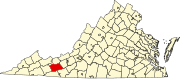 | |
| CDPs | ||
| Other communities | ||
| International | |
|---|---|
| National | |