
Marriott-Slaterville, Utah: Difference between revisions
m r2.6.5) (Robot: Adding it:Marriott-Slaterville |
add "use mdy dates" template |
||
| (43 intermediate revisions by 33 users not shown) | |||
| Line 1: | Line 1: | ||
{{short description|City in Utah, United States}} |
|||
{{Use mdy dates|date=July 2023}} |
|||
{{Infobox settlement |
{{Infobox settlement |
||
|official_name = Marriott-Slaterville, Utah |
|official_name = Marriott-Slaterville, Utah |
||
|settlement_type = [[City]] |
|settlement_type = [[City]] |
||
|nickname = |
|nickname = |
||
|motto = |
|motto = |
||
<!-- Images --> |
<!-- Images --> |
||
|image_skyline = |
|image_skyline = |
||
|imagesize = |
|imagesize = |
||
|image_caption = |
|image_caption = |
||
|image_flag = |
|image_flag = |
||
|image_seal = |
|image_seal = |
||
<!-- Maps --> |
<!-- Maps --> |
||
|image_map = |
|image_map = Weber County Utah incorporated and unincorporated areas Marriott-Slaterville highlighted.svg |
||
|mapsize = |
|mapsize = 260px |
||
|map_caption = Location |
|map_caption = Location in [[Weber County, UT|Weber County]] and the state of [[Utah]] |
||
|image_map1 = |
|||
|mapsize1 = |
|||
|map_caption1 = |
|||
<!-- Location --> |
<!-- Location --> |
||
|subdivision_type = [[List of |
|subdivision_type = [[List of sovereign states|Country]] |
||
|subdivision_name = |
|subdivision_name = United States |
||
|subdivision_type1 = [[ |
|subdivision_type1 = [[U.S. state|State]] |
||
|subdivision_name1 = [[Utah]] |
|subdivision_name1 = [[Utah]] |
||
|subdivision_type2 = [[List of counties in Utah|County]] |
|subdivision_type2 = [[List of counties in Utah|County]] |
||
| Line 29: | Line 28: | ||
<!-- Government --> |
<!-- Government --> |
||
|government_footnotes = |
|government_footnotes = |
||
|government_type = |
|government_type = |
||
|leader_title = |
|leader_title = |
||
|leader_name = |
|leader_name = |
||
|leader_title1 = |
|leader_title1 = |
||
|leader_name1 = |
|leader_name1 = |
||
|established_title = Settled |
|established_title = Settled |
||
|established_date = 1850s |
|established_date = 1850s |
||
| Line 42: | Line 41: | ||
<!-- Area --> |
<!-- Area --> |
||
|unit_pref = |
|unit_pref = Imperial |
||
|area_footnotes = <ref name="CenPopGazetteer2019">{{cite web|title=2019 U.S. Gazetteer Files|url=https://www2.census.gov/geo/docs/maps-data/data/gazetteer/2019_Gazetteer/2019_gaz_place_49.txt|publisher=United States Census Bureau|accessdate=August 7, 2020}}</ref> |
|||
|area_footnotes = |
|||
|area_magnitude = |
|area_magnitude = |
||
|area_total_km2 = 19. |
|area_total_km2 = 19.10 |
||
|area_land_km2 = 18. |
|area_land_km2 = 18.68 |
||
|area_water_km2 = 0. |
|area_water_km2 = 0.42 |
||
|area_total_sq_mi = 7. |
|area_total_sq_mi = 7.38 |
||
|area_land_sq_mi = 7. |
|area_land_sq_mi = 7.21 |
||
|area_water_sq_mi = 0. |
|area_water_sq_mi = 0.16 |
||
<!-- Population --> |
<!-- Population --> |
||
|population_as_of = [[ |
|population_as_of = [[2010 United States Census|2010]] |
||
|population_footnotes = |
|population_footnotes = |
||
|population_total = |
|population_total = 1701 |
||
|population_density_km2 = |
|population_density_km2 = 101.59 |
||
|population_density_sq_mi = |
|population_density_sq_mi = 263.10 |
||
<!-- General information --> |
<!-- General information --> |
||
| Line 64: | Line 63: | ||
|timezone_DST = MDT |
|timezone_DST = MDT |
||
|utc_offset_DST = -6 |
|utc_offset_DST = -6 |
||
|elevation_footnotes = |
|elevation_footnotes = |
||
|elevation_m = 1296 |
|elevation_m = 1296 |
||
|elevation_ft = 4252 |
|elevation_ft = 4252 |
||
| |
|coordinates = {{coord|41|15|40|N|112|1|46|W|region:US_type:city|display=inline,title}} |
||
| |
|postal_code_type = |
||
| |
|postal_code = |
||
| |
|area_code = |
||
<!-- Area/postal codes & others --> |
|||
|postal_code_type = |
|||
|postal_code = |
|||
|area_code = |
|||
|blank_name = [[Federal Information Processing Standard|FIPS code]] |
|blank_name = [[Federal Information Processing Standard|FIPS code]] |
||
|blank_info = 49-48300{{ |
|blank_info = 49-48300<ref name="GR2">{{cite web|url=https://www.census.gov|publisher=[[United States Census Bureau]]|accessdate=31 Jan 2008|title=U.S. Census website}}</ref> |
||
|blank1_name = [[Geographic Names Information System|GNIS]] feature ID |
|blank1_name = [[Geographic Names Information System|GNIS]] feature ID |
||
|blank1_info = 1851823{{ |
|blank1_info = 1851823<ref>{{cite gnis|1851823|Marriott-Slaterville}}</ref> |
||
|website = |
|website = {{URL|http://www.marriott-slaterville.org/}} |
||
|footnotes = |
|footnotes = |
||
|pop_est_as_of = 2019 |
|||
|pop_est_footnotes = <ref name="USCensusEst2019CenPopScriptOnlyDirtyFixDoNotUse"/> |
|||
|population_est = 1898 |
|||
}} |
}} |
||
'''Marriott-Slaterville''' is a city in [[Weber County, Utah|Weber County]], [[Utah]], |
'''Marriott-Slaterville''' is a city in [[Weber County, Utah|Weber County]], [[Utah]], United States. The population was 1,701 at the [[2010 United States Census|2010 census]]. It is part of the [[Ogden, Utah|Ogden]]–[[Clearfield, Utah|Clearfield]], Utah [[Ogden-Clearfield metropolitan area|Metropolitan Statistical Area]]. The city was incorporated in July 1999, in a merger of the previously [[unincorporated area|unincorporated communities]] of '''Marriott''' and '''Slaterville'''. |
||
==Geography== |
==Geography== |
||
According to the [[United States Census Bureau]], the city has a total area of 7.5 square miles (19.3 km |
According to the [[United States Census Bureau]], the city has a total area of 7.5 square miles (19.3 km<sup>2</sup>), of which {{convert|7.3|sqmi|km2}} is land and {{convert|0.2|sqmi|km2}} (2.68%) is water. |
||
==History== |
==History== |
||
Marriott-Slaterville City was originally settled by several |
Marriott-Slaterville City was originally settled by several Latter Day Saint pioneer families, in 1852, including the Richard Slater family, and the Perry, Smout, Marriott, and Field families. Many living descendants of these families, including relatives of [[J. Willard Marriott]], pioneer hotelier of the 20th century and founder of Marriott International, still reside within Marriott-Slaterville. |
||
==Demographics== |
==Demographics== |
||
{{US Census population |
|||
| ⚫ | As of the [[census]] |
||
|align=left |
|||
|2000= 1425 |
|||
|2010= 1701 |
|||
|estyear=2019 |
|||
|estimate=1898 |
|||
|estref=<ref name="USCensusEst2019CenPopScriptOnlyDirtyFixDoNotUse">{{cite web|url=https://www.census.gov/programs-surveys/popest/data/tables.2019.html|date=May 24, 2020|title=Population and Housing Unit Estimates|publisher=United States Census Bureau|accessdate=May 27, 2020}}</ref> |
|||
|footnote=U.S. Decennial Census<ref name="DecennialCensus">{{cite web|url=https://www.census.gov/programs-surveys/decennial-census.html|title=Census of Population and Housing|website=census.gov|publisher=[[United States Census Bureau]]|accessdate=4 Jun 2015}}</ref> |
|||
}} |
|||
| ⚫ | As of the [[census]]<ref name="GR2" /> of 2000, there were 1,425 people, 458 households, and 381 families residing in the city. The [[population density]] was 196.4 people per square mile (75.8/km<sup>2</sup>). There were 471 housing units at an average density of 64.9 per square mile (25.0/km<sup>2</sup>). The racial makeup of the city was 96.14% [[White (U.S. Census)|White]], 0.21% [[Native American (U.S. Census)|Native American]], 0.49% [[Asian (U.S. Census)|Asian]], 0.07% [[Pacific Islander (U.S. Census)|Pacific Islander]], 2.11% from [[Race (United States Census)|other races]], and 0.98% from two or more races. [[Hispanic (U.S. Census)|Hispanic]] or [[Latino (U.S. Census)|Latino]] of any race were 3.37% of the population. |
||
There were 458 households out of which 38.4% had children under the age of 18 living with them, 70.1% were [[Marriage|married couples]] living together, 7.9% had a female householder with no husband present, and 16.6% were non-families. 14.2% of all households were made up of individuals and 6.3% had someone living alone who was 65 years of age or older. The average household size was 3.11 and the average family size was 3.43. |
There were 458 households, out of which 38.4% had children under the age of 18 living with them, 70.1% were [[Marriage|married couples]] living together, 7.9% had a female householder with no husband present, and 16.6% were non-families. 14.2% of all households were made up of individuals, and 6.3% had someone living alone who was 65 years of age or older. The average household size was 3.11 and the average family size was 3.43. |
||
In the city the population was spread out with 29.4% under the age of 18, 10.7% from 18 to 24, 25.9% from 25 to 44, 23.1% from 45 to 64, and 10.9% who were 65 years of age or older. The median age was 34 years. For every 100 females there were 102.1 males. For every 100 females age 18 and over, there were 105.7 males. |
In the city, the population was spread out, with 29.4% under the age of 18, 10.7% from 18 to 24, 25.9% from 25 to 44, 23.1% from 45 to 64, and 10.9% who were 65 years of age or older. The median age was 34 years. For every 100 females, there were 102.1 males. For every 100 females age 18 and over, there were 105.7 males. |
||
The median income for a household in the city was $49,732, and the median income for a family was $57,083. Males had a median income of $41,466 versus $27,788 for females. The [[per capita income]] for the city was $19,534. About 5.9% of families and 7.3% of the population were below the [[poverty line]], including 6.4% of those under age 18 and 8.5% of those age 65 or over. |
The median income for a household in the city was $49,732, and the median income for a family was $57,083. Males had a median income of $41,466 versus $27,788 for females. The [[per capita income]] for the city was $19,534. About 5.9% of families and 7.3% of the population were below the [[poverty line]], including 6.4% of those under age 18 and 8.5% of those age 65 or over. |
||
== Federal Representation == |
|||
Marriott-Slaterville is located in Utah's First Congressional District |
|||
For the [[116th United States Congress]], [[Utah's 1st congressional district|Utah's First Congressional District]] is represented by [[Rob Bishop]] ([[Republican Party (United States)|(R)]] [[Brigham City, Utah|Brigham City]])<ref>{{Cite web|title=Representatives {{!}} house.gov|url=https://www.house.gov/representatives#state-utah|access-date=2020-08-09|website=www.house.gov}}</ref> |
|||
==See also== |
|||
{{portal|Utah}} |
|||
* [[List of cities and towns in Utah]] |
|||
==References== |
==References== |
||
{{reflist|22em}} |
|||
<references /> |
|||
==External links== |
|||
| ⚫ | |||
* {{official website|http://www.marriott-slaterville.org/}} |
|||
{{Geographic Location |
{{Geographic Location |
||
| Line 114: | Line 133: | ||
|Northwest = [[Plain City, Utah|Plain City]] |
|Northwest = [[Plain City, Utah|Plain City]] |
||
}} |
}} |
||
{{Weber County, Utah}} |
{{Weber County, Utah}} |
||
{{authority control}} |
|||
[[Category:Cities in Utah]] |
[[Category:Cities in Utah]] |
||
[[Category: |
[[Category:Cities in Weber County, Utah]] |
||
[[Category:Ogden–Clearfield metropolitan area]] |
[[Category:Ogden–Clearfield metropolitan area]] |
||
[[Category:1999 establishments in |
[[Category:1999 establishments in Utah]] |
||
[[Category:Populated places established in 1999]] |
[[Category:Populated places established in 1999]] |
||
| ⚫ | |||
[[it:Marriott-Slaterville]] |
|||
[[nl:Marriott-Slaterville]] |
|||
[[pt:Marriott-Slaterville]] |
|||
Latest revision as of 02:53, 18 July 2023
Marriott-Slaterville, Utah | |
|---|---|
 Location in Weber County and the state of Utah | |
| Coordinates: 41°15′40″N 112°1′46″W / 41.26111°N 112.02944°W | |
| Country | United States |
| State | Utah |
| County | Weber |
| Settled | 1850s |
| Incorporated | July 1999 |
| Named for | John Marriott and Richard Slater |
| Area | |
| • Total | 7.38 sq mi (19.10 km2) |
| • Land | 7.21 sq mi (18.68 km2) |
| • Water | 0.16 sq mi (0.42 km2) |
| Elevation | 4,252 ft (1,296 m) |
| Population (2010) | |
| • Total | 1,701 |
| • Estimate (2019)[2] | 1,898 |
| • Density | 263.10/sq mi (101.59/km2) |
| Time zone | UTC-7 (Mountain (MST)) |
| • Summer (DST) | UTC-6 (MDT) |
| FIPS code | 49-48300[3] |
| GNIS feature ID | 1851823[4] |
| Website | www |
Marriott-Slaterville is a city in Weber County, Utah, United States. The population was 1,701 at the 2010 census. It is part of the Ogden–Clearfield, Utah Metropolitan Statistical Area. The city was incorporated in July 1999, in a merger of the previously unincorporated communities of Marriott and Slaterville.
Geography
[edit]According to the United States Census Bureau, the city has a total area of 7.5 square miles (19.3 km2), of which 7.3 square miles (19 km2) is land and 0.2 square miles (0.52 km2) (2.68%) is water.
History
[edit]Marriott-Slaterville City was originally settled by several Latter Day Saint pioneer families, in 1852, including the Richard Slater family, and the Perry, Smout, Marriott, and Field families. Many living descendants of these families, including relatives of J. Willard Marriott, pioneer hotelier of the 20th century and founder of Marriott International, still reside within Marriott-Slaterville.
Demographics
[edit]| Census | Pop. | Note | %± |
|---|---|---|---|
| 2000 | 1,425 | — | |
| 2010 | 1,701 | 19.4% | |
| 2019 (est.) | 1,898 | [2] | 11.6% |
| U.S. Decennial Census[5] | |||
As of the census[3] of 2000, there were 1,425 people, 458 households, and 381 families residing in the city. The population density was 196.4 people per square mile (75.8/km2). There were 471 housing units at an average density of 64.9 per square mile (25.0/km2). The racial makeup of the city was 96.14% White, 0.21% Native American, 0.49% Asian, 0.07% Pacific Islander, 2.11% from other races, and 0.98% from two or more races. Hispanic or Latino of any race were 3.37% of the population.
There were 458 households, out of which 38.4% had children under the age of 18 living with them, 70.1% were married couples living together, 7.9% had a female householder with no husband present, and 16.6% were non-families. 14.2% of all households were made up of individuals, and 6.3% had someone living alone who was 65 years of age or older. The average household size was 3.11 and the average family size was 3.43.
In the city, the population was spread out, with 29.4% under the age of 18, 10.7% from 18 to 24, 25.9% from 25 to 44, 23.1% from 45 to 64, and 10.9% who were 65 years of age or older. The median age was 34 years. For every 100 females, there were 102.1 males. For every 100 females age 18 and over, there were 105.7 males.
The median income for a household in the city was $49,732, and the median income for a family was $57,083. Males had a median income of $41,466 versus $27,788 for females. The per capita income for the city was $19,534. About 5.9% of families and 7.3% of the population were below the poverty line, including 6.4% of those under age 18 and 8.5% of those age 65 or over.
Federal Representation
[edit]Marriott-Slaterville is located in Utah's First Congressional District For the 116th United States Congress, Utah's First Congressional District is represented by Rob Bishop ((R) Brigham City)[6]
See also
[edit]References
[edit]- ^ "2019 U.S. Gazetteer Files". United States Census Bureau. Retrieved August 7, 2020.
- ^ a b "Population and Housing Unit Estimates". United States Census Bureau. May 24, 2020. Retrieved May 27, 2020.
- ^ a b "U.S. Census website". United States Census Bureau. Retrieved January 31, 2008.
- ^ "Marriott-Slaterville". Geographic Names Information System. United States Geological Survey, United States Department of the Interior.
- ^ "Census of Population and Housing". census.gov. United States Census Bureau. Retrieved June 4, 2015.
- ^ "Representatives | house.gov". www.house.gov. Retrieved August 9, 2020.
External links
[edit]Places adjacent to Marriott-Slaterville, Utah | ||||||||||||||||
|---|---|---|---|---|---|---|---|---|---|---|---|---|---|---|---|---|
| ||||||||||||||||
Municipalities and communities of Weber County, Utah, United States | ||
|---|---|---|
| Cities | 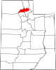 | |
| Town | ||
| Townships | ||
| CDPs | ||
| Unincorporated communities | ||
| International | |
|---|---|
| National | |