
Butte La Rose, Louisiana: Difference between revisions
tweaked; cruft rv |
→top: add "use mdy dates" template |
||
| (29 intermediate revisions by 23 users not shown) | |||
| Line 1: | Line 1: | ||
{{Use mdy dates|date=July 2023}} |
|||
{{Geobox |
|||
{{Infobox settlement |
|||
| Settlement |
|||
| ⚫ | |||
<!-- *** Name section *** --> |
|||
| |
| native_name = |
||
| |
| other_name = |
||
| |
| settlement_type = |
||
| ⚫ | |||
| ⚫ | |||
| |
| image_skyline = |
||
| image_caption = |
|||
| ⚫ | |||
| |
| image_flag = |
||
| |
| image_shield = |
||
| |
| motto = |
||
| ⚫ | |||
<!-- *** Symbols *** --> |
|||
| |
| etymology = |
||
<!-- location --> |
|||
| ⚫ | |||
| |
| subdivision_type = Country |
||
| |
| subdivision_name = United States |
||
| |
| subdivision_type1 = State |
||
| ⚫ | |||
| ⚫ | |||
| |
| subdivision_type2 = Parish |
||
| subdivision_name2 = [[St. Martin Parish, Louisiana|St. Martin]] |
|||
| motto = |
|||
| subdivision_type3 = |
|||
<!-- *** Country etc. *** --> |
|||
| |
| subdivision_name3 = |
||
<!-- maps and coordinates --> |
|||
| ⚫ | |||
| |
| image_map = |
||
| |
| map_caption = |
||
| ⚫ | |||
<!-- *** Geography *** --> |
|||
| |
| pushpin_relief = |
||
| ⚫ | |||
| ⚫ | |||
| coordinates = {{coord|30|16|40|N|91|41|12|W|display=inline,title}} |
|||
| ⚫ | |||
| |
| coordinates_footnotes = |
||
<!-- established --> |
|||
| area_percentage_round = |
|||
| |
| established_title = |
||
| |
| established_date = |
||
<!-- area --> |
|||
| lat_d = 30 |
|||
| |
| area_footnotes = |
||
| |
| dunam_link = |
||
| |
| area_total_km2 = |
||
| |
| area_total_sq_mi = |
||
| |
| area_land_sq_mi = |
||
| |
| area_water_sq_mi = |
||
<!-- elevation --> |
|||
| long_EW = W |
|||
| |
| elevation_footnotes = |
||
| |
| elevation_m = |
||
| ⚫ | |||
<!-- *** Population *** --> |
|||
<!-- population --> |
|||
| population_as_of = |
|||
| |
| population_as_of = |
||
| population_footnotes = |
|||
| population_density_imperial = |
|||
| |
| population_total = |
||
| population_density_km2 = auto |
|||
<!-- *** Government *** --> |
|||
| population_density_sq_mi= |
|||
| government = |
|||
| |
| population_demonym = |
||
| ⚫ | |||
| established = |
|||
| |
| timezone1 = [[North American Central Time Zone|CST]] |
||
| |
| utc_offset1 = -6 |
||
| |
| timezone1_DST = [[North American Central Time Zone|CDT]] |
||
| utc_offset1_DST = -5 |
|||
<!-- *** Various codes *** --> |
|||
| |
| timezone2 = |
||
| |
| utc_offset2 = |
||
| |
| timezone2_DST = |
||
| |
| utc_offset2_DST = |
||
<!-- postal codes, area code --> |
|||
| postal_code = |
|||
| postal_code_type |
| postal_code_type = |
||
| |
| postal_code = |
||
| area_code_type |
| area_code_type = |
||
| |
| area_code = |
||
| |
| geocode = |
||
| ⚫ | |||
<!-- *** Free fields *** --> |
|||
<!-- website, footnotes --> |
|||
| free_type = |
|||
| |
| website = |
||
| |
| footnotes = |
||
| free1 = |
|||
<!-- *** Map section *** --> |
|||
| map = Louisiana Locator Map.PNG |
|||
| ⚫ | |||
| ⚫ | |||
| ⚫ | |||
| map1_caption = |
|||
}} |
}} |
||
[[Image:Fort Butte LaRose 1863.jpg|right|thumb|250 px|Fort Butte La Rose, Louisiana in 1863]] |
[[Image:Fort Butte LaRose 1863.jpg|right|thumb|250 px|Fort Butte La Rose, Louisiana in 1863]] |
||
'''Butte La Rose''' (also known as '''Butte- |
'''Butte La Rose''' (also known as '''Butte-à-la-Rose''') is an [[Unincorporated area|unincorporated community]] in [[St. Martin Parish, Louisiana]], United States. In the 21st century, the area is known for its wilderness campgrounds,<ref>{{Cite web |url=http://cajuncountry.org/campgrounds.html# |title="Campgrounds" |access-date=2008-05-21 |archive-url=https://web.archive.org/web/20080704190147/http://www.cajuncountry.org/campgrounds.html# |archive-date=2008-07-04 |url-status=dead }}</ref> and the Atchafalaya Welcome Center.<ref>[http://dnr.louisiana.gov/sec/atchafalaya/education/INTRODUCTION_Teachers.doc dnr.louisiana.gov "Atchafalaya Basin Program"]</ref> |
||
| ⚫ | In 2011, Ed Lavandera of ''[[CNN]]'' said that Butte La Rose was "home to an eclectic collection of [[Cajun]]s who've come to this hideaway for generations to drift through the hidden waters catching crawfish."<ref name="LavanderaEd" /> As of 2011 about 800 houses were located in the community. Many members of the community referred to their houses as "camps". |
||
==History== |
==History== |
||
| ⚫ | |||
=== Early history === |
|||
| ⚫ | Some {{Who |
||
| ⚫ | |||
| ⚫ | Some {{Who|date=May 2011}} claim an old [[Native Americans in the United States|Indian]], Celestin Rose, who resided at one time in [[Grand Bois, Louisiana|Grand Bois]] said that the butte was named after one of his ancestors, "a famous [[Chitimacha]] Indian". Another version is that following the [[French Revolution]], some royalists made the butte their home and named it Rose in memory of the flower which was the symbol of their fallen society.<ref>[http://www.gladysdevilliers.acadian-home.org/the-river-people.html Acadian-Home website]</ref> |
||
| ⚫ | During the [[U.S. Civil War]], the [[Union Army]] capture of [[Fort Burton]] at Butte a la Rose took place on April 20, 1863.<ref> |
||
===U.S. Civil War=== |
|||
In the 21st century, the area is known for its wilderness campgrounds <ref>[http://cajuncountry.org/campgrounds.html "Campgrounds"]</ref> and the '''Atchafalaya Welcome Center'''.<ref> [http://dnr.louisiana.gov/sec/atchafalaya/education/INTRODUCTION_Teachers.doc dnr.louisiana.gov "Atchafalaya Basin Program"]</ref> |
|||
| ⚫ | During the [[U.S. Civil War]], the [[Union Army]] capture of [[Fort Burton]] at Butte a la Rose took place on April 20, 1863.<ref>{{cite web|url=http://www.mvn.usace.army.mil/prj/hist_arch/bayou_chene/bayou_chene.pdf |title=Bayou Chene: The Life Story of an Atchafalaya Basin Community |accessdate=2007-09-21 |last=Maygarden |first=Benjamin D. |author2=Jill-Karen Yakubik |year=1999 |format=PDF |publisher=U.S. Army Corps of Engineers |url-status=dead |archiveurl=https://web.archive.org/web/20070823060356/http://www.mvn.usace.army.mil/prj/hist_arch/bayou_chene/bayou_chene.pdf |archivedate=2007-08-23 }}</ref> |
||
=== 2011 flooding === |
|||
In May 2011, the area was threatened by flood due to the [[United States Army Corps of Engineers|Army Corps of Engineers]] opening the [[Morganza Spillway]], in order to divert flood water from more populous areas such as [[Baton Rouge, Louisiana|Baton Rouge]] and [[New Orleans]].<ref name="LavanderaEd">Lavandera, Ed. "[http://www.cnn.com/2011/US/05/13/lousiana.town.disaster/index.html?hpt=T2 For Louisiana town, a collective gasp as it braces for floodwaters]." ''[[CNN]]''. May 13, 2011; retrieved May 13, 2011</ref> |
|||
==Community== |
|||
| ⚫ | In 2011 Ed Lavandera of ''[[CNN]]'' said that Butte La Rose was "home to an eclectic collection of [[Cajun]]s who've come to this hideaway for generations to drift through the hidden waters catching |
||
==Education== |
==Education== |
||
| Line 101: | Line 95: | ||
==See also== |
==See also== |
||
{{Portal| |
{{Portal|United States}} |
||
*[[USS Clifton (1862)]] |
*[[USS Clifton (1862)]] |
||
*[[USS Arizona (1858)]] |
*[[USS Arizona (1858)]] |
||
| Line 107: | Line 101: | ||
==References== |
==References== |
||
{{Reflist}} |
{{Reflist}} |
||
==External links== |
|||
* Kunzelman, Michael. "[http://www.chron.com/disp/story.mpl/nation/7575454.html As water inches closer, La. town waits in agony]." ''[[Associated Press]]'' at the ''[[Houston Chronicle]]''. May 21, 2011. |
|||
{{St. Martin Parish, Louisiana}} |
{{St. Martin Parish, Louisiana}} |
||
{{Louisiana-stub}} |
|||
{{authority control}} |
|||
{{coord|30|16|40|N|91|41|12|W|type:city_region:US-LA_source:GNIS-enwiki|display=title}} |
|||
[[Category:St. Martin Parish, Louisiana]] |
[[Category:Unincorporated communities in St. Martin Parish, Louisiana]] |
||
[[Category:Unincorporated communities in Louisiana]] |
[[Category:Unincorporated communities in Louisiana]] |
||
[[Category:Acadiana]] |
[[Category:Acadiana]] |
||
[[Category:Lafayette |
[[Category:Lafayette metropolitan area, Louisiana]] |
||
Latest revision as of 21:11, 22 July 2023
Butte La Rose | |
|---|---|
 Butte La Rose Location of Butte La Rose in Louisiana | |
| Coordinates: 30°16′40″N 91°41′12″W / 30.27778°N 91.68667°W | |
| Land | Vereinigte Staaten |
| State | Louisiana |
| Parish | St. Martin |
| Time zone | UTC-6 (CST) |
| • Summer (DST) | UTC-5 (CDT) |

Butte La Rose (also known as Butte-à-la-Rose) is an unincorporated community in St. Martin Parish, Louisiana, United States. In the 21st century, the area is known for its wilderness campgrounds,[1] and the Atchafalaya Welcome Center.[2]
In 2011, Ed Lavandera of CNN said that Butte La Rose was "home to an eclectic collection of Cajuns who've come to this hideaway for generations to drift through the hidden waters catching crawfish."[3] As of 2011 about 800 houses were located in the community. Many members of the community referred to their houses as "camps".
History
[edit]Early history
[edit]The community is located on a high point where the Atchafalaya River makes a sharp bend and divides into the Little Atchafalaya River to the south and the Upper Grand River to the north.
Some [who?] claim an old Indian, Celestin Rose, who resided at one time in Grand Bois said that the butte was named after one of his ancestors, "a famous Chitimacha Indian". Another version is that following the French Revolution, some royalists made the butte their home and named it Rose in memory of the flower which was the symbol of their fallen society.[4]
U.S. Civil War
[edit]During the U.S. Civil War, the Union Army capture of Fort Burton at Butte a la Rose took place on April 20, 1863.[5]
2011 flooding
[edit]In May 2011, the area was threatened by flood due to the Army Corps of Engineers opening the Morganza Spillway, in order to divert flood water from more populous areas such as Baton Rouge and New Orleans.[3]
Bildung
[edit]Residents are zoned to the St. Martin Parish School Board.
See also
[edit]References
[edit]- ^ ""Campgrounds"". Archived from the original on July 4, 2008. Retrieved May 21, 2008.
- ^ dnr.louisiana.gov "Atchafalaya Basin Program"
- ^ a b Lavandera, Ed. "For Louisiana town, a collective gasp as it braces for floodwaters." CNN. May 13, 2011; retrieved May 13, 2011
- ^ Acadian-Home website
- ^ Maygarden, Benjamin D.; Jill-Karen Yakubik (1999). "Bayou Chene: The Life Story of an Atchafalaya Basin Community" (PDF). U.S. Army Corps of Engineers. Archived from the original (PDF) on August 23, 2007. Retrieved September 21, 2007.
External links
[edit]- Kunzelman, Michael. "As water inches closer, La. town waits in agony." Associated Press at the Houston Chronicle. May 21, 2011.
Municipalities and communities of St. Martin Parish, Louisiana, United States | ||
|---|---|---|
| Cities | 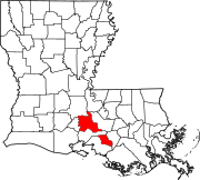 | |
| Towns | ||
| Village | ||
| CDPs | ||
| Other communities | ||
| Ghost town | ||
| Footnotes | ‡This populated place also has portions in an adjacent parish or parishes | |