
Al-Heila: Difference between revisions
Content deleted Content added
←Created page with '{{lowercase}} {{Infobox Palestinian Authority muni |name=al-Heila |image= |imgsize= |caption= |arname= |meaning= |founded= |type=mund |typefrom= |altOffSp= |altU...' |
Tom.Reding (talk | contribs) m +{{Authority control}} (1 ID from Wikidata); WP:GenFixes & cleanup on |
||
| (22 intermediate revisions by 16 users not shown) | |||
| Line 1: | Line 1: | ||
{{ |
{{Lowercase title}} |
||
{{Infobox |
{{Infobox settlement |
||
|name=al-Heila |
| name = al-Heila |
||
| translit_lang1 = Arabic |
|||
|image= |
|||
| translit_lang1_type = [[Arabic script|Arabic]] |
|||
|imgsize= |
|||
| translit_lang1_info = الحيلة |
|||
|caption= |
|||
| type = [[Village council (Palestinian Authority)|Municipality type D (Village council)]] |
|||
|arname= |
|||
| image_skyline = |
|||
|meaning= |
|||
| image_caption = |
|||
|founded= |
|||
| pushpin_map = Palestine |
|||
|type=mund |
|||
| pushpin_map_caption = Location of al-Heila within [[State of Palestine|Palestine]] |
|||
|typefrom= |
|||
| image_map = |
|||
|altOffSp= |
|||
| map_caption = |
|||
|altUnoSp= |
|||
| coordinates = {{coord|31|28|24|N|35|06|26|E|region:PS|display=inline,title}} |
|||
|governorate=hb |
|||
| grid_name = [[Palestine grid|Palestine grid]] |
|||
|latd=31|latm=28|lats=24.07|latNS=N |
|||
| grid_position = |
|||
|longd=35|longm=06|longs=25.84|longEW=E |
|||
| subdivision_type = State |
|||
|population=995 |
|||
| subdivision_name = [[State of Palestine]] |
|||
|popyear=2006 |
|||
| subdivision_type1 = [[Governorates of the Palestinian National Authority|Governorate]] |
|||
|area= |
|||
| subdivision_name1 = [[Hebron Governorate|Hebron]] |
|||
|areakm= |
|||
| established_title = Founded |
|||
|mayor= |
|||
| established_date = |
|||
| government_footnotes = <!-- for references: use <ref> tags --> |
|||
| government_type = [[Village council (Palestinian Authority)|Village council]] |
|||
| leader_title = |
|||
| leader_name = |
|||
| unit_pref = dunam |
|||
| area_footnotes = |
|||
| area_total_km2 = |
|||
| area_total_dunam = |
|||
| elevation_footnotes = |
|||
| elevation_m = |
|||
| elevation_min_m = |
|||
| elevation_max_m = |
|||
| population_footnotes = |
|||
| population_total = 1,277 |
|||
| population_as_of = 2007 |
|||
| population_note = |
|||
| population_density_km2 = auto |
|||
| website = |
|||
| footnotes = |
|||
}} |
}} |
||
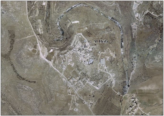
'''al-Heila''' ({{lang-ar|}}) is a [[Palestinian]] village located eight kilometers south of [[Hebron]]. The village is in the [[Hebron Governorate]] Southern [[West Bank]]. According to the [[Palestinian Central Bureau of Statistics]], the village had a population of |
'''al-Heila''' ({{lang-ar|الحيلة}}) is a [[Palestinian territories|Palestinian]] village located eight kilometers south of [[Hebron]]. The village is in the [[Hebron Governorate]] Southern [[West Bank]]. According to the [[Palestinian Central Bureau of Statistics]], the village had a population of 1,277 in 2007.<ref name="PCBS">[http://www.pcbs.gov.ps/Portals/_PCBS/Downloads/book1487.pdf 2007 PCBS Census] [[Palestinian Central Bureau of Statistics]]. p.119.</ref> The primary health care facilities for the village are designated by the Ministry of Health as level 1.<ref>[http://www.reliefweb.int/rw/fullMaps_Sa.nsf/luFullMap/BB0D1D0CC89A371F8525706F00517495/$File/healthinforum_HLT_westbank_opt110205.pdf?OpenElement West Bank Health care] {{webarchive|url=http://webarchive.loc.gov/all/20060313002206/http://www.reliefweb.int/rw/fullMaps_Sa.nsf/luFullMap/BB0D1D0CC89A371F8525706F00517495/$File/healthinforum_HLT_westbank_opt110205.pdf?OpenElement |date=2006-03-13 }}</ref> |
||
==Footnotes== |
==Footnotes== |
||
{{Reflist}} |
{{Reflist}} |
||
==External links== |
==External links== |
||
*[http://www.palestineremembered.com/GeoPoints/al_Heila_8457/index.html Welcome To al-Heila] |
|||
| ⚫ | |||
*Survey of Western Palestine, Map 21: [http://www.iaa-archives.org.il/zoom/zoom.aspx?folder_id=93&type_id=6&id=8383 IAA], [http://commons.wikimedia.org/wiki/File:Survey_of_Western_Palestine_1880.21.jpg Wikimedia commons] |
|||
*[http://vprofile.arij.org/hebron/pdfs/Al%20Heila.pdf Al Heila Village (Fact Sheet)], [[Applied Research Institute–Jerusalem]], ARIJ |
|||
*[http://vprofile.arij.org/hebron/pdfs/Al%20Heila_pro.pdf Al Heila Village Profile], ARIJ |
|||
*[http://vprofile.arij.org/hebron/images/Al%20Heila%20Areal%20Photo.jpg Al Heila Village Area Photo], ARIJ |
|||
*[http://vprofile.arij.org/hebron/pdfs/needsfordevelopment/Al%20Heila_vp_en.pdf The priorities and needs for development in Al Heila village based on the community and local authorities’ assessment], ARIJ |
|||
{{Hebron Governorate}} |
{{Hebron Governorate}} |
||
{{Authority control}} |
|||
| ⚫ | |||
| ⚫ | |||
| ⚫ | |||
| ⚫ | |||
[[Category:Hebron Governorate]] |
[[Category:Hebron Governorate]] |
||
[[Category:Municipalities of the State of Palestine]] |
|||
[[ar:]] |
|||
| ⚫ | |||
Revision as of 22:19, 20 October 2023
al-Heila | |
|---|---|
| Arabic transcription(s) | |
| • Arabic | الحيلة |
 al-Heila Location of al-Heila within Palestine | |
| Coordinates: 31°28′24″N 35°06′26″E / 31.47333°N 35.10722°E | |
| State | State of Palestine |
| Governorate | Hebron |
| Regierung | |
| • Type | Village council |
| Population (2007) | |
| • Total | 1,277 |
al-Heila (Arabic: الحيلة) is a Palestinian village located eight kilometers south of Hebron. The village is in the Hebron Governorate Southern West Bank. According to the Palestinian Central Bureau of Statistics, the village had a population of 1,277 in 2007.[1] The primary health care facilities for the village are designated by the Ministry of Health as level 1.[2]
Footnotes
- ^ 2007 PCBS Census Palestinian Central Bureau of Statistics. p.119.
- ^ West Bank Health care Archived 2006-03-13 at the Library of Congress Web Archives
External links
- Welcome To al-Heila
- Survey of Western Palestine, Map 21: IAA, Wikimedia commons
- Al Heila Village (Fact Sheet), Applied Research Institute–Jerusalem, ARIJ
- Al Heila Village Profile, ARIJ
- Al Heila Village Area Photo, ARIJ
- The priorities and needs for development in Al Heila village based on the community and local authorities’ assessment, ARIJ

| Authority control databases: National |
|---|
This geography of the State of Palestine article is a stub. You can help Wikipedia by expanding it. |