
Camel's Hump: Difference between revisions
→Name: Fix year |
|||
| (47 intermediate revisions by 21 users not shown) | |||
| Line 1: | Line 1: | ||
{{Short description|Mountain in Vermont, US}} |
|||
{{For|the peak named "Camels Hump" in Australia|Mount Macedon}} |
|||
{{About||the peak named "Camels Hump" in Australia|Mount Macedon|the hump of a camel|Camel#Hump}} |
|||
{{Infobox mountain |
{{Infobox mountain |
||
| name = Camel's Hump |
| name = Camel's Hump |
||
| photo = |
| photo = CamelsHumpMT 20060728.jpg |
||
| photo_caption = Camel's Hump, July |
| photo_caption = Camel's Hump, July 2006 |
||
| map = Vermont |
|||
| map_alt = Camel's Hump in the State of Vermont in the United States |
|||
| map_caption = Vermont, U.S.A. |
|||
| map_relief = yes |
|||
| map_size = 200 |
|||
| elevation_ft = 4083 |
| elevation_ft = 4083 |
||
| elevation_ref = <ref name="GMC Long Trail map">{{cite map |author=Green Mountain Club |author-link=Green Mountain Club |title=Vermont's Long Trail: A Footpath in the Wilderness |year=2015 |type=Topographic map |scale=1:85,000 |cartography=Center for Community GIS |edition=5th |isbn=978-1-888021-46-2}}</ref> |
|||
| elevation_ref = {{NAVD88}}<ref name="ngs">{{cite ngs |id=PG1684 |name=Camels Hump 2 Reset |accessdate=2008-11-24}}</ref> |
|||
| prominence_ft = 1860 |
| prominence_ft = 1860 |
||
| prominence_ref = <ref>{{cite peakbagger |pid=7016 |name=Camels Hump, Vermont |accessdate=2008-11-24}}</ref> |
| prominence_ref = <ref>{{cite peakbagger |pid=7016 |name=Camels Hump, Vermont |accessdate=2008-11-24}}</ref> |
||
| listing = [[Four-thousand footers|New England 4,000-footers]]<br />[[New England Fifty Finest]] #46 |
| listing = [[Four-thousand footers|New England 4,000-footers]]<br />[[New England Fifty Finest]] #46 |
||
| country = [[United States]] |
|||
| location = [[Huntington, Vermont|Huntington]] / [[Duxbury, Vermont|Duxbury]], [[Vermont|Vermont, U.S.]] |
|||
| state = [[Vermont]] |
|||
| district = [[Chittenden County, Vermont|Chittenden]] / [[Washington County, Vermont|Washington]] |
|||
| district_type = County |
|||
| settlement = [[Huntington, Vermont|Huntington]] / [[Duxbury, Vermont|Duxbury]] |
|||
| settlement_type = Town |
|||
| range = [[Green Mountains]] |
| range = [[Green Mountains]] |
||
| coordinates = {{coord|44|19| |
| coordinates = {{coord|44|19|11|N|72|53|10|W|region:US-VT_type:mountain_source:ngs|display=inline,title}} |
||
| coordinates_ref = <ref name="ngs">{{cite ngs |id=PG1684 |name=Camels Hump 2 Reset |accessdate=2008-11-24}}</ref> |
|||
| age = 550 million years<ref name="Bazilchuk" /> |
| age = 550 million years<ref name="Bazilchuk" /> |
||
| first_ascent = |
| first_ascent = |
||
| Line 18: | Line 30: | ||
}} |
}} |
||
'''Camel's Hump''' (alternatively '''Camels Hump''') is a mountain in the [[Green Mountains]] in the [[U.S. state]] of [[Vermont]]. |
'''Camel's Hump''' (alternatively '''Camels Hump''') is a mountain in the [[Green Mountains]] in the [[U.S. state]] of [[Vermont]]. The north slope of the mountain borders the [[Winooski River]], which has carved through the Green Mountains over eons. At {{cvt|4083|feet}}, it is tied with [[Mount Ellen (Vermont)|Mount Ellen]] for the third-highest mountain in Vermont. Surmounted by {{cvt|10|acre|ha|0}} of [[alpine tundra]], the mountain is the most significant feature in [[Camel's Hump State Park]]. Because of its distinctive profile, it is perhaps the state's most recognized mountain, featured on the state quarter. |
||
==Name== |
==Name== |
||
Since Europeans first saw the mountain, probably on [[Samuel de Champlain]]'s 1609 trip down [[Lake Champlain]] to the west, the mountain has had a number of names related to its distinctive shape. De Champlain named the mountain "Le Lion Couchant", a heraldic image which roughly translates as "The Resting Lion". [[Ira Allen]] later referred to the mountain as "Camel's Rump" on a map from 1798. It was not until 1830 that the name "Camel's Hump" came into usage.<ref name="statepark">{{cite web |url |
Since Europeans first saw the mountain, probably on [[Samuel de Champlain]]'s 1609 trip down [[Lake Champlain]] to the west, the mountain has had a number of names related to its distinctive shape. De Champlain named the mountain "Le Lion Couchant", a heraldic image which roughly translates as "The Resting Lion".<ref>{{cite web |last1=Bushnell |first1=Mark |title=Whence Camel's Hump and other Vermont mountain names? |url=https://vtdigger.org/2019/09/15/then-again-whence-camels-hump-and-other-vermont-mountain-names/ |publisher=[[VTDigger]] |access-date=16 March 2020 |date=September 15, 2019}}</ref> [[Ira Allen]] later referred to the mountain as "Camel's Rump" on a map from 1798. It was not until 1830 that the name "Camel's Hump" came into usage.<ref name="statepark">{{cite web |url=http://www.central-vt.com/visit/attract/camhump/index.html |title=Camel's Hump State Park |access-date=July 1, 2007}}</ref> |
||
The [[Geographic Names Information System]] (GNIS) lists twelve variant names including ''Tah-wak-be-dee-ee-so wadso'' and Catamountain.<ref name="gnis">{{cite gnis |id |
The [[Geographic Names Information System]] (GNIS) lists twelve variant names including ''Tah-wak-be-dee-ee-so wadso'' and Catamountain.<ref name="gnis">{{cite gnis |id=1456724 |name=Camels Hump |accessdate=April 4, 2010}}</ref> While place names are determined by local usage the [[U.S. Board on Geographic Names]] (BGN) serves as a central authority in the United States concerning place names. Since its inception in 1890 the BGN has discouraged the use of the genitive apostrophe.<ref>{{cite web |url=http://geonames.usgs.gov/domestic/faqs.htm |title=Domestic Names - Frequently Asked Questions |publisher=U.S. Board on Geographic Names |access-date=April 4, 2010 |archive-date=January 5, 2017 |archive-url=https://web.archive.org/web/20170105041005/https://geonames.usgs.gov/domestic/faqs.htm |url-status=live }}</ref> Local usage is often at odds with this policy and so the name of this mountain is alternatively spelled with and without an apostrophe. |
||
==Geology== |
==Geology== |
||
Camel's Hump is more notable for its shape than its height. Isolated from neighboring peaks by the Winooski Valley and [[glacier|glacial]] action, the mountain's conical silhouette is distinctive, if misleading. It has two "humps", with the southernmost being the higher, and a steep drop to the south as a result of a quarrying action of the ice passing over it. The movement of glacial ice shaped it into what is referred to as a [[roche moutonnée]].{{Citation needed|reason=Reliable source needed|date=February 2020}} The bedrock consists of [[phyllite]], [[quartzite]] and schist.<ref>{{Cite web|url |
Camel's Hump is more notable for its shape than its height. Isolated from neighboring peaks by the Winooski Valley and [[glacier|glacial]] action, the mountain's conical silhouette is distinctive, if misleading. It has two "humps", with the southernmost being the higher, and a steep drop to the south as a result of a quarrying action of the ice passing over it. The movement of glacial ice shaped it into what is referred to as a [[roche moutonnée]].{{Citation needed|reason=Reliable source needed|date=February 2020}} The bedrock consists of [[phyllite]], [[quartzite]], and schist.<ref>{{Cite web |url=http://www.anr.state.vt.us/dec/geo/SpecialBulletins/Thompson_1991SpB12.pdf |title=Bedrock Geology of the Camels Hump-Bolton Mountain Area, North-Central Vermont |date=1991 |access-date=27 January 2016 |last=Thompson |first=Peter and Thelma |archive-date=7 September 2015 |archive-url=https://web.archive.org/web/20150907011012/http://www.anr.state.vt.us/dec/geo/SpecialBulletins/Thompson_1991SpB12.pdf |url-status=live }}</ref> |
||
In 1968 the [[National Park Service]] designated Camel's Hump a [[National Natural Landmark]], citing the peak as "an exceptional illustration of the complex anticlinal deformation which formed the Green Mountains".<ref name="nps">{{cite web |title=Camel's Hump: National Natural Landmark |publisher=[[National Park Service]] |url=http://www.nature.nps.gov/nnl/Registry/USA_Map/States/Vermont/NNL/CH/index.cfm |access-date=2007-06-19 |archive-url=https://web.archive.org/web/20100528141037/http://www.nature.nps.gov/nnl/Registry/USA_Map/States/Vermont/NNL/CH/index.cfm |archive-date=2010-05-28 |url-status=dead}}</ref> The landmark area consists of approximately {{cvt|5300|acres}} from the summit down to {{cvt|2500|feet}}.<ref>{{cite web |url=https://www.nps.gov/subjects/nnlandmarks/site.htm?Site=CAHU-VT |title=National Natural Landmarks: Camel's Hump |publisher=[[National Park Service]] |language=en |access-date=11 February 2020 |archive-date=13 July 2019 |archive-url=https://web.archive.org/web/20190713090053/https://www.nps.gov/subjects/nnlandmarks/site.htm?Site=CAHU-VT |url-status=live }}</ref><ref>{{cite book |title=Preserving Our Natural Heritage, Volume II |page=586 |url=https://books.google.com/books?id=bRFF-ixDXT8C&pg=PA586 |access-date=11 February 2020 |archive-date=2 October 2022 |archive-url=https://web.archive.org/web/20221002193922/https://books.google.com/books?id=bRFF-ixDXT8C&pg=PA586 |url-status=live }}</ref> |
|||
In 1968 the [[National Park Service]] designated Camel's Hump a [[National Natural Landmark]], citing the peak as "an exceptional illustration of the complex anticlinal deformation which formed the Green Mountains".<ref name="nps"> |
|||
{{cite web |
|||
| title = Camel's Hump: National Natural Landmark |
|||
| publisher = [[National Park Service]] |
|||
| url = http://www.nature.nps.gov/nnl/Registry/USA_Map/States/Vermont/NNL/CH/index.cfm |
|||
| accessdate = 2007-06-19 |
|||
| archive-url = https://web.archive.org/web/20100528141037/http://www.nature.nps.gov/nnl/Registry/USA_Map/States/Vermont/NNL/CH/index.cfm |
|||
| archive-date = 2010-05-28 |
|||
| url-status = dead |
|||
}}</ref> The landmark area consists of approximately {{convert|5300|acres}} from the summit down to {{convert|2500|feet}}.<ref>{{cite web |
|||
|url=https://www.nps.gov/subjects/nnlandmarks/site.htm?Site=CAHU-VT |
|||
|title=National Natural Landmarks: Camel's Hump |
|||
|publisher=[[National Park Service]] |
|||
|language=en |
|||
|access-date=11 February 2020}}</ref><ref>{{cite book |title=Preserving Our Natural Heritage, Volume II |page=586 |url={{Google books|bRFF-ixDXT8C|page=586|plainurl=yes}} |accessdate=11 February 2020}}</ref> |
|||
== |
==Climate== |
||
{{Weather box |
|||
[[File:CamelsHumpSummitGrass 20080624.jpg|thumb|left|[[Alpine tundra]] grasses at the summit of Camel's Hump, Vermont, June 2008.]] |
|||
|location = Camel's Hump 44.3168 N, 72.8828 W, Elevation: {{cvt|3438|ft}} (1991–2020 normals) |
|||
|single line = y |
|||
|Jan high F = 19.0 |
|||
The summit of Camel's Hump is home to {{convert|10|acre|ha|0}} of [[alpine tundra]] vegetation.<ref name="nps"/> Common plants found in this area include: Bigelow's sedge (''[[Carex bigelowii]]''), alpine bilberry (''[[Vaccinium uliginosum]]''), mountain sandwort (''[[Minuartia groenlandica]]''), crowberry (''[[Empetrum nigrum]]''), mountain cranberry (''[[Vaccinium vitis-idaea]]''), and Labrador tea (''[[Rhododendron groenlandicum]]''). A direct result of glacial formation, these alpine species were once widespread but as the lower elevations warmed, only the very peak of Camel's Hump remained hospitable to the fragile plants.<ref name="Bazilchuk"> |
|||
|Feb high F = 21.0 |
|||
{{cite book |
|||
|Mar high F = 28.6 |
|||
| chapterurl = http://www.nasw.org/users/nbazilchuk/Articles/Camel.htm |
|||
|Apr high F = 42.7 |
|||
| last = Bazilchuk |
|||
|May high F = 56.0 |
|||
| first = Nancy |
|||
|Jun high F = 64.3 |
|||
| chapter = Camel's Hump State Park |
|||
|Jul high F = 68.4 |
|||
| title = The Longstreet Highroad Guide to the Vermont Mountains |
|||
|Aug high F = 66.8 |
|||
| accessdate = 2008-04-16 |
|||
|Sep high F = 60.6 |
|||
| isbn = 1-56352-504-6 }}</ref> |
|||
|Oct high F = 47.6 |
|||
|Nov high F = 34.7 |
|||
|Dec high F = 24.6 |
|||
|Jan mean F = 11.1 |
|||
|Feb mean F = 13.0 |
|||
|Mar mean F = 21.0 |
|||
|Apr mean F = 34.2 |
|||
|May mean F = 47.7 |
|||
|Jun mean F = 56.9 |
|||
|Jul mean F = 61.5 |
|||
|Aug mean F = 59.9 |
|||
|Sep mean F = 53.2 |
|||
|Oct mean F = 40.7 |
|||
|Nov mean F = 28.2 |
|||
|Dec mean F = 17.8 |
|||
|Jan low F = 3.2 |
|||
|Feb low F = 5.0 |
|||
|Mar low F = 13.3 |
|||
|Apr low F = 25.8 |
|||
|May low F = 39.5 |
|||
|Jun low F = 49.4 |
|||
|Jul low F = 54.5 |
|||
|Aug low F = 53.0 |
|||
|Sep low F = 45.8 |
|||
|Oct low F = 33.8 |
|||
|Nov low F = 21.7 |
|||
|Dec low F = 11.0 |
|||
|precipitation colour = green |
|||
|Jan precipitation inch = 4.77 |
|||
|Feb precipitation inch = 4.34 |
|||
|Mar precipitation inch = 5.21 |
|||
|Apr precipitation inch = 5.49 |
|||
|May precipitation inch = 5.93 |
|||
|Jun precipitation inch = 6.77 |
|||
|Jul precipitation inch = 6.74 |
|||
|Aug precipitation inch = 6.33 |
|||
|Sep precipitation inch = 5.70 |
|||
|Oct precipitation inch = 6.83 |
|||
|Nov precipitation inch = 5.62 |
|||
|Dec precipitation inch = 5.94 |
|||
|source=PRISM Climate Group<ref>{{cite web |
|||
|url= http://prism.oregonstate.edu/explorer/ |
|||
|title= PRISM Climate Group, Oregon State University |
|||
|publisher= PRISM Climate Group, Oregon State University |
|||
|access-date= October 22, 2023 |
|||
|quote= To find the table data on the PRISM website, start by clicking ''Coordinates'' (under ''Location''); copy ''Latitude'' and ''Longitude figures'' from top of table; click ''Zoom to location''; click ''Precipitation, Minimum temp, Mean temp, Maximum temp''; click ''30-year normals, 1991-2020''; click ''800m''; click ''Retrieve Time Series'' button.}}</ref> |
|||
}} |
|||
==Botany== |
|||
[[File:CamelsHumpSummitGrass 20080624.jpg|thumb|left|[[Alpine tundra]] grasses at the summit of Camel's Hump, Vermont, June 2008.]] |
|||
The summit of Camel's Hump is home to {{cvt|10|acre|ha|0}} of [[alpine tundra]] vegetation.<ref name="nps"/> Common plants found in this area include: Bigelow's sedge (''[[Carex bigelowii]]''), alpine bilberry (''[[Vaccinium uliginosum]]''), mountain sandwort (''[[Minuartia groenlandica]]''), crowberry (''[[Empetrum nigrum]]''), mountain cranberry (''[[Vaccinium vitis-idaea]]''), and Labrador tea (''[[Rhododendron groenlandicum]]''). A direct result of glacial formation, these alpine species were once widespread but as the lower elevations warmed, only the very peak of Camel's Hump remained hospitable to the fragile plants.<ref name="Bazilchuk">{{cite book |chapter-url=http://www.nasw.org/users/nbazilchuk/Articles/Camel.htm |last=Bazilchuk |first=Nancy |chapter=Camel's Hump State Park |title=The Longstreet Highroad Guide to the Vermont Mountains |access-date=2008-04-16 |isbn=1-56352-504-6 |archive-date=2022-10-02 |archive-url=https://web.archive.org/web/20221002193919/https://www.nasw.org/users/nbazilchuk/Articles/Camel.htm |url-status=live }}</ref> |
|||
There are 18 species of plants at or near the summit of Camel’s Hump that are thought to be rare or very rare.{{sfn|Alfieri|Chipman|Gobeille|Johnson|2017|pp=31–33}} Of these, five species are protected by the Vermont endangered and threatened species rule:<ref>{{cite web |title=10 App. V.S.A. § 10 |url=https://legislature.vermont.gov/statutes/section/10APPENDIX/001/00010 |publisher=The Vermont Statutes Online |accessdate=29 January 2020}}</ref> Boott's rattlesnake-root (''[[Nabalus]] boottii'', generically known as white lettuce), bearberry [[willow]] (''Salix uva-ursi''), lesser wintergreen (''[[Pyrola minor]]''), alpine sweetgrass (''[[Anthoxanthum]] monticola''), and squashberry (''[[Viburnum edule]]''). The Green Mountain Club's Summit Caretaker program actively promotes [[Leave No Trace]] principles and helps to protect the alpine tundra natural community on the summit of Camel's Hump.<ref>{{cite web |title=Backcountry Caretakers |url=https://www.greenmountainclub.org/about/employment-opportunities/seasonal-jobs/backcountry-caretakers/ |publisher=[[Green Mountain Club]] |accessdate=29 January 2020}}</ref> |
|||
There are 18 species of plants at or near the summit of Camel's Hump that are thought to be rare or very rare.{{sfn|Alfieri|Chipman|Gobeille|Johnson|2017|pp=31–33}} Of these, five species are protected by the Vermont endangered and threatened species rule:<ref>{{cite web |title=10 App. V.S.A. § 10 |url=https://legislature.vermont.gov/statutes/section/10APPENDIX/001/00010 |publisher=The Vermont Statutes Online |access-date=29 January 2020 |archive-date=29 January 2020 |archive-url=https://web.archive.org/web/20200129153101/https://legislature.vermont.gov/statutes/section/10APPENDIX/001/00010 |url-status=live }}</ref> Boott's rattlesnake-root (''[[Nabalus boottii]]'', generically known as white lettuce), bearberry willow (''[[Salix uva-ursi]]''), lesser wintergreen (''[[Pyrola minor]]''), alpine sweetgrass (''[[Anthoxanthum monticola]]''), and squashberry (''[[Viburnum edule]]''). The Green Mountain Club's Summit Caretaker program actively promotes [[Leave No Trace]] principles and helps to protect the alpine tundra natural community on the summit of Camel's Hump.<ref>{{cite web |title=Backcountry Caretakers |url=https://www.greenmountainclub.org/about/employment-opportunities/seasonal-jobs/backcountry-caretakers/ |publisher=[[Green Mountain Club]] |access-date=29 January 2020 |archive-date=29 January 2020 |archive-url=https://web.archive.org/web/20200129153057/https://www.greenmountainclub.org/about/employment-opportunities/seasonal-jobs/backcountry-caretakers/ |url-status=live }}</ref> |
|||
Despite extensive logging during the late 1800s and a great fire in 1903, Camel's Hump continues to support a significant population of red spruce (''[[Picea rubens]]''). Starting in the 1960s, Hub Vogelmann and his graduate students from the [[University of Vermont]] observed an extensive decline in the red spruce population on the west slope of Camel’s Hump. Vogelmann’s 1982 landmark paper “Catastrophe on Camel’s Hump” identified the cause of the decline to be [[acid rain]].{{sfn|Alfieri|Chipman|Gobeille|Johnson|2017|p=11}}<ref>{{cite web |last1=Brown |first1=Joshua E. |title=Remembering Hub Vogelmann |url=https://www.uvm.edu/uvmnews/news/remembering-hub-vogelmann |publisher=[[University of Vermont]] |accessdate=30 January 2020 |date=October 14, 2013}}</ref> Similarly the Forest Decline Project at the University of Vermont published a study in 1991 that again cited acid rain as the culprit.<ref> |
|||
{{cite journal |
|||
| last = Klein |
|||
| first = Richard M. |
|||
| title = Factors Affecting Red Spruce Regeneration in Declining Areas of Camel's Hump Mountain, Vermont |
|||
| journal = American Journal of Botany |
|||
| volume = 78 |
|||
| issue = 9 |
|||
| date=Sep 1991 |
|||
| pages = 1191–1198 |
|||
| doi = 10.2307/2444923 |
|||
| author2 = Perkins |
|||
| author3 = Tricou |
|||
| author4 = Oates |
|||
| author5 = Cutler |
|||
| jstor=2444923}}<!--| accessdate = June 30, 2007--></ref> |
|||
These findings raised public awareness and eventually led to a revision of the [[Clean Air Act (United States)|Clean Air Act]]. By 2017, with mounting evidence that the health of red spruce was on the rise,{{sfn|Alfieri|Chipman|Gobeille|Johnson|2017|p=54}}<ref>{{cite web |last1=Dillon |first1=John |title=UVM Study: Spruce Trees Are Recovering From Acid Rain, Years After Tighter Pollution Controls |url=https://www.vpr.org/post/uvm-study-spruce-trees-are-recovering-acid-rain-years-after-tighter-pollution-controls |publisher=Vermont Public Radio |accessdate=29 January 2020 |date=June 12, 2018}}</ref> the scourge of acid rain in the northeast had largely come to an end. |
|||
Despite extensive logging during the late 1800s and a great fire in 1903, Camel's Hump continues to support a significant population of red spruce (''[[Picea rubens]]''). Starting in the 1960s, Hub Vogelmann and his graduate students from the [[University of Vermont]] observed an extensive decline in the red spruce population on the west slope of Camel's Hump. Vogelmann's 1982 landmark paper “Catastrophe on Camel’s Hump” identified the cause of the decline to be [[acid rain]].{{sfn|Alfieri|Chipman|Gobeille|Johnson|2017|p=11}}<ref>{{cite web |last1=Brown |first1=Joshua E. |title=Remembering Hub Vogelmann |url=https://www.uvm.edu/uvmnews/news/remembering-hub-vogelmann |publisher=[[University of Vermont]] |access-date=30 January 2020 |date=October 14, 2013 |archive-date=30 January 2020 |archive-url=https://web.archive.org/web/20200130001400/https://www.uvm.edu/uvmnews/news/remembering-hub-vogelmann |url-status=live }}</ref> Similarly the Forest Decline Project at the University of Vermont published a study in 1991 that again cited acid rain as the culprit.<ref>{{cite journal |last=Klein |first=Richard M. |title=Factors Affecting Red Spruce Regeneration in Declining Areas of Camel's Hump Mountain, Vermont |journal=American Journal of Botany |volume=78 |issue=9 |date=Sep 1991 |pages=1191–1198 |doi=10.2307/2444923 |author2=Perkins |author3=Tricou |author4=Oates |author5=Cutler |jstor=2444923}}<!--|access-date=June 30, 2007--></ref> |
|||
These findings raised public awareness and eventually led to a revision of the [[Clean Air Act (United States)|Clean Air Act]]. By 2017, with mounting evidence that the health of red spruce was on the rise,{{sfn|Alfieri|Chipman|Gobeille|Johnson|2017|p=54}}<ref>{{cite web |last1=Dillon |first1=John |title=UVM Study: Spruce Trees Are Recovering From Acid Rain, Years After Tighter Pollution Controls |url=https://www.vpr.org/post/uvm-study-spruce-trees-are-recovering-acid-rain-years-after-tighter-pollution-controls |publisher=Vermont Public Radio |access-date=29 January 2020 |date=June 12, 2018 |archive-date=29 January 2020 |archive-url=https://web.archive.org/web/20200129191948/https://www.vpr.org/post/uvm-study-spruce-trees-are-recovering-acid-rain-years-after-tighter-pollution-controls |url-status=live }}</ref> the scourge of acid rain in the northeast had largely come to an end. |
|||
[[File:Vermont quarter, reverse side, 2001.jpg|180px|thumb|right|The Vermont [[state quarter]] depicts Camel's Hump and [[Maple]] trees with sap buckets]] |
[[File:Vermont quarter, reverse side, 2001.jpg|180px|thumb|right|The Vermont [[state quarter]] depicts Camel's Hump and [[Maple]] trees with sap buckets]] |
||
== |
==History== |
||
The [[ |
The [[Abenaki]] name for the mountain was "ta wak be dee esso wadso," or "tahwahbodeay wadso" (wadso meaning mountain), which has been variously translated as "resting place", "sit-down place", and "prudently, we make a campfire in a circle near water (and rest) at this mountain."<ref>{{cite book |last=Huden |first=John C |title=Indian Place Names of New England |url=https://archive.org/details/indianplacenames00hude |publisher=Museum of the American Indian Heye Foundation |year=1962 |isbn=0-934490-18-X}}</ref> |
||
{{cite book |
|||
| last = Huden |
|||
| first = John C |
|||
| title = Indian Place Names of New England |
|||
| url = https://archive.org/details/indianplacenames00hude |
|||
| publisher = Museum of the American Indian Heye Foundation |
|||
| year = 1962 |
|||
| isbn = 0-934490-18-X }}</ref> |
|||
In 1905, publisher and philanthropist [[Joseph Battell]] donated {{ |
In 1905, publisher and philanthropist [[Joseph Battell]] donated {{cvt|1200|acres|km2|sigfig=2}} of virgin forest, including the summit of Camel's Hump, to the State of Vermont.<ref>{{cite news |last=Ring |first=Wilson |title=Vermont still has stands of old-growth forests |agency=The Associated Press State & Local Wire |date=October 7, 2001}}</ref> |
||
The bequest was intended to form a state park to be kept in a "primitive state" and in 1911 the state forester was given charge of the area who managed the land in accordance with Battell's wishes. Since then, Vermont has adopted new legislation to preserve its natural areas and in 1969 created a [[Camel's Hump Forest Reserve|Forest Reserve]] enclosing the mountain. [[Camel's Hump State Park]] has grown since the original bequest and in 1991 totalled approximately {{cvt|20000|acres|km2|0}}.<ref name="statepark" /> |
|||
{{cite news |
|||
| last = Ring |
|||
| first = Wilson |
|||
| title = Vermont still has stands of old-growth forests |
|||
| agency = The Associated Press State & Local Wire |
|||
| date = October 7, 2001 }}</ref> |
|||
The bequest was intended to form a state park to be kept in a "primitive state" and in 1911 the state forester was given charge of the area who managed the land in accordance with Battell's wishes. Since then, Vermont has adopted new legislation to preserve its natural areas and in 1969 created a Forest Reserve enclosing the mountain. Camel's Hump State Park has grown since the original bequest and in 1991 totalled approximately {{convert|20000|acres|km2|0}}.<ref name="statepark" /> |
|||
In October 1944, during [[World War II]], a [[B-24]]J bomber on a training mission crashed into the side of the mountain near the summit. |
In October 1944, during [[World War II]], a [[B-24]]J bomber on a training mission crashed into the side of the mountain near the summit. While most of the plane was salvaged and removed, portions of the wreckage (principally a wing section) still remain. The Alpine Trail passes by the site.<ref name="Bazilchuk" /> |
||
Though protected, the Camel's Hump area is a favorite recreational venue for hikers. Trail work began on Camel's Hump at the formation of the [[Green Mountain Club]] (GMC) and by 1912, a trail had been constructed between the mountain and Sterling Pond.<ref>{{cite web |
Though protected, the Camel's Hump area is a favorite recreational venue for hikers. Trail work began on Camel's Hump at the formation of the [[Green Mountain Club]] (GMC) and by 1912, a trail had been constructed between the mountain and Sterling Pond.<ref>{{cite web |url=http://www.greenmountainclub.org/page.php?id=15 |title=History of the Long Trail |publisher=The Green Mountain Club |access-date=June 19, 2007 |archive-url=https://web.archive.org/web/20070630044538/http://www.greenmountainclub.org/page.php?id=15 |archive-date=2007-06-30 |url-status=dead}}</ref> |
||
|url = http://www.greenmountainclub.org/page.php?id=15 |
|||
|title = History of the Long Trail |
|||
|publisher = The Green Mountain Club |
|||
|accessdate = June 19, 2007 |
|||
|archive-url = https://web.archive.org/web/20070630044538/http://www.greenmountainclub.org/page.php?id=15# |
|||
|archive-date = 2007-06-30 |
|||
|url-status = dead |
|||
}}</ref> |
|||
This initial trail would later become a high point in the "footpath in the wilderness" known as the [[Long Trail]]. In the 1950s, the GMC constructed shelters along the trail and at the summit. The GMC now trains and pays a caretaker to reside near the summit during the summer and educate hikers to respect the fragile alpine ecosystem that exists on the mountain. |
This initial trail would later become a high point in the "footpath in the wilderness" known as the [[Long Trail]]. In the 1950s, the GMC constructed shelters along the trail and at the summit. The GMC now trains and pays a caretaker to reside near the summit during the summer and educate hikers to respect the fragile alpine ecosystem that exists on the mountain. |
||
In 1999, an image of Camel's Hump was chosen as a prominent feature for the Vermont [[state quarter]]. While many other options were considered, including [[covered bridges]] and the snowflake photographs of [[Wilson Bentley]], the seven-person panel ultimately decided on Camel's Hump stating that it was "perfect for the quarter." The |
In 1999, an image of Camel's Hump was chosen as a prominent feature for the Vermont [[state quarter]]. While many other options were considered, including [[covered bridges]] and the snowflake photographs of [[Wilson Bentley]], the seven-person panel ultimately decided on Camel's Hump stating that it was "perfect for the quarter." The panel's findings explained the choice: "It's wild and natural, like the Vermont countryside. It's unique and asymmetrical, like the independent and quirky reputation Vermonters have."<ref>{{cite news |title=Camel's Hump picked for new Vt. quarter |agency=Associated Press |publisher=[[The Boston Globe]] |date=June 11, 1999}}</ref> |
||
Many notable Vermont institutions have adopted its memorable name, including the children's radio show "Camel's Hump Radio" hosted by [[Bill Harley]] on [[Vermont Public Radio]].<ref>{{cite web |url=http://www.vpr.net/camelshump/index.html |title=Camel's Hump |publisher=Vermont Public Radio |access-date=June 19, 2007 |archive-date=July 4, 2007 |archive-url=https://web.archive.org/web/20070704025841/http://www.vpr.net/camelshump/index.html |url-status=live }}</ref> |
|||
{{cite news |
|||
| title = Camel's Hump picked for new Vt. quarter |
|||
| agency = Associated Press |
|||
| publisher = [[The Boston Globe]] |
|||
| date = June 11, 1999 }}</ref> |
|||
Many notable Vermont institutions have adopted its memorable name, including the children's radio show "Camel's Hump Radio" hosted by [[Bill Harley]] on [[Vermont Public Radio]].<ref> |
|||
{{cite web |
|||
| url = http://www.vpr.net/camelshump/index.html |
|||
| title = Camel's Hump |
|||
| publisher = Vermont Public Radio |
|||
| accessdate = June 19, 2007 }}</ref> |
|||
The profile of Camel's Hump appears in the Vermont coat of arms on the [[Flag of Vermont|Vermont flag]]. |
The profile of Camel's Hump appears in the Vermont coat of arms on the [[Flag of Vermont|Vermont flag]]. |
||
==Hiking |
==Hiking== |
||
{{guidebook|section|date=February 2020}} |
|||
[[File:CamelsHumpMarker.jpg|thumb|right|300px|Summit marker on Camel's Hump. Notice the inscription reads "Camels Rump"]] |
[[File:CamelsHumpMarker.jpg|thumb|right|300px|Summit marker on Camel's Hump. Notice the inscription reads "Camels Rump"]] |
||
"With the only undeveloped alpine area in the Green Mountain State and a skyline that sets it apart from everything else, Camel's Hump may be Vermont's finest peak," says Michael Lanza in his guidebook for New England hiking enthusiasts.<ref>{{cite book |last=Lanza |first=Michael |title=Foghorn Outdoors' New England Hiking: The Complete Guide to More Than 380 Hikes | |
"With the only undeveloped alpine area in the Green Mountain State and a skyline that sets it apart from everything else, Camel's Hump may be Vermont's finest peak," says Michael Lanza in his guidebook for New England hiking enthusiasts.<ref>{{cite book |last=Lanza |first=Michael |title=Foghorn Outdoors' New England Hiking: The Complete Guide to More Than 380 Hikes |url=https://archive.org/details/foghornoutdoorsm00mich_0 |url-access=registration |publisher=Avalon Travel Publishing |isbn=1-56691-381-0 |year=2004}}</ref> The views from the summit are panoramic, and on a clear day one can see the highest peaks of the following states: [[Mount Marcy]] in New York, [[Mount Washington (New Hampshire)|Mount Washington]] in New Hampshire, as well as Vermont's [[Mount Mansfield]].<ref name="Dartmouth">{{cite web |url=http://www.dartmouth.edu/~doc/hiking/camelshump/ |title=Camel's Hump |work=Dartmouth Outing Guide |publisher=Dartmouth Outing Club |year=2004 |page=173 |access-date=2008-11-27 |archive-date=2008-12-12 |archive-url=https://web.archive.org/web/20081212130219/http://www.dartmouth.edu/~doc/hiking/camelshump/ |url-status=live }}</ref> |
||
{{cite web |
|||
| url = http://www.dartmouth.edu/~doc/hiking/camelshump/ |
|||
| title = Camel’s Hump |
|||
| work = Dartmouth Outing Guide |
|||
| publisher = Dartmouth Outing Club |
|||
| year = 2004 |
|||
| page = 173 |
|||
| accessdate = 2008-11-27 }}</ref> |
|||
The most popular |
The most popular access points for hikers are the Burrows Trailhead east of [[Huntington, Vermont|Huntington]] and the Monroe Trailhead south of [[Duxbury, Vermont|Duxbury]]. In 2016, almost 26,000 visitors signed the trail registers at these two trailheads.{{sfn|Alfieri|Chipman|Gobeille|Johnson|2017|loc=[https://fpr.vermont.gov/sites/fpr/files/State_Lands_Administration/Lands_Management_Planning/Library/CHMU_LRMP_APPENDIX%20G-Recreation%20Use%20Data.pdf Appendix G: Trail Register Sign-Ins Summary 1988–2016]}} Parking is also available along Duxbury Road west of Duxbury,<ref name="CHSP Directions">{{cite web |title=Detailed Directions to Camel's Hump State Park |url=https://vtstateparks.com/assets/pdf/camels-directions-detail.pdf |publisher=Vermont Department of Forests, Parks and Recreation |access-date=6 February 2020 |archive-date=4 October 2019 |archive-url=https://web.archive.org/web/20191004151530/https://vtstateparks.com/assets/pdf/camels-directions-detail.pdf |url-status=live }}</ref> but this parking area is much further from Camel's Hump. |
||
There are multiple trails in the vicinity of Camel's Hump.<ref name="CHSP Trails">{{cite web |title=Camel's Hump State Park Trails Guide |url=https://vtstateparks.com/assets/pdf/camels_hump_trails.pdf |publisher=Vermont Department of Forests, Parks and Recreation |access-date=21 January 2020 |date=2017 |archive-date=4 October 2019 |archive-url=https://web.archive.org/web/20191004002703/https://vtstateparks.com/assets/pdf/camels_hump_trails.pdf |url-status=live }}</ref><ref name="GMC Day Hiker">{{cite book |title=Day Hiker's Guide to Vermont |date=2011 |publisher=[[Green Mountain Club]] |location=Waterbury Center, Vermont |isbn=978-1-888021-35-6 |edition=6th}}</ref> The [[Long Trail]] traverses the summit of Camel's Hump on a north–south path. The Burrows Trail (from the west) and the Monroe Trail (from the east) intersect the Long Trail at the Hut Clearing just north of the Camel's Hump summit. |
|||
===From the Burrows Trailhead=== |
|||
'''Camel's Hump via the Burrows Trail.''' At the end of Camel's Hump Road east of [[Huntington, Vermont|Huntington]], the Burrows Trail ascends the west face of Camel's Hump, intersecting the Long Trail at the Hut Clearing. Round trip is {{convert|4.8|mi|1}} with {{convert|2400|feet}} of elevation change. |
|||
The Burrows Trailhead ({{cvt|1800|ft|m|disp=or}}) is at the end of Camel's Hump Road east of Huntington. The vertical rise from the trailhead to the summit is {{cvt|2283|feet}}. |
|||
'''Camel's Hump via the Burrows Trail.''' The Burrows Trail ascends the west face of Camel's Hump. The trail intersects the Long Trail at the Hut Clearing after {{cvt|2.1|mi|1}}. From the intersection, the summit is {{cvt|0.3|mi|1}} south on the Long Trail. One-way trip length: {{cvt|2.4|mi|1}}. This is the shortest (and steepest) hike to the summit of Camel's Hump. |
|||
The Burrows Trail, the oldest trail on Camel's Hump, travels through some of the oldest spruce-fir forest on the mountain, one of the few areas believed to have escaped the 1903 fire.<ref name="Bazilchuk" /> The Burrows Trail is also used in the winter as a snowshoe and ski route. |
The Burrows Trail, the oldest trail on Camel's Hump, travels through some of the oldest spruce-fir forest on the mountain, one of the few areas believed to have escaped the 1903 fire.<ref name="Bazilchuk" /> The Burrows Trail is also used in the winter as a snowshoe and ski route. |
||
'''Camel's Hump via the |
'''Camel's Hump via the Forest City Trail.''' The Forest City Trail is {{cvt|0.1|mi|1}} from the Burrows Trailhead along a connector trail. The Forest City Trail intersects the Long Trail in {{cvt|1.4|mi|1}}. From the intersection, the summit is {{cvt|1.9|mi|1}} north on the Long Trail. One-way trip length: {{cvt|3.4|mi|1}}. |
||
The |
The Forest City Trail follows an old logging road used by the Forest City Lumber Company to log much of the western side of the mountain in the late 1800s and early 1900s. The trail terminates at the Long Trail, not far from Montclair Glen Lodge, which was built by the Green Mountain Club in 1948.<ref name="Bazilchuk" /> |
||
===From the Monroe Trailhead=== |
|||
'''Camel's Hump East Loop #1.''' The Monroe Trail intersects the Dean Trail {{convert|1.3|mi|1}} from the trailhead. Turn left onto the Dean Trail to reach the Long Trail in {{convert|1.0|mi|1}}. Turn right (north), the summit is {{convert|1.7|mi|1}} northbound on the Long Trail. To return, continue north on the Long Trail {{convert|0.3|mi|1}} to the Hut Clearing. Turn right (east) onto the Monroe Trail, descending {{convert|3.1|mi|1}} to the trailhead. Round trip is {{convert|7.4|mi|1}} with {{convert|2583|feet}} of elevation change. |
|||
The Monroe Trailhead ({{cvt|1500|ft|m|disp=or}}) is at the end of Camel's Hump Road south of Duxbury. The vertical rise from the trailhead to the summit is {{cvt|2583|feet}}. |
|||
The Dean Trail crosses the Hump Brook Bridge {{convert|0.2|mi|1}} from the Monroe Trail. At {{convert|0.3|mi|1}}, it reaches a spur trail to the Hump Brook Tenting Area, with tent platforms and campsites (available for a fee). At {{convert|0.7|mi|1}} from the Monroe Trail, the Dean Trail overlooks a beaver pond with views of Camel's Hump.<ref name="GMC Day Hiker" /> |
|||
'''Camel's Hump |
'''Camel's Hump via the Monroe Trail.''' The Monroe Trail ascends the east face of Camel's Hump. The trail intersects the Long Trail at the Hut Clearing after {{cvt|3.1|mi|1}}. From the intersection, the summit is {{cvt|0.3|mi|1}} south on the Long Trail. One-way trip length: {{cvt|3.4|mi|1}}. |
||
The Monroe Trail was built in 1912. It is named for Will Monroe, who cut the Long Trail from Camel's Hump south to Middlebury Gap beginning in 1916. The Monroe Trail climbs through an extensive grove of [[Betula cordifolia|paper birch]] that dates from the 1903 fire.<ref name="Bazilchuk" /> |
|||
The Alpine Trail traverses the site of a plane crash that occurred on Camel's Hump in October 1944. A [[Consolidated B-24 Liberator|B-24J Liberator]] bomber from Westover Air Force Base (now [[Westover Air Reserve Base]]) in [[Massachusetts]] struck the mountain just {{convert|100|feet}} below the summit, scattering men and debris all over the snow-covered peak. The collision killed nine crew members and left one survivor.<ref name="Bazilchuk" /> |
|||
'''Camel's Hump |
'''Camel's Hump via the Dean Trail.''' The Dean Trail is {{cvt|1.3|mi|1}} from the Monroe Trailhead. The trail intersects the Long Trail in {{cvt|1.0|mi|1}}. From the intersection, the summit is {{cvt|1.7|mi|1}} north on the Long Trail. One-way trip length: {{cvt|4.0|mi|1}}. |
||
The |
The Dean Trail crosses the Hump Brook Bridge {{cvt|0.2|mi|1}} from the Monroe Trail. At {{cvt|0.3|mi|1}}, it reaches a spur trail to the Hump Brook Tenting Area, with tent platforms and campsites (available for a fee). At {{cvt|0.7|mi|1}} from the Monroe Trail, the Dean Trail overlooks a beaver pond with views of Camel's Hump.<ref name="GMC Day Hiker" /> |
||
'''Camel's Hump via the |
'''Camel's Hump via the Alpine Trail.''' The Alpine Trail is {{cvt|2.5|mi|1}} from the Monroe Trailhead. The trail intersects the Long Trail in {{cvt|0.5|mi|1}}. From the intersection, the summit is {{cvt|0.2|mi|1}} north on the Long Trail. One-way trip length: {{cvt|3.2|mi|1}}. |
||
The Alpine Trail traverses the site of a plane crash that occurred on Camel's Hump in October 1944. A [[Consolidated B-24 Liberator|B-24J Liberator]] bomber from Westover Air Force Base (now [[Westover Air Reserve Base]]) in [[Massachusetts]] struck the mountain just {{cvt|100|feet}} below the summit, scattering debris over the snow-covered peak. The collision killed nine crew members and left one survivor.<ref name="Bazilchuk" /> |
|||
== Gallery == |
|||
===From Duxbury Road=== |
|||
From the parking lot on Duxbury Road, the Long Trail climbs south {{cvt|2.7|mi|1}} to a spur that leads {{cvt|0.2|mi|1}} east to the Bamforth Ridge Shelter. From there, it is {{cvt|3.5|mi|1}} south on the Long Trail to the summit. With a stop at the shelter, the one-way trip is {{cvt|6.4|mi|1}} with {{cvt|3683|feet}} of elevation change. This is the longest climb on the entire Long Trail. |
|||
==Gallery== |
|||
<gallery> |
<gallery> |
||
Image:CamelsHumpFromWest 20150128.jpg|Western face of Camel's Hump Mountain from [[South Burlington, Vermont]]. |
Image:CamelsHumpFromWest 20150128.jpg|Western face of Camel's Hump Mountain from [[South Burlington, Vermont]]. |
||
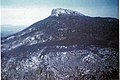
Image:CamelsHumpSummit Southward2 20170902.jpg|Southward view from the summit of Camel's Hump (''with Mt. Ethan Allen in the immediate foreground''), September 2017. |
|||
Image:CamelsHumpMT 20060728.jpg|Camel's Hump from Hinesburg Hollow Rd., [[Huntington, Vermont]]: Jul 2006 |
|||
Image:View of Lake Champlain and Vermont from Poke-O-Moonshine Mountain fire tower.jpg|View east from old fire tower atop Poke-O-Moonshine Mountain in Chesterfield, NY: 2008 |
Image:View of Lake Champlain and Vermont from Poke-O-Moonshine Mountain fire tower.jpg|View east from old fire tower atop Poke-O-Moonshine Mountain in Chesterfield, NY: 2008 |
||
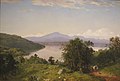
Image:'Camel's Hump from the Western Shore of Lake Champlain' by John Frederick Kensett.JPG|Painting of Camel's Hump by [[John Frederick Kensett]], 1852, oil on canvas. |
Image:'Camel's Hump from the Western Shore of Lake Champlain' by John Frederick Kensett.JPG|Painting of Camel's Hump by [[John Frederick Kensett]], 1852, oil on canvas. |
||
| Line 174: | Line 183: | ||
Image:Camels Hump, from golf course, Waterbury, Vt (66378).jpg|Postcard of eastern face of Camel's Hump |
Image:Camels Hump, from golf course, Waterbury, Vt (66378).jpg|Postcard of eastern face of Camel's Hump |
||
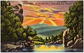
Image:Camel's Hump and Winooski River, Green Mountains, Vermont (70586).jpg|Postcard of western face of Camel's Hump |
Image:Camel's Hump and Winooski River, Green Mountains, Vermont (70586).jpg|Postcard of western face of Camel's Hump |
||
Image:Camels_Hump,_Vermont,_2020-05-19.jpg|A view of Camel's Hump from the Allis Trail to the southeast |
|||
</gallery> |
</gallery> |
||
== |
==See also== |
||
*[[List of New England Fifty Finest]] |
|||
*[[List of New England Hundred Highest]] |
|||
*[[Camel's Hump Natural Area]] |
|||
*[[Camel's Hump State Forest]] |
|||
*[[Mount Mansfield]] |
|||
==References== |
|||
{{Reflist}} |
|||
==Bibliography== |
|||
{{refbegin}} |
{{refbegin}} |
||
* |
*{{cite web |first1=Amy |last1=Alfieri |first2=Brian |last2=Chipman |first3=John |last3=Gobeille |first4=Michael |last4=Johnson |first5=Matthew |last5=Leonard |first6=Jason |last6=Nerenberg |first7=Robert |last7=Peterson |first8=David |last8=Sausville |first9=Gary |last9=Sabourin |first10=Robert |last10=Zaino |title=Camel's Hump Management Unit: Long Range Management Plan |url=https://fpr.vermont.gov/sites/fpr/files/State_Lands_Administration/Lands_Management_Planning/Library/CHMU_DRAFT_LRMP.pdf |publisher=State of Vermont: Agency of Natural Resources; Department of Forests, Parks and Recreation; Fish and Wildlife Department |access-date=21 January 2020 |date=2017 |archive-date=25 September 2020 |archive-url=https://web.archive.org/web/20200925171640/https://fpr.vermont.gov/sites/fpr/files/State_Lands_Administration/Lands_Management_Planning/Library/CHMU_DRAFT_LRMP.pdf |url-status=live }} |
||
*{{cite web |first1=Amy |last1=Alfieri |first2=Karen |last2=Bates |first3=John |last3=Gobeille |first4=Michael |last4=Johnson |first5=Matthew |last5=Leonard |first6=Toni |last6=Mikula |first7=Jason |last7=Nerenberg |first8=Robert |last8=Peterson |first9=David |last9=Sausville |first10=Lee |last10=Simard |first11=Kathryn |last11=Wrigley |first12=Robert |last12=Zaino |first13=Bill |last13=Baron |first14=Brian |last14=Chipman |first15=Gary |last15=Sabourin |first16=Gary |last16=Sawyer |title=Camel's Hump Management Unit: Long Range Management Plan |publisher=State of Vermont, Agency of Natural Resources: Department of Forests, Parks and Recreation; Fish and Wildlife Department |date=October 2021 |url=https://fpr.vermont.gov/sites/fpr/files/State_Lands_Administration/Lands_Management_Planning/Library/CHMU%20LRMP%20FINAL%20Signed%20-%20Compressed.pdf |access-date=1 May 2023}} |
|||
* {{cite book |
|||
*{{cite book |last=Johnson |first=Charles W. |year=1998 |title=The Nature of Vermont: Introduction and Guide to a New England Environment |publisher=University Press of New England |location=Hanover, NH |isbn=0-87451-856-3 |url=https://archive.org/details/natureofvermonti00char |url-access=registration }} |
|||
| last = Johnson |
|||
*{{cite book |last=Meeks |first=Harold A. |year=1986 |title=Vermont's Land and Resources |publisher=The New England Press |isbn=0-933050-40-2 |url-access=registration |url=https://archive.org/details/vermontslandreso00meek }} |
|||
| first = Charles W. |
|||
*{{cite book |last=Morrissey |first=Charles T. |year=1984 |title=Vermont: A History |publisher=W. W. Norton and Co. |isbn=0-393-30223-7}} |
|||
| year = 1998 |
|||
| title = The Nature of Vermont: Introduction and Guide to a New England Environment |
|||
| publisher = University Press of New England |
|||
| location = Hanover, NH |
|||
| isbn = 0-87451-856-3 |
|||
| url = https://archive.org/details/natureofvermonti00char |
|||
| url-access = registration |
|||
}} |
|||
* {{cite book |
|||
| last = Meeks |
|||
| first = Harold A. |
|||
| year = 1986 |
|||
| title = Vermont's Land and Resources |
|||
| publisher = The New England Press |
|||
| isbn = 0-933050-40-2 |
|||
| url-access = registration |
|||
| url = https://archive.org/details/vermontslandreso00meek |
|||
}} |
|||
* {{cite book |
|||
| last = Morrissey |
|||
| first = Charles T. |
|||
| year = 1984 |
|||
| title = Vermont: A History |
|||
| publisher = W. W. Norton and Co. |
|||
| isbn = 0-393-30223-7 |
|||
}} |
|||
{{refend}} |
{{refend}} |
||
==References== |
|||
{{reflist}} |
|||
==External links== |
==External links== |
||
{{commons category|Camel's Hump}} |
{{commons category|Camel's Hump}} |
||
* |
*[https://vtstateparks.com/camelshump.html Camel's Hump State Park] - official site |
||
* |
*{{cite gnis |id=1456724 |name=Camels Hump |accessdate=2008-11-27}} |
||
* |
*{{cite web |url=http://home.earthlink.net/~ellozy/camel-hump.html |title=Hiking Camel's Hump, Vermont |work=Peakbagging the 4000 Footer Mountains of New England |access-date=2008-11-27 |archive-url=https://web.archive.org/web/20081104142703/http://home.earthlink.net/~ellozy/camel-hump.html |archive-date=2008-11-04 |url-status=dead}} |
||
* |
*{{cite web |title=Camel's Hump Mountain Photo Group |date=May 2014 |publisher=Flickr |url=https://www.flickr.com/groups/camelshump/ |access-date=2014-05-24}} |
||
* |
*{{cite web |title=Camel's Hump hike and trip report |date=June 2011 |publisher=Peak Fever |url=http://www.peakfever.com/hike-info-17.php |access-date=2011-07-14}} |
||
*{{cite web |last1=Robinson |first1=Shaun |title=Petition urges state to halt logging at Camel's Hump |url=https://vtdigger.org/2022/06/15/petition-urges-state-to-halt-logging-at-camels-hump/ |publisher=VTDigger |access-date=1 May 2023 |date=Jun 15, 2022}} |
|||
*[https://www.instagram.com/camelshumpdaily/ @camelshumpdaily (Instagram)] |
|||
{{NE 4k ft}} |
{{NE 4k ft}} |
||
| Line 226: | Line 220: | ||
{{Mountains of Vermont}} |
{{Mountains of Vermont}} |
||
{{ |
{{Authority control}} |
||
[[Category:Mountains of Vermont]] |
[[Category:Mountains of Vermont]] |
||
Latest revision as of 19:36, 5 February 2024
| Camel's Hump | |
|---|---|
 Camel's Hump, July 2006 | |
| Highest point | |
| Elevation | 4,083 ft (1,244 m)[1] |
| Prominence | 1,860 ft (570 m)[2] |
| Listing | New England 4,000-footers New England Fifty Finest #46 |
| Coordinates | 44°19′11″N 72°53′10″W / 44.31972°N 72.88611°W[3] |
| Geography | |
 Camel's Hump Vermont, U.S.A. | |
| Country | United States |
| State | Vermont |
| County | Chittenden / Washington |
| Town | Huntington / Duxbury |
| Parent range | Green Mountains |
| Geology | |
| Age of rock | 550 million years[4] |
| Climbing | |
| Easiest route | Hiking trail |
| Designated | 1968 |
Camel's Hump (alternatively Camels Hump) is a mountain in the Green Mountains in the U.S. state of Vermont. The north slope of the mountain borders the Winooski River, which has carved through the Green Mountains over eons. At 4,083 ft (1,244 m), it is tied with Mount Ellen for the third-highest mountain in Vermont. Surmounted by 10 acres (4 ha) of alpine tundra, the mountain is the most significant feature in Camel's Hump State Park. Because of its distinctive profile, it is perhaps the state's most recognized mountain, featured on the state quarter.
Name
[edit]Since Europeans first saw the mountain, probably on Samuel de Champlain's 1609 trip down Lake Champlain to the west, the mountain has had a number of names related to its distinctive shape. De Champlain named the mountain "Le Lion Couchant", a heraldic image which roughly translates as "The Resting Lion".[5] Ira Allen later referred to the mountain as "Camel's Rump" on a map from 1798. It was not until 1830 that the name "Camel's Hump" came into usage.[6] The Geographic Names Information System (GNIS) lists twelve variant names including Tah-wak-be-dee-ee-so wadso and Catamountain.[7] While place names are determined by local usage the U.S. Board on Geographic Names (BGN) serves as a central authority in the United States concerning place names. Since its inception in 1890 the BGN has discouraged the use of the genitive apostrophe.[8] Local usage is often at odds with this policy and so the name of this mountain is alternatively spelled with and without an apostrophe.
Geology
[edit]Camel's Hump is more notable for its shape than its height. Isolated from neighboring peaks by the Winooski Valley and glacial action, the mountain's conical silhouette is distinctive, if misleading. It has two "humps", with the southernmost being the higher, and a steep drop to the south as a result of a quarrying action of the ice passing over it. The movement of glacial ice shaped it into what is referred to as a roche moutonnée.[citation needed] The bedrock consists of phyllite, quartzite, and schist.[9]
In 1968 the National Park Service designated Camel's Hump a National Natural Landmark, citing the peak as "an exceptional illustration of the complex anticlinal deformation which formed the Green Mountains".[10] The landmark area consists of approximately 5,300 acres (2,100 ha) from the summit down to 2,500 ft (760 m).[11][12]
Climate
[edit]| Climate data for Camel's Hump 44.3168 N, 72.8828 W, Elevation: 3,438 ft (1,048 m) (1991–2020 normals) | |||||||||||||
|---|---|---|---|---|---|---|---|---|---|---|---|---|---|
| Month | Jan | Feb | Mar | Apr | May | Jun | Jul | Aug | Sep | Oct | Nov | Dec | Year |
| Mean daily maximum °F (°C) | 19.0 (−7.2) |
21.0 (−6.1) |
28.6 (−1.9) |
42.7 (5.9) |
56.0 (13.3) |
64.3 (17.9) |
68.4 (20.2) |
66.8 (19.3) |
60.6 (15.9) |
47.6 (8.7) |
34.7 (1.5) |
24.6 (−4.1) |
44.5 (7.0) |
| Daily mean °F (°C) | 11.1 (−11.6) |
13.0 (−10.6) |
21.0 (−6.1) |
34.2 (1.2) |
47.7 (8.7) |
56.9 (13.8) |
61.5 (16.4) |
59.9 (15.5) |
53.2 (11.8) |
40.7 (4.8) |
28.2 (−2.1) |
17.8 (−7.9) |
37.1 (2.8) |
| Mean daily minimum °F (°C) | 3.2 (−16.0) |
5.0 (−15.0) |
13.3 (−10.4) |
25.8 (−3.4) |
39.5 (4.2) |
49.4 (9.7) |
54.5 (12.5) |
53.0 (11.7) |
45.8 (7.7) |
33.8 (1.0) |
21.7 (−5.7) |
11.0 (−11.7) |
29.7 (−1.3) |
| Average precipitation inches (mm) | 4.77 (121) |
4.34 (110) |
5.21 (132) |
5.49 (139) |
5.93 (151) |
6.77 (172) |
6.74 (171) |
6.33 (161) |
5.70 (145) |
6.83 (173) |
5.62 (143) |
5.94 (151) |
69.67 (1,769) |
| Source: PRISM Climate Group[13] | |||||||||||||
Botany
[edit]
The summit of Camel's Hump is home to 10 acres (4 ha) of alpine tundra vegetation.[10] Common plants found in this area include: Bigelow's sedge (Carex bigelowii), alpine bilberry (Vaccinium uliginosum), mountain sandwort (Minuartia groenlandica), crowberry (Empetrum nigrum), mountain cranberry (Vaccinium vitis-idaea), and Labrador tea (Rhododendron groenlandicum). A direct result of glacial formation, these alpine species were once widespread but as the lower elevations warmed, only the very peak of Camel's Hump remained hospitable to the fragile plants.[4]
There are 18 species of plants at or near the summit of Camel's Hump that are thought to be rare or very rare.[14] Of these, five species are protected by the Vermont endangered and threatened species rule:[15] Boott's rattlesnake-root (Nabalus boottii, generically known as white lettuce), bearberry willow (Salix uva-ursi), lesser wintergreen (Pyrola minor), alpine sweetgrass (Anthoxanthum monticola), and squashberry (Viburnum edule). The Green Mountain Club's Summit Caretaker program actively promotes Leave No Trace principles and helps to protect the alpine tundra natural community on the summit of Camel's Hump.[16]
Despite extensive logging during the late 1800s and a great fire in 1903, Camel's Hump continues to support a significant population of red spruce (Picea rubens). Starting in the 1960s, Hub Vogelmann and his graduate students from the University of Vermont observed an extensive decline in the red spruce population on the west slope of Camel's Hump. Vogelmann's 1982 landmark paper “Catastrophe on Camel’s Hump” identified the cause of the decline to be acid rain.[17][18] Similarly the Forest Decline Project at the University of Vermont published a study in 1991 that again cited acid rain as the culprit.[19] These findings raised public awareness and eventually led to a revision of the Clean Air Act. By 2017, with mounting evidence that the health of red spruce was on the rise,[20][21] the scourge of acid rain in the northeast had largely come to an end.

History
[edit]The Abenaki name for the mountain was "ta wak be dee esso wadso," or "tahwahbodeay wadso" (wadso meaning mountain), which has been variously translated as "resting place", "sit-down place", and "prudently, we make a campfire in a circle near water (and rest) at this mountain."[22]
In 1905, publisher and philanthropist Joseph Battell donated 1,200 acres (4.9 km2) of virgin forest, including the summit of Camel's Hump, to the State of Vermont.[23] The bequest was intended to form a state park to be kept in a "primitive state" and in 1911 the state forester was given charge of the area who managed the land in accordance with Battell's wishes. Since then, Vermont has adopted new legislation to preserve its natural areas and in 1969 created a Forest Reserve enclosing the mountain. Camel's Hump State Park has grown since the original bequest and in 1991 totalled approximately 20,000 acres (81 km2).[6]
In October 1944, during World War II, a B-24J bomber on a training mission crashed into the side of the mountain near the summit. While most of the plane was salvaged and removed, portions of the wreckage (principally a wing section) still remain. The Alpine Trail passes by the site.[4]
Though protected, the Camel's Hump area is a favorite recreational venue for hikers. Trail work began on Camel's Hump at the formation of the Green Mountain Club (GMC) and by 1912, a trail had been constructed between the mountain and Sterling Pond.[24] This initial trail would later become a high point in the "footpath in the wilderness" known as the Long Trail. In the 1950s, the GMC constructed shelters along the trail and at the summit. The GMC now trains and pays a caretaker to reside near the summit during the summer and educate hikers to respect the fragile alpine ecosystem that exists on the mountain.
In 1999, an image of Camel's Hump was chosen as a prominent feature for the Vermont state quarter. While many other options were considered, including covered bridges and the snowflake photographs of Wilson Bentley, the seven-person panel ultimately decided on Camel's Hump stating that it was "perfect for the quarter." The panel's findings explained the choice: "It's wild and natural, like the Vermont countryside. It's unique and asymmetrical, like the independent and quirky reputation Vermonters have."[25] Many notable Vermont institutions have adopted its memorable name, including the children's radio show "Camel's Hump Radio" hosted by Bill Harley on Vermont Public Radio.[26] The profile of Camel's Hump appears in the Vermont coat of arms on the Vermont flag.
Hiking
[edit]
"With the only undeveloped alpine area in the Green Mountain State and a skyline that sets it apart from everything else, Camel's Hump may be Vermont's finest peak," says Michael Lanza in his guidebook for New England hiking enthusiasts.[27] The views from the summit are panoramic, and on a clear day one can see the highest peaks of the following states: Mount Marcy in New York, Mount Washington in New Hampshire, as well as Vermont's Mount Mansfield.[28]
The most popular access points for hikers are the Burrows Trailhead east of Huntington and the Monroe Trailhead south of Duxbury. In 2016, almost 26,000 visitors signed the trail registers at these two trailheads.[29] Parking is also available along Duxbury Road west of Duxbury,[30] but this parking area is much further from Camel's Hump.
There are multiple trails in the vicinity of Camel's Hump.[31][32] The Long Trail traverses the summit of Camel's Hump on a north–south path. The Burrows Trail (from the west) and the Monroe Trail (from the east) intersect the Long Trail at the Hut Clearing just north of the Camel's Hump summit.
From the Burrows Trailhead
[edit]The Burrows Trailhead (1,800 ft or 550 m) is at the end of Camel's Hump Road east of Huntington. The vertical rise from the trailhead to the summit is 2,283 ft (696 m).
Camel's Hump via the Burrows Trail. The Burrows Trail ascends the west face of Camel's Hump. The trail intersects the Long Trail at the Hut Clearing after 2.1 mi (3.4 km). From the intersection, the summit is 0.3 mi (0.5 km) south on the Long Trail. One-way trip length: 2.4 mi (3.9 km). This is the shortest (and steepest) hike to the summit of Camel's Hump.
The Burrows Trail, the oldest trail on Camel's Hump, travels through some of the oldest spruce-fir forest on the mountain, one of the few areas believed to have escaped the 1903 fire.[4] The Burrows Trail is also used in the winter as a snowshoe and ski route.
Camel's Hump via the Forest City Trail. The Forest City Trail is 0.1 mi (0.2 km) from the Burrows Trailhead along a connector trail. The Forest City Trail intersects the Long Trail in 1.4 mi (2.3 km). From the intersection, the summit is 1.9 mi (3.1 km) north on the Long Trail. One-way trip length: 3.4 mi (5.5 km).
The Forest City Trail follows an old logging road used by the Forest City Lumber Company to log much of the western side of the mountain in the late 1800s and early 1900s. The trail terminates at the Long Trail, not far from Montclair Glen Lodge, which was built by the Green Mountain Club in 1948.[4]
From the Monroe Trailhead
[edit]The Monroe Trailhead (1,500 ft or 460 m) is at the end of Camel's Hump Road south of Duxbury. The vertical rise from the trailhead to the summit is 2,583 ft (787 m).
Camel's Hump via the Monroe Trail. The Monroe Trail ascends the east face of Camel's Hump. The trail intersects the Long Trail at the Hut Clearing after 3.1 mi (5.0 km). From the intersection, the summit is 0.3 mi (0.5 km) south on the Long Trail. One-way trip length: 3.4 mi (5.5 km).
The Monroe Trail was built in 1912. It is named for Will Monroe, who cut the Long Trail from Camel's Hump south to Middlebury Gap beginning in 1916. The Monroe Trail climbs through an extensive grove of paper birch that dates from the 1903 fire.[4]
Camel's Hump via the Dean Trail. The Dean Trail is 1.3 mi (2.1 km) from the Monroe Trailhead. The trail intersects the Long Trail in 1.0 mi (1.6 km). From the intersection, the summit is 1.7 mi (2.7 km) north on the Long Trail. One-way trip length: 4.0 mi (6.4 km).
The Dean Trail crosses the Hump Brook Bridge 0.2 mi (0.3 km) from the Monroe Trail. At 0.3 mi (0.5 km), it reaches a spur trail to the Hump Brook Tenting Area, with tent platforms and campsites (available for a fee). At 0.7 mi (1.1 km) from the Monroe Trail, the Dean Trail overlooks a beaver pond with views of Camel's Hump.[32]
Camel's Hump via the Alpine Trail. The Alpine Trail is 2.5 mi (4.0 km) from the Monroe Trailhead. The trail intersects the Long Trail in 0.5 mi (0.8 km). From the intersection, the summit is 0.2 mi (0.3 km) north on the Long Trail. One-way trip length: 3.2 mi (5.1 km).
The Alpine Trail traverses the site of a plane crash that occurred on Camel's Hump in October 1944. A B-24J Liberator bomber from Westover Air Force Base (now Westover Air Reserve Base) in Massachusetts struck the mountain just 100 ft (30 m) below the summit, scattering debris over the snow-covered peak. The collision killed nine crew members and left one survivor.[4]
From Duxbury Road
[edit]From the parking lot on Duxbury Road, the Long Trail climbs south 2.7 mi (4.3 km) to a spur that leads 0.2 mi (0.3 km) east to the Bamforth Ridge Shelter. From there, it is 3.5 mi (5.6 km) south on the Long Trail to the summit. With a stop at the shelter, the one-way trip is 6.4 mi (10.3 km) with 3,683 ft (1,123 m) of elevation change. This is the longest climb on the entire Long Trail.
Gallery
[edit]-
 Western face of Camel's Hump Mountain from South Burlington, Vermont.
 -
 Southward view from the summit of Camel's Hump (with Mt. Ethan Allen in the immediate foreground), September 2017.
 -
 View east from old fire tower atop Poke-O-Moonshine Mountain in Chesterfield, NY: 2008
 -
 Painting of Camel's Hump by John Frederick Kensett, 1852, oil on canvas.
 -
 Eastern face of Camel's Hump taken in 1968
 -
 Postcard of eastern face of Camel's Hump
 -
 Postcard of western face of Camel's Hump
 -
 A view of Camel's Hump from the Allis Trail to the southeast


.jpg)
.jpg)

See also
[edit]- List of New England Fifty Finest
- List of New England Hundred Highest
- Camel's Hump Natural Area
- Camel's Hump State Forest
- Mount Mansfield
References
[edit]- ^ Green Mountain Club (2015). Vermont's Long Trail: A Footpath in the Wilderness (Topographic map) (5th ed.). 1:85,000. Cartography by Center for Community GIS. ISBN 978-1-888021-46-2.
- ^ "Camels Hump, Vermont". Peakbagger.com. Retrieved 2008-11-24.
- ^ "Camels Hump 2 Reset". NGS Data Sheet. National Geodetic Survey, National Oceanic and Atmospheric Administration, United States Department of Commerce. Retrieved 2008-11-24.
- ^ a b c d e f g Bazilchuk, Nancy. "Camel's Hump State Park". The Longstreet Highroad Guide to the Vermont Mountains. ISBN 1-56352-504-6. Archived from the original on 2022-10-02. Retrieved 2008-04-16.
- ^ Bushnell, Mark (September 15, 2019). "Whence Camel's Hump and other Vermont mountain names?". VTDigger. Retrieved 16 March 2020.
- ^ a b "Camel's Hump State Park". Retrieved July 1, 2007.
- ^ "Camels Hump". Geographic Names Information System. United States Geological Survey, United States Department of the Interior. Retrieved April 4, 2010.
- ^ "Domestic Names - Frequently Asked Questions". U.S. Board on Geographic Names. Archived from the original on January 5, 2017. Retrieved April 4, 2010.
- ^ Thompson, Peter and Thelma (1991). "Bedrock Geology of the Camels Hump-Bolton Mountain Area, North-Central Vermont" (PDF). Archived (PDF) from the original on 7 September 2015. Retrieved 27 January 2016.
- ^ a b "Camel's Hump: National Natural Landmark". National Park Service. Archived from the original on 2010-05-28. Retrieved 2007-06-19.
- ^ "National Natural Landmarks: Camel's Hump". National Park Service. Archived from the original on 13 July 2019. Retrieved 11 February 2020.
- ^ Preserving Our Natural Heritage, Volume II. p. 586. Archived from the original on 2 October 2022. Retrieved 11 February 2020.
- ^ "PRISM Climate Group, Oregon State University". PRISM Climate Group, Oregon State University. Retrieved October 22, 2023.
To find the table data on the PRISM website, start by clicking Coordinates (under Location); copy Latitude and Longitude figures from top of table; click Zoom to location; click Precipitation, Minimum temp, Mean temp, Maximum temp; click 30-year normals, 1991-2020; click 800m; click Retrieve Time Series button.
- ^ Alfieri et al. 2017, pp. 31–33.
- ^ "10 App. V.S.A. § 10". The Vermont Statutes Online. Archived from the original on 29 January 2020. Retrieved 29 January 2020.
- ^ "Backcountry Caretakers". Green Mountain Club. Archived from the original on 29 January 2020. Retrieved 29 January 2020.
- ^ Alfieri et al. 2017, p. 11.
- ^ Brown, Joshua E. (October 14, 2013). "Remembering Hub Vogelmann". University of Vermont. Archived from the original on 30 January 2020. Retrieved 30 January 2020.
- ^ Klein, Richard M.; Perkins; Tricou; Oates; Cutler (Sep 1991). "Factors Affecting Red Spruce Regeneration in Declining Areas of Camel's Hump Mountain, Vermont". American Journal of Botany. 78 (9): 1191–1198. doi:10.2307/2444923. JSTOR 2444923.
- ^ Alfieri et al. 2017, p. 54.
- ^ Dillon, John (June 12, 2018). "UVM Study: Spruce Trees Are Recovering From Acid Rain, Years After Tighter Pollution Controls". Vermont Public Radio. Archived from the original on 29 January 2020. Retrieved 29 January 2020.
- ^ Huden, John C (1962). Indian Place Names of New England. Museum of the American Indian Heye Foundation. ISBN 0-934490-18-X.
- ^ Ring, Wilson (October 7, 2001). "Vermont still has stands of old-growth forests". The Associated Press State & Local Wire.
- ^ "History of the Long Trail". The Green Mountain Club. Archived from the original on 2007-06-30. Retrieved June 19, 2007.
- ^ "Camel's Hump picked for new Vt. quarter". The Boston Globe. Associated Press. June 11, 1999.
- ^ "Camel's Hump". Vermont Public Radio. Archived from the original on July 4, 2007. Retrieved June 19, 2007.
- ^ Lanza, Michael (2004). Foghorn Outdoors' New England Hiking: The Complete Guide to More Than 380 Hikes. Avalon Travel Publishing. ISBN 1-56691-381-0.
- ^ "Camel's Hump". Dartmouth Outing Guide. Dartmouth Outing Club. 2004. p. 173. Archived from the original on 2008-12-12. Retrieved 2008-11-27.
- ^ Alfieri et al. 2017, Appendix G: Trail Register Sign-Ins Summary 1988–2016.
- ^ "Detailed Directions to Camel's Hump State Park" (PDF). Vermont Department of Forests, Parks and Recreation. Archived (PDF) from the original on 4 October 2019. Retrieved 6 February 2020.
- ^ "Camel's Hump State Park Trails Guide" (PDF). Vermont Department of Forests, Parks and Recreation. 2017. Archived (PDF) from the original on 4 October 2019. Retrieved 21 January 2020.
- ^ a b Day Hiker's Guide to Vermont (6th ed.). Waterbury Center, Vermont: Green Mountain Club. 2011. ISBN 978-1-888021-35-6.
Bibliography
[edit]- Alfieri, Amy; Chipman, Brian; Gobeille, John; Johnson, Michael; Leonard, Matthew; Nerenberg, Jason; Peterson, Robert; Sausville, David; Sabourin, Gary; Zaino, Robert (2017). "Camel's Hump Management Unit: Long Range Management Plan" (PDF). State of Vermont: Agency of Natural Resources; Department of Forests, Parks and Recreation; Fish and Wildlife Department. Archived (PDF) from the original on 25 September 2020. Retrieved 21 January 2020.
- Alfieri, Amy; Bates, Karen; Gobeille, John; Johnson, Michael; Leonard, Matthew; Mikula, Toni; Nerenberg, Jason; Peterson, Robert; Sausville, David; Simard, Lee; Wrigley, Kathryn; Zaino, Robert; Baron, Bill; Chipman, Brian; Sabourin, Gary; Sawyer, Gary (October 2021). "Camel's Hump Management Unit: Long Range Management Plan" (PDF). State of Vermont, Agency of Natural Resources: Department of Forests, Parks and Recreation; Fish and Wildlife Department. Retrieved 1 May 2023.
- Johnson, Charles W. (1998). The Nature of Vermont: Introduction and Guide to a New England Environment. Hanover, NH: University Press of New England. ISBN 0-87451-856-3.
- Meeks, Harold A. (1986). Vermont's Land and Resources. The New England Press. ISBN 0-933050-40-2.
- Morrissey, Charles T. (1984). Vermont: A History. W. W. Norton and Co. ISBN 0-393-30223-7.
External links
[edit]- Camel's Hump State Park - official site
- "Camels Hump". Geographic Names Information System. United States Geological Survey, United States Department of the Interior. Retrieved 2008-11-27.
- "Hiking Camel's Hump, Vermont". Peakbagging the 4000 Footer Mountains of New England. Archived from the original on 2008-11-04. Retrieved 2008-11-27.
- "Camel's Hump Mountain Photo Group". Flickr. May 2014. Retrieved 2014-05-24.
- "Camel's Hump hike and trip report". Peak Fever. June 2011. Retrieved 2011-07-14.
- Robinson, Shaun (Jun 15, 2022). "Petition urges state to halt logging at Camel's Hump". VTDigger. Retrieved 1 May 2023.
- @camelshumpdaily (Instagram)