
Boundary Cone: Difference between revisions
m Task 18b (cosmetic): eval 2 templates: hyphenate params (2×); |
Salmoonlight (talk | contribs) mNo edit summary |
||
| (6 intermediate revisions by 5 users not shown) | |||
| Line 1: | Line 1: | ||
{{Short description|Landform in Mohave County, Arizona}} |
|||
{{Infobox mountain |
{{Infobox mountain |
||
| name = Boundary Cone |
| name = Boundary Cone |
||
| Line 12: | Line 13: | ||
| prominence_ref = <ref name="pb"/> |
| prominence_ref = <ref name="pb"/> |
||
| coordinates = {{coord|34.983788761|N|114.415665406|W|type:mountain_region:US-AZ_scale:100000_source:NGS|format=dms|display=inline,title}} |
| coordinates = {{coord|34.983788761|N|114.415665406|W|type:mountain_region:US-AZ_scale:100000_source:NGS|format=dms|display=inline,title}} |
||
| range_coordinates = |
| range_coordinates = |
||
| coordinates_ref = <ref name="ngs">{{cite ngs |pid=EU0943 |name=Boundary Cone |accessdate=2016-08-15}}</ref> |
| coordinates_ref = <ref name="ngs">{{cite ngs |pid=EU0943 |name=Boundary Cone |accessdate=2016-08-15}}</ref> |
||
| topo = [[United States Geological Survey|USGS]] Boundary Cone |
| topo = [[United States Geological Survey|USGS]] Boundary Cone |
||
| Line 23: | Line 24: | ||
==History== |
==History== |
||
Several [[ |
Several [[Indigenous peoples of the Americas|Indigenous people]]s attach religious and cultural significance to Boundary Cone as well as much of the surrounding landscape. In March 2006, the [[Bureau of Land Management]] determined and the Arizona [[State Historic Preservation Office]] concurred that Boundary Cone is eligible for inclusion on the [[National Register of Historic Places]] as a property of traditional, religious, and cultural importance to several Indigenous tribes.<ref name=ACHPnotice>[http://www.achp.gov/FedRegisterNotice.html Federal Register Notice regarding Boundary Cone] {{Webarchive|url=https://web.archive.org/web/20100917040538/http://achp.gov/FedRegisterNotice.html |date=2010-09-17 }}, October 8, 2008. This article incorporates [[public domain]] text from this official [[United States government]] document.</ref> |
||
Boundary Cone was a prominent [[landmark]] for early travelers in this region. |
Boundary Cone was a prominent [[landmark]] for early travelers in this region. |
||
| Line 36: | Line 37: | ||
{{Mountains of Arizona}} |
{{Mountains of Arizona}} |
||
{{Commons category-inline|Boundary Cone}} |
{{Commons category-inline|Boundary Cone}} |
||
[[Category:Volcanic plugs of Arizona]] |
[[Category:Volcanic plugs of Arizona]] |
||
[[Category:Mountains of Arizona]] |
[[Category:Mountains of Arizona]] |
||
[[Category:Religious places of the |
[[Category:Religious places of the Indigenous peoples of North America]] |
||
[[Category:Landforms of Mohave County, Arizona]] |
[[Category:Landforms of Mohave County, Arizona]] |
||
[[Category:Mountains of Mohave County, Arizona]] |
[[Category:Mountains of Mohave County, Arizona]] |
||
[[Category:Volcanoes of Arizona]] |
|||
[[Category:Sacred mountains of the Americas]] |
|||
{{MohaveCountyAZ-geo-stub}} |
|||
Latest revision as of 21:56, 20 February 2024
| Boundary Cone | |
|---|---|
 View of Boundary Cone from Mohave Valley, on the Colorado River | |
| Highest point | |
| Elevation | 3,432 ft (1,046 m) NAVD 88[1] |
| Prominence | 750 ft (229 m)[1] |
| Coordinates | 34°59′02″N 114°24′56″W / 34.983788761°N 114.415665406°W[2] |
| Geography | |
 Boundary Cone | |
| Location | Mohave County, Arizona, U.S |
| Parent range | Black Mountains |
| Topo map | USGS Boundary Cone |
| Geology | |
| Mountain type | volcanic neck[3] |
| Climbing | |
| Easiest route | from Oatman, Arizona |
Boundary Cone is a geologic promontory located in the western foothills of the Black Mountains in Mohave County, Arizona.[4] The peak is to the east of the Mohave Valley, northeast of Needles, California, and southeast of Bullhead City. The peak is about 4 miles (6 km) southwest of the mountain community of Oatman and 12 miles (19 km) east of the Colorado River.
History
[edit]Several Indigenous peoples attach religious and cultural significance to Boundary Cone as well as much of the surrounding landscape. In March 2006, the Bureau of Land Management determined and the Arizona State Historic Preservation Office concurred that Boundary Cone is eligible for inclusion on the National Register of Historic Places as a property of traditional, religious, and cultural importance to several Indigenous tribes.[5]
Boundary Cone was a prominent landmark for early travelers in this region.
-
 Fort Mojave Indian Reservation, with Boundary Cone in distance
 -
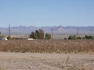
 Mohave Valley, with Boundary Cone at right


References
[edit]- ^ a b "Boundary Cone, Arizona". Peakbagger.com. Retrieved 2012-04-22.
- ^ "Boundary Cone". NGS Data Sheet. National Geodetic Survey, National Oceanic and Atmospheric Administration, United States Department of Commerce. Retrieved 2016-08-15.
- ^ Chronic, Halka (1983). Roadside Geology of Arizona. p. 85. ISBN 9780878421473.
- ^ "Boundary Cone". Geographic Names Information System. United States Geological Survey, United States Department of the Interior. Retrieved 2016-08-15.
- ^ Federal Register Notice regarding Boundary Cone Archived 2010-09-17 at the Wayback Machine, October 8, 2008. This article incorporates public domain text from this official United States government document.
![]() Media related to Boundary Cone at Wikimedia Commons
Media related to Boundary Cone at Wikimedia Commons