
Redfield, South Dakota: Difference between revisions
m Census data - past tense - and/or general fixes using AWB |
|||
| (205 intermediate revisions by more than 100 users not shown) | |||
| Line 1: | Line 1: | ||
{{Use mdy dates|date=July 2023}} |
|||
'''Redfield''' is a city located in [[Spink County, South Dakota]]. As of the 2000 census, the city had a total population of 2,897. It is the [[county seat]] of [[Spink County, South Dakota|Spink County]]{{GR|6}}. |
|||
{{Infobox settlement |
|||
<!--See the Table at Infobox settlement for all fields and descriptions of usage--> |
|||
<!-- Basic info ----------------> |
|||
|name = Redfield |
|||
|official_name = Redfield, South Dakota |
|||
|other_name = |
|||
|native_name = <!-- for cities whose native name is not in English --> |
|||
|nickname = |
|||
|settlement_type = [[City]] |
|||
|motto = "...The Pheasant Capital Of The World!" |
|||
<!-- images and maps -----------> |
|||
|image_skyline = |
|||
|imagesize = |
|||
|image_caption = |
|||
|image_flag = |
|||
|flag_size = |
|||
|image_seal = |
|||
|seal_size = |
|||
|image_shield = |
|||
|shield_size = |
|||
|image_blank_emblem = |
|||
|blank_emblem_type = |
|||
|blank_emblem_size = |
|||
|image_map = Spink_County_South_Dakota_Incorporated_and_Unincorporated_areas_Redfield_Highlighted.svg |
|||
|mapsize = 250px |
|||
|map_caption = Location in [[Spink County, South Dakota|Spink County]] and the state of [[South Dakota]] |
|||
|image_map1 = |
|||
|mapsize1 = |
|||
|map_caption1 = |
|||
|image_dot_map = |
|||
|dot_mapsize = |
|||
|dot_map_caption = |
|||
|dot_x = |
|||
|dot_y = |
|||
|pushpin_map = <!-- the name of a location map as per http://en.wikipedia.org/wiki/Template:Location_map --> |
|||
|pushpin_label_position = <!-- the position of the pushpin label: left, right, top, bottom, none --> |
|||
|pushpin_map_caption = |
|||
|pushpin_mapsize = |
|||
<!-- Location ------------------> |
|||
| subdivision_type = Country |
|||
|subdivision_name = United States |
|||
|subdivision_type1 = [[U.S. state|State]] |
|||
|subdivision_name1 = [[South Dakota]] |
|||
|subdivision_type2 = [[List of counties in South Dakota|County]] |
|||
|subdivision_name2 = [[Spink County, South Dakota|Spink]] |
|||
|subdivision_type3 = |
|||
|subdivision_name3 = |
|||
|subdivision_type4 = |
|||
|subdivision_name4 = |
|||
<!-- Politics -----------------> |
|||
|government_footnotes = |
|||
|government_type = |
|||
|leader_title = |
|||
|leader_name = |
|||
|leader_title1 = <!-- for places with, say, both a mayor and a city manager --> |
|||
|leader_name1 = |
|||
|leader_title2 = |
|||
|leader_name2 = |
|||
|leader_title3 = |
|||
|leader_name3 = |
|||
|leader_title4 = |
|||
|leader_name4 = |
|||
|established_title = <!-- Settled --> |
|||
|established_date = |
|||
|established_title2 = <!-- Incorporated (town) --> |
|||
|established_date2 = |
|||
|established_title3 = Incorporated |
|||
|established_date3 = 1883<ref>{{cite web|title=SD Towns|publisher=[[South Dakota State Historical Society]]|access-date=2010-02-15 | url = http://history.sd.gov/Archives/forms/exhibits/SD%20Towns.pdf}}</ref> |
|||
<!-- Area ---------------------> |
|||
|area_magnitude = |
|||
|unit_pref = Imperial |
|||
|area_footnotes = <ref name="TigerWebMapServer">{{cite web|title=ArcGIS REST Services Directory|url=https://tigerweb.geo.census.gov/arcgis/rest/services/TIGERweb/Places_CouSub_ConCity_SubMCD/MapServer/5/query?where=STATE='46'&outFields=NAME,STATE,PLACE,AREALAND,AREAWATER,LSADC,CENTLAT,CENTLON&orderByFields=PLACE&returnGeometry=false&returnTrueCurves=false&f=json|publisher=United States Census Bureau|accessdate=October 15, 2022}}</ref> |
|||
|area_total_km2 = 5.08 |
|||
|area_land_km2 = 4.99 |
|||
|area_water_km2 = 0.09 |
|||
|area_total_sq_mi = 1.96 |
|||
|area_land_sq_mi = 1.93 |
|||
|area_water_sq_mi = 0.03 |
|||
|area_water_percent = |
|||
|area_urban_km2 = |
|||
|area_urban_sq_mi = |
|||
|area_metro_km2 = |
|||
|area_metro_sq_mi = |
|||
|area_blank1_title = |
|||
|area_blank1_km2 = |
|||
|area_blank1_sq_mi = |
|||
<!-- Population -----------------------> |
|||
|population_as_of = [[2020 United States Census|2020]] |
|||
|population_est = |
|||
|pop_est_as_of = |
|||
|pop_est_footnotes = |
|||
|population_footnotes = <ref name="USCensusDecennial2020CenPopScriptOnly"/> |
|||
|population_total = 2214 |
|||
|population_density_km2 = 443.30 |
|||
|population_density_sq_mi = 1148.34 |
|||
|population_metro = |
|||
|population_density_metro_km2 = |
|||
|population_density_metro_sq_mi = |
|||
|population_urban = |
|||
|population_density_urban_km2 = |
|||
|population_density_urban_sq_mi = |
|||
|population_blank1_title = |
|||
|population_blank1 = |
|||
|population_density_blank1_km2 = |
|||
|population_density_blank1_sq_mi = |
|||
<!-- General information ---------------> |
|||
|timezone = [[North American Central Time Zone|Central (CST)]] |
|||
| utc_offset = −6 |
|||
|timezone_DST = CDT |
|||
| utc_offset_DST = −5 |
|||
|coordinates = {{coord|44|52|35|N|98|29|57|W|region:US-SD|display=inline,title}} |
|||
|elevation_footnotes = <ref name=gnis/> |
|||
|elevation_ft = 1303 |
|||
<!-- Area/postal codes & others --------> |
|||
|postal_code_type = [[ZIP code]] |
|||
|postal_code = 57469 |
|||
|area_code = [[Area code 605|605]] |
|||
|blank_name = [[Federal Information Processing Standard|FIPS code]] |
|||
|blank_info = 46-53460 |
|||
|blank1_name = [[Geographic Names Information System|GNIS]] feature ID |
|||
|blank1_info = 1267547<ref name=gnis>{{GNIS|1267547}}</ref> |
|||
|website = [http://www.redfield-sd.com/ City of Redfield] |
|||
|footnotes = |
|||
}} |
|||
'''Redfield''' is a city in and the [[county seat]] of [[Spink County, South Dakota|Spink County]], [[South Dakota]], United States.<ref name="GR6">{{cite web|url=http://www.naco.org/Counties/Pages/FindACounty.aspx|access-date=2011-06-07|title=Find a County|publisher=National Association of Counties}}</ref> The population was 2,214 at the [[2020 United States Census|2020 census]].<ref name=USCensus>{{cite web |title=U.S. Census Bureau: Redfield city, South Dakota |url=https://data.census.gov/cedsci/profile?g=1600000US4653460 |website=www.census.gov |publisher=United States Census Bureau |access-date=12 February 2022 |language=en}}</ref> The city was named for J. B. Redfield, a railroad official.<ref>{{cite book|author=Chicago and North Western Railway Company|title=A History of the Origin of the Place Names Connected with the Chicago & North Western and Chicago, St. Paul, Minneapolis & Omaha Railways|url=https://books.google.com/books?id=OspBAQAAMAAJ&pg=PA117|year=1908|page=117}}</ref> |
|||
==Geography== |
==Geography== |
||
According to the [[United States Census Bureau]], the city has a total area of {{convert|1.92|sqmi|sqkm|2}}, of which {{convert|1.89|sqmi|sqkm|2}} is land and {{convert|0.03|sqmi|sqkm|2}} is water.<ref name="Gazetteer files">{{cite web|title=US Gazetteer files 2010|url=https://www.census.gov/geo/www/gazetteer/files/Gaz_places_national.txt|publisher=[[United States Census Bureau]]|access-date=2012-06-21|url-status=dead|archive-url=https://web.archive.org/web/20120125061959/http://www.census.gov/geo/www/gazetteer/files/Gaz_places_national.txt|archive-date=2012-01-25}}</ref> |
|||
[[Image:SDMap-doton-Redfield.PNG|right|Location of Redfield, South Dakota]] |
|||
Redfield is located at 44°52'31" North, 98°31'4" West (44.875145, -98.517850){{GR|1}}. |
|||
==History== |
|||
According to the [[United States Census Bureau]], the city has a total area of 4.6 [[square kilometer|km²]] (1.8 [[square mile|mi²]]). 4.5 km² (1.7 mi²) of it is land and 0.1 km² (0.04 mi²) of it is water. The total area is 1.70% water. |
|||
The first settlers arrived in the Redfield area in 1878, and a post office was established two years later under the name "Stennett Junction." The "Redfield" name was adopted in 1881. The town became the seat of [[Spink County, South Dakota|Spink County]] in 1886, following a six-year legal and political battle among several Spink County towns. Redfield rapidly became a major town in the region, due in part to its status as a railroad center—the town was a crossroads of two lines of the [[Chicago and North Western Railway]], and was also served by the [[Chicago, Milwaukee, St. Paul and Pacific Railroad|Milwaukee Road]] Railroad. Railroads brought supplies, people, and animals, and also provided for transportation of crops back East. |
|||
[[Redfield College (South Dakota)|Redfield College]] was established in the town in 1887, and operated until 1932. In 1902 the "Northern Hospital for the Insane," a state institution, opened on a campus just north of town. That facility remains in operation today as the [[South Dakota Developmental Center]]. |
|||
Redfield has been assigned the [[ZIP code]] 57469 and the [[FIPS place code]] 53460. |
|||
==Demographics== |
==Demographics== |
||
{{US Census population |
|||
As of the [[census]]{{GR|2}} of 2000, there were 2,897 people, 1,123 households, and 656 families residing in the city. The [[population density]] was 646.6/km² (1,670.3/mi²). There were 1,261 housing units at an average density of 281.4/km² (727.1/mi²). The racial makeup of the city was 95.37% [[White (U.S. Census)|White]], 0.41% [[African American (U.S. Census)|African American]], 3.00% [[Native American (U.S. Census)|Native American]], 0.10% [[Asian (U.S. Census)|Asian]], 0.03% [[Pacific Islander (U.S. Census)|Pacific Islander]], 0.21% from [[Race (U.S. Census)|other races]], and 0.86% from two or more races. 0.66% of the population were [[Hispanic (U.S. Census)|Hispanic]] or [[Latino (U.S. Census)|Latino]] of any race. |
|||
|1890= 796 |
|||
|1900= 1015 |
|||
|1910= 2856 |
|||
|1920= 2755 |
|||
|1930= 2664 |
|||
|1940= 2428 |
|||
|1950= 2655 |
|||
|1960= 2952 |
|||
|1970= 2943 |
|||
|1980= 3027 |
|||
|1990= 2770 |
|||
|2000= 2897 |
|||
|2010= 2333 |
|||
|2020= 2214 |
|||
|align-fn=center |
|||
|footnote=U.S. Decennial Census<ref>{{cite web|url=https://www.census.gov/prod/www/decennial.html|title=Census of Population and Housing|author=United States Census Bureau|author-link=United States Census Bureau|access-date=September 23, 2013}}</ref><br>2018 Estimate<ref name="USCensusEst2018">{{cite web|url=https://www.census.gov/programs-surveys/popest/data/tables.2018.html|title=Population and Housing Unit Estimates|access-date=December 15, 2019}}</ref><ref name="USCensusDecennial2020CenPopScriptOnly">{{cite web|url=https://api.census.gov/data/2020/dec/pl?get=P1_001N,NAME&for=place:*&in=state:46&key=5ccd0821c15d9f4520e2dcc0f8d92b2ec9336108|title=Census Population API|publisher=United States Census Bureau|accessdate=Oct 15, 2022}}</ref> |
|||
}} |
|||
===2010 census=== |
|||
As of the [[census]]<ref name ="FactFinder">{{cite web|title=American FactFinder|url=http://factfinder.census.gov/faces/nav/jsf/pages/index.xhtml|archive-url=https://archive.today/20200212234628/http://factfinder.census.gov/faces/nav/jsf/pages/index.xhtml|url-status=dead|archive-date=2020-02-12|publisher=[[United States Census Bureau]]|access-date=2012-06-21}}</ref> of 2010, there were 2,333 people, 1,057 households, and 593 families living in the city. The [[population density]] was {{convert|1234.4|PD/sqmi|PD/km2|1}}. There were 1,187 housing units at an average density of {{convert|628.0|/sqmi|/km2|1}}. The racial makeup of the city was 96.9% [[White (U.S. Census)|White]], 0.5% [[African American (U.S. Census)|African American]], 0.9% [[Native American (U.S. Census)|Native American]], 0.1% [[Asian (U.S. Census)|Asian]], 0.5% from [[Race (U.S. Census)|other races]], and 1.1% from two or more races. [[Hispanic (U.S. Census)|Hispanic]] or [[Latino (U.S. Census)|Latino]] of any race were 1.4% of the population. |
|||
There were 1,057 households, of which 25.4% had children under the age of 18 living with them, 43.3% were [[Marriage|married couples]] living together, 8.9% had a female householder with no husband present, 3.9% had a male householder with no wife present, and 43.9% were non-families. 39.5% of all households were made up of individuals, and 21.2% had someone living alone who was 65 years of age or older. The average household size was 2.13 and the average family size was 2.82. |
|||
The median age in the city was 47.3 years. 22.4% of residents were under the age of 18; 5.8% were between the ages of 18 and 24; 19% were from 25 to 44; 26.7% were from 45 to 64; and 26.2% were 65 years of age or older. The gender makeup of the city was 46.7% male and 53.3% female. |
|||
===2000 census=== |
|||
As of the [[census]] of 2000, there were 2,897 people, 1,123 households, and 656 families living in the city. The population density was {{convert|1,670.3|PD/sqmi|PD/km2|sp=us|adj=off}}. There were 1,261 housing units at an average density of {{convert|727.1|/sqmi|/km2|sp=us|adj=off}}. The racial makeup of the city was 95.37% [[White (U.S. Census)|White]], 0.41% [[African American (U.S. Census)|African American]], 3.00% [[Native American (U.S. Census)|Native American]], 0.10% [[Asian (U.S. Census)|Asian]], 0.03% [[Pacific Islander (U.S. Census)|Pacific Islander]], 0.21% from [[Race (United States Census)|other races]], and 0.86% from two or more races. [[Hispanic (U.S. Census)|Hispanic]] or [[Latino (U.S. Census)|Latino]] of any race were 0.66% of the population. |
|||
There were 1,123 households, out of which 26.2% had children under the age of 18 living with them, 46.9% were [[Marriage|married couples]] living together, 8.6% had a female householder with no husband present, and 41.5% were non-families. 38.6% of all households were made up of individuals, and 23.2% had someone living alone who was 65 years of age or older. The average household size was 2.15 and the average family size was 2.87. |
|||
In the city, the population was spread out, with 21.3% under the age of 18, 7.8% from 18 to 24, 27.2% from 25 to 44, 20.0% from 45 to 64, and 23.7% who were 65 years of age or older. The median age was 41 years. For every 100 females, there were 106.8 males. For every 100 females age 18 and over, there were 104.2 males. |
|||
As of 2000 the median income for a household in the city was $27,743, and the median income for a family was $37,500. Males had a median income of $27,566 versus $20,938 for females. The [[per capita income]] for the city was $15,505. About 9.6% of families and 10.5% of the population were below the [[poverty line]], including 9.9% of those under age 18 and 11.8% of those age 65 or over. |
|||
==Media== |
|||
===AM radio=== |
|||
{| class="wikitable" |
|||
!align="center" colspan="6"|'''[[AM radio]] stations''' |
|||
|- |
|||
!Frequency!!Call sign!!Name!!Format!!Owner!!City |
|||
|- |
|||
|1380 AM||[[KQKD]]||KQ1380||[[Full-service radio|Full Service]]||Gray Ghost Broadcasting LLC||Redfield |
|||
|} |
|||
===FM radio=== |
|||
There were 1,123 households out of which 26.2% had children under the age of 18 living with them, 46.9% were [[Marriage|married couples]] living together, 8.6% had a female householder with no husband present, and 41.5% were non-families. 38.6% of all households were made up of individuals and 23.2% had someone living alone who was 65 years of age or older. The average household size was 2.15 and the average family size was 2.87. |
|||
{|class="wikitable" |
|||
!align="center" colspan="7"|'''[[FM radio]] stations''' |
|||
|- |
|||
!Frequency!!Call sign!!Name!!Format!!Owner!!Target city/[[media market|market]]!![[City of license]] |
|||
|- |
|||
|99.9 FM||[[KQKD|K260DG]]||KQ1380||[[Full-service radio|Full Service]]||Gray Ghost Broadcasting LLC||Redfield||Redfield |
|||
|- |
|||
|} |
|||
==Notable people== |
|||
In the city the population was spread out with 21.3% under the age of 18, 7.8% from 18 to 24, 27.2% from 25 to 44, 20.0% from 45 to 64, and 23.7% who were 65 years of age or older. The median age was 41 years. For every 100 females there were 106.8 males. For every 100 females age 18 and over, there were 104.2 males. |
|||
* [[Joseph Charron]]-Roman Catholic bishop |
|||
* [[Hallie Flanagan]]-Director of the [[Federal Theatre Project]]. |
|||
* [[Mel Hansen]]-racing driver |
|||
* [[Carrie Ingalls]]-teacher and journalist for ''De Smet News'' |
|||
* [[Conde McCullough]]-Bridge engineer. |
|||
* [[Gene Roth]]-actor who appeared with [[The Three Stooges]] |
|||
* [[Arthur H. Parmelee]]-college football coach and physician |
|||
* [[Thomas J. Walsh]]-US senator from Montana<ref>{{Cite web |title=Bioguide Search |url=https://bioguide.congress.gov/search/bio/W000104 |access-date=2022-05-03 |website=bioguide.congress.gov}}</ref> |
|||
* [[Chuck Welke]]-educator and South Dakota state legislator |
|||
==References== |
|||
The median income for a household in the city was $27,743, and the median income for a family was $37,500. Males had a median income of $27,566 versus $20,938 for females. The [[per capita income]] for the city was $15,505. 10.5% of the population and 9.6% of families were below the [[poverty line]]. 9.9% of those under the age of 18 and 11.8% of those 65 and older were living below the poverty line. |
|||
{{Reflist}} |
|||
{{Spink County, South Dakota}} |
|||
== Noted natives == |
|||
{{South Dakota}} |
|||
*[[Hallie Flanagan]]-Director of the [[Federal Theatre Project]]. |
|||
{{South Dakota county seats}} |
|||
*[[Conde McCullough]]-Bridge engineer. |
|||
{{Authority control}} |
|||
==External links== |
|||
{{Geolinks-US-cityscale|44.875145|-98.51785}} |
|||
[[Category:Spink County, South Dakota]] |
[[Category:Cities in Spink County, South Dakota]] |
||
[[Category:Cities in South Dakota]] |
[[Category:Cities in South Dakota]] |
||
[[Category:County seats in South Dakota]] |
|||
[[Category:Populated places established in 1880]] |
|||
[[Category:1880 establishments in Dakota Territory]] |
|||
Latest revision as of 05:48, 23 March 2024
Redfield | |
|---|---|
| Redfield, South Dakota | |
| Motto: "...The Pheasant Capital Of The World!" | |
 Location in Spink County and the state of South Dakota | |
| Coordinates: 44°52′35″N 98°29′57″W / 44.87639°N 98.49917°W | |
| Land | Vereinigte Staaten |
| State | South Dakota |
| County | Spink |
| Incorporated | 1883[1] |
| Area | |
| • Total | 1.96 sq mi (5.08 km2) |
| • Land | 1.93 sq mi (4.99 km2) |
| • Water | 0.03 sq mi (0.09 km2) |
| Elevation | 1,303 ft (397 m) |
| Population | |
| • Total | 2,214 |
| • Density | 1,148.34/sq mi (443.30/km2) |
| Time zone | UTC−6 (Central (CST)) |
| • Summer (DST) | UTC−5 (CDT) |
| ZIP code | 57469 |
| Area code | 605 |
| FIPS code | 46-53460 |
| GNIS feature ID | 1267547[3] |
| Website | City of Redfield |
Redfield is a city in and the county seat of Spink County, South Dakota, United States.[5] The population was 2,214 at the 2020 census.[6] The city was named for J. B. Redfield, a railroad official.[7]
Geography
[edit]According to the United States Census Bureau, the city has a total area of 1.92 square miles (4.97 km2), of which 1.89 square miles (4.90 km2) is land and 0.03 square miles (0.08 km2) is water.[8]
History
[edit]The first settlers arrived in the Redfield area in 1878, and a post office was established two years later under the name "Stennett Junction." The "Redfield" name was adopted in 1881. The town became the seat of Spink County in 1886, following a six-year legal and political battle among several Spink County towns. Redfield rapidly became a major town in the region, due in part to its status as a railroad center—the town was a crossroads of two lines of the Chicago and North Western Railway, and was also served by the Milwaukee Road Railroad. Railroads brought supplies, people, and animals, and also provided for transportation of crops back East.
Redfield College was established in the town in 1887, and operated until 1932. In 1902 the "Northern Hospital for the Insane," a state institution, opened on a campus just north of town. That facility remains in operation today as the South Dakota Developmental Center.
Demographics
[edit]| Census | Pop. | Note | %± |
|---|---|---|---|
| 1890 | 796 | — | |
| 1900 | 1,015 | 27.5% | |
| 1910 | 2,856 | 181.4% | |
| 1920 | 2,755 | −3.5% | |
| 1930 | 2,664 | −3.3% | |
| 1940 | 2,428 | −8.9% | |
| 1950 | 2,655 | 9.3% | |
| 1960 | 2,952 | 11.2% | |
| 1970 | 2,943 | −0.3% | |
| 1980 | 3,027 | 2.9% | |
| 1990 | 2,770 | −8.5% | |
| 2000 | 2,897 | 4.6% | |
| 2010 | 2,333 | −19.5% | |
| 2020 | 2,214 | −5.1% | |
| U.S. Decennial Census[9] 2018 Estimate[10][4] | |||
2010 census
[edit]As of the census[11] of 2010, there were 2,333 people, 1,057 households, and 593 families living in the city. The population density was 1,234.4 inhabitants per square mile (476.6/km2). There were 1,187 housing units at an average density of 628.0 per square mile (242.5/km2). The racial makeup of the city was 96.9% White, 0.5% African American, 0.9% Native American, 0.1% Asian, 0.5% from other races, and 1.1% from two or more races. Hispanic or Latino of any race were 1.4% of the population.
There were 1,057 households, of which 25.4% had children under the age of 18 living with them, 43.3% were married couples living together, 8.9% had a female householder with no husband present, 3.9% had a male householder with no wife present, and 43.9% were non-families. 39.5% of all households were made up of individuals, and 21.2% had someone living alone who was 65 years of age or older. The average household size was 2.13 and the average family size was 2.82.
The median age in the city was 47.3 years. 22.4% of residents were under the age of 18; 5.8% were between the ages of 18 and 24; 19% were from 25 to 44; 26.7% were from 45 to 64; and 26.2% were 65 years of age or older. The gender makeup of the city was 46.7% male and 53.3% female.
2000 census
[edit]As of the census of 2000, there were 2,897 people, 1,123 households, and 656 families living in the city. The population density was 1,670.3 inhabitants per square mile (644.9/km2). There were 1,261 housing units at an average density of 727.1 per square mile (280.7/km2). The racial makeup of the city was 95.37% White, 0.41% African American, 3.00% Native American, 0.10% Asian, 0.03% Pacific Islander, 0.21% from other races, and 0.86% from two or more races. Hispanic or Latino of any race were 0.66% of the population.
There were 1,123 households, out of which 26.2% had children under the age of 18 living with them, 46.9% were married couples living together, 8.6% had a female householder with no husband present, and 41.5% were non-families. 38.6% of all households were made up of individuals, and 23.2% had someone living alone who was 65 years of age or older. The average household size was 2.15 and the average family size was 2.87.
In the city, the population was spread out, with 21.3% under the age of 18, 7.8% from 18 to 24, 27.2% from 25 to 44, 20.0% from 45 to 64, and 23.7% who were 65 years of age or older. The median age was 41 years. For every 100 females, there were 106.8 males. For every 100 females age 18 and over, there were 104.2 males.
As of 2000 the median income for a household in the city was $27,743, and the median income for a family was $37,500. Males had a median income of $27,566 versus $20,938 for females. The per capita income for the city was $15,505. About 9.6% of families and 10.5% of the population were below the poverty line, including 9.9% of those under age 18 and 11.8% of those age 65 or over.
Media
[edit]AM radio
[edit]| AM radio stations | |||||
|---|---|---|---|---|---|
| Frequency | Call sign | Name | Format | Owner | City |
| 1380 AM | KQKD | KQ1380 | Full Service | Gray Ghost Broadcasting LLC | Redfield |
FM radio
[edit]| FM radio stations | ||||||
|---|---|---|---|---|---|---|
| Frequency | Call sign | Name | Format | Owner | Target city/market | City of license |
| 99.9 FM | K260DG | KQ1380 | Full Service | Gray Ghost Broadcasting LLC | Redfield | Redfield |
Notable people
[edit]- Joseph Charron-Roman Catholic bishop
- Hallie Flanagan-Director of the Federal Theatre Project.
- Mel Hansen-racing driver
- Carrie Ingalls-teacher and journalist for De Smet News
- Conde McCullough-Bridge engineer.
- Gene Roth-actor who appeared with The Three Stooges
- Arthur H. Parmelee-college football coach and physician
- Thomas J. Walsh-US senator from Montana[12]
- Chuck Welke-educator and South Dakota state legislator
References
[edit]- ^ "SD Towns" (PDF). South Dakota State Historical Society. Retrieved February 15, 2010.
- ^ "ArcGIS REST Services Directory". United States Census Bureau. Retrieved October 15, 2022.
- ^ a b U.S. Geological Survey Geographic Names Information System: Redfield, South Dakota
- ^ a b "Census Population API". United States Census Bureau. Retrieved October 15, 2022.
- ^ "Find a County". National Association of Counties. Retrieved June 7, 2011.
- ^ "U.S. Census Bureau: Redfield city, South Dakota". www.census.gov. United States Census Bureau. Retrieved February 12, 2022.
- ^ Chicago and North Western Railway Company (1908). A History of the Origin of the Place Names Connected with the Chicago & North Western and Chicago, St. Paul, Minneapolis & Omaha Railways. p. 117.
- ^ "US Gazetteer files 2010". United States Census Bureau. Archived from the original on January 25, 2012. Retrieved June 21, 2012.
- ^ United States Census Bureau. "Census of Population and Housing". Retrieved September 23, 2013.
- ^ "Population and Housing Unit Estimates". Retrieved December 15, 2019.
- ^ "American FactFinder". United States Census Bureau. Archived from the original on February 12, 2020. Retrieved June 21, 2012.
- ^ "Bioguide Search". bioguide.congress.gov. Retrieved May 3, 2022.
Municipalities and communities of Spink County, South Dakota, United States | ||
|---|---|---|
| Cities | 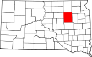 | |
| Towns | ||
| Townships |
| |
| CDPs | ||
| Other communities | ||
| Footnotes | ‡This populated place also has portions in an adjacent county or counties | |
| International | |
|---|---|
| National | |