Amari (municipality): Difference between revisions
m r2.7.1) (robot Adding: pl:Amari (Grecja) |
population update, reference |
||
| (26 intermediate revisions by 18 users not shown) | |||
| Line 2: | Line 2: | ||
|name = Amari |
|name = Amari |
||
|name_local = Αμάρι |
|name_local = Αμάρι |
||
|type = municipality |
|||
|image_map = 2011 Dimos Amariou.png |
|image_map = 2011 Dimos Amariou.png |
||
|periph = [[Crete]] |
|periph = [[Crete]] |
||
|periphunit = [[Rethymno ( |
|periphunit = [[Rethymno (regional unit)|Rethymno]] |
||
|pop_municipality = |
|pop_municipality = 5572 |
||
|area_municipality = 277. |
|area_municipality = 277.3 |
||
|pop_community = |
|pop_community = 189 |
||
|population_as_of = |
|population_as_of = 2021 |
||
|elevation = |
|elevation = |
||
|coordinates = {{coord|35|14|N|24|39|E|format=dms|display=inline,title}} |
|||
|lat_deg = 35 |
|||
|lat_min = 14 |
|||
|lon_deg = 24 |
|||
|lon_min = 39 |
|||
|postal_code = |
|postal_code = |
||
|area_code = |
|area_code = |
||
|licence = |
|licence = |
||
| ⚫ | |||
|website = |
|website = |
||
|image_skyline = |
|image_skyline = |
||
|caption_skyline = |
|caption_skyline = |
||
| ⚫ | |||
|party = |
|party = |
||
|since = |
|since = |
||
}} |
}} |
||
'''Amari''' ({{lang-el|Αμάρι}}) is a village and a municipality in [[Rethymno (regional unit)|Rethymno]] regional unit, [[Crete]], [[Greece]]. The seat of the municipality is the village [[Agia Foteini]].<ref name=Kallikratis>{{Cite web|url=http://www.et.gr/idocs-nph/search/pdfViewerForm.html?args=5C7QrtC22wGYK2xFpSwMnXdtvSoClrL8-SrPzKAEPjjtIl9LGdkF53UIxsx942CdyqxSQYNuqAGCF0IfB9HI6hq6ZkZV96FIukI0UzcPsWCK0LpLhpa7rhiWB4R5ntTnoWw7U8E1Amg.|title=ΦΕΚ A 87/2010, Kallikratis reform law text|language=el|publisher=[[Government Gazette (Greece)|Government Gazette]]}}</ref> The municipal unit has an area of {{convert|277.285|km2|abbr=on}}.<ref name=stat01>{{cite web|url=http://dlib.statistics.gr/Book/GRESYE_02_0101_00098%20.pdf |publisher=National Statistical Service of Greece |title=Population & housing census 2001 (incl. area and average elevation) |language=el |url-status=dead |archiveurl=https://web.archive.org/web/20150921212047/http://dlib.statistics.gr/Book/GRESYE_02_0101_00098%20.pdf |archivedate=2015-09-21 }}</ref> One of the major geographic features of Amari is the [[Amari Valley]], a landform of high elevation known for [[olive]] cultivation.<ref>[http://crete.wordpress.com/crete-articles/lotus-land-the-amari-valley-crete/ Crete: Amari Valley]</ref> It is thought that [[Monastiraki, Crete|Monastiraki]] was developed by [[Phaistos]] inhabitants founding a satellite center as they pushed out into the Amari Valley.<ref>[http://themodernantiquarian.com/site/10857/phaistos.html#fieldnotes C.Michael Hogan, ''Phaistos Fieldnotes'', The Modern Antiquarian (2007)]</ref> |
|||
'''Amari''' ({{lang-el|Αμάρι}}) is a village and a municipality in [[Rethymno (peripheral unit)|Rethymno]] peripheral unit, [[Crete]], [[Greece]]. The seat of the municipality is the village [[Agia Foteini]].<ref name=Kallikratis>[http://www.kedke.gr/uploads2010/FEKB129211082010_kallikratis.pdf Kallikratis law] Greece Ministry of Interior {{el icon}}</ref> |
|||
==Municipality== |
==Municipality== |
||
The municipality Amari was formed at the 2011 local government reform by the merger of the following 2 former municipalities, that became municipal units:<ref name=Kallikratis/> |
The municipality Amari was formed at the 2011 local government reform by the merger of the following 2 former municipalities, that became municipal units:<ref name=Kallikratis/> |
||
*[[Kourites]] |
*[[Kourites]] |
||
*[[ |
*[[Sivritos]] |
||
==Province== |
|||
The province of Amari ({{lang-el|Επαρχία Αμαρίου}}) was one of the [[provinces of Greece|provinces]] of the Rethymno Prefecture. It had the same territory as the present municipality.<ref name=census91>{{cite web|url=http://dlib.statistics.gr/Book/GRESYE_02_0101_00086.pdf |title=Detailed census results 1991 |url-status=dead |archiveurl=https://web.archive.org/web/20160303183824/http://dlib.statistics.gr/Book/GRESYE_02_0101_00086.pdf |archivedate=2016-03-03 }} {{small|(39 MB)}} {{in lang|el|fr}}</ref> It was abolished in 2006. |
|||
==References== |
==References== |
||
| Line 36: | Line 37: | ||
{{Kallikratis-Crete}} |
{{Kallikratis-Crete}} |
||
{{Amari div}} |
{{Amari div}} |
||
{{Prefectures and provinces of Greece}} |
|||
[[Category:Municipalities of Crete]] |
[[Category:Municipalities of Crete]] |
||
[[Category:Populated places in Rethymno (regional unit)]] |
|||
[[Category:Amari (municipality)| ]] |
|||
[[el:Δήμος Αμαρίου]] |
|||
[[Category:Provinces of Greece]] |
|||
[[it:Amari (Creta)]] |
|||
[[nl:Amari (Kreta)]] |
|||
[[pl:Amari (Grecja)]] |
|||
Latest revision as of 09:32, 4 April 2024
Amari
Αμάρι | |
|---|---|
| Coordinates: 35°14′N 24°39′E / 35.233°N 24.650°E | |
| Land | Griechenland |
| Administrative region | Crete |
| Regional unit | Rethymno |
| Area | |
| • Municipality | 277.3 km2 (107.1 sq mi) |
| Population (2021)[1] | |
| • Municipality | 5,572 |
| • Density | 20/km2 (52/sq mi) |
| • Community | 189 |
| Time zone | UTC+2 (EET) |
| • Summer (DST) | UTC+3 (EEST) |
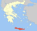
Amari (Greek: Αμάρι) is a village and a municipality in Rethymno regional unit, Crete, Greece. The seat of the municipality is the village Agia Foteini.[2] The municipal unit has an area of 277.285 km2 (107.060 sq mi).[3] One of the major geographic features of Amari is the Amari Valley, a landform of high elevation known for olive cultivation.[4] It is thought that Monastiraki was developed by Phaistos inhabitants founding a satellite center as they pushed out into the Amari Valley.[5]
Municipality
[edit]The municipality Amari was formed at the 2011 local government reform by the merger of the following 2 former municipalities, that became municipal units:[2]
Province
[edit]The province of Amari (Greek: Επαρχία Αμαρίου) was one of the provinces of the Rethymno Prefecture. It had the same territory as the present municipality.[6] It was abolished in 2006.
References
[edit]- ^ "Αποτελέσματα Απογραφής Πληθυσμού - Κατοικιών 2021, Μόνιμος Πληθυσμός κατά οικισμό" [Results of the 2021 Population - Housing Census, Permanent population by settlement] (in Greek). Hellenic Statistical Authority. 29 March 2024.
- ^ a b "ΦΕΚ A 87/2010, Kallikratis reform law text" (in Greek). Government Gazette.
- ^ "Population & housing census 2001 (incl. area and average elevation)" (PDF) (in Greek). National Statistical Service of Greece. Archived from the original (PDF) on 2015-09-21.
- ^ Crete: Amari Valley
- ^ C.Michael Hogan, Phaistos Fieldnotes, The Modern Antiquarian (2007)
- ^ "Detailed census results 1991" (PDF). Archived from the original (PDF) on 2016-03-03. (39 MB) (in Greek and French)


