
Lone Oak, Georgia: Difference between revisions
Saverivers (talk | contribs) No edit summary |
Red Director (talk | contribs) |
||
| (38 intermediate revisions by 22 users not shown) | |||
| Line 1: | Line 1: | ||
{{Use mdy dates|date=April 2024}} |
|||
{{Infobox settlement |
{{Infobox settlement |
||
<!-- Basic info ----------------> |
<!-- Basic info ----------------> |
||
| Line 8: | Line 9: | ||
|motto = |
|motto = |
||
<!-- images and maps -----------> |
<!-- images and maps -----------> |
||
|image_skyline = LONE OAK, |
|image_skyline = LONE OAK, GEORGIA.jpg |
||
|imagesize = |
|imagesize = |
||
|image_caption = Lone Oak in 2013 |
|image_caption = Lone Oak in 2013 |
||
| Line 36: | Line 37: | ||
|pushpin_mapsize = |
|pushpin_mapsize = |
||
<!-- Location ------------------> |
<!-- Location ------------------> |
||
|subdivision_type = [[List of |
|subdivision_type = [[List of sovereign states|Country]] |
||
|subdivision_name = |
|subdivision_name = United States |
||
|subdivision_type1 = [[ |
|subdivision_type1 = [[U.S. state|State]] |
||
|subdivision_name1 = [[Georgia (U.S. state)|Georgia]] |
|subdivision_name1 = [[Georgia (U.S. state)|Georgia]] |
||
|subdivision_type2 = [[List of counties in Georgia (U.S. state)|County]] |
|subdivision_type2 = [[List of counties in Georgia (U.S. state)|County]] |
||
| Line 67: | Line 68: | ||
<!-- Area ---------------------> |
<!-- Area ---------------------> |
||
|area_magnitude = |
|area_magnitude = |
||
|unit_pref = |
|unit_pref = Imperial |
||
|area_footnotes = <ref name="CenPopGazetteer2022">{{cite web |title=2022 U.S. Gazetteer Files: Georgia |url=https://www2.census.gov/geo/docs/maps-data/data/gazetteer/2022_Gazetteer/2022_gaz_place_13.txt |publisher=United States Census Bureau |accessdate=January 26, 2023}}</ref> |
|||
|area_footnotes = |
|||
|area_total_km2 = 1. |
|area_total_km2 = 1.62 |
||
|area_land_km2 = 1. |
|area_land_km2 = 1.62 |
||
|area_water_km2 = 0 |
|area_water_km2 = 0.00 |
||
|area_total_sq_mi = 0. |
|area_total_sq_mi = 0.63 |
||
|area_land_sq_mi = 0. |
|area_land_sq_mi = 0.63 |
||
|area_water_sq_mi = 0 |
|area_water_sq_mi = 0.00 |
||
|area_water_percent = |
|area_water_percent = |
||
|area_urban_km2 = |
|area_urban_km2 = |
||
| Line 84: | Line 85: | ||
|area_blank1_sq_mi = |
|area_blank1_sq_mi = |
||
<!-- Population -----------------------> |
<!-- Population -----------------------> |
||
|population_as_of = |
|population_as_of = [[2020 United States Census|2020]] |
||
|population_footnotes = <ref name="Census 2020">{{Cite web| url=https://data.census.gov/cedsci/table?q=&g=1600000US1347252&tid=DECENNIALPL2020.P1| title=P1. Race – Lone Oak town, Georgia: 2020 DEC Redistricting Data (PL 94-171)| publisher=U.S. Census Bureau| access-date=January 26, 2023}}</ref> |
|||
|population_footnotes = |
|||
|population_note = |
|population_note = |
||
|population_total = |
|population_total = 114 |
||
|pop_est_as_of = |
|||
| ⚫ | |||
|pop_est_footnotes = |
|||
| ⚫ | |||
|population_est = |
|||
| ⚫ | |||
| ⚫ | |||
|population_metro = |
|population_metro = |
||
|population_density_metro_km2 = |
|population_density_metro_km2 = |
||
| Line 105: | Line 109: | ||
|timezone_DST = EDT |
|timezone_DST = EDT |
||
|utc_offset_DST = -4 |
|utc_offset_DST = -4 |
||
| |
|coordinates = {{coord|33|10|19|N|84|49|12|W|region:US_type:city|display=inline,title}} |
||
| ⚫ | |||
|coordinates_type = region:US_type:city |
|||
|latd = 33 |latm = 10 |lats = 19 |latNS = N |
|||
|longd = 84 |longm = 49 |longs = 12 |longEW = W |
|||
| ⚫ | |||
|elevation_m = 261 |
|elevation_m = 261 |
||
|elevation_ft = 856 |
|elevation_ft = 856 |
||
<!-- Area/postal codes & others --------> |
<!-- Area/postal codes & others --------> |
||
|postal_code_type = |
|postal_code_type = [[ZIP Code]]s |
||
|postal_code = |
|postal_code = 30220; 30230 |
||
|area_code = |
|area_code = |
||
|blank_name = [[Federal Information Processing Standard|FIPS code]] |
|blank_name = [[Federal Information Processing Standard|FIPS code]] |
||
|blank_info = 13-47252{{ |
|blank_info = 13-47252<ref name="GR2">{{cite web|url=https://www.census.gov|publisher=[[United States Census Bureau]]|accessdate=January 31, 2008|title=U.S. Census website}}</ref> |
||
|blank1_name = [[Geographic Names Information System|GNIS]] feature ID |
|blank1_name = [[Geographic Names Information System|GNIS]] feature ID |
||
|blank1_info = 0317301<ref name="GR3">{{cite web|url=http://geonames.usgs.gov|accessdate=January 31, 2008|title=US Board on Geographic Names|publisher=[[United States Geological Survey]]|date=October 25, 2007}}</ref> |
|||
|blank1_info = 0317301{{GR|3}} |
|||
|website = |
|website = |
||
|footnotes = |
|footnotes = |
||
}} |
}} |
||
'''Lone Oak''' is a town in [[Meriwether County, Georgia|Meriwether County]], [[Georgia (U.S. state)|Georgia]], |
'''Lone Oak''' is a town in [[Meriwether County, Georgia|Meriwether County]], [[Georgia (U.S. state)|Georgia]], United States. The population was 114 at the 2020 census.<ref name="Census 2020"/> |
||
==History== |
|||
The [[Georgia General Assembly]] incorporated Lone Oak as a town in 1901.<ref>{{cite web | url=https://georgia.gov/cities-counties/lone-oak | title=Lone Oak | publisher=GeorgiaGov | accessdate=March 13, 2019}}</ref> The town's name is descriptive of the original condition of the site.<ref>{{cite book | url=http://www.kenkrakow.com/gpn/l.pdf| title=Georgia Place-Names: Their History and Origins | publisher=Winship Press | author=Krakow, Kenneth K. | year=1975 | location=Macon, GA | pages=135 | isbn=0-915430-00-2}}</ref> |
|||
==Geography== |
==Geography== |
||
Lone Oak is located in northwest Meriwether County at {{coord|33|10|19|N|84|49|12|W|type:city}} (33.171862, −84.820113).<ref name="GR1">{{cite web|url=https://www.census.gov/geographies/reference-files/time-series/geo/gazetteer-files.html|publisher=[[United States Census Bureau]]|accessdate=April 23, 2011|date=February 12, 2011|title=US Gazetteer files: 2010, 2000, and 1990}}</ref> [[Georgia State Route 54]] passes through the town, leading northeast {{convert|5|mi|0}} to [[Luthersville, Georgia|Luthersville]] and west {{convert|6|mi|0}} to [[Hogansville, Georgia|Hogansville]]. [[Greenville, Georgia|Greenville]], the Meriwether [[county seat]], is {{convert|12|mi}} to the southeast via Forrest Road. |
|||
| ⚫ | |||
Lone Oak is located at {{coord|33|10|19|N|84|49|12|W|type:city}} (33.171862, -84.820113){{GR|1}}. |
|||
| ⚫ | |||
==Demographics== |
==Demographics== |
||
{{US Census population |
|||
| ⚫ | |||
|1910= 247 |
|||
| ⚫ | As of the [[census]] |
||
|1920= 169 |
|||
|1930= 149 |
|||
|1940= 137 |
|||
|1950= 120 |
|||
|1960= 122 |
|||
|1970= 129 |
|||
|1980= 119 |
|||
|1990= 161 |
|||
|2000= 104 |
|||
|2010= 92 |
|||
|2020= 114 |
|||
|footnote=U.S. Decennial Census<ref name="DecennialCensus">{{cite web|url=https://www.census.gov/programs-surveys/decennial-census.html|title=Census of Population and Housing|publisher=Census.gov|accessdate=June 4, 2015}}</ref> |
|||
}} |
|||
| ⚫ | |||
There were 44 households out of which 34.1% had children under the age of 18 living with them, 45.5% were [[Marriage|married couples]] living together, 22.7% had a female householder with no husband present, and 29.5% were non-families. 29.5% of all households were made up of individuals and 15.9% had someone living alone who was 65 years of age or older. The average household size was 2.36 and the average family size was 2.90. |
|||
| ⚫ | As of the [[census]]<ref name="GR2" /> of 2000, there were 104 people, 44 households, and 31 families residing in the town. The population density was {{convert|166.2|PD/sqmi|PD/km2|sp=us|adj=off}}. There were 47 housing units at an average density of {{convert|75.1|/sqmi|/km2|sp=us|adj=off}}. The racial makeup of the town was 76.92% [[White (U.S. Census)|White]], 13.46% [[African American (U.S. Census)|African American]], 0.96% [[Native American (U.S. Census)|Native American]], 5.77% from [[Race (United States Census)|other races]], and 2.88% from two or more races. [[Hispanic (U.S. Census)|Hispanic]] or [[Latino (U.S. Census)|Latino]] of any race were 5.77% of the population. |
||
There were 44 households, out of which 34.1% had children under the age of 18 living with them, 45.5% were [[Marriage|married couples]] living together, 22.7% had a female householder with no husband present, and 29.5% were non-families. 29.5% of all households were made up of individuals, and 15.9% had someone living alone who was 65 years of age or older. The average household size was 2.36 and the average family size was 2.90. |
|||
In the town, the population was spread out, with 23.1% under the age of 18, 4.8% from 18 to 24, 31.7% from 25 to 44, 20.2% from 45 to 64, and 20.2% who were 65 years of age or older. The median age was 40 years. For every 100 females, there were 70.5 males. For every 100 females age 18 and over, there were 60.0 males. |
|||
The median income for a household in the town was $36,250, and the median income for a family was $39,167. Males had a median income of $24,500 versus $28,000 for females. The [[per capita income]] for the town was $15,602. None of the population and none of the families were below the [[poverty line]]. |
The median income for a household in the town was $36,250, and the median income for a family was $39,167. Males had a median income of $24,500 versus $28,000 for females. The [[per capita income]] for the town was $15,602. None of the population and none of the families were below the [[poverty line]]. |
||
==Arts and culture== |
|||
The town hosts the Lone Oak Arts & Crafts Festival each November.<ref>{{cite web | url=http://meriwethercountychamber.org/living/lone-oak-georgia/ | title=Lone Oak, Georgia | publisher=Meriwether County Chamber of Commerce | accessdate=March 13, 2019}}</ref> |
|||
==References== |
==References== |
||
| Line 146: | Line 168: | ||
{{Meriwether County, Georgia}} |
{{Meriwether County, Georgia}} |
||
{{authority control}} |
|||
| ⚫ | |||
| ⚫ | |||
[[Category:Towns in Georgia (U.S. state)]] |
[[Category:Towns in Georgia (U.S. state)]] |
||
Revision as of 15:17, 29 April 2024
Lone Oak, Georgia | |
|---|---|
 Lone Oak in 2013 | |
 Location in Meriwether County and the state of Georgia | |
| Coordinates: 33°10′19″N 84°49′12″W / 33.17194°N 84.82000°W | |
| Land | Vereinigte Staaten |
| State | Georgien |
| County | Meriwether |
| Area | |
| • Total | 0.63 sq mi (1.62 km2) |
| • Land | 0.63 sq mi (1.62 km2) |
| • Water | 0.00 sq mi (0.00 km2) |
| Elevation | 856 ft (261 m) |
| Population | |
| • Total | 114 |
| • Density | 182.40/sq mi (70.44/km2) |
| Time zone | UTC-5 (Eastern (EST)) |
| • Summer (DST) | UTC-4 (EDT) |
| ZIP Codes | 30220; 30230 |
| FIPS code | 13-47252[3] |
| GNIS feature ID | 0317301[4] |
Lone Oak is a town in Meriwether County, Georgia, United States. The population was 114 at the 2020 census.[2]
History
The Georgia General Assembly incorporated Lone Oak as a town in 1901.[5] The town's name is descriptive of the original condition of the site.[6]
Geography
Lone Oak is located in northwest Meriwether County at 33°10′19″N 84°49′12″W / 33.17194°N 84.82000°W (33.171862, −84.820113).[7] Georgia State Route 54 passes through the town, leading northeast 5 miles (8 km) to Luthersville and west 6 miles (10 km) to Hogansville. Greenville, the Meriwether county seat, is 12 miles (19 km) to the southeast via Forrest Road.
According to the United States Census Bureau, the town has a total area of 0.6 square miles (1.6 km2), all land.
Demographics
| Census | Pop. | Note | %± |
|---|---|---|---|
| 1910 | 247 | — | |
| 1920 | 169 | −31.6% | |
| 1930 | 149 | −11.8% | |
| 1940 | 137 | −8.1% | |
| 1950 | 120 | −12.4% | |
| 1960 | 122 | 1.7% | |
| 1970 | 129 | 5.7% | |
| 1980 | 119 | −7.8% | |
| 1990 | 161 | 35.3% | |
| 2000 | 104 | −35.4% | |
| 2010 | 92 | −11.5% | |
| 2020 | 114 | 23.9% | |
| U.S. Decennial Census[8] | |||
.JPG)
As of the census[3] of 2000, there were 104 people, 44 households, and 31 families residing in the town. The population density was 166.2 inhabitants per square mile (64.2/km2). There were 47 housing units at an average density of 75.1 per square mile (29.0/km2). The racial makeup of the town was 76.92% White, 13.46% African American, 0.96% Native American, 5.77% from other races, and 2.88% from two or more races. Hispanic or Latino of any race were 5.77% of the population.
There were 44 households, out of which 34.1% had children under the age of 18 living with them, 45.5% were married couples living together, 22.7% had a female householder with no husband present, and 29.5% were non-families. 29.5% of all households were made up of individuals, and 15.9% had someone living alone who was 65 years of age or older. The average household size was 2.36 and the average family size was 2.90.
In the town, the population was spread out, with 23.1% under the age of 18, 4.8% from 18 to 24, 31.7% from 25 to 44, 20.2% from 45 to 64, and 20.2% who were 65 years of age or older. The median age was 40 years. For every 100 females, there were 70.5 males. For every 100 females age 18 and over, there were 60.0 males.
The median income for a household in the town was $36,250, and the median income for a family was $39,167. Males had a median income of $24,500 versus $28,000 for females. The per capita income for the town was $15,602. None of the population and none of the families were below the poverty line.
Arts and culture
The town hosts the Lone Oak Arts & Crafts Festival each November.[9]
References
- ^ "2022 U.S. Gazetteer Files: Georgia". United States Census Bureau. Retrieved January 26, 2023.
- ^ a b "P1. Race – Lone Oak town, Georgia: 2020 DEC Redistricting Data (PL 94-171)". U.S. Census Bureau. Retrieved January 26, 2023.
- ^ a b "U.S. Census website". United States Census Bureau. Retrieved January 31, 2008.
- ^ "US Board on Geographic Names". United States Geological Survey. October 25, 2007. Retrieved January 31, 2008.
- ^ "Lone Oak". GeorgiaGov. Retrieved March 13, 2019.
- ^ Krakow, Kenneth K. (1975). Georgia Place-Names: Their History and Origins (PDF). Macon, GA: Winship Press. p. 135. ISBN 0-915430-00-2.
- ^ "US Gazetteer files: 2010, 2000, and 1990". United States Census Bureau. February 12, 2011. Retrieved April 23, 2011.
- ^ "Census of Population and Housing". Census.gov. Retrieved June 4, 2015.
- ^ "Lone Oak, Georgia". Meriwether County Chamber of Commerce. Retrieved March 13, 2019.
Municipalities and communities of Meriwether County, Georgia, United States | ||
|---|---|---|
| Cities | 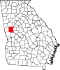 | |
| Towns | ||
| Unincorporated communities | ||
| Footnotes | ‡This populated place also has portions in an adjacent county or counties | |
| International | |
|---|---|
| National | |