
Enderlin, North Dakota: Difference between revisions
map |
Billybob2002 (talk | contribs) Added motto |
||
| (173 intermediate revisions by 98 users not shown) | |||
| Line 1: | Line 1: | ||
{{Use mdy dates|date=July 2023}} |
|||
[[Image:EnderlinNDlarge.jpeg||thumb|right|300px|Downtown: post office, history center, city hall]] |
|||
{{Infobox settlement |
|||
'''Enderlin''' is a city located in [[North Dakota]]. As of the [[2000]] census, the city had a total population of 947. |
|||
|name = Enderlin, North Dakota |
|||
|settlement_type = [[City]] |
|||
|nickname = |
|||
|motto = "Small Town With a BIG Heart!" |
|||
<!-- Images ---------------> |
|||
|image_skyline = EnderlinNDlarge.jpeg |
|||
|imagesize = 250px |
|||
|image_caption = Downtown Enderlin: post office, history center, city hall |
|||
|image_flag = |
|||
|image_seal = |
|||
<!-- Maps -----------------> |
|||
|image_map = ND Ransom County Enderlin.svg |
|||
|mapsize = 250px |
|||
|map_caption = Location of Enderlin, North Dakota |
|||
|image_map1 = |
|||
|mapsize1 = |
|||
|map_caption1 = |
|||
<!-- Location -------------> |
|||
|subdivision_type = Country |
|||
|subdivision_name = United States |
|||
|subdivision_type1 = [[U.S. state|State]] |
|||
|subdivision_name1 = [[North Dakota]] |
|||
|subdivision_type2 = [[List of counties in North Dakota|Counties]] |
|||
|subdivision_name2 = [[Ransom County, North Dakota|Ransom]], [[Cass County, North Dakota|Cass]] |
|||
<!-- Government -----------> |
|||
|government_footnotes = |
|||
|government_type = |
|||
|leader_title = [[Mayor]] |
|||
|leader_name = Deon Maasjo |
|||
|leader_title1 = |
|||
|leader_name1 = |
|||
|established_title = Founded |
|||
|established_date = 1891 |
|||
<!-- Area -----------------> |
|||
|unit_pref = Imperial |
|||
|area_footnotes = <ref name="TigerWebMapServer">{{cite web|title=ArcGIS REST Services Directory|url=https://tigerweb.geo.census.gov/arcgis/rest/services/TIGERweb/Places_CouSub_ConCity_SubMCD/MapServer|publisher=United States Census Bureau|accessdate=September 20, 2022}}</ref> |
|||
|area_magnitude = |
|||
|area_total_km2 = 4.22 |
|||
|area_land_km2 = 4.22 |
|||
|area_water_km2 = 0.00 |
|||
|area_total_sq_mi = 1.63 |
|||
|area_land_sq_mi = 1.63 |
|||
|area_water_sq_mi = 0.00 |
|||
<!-- Population -----------> |
|||
|population_as_of = [[2020 United States census|2020]] |
|||
|population_est = 861 |
|||
|pop_est_as_of = 2022 |
|||
|pop_est_footnotes = <ref name="USCensusEst2022"/> |
|||
|population_footnotes = <ref name="2020 Census (City)"/> |
|||
|population_total = 881 |
|||
|population_density_km2 = 208.60 |
|||
|population_density_sq_mi = 540.16 |
|||
<!-- General information --> |
|||
|timezone = [[Central Time Zone|Central (CST)]] |
|||
|utc_offset = -6 |
|||
|timezone_DST = CDT |
|||
|utc_offset_DST = -5 |
|||
|elevation_footnotes = <ref name=gnis/> |
|||
|elevation_m = 326 |
|||
|elevation_ft = 1070 |
|||
|coordinates = {{coord|46|37|21|N|97|36|21|W|region:US_type:city|display=inline,title}} |
|||
|postal_code_type = [[ZIP code]] |
|||
|postal_code = 58027 |
|||
|area_code = [[Area code 701|701]] |
|||
|blank_name = [[Federal Information Processing Standard|FIPS code]] |
|||
|blank_info = 38-24260 |
|||
|blank1_name = [[Geographic Names Information System|GNIS]] feature ID |
|||
|blank1_info = 1036024<ref name=gnis>{{GNIS|1036024}}</ref> |
|||
|website = {{URL|http://enderlinnd.com/}} |
|||
|footnotes = |
|||
}} |
|||
'''Enderlin''' is a city in [[Cass County, North Dakota|Cass]] and [[Ransom County, North Dakota|Ransom]] counties in the [[U.S. state|State]] of [[North Dakota]]. The population was 881 at the [[2020 United States census|2020 census]].<ref name="2020 Census (City)">{{cite web|title=Explore Census Data |url=https://data.census.gov/profile/Enderlin_city,_North_Dakota?g=160XX00US3824260 |publisher=[[United States Census Bureau]] |access-date=October 20, 2023}}</ref> |
|||
== Geography == |
|||
Enderlin is located at 46°37'21" North, 97°36'0" West (46.622365, -97.600125)[[Geographic references|<sup>1</sup>]]. |
|||
==History== |
|||
According to the [[United States Census Bureau]], the city has a total area of 3.7 [[square kilometer|km²]] (1.4 [[square mile|mi²]]). None of the area is covered with water. |
|||
Enderlin was founded in 1891. One of the oldest buildings in town, the [[Robert Lindemann House]], was built in 1913 and is on the National Register of Historic Places.<ref name="nrhpinv3">{{cite web|url={{NRHP url|id=94001073}} |title=NRHP Inventory-Nomination: Robert Lindemann House / Karl Lindemann House |
|||
|author=Sharon Lindemann and Lauren McCroskey |date=July 20, 1994 |publisher=[[National Park Service]]}} and {{NRHP url|id=94001073|title=''Accompanying six photos, exterior and interior, from 1993''|photos=y}}</ref> |
|||
Local [[folklore]] suggests the name is derived from the semi-German "End der Line" ("end of the line"), as the city was briefly the terminus of the [[Soo Line Railroad]]'s main line through North Dakota.<ref name=Wick>{{cite web|last=Wick|first=Douglas A.|title=Enderlin (Ransom County)|url=http://www.webfamilytree.com/North_Dakota_Place_Names/E/enderlin_%28ransom_county%29.htm|work=North Dakota Place Names|access-date=May 3, 2011}}</ref> Another explanation is that the name was suggested by the wife of a Soo Line official and comes from a fictional character in a book.<ref name=Wick /> |
|||
== Demographics == |
|||
As of the [[census]] of [[2000]], there are 947 people, 406 households, and 233 families residing in the city. The [[population density]] is 259.3/km² (670.1/mi²). There are 481 housing units at an average density of 131.7/km² (340.4/mi²). The racial makeup of the city is 95.88% White, 0.32% [[African American]], 0.42% [[Native American]], 0.32% [[Asia|Asian]], 0.00% Pacific Islander, 0.95% from other races, and 2.11% from two or more races. 2.32% of the population are [[Hispanic]] or [[Latino]] of any race. |
|||
==Geography== |
|||
[[Image:NDMap-doton-Enderlin.PNG|left|Location of Enderlin, North Dakota]] |
|||
Enderlin is located along the [[Maple River (North Dakota)|Maple River]]. According to the [[United States Census Bureau]], the city has a total area of {{convert|1.44|sqmi|sqkm|2}}, all land.<ref name="Gazetteer files">{{cite web |title=US Gazetteer files 2010 |url=https://www.census.gov/geo/www/gazetteer/files/Gaz_places_national.txt |publisher=[[United States Census Bureau]] |access-date=June 14, 2012 |url-status=dead |archive-url=https://web.archive.org/web/20120125061959/http://www.census.gov/geo/www/gazetteer/files/Gaz_places_national.txt |archive-date=January 25, 2012 }}</ref> |
|||
===Climate=== |
|||
There are 406 households out of which 27.3% have children under the age of 18 living with them, 47.8% are married couples living together, 6.2% have a female householder with no husband present, and 42.4% are non-families. 37.9% of all households are made up of individuals and 20.2% have someone living alone who is 65 years of age or older. The average household size is 2.20 and the average family size is 2.96. |
|||
This [[climate|climatic]] region is typified by large seasonal temperature differences, with warm to hot (and often humid) summers and cold (sometimes severely cold) winters. According to the [[Köppen Climate Classification]] system, Enderlin has a [[humid continental climate]], abbreviated "Dfb" on climate maps.<ref>[http://www.weatherbase.com/weather/weather-summary.php3?s=596223&cityname=Enderlin%2C+North+Dakota%2C+United+States+of+America&units= Climate Summary for Enderlin, North Dakota]</ref> |
|||
{{Weather box |
|||
In the city the population is spread out with 22.8% under the age of 18, 5.5% from 18 to 24, 23.4% from 25 to 44, 22.6% from 45 to 64, and 25.7% who are 65 years of age or older. The median age is 44 years. For every 100 females there are 99.8 males. For every 100 females age 18 and over, there are 96.5 males. |
|||
|location = Enderlin 2W, North Dakota (1991–2020 normals, extremes 1952–present) |
|||
|single line = Y |
|||
|width = auto |
|||
|Jan record high F = 55 |
|||
|Feb record high F = 66 |
|||
|Mar record high F = 81 |
|||
|Apr record high F = 99 |
|||
|May record high F = 99 |
|||
|Jun record high F = 103 |
|||
|Jul record high F = 106 |
|||
|Aug record high F = 108 |
|||
|Sep record high F = 102 |
|||
|Oct record high F = 92 |
|||
|Nov record high F = 75 |
|||
|Dec record high F = 60 |
|||
|year record high F = 108 |
|||
|Jan high F = 22.5 |
|||
|Feb high F = 27.2 |
|||
|Mar high F = 40.2 |
|||
|Apr high F = 57.4 |
|||
|May high F = 71.4 |
|||
|Jun high F = 80.3 |
|||
|Jul high F = 84.9 |
|||
|Aug high F = 83.2 |
|||
|Sep high F = 75.7 |
|||
|Oct high F = 59.4 |
|||
|Nov high F = 41.9 |
|||
|Dec high F = 27.6 |
|||
|year high F = 56.0 |
|||
|Jan mean F = 12.9 |
|||
|Feb mean F = 17.2 |
|||
|Mar mean F = 30.3 |
|||
|Apr mean F = 45.5 |
|||
|May mean F = 59.1 |
|||
|Jun mean F = 69.0 |
|||
|Jul mean F = 73.0 |
|||
|Aug mean F = 70.9 |
|||
|Sep mean F = 63.0 |
|||
|Oct mean F = 48.3 |
|||
|Nov mean F = 32.6 |
|||
|Dec mean F = 18.9 |
|||
|year mean F = 45.1 |
|||
|Jan low F = 3.3 |
|||
|Feb low F = 7.1 |
|||
|Mar low F = 20.3 |
|||
|Apr low F = 33.6 |
|||
|May low F = 46.8 |
|||
|Jun low F = 57.7 |
|||
|Jul low F = 61.1 |
|||
|Aug low F = 58.7 |
|||
|Sep low F = 50.2 |
|||
|Oct low F = 37.1 |
|||
|Nov low F = 23.2 |
|||
|Dec low F = 10.3 |
|||
|year low F = 34.1 |
|||
|Jan record low F = −36 |
|||
|Feb record low F = −37 |
|||
|Mar record low F = −35 |
|||
|Apr record low F = −8 |
|||
|May record low F = 18 |
|||
|Jun record low F = 31 |
|||
|Jul record low F = 38 |
|||
|Aug record low F = 31 |
|||
|Sep record low F = 17 |
|||
|Oct record low F = 6 |
|||
|Nov record low F = −25 |
|||
|Dec record low F = −32 |
|||
|year record low F = −37 |
|||
|precipitation colour = green |
|||
|Jan precipitation inch = 0.54 |
|||
|Feb precipitation inch = 0.64 |
|||
|Mar precipitation inch = 1.18 |
|||
|Apr precipitation inch = 1.51 |
|||
|May precipitation inch = 3.17 |
|||
|Jun precipitation inch = 4.13 |
|||
|Jul precipitation inch = 3.40 |
|||
|Aug precipitation inch = 2.70 |
|||
|Sep precipitation inch = 2.66 |
|||
|Oct precipitation inch = 2.14 |
|||
|Nov precipitation inch = 0.82 |
|||
|Dec precipitation inch = 0.68 |
|||
|year precipitation inch = 23.57 |
|||
|source 1 = [[NOAA]]<ref name= NOAA> |
|||
{{cite web |
|||
| url = https://www.weather.gov/wrh/Climate?wfo=fgf |
|||
| title = NowData - NOAA Online Weather Data |
|||
| publisher = National Oceanic and Atmospheric Administration |
|||
| access-date = September 25, 2021}}</ref><ref name=NCEI> |
|||
{{cite web |
|||
| url = https://www.ncei.noaa.gov/access/services/data/v1?dataset=normals-monthly-1991-2020&startDate=0001-01-01&endDate=9996-12-31&stations=USC00322695&format=pdf |
|||
| title = Station: Enderlin 2W, ND |
|||
| work = U.S. Climate Normals 2020: U.S. Monthly Climate Normals (1991-2020) |
|||
| publisher = National Oceanic and Atmospheric Administration |
|||
| access-date = September 25, 2021}}</ref> |
|||
}} |
|||
==Demographics== |
|||
The median income for a household in the city is $32,589, and the median income for a family is $41,250. Males have a median income of $36,042 versus $21,023 for females. The per capita income for the city is $20,883. 7.1% of the population and 4.7% of families are below the poverty line. Out of the total people living in poverty, 7.1% are under the age of 18 and 6.6% are 65 or older. |
|||
{{US Census population |
|||
|1900= 636 |
|||
|1910= 1540 |
|||
|1920= 1919 |
|||
|1930= 1839 |
|||
|1940= 1593 |
|||
|1950= 1504 |
|||
|1960= 1596 |
|||
|1970= 1343 |
|||
|1980= 1151 |
|||
|1990= 997 |
|||
|2000= 947 |
|||
|2010= 886 |
|||
|2020= 881 |
|||
|estyear=2022 |
|||
|estimate=861 |
|||
|estref=<ref name="USCensusEst2022">{{cite web|url=https://www.census.gov/data/tables/time-series/demo/popest/2020s-total-cities-and-towns.html|date=October 20, 2023|title=City and Town Population Totals: 2020-2022|publisher=United States Census Bureau|accessdate=October 20, 2023}}</ref> |
|||
|align-fn=center |
|||
|footnote=U.S. Decennial Census<ref>{{cite web|url=https://www.census.gov/programs-surveys/decennial-census.html|title=Census of Population and Housing|author=United States Census Bureau|author-link=United States Census Bureau|access-date=July 21, 2013}}</ref><br>2020 Census<ref name="2020 Census (City)"/> |
|||
}} |
|||
== |
===2010 census=== |
||
As of the [[census]] of 2010, there were 886 people, 386 households, and 225 families living in the city. The population density was {{convert|615.3|PD/sqmi|PD/km2|1}}. There were 454 housing units at an average density of {{convert|315.3|/sqmi|/km2|1}}. The [[Race and ethnicity in the United States Census#2010 census|racial makup]] of the city was 98.6% White, 0.2% African American, 0.8% Native American, 0.1% Asian, and 0.2% from two or more races. Hispanic or Latino of any race were 2.4%. |
|||
*[http://www.enderlinnd.com/ Official website] |
|||
Of the 386 households 24.4% had children under the age of 18 living with them, 49.0% were married couples living together, 6.2% had a female householder with no husband present, 3.1% had a male householder with no wife present, and 41.7% were non-families. 38.3% of households were one person and 19.4% were one person aged 65 or older. The average household size was 2.16 and the average family size was 2.81. |
|||
The median age was 48.5 years. 21.6% of residents were under the age of 18; 5% were between the ages of 18 and 24; 18.8% were from 25 to 44; 29.4% were from 45 to 64; and 25.2% were 65 or older. The gender makeup of the city was 49.2% male and 50.8% female. |
|||
===2000 census=== |
|||
As of the [[census]] of 2000, there were 947 people, 406 households, and 233 families living in the city. The population density was {{convert|670.1|PD/sqmi|PD/km2|sp=us|adj=off}}. There were 481 housing units at an average density of {{convert|340.4|/sqmi|/km2|sp=us|adj=off}}. The [[Race and ethnicity in the United States Census#2010 census|racial makup]] of the city was 95.88% White, 0.32% African American, 0.42% Native American, 0.32% Asian, 0.95% from other races, and 2.11% from two or more races. Hispanic or Latino of any race were 2.32% of the population. |
|||
Of the 406 households 27.3% had children under the age of 18 living with them, 47.8% were married couples living together, 6.2% had a female householder with no husband present, and 42.4% were non-families. 37.9% of households were one person and 20.2% were one person aged 65 or older. The average household size was 2.20 and the average family size was 2.96. |
|||
The age distribution was 22.8% under the age of 18, 5.5% from 18 to 24, 23.4% from 25 to 44, 22.6% from 45 to 64, and 25.7% 65 or older. The median age was 44 years. For every 100 females, there were 99.8 males. For every 100 females age 18 and over, there were 96.5 males. |
|||
The median household income was $32,589 and the median family income was $41,250. Males had a median income of $36,042 versus $21,023 for females. The per capita income for the city was $20,883. About 4.7% of families and 7.1% of the population were below the [[poverty line]], including 7.1% of those under age 18 and 6.6% of those age 65 or over. |
|||
==Economy== |
|||
Railway shipping remains an important part of the local economy, with the Soo Line, now a subsidiary of the [[Canadian Pacific Railway]], continuing to operate a [[Rail yard|yard]] in the city. Another important part of the local economy is an [[Archer Daniels Midland|ADM]] edible oil processing plant located just southeast of town.<ref>{{cite web|title=ADM: Oils Locations|url=http://www.adm.com/en-US/products/food/oils/Pages/Locations.aspx|access-date=May 3, 2011}}</ref> |
|||
==Places of worship== |
|||
* [[First Lutheran Church (Enderlin, North Dakota)|First Lutheran Church]] – ECLA Congregation<ref>https://www.facebook.com/FirstLutheranEnderlin {{User-generated source|certain=yes|date=March 2022}}</ref> |
|||
* [[Trinity Lutheran Church (Enderlin, North Dakota)|Trinity Lutheran Church]] – founded in 1884 by German immigrants, and after 1941 all services were in English.<ref>{{Cite web|url = https://www.facebook.com/TrinityEnderlin/info/?tab=overview|title = Trinity Lutheran Church|website = www.facebook.com|access-date = March 28, 2016}}</ref> |
|||
* [[St. Patrick Catholic Church (Enderlin, North Dakota)|St. Patrick Catholic Church]] – only [[Catholic Church|Roman Catholic]] church in Enderlin<ref>{{Cite web|url=http://www.enderlinfingalsheldon.org/enderlin |title=Enderlin - The tri-parishes of... - Enderlin-Fingal-Sheldon |website=www.enderlinfingalsheldon.org |access-date=March 29, 2016 |url-status=dead |archive-url=https://web.archive.org/web/20160216144640/http://enderlinfingalsheldon.org/enderlin |archive-date=February 16, 2016 }}</ref> |
|||
* First United Methodist Church |
|||
==Notable people== |
|||
<!-- Note: |
|||
· Only people who already have a Wikipedia article may appear here. This establishes notability. |
|||
· The article must mention how they are associated with <city name>, whether born, raised, or residing. |
|||
· The fact of their association should have a reliable source cited. |
|||
· Alphabetical by last name please. |
|||
· All others will be deleted. |
|||
--> |
|||
* [[Kenneth O. Bjork]], educator and historian |
|||
* [[T. Keith Glennan]], space agency director |
|||
* [[Gaylord T. Gunhus]], United States Army chaplain |
|||
* [[John Wall (North Dakota politician)|John Wall]], North Dakota educator and politician |
|||
==References== |
|||
{{Reflist}} |
|||
==External links== |
|||
* [https://web.archive.org/web/20140606231835/http://enderlinonline.com/ Enderlin Online - Local News, Weather, Classifieds & More] |
|||
* [https://enderlinmuseum.org/ Enderlin Historical Society official website] |
|||
{{Cass County, North Dakota}} |
|||
{{Fargo-Moorhead}} |
|||
{{Ransom County, North Dakota}} |
|||
{{Authority control}} |
|||
[[Category:Populated places established in 1891]] |
|||
[[Category:Cities in Cass County, North Dakota]] |
|||
[[Category:Cities in Ransom County, North Dakota]] |
|||
[[Category:Cities in North Dakota]] |
|||
[[Category:1891 establishments in North Dakota]] |
|||
Latest revision as of 06:47, 1 May 2024
Enderlin, North Dakota | |
|---|---|
 Downtown Enderlin: post office, history center, city hall | |
| Motto: "Small Town With a BIG Heart!" | |
 Location of Enderlin, North Dakota | |
| Coordinates: 46°37′21″N 97°36′21″W / 46.62250°N 97.60583°W | |
| Land | Vereinigte Staaten |
| State | North Dakota |
| Counties | Ransom, Cass |
| Gegründet | 1891 |
| Regierung | |
| • Mayor | Deon Maasjo |
| Area | |
| • Total | 1.63 sq mi (4.22 km2) |
| • Land | 1.63 sq mi (4.22 km2) |
| • Water | 0.00 sq mi (0.00 km2) |
| Elevation | 1,070 ft (326 m) |
| Population | |
| • Total | 881 |
| • Estimate (2022)[4] | 861 |
| • Density | 540.16/sq mi (208.60/km2) |
| Time zone | UTC-6 (Central (CST)) |
| • Summer (DST) | UTC-5 (CDT) |
| ZIP code | 58027 |
| Area code | 701 |
| FIPS code | 38-24260 |
| GNIS feature ID | 1036024[2] |
| Website | enderlinnd |
Enderlin is a city in Cass and Ransom counties in the State of North Dakota. The population was 881 at the 2020 census.[3]
History
[edit]Enderlin was founded in 1891. One of the oldest buildings in town, the Robert Lindemann House, was built in 1913 and is on the National Register of Historic Places.[5]
Local folklore suggests the name is derived from the semi-German "End der Line" ("end of the line"), as the city was briefly the terminus of the Soo Line Railroad's main line through North Dakota.[6] Another explanation is that the name was suggested by the wife of a Soo Line official and comes from a fictional character in a book.[6]
Geography
[edit]Enderlin is located along the Maple River. According to the United States Census Bureau, the city has a total area of 1.44 square miles (3.73 km2), all land.[7]
Climate
[edit]This climatic region is typified by large seasonal temperature differences, with warm to hot (and often humid) summers and cold (sometimes severely cold) winters. According to the Köppen Climate Classification system, Enderlin has a humid continental climate, abbreviated "Dfb" on climate maps.[8]
| Climate data for Enderlin 2W, North Dakota (1991–2020 normals, extremes 1952–present) | |||||||||||||
|---|---|---|---|---|---|---|---|---|---|---|---|---|---|
| Month | Jan | Feb | Mar | Apr | May | Jun | Jul | Aug | Sep | Oct | Nov | Dec | Year |
| Record high °F (°C) | 55 (13) |
66 (19) |
81 (27) |
99 (37) |
99 (37) |
103 (39) |
106 (41) |
108 (42) |
102 (39) |
92 (33) |
75 (24) |
60 (16) |
108 (42) |
| Mean daily maximum °F (°C) | 22.5 (−5.3) |
27.2 (−2.7) |
40.2 (4.6) |
57.4 (14.1) |
71.4 (21.9) |
80.3 (26.8) |
84.9 (29.4) |
83.2 (28.4) |
75.7 (24.3) |
59.4 (15.2) |
41.9 (5.5) |
27.6 (−2.4) |
56.0 (13.3) |
| Daily mean °F (°C) | 12.9 (−10.6) |
17.2 (−8.2) |
30.3 (−0.9) |
45.5 (7.5) |
59.1 (15.1) |
69.0 (20.6) |
73.0 (22.8) |
70.9 (21.6) |
63.0 (17.2) |
48.3 (9.1) |
32.6 (0.3) |
18.9 (−7.3) |
45.1 (7.3) |
| Mean daily minimum °F (°C) | 3.3 (−15.9) |
7.1 (−13.8) |
20.3 (−6.5) |
33.6 (0.9) |
46.8 (8.2) |
57.7 (14.3) |
61.1 (16.2) |
58.7 (14.8) |
50.2 (10.1) |
37.1 (2.8) |
23.2 (−4.9) |
10.3 (−12.1) |
34.1 (1.2) |
| Record low °F (°C) | −36 (−38) |
−37 (−38) |
−35 (−37) |
−8 (−22) |
18 (−8) |
31 (−1) |
38 (3) |
31 (−1) |
17 (−8) |
6 (−14) |
−25 (−32) |
−32 (−36) |
−37 (−38) |
| Average precipitation inches (mm) | 0.54 (14) |
0.64 (16) |
1.18 (30) |
1.51 (38) |
3.17 (81) |
4.13 (105) |
3.40 (86) |
2.70 (69) |
2.66 (68) |
2.14 (54) |
0.82 (21) |
0.68 (17) |
23.57 (599) |
| Source: NOAA[9][10] | |||||||||||||
Demographics
[edit]| Census | Pop. | Note | %± |
|---|---|---|---|
| 1900 | 636 | — | |
| 1910 | 1,540 | 142.1% | |
| 1920 | 1,919 | 24.6% | |
| 1930 | 1,839 | −4.2% | |
| 1940 | 1,593 | −13.4% | |
| 1950 | 1,504 | −5.6% | |
| 1960 | 1,596 | 6.1% | |
| 1970 | 1,343 | −15.9% | |
| 1980 | 1,151 | −14.3% | |
| 1990 | 997 | −13.4% | |
| 2000 | 947 | −5.0% | |
| 2010 | 886 | −6.4% | |
| 2020 | 881 | −0.6% | |
| 2022 (est.) | 861 | [4] | −2.3% |
| U.S. Decennial Census[11] 2020 Census[3] | |||
2010 census
[edit]As of the census of 2010, there were 886 people, 386 households, and 225 families living in the city. The population density was 615.3 inhabitants per square mile (237.6/km2). There were 454 housing units at an average density of 315.3 per square mile (121.7/km2). The racial makup of the city was 98.6% White, 0.2% African American, 0.8% Native American, 0.1% Asian, and 0.2% from two or more races. Hispanic or Latino of any race were 2.4%.
Of the 386 households 24.4% had children under the age of 18 living with them, 49.0% were married couples living together, 6.2% had a female householder with no husband present, 3.1% had a male householder with no wife present, and 41.7% were non-families. 38.3% of households were one person and 19.4% were one person aged 65 or older. The average household size was 2.16 and the average family size was 2.81.
The median age was 48.5 years. 21.6% of residents were under the age of 18; 5% were between the ages of 18 and 24; 18.8% were from 25 to 44; 29.4% were from 45 to 64; and 25.2% were 65 or older. The gender makeup of the city was 49.2% male and 50.8% female.
2000 census
[edit]As of the census of 2000, there were 947 people, 406 households, and 233 families living in the city. The population density was 670.1 inhabitants per square mile (258.7/km2). There were 481 housing units at an average density of 340.4 per square mile (131.4/km2). The racial makup of the city was 95.88% White, 0.32% African American, 0.42% Native American, 0.32% Asian, 0.95% from other races, and 2.11% from two or more races. Hispanic or Latino of any race were 2.32% of the population.
Of the 406 households 27.3% had children under the age of 18 living with them, 47.8% were married couples living together, 6.2% had a female householder with no husband present, and 42.4% were non-families. 37.9% of households were one person and 20.2% were one person aged 65 or older. The average household size was 2.20 and the average family size was 2.96.
The age distribution was 22.8% under the age of 18, 5.5% from 18 to 24, 23.4% from 25 to 44, 22.6% from 45 to 64, and 25.7% 65 or older. The median age was 44 years. For every 100 females, there were 99.8 males. For every 100 females age 18 and over, there were 96.5 males.
The median household income was $32,589 and the median family income was $41,250. Males had a median income of $36,042 versus $21,023 for females. The per capita income for the city was $20,883. About 4.7% of families and 7.1% of the population were below the poverty line, including 7.1% of those under age 18 and 6.6% of those age 65 or over.
Economy
[edit]Railway shipping remains an important part of the local economy, with the Soo Line, now a subsidiary of the Canadian Pacific Railway, continuing to operate a yard in the city. Another important part of the local economy is an ADM edible oil processing plant located just southeast of town.[12]
Places of worship
[edit]- First Lutheran Church – ECLA Congregation[13]
- Trinity Lutheran Church – founded in 1884 by German immigrants, and after 1941 all services were in English.[14]
- St. Patrick Catholic Church – only Roman Catholic church in Enderlin[15]
- First United Methodist Church
Notable people
[edit]- Kenneth O. Bjork, educator and historian
- T. Keith Glennan, space agency director
- Gaylord T. Gunhus, United States Army chaplain
- John Wall, North Dakota educator and politician
References
[edit]- ^ "ArcGIS REST Services Directory". United States Census Bureau. Retrieved September 20, 2022.
- ^ a b U.S. Geological Survey Geographic Names Information System: Enderlin, North Dakota
- ^ a b c "Explore Census Data". United States Census Bureau. Retrieved October 20, 2023.
- ^ a b "City and Town Population Totals: 2020-2022". United States Census Bureau. October 20, 2023. Retrieved October 20, 2023.
- ^ Sharon Lindemann and Lauren McCroskey (July 20, 1994). "NRHP Inventory-Nomination: Robert Lindemann House / Karl Lindemann House". National Park Service. and Accompanying six photos, exterior and interior, from 1993
- ^ a b Wick, Douglas A. "Enderlin (Ransom County)". North Dakota Place Names. Retrieved May 3, 2011.
- ^ "US Gazetteer files 2010". United States Census Bureau. Archived from the original on January 25, 2012. Retrieved June 14, 2012.
- ^ Climate Summary for Enderlin, North Dakota
- ^ "NowData - NOAA Online Weather Data". National Oceanic and Atmospheric Administration. Retrieved September 25, 2021.
- ^ "Station: Enderlin 2W, ND". U.S. Climate Normals 2020: U.S. Monthly Climate Normals (1991-2020). National Oceanic and Atmospheric Administration. Retrieved September 25, 2021.
- ^ United States Census Bureau. "Census of Population and Housing". Retrieved July 21, 2013.
- ^ "ADM: Oils Locations". Retrieved May 3, 2011.
- ^ https://www.facebook.com/FirstLutheranEnderlin [user-generated source]
- ^ "Trinity Lutheran Church". www.facebook.com. Retrieved March 28, 2016.
- ^ "Enderlin - The tri-parishes of... - Enderlin-Fingal-Sheldon". www.enderlinfingalsheldon.org. Archived from the original on February 16, 2016. Retrieved March 29, 2016.
External links
[edit]- Enderlin Online - Local News, Weather, Classifieds & More
- Enderlin Historical Society official website
Municipalities and communities of Cass County, North Dakota, United States | ||
|---|---|---|
| Cities |  | |
| Townships |
| |
| CDPs | ||
| Unincorporated communities | ||
| Footnotes | ‡This populated place also has portions in an adjacent county or counties | |
| Counties |   | |
|---|---|---|
| Main cities | ||
| Surrounding areas |
| |
‡ - county seat | ||
Municipalities and communities of Ransom County, North Dakota, United States | ||
|---|---|---|
| Cities | 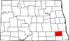 | |
| Townships | ||
| CDPs | ||
| Footnotes | ‡This populated place also has portions in an adjacent county or counties | |
| International | |
|---|---|
| National | |