
Ensign Township, Michigan: Difference between revisions
m update, Replaced: township]] in → township]] of using AWB |
AleXYZ-510 (talk | contribs) 2020 census |
||
| (43 intermediate revisions by 31 users not shown) | |||
| Line 1: | Line 1: | ||
{{Use mdy dates|date=July 2023}} |
|||
{{Infobox Settlement |
|||
{{Infobox settlement |
|||
|official_name = Ensign Township, Michigan |
|||
| |
| official_name = Ensign Township, Michigan |
||
| settlement_type = [[Civil township]] |
|||
|nickname = |
|||
| |
| nickname = |
||
| motto = <!-- Images --> |
|||
| image_skyline = |
|||
| imagesize = |
|||
| image_caption = |
|||
| image_flag = |
|||
| image_seal = <!-- Maps --> |
|||
| pushpin_map = Michigan#USA |
|||
| pushpin_label_position = right<!-- the position of the pushpin label: left, right, top, bottom, none --> |
|||
| pushpin_label = Ensign Township |
|||
| pushpin_map_caption = Location within the state of Michigan |
|||
| pushpin_mapsize = |
|||
| image_map = Ensign Township, MI location2.png |
|||
| mapsize = 250 |
|||
| map_caption = Location within [[Delta County, Michigan|Delta County]] |
|||
<!-- Location -->| subdivision_type = [[List of sovereign states|Country]] |
|||
<!-- Images --> |
|||
| subdivision_name = United States |
|||
|image_skyline = |
|||
| subdivision_type1 = [[U.S. state|State]] |
|||
|imagesize = |
|||
| subdivision_name1 = [[Michigan]] |
|||
|image_caption = |
|||
| subdivision_type2 = [[List of counties in Michigan|County]] |
|||
|image_flag = |
|||
| subdivision_name2 = [[Delta County, Michigan|Delta]] |
|||
|image_seal = |
|||
<!-- |
<!-- Government -->| government_footnotes = |
||
| government_type = |
|||
||pushpin_map =Michigan |
|||
| leader_title = Supervisor |
|||
|pushpin_label_position =left <!-- the position of the pushpin label: left, right, top, bottom, none --> |
|||
| leader_name = John Wolf |
|||
|pushpin_map_caption =Location within the state of Michigan |
|||
| |
| leader_title1 = |
||
| |
| leader_name1 = |
||
| established_title = |
|||
|mapsize = |
|||
| established_date = <!-- Area --> |
|||
|map_caption = |
|||
| |
| unit_pref = Imperial |
||
| |
| area_footnotes = |
||
| |
| area_magnitude = |
||
| area_total_km2 = 170.4 |
|||
| area_land_km2 = 152.7 |
|||
| area_water_km2 = 17.7 |
|||
| area_total_sq_mi = 65.8 |
|||
| area_land_sq_mi = 59.0 |
|||
| area_water_sq_mi = 6.8 |
|||
<!-- Population -->| population_as_of = [[United States Census, 2020|2020]] |
|||
<!-- Location --> |
|||
| population_footnotes = |
|||
|subdivision_type = [[List of countries|Country]] |
|||
| population_total = 746 |
|||
|subdivision_name = [[United States]] |
|||
| population_density_km2 = auto |
|||
|subdivision_type1 = [[Political divisions of the United States|State]] |
|||
| population_density_sq_mi = auto |
|||
|subdivision_name1 = [[Michigan]] |
|||
|subdivision_type2 = [[List of counties in Michigan|County]] |
|||
|subdivision_name2 = [[Delta County, Michigan|Delta]] |
|||
<!-- General information -->| timezone = [[North American Eastern Time Zone|Eastern (EST)]] |
|||
<!-- Government --> |
|||
| |
| utc_offset = -5 |
||
| |
| timezone_DST = EDT |
||
| |
| utc_offset_DST = -4 |
||
| elevation_footnotes = |
|||
|leader_name = |
|||
| |
| elevation_m = 218 |
||
| |
| elevation_ft = 715 |
||
| coordinates = {{coord|45|52|16|N|86|53|39|W|region:US-MI|display=inline,title}} |
|||
|established_title = |
|||
| postal_code_type = [[ZIP Code|ZIP code(s)]] |
|||
|established_date = |
|||
| postal_code = 49878 |
|||
| area_code = [[Area code 906|906]] |
|||
| blank_name = [[Federal Information Processing Standard|FIPS code]] |
|||
| blank_info = 26-26140<ref name="GR2">{{cite web |url=https://www.census.gov |publisher=[[United States Census Bureau]] |access-date=2008-01-31 |title=U.S. Census website }}</ref> |
|||
| blank1_name = [[Geographic Names Information System|GNIS]] feature ID |
|||
| blank1_info = 1626242<ref>{{gnis|1626242}}</ref> |
|||
| website = |
|||
| footnotes = |
|||
}} |
|||
'''Ensign Township''' is a [[civil township]] of [[Delta County, Michigan|Delta County]] in the [[U.S. state]] of [[Michigan]]. The population was 746 at the [[2020 United States census|2020 census]], slightly down from 748 at the [[2010 United States census|2010 census]].<ref>{{Cite web |title=Explore Census Data |url=https://data.census.gov/profile/Ensign_township,_Delta_County,_Michigan?g=060XX00US2604126140 |access-date=2024-05-02 |website=data.census.gov}}</ref> |
|||
==Communities== |
|||
<!-- Area --> |
|||
*'''Maywood''' is an unincorporated community in the township.<ref>{{cite book |title=Land Atlas and Plat Book, Delta County, Michigan 2004-2005 |year=2004–2005 |publisher=Rockford Map Publishers, Inc. |location=Rockford, Illinois|pages=23 |
|||
|unit_pref = Imperial |
|||
}}</ref> |
|||
|area_footnotes = |
|||
==Geography== |
|||
|area_magnitude = |
|||
According to the [[United States Census Bureau]], the township has a total area of {{convert|65.8|sqmi|km2}}, of which {{convert|59.0|sqmi|km2}} is land and {{convert|6.8|sqmi|km2}} (10.37%) is water. |
|||
|area_total_km2 = 170.4 |
|||
|area_land_km2 = 152.7 |
|||
|area_water_km2 = 17.7 |
|||
|area_total_sq_mi = 65.8 |
|||
|area_land_sq_mi = 59.0 |
|||
|area_water_sq_mi = 6.8 |
|||
===Climate=== |
|||
<!-- Population --> |
|||
{| |
|||
|population_as_of = [[United States Census, 2000|2000]] |
|||
|- |
|||
|population_footnotes = |
|||
|{{climate chart |
|||
|population_total = 780 |
|||
| Malman Marsh |
|||
|population_density_km2 = 5.1 |
|||
| -18| -12| 63 |
|||
|population_density_sq_mi = 13.2 |
|||
| -21| -13| 52 |
|||
| -8| -2| 55 |
|||
<!-- General information --> |
|||
| -2| 9| 78 |
|||
|timezone = [[North American Eastern Time Zone|Eastern (EST)]] |
|||
| 6| 13| 63 |
|||
|utc_offset = -5 |
|||
| 12| 16| 91 |
|||
|timezone_DST = EDT |
|||
| 15| 21| 113 |
|||
|utc_offset_DST = -4 |
|||
| 14| 19| 74 |
|||
|elevation_footnotes = |
|||
| 14| 19| 118 |
|||
|elevation_m = 218 |
|||
| 5| 8| 118 |
|||
|elevation_ft = 715 |
|||
| 0| 7| 104 |
|||
|latd = 45 |latm = 52 |lats = 16 |latNS = N |
|||
| -5| 0| 64 |
|||
|longd = 86 |longm = 53 |longs = 39 |longEW = W |
|||
|float=left |
|||
|clear=left |
|||
<!-- Area/postal codes & others --> |
|||
|source = <ref name = "nasa">{{Cite web|url= http://neo.sci.gsfc.nasa.gov/dataset_index.php|title= NASA Earth Observations Data Set Index|access-date= 30 January 2016|publisher= NASA|archive-date= May 11, 2020|archive-url= https://web.archive.org/web/20200511075542/https://neo.sci.gsfc.nasa.gov/dataset_index.php|url-status= dead}}</ref> |
|||
|postal_code_type = |
|||
|postal_code = |
|||
|area_code = |
|||
|blank_name = [[Federal Information Processing Standard|FIPS code]] |
|||
|blank_info = 26-26140{{GR|2}} |
|||
|blank1_name = [[Geographic Names Information System|GNIS]] feature ID |
|||
|blank1_info = 1626242<ref>{{gnis|1626242}}</ref> |
|||
|website = |
|||
|footnotes = |
|||
}} |
}} |
||
|} |
|||
'''Ensign Township''' is a [[civil township]] of [[Delta County, Michigan|Delta County]] in the [[U.S. state]] of [[Michigan]]. The population was 780 at the [[United States Census, 2000|2000 census]]. Fire coverage is provided by the Ensign Township Fire Department which is the only department in Delta county to possess Compressed Air Foam. This Fire Department also performs Ice-Rescue operations with a fully set up trailer, Argo 8x8 a.t.v. with backboard, and 12 Mustang ice rescue suits. EMS coverage is provided by Masonville EMS which covers Masonville, Ensign, and Bay De Noc townships. |
|||
==Geography== |
|||
According to the [[United States Census Bureau]], the township has a total area of 65.8 [[square mile]]s (170.4 [[km²]]), of which, 59.0 square miles (152.7 km²) of it is land and 6.8 square miles (17.7 km²) of it (10.37%) is water. This area is also very famous for its fires due to the vast Jackpine forests know as the "plains" because of its sandy soils and western like fire fuels. It was home to the famous "Stockyard Fire" which jumped highway U.S. 2 and consumed more than 1200 acres in less than 1 hour due to a fast moving crown fire. |
|||
==Demographics== |
==Demographics== |
||
As of the [[census]] |
As of the [[census]]<ref name="GR2" /> of 2000, there were 780 people, 327 households, and 236 families residing in the township. The population density was {{convert|13.2|PD/sqmi|PD/km2|sp=us|adj=off}}. There were 532 housing units at an average density of {{convert|9.0|/sqmi|/km2|sp=us|adj=off}}. The racial makeup of the township was 94.62% [[White (U.S. Census)|White]], 0.38% [[African American (U.S. Census)|African American]], 3.85% [[Native American (U.S. Census)|Native American]], and 1.15% from two or more races. |
||
There were 327 households out of which 27.8% had children under the age of 18 living with them, 64.5% were [[Marriage|married couples]] living together, 4.6% had a female householder with no husband present, and 27.8% were non-families. 23.5% of all households were made up of individuals and 7.6% had someone living alone who was 65 years of age or older. The average household size was 2.39 and the average family size was 2.82. |
There were 327 households, out of which 27.8% had children under the age of 18 living with them, 64.5% were [[Marriage|married couples]] living together, 4.6% had a female householder with no husband present, and 27.8% were non-families. 23.5% of all households were made up of individuals, and 7.6% had someone living alone who was 65 years of age or older. The average household size was 2.39 and the average family size was 2.82. |
||
In the township the population was spread out with 22.8% under the age of 18, 4.5% from 18 to 24, 25.0% from 25 to 44, 29.6% from 45 to 64, and 18.1% who were 65 years of age or older. The median age was 44 years. For every 100 females there were 107.4 males. For every 100 females age 18 and over, there were 109.8 males. |
In the township the population was spread out, with 22.8% under the age of 18, 4.5% from 18 to 24, 25.0% from 25 to 44, 29.6% from 45 to 64, and 18.1% who were 65 years of age or older. The median age was 44 years. For every 100 females, there were 107.4 males. For every 100 females age 18 and over, there were 109.8 males. |
||
The median income for a household in the township was $39,375, and the median income for a family was $48,906. Males had a median income of $38,438 versus $28,333 for females. The [[per capita income]] for the township was $25,546. About 2.1% of families and 4.1% of the population were below the [[poverty line]], including 3.6% of those under age 18 and 4.0% of those age 65 or over. |
The median income for a household in the township was $39,375, and the median income for a family was $48,906. Males had a median income of $38,438 versus $28,333 for females. The [[per capita income]] for the township was $25,546. About 2.1% of families and 4.1% of the population were below the [[poverty line]], including 3.6% of those under age 18 and 4.0% of those age 65 or over. |
||
Fire coverage is provided by the Ensign Township Fire Department. EMS coverage is provided by Masonville EMS. |
|||
==References== |
==References== |
||
| Line 102: | Line 116: | ||
{{Delta County, Michigan}} |
{{Delta County, Michigan}} |
||
{{authority control}} |
|||
[[Category:Delta County, Michigan]] |
|||
[[Category:Townships in Delta County, Michigan]] |
|||
[[Category:Townships in Michigan]] |
[[Category:Townships in Michigan]] |
||
[[Category:Michigan populated places on Lake Michigan]] |
|||
Latest revision as of 06:01, 2 May 2024
Ensign Township, Michigan | |
|---|---|
 Location within Delta County | |
 Ensign Township Location within the state of Michigan  Ensign Township Ensign Township (the United States) | |
| Coordinates: 45°52′16″N 86°53′39″W / 45.87111°N 86.89417°W | |
| Land | Vereinigte Staaten |
| State | Michigan |
| County | Delta |
| Regierung | |
| • Supervisor | John Wolf |
| Area | |
| • Total | 65.8 sq mi (170.4 km2) |
| • Land | 59.0 sq mi (152.7 km2) |
| • Water | 6.8 sq mi (17.7 km2) |
| Elevation | 715 ft (218 m) |
| Population (2020) | |
| • Total | 746 |
| • Density | 11/sq mi (4.4/km2) |
| Time zone | UTC-5 (Eastern (EST)) |
| • Summer (DST) | UTC-4 (EDT) |
| ZIP code(s) | 49878 |
| Area code | 906 |
| FIPS code | 26-26140[1] |
| GNIS feature ID | 1626242[2] |
Ensign Township is a civil township of Delta County in the U.S. state of Michigan. The population was 746 at the 2020 census, slightly down from 748 at the 2010 census.[3]
Communities
[edit]- Maywood is an unincorporated community in the township.[4]
Geography
[edit]According to the United States Census Bureau, the township has a total area of 65.8 square miles (170 km2), of which 59.0 square miles (153 km2) is land and 6.8 square miles (18 km2) (10.37%) is water.
Climate
[edit]
| ||||||||||||||||||||||||||||||||||||||||||||||||||||||||||||||||||||||||||||||||||||||||||||||||||||||||||||||||||||||||||||
Demographics
[edit]As of the census[1] of 2000, there were 780 people, 327 households, and 236 families residing in the township. The population density was 13.2 inhabitants per square mile (5.1/km2). There were 532 housing units at an average density of 9.0 per square mile (3.5/km2). The racial makeup of the township was 94.62% White, 0.38% African American, 3.85% Native American, and 1.15% from two or more races.
There were 327 households, out of which 27.8% had children under the age of 18 living with them, 64.5% were married couples living together, 4.6% had a female householder with no husband present, and 27.8% were non-families. 23.5% of all households were made up of individuals, and 7.6% had someone living alone who was 65 years of age or older. The average household size was 2.39 and the average family size was 2.82.
In the township the population was spread out, with 22.8% under the age of 18, 4.5% from 18 to 24, 25.0% from 25 to 44, 29.6% from 45 to 64, and 18.1% who were 65 years of age or older. The median age was 44 years. For every 100 females, there were 107.4 males. For every 100 females age 18 and over, there were 109.8 males.
The median income for a household in the township was $39,375, and the median income for a family was $48,906. Males had a median income of $38,438 versus $28,333 for females. The per capita income for the township was $25,546. About 2.1% of families and 4.1% of the population were below the poverty line, including 3.6% of those under age 18 and 4.0% of those age 65 or over.
Fire coverage is provided by the Ensign Township Fire Department. EMS coverage is provided by Masonville EMS.
References
[edit]- ^ a b "U.S. Census website". United States Census Bureau. Retrieved January 31, 2008.
- ^ U.S. Geological Survey Geographic Names Information System: Ensign Township, Michigan
- ^ "Explore Census Data". data.census.gov. Retrieved May 2, 2024.
- ^ Land Atlas and Plat Book, Delta County, Michigan 2004-2005. Rockford, Illinois: Rockford Map Publishers, Inc. 2004–2005. p. 23.
- ^ "NASA Earth Observations Data Set Index". NASA. Archived from the original on May 11, 2020. Retrieved January 30, 2016.
Municipalities and communities of Delta County, Michigan, United States | ||
|---|---|---|
| Cities | 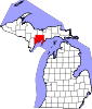 | |
| Village | ||
| Townships | ||
| CDPs | ||
| Other communities | ||
| Ghost town | ||
| Indian reservations | ||
| Footnotes | ‡This populated place also has portions in an adjacent county or counties | |