
Weber County, Utah: Difference between revisions
(1) I moved up the citation and link to the "Weber County" article in the online Utah History Encyclopedia (1994) from the "External links" section to the new "Further reading" section. (2) I also reformatted the citation so that the year of publication is listed first and I added links to an original copy of the article, a newer archived copy of the article (the last one was from 2004) and to the Encyclopedia's home page / table of contents. |
|||
| (37 intermediate revisions by 29 users not shown) | |||
| Line 1: | Line 1: | ||
{{Short description|County in Utah, United States}} |
|||
{{Use mdy dates|date=April 2019}} |
|||
{{Use mdy dates|date=April 2024}} |
|||
{{Infobox U.S. county |
{{Infobox U.S. county |
||
| county = Weber County |
| county = Weber County |
||
| state = Utah |
| state = Utah |
||
| ex image = Old Post Office Ogden Utah.jpeg |
| ex image = Old Post Office Ogden Utah.jpeg |
||
| ex image size = 220px |
| ex image size = 220px |
||
| ex image cap = [[United States Post Office and Courthouse (Ogden, Utah)|Historic United States Post Office and Courthouse]] in [[Ogden, Utah]]. |
| ex image cap = [[United States Post Office and Courthouse (Ogden, Utah)|Historic United States Post Office and Courthouse]] in [[Ogden, Utah]]. |
||
| seal = |
| seal = |
||
| founded = January 31, 1850 (created)<br/>March 3, 1852 (organized) |
| founded = January 31, 1850 (created)<br/>March 3, 1852 (organized) |
||
| seat wl = Ogden |
| seat wl = Ogden |
||
| largest city wl = Ogden |
| largest city wl = Ogden |
||
| area_total_sq_mi = 659 |
| area_total_sq_mi = 659 |
||
| area_land_sq_mi = 576 |
| area_land_sq_mi = 576 |
||
| area_water_sq_mi = 83 |
| area_water_sq_mi = 83 |
||
| area percentage = 13 |
| area percentage = 13 |
||
| population_as_of = 2020 |
| population_as_of = 2020 |
||
| population_total = 262223 |
| population_total = 262223 |
||
| pop_est_as_of = |
| pop_est_as_of = 2021 |
||
| population_est = |
| population_est = 267066 |
||
| population_density_sq_mi = auto |
| population_density_sq_mi = auto |
||
| time zone = Mountain |
| time zone = Mountain |
||
| named for = |
| named for = Trapper John Weber |
||
| web = http://www. |
| web = http://www.webercountyutah.gov |
||
| district = 1st |
| district = 1st |
||
}} |
}} |
||
'''Weber County''' ({{IPAc-en|ˈ|w|iː|b|ər}} {{respell|WEE|bər}}) is a [[County (United States)|county]] in the [[U.S. state]] of [[Utah]]. As of the [[ |
'''Weber County''' ({{IPAc-en|ˈ|w|iː|b|ər}} {{respell|WEE|bər}}) is a [[County (United States)|county]] in the [[U.S. state]] of [[Utah]]. As of the [[2020 United States Census|2020 census]], the population was 262,223,<ref name="QuickFacts">{{cite web|title=State & County QuickFacts|url=https://www.census.gov/quickfacts/fact/table/webercountyutah/PST120221|publisher=United States Census Bureau|access-date=August 16, 2022}}</ref> making it Utah's fourth-most populous county. Its [[county seat]] and largest city is [[Ogden, Utah|Ogden]],<ref name="GR6">{{cite web|url=http://www.naco.org/Counties/Pages/FindACounty.aspx|access-date=June 7, 2011|title=Find a County|publisher=National Association of Counties}}</ref> the home of [[Weber State University]]. The county was named after a fur trapper John Weber. |
||
Weber County is part of the Ogden-[[Clearfield, Utah|Clearfield]], UT [[Ogden-Clearfield metropolitan area|Metropolitan Statistical Area]] as well as the [[Salt Lake City]]-[[Provo, Utah|Provo]]-[[ |
Weber County is part of the Ogden-[[Clearfield, Utah|Clearfield]], UT [[Ogden-Clearfield metropolitan area|Metropolitan Statistical Area]] as well as the [[Salt Lake City]]-[[Provo, Utah|Provo]]-[[Ogden, Utah|Ogden]], UT [[Salt Lake City metropolitan area|Combined Statistical Area]]. |
||
==History== |
==History== |
||
The Weber Valley was visited by many trappers seeking beavers and muskrats along its streams. One of the first on record reached the area in 1824, traveling from [[Fort Bridger]]. He reported that the [[Bear River (Great Salt Lake)|Bear River]] flowed into a salt bay. [[Peter Skene Ogden]] passed through in 1826, representing the [[Hudson's Bay Company]]. He traded in this area for several years, near present-day North Ogden. [[John C. Frémont]] explored the Weber Valley in 1843 |
The Weber Valley was visited by many trappers seeking beavers and muskrats along its streams. One of the first on record reached the area in 1824, traveling from [[Fort Bridger]]. He reported that the [[Bear River (Great Salt Lake)|Bear River]] flowed into a salt bay. [[Peter Skene Ogden]] passed through in 1826, representing the [[Hudson's Bay Company]]. He traded in this area for several years, near present-day North Ogden. [[John C. Frémont]] explored the Weber Valley in 1843 and made maps of the area. The Fremont reports encouraged readers to seek their fortunes in the western frontier. [[Miles Goodyear]] was a fur trapper who constructed a way station on the [[Weber River]] in 1845. In 1847 he sold it to incoming [[Mormon pioneers]]. James Brown purchased and changed the site's name to Brownsville (later changed to Ogden).<ref>[http://www.webercountyutah.gov/Parks/fortb/history.php History - Buenaventura Park (accessed March 31, 2019)]</ref> |
||
After the Mormon pioneers began filling out into the future state of Utah, the fledgling government (as of 1849 known as [[State of Deseret]]) began a system of government. On January 31, 1850 the legislature provided for the creation of six counties to generally cover the area, named in this order: |
After the Mormon pioneers began filling out into the future state of Utah, the fledgling government (as of 1849 known as [[State of Deseret]]) began a system of government. On January 31, 1850, the legislature provided for the creation of six counties to generally cover the area, named in this order: |
||
* Weber (with Ogden as county seat) |
* Weber (with Ogden as county seat) |
||
* Great Salt Lake |
* Great Salt Lake |
||
| Line 40: | Line 41: | ||
* Little Salt Lake<ref>[http://www.riversimulator.org/Resources/History/UtahCounties/HistoryOfWeberCounty1996RobertsSadler.pdf Richard C. Roberts & Richard W. Sadler, A History of Weber County (1997). Accessed 31 March 2019]</ref> |
* Little Salt Lake<ref>[http://www.riversimulator.org/Resources/History/UtahCounties/HistoryOfWeberCounty1996RobertsSadler.pdf Richard C. Roberts & Richard W. Sadler, A History of Weber County (1997). Accessed 31 March 2019]</ref> |
||
The county boundaries were better |
The county boundaries were better defined by the 1852 [[Utah Territory]] legislature. The borders were adjusted by subsequent acts in 1855, 1856, and 1862. The creation of [[Nevada Territory]] in 1862 also administratively reduced the county's territory significantly since its 1852 description had it running to the Sierra Nevada mountains in central California. A final adjustment in 1880 concerning the various lands in the [[Great Salt Lake]] area brought the county's borders to their present configuration.<ref>{{cite web|url=http://publications.newberry.org/ahcbp/documents/UT_Individual_County_Chronologies.htm|title=Utah: Individual County Chronologies|website=Utah Atlas of Historical County Boundaries|publisher=[[Newberry Library|The Newberry Library]]|date=2008|access-date=March 31, 2019|archive-date=March 6, 2016|archive-url=https://web.archive.org/web/20160306153326/http://publications.newberry.org/ahcbp/documents/UT_Individual_County_Chronologies.htm|url-status=dead}}</ref> |
||
As of the 1852 description, the original Weber County stretched from California in the west, to the Oregon boundary on the north, to a point in middle [[Davis County, Utah|Davis County]] in the south.<ref>{{cite book|first=Richard Swainson|last=Fisher|title=A new and complete statistical gazetteer of the United States of America| publisher=J.H. Colton Co.|location=New York|year=1855|page=[https://archive.org/details/newcompletestati01fish/page/870 870]|url=https://archive.org/details/newcompletestati01fish|access-date=February 5, 2011}}</ref> As Nevada and the State of Utah evolved, Weber County was trimmed so that it now occupies a stretch of the [[Wasatch Front]], part of the eastern shores of [[Great Salt Lake]], and much of the rugged [[Wasatch Range|Wasatch Mountains]]. |
As of the 1852 description, the original Weber County stretched from California in the west, to the Oregon boundary on the north, to a point in the middle [[Davis County, Utah|Davis County]] in the south.<ref>{{cite book|first=Richard Swainson|last=Fisher|title=A new and complete statistical gazetteer of the United States of America| publisher=J.H. Colton Co.|location=New York|year=1855|page=[https://archive.org/details/newcompletestati01fish/page/870 870]|url=https://archive.org/details/newcompletestati01fish|access-date=February 5, 2011}}</ref> As Nevada and the State of Utah evolved, Weber County was trimmed so that it now occupies a stretch of the [[Wasatch Front]], part of the eastern shores of [[Great Salt Lake]], and much of the rugged [[Wasatch Range|Wasatch Mountains]]. |
||
==Geography== |
==Geography== |
||
The county extends from high in the [[Wasatch Range]] in the east into a portion of the [[Great Salt Lake]] to the west where the county's elongated point exists. The Weber and [[Ogden River|Ogden rivers]] and their [[tributary|tributaries]] run through its valleys.<ref name=WCU>[https://www.google.com/maps/place/Weber+County,+UT/@41.2412973,-112.1195489,11.75z/data=!4m5!3m4!1s0x87530c0b357d8a97:0x6305f2940ccb94f4!8m2!3d41.2602635!4d-111.9522491 ''Weber County UT'' |
The county extends from high in the [[Wasatch Range]] in the east into a portion of the [[Great Salt Lake]] to the west, where the county's elongated point exists. The Weber and [[Ogden River|Ogden rivers]] and their [[tributary|tributaries]] run through its valleys.<ref name=WCU>[https://www.google.com/maps/place/Weber+County,+UT/@41.2412973,-112.1195489,11.75z/data=!4m5!3m4!1s0x87530c0b357d8a97:0x6305f2940ccb94f4!8m2!3d41.2602635!4d-111.9522491 ''Weber County UT'' Google Maps (accessed 31 March 2019)]</ref> The Weber County Surveyor's office divides the county into two regions, the "Lower Valley" and the "Upper Valley", divided by the ridge of the Wasatch front range south through the county. Lower Valley, adjacent to the Lake, is the county's more populous part. The Upper Valley consists mostly of the [[Ogden Valley]], the watershed of the [[Ogden River]]. The county's highest elevation is [[Willard Peak]] in the [[Wasatch Mountains]], at {{convert|9,763|ft|m|abbr=on}} ASL.<ref>{{Cite web |url=https://www.peakbagger.com/list.aspx?lid=13209 |title=Utah County High Points/Weber County. Peakbagger.com (accessed 31 March 2019) |access-date=March 31, 2019 |archive-url=https://web.archive.org/web/20190327090116/https://www.peakbagger.com/list.aspx?lid=13209 |archive-date=March 27, 2019 |url-status=dead }}</ref> The county has an area of {{convert|659|sqmi}}, of which {{convert|576|sqmi}} is land and {{convert|83|sqmi}} (13%) is water.<ref>{{cite web|url=http://www2.census.gov/geo/docs/maps-data/data/gazetteer/counties_list_49.txt|publisher=US Census Bureau|access-date=June 26, 2015|date=August 22, 2012|title=2010 Census Gazetteer Files}}</ref> It is the second-smallest county in Utah by land area and third-smallest by total area. |
||
===Major highways=== |
===Major highways=== |
||
| Line 133: | Line 134: | ||
|2010= 231236 |
|2010= 231236 |
||
|2020= 262223 |
|2020= 262223 |
||
|estyear= |
|estyear= 2021 |
||
|estimate= |
|estimate= 267066 |
||
|estref= <ref name="QuickFacts"/> |
|||
|estref=<ref name="USCensusEst2019">{{cite web|url=https://www2.census.gov/programs-surveys/popest/tables/2010-2019/counties/totals/|title=Population and Housing Unit Estimates|access-date=March 26, 2020}}</ref> |
|||
|align-fn=center |
|align-fn=center |
||
|footnote= |
|footnote=United States Census Bureau<ref>{{cite web|url=https://www.census.gov/programs-surveys/decennial-census.html|title=US Decennial Census|publisher=US Census Bureau|access-date=June 26, 2015}}</ref><br/>1790–1960<ref>{{cite web|url=http://mapserver.lib.virginia.edu|title=Historical Census Browser|publisher=University of Virginia Library|access-date=June 26, 2015}}</ref> 1900–1990<ref>{{cite web|url=https://www.census.gov/population/cencounts/ut190090.txt|title=Population of Counties by Decennial Census: 1900 to 1990|publisher=US Census Bureau|editor-last=Forstall|editor-first=Richard L.|date=March 27, 1995|access-date=June 26, 2015}}</ref><br/>1990–2000<ref>{{cite web|url=https://www.census.gov/population/www/cen2000/briefs/phc-t4/tables/tab02.pdf|title=Census 2000 PHC-T-4. Ranking Tables for Counties: 1990 and 2000|publisher=US Census Bureau|date=April 2, 2001|access-date=June 26, 2015 |
||
}}</ref><br />2010–2020, 2021<ref name="QuickFacts"/> |
|||
}} |
}} |
||
===2010 census=== |
===2010 census=== |
||
As of the [[2010 United States Census]], there were 231,236 people in the county, organized into 78,784 households and 57,867 families.<ref name=":0">{{Cite web|url=https://www.census.gov|title=U.S. Census website|last=Bureau|first=U. S. Census|website=census.gov|language=en|access-date= |
As of the [[2010 United States Census]], there were 231,236 people in the county, organized into 78,784 households and 57,867 families.<ref name=":0">{{Cite web|url=https://www.census.gov|title=U.S. Census website|last=Bureau|first=U. S. Census|website=census.gov|language=en|access-date=April 24, 2019}}</ref> The [[population density]] was {{convert|351|/mi2|/km2|disp=preunit|people |people|}}. There were 86,187 housing units at an average density of {{convert|131|/mi2|/km2|disp=preunit|units |units|}}.<ref name=":0" /> The racial makeup of the county was 85.2% [[Race (U.S. census)|White]], 1.4% [[Race (U.S. census)|Black]] or [[Race (U.S. census)|African American]], 1.3% [[Race (U.S. census)|Asian]], 0.8% [[Race (U.S. census)|Native American]], 0.3% [[Race (U.S. census)|Pacific Islander]], 6.59% from [[race (U.S. census)|other races]], and 3.0% from two or more races. 16.7% of the population were [[Race (U.S. census)|Hispanic]] or [[Race (U.S. census)|Latino]] of any race.<ref name=":0" /> |
||
In the [[2000 United States Census]], there were 196,533 people in the county, organized into 65,698 households and 49,536 families. The [[population density]] was 341/ |
In the [[2000 United States Census]], there were 196,533 people in the county, organized into 65,698 households and 49,536 families. The [[population density]] was {{convert|341|/mi2|/km2|disp=preunit|people |people|}}. There were 70,454 housing units at an average density of {{convert|122|/mi2|/km2|disp=preunit|units |units|}}. The racial makeup of the county was 87.69% [[Race (U.S. census)|White]], 1.40% [[Race (U.S. census)|Black]] or [[Race (U.S. census)|African American]], 1.28% [[Race (U.S. census)|Asian]], 0.77% [[Race (U.S. census)|Native American]], 0.16% [[Race (U.S. census)|Pacific Islander]], 6.59% from [[Race (U.S. census)|other races]], and 2.12% from two or more races. 12.65% of the population were [[Race (U.S. census)|Hispanic]] or [[Race (U.S. census)|Latino]] of any race. |
||
By 2005 80.4% of the population was non-Hispanic whites. |
By 2005 80.4% of the population was non-Hispanic whites. 1.5% were African-Americans, while 0.9% were Native Americans. Asians were 1.4% of the population. Latinos were 15.2% of the county population. |
||
There were 78,748 households, |
There were 78,748 households, of which 36.8% had children under 18 living with them, 56.7% were [[Marriage|married couples]] living together, 11.5% had a female householder with no husband present, and 26.5% were non-families. 21.1% of all households had an individual who was 65 years of age or older, and 7.3% had someone living alone who was 65 years of age or older. The average household size was 2.90, and the average family size was 3.40.<ref name=":0" /> |
||
===Ages=== |
===Ages=== |
||
| Line 185: | Line 187: | ||
|- |
|- |
||
|35 to 39 years |
|35 to 39 years |
||
|14, |
|14,559 |
||
|6.3 |
|6.3 |
||
|- |
|- |
||
| Line 212: | Line 214: | ||
|10.1 |
|10.1 |
||
|} |
|} |
||
The median age was 30.7 years. For every 100 females, there were 100.7 males. For every 100 females |
The median age was 30.7 years. For every 100 females, there were 100.7 males. For every 100 females aged 18 and over, there were 99.0 males.<ref name=":0" /> |
||
===Income and employment=== |
===Income and employment=== |
||
As of the 2010 census, |
As of the 2010 census, the median income for a household in the county was $62,036, and the median income for a family was $71,359. Males had a median income of $49,081 versus $34,954 for females. The [[per capita income]] for the county was $25,275. 12.1% of the population and 8.7% of families were below the [[poverty line]]. Out of the total population, 15.4% of those under 18 and 8.5% of those 65 and older lived below the poverty line.<ref name=":0" /> |
||
The 2000 census found |
The 2000 census found the median income for a household in the county was $44,014, and the median income for a family was $49,724. Males had a median income of $36,239 versus $24,719 for females. The [[per capita income]] for the county was $18,246. 9.30% of the population and 6.90% of families were below the [[poverty line]]. Out of the total population, 11.10% of those under 18 and 5.50% of those 65 and older lived below the poverty line. |
||
In the 2010 census, 67.0% of people over 16 were in labor and 33.0% were not in labor. The unemployment rate was 3.2%.<ref name=":0" /> |
In the 2010 census, 67.0% of people over 16 were in labor, and 33.0% were not in labor. The unemployment rate was 3.2%.<ref name=":0" /> |
||
===Ancestry=== |
===Ancestry=== |
||
| Line 235: | Line 237: | ||
* Welsh (1.9%) |
* Welsh (1.9%) |
||
* Norwegian (1.9%) |
* Norwegian (1.9%) |
||
==Politics and government== |
|||
Like most of Utah, Weber County voters usually vote Republican. In no national election since 1964 has the county selected the Democratic Party candidate. |
|||
{| class="wikitable" |
|||
|+State elected offices |
|||
! colspan="2" style="text-align:center; vertical-align:bottom;" |Position |
|||
!District |
|||
! style="text-align:center;" |Name |
|||
! valign="bottom" |Affiliation |
|||
! style="vertical-align:bottom; text-align:center;" |First elected |
|||
|- |
|||
| style="background-color:{{party color|Republican Party (United States)}}" | |
|||
|[[Utah Senate|Senate]] |
|||
|18 |
|||
| style="text-align:center;" |[[F. Ann Millner]] |
|||
| style="text-align:center;" |[[Republican Party (United States)|Republican]] |
|||
| style="text-align:center;" |2014<ref>{{Cite web|title=Senator Millner Utah Senate|url=https://senate.utah.gov/sen/MILLNA/|access-date=November 16, 2021|website=senate.utah.gov}}</ref> |
|||
|- |
|||
| style="background-color:{{party color|Republican Party (United States)}}" | |
|||
|[[Utah Senate|Senate]] |
|||
|19 |
|||
| style="text-align:center;" |[[John D. Johnson (politician)|John D. Johnson]] |
|||
| style="text-align:center;" |[[Republican Party (United States)|Republican]] |
|||
| style="text-align:center;" |2020<ref>{{Cite web|title=Senator Johnson Utah Senate|url=https://senate.utah.gov/sen/JOHNSJD/|access-date=November 16, 2021|website=senate.utah.gov}}</ref> |
|||
|- |
|||
| style="background-color:{{party color|Republican Party (United States)}}" | |
|||
|[[Utah Senate|Senate]] |
|||
|20 |
|||
| style="text-align:center;" |[[D. Gregg Buxton]] |
|||
| style="text-align:center;" |[[Republican Party (United States)|Republican]] |
|||
| style="text-align:center;" |2016<ref>{{Cite web|title=Senator Buxton Utah Senate|url=https://senate.utah.gov/sen/BUXTODG/|access-date=November 16, 2021|website=senate.utah.gov}}</ref> |
|||
|- |
|||
| style="background-color:{{party color|Republican Party (United States)}}" | |
|||
|[[Utah House of Representatives|House of Representatives]] |
|||
|7 |
|||
| style="text-align:center;" |[[Ryan Wilcox]] |
|||
| style="text-align:center;" |[[Republican Party (United States)|Republican]] |
|||
| style="text-align:center;" |2020<ref>{{Cite web|title=Rep. Wilcox, Ryan D.|url=https://house.utah.gov/rep/WILCORD/|access-date=November 16, 2021|website=Utah House of Representatives|language=en-US}}</ref> |
|||
|- |
|||
| style="background-color:{{party color|Republican Party (United States)}}" | |
|||
|[[Utah House of Representatives|House of Representatives]] |
|||
|8 |
|||
| style="text-align:center;" |[[Steve Waldrip]] |
|||
| style="text-align:center;" |[[Republican Party (United States)|Republican]] |
|||
| style="text-align:center;" |2018<ref>{{Cite web|title=Rep. Waldrip, Steve|url=https://house.utah.gov/rep/WALDRS/|access-date=November 16, 2021|website=Utah House of Representatives|language=en-US}}</ref> |
|||
|- |
|||
| style="background-color:{{party color|Republican Party (United States)}}" | |
|||
|[[Utah House of Representatives|House of Representatives]] |
|||
|9 |
|||
| style="text-align:center;" |[[Cal Musselman]] |
|||
| style="text-align:center;" |[[Republican Party (United States)|Republican]] |
|||
| style="text-align:center;" |2018<ref>{{Cite web|title=Rep. Musselman, Calvin R.|url=https://house.utah.gov/rep/MUSSECR/|access-date=November 16, 2021|website=Utah House of Representatives|language=en-US}}</ref> |
|||
|- |
|||
| style="background-color:{{party color|Democratic Party (United States)}}" | |
|||
|[[Utah House of Representatives|House of Representatives]] |
|||
|10 |
|||
| style="text-align:center;" |[[Rosemary Lesser]] |
|||
| style="text-align:center;" |[[Democratic Party (United States)|Democrat]] |
|||
| style="text-align:center;" |2021<ref>{{Cite web|title=Rep. Lesser, Rosemary T.|url=https://house.utah.gov/rep/LESSER/|access-date=November 16, 2021|website=Utah House of Representatives|language=en-US}}</ref> |
|||
|- |
|||
| style="background-color:{{party color|Republican Party (United States)}}" | |
|||
|[[Utah House of Representatives|House of Representatives]] |
|||
|11 |
|||
| style="text-align:center;" |[[Kelly Miles]] |
|||
| style="text-align:center;" |[[Republican Party (United States)|Republican]] |
|||
| style="text-align:center;" |2016<ref>{{Cite web|title=Rep. Miles, Kelly B.|url=https://house.utah.gov/rep/MILESKB/|access-date=November 16, 2021|website=Utah House of Representatives|language=en-US}}</ref> |
|||
|- |
|||
| style="background-color:{{party color|Republican Party (United States)}}" | |
|||
|[[Utah House of Representatives|House of Representatives]] |
|||
|12 |
|||
| style="text-align:center;" |[[Mike Schultz (politician)|Mike Schultz]] |
|||
| style="text-align:center;" |[[Republican Party (United States)|Republican]] |
|||
| style="text-align:center;" |2014<ref>{{Cite web|title=Rep. Schultz, Mike|url=https://house.utah.gov/rep/SCHULM/|access-date=November 16, 2021|website=Utah House of Representatives|language=en-US}}</ref> |
|||
|- |
|||
| style="background-color:{{party color|Republican Party (United States)}}" | |
|||
|[[Utah House of Representatives|House of Representatives]] |
|||
|29 |
|||
| style="text-align:center;" |[[Matthew Gwynn]] |
|||
| style="text-align:center;" |[[Republican Party (United States)|Republican]] |
|||
| style="text-align:center;" |2020<ref>{{Cite web|title=Rep. Gwynn, Matthew|url=https://house.utah.gov/rep/GWYNNM/|access-date=November 17, 2021|website=Utah House of Representatives|language=en-US}}</ref> |
|||
|- |
|||
| style="background-color:lightgrey" | |
|||
|Board of Education |
|||
|1 |
|||
| style="text-align:center;" |Jennie Earl |
|||
| style="text-align:center;" |Nonpartisan |
|||
| style="text-align:center;" |2018<ref>{{Cite web|title=Jennie Earl|url=https://www.schools.utah.gov/board/members/utah/jennieearl|access-date=November 16, 2021|website=www.schools.utah.gov}}</ref> |
|||
|- |
|||
| style="background-color:lightgrey" | |
|||
|Board of Education |
|||
|2 |
|||
| style="text-align:center;" |Scott Hansen |
|||
| style="text-align:center;" |Nonpartisan |
|||
| style="text-align:center;" |2018<ref>{{Cite web|title=Scott Hansen|url=https://www.schools.utah.gov/board/members/utah/scotthansen|access-date=November 16, 2021|website=www.schools.utah.gov}}</ref> |
|||
|- |
|||
| style="background-color:{{party color|Republican Party (United States)}}" | |
|||
|Board of Education |
|||
|4 |
|||
| style="text-align:center;" |Brent Strate |
|||
| style="text-align:center;" |[[Republican Party (United States)|Republican]] |
|||
| style="text-align:center;" |2020<ref>{{Cite web|title=Brent Strate|url=https://www.schools.utah.gov/board/members/utah/brentstrate|access-date=November 16, 2021|website=www.schools.utah.gov}}</ref> |
|||
|- |
|||
|} |
|||
{{PresHead|place=Weber County, Utah|source=<ref>{{cite web|url=http://uselectionatlas.org/RESULTS|title=Atlas of US Presidential Elections|last=Leip|first=David|website=uselectionatlas.org|access-date=March 31, 2018}}</ref>}} |
|||
<!-- PresRow should be {{PresRow|Year|Winning party|GOP vote #|Dem vote #|3rd party vote #|State}} --> |
|||
{{PresRow|2020|Republican|65,949|40,695|6,005|Utah}} |
|||
{{PresRow|2016|Republican|40,235|23,131|22,640|Utah}} |
|||
{{PresRow|2012|Republican|54,224|19,841|2,225|Utah}} |
|||
{{PresRow|2008|Republican|45,885|25,666|2,471|Utah}} |
|||
{{PresRow|2004|Republican|51,199|19,862|1,630|Utah}} |
|||
{{PresRow|2000|Republican|39,254|19,890|3,598|Utah}} |
|||
{{PresRow|1996|Republican|27,443|21,404|7,395|Utah}} |
|||
{{PresRow|1992|Republican|26,812|17,795|23,609|Utah}} |
|||
{{PresRow|1988|Republican|39,676|21,431|911|Utah}} |
|||
{{PresRow|1984|Republican|44,590|18,346|398|Utah}} |
|||
{{PresRow|1980|Republican|43,807|15,404|3,388|Utah}} |
|||
{{PresRow|1976|Republican|34,811|23,111|1,762|Utah}} |
|||
{{PresRow|1972|Republican|37,753|14,503|3,078|Utah}} |
|||
{{PresRow|1968|Republican|27,034|20,465|3,683|Utah}} |
|||
{{PresRow|1964|Democratic|20,206|29,666|0|Utah}} |
|||
{{PresRow|1960|Democratic|22,293|24,239|31|Utah}} |
|||
{{PresRow|1956|Republican|22,542|17,747|0|Utah}} |
|||
{{PresRow|1952|Republican|20,692|19,795|0|Utah}} |
|||
{{PresRow|1948|Democratic|12,445|20,861|253|Utah}} |
|||
{{PresRow|1944|Democratic|9,518|19,639|48|Utah}} |
|||
{{PresRow|1940|Democratic|7,946|18,037|24|Utah}} |
|||
{{PresRow|1936|Democratic|4,989|17,594|243|Utah}} |
|||
{{PresRow|1932|Democratic|8,019|11,541|989|Utah}} |
|||
{{PresRow|1928|Republican|9,934|8,361|173|Utah}} |
|||
{{PresRow|1924|Republican|7,382|3,970|5,579|Utah}} |
|||
{{PresRow|1920|Republican|7,122|5,239|1,684|Utah}} |
|||
{{PresRow|1916|Democratic|4,720|8,139|454|Utah}} |
|||
{{PresRow|1912|Progressive|3,171|2,986|4,661|Utah}} |
|||
{{PresRow|1908|Republican|5,881|3,965|644|Utah}} |
|||
{{PresRow|1904|Republican|6,331|3,108|714|Utah}} |
|||
{{PresRow|1900|Republican|4,585|4,092|82|Utah}} |
|||
{{PresFoot|1896|Democratic|1,373|6,343|0|Utah}} |
|||
==Education== |
==Education== |
||
Tertiary institutions and organizations of education in Weber County: |
|||
{{div col}} |
|||
* [[Weber State University]] |
* [[Weber State University]] |
||
* [[Ogden–Weber Technical College]] |
* [[Ogden–Weber Technical College]] |
||
* [[Ogden City School District]] |
|||
The two K-12 school districts in the county are [[Ogden City School District]] and [[Weber School District]].<ref>{{cite web|url=https://www2.census.gov/geo/maps/DC2020/PL20/st49_ut/schooldistrict_maps/c49057_weber/DC20SD_C49057.pdf|title=2020 CENSUS - SCHOOL DISTRICT REFERENCE MAP: Weber County, UT|publisher=[[U.S. Census Bureau]]|accessdate=July 22, 2022}} - [https://www2.census.gov/geo/maps/DC2020/PL20/st49_ut/schooldistrict_maps/c49057_weber/DC20SD_C49057_SD2MS.txt Text list]</ref> |
|||
* [[Weber School District]] |
|||
{{div col end}} |
|||
There is also a state-operated school, [[Utah Schools for the Deaf and the Blind]]. |
|||
==Communities== |
==Communities== |
||
| Line 278: | Line 419: | ||
* [[Wolf Creek, Utah|Wolf Creek]] |
* [[Wolf Creek, Utah|Wolf Creek]] |
||
==Census county division== |
=== Census county division === |
||
* [[Ogden Valley, Utah|Ogden Valley]] |
* [[Ogden Valley, Utah|Ogden Valley]] |
||
| Line 291: | Line 432: | ||
* [[Hal Ashby]] - film director |
* [[Hal Ashby]] - film director |
||
* [[Rodney Bagley]] - developed catalytic converter |
* [[Rodney Bagley]] - developed catalytic converter |
||
* [[Gilbert Belnap]] - pioneer, sheriff of Weber County 1862-1870 |
|||
* [[Solon Borglum]] - sculptor |
* [[Solon Borglum]] - sculptor |
||
* [[Fawn M. Brodie]] - historian |
* [[Fawn M. Brodie]] - historian |
||
| Line 296: | Line 438: | ||
* [[Bernard DeVoto]] - historian |
* [[Bernard DeVoto]] - historian |
||
* [[David Eccles (businessman)|David Eccles]] - businessman |
* [[David Eccles (businessman)|David Eccles]] - businessman |
||
* [[Lester Herrick]] - pioneer, sheriff of Weber County in 1860 |
|||
* [[Jefferson Hunt]] - founded Huntsville |
* [[Jefferson Hunt]] - founded Huntsville |
||
* [[J. Willard Marriott]] - businessman |
* [[J. Willard Marriott]] - businessman |
||
| Line 302: | Line 445: | ||
* [[Olene S. Walker]] - Utah governor |
* [[Olene S. Walker]] - Utah governor |
||
{{div col end}} |
{{div col end}} |
||
==Politics== |
|||
Like most of Utah, Weber County voters usually vote Republican. In no national election since 1964 has the county selected the Democratic Party candidate. |
|||
{{Hidden begin|titlestyle=background:#ccccff|title=Presidential election results}} |
|||
{| align="center" border="2" cellpadding="4" cellspacing="0" style="float:right; margin: 1em 1em 1em 0; border: 1px #aaa solid; border-collapse: collapse; font-size: 95%;" |
|||
|+ '''Presidential elections results'''<ref>{{cite web|url=http://uselectionatlas.org/RESULTS|title=Atlas of US Presidential Elections|last=Leip|first=David|website=uselectionatlas.org|access-date=March 31, 2018}}</ref> |
|||
|- bgcolor=lightgrey |
|||
! Year |
|||
! [[Republican Party (United States)|Republican]] |
|||
! [[Democratic Party (United States)|Democratic]] |
|||
! [[Third Party (United States)|Third parties]] |
|||
|- |
|||
| style="text-align:center;" {{Party shading/Republican}}|'''[[United States presidential election in Utah, 2020|2020]]''' |
|||
| style="text-align:center;" {{Party shading/Republican}}|'''58.5%''' ''65,949'' |
|||
| style="text-align:center;" {{Party shading/Democratic}}|36.1% ''40,695'' |
|||
| style="text-align:center; background:honeyDew;"|5.3% ''6,005'' |
|||
|- |
|||
| style="text-align:center;" {{Party shading/Republican}}|'''[[United States presidential election in Utah, 2016|2016]]''' |
|||
| style="text-align:center;" {{Party shading/Republican}}|'''46.8%''' ''40,235'' |
|||
| style="text-align:center;" {{Party shading/Democratic}}|26.9% ''23,131'' |
|||
| style="text-align:center; background:honeyDew;"|26.3% ''22,640'' |
|||
|- |
|||
| style="text-align:center;" {{Party shading/Republican}}|'''[[United States presidential election in Utah, 2012|2012]]''' |
|||
| style="text-align:center;" {{Party shading/Republican}}|'''71.1%''' ''54,224'' |
|||
| style="text-align:center;" {{Party shading/Democratic}}|26.0% ''19,841'' |
|||
| style="text-align:center; background:honeyDew;"|2.9% ''2,225'' |
|||
|- |
|||
| style="text-align:center;" {{Party shading/Republican}}|'''[[United States presidential election in Utah, 2008|2008]]''' |
|||
| style="text-align:center;" {{Party shading/Republican}}|'''62.0%''' ''45,885'' |
|||
| style="text-align:center;" {{Party shading/Democratic}}|34.7% ''25,666'' |
|||
| style="text-align:center; background:honeyDew;"|3.3% ''2,471'' |
|||
|- |
|||
| style="text-align:center;" {{Party shading/Republican}}|'''[[United States presidential election in Utah, 2004|2004]]''' |
|||
| style="text-align:center;" {{Party shading/Republican}}|'''70.4%''' ''51,199'' |
|||
| style="text-align:center;" {{Party shading/Democratic}}|27.3% ''19,862'' |
|||
| style="text-align:center; background:honeyDew;"|2.2% ''1,630'' |
|||
|- |
|||
| style="text-align:center;" {{Party shading/Republican}}|'''[[United States presidential election in Utah, 2000|2000]]''' |
|||
| style="text-align:center;" {{Party shading/Republican}}|'''62.6%''' ''39,254'' |
|||
| style="text-align:center;" {{Party shading/Democratic}}|31.7% ''19,890'' |
|||
| style="text-align:center; background:honeyDew;"|5.7% ''3,598'' |
|||
|- |
|||
| style="text-align:center;" {{Party shading/Republican}}|'''[[United States presidential election in Utah, 1996|1996]]''' |
|||
| style="text-align:center;" {{Party shading/Republican}}|'''48.8%''' ''27,443'' |
|||
| style="text-align:center;" {{Party shading/Democratic}}|38.1% ''21,404'' |
|||
| style="text-align:center; background:honeyDew;"|13.2% ''7,395'' |
|||
|- |
|||
| style="text-align:center;" {{Party shading/Republican}}|'''[[United States presidential election in Utah, 1992|1992]]''' |
|||
| style="text-align:center;" {{Party shading/Republican}}|'''39.3%''' ''26,812'' |
|||
| style="text-align:center;" {{Party shading/Democratic}}|26.1% ''17,795'' |
|||
| style="text-align:center; background:honeyDew;"|34.6% ''23,609'' |
|||
|- |
|||
| style="text-align:center;" {{Party shading/Republican}}|'''[[United States presidential election in Utah, 1988|1988]]''' |
|||
| style="text-align:center;" {{Party shading/Republican}}|'''64.0%''' ''39,676'' |
|||
| style="text-align:center;" {{Party shading/Democratic}}|34.6% ''21,431'' |
|||
| style="text-align:center; background:honeyDew;"|1.5% ''911'' |
|||
|- |
|||
| style="text-align:center;" {{Party shading/Republican}}|'''[[United States presidential election in Utah, 1984|1984]]''' |
|||
| style="text-align:center;" {{Party shading/Republican}}|'''70.4%''' ''44,590'' |
|||
| style="text-align:center;" {{Party shading/Democratic}}|29.0% ''18,346'' |
|||
| style="text-align:center; background:honeyDew;"|0.6% ''398'' |
|||
|- |
|||
| style="text-align:center;" {{Party shading/Republican}}|'''[[United States presidential election in Utah, 1980|1980]]''' |
|||
| style="text-align:center;" {{Party shading/Republican}}|'''70.0%''' ''43,807'' |
|||
| style="text-align:center;" {{Party shading/Democratic}}|24.6% ''15,404'' |
|||
| style="text-align:center; background:honeyDew;"|5.4% ''3,388'' |
|||
|- |
|||
| style="text-align:center;" {{Party shading/Republican}}|'''[[United States presidential election in Utah, 1976|1976]]''' |
|||
| style="text-align:center;" {{Party shading/Republican}}|'''58.3%''' ''34,811'' |
|||
| style="text-align:center;" {{Party shading/Democratic}}|38.7% ''23,111'' |
|||
| style="text-align:center; background:honeyDew;"|3.0% ''1,762'' |
|||
|- |
|||
| style="text-align:center;" {{Party shading/Republican}}|'''[[United States presidential election in Utah, 1972|1972]]''' |
|||
| style="text-align:center;" {{Party shading/Republican}}|'''68.2%''' ''37,753'' |
|||
| style="text-align:center;" {{Party shading/Democratic}}|26.2% ''14,503'' |
|||
| style="text-align:center; background:honeyDew;"|5.6% ''3,078'' |
|||
|- |
|||
| style="text-align:center;" {{Party shading/Republican}}|'''[[United States presidential election in Utah, 1968|1968]]''' |
|||
| style="text-align:center;" {{Party shading/Republican}}|'''52.8%''' ''27,034'' |
|||
| style="text-align:center;" {{Party shading/Democratic}}|40.0% ''20,465'' |
|||
| style="text-align:center; background:honeyDew;"|7.2% ''3,683'' |
|||
|- |
|||
| style="text-align:center;" {{Party shading/Democratic}}|'''[[United States presidential election in Utah, 1964|1964]]''' |
|||
| style="text-align:center;" {{Party shading/Republican}}|40.5% ''20,206'' |
|||
| style="text-align:center;" {{Party shading/Democratic}}|'''59.5%''' ''29,666'' |
|||
| style="text-align:center;| |
|||
|- |
|||
| style="text-align:center;" {{Party shading/Democratic}}|'''[[United States presidential election in Utah, 1960|1960]]''' |
|||
| style="text-align:center;" {{Party shading/Republican}}|47.9% ''22,293'' |
|||
| style="text-align:center;" {{Party shading/Democratic}}|'''52.1%''' ''24,239'' |
|||
| style="text-align:center; background:honeyDew;"|0.1% ''31'' |
|||
|- |
|||
| style="text-align:center;" {{Party shading/Republican}}|'''[[1956 United States presidential election|1956]]''' |
|||
| style="text-align:center;" {{Party shading/Republican}}|'''56.0%''' ''22,542'' |
|||
| style="text-align:center;" {{Party shading/Democratic}}|44.1% ''17,747'' |
|||
| style="text-align:center;| |
|||
|- |
|||
| style="text-align:center;" {{Party shading/Republican}}|'''[[1952 United States presidential election|1952]]''' |
|||
| style="text-align:center;" {{Party shading/Republican}}|'''51.1%''' ''20,692'' |
|||
| style="text-align:center;" {{Party shading/Democratic}}|48.9% ''19,795'' |
|||
| style="text-align:center;| |
|||
|- |
|||
| style="text-align:center;" {{Party shading/Democratic}}|'''[[1948 United States presidential election|1948]]''' |
|||
| style="text-align:center;" {{Party shading/Republican}}|37.1% ''12,445'' |
|||
| style="text-align:center;" {{Party shading/Democratic}}|'''62.2%''' ''20,861'' |
|||
| style="text-align:center; background:honeyDew;"|0.8% ''253'' |
|||
|- |
|||
| style="text-align:center;" {{Party shading/Democratic}}|'''[[1944 United States presidential election|1944]]''' |
|||
| style="text-align:center;" {{Party shading/Republican}}|32.6% ''9,518'' |
|||
| style="text-align:center;" {{Party shading/Democratic}}|'''67.3%''' ''19,639'' |
|||
| style="text-align:center; background:honeyDew;"|0.2% ''48'' |
|||
|- |
|||
| style="text-align:center;" {{Party shading/Democratic}}|'''[[1940 United States presidential election|1940]]''' |
|||
| style="text-align:center;" {{Party shading/Republican}}|30.6% ''7,946'' |
|||
| style="text-align:center;" {{Party shading/Democratic}}|'''69.4%''' ''18,037'' |
|||
| style="text-align:center; background:honeyDew;"|0.1% ''24'' |
|||
|- |
|||
| style="text-align:center;" {{Party shading/Democratic}}|'''[[1936 United States presidential election|1936]]''' |
|||
| style="text-align:center;" {{Party shading/Republican}}|21.9% ''4,989'' |
|||
| style="text-align:center;" {{Party shading/Democratic}}|'''77.1%''' ''17,594'' |
|||
| style="text-align:center; background:honeyDew;"|1.1% ''243'' |
|||
|- |
|||
| style="text-align:center;" {{Party shading/Democratic}}|'''[[1932 United States presidential election|1932]]''' |
|||
| style="text-align:center;" {{Party shading/Republican}}|39.0% ''8,019'' |
|||
| style="text-align:center;" {{Party shading/Democratic}}|'''56.2%''' ''11,541'' |
|||
| style="text-align:center; background:honeyDew;"|4.8% ''989'' |
|||
|- |
|||
| style="text-align:center;" {{Party shading/Republican}}|'''[[1928 United States presidential election|1928]]''' |
|||
| style="text-align:center;" {{Party shading/Republican}}|'''53.8%''' ''9,934'' |
|||
| style="text-align:center;" {{Party shading/Democratic}}|45.3% ''8,361'' |
|||
| style="text-align:center; background:honeyDew;"|0.9% ''173'' |
|||
|- |
|||
| style="text-align:center;" {{Party shading/Republican}}|'''[[1924 United States presidential election|1924]]''' |
|||
| style="text-align:center;" {{Party shading/Republican}}|'''43.6%''' ''7,382'' |
|||
| style="text-align:center;" {{Party shading/Democratic}}|23.5% ''3,970'' |
|||
| style="text-align:center; background:honeyDew;"|33.0% ''5,579'' |
|||
|- |
|||
| style="text-align:center;" {{Party shading/Republican}}|'''[[1920 United States presidential election|1920]]''' |
|||
| style="text-align:center;" {{Party shading/Republican}}|'''50.7%''' ''7,122'' |
|||
| style="text-align:center;" {{Party shading/Democratic}}|37.3% ''5,239'' |
|||
| style="text-align:center; background:honeyDew;"|12.0% ''1,684'' |
|||
|- |
|||
| style="text-align:center;" {{Party shading/Democratic}}|'''[[1916 United States presidential election|1916]]''' |
|||
| style="text-align:center;" {{Party shading/Republican}}|35.5% ''4,720'' |
|||
| style="text-align:center;" {{Party shading/Democratic}}|'''61.1%''' ''8,139'' |
|||
| style="text-align:center; background:honeyDew;"|3.4% ''454'' |
|||
|- |
|||
| style="text-align:center;" {{Party shading/Progressive}}|'''[[1912 United States presidential election|1912]]''' |
|||
| style="text-align:center;" {{Party shading/Republican}}|29.3% ''3,171'' |
|||
| style="text-align:center;" {{Party shading/Democratic}}|27.6% ''2,986'' |
|||
| style="text-align:center; background:honeyDew;"|'''43.1%''' ''4,661'' |
|||
|- |
|||
| style="text-align:center;" {{Party shading/Republican}}|'''[[1908 United States presidential election|1908]]''' |
|||
| style="text-align:center;" {{Party shading/Republican}}|'''56.1%''' ''5,881'' |
|||
| style="text-align:center;" {{Party shading/Democratic}}|37.8% ''3,965'' |
|||
| style="text-align:center; background:honeyDew;"|6.1% ''644'' |
|||
|- |
|||
| style="text-align:center;" {{Party shading/Republican}}|'''[[1904 United States presidential election|1904]]''' |
|||
| style="text-align:center;" {{Party shading/Republican}}|'''62.4%''' ''6,331'' |
|||
| style="text-align:center;" {{Party shading/Democratic}}|30.6% ''3,108'' |
|||
| style="text-align:center; background:honeyDew;"|7.0% ''714'' |
|||
|- |
|||
| style="text-align:center;" {{Party shading/Republican}}|'''[[1900 United States presidential election|1900]]''' |
|||
| style="text-align:center;" {{Party shading/Republican}}|'''52.4%''' ''4,585'' |
|||
| style="text-align:center;" {{Party shading/Democratic}}|46.7% ''4,092'' |
|||
| style="text-align:center; background:honeyDew;"|0.9% ''82'' |
|||
|- |
|||
| style="text-align:center;" {{Party shading/Democratic}}|'''[[1896 United States presidential election|1896]]''' |
|||
| style="text-align:center;" {{Party shading/Republican}}|17.8% ''1,373'' |
|||
| style="text-align:center;" {{Party shading/Democratic}}|'''82.2%''' ''6,343'' |
|||
| style="text-align:center;| |
|||
|}{{hidden end}} |
|||
==See also== |
==See also== |
||
| Line 481: | Line 452: | ||
==References== |
==References== |
||
{{Reflist|30em}} |
{{Reflist|30em}} |
||
==Further reading== |
|||
* (1994) [https://web.archive.org/web/20230206150810/https://www.uen.org/utah_history_encyclopedia/h/HILL_AIR_FORCE_BASE.shtml "Hill Air Force Base"] article in the [https://www.uen.org/utah_history_encyclopedia/ ''Utah History Encyclopedia.''] The article was written by Charles G. Hibbard and the Encyclopedia was published by the University of Utah Press. ISBN 9780874804256. Archived from [https://www.uen.org/utah_history_encyclopedia/h/HILL_AIR_FORCE_BASE.shtml the original] on February 6, 2023 and retrieved on May 9, 2024. |
|||
* (1994) [https://web.archive.org/web/20240321165652/https://www.uen.org/utah_history_encyclopedia/w/WEBER_COUNTY.shtml "Weber County"] article in the [https://www.uen.org/utah_history_encyclopedia/ ''Utah History Encyclopedia.''] The article was written by Murray M. Moler and the Encyclopedia was published by the University of Utah Press. ISBN 9780874804256. Archived from [https://www.uen.org/utah_history_encyclopedia/w/WEBER_COUNTY.shtml the original] on March 21, 2024 and retrieved on May 9, 2024. |
|||
==External links== |
==External links== |
||
| Line 487: | Line 462: | ||
* [http://www.ogdencvb.org/ Ogden/Weber Convention/Visitors Bureau] |
* [http://www.ogdencvb.org/ Ogden/Weber Convention/Visitors Bureau] |
||
* [https://web.archive.org/web/20070509061030/http://envisionogden.org/ Envision Ogden] Outdoor recreation directory |
* [https://web.archive.org/web/20070509061030/http://envisionogden.org/ Envision Ogden] Outdoor recreation directory |
||
* [https://web.archive.org/web/20040512054254/http://www.media.utah.edu/UHE/w/WEBERCT.html Weber County History] from the ''Utah History Encyclopedia'' at the [[University of Utah]] |
|||
* [http://www.weberpathways.org/ Weber Pathways] Public trails in Weber County. |
* [http://www.weberpathways.org/ Weber Pathways] Public trails in Weber County. |
||
* [https://web.archive.org/web/20100403111325/http://www.ovpathways.org/ Ogden Valley Pathways] Public trails in Weber County focused on Ogden Valley. |
* [https://web.archive.org/web/20100403111325/http://www.ovpathways.org/ Ogden Valley Pathways] Public trails in Weber County focused on Ogden Valley. |
||
Latest revision as of 21:11, 9 May 2024
Weber County | |
|---|---|
 | |
 Location within the U.S. state of Utah | |
 Utah's location within the U.S. | |
| Coordinates: 41°18′N 111°55′W / 41.3°N 111.92°W | |
| Country | |
| State | |
| Founded | January 31, 1850 (created) March 3, 1852 (organized) |
| Named for | Trapper John Weber |
| Seat | Ogden |
| Largest city | Ogden |
| Area | |
| • Total | 659 sq mi (1,710 km2) |
| • Land | 576 sq mi (1,490 km2) |
| • Water | 83 sq mi (210 km2) 13% |
| Population (2020) | |
| • Total | 262,223 |
| • Estimate (2021) | 267,066 |
| • Density | 400/sq mi (150/km2) |
| Time zone | UTC−7 (Mountain) |
| • Summer (DST) | UTC−6 (MDT) |
| Congressional district | 1st |
| Website | www |
Weber County (/ˈwiːbər/ WEE-bər) is a county in the U.S. state of Utah. As of the 2020 census, the population was 262,223,[1] making it Utah's fourth-most populous county. Its county seat and largest city is Ogden,[2] the home of Weber State University. The county was named after a fur trapper John Weber.
Weber County is part of the Ogden-Clearfield, UT Metropolitan Statistical Area as well as the Salt Lake City-Provo-Ogden, UT Combined Statistical Area.
History[edit]
The Weber Valley was visited by many trappers seeking beavers and muskrats along its streams. One of the first on record reached the area in 1824, traveling from Fort Bridger. He reported that the Bear River flowed into a salt bay. Peter Skene Ogden passed through in 1826, representing the Hudson's Bay Company. He traded in this area for several years, near present-day North Ogden. John C. Frémont explored the Weber Valley in 1843 and made maps of the area. The Fremont reports encouraged readers to seek their fortunes in the western frontier. Miles Goodyear was a fur trapper who constructed a way station on the Weber River in 1845. In 1847 he sold it to incoming Mormon pioneers. James Brown purchased and changed the site's name to Brownsville (later changed to Ogden).[3]
After the Mormon pioneers began filling out into the future state of Utah, the fledgling government (as of 1849 known as State of Deseret) began a system of government. On January 31, 1850, the legislature provided for the creation of six counties to generally cover the area, named in this order:
- Weber (with Ogden as county seat)
- Great Salt Lake
- Utah
- San Pete
- Tuilla
- Little Salt Lake[4]
The county boundaries were better defined by the 1852 Utah Territory legislature. The borders were adjusted by subsequent acts in 1855, 1856, and 1862. The creation of Nevada Territory in 1862 also administratively reduced the county's territory significantly since its 1852 description had it running to the Sierra Nevada mountains in central California. A final adjustment in 1880 concerning the various lands in the Great Salt Lake area brought the county's borders to their present configuration.[5]
As of the 1852 description, the original Weber County stretched from California in the west, to the Oregon boundary on the north, to a point in the middle Davis County in the south.[6] As Nevada and the State of Utah evolved, Weber County was trimmed so that it now occupies a stretch of the Wasatch Front, part of the eastern shores of Great Salt Lake, and much of the rugged Wasatch Mountains.
Geography[edit]
The county extends from high in the Wasatch Range in the east into a portion of the Great Salt Lake to the west, where the county's elongated point exists. The Weber and Ogden rivers and their tributaries run through its valleys.[7] The Weber County Surveyor's office divides the county into two regions, the "Lower Valley" and the "Upper Valley", divided by the ridge of the Wasatch front range south through the county. Lower Valley, adjacent to the Lake, is the county's more populous part. The Upper Valley consists mostly of the Ogden Valley, the watershed of the Ogden River. The county's highest elevation is Willard Peak in the Wasatch Mountains, at 9,763 ft (2,976 m) ASL.[8] The county has an area of 659 square miles (1,710 km2), of which 576 square miles (1,490 km2) is land and 83 square miles (210 km2) (13%) is water.[9] It is the second-smallest county in Utah by land area and third-smallest by total area.
Major highways[edit]
Adjacent counties[edit]
- Box Elder County - northwest
- Cache County - north
- Rich County - northeast
- Morgan County - southeast
- Davis County - south
- Tooele County - southwest
Protected areas[edit]
- Cache National Forest (part)
- Ogden Bay Waterfowl Management Area
- Weber Memorial Park
- Willard Bay Upland Game Management Area (part)[7]
Lakes[edit]
- Beus Pond (aka Beus Reservoir)
- Bluebell Spring
- Box Spring
- Bybee Pond (aka Lybee Reservoir)
- Causey Reservoir
- Choke Spring
- Cold Springs
- Cutler Spring
- Deseret Spring (aka Desert Spring)
- Front Hollow Spring
- Glassman Pond
- Great Salt Lake (part)
- Green Pond
- Huntsville Reservoir
- Lime Kiln Spring
- Limestone Spring
- Little Monte Springs
- Lower Dry Bread Pond
- Meadow Creek Pond
- Monastery Spring
- Norma Springs
- Pineview Reservoir
- The Horseshoe Bend
- Twenty-First Street Pond
- Utaba Reservoir
Demographics[edit]
| Census | Pop. | Note | %± |
|---|---|---|---|
| 1850 | 1,186 | — | |
| 1860 | 8,675 | 631.5% | |
| 1870 | 7,858 | −9.4% | |
| 1880 | 12,344 | 57.1% | |
| 1890 | 22,723 | 84.1% | |
| 1900 | 25,239 | 11.1% | |
| 1910 | 35,179 | 39.4% | |
| 1920 | 43,663 | 24.1% | |
| 1930 | 52,172 | 19.5% | |
| 1940 | 56,714 | 8.7% | |
| 1950 | 83,319 | 46.9% | |
| 1960 | 110,744 | 32.9% | |
| 1970 | 126,278 | 14.0% | |
| 1980 | 144,616 | 14.5% | |
| 1990 | 158,330 | 9.5% | |
| 2000 | 196,533 | 24.1% | |
| 2010 | 231,236 | 17.7% | |
| 2020 | 262,223 | 13.4% | |
| 2021 (est.) | 267,066 | [1] | 1.8% |
| United States Census Bureau[10] 1790–1960[11] 1900–1990[12] 1990–2000[13] 2010–2020, 2021[1] | |||
2010 census[edit]
As of the 2010 United States Census, there were 231,236 people in the county, organized into 78,784 households and 57,867 families.[14] The population density was 351 people per square mile (136 people/km2). There were 86,187 housing units at an average density of 131 units per square mile (51 units/km2).[14] The racial makeup of the county was 85.2% White, 1.4% Black or African American, 1.3% Asian, 0.8% Native American, 0.3% Pacific Islander, 6.59% from other races, and 3.0% from two or more races. 16.7% of the population were Hispanic or Latino of any race.[14]
In the 2000 United States Census, there were 196,533 people in the county, organized into 65,698 households and 49,536 families. The population density was 341 people per square mile (132 people/km2). There were 70,454 housing units at an average density of 122 units per square mile (47 units/km2). The racial makeup of the county was 87.69% White, 1.40% Black or African American, 1.28% Asian, 0.77% Native American, 0.16% Pacific Islander, 6.59% from other races, and 2.12% from two or more races. 12.65% of the population were Hispanic or Latino of any race.
By 2005 80.4% of the population was non-Hispanic whites. 1.5% were African-Americans, while 0.9% were Native Americans. Asians were 1.4% of the population. Latinos were 15.2% of the county population.
There were 78,748 households, of which 36.8% had children under 18 living with them, 56.7% were married couples living together, 11.5% had a female householder with no husband present, and 26.5% were non-families. 21.1% of all households had an individual who was 65 years of age or older, and 7.3% had someone living alone who was 65 years of age or older. The average household size was 2.90, and the average family size was 3.40.[14]
Ages[edit]
| Age Range | Number | Percent |
|---|---|---|
| Under 5 years | 20,837 | 9.0 |
| 5 to 9 years | 19,667 | 8.5 |
| 10 to 14 years | 18,375 | 7.9 |
| 15 to 19 years | 17,261 | 7.5 |
| 20 to 24 years | 17,636 | 7.6 |
| 25 to 29 years | 19,131 | 8.3 |
| 30 to 34 years | 17,469 | 7.6 |
| 35 to 39 years | 14,559 | 6.3 |
| 40 to 44 years | 12,899 | 5.6 |
| 45 to 49 years | 14,160 | 6.1 |
| 50 to 54 years | 14,123 | 6.1 |
| 55 to 59 years | 11,904 | 5.1 |
| 60 to 64 years | 9,824 | 4.2 |
| 65 years and over | 23,388 | 10.1 |
The median age was 30.7 years. For every 100 females, there were 100.7 males. For every 100 females aged 18 and over, there were 99.0 males.[14]
Income and employment[edit]
As of the 2010 census, the median income for a household in the county was $62,036, and the median income for a family was $71,359. Males had a median income of $49,081 versus $34,954 for females. The per capita income for the county was $25,275. 12.1% of the population and 8.7% of families were below the poverty line. Out of the total population, 15.4% of those under 18 and 8.5% of those 65 and older lived below the poverty line.[14]
The 2000 census found the median income for a household in the county was $44,014, and the median income for a family was $49,724. Males had a median income of $36,239 versus $24,719 for females. The per capita income for the county was $18,246. 9.30% of the population and 6.90% of families were below the poverty line. Out of the total population, 11.10% of those under 18 and 5.50% of those 65 and older lived below the poverty line.
In the 2010 census, 67.0% of people over 16 were in labor, and 33.0% were not in labor. The unemployment rate was 3.2%.[14]
Ancestry[edit]
As of 2017, the largest self-identified ancestry groups in Weber County, Utah were:[15]
- English (21.6%)
- German (10.5%)
- "American" (7.5%)
- Irish (6.1%)
- Scottish (4.1%)
- Danish (3.9%)
- Italian (3.6%)
- Dutch (3.1%)
- Swedish (3.0%)
- Welsh (1.9%)
- Norwegian (1.9%)
Politics and government[edit]
Like most of Utah, Weber County voters usually vote Republican. In no national election since 1964 has the county selected the Democratic Party candidate.
| Position | District | Name | Affiliation | First elected | |
|---|---|---|---|---|---|
| Senate | 18 | F. Ann Millner | Republican | 2014[16] | |
| Senate | 19 | John D. Johnson | Republican | 2020[17] | |
| Senate | 20 | D. Gregg Buxton | Republican | 2016[18] | |
| House of Representatives | 7 | Ryan Wilcox | Republican | 2020[19] | |
| House of Representatives | 8 | Steve Waldrip | Republican | 2018[20] | |
| House of Representatives | 9 | Cal Musselman | Republican | 2018[21] | |
| House of Representatives | 10 | Rosemary Lesser | Democrat | 2021[22] | |
| House of Representatives | 11 | Kelly Miles | Republican | 2016[23] | |
| House of Representatives | 12 | Mike Schultz | Republican | 2014[24] | |
| House of Representatives | 29 | Matthew Gwynn | Republican | 2020[25] | |
| Board of Education | 1 | Jennie Earl | Nonpartisan | 2018[26] | |
| Board of Education | 2 | Scott Hansen | Nonpartisan | 2018[27] | |
| Board of Education | 4 | Brent Strate | Republican | 2020[28] | |
| Year | Republican | Democratic | Third party | |||
|---|---|---|---|---|---|---|
| No. | % | No. | % | No. | % | |
| 2020 | 65,949 | 58.54% | 40,695 | 36.13% | 6,005 | 5.33% |
| 2016 | 40,235 | 46.78% | 23,131 | 26.89% | 22,640 | 26.32% |
| 2012 | 54,224 | 71.08% | 19,841 | 26.01% | 2,225 | 2.92% |
| 2008 | 45,885 | 61.99% | 25,666 | 34.67% | 2,471 | 3.34% |
| 2004 | 51,199 | 70.43% | 19,862 | 27.32% | 1,630 | 2.24% |
| 2000 | 39,254 | 62.56% | 19,890 | 31.70% | 3,598 | 5.73% |
| 1996 | 27,443 | 48.79% | 21,404 | 38.06% | 7,395 | 13.15% |
| 1992 | 26,812 | 39.30% | 17,795 | 26.09% | 23,609 | 34.61% |
| 1988 | 39,676 | 63.97% | 21,431 | 34.56% | 911 | 1.47% |
| 1984 | 44,590 | 70.40% | 18,346 | 28.97% | 398 | 0.63% |
| 1980 | 43,807 | 69.98% | 15,404 | 24.61% | 3,388 | 5.41% |
| 1976 | 34,811 | 58.33% | 23,111 | 38.72% | 1,762 | 2.95% |
| 1972 | 37,753 | 68.23% | 14,503 | 26.21% | 3,078 | 5.56% |
| 1968 | 27,034 | 52.82% | 20,465 | 39.98% | 3,683 | 7.20% |
| 1964 | 20,206 | 40.52% | 29,666 | 59.48% | 0 | 0.00% |
| 1960 | 22,293 | 47.88% | 24,239 | 52.06% | 31 | 0.07% |
| 1956 | 22,542 | 55.95% | 17,747 | 44.05% | 0 | 0.00% |
| 1952 | 20,692 | 51.11% | 19,795 | 48.89% | 0 | 0.00% |
| 1948 | 12,445 | 37.08% | 20,861 | 62.16% | 253 | 0.75% |
| 1944 | 9,518 | 32.59% | 19,639 | 67.25% | 48 | 0.16% |
| 1940 | 7,946 | 30.55% | 18,037 | 69.35% | 24 | 0.09% |
| 1936 | 4,989 | 21.86% | 17,594 | 77.08% | 243 | 1.06% |
| 1932 | 8,019 | 39.02% | 11,541 | 56.16% | 989 | 4.81% |
| 1928 | 9,934 | 53.79% | 8,361 | 45.27% | 173 | 0.94% |
| 1924 | 7,382 | 43.60% | 3,970 | 23.45% | 5,579 | 32.95% |
| 1920 | 7,122 | 50.71% | 5,239 | 37.30% | 1,684 | 11.99% |
| 1916 | 4,720 | 35.45% | 8,139 | 61.14% | 454 | 3.41% |
| 1912 | 3,171 | 29.31% | 2,986 | 27.60% | 4,661 | 43.09% |
| 1908 | 5,881 | 56.06% | 3,965 | 37.80% | 644 | 6.14% |
| 1904 | 6,331 | 62.36% | 3,108 | 30.61% | 714 | 7.03% |
| 1900 | 4,585 | 52.35% | 4,092 | 46.72% | 82 | 0.94% |
| 1896 | 1,373 | 17.79% | 6,343 | 82.21% | 0 | 0.00% |
Education[edit]
Tertiary institutions and organizations of education in Weber County:
The two K-12 school districts in the county are Ogden City School District and Weber School District.[30]
There is also a state-operated school, Utah Schools for the Deaf and the Blind.
Communities[edit]
Cities[edit]
Towns[edit]
Townships[edit]
Census-designated places[edit]
Census county division[edit]
Unincorporated communities[edit]
Notable residents[edit]
- Hal Ashby - film director
- Rodney Bagley - developed catalytic converter
- Gilbert Belnap - pioneer, sheriff of Weber County 1862-1870
- Solon Borglum - sculptor
- Fawn M. Brodie - historian
- John Browning - firearms manufacturer
- Bernard DeVoto - historian
- David Eccles - businessman
- Lester Herrick - pioneer, sheriff of Weber County in 1860
- Jefferson Hunt - founded Huntsville
- J. Willard Marriott - businessman
- Herbert B. Maw - Utah governor
- David O. McKay
- Olene S. Walker - Utah governor
See also[edit]
References[edit]
- ^ a b c "State & County QuickFacts". United States Census Bureau. Retrieved August 16, 2022.
- ^ "Find a County". National Association of Counties. Retrieved June 7, 2011.
- ^ History - Buenaventura Park (accessed March 31, 2019)
- ^ Richard C. Roberts & Richard W. Sadler, A History of Weber County (1997). Accessed 31 March 2019
- ^ "Utah: Individual County Chronologies". Utah Atlas of Historical County Boundaries. The Newberry Library. 2008. Archived from the original on March 6, 2016. Retrieved March 31, 2019.
- ^ Fisher, Richard Swainson (1855). A new and complete statistical gazetteer of the United States of America. New York: J.H. Colton Co. p. 870. Retrieved February 5, 2011.
- ^ a b c d Weber County UT Google Maps (accessed 31 March 2019)
- ^ "Utah County High Points/Weber County. Peakbagger.com (accessed 31 March 2019)". Archived from the original on March 27, 2019. Retrieved March 31, 2019.
- ^ "2010 Census Gazetteer Files". US Census Bureau. August 22, 2012. Retrieved June 26, 2015.
- ^ "US Decennial Census". US Census Bureau. Retrieved June 26, 2015.
- ^ "Historical Census Browser". University of Virginia Library. Retrieved June 26, 2015.
- ^ Forstall, Richard L., ed. (March 27, 1995). "Population of Counties by Decennial Census: 1900 to 1990". US Census Bureau. Retrieved June 26, 2015.
- ^ "Census 2000 PHC-T-4. Ranking Tables for Counties: 1990 and 2000" (PDF). US Census Bureau. April 2, 2001. Retrieved June 26, 2015.
- ^ a b c d e f g Bureau, U. S. Census. "U.S. Census website". census.gov. Retrieved April 24, 2019.
- ^ Factfinder (US Census Bureau)
- ^ "Senator Millner Utah Senate". senate.utah.gov. Retrieved November 16, 2021.
- ^ "Senator Johnson Utah Senate". senate.utah.gov. Retrieved November 16, 2021.
- ^ "Senator Buxton Utah Senate". senate.utah.gov. Retrieved November 16, 2021.
- ^ "Rep. Wilcox, Ryan D." Utah House of Representatives. Retrieved November 16, 2021.
- ^ "Rep. Waldrip, Steve". Utah House of Representatives. Retrieved November 16, 2021.
- ^ "Rep. Musselman, Calvin R." Utah House of Representatives. Retrieved November 16, 2021.
- ^ "Rep. Lesser, Rosemary T." Utah House of Representatives. Retrieved November 16, 2021.
- ^ "Rep. Miles, Kelly B." Utah House of Representatives. Retrieved November 16, 2021.
- ^ "Rep. Schultz, Mike". Utah House of Representatives. Retrieved November 16, 2021.
- ^ "Rep. Gwynn, Matthew". Utah House of Representatives. Retrieved November 17, 2021.
- ^ "Jennie Earl". www.schools.utah.gov. Retrieved November 16, 2021.
- ^ "Scott Hansen". www.schools.utah.gov. Retrieved November 16, 2021.
- ^ "Brent Strate". www.schools.utah.gov. Retrieved November 16, 2021.
- ^ Leip, David. "Atlas of US Presidential Elections". uselectionatlas.org. Retrieved March 31, 2018.
- ^ "2020 CENSUS - SCHOOL DISTRICT REFERENCE MAP: Weber County, UT" (PDF). U.S. Census Bureau. Retrieved July 22, 2022. - Text list
Further reading[edit]
- (1994) "Hill Air Force Base" article in the Utah History Encyclopedia. The article was written by Charles G. Hibbard and the Encyclopedia was published by the University of Utah Press. ISBN 9780874804256. Archived from the original on February 6, 2023 and retrieved on May 9, 2024.
- (1994) "Weber County" article in the Utah History Encyclopedia. The article was written by Murray M. Moler and the Encyclopedia was published by the University of Utah Press. ISBN 9780874804256. Archived from the original on March 21, 2024 and retrieved on May 9, 2024.
External links[edit]
- Ogden County Official Website
- Ogden/Weber Chamber of Commerce
- Ogden/Weber Convention/Visitors Bureau
- Envision Ogden Outdoor recreation directory
- Weber Pathways Public trails in Weber County.
- Ogden Valley Pathways Public trails in Weber County focused on Ogden Valley.
- Weber County Library
Places adjacent to Weber County, Utah | |
|---|---|
Municipalities and communities of Weber County, Utah, United States | ||
|---|---|---|
| Cities | 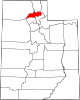 | |
| Town | ||
| Townships | ||
| CDPs | ||
| Unincorporated communities | ||
| International | |
|---|---|
| National | |