
Lyle, Washington: Difference between revisions
Moved item to chronological position, copyedit and trimmed to just the facts. |
AleXYZ-510 (talk | contribs) 2020 census |
||
| (43 intermediate revisions by 31 users not shown) | |||
| Line 1: | Line 1: | ||
{{Use mdy dates|date=July 2023}} |
|||
{{Infobox settlement |
{{Infobox settlement |
||
|official_name |
| official_name = Lyle, Washington |
||
|settlement_type |
| settlement_type = [[Census-designated place]] |
||
|nickname |
| nickname = |
||
|motto |
| motto = |
||
|image_skyline |
| image_skyline = LyleWashingtonView.jpg |
||
|imagesize |
| imagesize = 300px |
||
|image_caption |
| image_caption = Lyle as seen from Oregon |
||
|image_flag |
| image_flag = |
||
|image_seal |
| image_seal = |
||
|image_map = Klickitat_County_Washington_Incorporated_and_Unincorporated_areas_Lyle_Highlighted.svg |
| image_map = Klickitat_County_Washington_Incorporated_and_Unincorporated_areas_Lyle_Highlighted.svg |
||
|mapsize |
| mapsize = 250px |
||
|map_caption |
| map_caption = Location of Lyle in Klickitat County, Washington |
||
|image_map1 |
| image_map1 = |
||
|mapsize1 |
| mapsize1 = |
||
|map_caption1 |
| map_caption1 = |
||
|subdivision_type |
| subdivision_type = [[List of sovereign states|Country]] |
||
|subdivision_name |
| subdivision_name = United States |
||
|subdivision_type1 |
| subdivision_type1 = [[U.S. state|State]] |
||
|subdivision_name1 |
| subdivision_name1 = [[Washington (state)|Washington]] |
||
|subdivision_type2 |
| subdivision_type2 = [[List of counties in Washington|County]] |
||
|subdivision_name2 |
| subdivision_name2 = [[Klickitat County, Washington|Klickitat]] |
||
|government_type |
| government_type = |
||
|leader_title |
| leader_title = |
||
|leader_name |
| leader_name = |
||
|established_title |
| established_title = |
||
|established_date |
| established_date = |
||
|area_magnitude |
| area_magnitude = |
||
|area_total_km2 |
| area_total_km2 = 1.83 |
||
|area_total_sq_mi |
| area_total_sq_mi = |
||
|area_land_km2 |
| area_land_km2 = 1.83 |
||
|area_land_sq_mi |
| area_land_sq_mi = |
||
|area_water_km2 |
| area_water_km2 = 0.0 |
||
|area_water_sq_mi |
| area_water_sq_mi = |
||
|area_water_percent |
| area_water_percent = |
||
|area_urban_km2 |
| area_urban_km2 = |
||
|area_urban_sq_mi |
| area_urban_sq_mi = |
||
|area_metro_km2 |
| area_metro_km2 = |
||
|area_metro_sq_mi |
| area_metro_sq_mi = |
||
|population_as_of |
| population_as_of = [[2020 United States Census|2020]] |
||
|population_note |
| population_note = |
||
|population_total |
| population_total = 518 |
||
| ⚫ | |||
|population_metro = |
|||
| ⚫ | |||
|population_urban = |
|||
| ⚫ | |||
| ⚫ | |||
| utc_offset = -8 |
|||
| ⚫ | |||
| ⚫ | |||
| ⚫ | |||
| |
| utc_offset_DST = -7 |
||
| coordinates = {{coord|45|41|45|N|121|16|56|W|region:US_type:city|display=inline,title}} |
|||
| ⚫ | |||
| |
| elevation_m = 62 |
||
| |
| elevation_ft = 203 |
||
| |
| website = |
||
| ⚫ | |||
|latd = 45 |latm = 41 |lats = 45 |latNS = N |
|||
| ⚫ | |||
|longd = 121 |longm = 16 |longs = 56 |longEW = W |
|||
| |
| area_code = [[Area code 509|509]] |
||
| ⚫ | |||
|elevation_ft = 203 |
|||
| blank_info = 53-40735<ref name="GR2">{{cite web|url=https://www.census.gov|publisher=[[United States Census Bureau]]|accessdate=2008-01-31|title=U.S. Census website}}</ref> |
|||
| ⚫ | |||
| ⚫ | |||
| ⚫ | |||
| blank1_info = 1512412<ref name="GR3">{{cite gnis|id=1512412|name=Lyle}}</ref> |
|||
| ⚫ | |||
| |
| footnotes = |
||
| ⚫ | |||
|blank_info = 53-40735{{GR|2}} |
|||
| ⚫ | |||
|blank1_info = 1512412{{GR|3}} |
|||
|footnotes = |
|||
}} |
}} |
||
'''Lyle''' is |
'''Lyle''' is an [[unincorporated community]] and [[census-designated place]] (CDP) in [[Klickitat County, Washington|Klickitat County]], [[Washington (state)|Washington]], United States. The population was 518 at the [[2020 United States census|2020 census]]. |
||
== History == |
== History == |
||
Established around 1859, the |
Established around 1859, the community was originally called "Klickitat Landing". The first European settler was Egbert French, who arrived from [[Ohio]]. In 1866, French sold his holdings to James O. Lyle from [[The Dalles, Oregon]], who moved to the north bank of the [[Columbia River]].<ref name="History_Link">{{cite web| title=Klickitat County — Thumbnail History |author1=Becker, Paula |url=https://www.historylink.org/File/7800 |website=HistoryLink.org Essay 7800 |publisher=Washington State Department of Archeology and Historic Preservation |access-date=12 May 2024 |date=2006-06-10}}</ref> |
||
A post office was soon established with Lyle as the first postmaster, and mail delivered by steamer from the opposite shore. |
A post office was soon established with Lyle as the first postmaster, and with mail delivered by steamer from the opposite shore. [[Steamboat]] operation lasted until the North Shore Railroad was completed. When the [[Spokane, Portland and Seattle Railway]] came to town in 1907, its line passed somewhat north of the town. The present townsite was plotted in 1909, and the older townsite became known as "downtown". In 1941 there was a small airport in Lyle.<ref name="History_Link"/> |
||
[[Steamboat]] operation lasted until the North shore railroad was completed. |
|||
When the [[Spokane, Portland and Seattle Railway]] came to town in 1907, its line passed somewhat north of the town. The present townsite was plotted in 1909, and the older townsite became known as 'downtown'. In 1941 there was a small airport in Lyle. |
|||
==Lyle |
==Lyle today== |
||
Lyle has two main areas: that part which is built on the north |
Lyle has two main areas: that part which is built on the north bank of the Columbia River, including the downtown, and that part which is built on the hills above the river. The downtown area has one grocery store (which is a super-sized quick-mart), two churches, a museum, a tavern, a restaurant/cafe, a gas station and vehicle repair shop, a second-hand store, an espresso stand, and a historic hotel with restaurant and bar. Other small businesses come and go, and all are located in the downtown area. |
||
Residential areas flank downtown and extend east and west. Newer residences have sprung up on the northern hill overlooking downtown, with row upon row of homes on terraces. Less than 30 years ago, there were fewer than half a dozen homes on the entire hill. Now there are dozens, all seemingly vying for the best view of the Columbia River. Prices for hillside property are high for such a small town, and are based primarily on the view. |
Residential areas flank downtown and extend east and west. Newer residences have sprung up on the northern hill overlooking downtown, with row upon row of homes on terraces. Less than 30 years ago, there were fewer than half a dozen homes on the entire hill. Now there are dozens, all seemingly vying for the best view of the Columbia River. Prices for hillside property are high for such a small town, and are based primarily on the view. |
||
Although Lyle is |
Although Lyle is more than {{convert|70|mi}} east of [[Portland, Oregon|Portland]]/[[Vancouver, Washington|Vancouver]], it is a [[bedroom community]] using freeway transportation on the Oregon side. |
||
The Lyle Community Schools Campus includes three independent, small, rural schools: the area's elementary, middle school and high school, which incorporate students from Dallesport and Murdock. ({{convert|6|mi|0}} east of Lyle) The campus is located at the northernmost part of town, high on the hill overlooking Lyle. The student body is small and combines with nearby towns to make up teams for some sports. |
|||
Although tiny, somewhat rustic, and usually quiet, Lyle has attracted some attention because it lies very near several popular windsurfing beaches, including |
Although tiny, somewhat rustic, and usually quiet, Lyle has attracted some attention because it lies very near several popular [[windsurfing]] beaches, including Doug's Beach. The area is also home to six boutique wineries: Cor Cellars, Domaine Pouillon, Jacob Williams Winery, Klickitat Canyon Winery, Tetrahedron Wines and Syncline. |
||
== Geography == |
== Geography == |
||
Lyle is located in southwestern Klickitat County at {{coord|45|41|45|N|121|16|56|W|type:city}} (45.695845, -121.282279),<ref name="GR1">{{cite web|url=https://www.census.gov/geographies/reference-files/time-series/geo/gazetteer-files.html|publisher=[[United States Census Bureau]]|accessdate=2011-04-23|date=2011-02-12|title=US Gazetteer files: 2010, 2000, and 1990}}</ref> on the north side of the [[Columbia River]] where it is joined by the [[Klickitat River]]. [[Washington State Route 14|State Route 14]] passes through the town, leading {{convert|8|mi|0}} east to [[Dallesport, Washington|Dallesport]] and a junction with [[U.S. Route 197]], and {{convert|11|mi}} west to [[White Salmon, Washington|White Salmon]]. Dallesport and White Salmon are the locations of the closest road crossings of the Columbia River to the east and west, respectively. In addition, [[Washington State Route 142|State Route 142]] travels from Lyle to [[Goldendale, Washington|Goldendale]] along the Klickitat River. |
|||
Lyle is located at {{coord|45|41|45|N|121|16|56|W|type:city}} (45.695845, -121.282279){{GR|1}}. |
|||
According to the [[United States Census Bureau]], the Lyle CDP has a total area of {{convert|1.8|sqkm|order=flip}}, all of it land.<ref name="Census 2010">{{cite web |title=Geographic Identifiers: 2010 Census Summary File 1 (G001), Lyle CDP, Washington |url=http://factfinder.census.gov/bkmk/table/1.0/en/DEC/10_SF1/G001/1600000US5340735 |url-status=dead |archive-url=https://archive.today/20200213084645/http://factfinder.census.gov/bkmk/table/1.0/en/DEC/10_SF1/G001/1600000US5340735 |archive-date=February 13, 2020 |accessdate=July 11, 2019 |work=American FactFinder |publisher=U.S. Census Bureau}}</ref> Behind the town, most of the land consists of hills leading to a large plateau that is commonly found in south-central Washington. |
|||
According to the [[United States Census Bureau]], the CDP has a total area of 3.4 square miles (8.8 km²), all of it land. |
|||
===Climate=== |
|||
This region experiences warm (but not hot) and dry summers, with no average monthly temperatures above {{convert|71.6|F}}. According to the [[Köppen Climate Classification]] system, Lyle has a [[Mediterranean climate#Warm-summer Mediterranean climate|warm-summer Mediterranean climate]], abbreviated "Csb" on climate maps.<ref>[http://www.weatherbase.com/weather/weather-summary.php3?s=712054&cityname=Lyle%2C+Washington%2C+United+States+of+America&units= Climate Summary for Lyle, Washington]</ref> |
|||
== Demographics == |
== Demographics == |
||
{{US Census population |
|||
| ⚫ | As of the [[census]] |
||
| footnote = US Decennial Census<ref name="GR1">{{cite web|url=https://www.census.gov/geographies/reference-files/time-series/geo/gazetteer-files.html|publisher=[[United States Census Bureau]]|accessdate=2011-04-23|date=2011-02-12|title=US Gazetteer files: 2010, 2000, and 1990}}</ref><br>2020 Census<ref name="2020 Census">{{cite web |date=May 2023 |title=Census Bureau profile: Lyle, Washington |url=https://data.census.gov/all?q=Lyle%20CDP,%20Washington |publisher=[[United States Census Bureau]] |access-date=May 13, 2024}}</ref> |
|||
| 2000 = 530 |
|||
| 2010 = 499 |
|||
| 2020 = 518 |
|||
}} |
|||
| ⚫ | As of the [[census]]<ref name="GR2" /> of 2000, there were 530 people, 221 households, and 152 families residing in the CDP. The [[population density]] was 156.5 people per square mile (60.4/km<sup>2</sup>). There were 260 housing units at an average density of 76.8/sq mi (29.6/km<sup>2</sup>). The racial makeup of the CDP was 87.55% [[White (U.S. Census)|White]], 1.89% [[Native American (U.S. Census)|Native American]], 0.94% [[Asian (U.S. Census)|Asian]], 0.38% [[Pacific Islander (U.S. Census)|Pacific Islander]], 4.91% from [[Race (United States Census)|other races]], and 4.34% from two or more races. [[Hispanic (U.S. Census)|Hispanic]] or [[Latino (U.S. Census)|Latino]] of any race were 7.55% of the population. |
||
There were 221 households out of which 31.7% had children under the age of 18 living with them, 51.6% were [[Marriage|married couples]] living together, 13.1% had a female householder with no husband present, and 30.8% were non-families. 25.8% of all households were made up of individuals and 12.2% had someone living alone who was 65 years of age or older. The average household size was 2.34 and the average family size was 2.76. |
There were 221 households, out of which 31.7% had children under the age of 18 living with them, 51.6% were [[Marriage|married couples]] living together, 13.1% had a female householder with no husband present, and 30.8% were non-families. 25.8% of all households were made up of individuals, and 12.2% had someone living alone who was 65 years of age or older. The average household size was 2.34 and the average family size was 2.76. |
||
In the CDP the population was spread out with 26.8% under the age of 18, 7.4% from 18 to 24, 25.1% from 25 to 44, 25.3% from 45 to 64, and 15.5% who were 65 years of age or older. The median age was 41 years. For every 100 females there were 100.0 males. For every 100 females age 18 and over, there were 99.0 males. |
In the CDP, the population was spread out, with 26.8% under the age of 18, 7.4% from 18 to 24, 25.1% from 25 to 44, 25.3% from 45 to 64, and 15.5% who were 65 years of age or older. The median age was 41 years. For every 100 females, there were 100.0 males. For every 100 females age 18 and over, there were 99.0 males. |
||
The median income for a household in the CDP was $33,438, and the median income for a family was $40,083. Males had a median income of $37,292 versus $25,500 for females. The [[per capita income]] for the CDP was $17,355. About 8.1% of families and 11.6% of the population were below the [[poverty line]], including 8.2% of those under age 18 and 20.6% of those age 65 or over. |
The median income for a household in the CDP was $33,438, and the median income for a family was $40,083. Males had a median income of $37,292 versus $25,500 for females. The [[per capita income]] for the CDP was $17,355. About 8.1% of families and 11.6% of the population were below the [[poverty line]], including 8.2% of those under age 18 and 20.6% of those age 65 or over. |
||
== See also == |
|||
*[[Lavina Washines]] |
|||
==References== |
==References== |
||
<references /> |
<references /> |
||
==External links== |
|||
| ⚫ | |||
{{Klickitat County, Washington}} |
{{Klickitat County, Washington}} |
||
{{authority control}} |
|||
| ⚫ | |||
| ⚫ | |||
[[Category:Census-designated places in Washington (state)]] |
[[Category:Census-designated places in Washington (state)]] |
||
[[Category:Columbia River Gorge]] |
[[Category:Columbia River Gorge]] |
||
[[Category:Washington (state) populated places on the Columbia River]] |
|||
[[ca:Lyle (Washington)]] |
|||
[[es:Lyle (Washington)]] |
|||
[[nl:Lyle (Washington)]] |
|||
[[pt:Lyle (Washington)]] |
|||
[[vo:Lyle (Washington)]] |
|||
Latest revision as of 23:36, 13 May 2024
Lyle, Washington | |
|---|---|
 Lyle as seen from Oregon | |
 Location of Lyle in Klickitat County, Washington | |
| Coordinates: 45°41′45″N 121°16′56″W / 45.69583°N 121.28222°W | |
| Land | Vereinigte Staaten |
| State | Washington |
| County | Klickitat |
| Area | |
| • Total | 0.71 sq mi (1.83 km2) |
| • Land | 0.71 sq mi (1.83 km2) |
| • Water | 0.0 sq mi (0.0 km2) |
| Elevation | 203 ft (62 m) |
| Population (2020) | |
| • Total | 518 |
| • Density | 730/sq mi (280/km2) |
| Time zone | UTC-8 (Pacific (PST)) |
| • Summer (DST) | UTC-7 (PDT) |
| ZIP code | 98635 |
| Area code | 509 |
| FIPS code | 53-40735[1] |
| GNIS feature ID | 1512412[2] |
Lyle is an unincorporated community and census-designated place (CDP) in Klickitat County, Washington, United States. The population was 518 at the 2020 census.
History
[edit]Established around 1859, the community was originally called "Klickitat Landing". The first European settler was Egbert French, who arrived from Ohio. In 1866, French sold his holdings to James O. Lyle from The Dalles, Oregon, who moved to the north bank of the Columbia River.[3]
A post office was soon established with Lyle as the first postmaster, and with mail delivered by steamer from the opposite shore. Steamboat operation lasted until the North Shore Railroad was completed. When the Spokane, Portland and Seattle Railway came to town in 1907, its line passed somewhat north of the town. The present townsite was plotted in 1909, and the older townsite became known as "downtown". In 1941 there was a small airport in Lyle.[3]
Lyle today
[edit]Lyle has two main areas: that part which is built on the north bank of the Columbia River, including the downtown, and that part which is built on the hills above the river. The downtown area has one grocery store (which is a super-sized quick-mart), two churches, a museum, a tavern, a restaurant/cafe, a gas station and vehicle repair shop, a second-hand store, an espresso stand, and a historic hotel with restaurant and bar. Other small businesses come and go, and all are located in the downtown area.
Residential areas flank downtown and extend east and west. Newer residences have sprung up on the northern hill overlooking downtown, with row upon row of homes on terraces. Less than 30 years ago, there were fewer than half a dozen homes on the entire hill. Now there are dozens, all seemingly vying for the best view of the Columbia River. Prices for hillside property are high for such a small town, and are based primarily on the view.
Although Lyle is more than 70 miles (110 km) east of Portland/Vancouver, it is a bedroom community using freeway transportation on the Oregon side.
The Lyle Community Schools Campus includes three independent, small, rural schools: the area's elementary, middle school and high school, which incorporate students from Dallesport and Murdock. (6 miles (10 km) east of Lyle) The campus is located at the northernmost part of town, high on the hill overlooking Lyle. The student body is small and combines with nearby towns to make up teams for some sports.
Although tiny, somewhat rustic, and usually quiet, Lyle has attracted some attention because it lies very near several popular windsurfing beaches, including Doug's Beach. The area is also home to six boutique wineries: Cor Cellars, Domaine Pouillon, Jacob Williams Winery, Klickitat Canyon Winery, Tetrahedron Wines and Syncline.
Geography
[edit]Lyle is located in southwestern Klickitat County at 45°41′45″N 121°16′56″W / 45.69583°N 121.28222°W (45.695845, -121.282279),[4] on the north side of the Columbia River where it is joined by the Klickitat River. State Route 14 passes through the town, leading 8 miles (13 km) east to Dallesport and a junction with U.S. Route 197, and 11 miles (18 km) west to White Salmon. Dallesport and White Salmon are the locations of the closest road crossings of the Columbia River to the east and west, respectively. In addition, State Route 142 travels from Lyle to Goldendale along the Klickitat River.
According to the United States Census Bureau, the Lyle CDP has a total area of 0.69 square miles (1.8 km2), all of it land.[5] Behind the town, most of the land consists of hills leading to a large plateau that is commonly found in south-central Washington.
Climate
[edit]This region experiences warm (but not hot) and dry summers, with no average monthly temperatures above 71.6 °F (22.0 °C). According to the Köppen Climate Classification system, Lyle has a warm-summer Mediterranean climate, abbreviated "Csb" on climate maps.[6]
Demographics
[edit]| Census | Pop. | Note | %± |
|---|---|---|---|
| 2000 | 530 | — | |
| 2010 | 499 | −5.8% | |
| 2020 | 518 | 3.8% | |
| US Decennial Census[4] 2020 Census[7] | |||
As of the census[1] of 2000, there were 530 people, 221 households, and 152 families residing in the CDP. The population density was 156.5 people per square mile (60.4/km2). There were 260 housing units at an average density of 76.8/sq mi (29.6/km2). The racial makeup of the CDP was 87.55% White, 1.89% Native American, 0.94% Asian, 0.38% Pacific Islander, 4.91% from other races, and 4.34% from two or more races. Hispanic or Latino of any race were 7.55% of the population.
There were 221 households, out of which 31.7% had children under the age of 18 living with them, 51.6% were married couples living together, 13.1% had a female householder with no husband present, and 30.8% were non-families. 25.8% of all households were made up of individuals, and 12.2% had someone living alone who was 65 years of age or older. The average household size was 2.34 and the average family size was 2.76.
In the CDP, the population was spread out, with 26.8% under the age of 18, 7.4% from 18 to 24, 25.1% from 25 to 44, 25.3% from 45 to 64, and 15.5% who were 65 years of age or older. The median age was 41 years. For every 100 females, there were 100.0 males. For every 100 females age 18 and over, there were 99.0 males.
The median income for a household in the CDP was $33,438, and the median income for a family was $40,083. Males had a median income of $37,292 versus $25,500 for females. The per capita income for the CDP was $17,355. About 8.1% of families and 11.6% of the population were below the poverty line, including 8.2% of those under age 18 and 20.6% of those age 65 or over.
See also
[edit]References
[edit]- ^ a b "U.S. Census website". United States Census Bureau. Retrieved January 31, 2008.
- ^ "Lyle". Geographic Names Information System. United States Geological Survey, United States Department of the Interior.
- ^ a b Becker, Paula (June 10, 2006). "Klickitat County — Thumbnail History". HistoryLink.org Essay 7800. Washington State Department of Archeology and Historic Preservation. Retrieved May 12, 2024.
- ^ a b "US Gazetteer files: 2010, 2000, and 1990". United States Census Bureau. February 12, 2011. Retrieved April 23, 2011.
- ^ "Geographic Identifiers: 2010 Census Summary File 1 (G001), Lyle CDP, Washington". American FactFinder. U.S. Census Bureau. Archived from the original on February 13, 2020. Retrieved July 11, 2019.
- ^ Climate Summary for Lyle, Washington
- ^ "Census Bureau profile: Lyle, Washington". United States Census Bureau. May 2023. Retrieved May 13, 2024.
External links
[edit]Municipalities and communities of Klickitat County, Washington, United States | ||
|---|---|---|
| Cities | 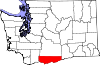 | |
| CDPs | ||
| Unincorporated communities | ||
| Ghost towns | ||
| Indian reservation | ||
| Footnotes | ‡This populated place also has portions in an adjacent county or counties | |