Beša, Michalovce District: Difference between revisions
Appearance
Content deleted Content added
m #article-add-desc Tags: Mobile edit Mobile app edit iOS app edit |
A detail |
||
| Line 5: | Line 5: | ||
==History== |
==History== |
||
In [[history|historical records]] the village was first mentioned in [[1260]]. |
In [[history|historical records]] the village was first mentioned in [[1260]]. Before the establishment of independent [[Czechoslovakia]] in 1918, it was part of [[Ung County]] within the [[Kingdom of Hungary]]. |
||
==Geography== |
==Geography== |
||
| Line 46: | Line 46: | ||
{{DEFAULTSORT:Besa, Michalovce District}} |
{{DEFAULTSORT:Besa, Michalovce District}} |
||
[[Category:Villages and municipalities in Michalovce District]] |
[[Category:Villages and municipalities in Michalovce District]] |
||
[[Category:First Vienna Award]] |
|||
{{Michalovce-geo-stub}} |
{{Michalovce-geo-stub}} |
||
Latest revision as of 08:29, 22 May 2024

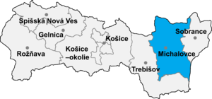
Beša (Hungarian: Bés) is a village and municipality in Michalovce District in the Kosice Region of eastern Slovakia.
History
[edit]In historical records the village was first mentioned in 1260. Before the establishment of independent Czechoslovakia in 1918, it was part of Ung County within the Kingdom of Hungary.
Geography
[edit]The village lies at an altitude of 107 metres and covers an area of 19.53 km2 (7.54 sq mi) (2020-06-30/-07-01).[1]
Ethnicity
[edit]The population is 96% Hungarian in ethnicity.
Economy
[edit]The village has a food store.
Sports
[edit]The village has a football pitch.
Transport
[edit]The nearest railway station is located 6 kilometres away at Vojany.
Genealogical resources
[edit]The records for genealogical research are available at the state archive "Statny Archiv in Kosice, Slovakia"
- Roman Catholic church records (births/marriages/deaths): 1818-1898 (parish A)
- Reformated church records (births/marriages/deaths): 1781-1876 (parish B)
See also
[edit]References
[edit]- ^ "Statistic of Slovak places by Dušan Kreheľ – Export". Archived from the original on 2021-06-27. Retrieved 2021-07-05.
