
Crosbyton, Texas: Difference between revisions
m →Notable people: spelling |
AleXYZ-510 (talk | contribs) 2020 census |
||
| (17 intermediate revisions by 12 users not shown) | |||
| Line 1: | Line 1: | ||
{{Use mdy dates|date=July 2023}} |
|||
{{Infobox settlement |
{{Infobox settlement |
||
|official_name |
| official_name = Crosbyton, Texas |
||
|settlement_type |
| settlement_type = [[City]] |
||
|nickname |
| nickname = |
||
|motto |
| motto = "Where the 19th century meets the 21st century" |
||
<!-- Images --> |
<!-- Images -->| image_skyline = Crosbyton01_courthouse.jpg |
||
| |
| imagesize = 250px |
||
| image_caption = The Crosby County Courthouse in Crosbyton |
|||
|imagesize = 250px |
|||
| image_flag = |
|||
|image_caption = The Crosby County Courthouse in Crosbyton |
|||
| |
| image_seal = <!-- Maps --> |
||
| |
| image_map = TXMap-doton-Crosbyton.PNG |
||
| mapsize = 250px |
|||
| map_caption = Location of Crosbyton, Texas |
|||
| image_map1 = Crosby County Crosbyton.svg |
|||
| mapsize1 = 250px |
|||
| map_caption1 = <!-- Location --> |
|||
| subdivision_type = Country |
|||
| subdivision_name = United States |
|||
| subdivision_type1 = [[U.S. state|State]] |
|||
| subdivision_name1 = [[Texas]] |
|||
| subdivision_type2 = [[List of counties in Texas|County]] |
|||
| subdivision_name2 = [[Crosby County, Texas|Crosby]] |
|||
<!-- |
<!-- Government -->| government_footnotes = |
||
| government_type = Mayor-Council |
|||
|image_map = TXMap-doton-Crosbyton.PNG |
|||
| |
| leader_title = Mayor |
||
| leader_name = Dusty Cornelius {{cn|date=January 2024}} |
|||
|map_caption = Location of Crosbyton, Texas |
|||
| leader_title1 = |
|||
|image_map1 = Crosby County Crosbyton.svg |
|||
| |
| leader_name1 = |
||
| established_title = Incorporated (city) |
|||
|map_caption1 = |
|||
| established_date = 1917 |
|||
<!-- Area -->| unit_pref = Imperial |
|||
<!-- Location --> |
|||
| area_footnotes = <ref name="CenPopGazetteer2019">{{cite web|title=2019 U.S. Gazetteer Files|url=https://www2.census.gov/geo/docs/maps-data/data/gazetteer/2019_Gazetteer/2019_gaz_place_48.txt|publisher=United States Census Bureau|access-date=August 7, 2020}}</ref> |
|||
|subdivision_type = Country |
|||
| area_magnitude = |
|||
|subdivision_name = United States |
|||
| area_total_km2 = 5.47 |
|||
|subdivision_type1 = [[U.S. state|State]] |
|||
| area_land_km2 = 5.47 |
|||
|subdivision_name1 = [[Texas]] |
|||
| area_water_km2 = 0.00 |
|||
|subdivision_type2 = [[List of counties in Texas|County]] |
|||
| area_total_sq_mi = 2.11 |
|||
|subdivision_name2 = [[Crosby County, Texas|Crosby]] |
|||
| area_land_sq_mi = 2.11 |
|||
| area_water_sq_mi = 0.00 |
|||
<!-- Population -->| population_as_of = [[2020 United States Census|2020]] |
|||
<!-- Government --> |
|||
| population_footnotes = |
|||
|government_footnotes = |
|||
| population_total = 1492 |
|||
|government_type = Mayor-Council |
|||
| population_density_km2 = auto |
|||
|leader_title = Mayor |
|||
| population_density_sq_mi = auto |
|||
|leader_name = Dusty Cornelius |
|||
| population_blank1_title = [[Demonym]] |
|||
|leader_title1 = |
|||
| population_blank1 = Crosbytonian |
|||
|leader_name1 = |
|||
|established_title = Incorporated (city) |
|||
|established_date = 1917 |
|||
<!-- General information -->| timezone = [[North American Central Time Zone|Central (CST)]] |
|||
<!-- Area --> |
|||
| utc_offset = −6 |
|||
|unit_pref = Imperial |
|||
| timezone_DST = CDT |
|||
|area_footnotes = <ref name="CenPopGazetteer2019">{{cite web|title=2019 U.S. Gazetteer Files|url=https://www2.census.gov/geo/docs/maps-data/data/gazetteer/2019_Gazetteer/2019_gaz_place_48.txt|publisher=United States Census Bureau|access-date=August 7, 2020}}</ref> |
|||
| utc_offset_DST = −5 |
|||
|area_magnitude = |
|||
| elevation_footnotes = <ref name=gnis/> |
|||
|area_total_km2 = 5.47 |
|||
| |
| elevation_ft = 3009 |
||
| coordinates = {{coord|33|38|29|N|101|14|16|W|type:city_region:US-TX|display=it}} |
|||
|area_water_km2 = 0.00 |
|||
| postal_code_type = [[ZIP code]] |
|||
|area_total_sq_mi = 2.11 |
|||
| |
| postal_code = 79322 |
||
| |
| area_code = [[Area code 806|806]] |
||
| blank_name = [[Federal Information Processing Standard|FIPS code]] |
|||
| blank_info = 48-17768<ref name="GR2">{{cite web|url=https://www.census.gov |publisher=[[United States Census Bureau]] |access-date=2008-01-31 |title=U.S. Census website }}</ref> |
|||
<!-- Population --> |
|||
| |
| blank1_name = [[Geographic Names Information System|GNIS]] feature ID |
||
| blank1_info = 2410267<ref name=gnis>{{GNIS|2410267}}</ref> |
|||
|population_footnotes = |
|||
| |
| website = {{URL|www.cityofcrosbyton.org}} |
||
| footnotes = |
|||
|population_density_km2 = 294.90 |
|||
|population_density_sq_mi = 763.62 |
|||
|population_blank1_title = [[Demonym]] |
|||
|population_blank1 = Crosbytonian |
|||
<!-- General information --> |
|||
|timezone = [[North American Central Time Zone|Central (CST)]] |
|||
|utc_offset = −6 |
|||
|timezone_DST = CDT |
|||
|utc_offset_DST = −5 |
|||
|elevation_footnotes = |
|||
|elevation_m = 921 |
|||
|elevation_ft = 3022 |
|||
|coordinates = {{coord|33|39|24|N|101|14|20|W|type:city_region:US-TX|display=it}} |
|||
|postal_code_type = [[ZIP code]] |
|||
|postal_code = 79322 |
|||
|area_code = [[Area code 806|806]] |
|||
|blank_name = [[Federal Information Processing Standard|FIPS code]] |
|||
|blank_info = 48-17768<ref name="GR2">{{cite web|url=https://www.census.gov |publisher=[[United States Census Bureau]] |access-date=2008-01-31 |title=U.S. Census website }}</ref> |
|||
|blank1_name = [[Geographic Names Information System|GNIS]] feature ID |
|||
|blank1_info = 1355398<ref name="GR3">{{cite web|url=http://geonames.usgs.gov|access-date=2008-01-31|title=US Board on Geographic Names|publisher=[[United States Geological Survey]]|date=2007-10-25}}</ref> |
|||
|website = {{URL|www.cityofcrosbyton.org}} |
|||
|footnotes = |
|||
|pop_est_as_of = 2019 |
|||
|pop_est_footnotes = <ref name="USCensusEst2019CenPopScriptOnlyDirtyFixDoNotUse"/> |
|||
|population_est = 1612 |
|||
}} |
}} |
||
'''Crosbyton''' is a city in and the [[county seat]] of [[Crosby County, Texas]], United States.<ref name="GR6">{{cite web|url=http://www.naco.org/Counties/Pages/FindACounty.aspx |access-date=2011-06-07 |title=Find a County |publisher=National Association of Counties |url-status=dead |archive-url=https://web.archive.org/web/20110531210815/http://www.naco.org/Counties/Pages/FindACounty.aspx |archive-date=May 31, 2011 }}</ref> The population was 1, |
'''Crosbyton''' is a city in and the [[county seat]] of [[Crosby County, Texas]], United States.<ref name="GR6">{{cite web|url=http://www.naco.org/Counties/Pages/FindACounty.aspx |access-date=2011-06-07 |title=Find a County |publisher=National Association of Counties |url-status=dead |archive-url=https://web.archive.org/web/20110531210815/http://www.naco.org/Counties/Pages/FindACounty.aspx |archive-date=May 31, 2011 }}</ref> The population was 1,492 at the [[2020 United States census|2020 census]].<ref name=":0" /> Crosbyton is part of the [[Lubbock, Texas|Lubbock]] [[Lubbock metropolitan area|Metropolitan Statistical Area]]. |
||
==History== |
==History== |
||
The city was named for land office commissioner Stephen Crosby.<ref>{{cite web| url=http://www.epodunk.com/cgi-bin/genInfo.php?locIndex=26325| title=Profile for Crosbyton, Texas| publisher=[[ePodunk]]| access-date=2010-06-15}}</ref> |
The city was named for land office commissioner Stephen Crosby.<ref>{{cite web| url=http://www.epodunk.com/cgi-bin/genInfo.php?locIndex=26325| title=Profile for Crosbyton, Texas| publisher=[[ePodunk]]| access-date=2010-06-15}}</ref><ref name=CrosbytonHistory>{{Cite web |title=Crosbyton, TX |last=Jenkins |first=Edloe A. |work=Handbook Of Texas |publisher=Texas State Historical Association |access-date=20 December 2023 |url= https://www.tshaonline.org/handbook/entries/crosbyton-tx }}</ref> |
||
In 1902, the C. B. Livestock Company purchased 90,000 acres. By 1912, a 10,000-acre demonstration farm, managed by Judge L. Gough, showcased the area's potential for cotton cultivation, leading to significant land sales from 1907 to 1915.<ref name=CrosbytonHistory/> |
|||
The town's foundation began in 1908 when the C. B. Livestock Company surveyed a townsite, subsequently opening Crosbyton for settlement. The Crosbyton post office was established in July 1908. The Crosbyton Inn, a three-story hotel, was erected the same year.<ref name=CrosbytonHistory/> |
|||
In 1910, Crosbyton secured the county seat designation after winning a vote against Emma. The Crosbyton-South Plains Railroad commenced operations on April 10, 1911.<ref name=CrosbytonHistory/> |
|||
The town's first hospital opened in 1947, and in 1975, the Crosbyton Municipal Airport was dedicated. In 1976, [[Texas Tech University]] built a 65-foot diameter solar dish, the world's largest at the time, to harvest solar power.<ref name=CrosbytonHistory/><ref>{{Cite web |title=Crosbyton Solar Power Project |publisher=Texas Tech University |work=Texas Tech University Southwest Collection/Special Collections Library |access-date=20 December 2023 |url= https://swco-ir.tdl.org/browse/title?scope=e2dbd430-5ca8-4562-96c8-ecd561568368 }}</ref> |
|||
Recognizing the town's heritage, Zina Lamar established the Crosby County Pioneer Memorial Museum in 1958. This facility serves as a community center and museum, preserving artifacts of area pioneers.<ref name=CrosbytonHistory/> |
|||
== Geography == |
== Geography == |
||
Crosbyton is located slightly northeast of the center of Crosby County at {{coord|33|39|24|N|101|14|20|W|type:city}} (33.656733, -101.238811),<ref name="GR1">{{cite web|url=https://www.census.gov/geographies/reference-files/time-series/geo/gazetteer-files.html|publisher=[[United States Census Bureau]]|access-date=2011-04-23|date=2011-02-12|title=US Gazetteer files: 2010, 2000, and 1990}}</ref> along [[U.S. Route 82]] about {{convert|2|mi|0}} west of [[Blanco Canyon]] at the eastern edge of the [[Llano Estacado]]. US 82 leads east {{convert|24|mi}} to [[Dickens, Texas|Dickens]] and west {{convert|38|mi}} to [[Lubbock, Texas|Lubbock]]. |
|||
Crosbyton is located slightly northeast of the center of Crosby County along [[U.S. Route 82 in Texas|U.S. Route 82]], approximately {{convert|2|mi|0}} west of [[Blanco Canyon]] at the eastern edge of the [[Llano Estacado]]. US 82 leads east {{convert|24|mi}} to [[Dickens, Texas|Dickens]] and west {{convert|38|mi}} to [[Lubbock, Texas|Lubbock]]. |
|||
According to the [[United States Census Bureau]], Crosbyton has a total area of {{convert|5.5|km2|order=flip}}, all of it land.<ref name="Census 2010"/> |
|||
According to the [[United States Census Bureau]], Crosbyton has a total area of {{convert|5.5|km2|order=flip}}, all land.<ref name="Census 2010">{{cite web |title=Geographic Identifiers: 2010 Census Summary File 1 (G001): Crosbyton city, Texas |url=http://factfinder.census.gov/bkmk/table/1.0/en/DEC/10_SF1/G001/1600000US4817768 |url-status=dead |archive-url=https://archive.today/20200213061638/http://factfinder.census.gov/bkmk/table/1.0/en/DEC/10_SF1/G001/1600000US4817768 |archive-date=February 13, 2020 |access-date=August 6, 2015 |publisher=U.S. Census Bureau, American Factfinder}}</ref> |
|||
== Demographics == |
== Demographics == |
||
{{US Census population |
{{US Census population |
||
|1920= 809 |
| 1920 = 809 |
||
|1930= 1250 |
| 1930 = 1250 |
||
|1940= 1615 |
| 1940 = 1615 |
||
|1950= 1879 |
| 1950 = 1879 |
||
|1960= 2088 |
| 1960 = 2088 |
||
|1970= 2251 |
| 1970 = 2251 |
||
|1980= 2289 |
| 1980 = 2289 |
||
|1990= 2026 |
| 1990 = 2026 |
||
|2000= 1874 |
| 2000 = 1874 |
||
|2010= 1741 |
| 2010 = 1741 |
||
| 2020 = 1492 |
|||
|estyear=2019 |
|||
| footnote = U.S. Decennial Census<ref name="DecennialCensus">{{cite web|url=https://www.census.gov/programs-surveys/decennial-census.html|title=Census of Population and Housing|publisher=Census.gov|access-date=June 4, 2015}}</ref> |
|||
|estimate=1612 |
|||
|estref=<ref name="USCensusEst2019CenPopScriptOnlyDirtyFixDoNotUse">{{cite web|url=https://www.census.gov/programs-surveys/popest/data/tables.2019.html|date=May 24, 2020|title=Population and Housing Unit Estimates|publisher=United States Census Bureau|access-date=May 27, 2020}}</ref> |
|||
|footnote=U.S. Decennial Census<ref name="DecennialCensus">{{cite web|url=https://www.census.gov/programs-surveys/decennial-census.html|title=Census of Population and Housing|publisher=Census.gov|access-date=June 4, 2015}}</ref> |
|||
}} |
}} |
||
As of the [[census]]<ref name="GR2" /> of 2000, 1,874 people, 677 households, and 482 families resided in the city. The [[population density]] was 886.9 people per square mile (342.9/km{{sup|2}}). The 781 housing units averaged 369.6 per square mile (142.9/km{{sup|2}}). The [[Race (United States Census)|racial makeup]] of the city was 62.49% White, 5.71% African American, 0.21% Native American, 0.05% Asian, 30.15% from other races, and 1.39% from two or more races. Hispanics or Latinos of any race were 47.65% of the population. |
|||
===2020 census=== |
|||
{| class="wikitable" |
|||
|+'''Crosbyton racial composition'''<ref name=":0">{{Cite web |title=Explore Census Data |url=https://data.census.gov/cedsci/table?g=1600000US4817768&tid=DECENNIALPL2020.P2 |access-date=2022-05-20 |website=data.census.gov}}</ref><br> (''NH = Non-Hispanic''){{efn|Note: the US Census treats Hispanic/Latino as an ethnic category. This table excludes Latinos from the racial categories and assigns them to a separate category. Hispanics/Latinos can be of any race.<ref>{{cite web |title=About the Hispanic Population and its Origin |url=https://www.census.gov/topics/population/hispanic-origin/about.html |website=www.census.gov |access-date=18 May 2022}}</ref>}} |
|||
!Race |
|||
!Number |
|||
!Percentage |
|||
|- |
|||
|[[Non-Hispanic or Latino whites|White]] (NH) |
|||
|547 |
|||
|36.66% |
|||
|- |
|||
|[[Non-Hispanic or Latino African Americans|Black or African American]] (NH) |
|||
|50 |
|||
|3.35% |
|||
|- |
|||
|[[Native Americans in the United States|Native American]] or [[Alaska Native]] (NH) |
|||
|1 |
|||
|0.07% |
|||
|- |
|||
|[[Asian Americans|Asian]] (NH) |
|||
|2 |
|||
|0.13% |
|||
|- |
|||
|[[Multiracial Americans|Mixed/Multi-Racial]] (NH) |
|||
|11 |
|||
|0.74% |
|||
|- |
|||
|[[Hispanic and Latino Americans|Hispanic or Latino]] |
|||
|881 |
|||
|59.05% |
|||
|- |
|||
|'''Total''' |
|||
|'''1,492''' |
|||
| |
|||
|} |
|||
As of the [[2020 United States census]], there were 1,492 people, 667 households, and 498 families residing in the city. |
|||
===2000 census=== |
|||
As of the [[census]]<ref name="GR2" /> of 2000, 1,874 people, 677 households, and 482 families resided in the city. The population density was {{convert|886.9|PD/sqmi|PD/km2|sp=us|adj=off}}. The 781 housing units averaged 369.6 per square mile (142.9/km{{sup|2}}). The [[Race (United States Census)|racial makeup]] of the city was 62.49% White, 5.71% African American, 0.21% Native American, 0.05% Asian, 30.15% from other races, and 1.39% from two or more races. Hispanics or Latinos of any race were 47.65% of the population. |
|||
Of the 677 households, 34.6% had children under the age of 18 living with them, 55.8% were married couples living together, 11.1% had a female householder with no husband present, and 28.8% were not families. About 27.3% of all households were made up of individuals, and 17.6% had someone living alone who was 65 years of age or older. The average household size was 2.68 and the average family size was 3.26. |
Of the 677 households, 34.6% had children under the age of 18 living with them, 55.8% were married couples living together, 11.1% had a female householder with no husband present, and 28.8% were not families. About 27.3% of all households were made up of individuals, and 17.6% had someone living alone who was 65 years of age or older. The average household size was 2.68 and the average family size was 3.26. |
||
| Line 114: | Line 151: | ||
The median income for a household in the city was $24,722, and for a family was $30,900. Males had a median income of $22,647 versus $18,000 for females. The [[per capita income]] for the city was $16,329. About 23.7% of families and 28.0% of the population were below the [[poverty line]], including 36.9% of those under age 18 and 25.9% of those age 65 or over. |
The median income for a household in the city was $24,722, and for a family was $30,900. Males had a median income of $22,647 versus $18,000 for females. The [[per capita income]] for the city was $16,329. About 23.7% of families and 28.0% of the population were below the [[poverty line]], including 36.9% of those under age 18 and 25.9% of those age 65 or over. |
||
==Government== |
|||
Former Crosby County Administrative County Judge [[Joseph P. Heflin]] represented District 85 in the [[Texas House of Representatives]] from 2007 to 2011. During his tenure, Heflin was the only [[Democratic Party (United States)|Democrat]] from either [[West Texas]] or the [[Texas Panhandle|Panhandle]] serving in the legislature. He was unseated in the 2010 [[general election]] by the [[Republican Party (United States)|Republican]] [[Jim Landtroop]] of [[Plainview, Texas|Plainview]] in [[Hale County, Texas|Hale County]]. In 2006, Heflin had defeated Landtroop by fewer than 225 votes. |
|||
==Education== |
==Education== |
||
| Line 122: | Line 156: | ||
==Climate== |
==Climate== |
||
Crosbyton gets about 23 inches of rain each year. As a comparison, the US average is 39 inches. Snowfall averages |
Crosbyton gets about 23 inches of rain each year. As a comparison, the US average is 39 inches. Snowfall averages seven inches, compared to the average of 26 inches of snow in American cities. The city receives some measurable precipitation approximately 40 days a year. |
||
Sunny weather typically occurs 263 days. The Sperling comfort index for Crosbyton is 62 out of 100 (the higher score indicates a more comfortable year-round climate.<ref name="Sperling's Best Places - Crosbyton, Texas">{{cite web| url=https://www.bestplaces.net/climate/city/texas/crosbyton |title=Sperling's Best Places - Crosbyton, Texas}}</ref> |
Sunny weather typically occurs 263 days per year. The Sperling comfort index for Crosbyton is 62 out of 100 (the higher score indicates a more comfortable year-round climate.<ref name="Sperling's Best Places - Crosbyton, Texas">{{cite web| url=https://www.bestplaces.net/climate/city/texas/crosbyton |title=Sperling's Best Places - Crosbyton, Texas}}</ref> |
||
{{Weather box |
{{Weather box |
||
| width= |
| width = auto |
||
| collapsed = yes |
|||
|location = Crosbyton, Texas (1981–2010) |
|||
|single line = |
| single line = yes |
||
| location = Crosbyton, Texas (1991–2020 normals, extremes 1893–present) |
|||
|Jan high F = |
| Jan record high F = 87 |
||
|Feb high F = |
| Feb record high F = 92 |
||
|Mar high F = |
| Mar record high F = 96 |
||
|Apr high F = |
| Apr record high F = 103 |
||
|May high F = |
| May record high F = 111 |
||
|Jun high F = |
| Jun record high F = 113 |
||
|Jul high F = |
| Jul record high F = 110 |
||
|Aug high F = |
| Aug record high F = 110 |
||
|Sep high F = |
| Sep record high F = 108 |
||
|Oct high F = |
| Oct record high F = 101 |
||
|Nov high F = |
| Nov record high F = 92 |
||
|Dec high F = |
| Dec record high F = 84 |
||
|year high F = |
| year record high F = |
||
| Jan avg record high F = 75.9 |
|||
| |
| Feb avg record high F = 80.4 |
||
| |
| Mar avg record high F = 88.3 |
||
| |
| Apr avg record high F = 92.8 |
||
| |
| May avg record high F = 98.5 |
||
| |
| Jun avg record high F = 101.1 |
||
| |
| Jul avg record high F = 101.4 |
||
| |
| Aug avg record high F = 100.0 |
||
| |
| Sep avg record high F = 97.1 |
||
| |
| Oct avg record high F = 92.1 |
||
| |
| Nov avg record high F = 82.9 |
||
| |
| Dec avg record high F = 75.2 |
||
| |
| year avg record high F = 104.3 |
||
| |
| Jan high F = 54.0 |
||
| Feb high F = 58.7 |
|||
| Mar high F = 67.2 |
|||
|precipitation colour = green |
|||
| |
| Apr high F = 75.6 |
||
| |
| May high F = 83.0 |
||
| |
| Jun high F = 89.9 |
||
| |
| Jul high F = 92.7 |
||
| |
| Aug high F = 92.0 |
||
| |
| Sep high F = 84.8 |
||
| |
| Oct high F = 75.4 |
||
| |
| Nov high F = 63.5 |
||
| |
| Dec high F = 54.6 |
||
| |
| year high F = 74.3 |
||
| |
| Jan mean F = 40.0 |
||
| |
| Feb mean F = 43.8 |
||
| Mar mean F = 51.9 |
|||
|year precipitation inch= 23.32 |
|||
| Apr mean F = 60.0 |
|||
| |
| May mean F = 69.1 |
||
| |
| Jun mean F = 77.0 |
||
| |
| Jul mean F = 80.1 |
||
| |
| Aug mean F = 79.3 |
||
| |
| Sep mean F = 72.0 |
||
| |
| Oct mean F = 61.6 |
||
| |
| Nov mean F = 49.7 |
||
| |
| Dec mean F = 41.2 |
||
| |
| year mean F = 60.5 |
||
| |
| Jan low F = 26.1 |
||
| |
| Feb low F = 28.9 |
||
| |
| Mar low F = 36.5 |
||
| |
| Apr low F = 44.3 |
||
| May low F = 55.2 |
|||
|source 1 = NOAA<ref>{{cite web |url = https://w2.weather.gov/climate/xmacis.php?wfo=lub |title = NOWData - NOAA Online Weather Data |publisher = [[National Oceanic and Atmospheric Administration]] |access-date = May 6, 2013}}</ref> |
|||
| Jun low F = 64.1 |
|||
| Jul low F = 67.5 |
|||
| Aug low F = 66.6 |
|||
| Sep low F = 59.1 |
|||
| Oct low F = 47.7 |
|||
| Nov low F = 36.0 |
|||
| Dec low F = 27.8 |
|||
| year low F = 46.6 |
|||
| Jan avg record low F = 13.5 |
|||
| Feb avg record low F = 16.2 |
|||
| Mar avg record low F = 21.5 |
|||
| Apr avg record low F = 30.9 |
|||
| May avg record low F = 42.3 |
|||
| Jun avg record low F = 56.6 |
|||
| Jul avg record low F = 61.8 |
|||
| Aug avg record low F = 60.4 |
|||
| Sep avg record low F = 47.2 |
|||
| Oct avg record low F = 32.7 |
|||
| Nov avg record low F = 21.3 |
|||
| Dec avg record low F = 14.0 |
|||
| year avg record low F = 9.3 |
|||
| Jan record low F = -10 |
|||
| Feb record low F = -14 |
|||
| Mar record low F = -2 |
|||
| Apr record low F = 17 |
|||
| May record low F = 28 |
|||
| Jun record low F = 39 |
|||
| Jul record low F = 48 |
|||
| Aug record low F = 42 |
|||
| Sep record low F = 32 |
|||
| Oct record low F = 16 |
|||
| Nov record low F = 4 |
|||
| Dec record low F = -6 |
|||
| year record low F = |
|||
| precipitation colour = green |
|||
| Jan precipitation inch = 0.79 |
|||
| Feb precipitation inch = 0.86 |
|||
| Mar precipitation inch = 1.40 |
|||
| Apr precipitation inch = 1.82 |
|||
| May precipitation inch = 2.88 |
|||
| Jun precipitation inch = 2.98 |
|||
| Jul precipitation inch = 2.40 |
|||
| Aug precipitation inch = 2.01 |
|||
| Sep precipitation inch = 2.73 |
|||
| Oct precipitation inch = 1.73 |
|||
| Nov precipitation inch = 1.12 |
|||
| Dec precipitation inch = 0.98 |
|||
| year precipitation inch = 21.70 |
|||
| unit precipitation days = 0.01 in |
|||
| Jan precipitation days = 3.0 |
|||
| Feb precipitation days = 3.7 |
|||
| Mar precipitation days = 5.1 |
|||
| Apr precipitation days = 4.4 |
|||
| May precipitation days = 6.8 |
|||
| Jun precipitation days = 7.3 |
|||
| Jul precipitation days = 5.6 |
|||
| Aug precipitation days = 5.9 |
|||
| Sep precipitation days = 6.2 |
|||
| Oct precipitation days = 5.4 |
|||
| Nov precipitation days = 3.5 |
|||
| Dec precipitation days = 3.5 |
|||
| year precipitation days = 60.4 |
|||
| source = [[National Oceanic and Atmospheric Administration|NOAA]]<ref name="NOWData">{{cite web |
|||
|url = https://www.weather.gov/wrh/Climate?wfo=lub |
|||
|title = NOWData - NOAA Online Weather Data |
|||
|publisher = National Oceanic and Atmospheric Administration |
|||
|access-date = December 20, 2023}}</ref><ref name="NCEI">{{cite web |
|||
|url = https://www.ncei.noaa.gov/access/services/data/v1?dataset=normals-monthly-1991-2020&stations=USC00412121&format=pdf&dataTypes=MLY-TMAX-NORMAL,MLY-TMIN-NORMAL,MLY-TAVG-NORMAL,MLY-PRCP-NORMAL,MLY-SNOW-NORMAL |
|||
|title = Summary of Monthly Normals 1991-2020 |
|||
|publisher = National Oceanic and Atmospheric Administration |
|||
|access-date = December 20, 2023}}</ref> |
|||
}} |
}} |
||
==Notable people== |
==Notable people== |
||
*[[Randy Crouch]], Oklahoma Music Awards: 2004 Fiddler Of The Year, 2005 Red Dirt Hall of Fame, and 2006 Steel Guitarist Of The Year.<ref name="Sonicbids Randy Crouch Biography">{{cite web| url=https://www.sonicbids.com/band/randycrouch/ |title=Sonicbids Randy Crouch Biography}}</ref> |
|||
* [[Randy Crouch]], Oklahoma Music Awards: 2004 Fiddler Of The Year, 2005 Red Dirt Hall of Fame, and 2006 Steel Guitarist Of The Year<ref name="Sonicbids Randy Crouch Biography">{{cite web| url=https://www.sonicbids.com/band/randycrouch/ |title=Sonicbids Randy Crouch Biography}}</ref> |
|||
*[[Don Maynard]]. member of the [[Pro Football Hall of Fame]] |
|||
* [[Don Maynard]]. member of the [[Pro Football Hall of Fame]] |
|||
==See also== |
==See also== |
||
| Line 202: | Line 308: | ||
==References== |
==References== |
||
{{Reflist}} |
{{Reflist}} |
||
{{notelist}} |
|||
==External links== |
==External links== |
||
Latest revision as of 00:42, 11 June 2024
Crosbyton, Texas | |
|---|---|
 The Crosby County Courthouse in Crosbyton | |
| Motto: "Where the 19th century meets the 21st century" | |
 Location of Crosbyton, Texas | |
 | |
| Coordinates: 33°38′29″N 101°14′16″W / 33.64139°N 101.23778°W | |
| Country | United States |
| State | Texas |
| County | Crosby |
| Incorporated (city) | 1917 |
| Government | |
| • Type | Mayor-Council |
| • Mayor | Dusty Cornelius [citation needed] |
| Area | |
| • Total | 2.11 sq mi (5.47 km2) |
| • Land | 2.11 sq mi (5.47 km2) |
| • Water | 0.00 sq mi (0.00 km2) |
| Elevation | 3,009 ft (917 m) |
| Population (2020) | |
| • Total | 1,492 |
| • Density | 710/sq mi (270/km2) |
| • Demonym | Crosbytonian |
| Time zone | UTC−6 (Central (CST)) |
| • Summer (DST) | UTC−5 (CDT) |
| ZIP code | 79322 |
| Area code | 806 |
| FIPS code | 48-17768[3] |
| GNIS feature ID | 2410267[2] |
| Website | www |
Crosbyton is a city in and the county seat of Crosby County, Texas, United States.[4] The population was 1,492 at the 2020 census.[5] Crosbyton is part of the Lubbock Metropolitan Statistical Area.
History[edit]
The city was named for land office commissioner Stephen Crosby.[6][7]
In 1902, the C. B. Livestock Company purchased 90,000 acres. By 1912, a 10,000-acre demonstration farm, managed by Judge L. Gough, showcased the area's potential for cotton cultivation, leading to significant land sales from 1907 to 1915.[7]
The town's foundation began in 1908 when the C. B. Livestock Company surveyed a townsite, subsequently opening Crosbyton for settlement. The Crosbyton post office was established in July 1908. The Crosbyton Inn, a three-story hotel, was erected the same year.[7]
In 1910, Crosbyton secured the county seat designation after winning a vote against Emma. The Crosbyton-South Plains Railroad commenced operations on April 10, 1911.[7]
The town's first hospital opened in 1947, and in 1975, the Crosbyton Municipal Airport was dedicated. In 1976, Texas Tech University built a 65-foot diameter solar dish, the world's largest at the time, to harvest solar power.[7][8]
Recognizing the town's heritage, Zina Lamar established the Crosby County Pioneer Memorial Museum in 1958. This facility serves as a community center and museum, preserving artifacts of area pioneers.[7]
Geography[edit]
Crosbyton is located slightly northeast of the center of Crosby County along U.S. Route 82, approximately 2 miles (3 km) west of Blanco Canyon at the eastern edge of the Llano Estacado. US 82 leads east 24 miles (39 km) to Dickens and west 38 miles (61 km) to Lubbock.
According to the United States Census Bureau, Crosbyton has a total area of 2.1 square miles (5.5 km2), all land.[9]
Demographics[edit]
| Census | Pop. | Note | %± |
|---|---|---|---|
| 1920 | 809 | — | |
| 1930 | 1,250 | 54.5% | |
| 1940 | 1,615 | 29.2% | |
| 1950 | 1,879 | 16.3% | |
| 1960 | 2,088 | 11.1% | |
| 1970 | 2,251 | 7.8% | |
| 1980 | 2,289 | 1.7% | |
| 1990 | 2,026 | −11.5% | |
| 2000 | 1,874 | −7.5% | |
| 2010 | 1,741 | −7.1% | |
| 2020 | 1,492 | −14.3% | |
| U.S. Decennial Census[10] | |||
2020 census[edit]
| Race | Number | Percentage |
|---|---|---|
| White (NH) | 547 | 36.66% |
| Black or African American (NH) | 50 | 3.35% |
| Native American or Alaska Native (NH) | 1 | 0.07% |
| Asian (NH) | 2 | 0.13% |
| Mixed/Multi-Racial (NH) | 11 | 0.74% |
| Hispanic or Latino | 881 | 59.05% |
| Total | 1,492 |
As of the 2020 United States census, there were 1,492 people, 667 households, and 498 families residing in the city.
2000 census[edit]
As of the census[3] of 2000, 1,874 people, 677 households, and 482 families resided in the city. The population density was 886.9 inhabitants per square mile (342.4/km2). The 781 housing units averaged 369.6 per square mile (142.9/km2). The racial makeup of the city was 62.49% White, 5.71% African American, 0.21% Native American, 0.05% Asian, 30.15% from other races, and 1.39% from two or more races. Hispanics or Latinos of any race were 47.65% of the population.
Of the 677 households, 34.6% had children under the age of 18 living with them, 55.8% were married couples living together, 11.1% had a female householder with no husband present, and 28.8% were not families. About 27.3% of all households were made up of individuals, and 17.6% had someone living alone who was 65 years of age or older. The average household size was 2.68 and the average family size was 3.26.
In the city, the population was distributed as 28.8% under the age of 18, 8.8% from 18 to 24, 24.3% from 25 to 44, 20.8% from 45 to 64, and 17.4% who were 65 years of age or older. The median age was 36 years. For every 100 females, there were 85.9 males. For every 100 females age 18 and over, there were 82.4 males.
The median income for a household in the city was $24,722, and for a family was $30,900. Males had a median income of $22,647 versus $18,000 for females. The per capita income for the city was $16,329. About 23.7% of families and 28.0% of the population were below the poverty line, including 36.9% of those under age 18 and 25.9% of those age 65 or over.
Education[edit]
The city is served by the Crosbyton Consolidated Independent School District.
Climate[edit]
Crosbyton gets about 23 inches of rain each year. As a comparison, the US average is 39 inches. Snowfall averages seven inches, compared to the average of 26 inches of snow in American cities. The city receives some measurable precipitation approximately 40 days a year.
Sunny weather typically occurs 263 days per year. The Sperling comfort index for Crosbyton is 62 out of 100 (the higher score indicates a more comfortable year-round climate.[12]
| Climate data for Crosbyton, Texas (1991–2020 normals, extremes 1893–present) | |||||||||||||
|---|---|---|---|---|---|---|---|---|---|---|---|---|---|
| Month | Jan | Feb | Mar | Apr | May | Jun | Jul | Aug | Sep | Oct | Nov | Dec | Year |
| Record high °F (°C) | 87 (31) |
92 (33) |
96 (36) |
103 (39) |
111 (44) |
113 (45) |
110 (43) |
110 (43) |
108 (42) |
101 (38) |
92 (33) |
84 (29) |
113 (45) |
| Mean maximum °F (°C) | 75.9 (24.4) |
80.4 (26.9) |
88.3 (31.3) |
92.8 (33.8) |
98.5 (36.9) |
101.1 (38.4) |
101.4 (38.6) |
100.0 (37.8) |
97.1 (36.2) |
92.1 (33.4) |
82.9 (28.3) |
75.2 (24.0) |
104.3 (40.2) |
| Mean daily maximum °F (°C) | 54.0 (12.2) |
58.7 (14.8) |
67.2 (19.6) |
75.6 (24.2) |
83.0 (28.3) |
89.9 (32.2) |
92.7 (33.7) |
92.0 (33.3) |
84.8 (29.3) |
75.4 (24.1) |
63.5 (17.5) |
54.6 (12.6) |
74.3 (23.5) |
| Daily mean °F (°C) | 40.0 (4.4) |
43.8 (6.6) |
51.9 (11.1) |
60.0 (15.6) |
69.1 (20.6) |
77.0 (25.0) |
80.1 (26.7) |
79.3 (26.3) |
72.0 (22.2) |
61.6 (16.4) |
49.7 (9.8) |
41.2 (5.1) |
60.5 (15.8) |
| Mean daily minimum °F (°C) | 26.1 (−3.3) |
28.9 (−1.7) |
36.5 (2.5) |
44.3 (6.8) |
55.2 (12.9) |
64.1 (17.8) |
67.5 (19.7) |
66.6 (19.2) |
59.1 (15.1) |
47.7 (8.7) |
36.0 (2.2) |
27.8 (−2.3) |
46.6 (8.1) |
| Mean minimum °F (°C) | 13.5 (−10.3) |
16.2 (−8.8) |
21.5 (−5.8) |
30.9 (−0.6) |
42.3 (5.7) |
56.6 (13.7) |
61.8 (16.6) |
60.4 (15.8) |
47.2 (8.4) |
32.7 (0.4) |
21.3 (−5.9) |
14.0 (−10.0) |
9.3 (−12.6) |
| Record low °F (°C) | −10 (−23) |
−14 (−26) |
−2 (−19) |
17 (−8) |
28 (−2) |
39 (4) |
48 (9) |
42 (6) |
32 (0) |
16 (−9) |
4 (−16) |
−6 (−21) |
−14 (−26) |
| Average precipitation inches (mm) | 0.79 (20) |
0.86 (22) |
1.40 (36) |
1.82 (46) |
2.88 (73) |
2.98 (76) |
2.40 (61) |
2.01 (51) |
2.73 (69) |
1.73 (44) |
1.12 (28) |
0.98 (25) |
21.70 (551) |
| Average precipitation days (≥ 0.01 in) | 3.0 | 3.7 | 5.1 | 4.4 | 6.8 | 7.3 | 5.6 | 5.9 | 6.2 | 5.4 | 3.5 | 3.5 | 60.4 |
| Source: NOAA[13][14] | |||||||||||||
Notable people[edit]
- Randy Crouch, Oklahoma Music Awards: 2004 Fiddler Of The Year, 2005 Red Dirt Hall of Fame, and 2006 Steel Guitarist Of The Year[15]
- Don Maynard. member of the Pro Football Hall of Fame
See also[edit]
References[edit]
- ^ "2019 U.S. Gazetteer Files". United States Census Bureau. Retrieved August 7, 2020.
- ^ a b U.S. Geological Survey Geographic Names Information System: Crosbyton, Texas
- ^ a b "U.S. Census website". United States Census Bureau. Retrieved January 31, 2008.
- ^ "Find a County". National Association of Counties. Archived from the original on May 31, 2011. Retrieved June 7, 2011.
- ^ a b "Explore Census Data". data.census.gov. Retrieved May 20, 2022.
- ^ "Profile for Crosbyton, Texas". ePodunk. Retrieved June 15, 2010.
- ^ a b c d e f Jenkins, Edloe A. "Crosbyton, TX". Handbook Of Texas. Texas State Historical Association. Retrieved December 20, 2023.
- ^ "Crosbyton Solar Power Project". Texas Tech University Southwest Collection/Special Collections Library. Texas Tech University. Retrieved December 20, 2023.
- ^ "Geographic Identifiers: 2010 Census Summary File 1 (G001): Crosbyton city, Texas". U.S. Census Bureau, American Factfinder. Archived from the original on February 13, 2020. Retrieved August 6, 2015.
- ^ "Census of Population and Housing". Census.gov. Retrieved June 4, 2015.
- ^ "About the Hispanic Population and its Origin". www.census.gov. Retrieved May 18, 2022.
- ^ "Sperling's Best Places - Crosbyton, Texas".
- ^ "NOWData - NOAA Online Weather Data". National Oceanic and Atmospheric Administration. Retrieved December 20, 2023.
- ^ "Summary of Monthly Normals 1991-2020". National Oceanic and Atmospheric Administration. Retrieved December 20, 2023.
- ^ "Sonicbids Randy Crouch Biography".
External links[edit]
Municipalities and communities of Crosby County, Texas, United States | ||
|---|---|---|
| Cities | 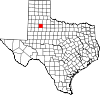 | |
| Unincorporated communities | ||
| Ghost towns | ||
| Footnotes | ‡This populated place also has portions in an adjacent county or counties | |
| International | |
|---|---|
| National | |