
Wangaratta: Difference between revisions
Tassedethe (talk | contribs) m v2.05 - Repaired 1 link to disambiguation page - (You can help) - Edward Dunlop |
m Dating maintenance tags: {{Refimprove}} {{Cn}} |
||
| (38 intermediate revisions by 15 users not shown) | |||
| Line 1: | Line 1: | ||
{{about|the city in Victoria, Australia|the [[local government area]]|Rural City of Wangaratta}} |
|||
{{Other uses}} |
|||
{{Refimprove|date=June 2024}} |
|||
{{Use dmy dates|date=October 2020}} |
{{Use dmy dates|date=October 2020}} |
||
{{Use Australian English|date=August 2012}} |
{{Use Australian English|date=August 2012}} |
||
| Line 15: | Line 16: | ||
| pop_year = 2021 |
| pop_year = 2021 |
||
| elevation = 150 |
| elevation = 150 |
||
| maxtemp = 22. |
| maxtemp = 22.2 |
||
| mintemp = 7. |
| mintemp = 7.6 |
||
| rainfall = |
| rainfall = 613.6 |
||
| poprank = |
| poprank = |
||
| est = |
| est = |
||
| Line 45: | Line 46: | ||
==History== |
==History== |
||
The [[Victorian Aborigines|original inhabitants]] of the area were the |
The [[Victorian Aborigines|original inhabitants]] of the area were the ''Pallanganmiddang'', ''WayWurru'', ''Waveroo''.<ref>{{cite web |url=http://www.abc.net.au/indigenous/map/ |title=ABC Online Indigenous - Interactive Map |website=[[Australian Broadcasting Corporation]] |access-date=2016-05-05 |url-status=live |archive-url=https://web.archive.org/web/20160426141016/http://www.abc.net.au/indigenous/map/ |archive-date=26 April 2016}}</ref> |
||
The first European explorers to pass through the Wangaratta area were [[Hume and Hovell]] (1824) who named the Oxley Plains immediately south of Wangaratta.<ref>{{cite web|url=http://shawfactor.com/gazetteer/victoria/wangaratta/|title=History of Wangaratta|url-status=live|archive-url=https://web.archive.org/web/20140128043516/http://shawfactor.com/gazetteer/victoria/wangaratta/|archive-date=28 January 2014}}</ref> [[Thomas Mitchell (explorer)|Major Thomas Mitchell]] during his 1836 expedition made a favourable report of its potential as grazing pasture. The first squatter to arrive was Thomas Rattray in 1838 who built a hut (on the site of the Wangaratta RSL) founding a settlement known as "Ovens Crossing". |
The first European explorers to pass through the Wangaratta area were [[Hume and Hovell]] (1824) who named the Oxley Plains immediately south of Wangaratta.<ref>{{cite web|url=http://shawfactor.com/gazetteer/victoria/wangaratta/|title=History of Wangaratta|url-status=live|archive-url=https://web.archive.org/web/20140128043516/http://shawfactor.com/gazetteer/victoria/wangaratta/|archive-date=28 January 2014}}</ref> [[Thomas Mitchell (explorer)|Major Thomas Mitchell]] during his 1836 expedition made a favourable report of its potential as grazing pasture. The first squatter to arrive was Thomas Rattray in 1838 who built a hut (on the site of the Wangaratta RSL) founding a settlement known as "Ovens Crossing". |
||
| Line 51: | Line 52: | ||
The Post Office in the area opened on 1 February 1843 as Ovens. The Ovens office, and the [[Kilmore, Victoria|Kilmore]] office which opened the same day, were the fifth and sixth to open in the Port Phillip District and the first two inland offices.<ref name="a">{{Citation | last = Phoenix Auctions History | title = Post Office List | url = http://www.phoenixauctions.com.au/cgi-bin/wsPhoenix.sh/Viewpocdwrapper.p?SortBy=VIC&filter=*Wangaratta* | access-date = 23 March 2021 }}</ref> |
The Post Office in the area opened on 1 February 1843 as Ovens. The Ovens office, and the [[Kilmore, Victoria|Kilmore]] office which opened the same day, were the fifth and sixth to open in the Port Phillip District and the first two inland offices.<ref name="a">{{Citation | last = Phoenix Auctions History | title = Post Office List | url = http://www.phoenixauctions.com.au/cgi-bin/wsPhoenix.sh/Viewpocdwrapper.p?SortBy=VIC&filter=*Wangaratta* | access-date = 23 March 2021 }}</ref> |
||
The name Wangaratta was given by colonial surveyor Thomas Wedge in 1848 after the "Wangaratta" cattle station, the name of which is believed to have been derived from an indigenous language and meaning "nesting place of cormorants" or "meeting of the waters".<ref>{{cite web|url=http://www.ozmobi.mobi/mobiles/viewregionlink/wangaratta |access-date=30 August 2011 |
The name Wangaratta was given by colonial surveyor Thomas Wedge in 1848 after the "Wangaratta" cattle station, the name of which is believed to have been derived from an indigenous language and meaning "nesting place of cormorants" or "meeting of the waters".<ref>{{cite web|url=http://www.ozmobi.mobi/mobiles/viewregionlink/wangaratta |access-date=30 August 2011 |archive-url=https://web.archive.org/web/20120331110104/http://www.ozmobi.mobi/mobiles/viewregionlink/wangaratta |archive-date=31 March 2012 |title=Wangaratta Holy Trinity Cathedral }}</ref> The first land sales occurred shortly afterward and the population at the time was around 200. The first school was established by William Bindall on Chisholm Street with 17 students.{{cn|date=June 2024}} |
||
Gold was found nearby at [[Beechworth]] in February 1852 and by the end of the year more than 8,000 prospectors rushed the fields of Ovens and Beechworth. Wangaratta became a major service centre to these goldfields. As a result, the first bridge over the Ovens was completed in early 1855. |
Gold was found nearby at [[Beechworth]] in February 1852 and by the end of the year more than 8,000 prospectors rushed the fields of Ovens and Beechworth.{{cn|date=June 2024}} Wangaratta became a major service centre to these goldfields. As a result, the first bridge over the Ovens was completed in early 1855.{{cn|date=June 2024}} |
||
A seven-member council incorporated the [[Borough of Wangaratta]] on 19 June 1863. |
A seven-member council incorporated the [[Borough of Wangaratta]] on 19 June 1863.{{cn|date=June 2024}} |
||
The 1870s saw the settlement establish a number of key infrastructure and services including the first water supply. Wangaratta hospital was opened in 1871 and the fire brigade was established in 1872. |
The 1870s saw the settlement establish a number of key infrastructure and services including the first water supply.{{cn|date=June 2024}} Wangaratta hospital was opened in 1871 and the fire brigade was established in 1872. The railway to Melbourne was opened on 28 October 1873.{{cn|date=June 2024}} |
||
| ⚫ | |||
On 28 June 1880 in the nearby small town of [[Glenrowan, Victoria|Glenrowan]], located some 10 km away, the final shootout that led to the capture of Australia's most famous [[bushranger]], [[Ned Kelly]] occurred. |
|||
| ⚫ | |||
| ⚫ | |||
| ⚫ | |||
[[File:Cr George Handley, Mayor and Hubert Opperman, Wangarratta, 15 Nov 1927.jpg|thumb|right|Cr George Handley, Mayor and [[Hubert Opperman]] in Wangaratta, November 15, 1927 after Opperman won the first stage of the [[Dunlop Grand Prix]]]] |
[[File:Cr George Handley, Mayor and Hubert Opperman, Wangarratta, 15 Nov 1927.jpg|thumb|right|Cr George Handley, Mayor and [[Hubert Opperman]] in Wangaratta, November 15, 1927 after Opperman won the first stage of the [[Dunlop Grand Prix]]]] |
||
| Line 73: | Line 72: | ||
Bruck textile mills was established in 1946, employing over a thousand workers.<ref>{{cite web |url=http://www.cv.vic.gov.au/stories/wangaratta-textile-town/11594/bruck-mills-wangaratta/ |title=Bruck Mills Wangaratta - Wangaratta, Textile Town |access-date=2012-07-17 |url-status=live |archive-url=https://web.archive.org/web/20120609032837/http://www.cv.vic.gov.au/stories/wangaratta-textile-town/11594/bruck-mills-wangaratta/ |archive-date=9 June 2012}}</ref> |
Bruck textile mills was established in 1946, employing over a thousand workers.<ref>{{cite web |url=http://www.cv.vic.gov.au/stories/wangaratta-textile-town/11594/bruck-mills-wangaratta/ |title=Bruck Mills Wangaratta - Wangaratta, Textile Town |access-date=2012-07-17 |url-status=live |archive-url=https://web.archive.org/web/20120609032837/http://www.cv.vic.gov.au/stories/wangaratta-textile-town/11594/bruck-mills-wangaratta/ |archive-date=9 June 2012}}</ref> |
||
Wangaratta was proclaimed a city on April 12, 1959 with a population of 12,000 people. New municipal offices were opened in 1980 which became the headquarters of the Rural City of Wangaratta after the amalgamation of municipalities in 1995. |
Wangaratta was proclaimed a city on April 12, 1959 with a population of 12,000 people.{{cn|date=June 2024}} New municipal offices were opened in 1980 which became the headquarters of the Rural City of Wangaratta after the amalgamation of municipalities in 1995.{{cn|date=June 2024}} |
||
== |
==Demographics== |
||
According to the [[2021 Australian census|2021 census]] of Population, there were 29,808 people in Wangaratta. |
According to the [[2021 Australian census|2021 census]] of Population, there were 29,808 people in Wangaratta. |
||
* Aboriginal and Torres Strait Islander people made up 1.9% of the population. |
* Aboriginal and Torres Strait Islander people made up 1.9% of the population. |
||
| Line 83: | Line 82: | ||
==Geography and landmarks== |
==Geography and landmarks== |
||
The geographical layout of the city is unusual in that the business district is located at the north-eastern extremity of the urban area, with outlying suburbs extending only to the south and west. The reason for this arrangement is that the area beyond the rivers, to the north and east of the business district, was until the 1990s prone to flooding and so unsuitable for building. Levees were constructed in the 1990s to alleviate the flooding, however development in this area has been slow. |
The geographical layout of the city is unusual in that the business district is located at the north-eastern extremity of the urban area, with outlying suburbs extending only to the south and west. The reason for this arrangement is that the area beyond the rivers, to the north and east of the business district, was until the 1990s prone to flooding and so unsuitable for building.{{cn|date=June 2024}} Levees were constructed in the 1990s to alleviate the flooding, however development in this area has been slow.{{cn|date=June 2024}} |
||
Notable buildings include the [[Holy Trinity Cathedral, Wangaratta|Holy Trinity]] [[Anglican Church of Australia|Anglican]] [[Cathedral]] and its Cathedral Close, St. Patrick's Catholic Church<ref>{{Cite web|title=Sandhurst Catholic|url=https://www.sandhurst.catholic.org.au/item/1157-wangaratta-st-patrick-s}}</ref> and the eccentric [[Art Deco|art déco]] courthouse. |
Notable buildings include the [[Holy Trinity Cathedral, Wangaratta|Holy Trinity]] [[Anglican Church of Australia|Anglican]] [[Cathedral]] and its Cathedral Close, St. Patrick's Catholic Church<ref>{{Cite web|title=Sandhurst Catholic|url=https://www.sandhurst.catholic.org.au/item/1157-wangaratta-st-patrick-s}}</ref> and the eccentric [[Art Deco|art déco]] courthouse. |
||
==Climate== |
==Climate== |
||
Since the warmest month mean reaches {{convert|22|C}}, Wangaratta would have a [[humid subtropical climate]] (''Cfa'' in the [[Köppen climate classification]]).<ref name="SpechtRundel2012">{{cite book| |
Since the warmest month mean reaches {{convert|22|C}}, Wangaratta would have a [[humid subtropical climate]] (''Cfa'' in the [[Köppen climate classification]]).<ref name="SpechtRundel2012">{{cite book|author=R.L. Specht |author2=Philip Rundel |author3=W.E. Westman |author4=P.C. Catling |author5=Jonathan Majer |author6=Penelope Greenslade |title=Mediterranean-type Ecosystems: A data source book|url=https://books.google.com/books?id=j93qCAAAQBAJ&pg=PA102|date=6 December 2012|publisher=Springer Science & Business Media|isbn=978-94-009-3099-5|page=95|url-status=live|archive-url=https://web.archive.org/web/20171111120146/https://books.google.com/books?id=j93qCAAAQBAJ&pg=PA102|archive-date=11 November 2017}}</ref> [[Rain and snow mixed|Sleet]] falls occasionally, but settled [[snowfalls]] are a very rare occurrence. |
||
Rain falls as thunderstorms in the summer, and in winter with [[cold fronts]]. Occasional severe [[heat wave]]s are caused by hot, dry air from the central deserts of Australia moving over the area. Temperatures of {{convert|40|C}} and slightly above occur 2–4 times a year on average; however, heatwaves are often succeeded by [[cold fronts]], which cause a significant drop in the temperature. Wangaratta has |
Rain falls as thunderstorms in the summer, and in winter with [[cold fronts]]. Occasional severe [[heat wave]]s are caused by hot, dry air from the central deserts of Australia moving over the area.{{cn|date=June 2024}} Temperatures of {{convert|40|C}} and slightly above occur 2–4 times a year on average; however, heatwaves are often succeeded by [[cold fronts]], which cause a significant drop in the temperature.{{cn|date=June 2024}} Wangaratta has cool nights and mornings in the summer, due in part to its western longitude exposing it to cold airmasses off the [[Southern Ocean]]. The city gets 105.1 clear days annually, which is akin to Sydney and Wollongong,{{cn|date=June 2024}} however the distribution is wildly different; Wangaratta being much sunnier from December to March, but the inverse from May to September. |
||
Rainfall averages out to {{convert| |
Rainfall averages out to {{convert|613.6|mm|in}} a year, most of which falls in winter with cold frontal showers; however these can occur at any time of year; and the main form of rainfall in late spring and summer is that from thunderstorms. Extreme temperatures have ranged from {{convert|45.8|C}} on 3 January 1990 and again on [[Early 2009 southeastern Australia heat wave|7 February 2009]] to {{convert|-7.2|C}} on 14 June 2006. |
||
{{Weather box |
{{Weather box |
||
|location = Wangaratta Aero ( |
|location = Wangaratta Aero (1987–2022); 153 m AMSL; 36.42° S, 146.31° E |
||
|metric first = Yes |
|metric first = Yes |
||
|single line = Yes |
|single line = Yes |
||
| |
|precipitation colour = green |
||
|Jan record high C = 45.8 |
|Jan record high C = 45.8 |
||
|Feb record high C = 45.8 |
|Feb record high C = 45.8 |
||
| Line 111: | Line 110: | ||
|Dec record high C = 43.1 |
|Dec record high C = 43.1 |
||
|year record high C = 45.8 |
|year record high C = 45.8 |
||
|Jan high C = 32. |
|Jan high C = 32.1 |
||
|Feb high C = |
|Feb high C = 30.9 |
||
|Mar high C = 27.6 |
|Mar high C = 27.6 |
||
|Apr high C = 22. |
|Apr high C = 22.6 |
||
|May high C = 17.4 |
|May high C = 17.4 |
||
|Jun high C = |
|Jun high C = 13.9 |
||
|Jul high C = 13. |
|Jul high C = 13.0 |
||
|Aug high C = 14.5 |
|Aug high C = 14.5 |
||
|Sep high C = 17.6 |
|Sep high C = 17.6 |
||
|Oct high C = 21. |
|Oct high C = 21.5 |
||
|Nov high C = |
|Nov high C = 25.8 |
||
|Dec high C = 29. |
|Dec high C = 29.3 |
||
|year high C = |
|year high C = |
||
|Jan low C = 14.3 |
|Jan low C = 14.3 |
||
|Feb low C = 13. |
|Feb low C = 13.7 |
||
|Mar low C = 10. |
|Mar low C = 10.8 |
||
|Apr low C = |
|Apr low C = 7.0 |
||
|May low C = 4. |
|May low C = 4.3 |
||
|Jun low C = 2. |
|Jun low C = 2.9 |
||
|Jul low C = 2.5 |
|Jul low C = 2.5 |
||
|Aug low C = |
|Aug low C = 3.0 |
||
|Sep low C = 4. |
|Sep low C = 4.6 |
||
|Oct low C = 6. |
|Oct low C = 6.5 |
||
|Nov low C = 9. |
|Nov low C = 9.5 |
||
|Dec low C = 11. |
|Dec low C = 11.8 |
||
|year low C = |
|year low C = |
||
|Jan record low C = 3.5 |
|Jan record low C = 3.5 |
||
|Feb record low C = 3.0 |
|Feb record low C = 3.0 |
||
| Line 150: | Line 149: | ||
|Dec record low C = 0.9 |
|Dec record low C = 0.9 |
||
|year record low C = -7.2 |
|year record low C = -7.2 |
||
|Jan |
|Jan precipitation mm = 44.6 |
||
|Feb |
|Feb precipitation mm = 41.2 |
||
|Mar |
|Mar precipitation mm = 40.7 |
||
|Apr |
|Apr precipitation mm = 38.6 |
||
|May |
|May precipitation mm = 56.0 |
||
|Jun |
|Jun precipitation mm = 64.9 |
||
|Jul |
|Jul precipitation mm = 63.0 |
||
|Aug |
|Aug precipitation mm = 57.8 |
||
|Sep |
|Sep precipitation mm = 54.3 |
||
|Oct |
|Oct precipitation mm = 51.5 |
||
|Nov |
|Nov precipitation mm = 51.6 |
||
|Dec |
|Dec precipitation mm = 44.2 |
||
|year |
|year precipitation mm = 613.6 |
||
|Jan |
|Jan precipitation days = 5.8 |
||
|Feb |
|Feb precipitation days = 5.4 |
||
|Mar |
|Mar precipitation days = 6.0 |
||
|Apr |
|Apr precipitation days = 6.9 |
||
|May |
|May precipitation days = 10.9 |
||
|Jun |
|Jun precipitation days = 14.5 |
||
|Jul |
|Jul precipitation days = 16.4 |
||
|Aug |
|Aug precipitation days = 14.6 |
||
|Sep |
|Sep precipitation days = 11.6 |
||
|Oct |
|Oct precipitation days = 9.6 |
||
|Nov |
|Nov precipitation days = 8.0 |
||
|Dec |
|Dec precipitation days = 7.1 |
||
|year |
|year precipitation days = 116.8 |
||
|unit |
|unit precipitation days = 0.2 mm |
||
|humidity colour=green |
|humidity colour=green |
||
|Jan afthumidity = 28 |
|Jan afthumidity = 28 |
||
|Feb afthumidity = |
|Feb afthumidity = 32 |
||
|Mar afthumidity = 33 |
|Mar afthumidity = 33 |
||
|Apr afthumidity = |
|Apr afthumidity = 42 |
||
|May afthumidity = |
|May afthumidity = 56 |
||
|Jun afthumidity = |
|Jun afthumidity = 67 |
||
|Jul afthumidity = |
|Jul afthumidity = 67 |
||
|Aug afthumidity = 61 |
|Aug afthumidity = 61 |
||
|Sep afthumidity = 55 |
|Sep afthumidity = 55 |
||
|Oct afthumidity = 46 |
|Oct afthumidity = 46 |
||
|Nov afthumidity = |
|Nov afthumidity = 38 |
||
|Dec afthumidity = 30 |
|Dec afthumidity = 30 |
||
|year afthumidity = 46 |
|year afthumidity = 46 |
||
| Line 207: | Line 206: | ||
|title=State Election 2006 Results: Electorate swings |
|title=State Election 2006 Results: Electorate swings |
||
|work=Victorian Electoral Commission website |
|work=Victorian Electoral Commission website |
||
|access-date=16 December 2007 |archive-url = https://web.archive.org/web/20071130000929/http://www.vec.vic.gov.au/electorateswing.html <!-- Bot retrieved archive --> |archive-date = 30 November 2007}}</ref> |
|access-date=16 December 2007 |archive-url = https://web.archive.org/web/20071130000929/http://www.vec.vic.gov.au/electorateswing.html <!-- Bot retrieved archive --> |archive-date = 30 November 2007}}</ref> [[Tim McCurdy]] is the current Member of Parliament for the Ovens Valley district.<ref>{{Cite web |date=2022-11-29 |title=Nationals’ Tim McCurdy wins Ovens Valley for fourth time |url=https://www.denipt.com.au/news/nationals-tim-mccurdy-wins-ovens-valley-for-fourth-time/ |access-date=2023-11-10 |website=Deniliquin Pastoral Times |language=en-US}}</ref> |
||
In [[Politics of Australia|federal politics]], Wangaratta is located in a single [[Australian House of Representatives|House of Representatives]] division—the [[Division of Indi]]. The Division of Indi was seen as a safe [[Liberal Party of Australia]] seat from 1977 until 2013, when the sitting member, [[Sophie Mirabella]] was defeated by independent candidate [[Cathy McGowan (politician)|Cathy McGowan]].<ref>{{cite web |url=http://www.theage.com.au/federal-politics/political-news/sophie-mirabella-concedes-in-indi-20130918-2tybz.html |title=Sophie Mirabella concedes in Indi |access-date=2013-09-22 |url-status=live |archive-url=https://web.archive.org/web/20130921002555/http://www.theage.com.au/federal-politics/political-news/sophie-mirabella-concedes-in-indi-20130918-2tybz.html |archive-date=21 September 2013|date=18 September 2013 }}</ref> |
In [[Politics of Australia|federal politics]], Wangaratta is located in a single [[Australian House of Representatives|House of Representatives]] division—the [[Division of Indi]]. The Division of Indi was seen as a safe [[Liberal Party of Australia]] seat from 1977 until 2013, when the sitting member, [[Sophie Mirabella]] was defeated by independent candidate [[Cathy McGowan (politician)|Cathy McGowan]].<ref>{{cite web |url=http://www.theage.com.au/federal-politics/political-news/sophie-mirabella-concedes-in-indi-20130918-2tybz.html |title=Sophie Mirabella concedes in Indi |access-date=2013-09-22 |url-status=live |archive-url=https://web.archive.org/web/20130921002555/http://www.theage.com.au/federal-politics/political-news/sophie-mirabella-concedes-in-indi-20130918-2tybz.html |archive-date=21 September 2013|date=18 September 2013 }}</ref> Dr [[Helen Haines]] is currently the federal Member of Parliament for the Division of Indi,<ref>{{Cite web |title=Indi (Key Seat) - Federal Electorate, Candidates, Results |url=https://abc.net.au/news/elections/federal/2022/guide/indi |access-date=2023-11-10 |website=abc.net.au |language=en-AU}}</ref> making history as the first independent candidate to succeed another independent, namely Cathy McGowan, in Federal Parliament.<ref>{{Cite news |date=2019-05-18 |title=Indi remains independent as Cathy McGowan's successor claims victory |language=en-AU |work=ABC News |url=https://www.abc.net.au/news/2019-05-19/federal-election-helen-haines-wins-indi-replaces-cathy-mcgowan/11126690 |access-date=2023-11-10}}</ref> |
||
==Industry== |
==Industry== |
||
| Line 251: | Line 250: | ||
The city hosted several games for the [[2005 Australian Football International Cup]] event, with several countries competing in the sport of Australian rules football. The event was played at the City Oval and Showgrounds and set the attendance records for the tournament to date. |
The city hosted several games for the [[2005 Australian Football International Cup]] event, with several countries competing in the sport of Australian rules football. The event was played at the City Oval and Showgrounds and set the attendance records for the tournament to date. |
||
Cricket in Wangaratta is organised by the [[Wangaratta and District Cricket Association]]. Clubs include City Colts, Wangaratta-Magpies & Rovers United Bruck.<ref>{{Citation | title = Wangaratta and District Cricket Association | url = http://wangaratta.cricketvictoria.com.au/wdcaclubs.html | access-date = 2009-05-11 |
Cricket in Wangaratta is organised by the [[Wangaratta and District Cricket Association]]. Clubs include City Colts, Wangaratta-Magpies & Rovers United Bruck.<ref>{{Citation | title = Wangaratta and District Cricket Association | url = http://wangaratta.cricketvictoria.com.au/wdcaclubs.html | access-date = 2009-05-11 | archive-url = https://web.archive.org/web/20091115063221/http://wangaratta.cricketvictoria.com.au/wdcaclubs.html | archive-date = 15 November 2009}}</ref> |
||
Wangaratta City Football Club is a [[soccer in Australia|soccer]] club based at South Wangaratta Reserve. Founded in 1951, they compete in the [[Albury Wodonga Football Association]]. |
Wangaratta City Football Club is a [[soccer in Australia|soccer]] club based at South Wangaratta Reserve. Founded in 1951, they compete in the [[Albury Wodonga Football Association]]. |
||
| Line 257: | Line 256: | ||
Wangaratta Knights play rugby league in NRL Victoria. |
Wangaratta Knights play rugby league in NRL Victoria. |
||
Wangaratta has a [[Thoroughbred racing in Australia|horse racing club]], the Wangaratta Turf Club, which schedules around eleven race meetings a year including the Wangaratta Cup meeting in April.<ref name="RaceClub">{{Citation|last=Country Racing Victoria |title=Wangaratta Turf Club |url=http://www.countryracing.com.au/index.php?option=com_club_info&club=52&Itemid=80 |access-date=2009-05-07 |
Wangaratta has a [[Thoroughbred racing in Australia|horse racing club]], the Wangaratta Turf Club, which schedules around eleven race meetings a year including the Wangaratta Cup meeting in April.<ref name="RaceClub">{{Citation|last=Country Racing Victoria |title=Wangaratta Turf Club |url=http://www.countryracing.com.au/index.php?option=com_club_info&club=52&Itemid=80 |access-date=2009-05-07 |archive-url=https://web.archive.org/web/20080719223537/http://countryracing.com.au/index.php?option=com_club_info&club=52&Itemid=80 |archive-date=19 July 2008 }}</ref> |
||
The Wangaratta [[Greyhound racing|Greyhound Racing]] Club, which held regular meetings at the same venue, has been discontinued. Avian Park is no longer used.<ref name="dogs">{{Citation | last = Greyhound Racing Victoria | title = Wangaratta | url = http://wangaratta.grv.org.au/index.html | access-date = 2009-04-15 |
The Wangaratta [[Greyhound racing|Greyhound Racing]] Club, which held regular meetings at the same venue, has been discontinued. Avian Park is no longer used.<ref name="dogs">{{Citation | last = Greyhound Racing Victoria | title = Wangaratta | url = http://wangaratta.grv.org.au/index.html | access-date = 2009-04-15 | archive-url = https://web.archive.org/web/20090330214043/http://wangaratta.grv.org.au/index.html | archive-date = 30 March 2009}}</ref> |
||
Golfers play at the course of the Wangaratta Golf Club on Yarrawonga Road,<ref name="golf">{{Citation | author = Golf Select | title = Wangaratta | url = http://www.golfselect.com.au/armchair/courseView.aspx?course_id=1118 | access-date = 2009-05-11 | url-status = live | archive-url = https://web.archive.org/web/20091022053225/http://golfselect.com.au/armchair/courseView.aspx?course_id=1118 | archive-date = 22 October 2009}}</ref> or at the course of the Jubilee Golf Club at Wangandary nearby.<ref name="golf2">{{Citation | author = Golf Select | title = Jubilee | url = http://www.golfselect.com.au/armchair/courseView.aspx?course_id=997 | access-date = 2009-05-11 | url-status = live | archive-url = https://web.archive.org/web/20091022042110/http://golfselect.com.au/armchair/courseView.aspx?course_id=997 | archive-date = 22 October 2009}}</ref> A nine-hole course is at [[Boorhaman]] to the north of Wangaratta.<ref name="golf3">{{Citation | author = Golf Select | title = Boorhaman | url = http://www.golfselect.com.au/armchair/courseView.aspx?course_id=934 | access-date = 2009-05-11 | url-status = live | archive-url = https://web.archive.org/web/20090924140903/http://golfselect.com.au/armchair/courseView.aspx?course_id=934 | archive-date = 24 September 2009}}</ref> |
Golfers play at the course of the Wangaratta Golf Club on Yarrawonga Road,<ref name="golf">{{Citation | author = Golf Select | title = Wangaratta | url = http://www.golfselect.com.au/armchair/courseView.aspx?course_id=1118 | access-date = 2009-05-11 | url-status = live | archive-url = https://web.archive.org/web/20091022053225/http://golfselect.com.au/armchair/courseView.aspx?course_id=1118 | archive-date = 22 October 2009}}</ref> or at the course of the Jubilee Golf Club at Wangandary nearby.<ref name="golf2">{{Citation | author = Golf Select | title = Jubilee | url = http://www.golfselect.com.au/armchair/courseView.aspx?course_id=997 | access-date = 2009-05-11 | url-status = live | archive-url = https://web.archive.org/web/20091022042110/http://golfselect.com.au/armchair/courseView.aspx?course_id=997 | archive-date = 22 October 2009}}</ref> A nine-hole course is at [[Boorhaman]] to the north of Wangaratta.<ref name="golf3">{{Citation | author = Golf Select | title = Boorhaman | url = http://www.golfselect.com.au/armchair/courseView.aspx?course_id=934 | access-date = 2009-05-11 | url-status = live | archive-url = https://web.archive.org/web/20090924140903/http://golfselect.com.au/armchair/courseView.aspx?course_id=934 | archive-date = 24 September 2009}}</ref> |
||
Between 1953 and 1956, the North Eastern Car Club ran motor racing meetings on the gravel and earth airstrip located on Wangarratta Common, south of the town centre.<ref name="Walker">{{cite book|last1=Walker|first1=Terry|title=Fast Tracks: Australia's Motor Racing Circuits: 1904-1995|date=1995|publisher=Turton & Armstrong|location=Wahroonga, NSW|isbn= |
Between 1953 and 1956, the North Eastern Car Club ran motor racing meetings on the gravel and earth airstrip located on Wangarratta Common, south of the town centre.<ref name="Walker">{{cite book|last1=Walker|first1=Terry|title=Fast Tracks: Australia's Motor Racing Circuits: 1904-1995|date=1995|publisher=Turton & Armstrong|location=Wahroonga, NSW|isbn=0-908031-55-6|page=176}}.</ref> The circuit ran up and down the airstrip, with a loop at the western end.<ref>{{cite web|last1=Galpin|first1=Darren|title=Wangaratta|url=http://www.silhouet.com/motorsport/tracks/wangarat.html|website=GEL Motorsport Information Page|access-date=1 April 2016|url-status=live|archive-url=https://web.archive.org/web/20080209023757/http://www.silhouet.com/motorsport/tracks/wangarat.html|archive-date=9 February 2008}}</ref> |
||
The North East Windsport Club regularly sail "Land Yachts" called Blokarts (Blo-karts) at their sailing site at the nearby town of [[Springhurst, Victoria]], |
The North East Windsport Club regularly sail "Land Yachts" called Blokarts (Blo-karts) at their sailing site at the nearby town of [[Springhurst, Victoria]], |
||
| Line 284: | Line 283: | ||
==Transport== |
==Transport== |
||
[[File:Wangaratta railway station.jpg|thumb|[[Wangaratta railway station]]]] |
[[File:Wangaratta railway station.jpg|thumb|[[Wangaratta railway station]]]] |
||
The [[Hume Freeway]] (M31) bypasses the city to the south and east, while the C314 now forms the main road through it (as Murphy Street and Wangaratta Road). The city is located at the junction of several other major roads, the Great Alpine Road (B500), Wangaratta-Yarrawonga Road (C374), Wangaratta-Whitfield Road (C521) and Wangaratta-Kilfeera Road (C523). A city bus service runs every half an hour during the day on weekdays and on Saturday mornings on a route covering Wangaratta's West End, the business district, Yarrunga and more recently, Yarrawonga Road. |
|||
Rail transport services both passengers and freight. [[Wangaratta railway station]] is on the [[North East railway line]], the main railway line between [[Sydney]] and Melbourne. It is served by the [[Albury V/Line rail service]] thrice-daily as well as the [[NSW TrainLink]] [[New South Wales XPT|XPT]] service twice-daily in both directions. |
Rail transport services both passengers and freight. [[Wangaratta railway station]] is on the [[North East railway line]], the main railway line between [[Sydney]] and Melbourne. It is served by the [[Albury V/Line rail service]] thrice-daily as well as the [[NSW TrainLink]] [[New South Wales XPT|XPT]] service twice-daily in both directions. |
||
| Line 294: | Line 293: | ||
Wangaratta is also serviced by a small regional airport, [[Wangaratta Airport]]. |
Wangaratta is also serviced by a small regional airport, [[Wangaratta Airport]]. |
||
== Environmental issues == |
|||
=== Land contamination at Wangaratta Clay Target Club === |
|||
In 2016, [[Environment Protection Authority (Victoria)|EPA Victoria]] received reports that lead shot were being used at the North Wangaratta Recreation Reserve. Several shots were found near the Wangaratta Clay Target Shooting Club in the Reserve. The Rural council tested the area and discovered lead levels to be above healthy conditions. The club closed for six months<ref>{{Cite web |last=Wright |first=Tony |date=2020-01-28 |title=The gun club was suffering lead poisoning... until Bridget arrived |url=https://www.smh.com.au/politics/federal/the-gun-club-was-suffering-lead-poisoning-until-bridget-arrived-20200128-p53vj8.html |access-date=2024-02-16 |website=The Sydney Morning Herald |language=en}}</ref> to remove the contaminated soil which has been stored by the club. A risk mitigation plan has been established to safely manage the soil.<ref>{{Cite web |last=Victoria |first=Environment Protection Authority |title=Contamination from the Wangaratta Clay Target Club {{!}} Environment Protection Authority Victoria |url=https://www.epa.vic.gov.au/for-community/incidents/wangaratta-clay-target-club |access-date=2024-02-16 |website=www.epa.vic.gov.au |language=en}}</ref> |
|||
=== Odour pollution at sausage skin manufacturing factory === |
|||
Van Hessen Australia is an Australian sausage skin manufacturer whose factory is situated on Shanley street in Wangaratta and impacted local communities with [[Odour pollution in Australia|odour pollution]] in 2022. More than 160 reports were received in 2 months by EPA Victoria.<ref>{{Cite web |last=Victoria |first=Environment Protection Authority |date=2022-12-23 |title=Charges against Van Hessen {{!}} Environment Protection Authority Victoria |url=https://www.epa.vic.gov.au/about-epa/news-media-and-updates/media-releases-and-news/charges-against-van-hessen |access-date=2024-01-22 |website=www.epa.vic.gov.au |language=en}}</ref> |
|||
The smell was due to Van Hessen's private wastewater treatment system which included desludging activities and upset conditions in the wastewater treatment pond. The company exceeded its licence boundary and received several notices from EPA to prevent further smell and maintain stable conditions.<ref>{{Cite web |last=Victoria |first=Environment Protection Authority |date=2023-12-06 |title=Van Hessen odour tested in court {{!}} Environment Protection Authority Victoria |url=https://www.epa.vic.gov.au/about-epa/news-media-and-updates/media-releases-and-news/van-hessen-court-outcome |access-date=2024-01-22 |website=www.epa.vic.gov.au |language=en}}</ref> |
|||
In December 2023, Van Hessen was found guilty in court and was ordered to provide $75,000 to an environmental improvement project in South Wangaratta.<ref>{{Cite web |last=Victoria |first=Environment Protection Authority |title=Wangaratta odour from wastewater treatment system {{!}} Environment Protection Authority Victoria |url=https://www.epa.vic.gov.au/for-community/incidents/wangaratta-odour-from-wastewater-treatment-system |access-date=2024-01-22 |website=www.epa.vic.gov.au |language=en}}</ref> |
|||
==Media== |
==Media== |
||
| Line 300: | Line 309: | ||
* 87.6 MHz Orbit FM – Relay of [[Kiss FM Australia|Kiss FM]] |
* 87.6 MHz Orbit FM – Relay of [[Kiss FM Australia|Kiss FM]] |
||
* 88.0 MHz [[Vision FM|Vision Radio Network]] – Christian narrowcast |
* 88.0 MHz [[Vision FM|Vision Radio Network]] – Christian narrowcast |
||
* 99.3 MHz [[Radio Sport National|RSN Racing & Sport]] |
* 99.3 MHz [[Radio Sport National|RSN Racing & Sport]] – Horse Racing narrowcast |
||
* 101.3 MHz [[3WPR|Oak FM]] |
* 101.3 MHz [[3WPR|Oak FM]] – Community |
||
* 102.1 MHz [[Edge FM]] |
* 102.1 MHz [[Edge FM]] – North East Broadcasters |
||
'''AM''' |
'''AM''' |
||
* 756 kHz [[Radio National]] – [[Australian Broadcasting Corporation|ABC]] |
* 756 kHz [[Radio National]] – [[Australian Broadcasting Corporation|ABC]] |
||
* 1566 kHz [[3NE]] |
* 1566 kHz [[3NE]] – North East Broadcasters |
||
Some stations from nearby centres such as [[ |
Some stations from nearby centres such as [[Albury–Wodonga]] and [[Shepparton]] can be heard across the region. |
||
==Notable residents and former residents== |
==Notable residents and former residents== |
||
* [[Rebecca Allen (basketball)|Rebecca Allen]] (born 1992), Australian basketball player |
* [[Rebecca Allen (basketball)|Rebecca Allen]] (born 1992), Australian basketball player |
||
* [[William Ah Ket]], Chinese Australian barrister, 1876–1936 |
* [[William Ah Ket]], Chinese Australian barrister, 1876–1936 |
||
* [[Daniel Andrews]], |
* [[Daniel Andrews]], Former Premier of Victoria |
||
* [[John Bowser|Sir John Bowser]], |
* [[John Bowser|Sir John Bowser]], Premier of Victoria, 1917–1918 |
||
* [[Alipate Carlile]], Australian rules footballer with [[Port Adelaide Football Club|Port Adelaide]] |
* [[Alipate Carlile]], Australian rules footballer with [[Port Adelaide Football Club|Port Adelaide]] |
||
* [[Isobelle Carmody]], author, born 1958 |
* [[Isobelle Carmody]], author, born 1958 |
||
| Line 322: | Line 331: | ||
* [[Greg Crump]], 5x Paralympic Wheelchair Tennis Coach |
* [[Greg Crump]], 5x Paralympic Wheelchair Tennis Coach |
||
* [[Anne Curtis]], Filipina actress, singer, TV Host |
* [[Anne Curtis]], Filipina actress, singer, TV Host |
||
* [[Weary Dunlop|Sir Edward "Weary" Dunlop]] 1907–1993 |
* [[Weary Dunlop|Sir Edward "Weary" Dunlop]], 1907–1993 |
||
* Simon Abney-Hastings, [[The Right Honourable|The Rt Hon.]] [[Simon Abney-Hastings, 15th Earl of Loudoun|The 15th Earl of Loudoun]] (born 1974), an [[Australian people|Australian]] who inherited a [[British peerage]] |
* Simon Abney-Hastings, [[The Right Honourable|The Rt Hon.]] [[Simon Abney-Hastings, 15th Earl of Loudoun|The 15th Earl of Loudoun]] (born 1974), an [[Australian people|Australian]] who inherited a [[British peerage]] |
||
* [[Belinda Hocking]], Olympic backstroke swimmer, born 1990 |
* [[Belinda Hocking]], Olympic backstroke swimmer, born 1990 |
||
* [[Steve Johnson (Australian footballer)|Steve Johnson]], Australian rules footballer with [[Geelong Football Club|Geelong]] |
* [[Steve Johnson (Australian footballer)|Steve Johnson]], Australian rules footballer with [[Geelong Football Club|Geelong]] |
||
* [[Chris Naish]], Former Australian rules footballer with [[Richmond Football Club|Richmond]] and [[Port Adelaide Football Club|Port Adelaide]] |
* [[Chris Naish]], Former Australian rules footballer with [[Richmond Football Club|Richmond]] and [[Port Adelaide Football Club|Port Adelaide]] |
||
* [[Sophie Mirabella]], |
* [[Sophie Mirabella]], Member for [[Division of Indi|Indi]], 2001–2013 |
||
* [[Nick Morris (basketball)|Nick Morris]], Paralympic Champion men's wheelchair basketball Atlanta 1996 |
* [[Nick Morris (basketball)|Nick Morris]], Paralympic Champion men's wheelchair basketball Atlanta 1996 |
||
* [[Sebastian Pasquali]], [[Association football|soccer player]] with [[AFC Ajax|Ajax]] and [[Melbourne Victory]] |
* [[Sebastian Pasquali]], [[Association football|soccer player]] with [[AFC Ajax|Ajax]] and [[Melbourne Victory]] |
||
| Line 374: | Line 383: | ||
{{authority control}} |
{{authority control}} |
||
[[Category:Cities in Victoria ( |
[[Category:Cities in Victoria (state)]] |
||
[[Category:Rural City of Wangaratta]] |
[[Category:Rural City of Wangaratta]] |
||
[[Category:Wangaratta| ]] |
[[Category:Wangaratta| ]] |
||
Latest revision as of 04:38, 12 June 2024
This article needs additional citations for verification. (June 2024) |
| Wangaratta Victoria | |||||||||
|---|---|---|---|---|---|---|---|---|---|
 Aerial view from the north-west, Hume Freeway bypass somewhere around top, One and Three Mile creeks meeting around the middle. | |||||||||
 Wangaratta Location in Victoria | |||||||||
| Coordinates | 36°21′30″S 146°18′45″E / 36.35833°S 146.31250°E | ||||||||
| Population | 29,808 (2021)[1] | ||||||||
| • Density | 517.5/km2 (1,340.3/sq mi) | ||||||||
| Elevation | 150 m (492 ft) | ||||||||
| Area | 57.6 km2 (22.2 sq mi)[2] (2011 urban) | ||||||||
| Time zone | AEST (UTC+10) | ||||||||
| • Summer (DST) | AEST (UTC+11) | ||||||||
| Location |
| ||||||||
| LGA(s) | Rural City of Wangaratta | ||||||||
| County | Moira, Delatite, Bogong | ||||||||
| State electorate(s) | Ovens Valley | ||||||||
| Federal division(s) | Indi | ||||||||
| |||||||||
Wangaratta (/ˌwæŋɡəˈrætə/ WANG-gə-RAT-ə[3]) is a city in the northeast of Victoria, Australia, 236 km (147 mi) from Melbourne along the Hume Highway. The city had a population of 29,808 per the 2021 Australian Census.[4]
The city is located at the junction of the Ovens and King rivers, which drain the northwestern slopes of the Victorian Alps. Wangaratta is the administrative centre and the most populous city in the Rural City of Wangaratta local government area.
History
[edit]The original inhabitants of the area were the Pallanganmiddang, WayWurru, Waveroo.[5]
The first European explorers to pass through the Wangaratta area were Hume and Hovell (1824) who named the Oxley Plains immediately south of Wangaratta.[6] Major Thomas Mitchell during his 1836 expedition made a favourable report of its potential as grazing pasture. The first squatter to arrive was Thomas Rattray in 1838 who built a hut (on the site of the Wangaratta RSL) founding a settlement known as "Ovens Crossing".
The Post Office in the area opened on 1 February 1843 as Ovens. The Ovens office, and the Kilmore office which opened the same day, were the fifth and sixth to open in the Port Phillip District and the first two inland offices.[7]
The name Wangaratta was given by colonial surveyor Thomas Wedge in 1848 after the "Wangaratta" cattle station, the name of which is believed to have been derived from an indigenous language and meaning "nesting place of cormorants" or "meeting of the waters".[8] The first land sales occurred shortly afterward and the population at the time was around 200. The first school was established by William Bindall on Chisholm Street with 17 students.[citation needed]
Gold was found nearby at Beechworth in February 1852 and by the end of the year more than 8,000 prospectors rushed the fields of Ovens and Beechworth.[citation needed] Wangaratta became a major service centre to these goldfields. As a result, the first bridge over the Ovens was completed in early 1855.[citation needed]
A seven-member council incorporated the Borough of Wangaratta on 19 June 1863.[citation needed]
The 1870s saw the settlement establish a number of key infrastructure and services including the first water supply.[citation needed] Wangaratta hospital was opened in 1871 and the fire brigade was established in 1872. The railway to Melbourne was opened on 28 October 1873.[citation needed]
In 1884, the railway was connected through to Sydney.[citation needed]
The population at the turn of the century reached 2,500 and the centre had developed an imposing streetscape of hotels, commercial public and religious buildings.[citation needed]

The Duke of Gloucester visited Wangaratta during his tour of Australia in 1934.[9]
,_Duke_of_Gloucester,_visit_to_Wangaratta_22_Oct_1934.jpg)
Bruck textile mills was established in 1946, employing over a thousand workers.[10]
Wangaratta was proclaimed a city on April 12, 1959 with a population of 12,000 people.[citation needed] New municipal offices were opened in 1980 which became the headquarters of the Rural City of Wangaratta after the amalgamation of municipalities in 1995.[citation needed]
Demographics
[edit]According to the 2021 census of Population, there were 29,808 people in Wangaratta.
- Aboriginal and Torres Strait Islander people made up 1.9% of the population.
- 84.6% of people were born in Australia. The next most common countries of birth were England 1.9%, Italy 1.0% and New Zealand 0.7%.
- 89.0% of people spoke only English at home. Other languages spoken at home included Italian at 1.4%.
- The most common responses for religion were No Religion 41.7%, Catholic 23.6% and Anglican 12.0%.[11]
Geography and landmarks
[edit]The geographical layout of the city is unusual in that the business district is located at the north-eastern extremity of the urban area, with outlying suburbs extending only to the south and west. The reason for this arrangement is that the area beyond the rivers, to the north and east of the business district, was until the 1990s prone to flooding and so unsuitable for building.[citation needed] Levees were constructed in the 1990s to alleviate the flooding, however development in this area has been slow.[citation needed]
Notable buildings include the Holy Trinity Anglican Cathedral and its Cathedral Close, St. Patrick's Catholic Church[12] and the eccentric art déco courthouse.
Climate
[edit]Since the warmest month mean reaches 22 °C (72 °F), Wangaratta would have a humid subtropical climate (Cfa in the Köppen climate classification).[13] Sleet falls occasionally, but settled snowfalls are a very rare occurrence.
Rain falls as thunderstorms in the summer, and in winter with cold fronts. Occasional severe heat waves are caused by hot, dry air from the central deserts of Australia moving over the area.[citation needed] Temperatures of 40 °C (104 °F) and slightly above occur 2–4 times a year on average; however, heatwaves are often succeeded by cold fronts, which cause a significant drop in the temperature.[citation needed] Wangaratta has cool nights and mornings in the summer, due in part to its western longitude exposing it to cold airmasses off the Southern Ocean. The city gets 105.1 clear days annually, which is akin to Sydney and Wollongong,[citation needed] however the distribution is wildly different; Wangaratta being much sunnier from December to March, but the inverse from May to September.
Rainfall averages out to 613.6 millimetres (24.16 in) a year, most of which falls in winter with cold frontal showers; however these can occur at any time of year; and the main form of rainfall in late spring and summer is that from thunderstorms. Extreme temperatures have ranged from 45.8 °C (114.4 °F) on 3 January 1990 and again on 7 February 2009 to −7.2 °C (19.0 °F) on 14 June 2006.
| Climate data for Wangaratta Aero (1987–2022); 153 m AMSL; 36.42° S, 146.31° E | |||||||||||||
|---|---|---|---|---|---|---|---|---|---|---|---|---|---|
| Month | Jan | Feb | Mar | Apr | May | Jun | Jul | Aug | Sep | Oct | Nov | Dec | Year |
| Record high °C (°F) | 45.8 (114.4) |
45.8 (114.4) |
39.4 (102.9) |
33.9 (93.0) |
28.2 (82.8) |
21.7 (71.1) |
20.0 (68.0) |
23.1 (73.6) |
29.3 (84.7) |
35.8 (96.4) |
41.4 (106.5) |
43.1 (109.6) |
45.8 (114.4) |
| Mean daily maximum °C (°F) | 32.1 (89.8) |
30.9 (87.6) |
27.6 (81.7) |
22.6 (72.7) |
17.4 (63.3) |
13.9 (57.0) |
13.0 (55.4) |
14.5 (58.1) |
17.6 (63.7) |
21.5 (70.7) |
25.8 (78.4) |
29.3 (84.7) |
22.2 (71.9) |
| Mean daily minimum °C (°F) | 14.3 (57.7) |
13.7 (56.7) |
10.8 (51.4) |
7.0 (44.6) |
4.3 (39.7) |
2.9 (37.2) |
2.5 (36.5) |
3.0 (37.4) |
4.6 (40.3) |
6.5 (43.7) |
9.5 (49.1) |
11.8 (53.2) |
7.6 (45.6) |
| Record low °C (°F) | 3.5 (38.3) |
3.0 (37.4) |
1.1 (34.0) |
−2.7 (27.1) |
−5.0 (23.0) |
−7.2 (19.0) |
−5.6 (21.9) |
−6.3 (20.7) |
−3.3 (26.1) |
−3.3 (26.1) |
0.1 (32.2) |
0.9 (33.6) |
−7.2 (19.0) |
| Average precipitation mm (inches) | 44.6 (1.76) |
41.2 (1.62) |
40.7 (1.60) |
38.6 (1.52) |
56.0 (2.20) |
64.9 (2.56) |
63.0 (2.48) |
57.8 (2.28) |
54.3 (2.14) |
51.5 (2.03) |
51.6 (2.03) |
44.2 (1.74) |
613.6 (24.16) |
| Average precipitation days (≥ 0.2 mm) | 5.8 | 5.4 | 6.0 | 6.9 | 10.9 | 14.5 | 16.4 | 14.6 | 11.6 | 9.6 | 8.0 | 7.1 | 116.8 |
| Average afternoon relative humidity (%) | 28 | 32 | 33 | 42 | 56 | 67 | 67 | 61 | 55 | 46 | 38 | 30 | 46 |
| Source 1: Bureau of Meteorology, Wangaratta Aero (1991–2020)[14] | |||||||||||||
| Source 2: Bureau of Meteorology, Wangaratta Aero (all years)[15] | |||||||||||||
Governance
[edit]
In local government, the Wangaratta region is covered by the Rural City of Wangaratta. The council was created in 1994 as an amalgamation of a number of other municipalities in the region with the council chambers located at the Government Centre in central Wangaratta. The city is represented by seven councillors elected once every four years by postal voting. The mayor is elected from these councillors by their colleagues for a one-year term.
In September 2013 the council was sacked by the state government. Victorian Local Government Minister Jeanette Powell said this was because "Council has failed to provide effective leadership and service for the community". The council will be replaced by an administrator who will serve until the 2016 local government elections.[16]
In state politics, Wangaratta is located in the Legislative Assembly district of Ovens Valley currently held by the National Party of Australia.[17] Tim McCurdy is the current Member of Parliament for the Ovens Valley district.[18]
In federal politics, Wangaratta is located in a single House of Representatives division—the Division of Indi. The Division of Indi was seen as a safe Liberal Party of Australia seat from 1977 until 2013, when the sitting member, Sophie Mirabella was defeated by independent candidate Cathy McGowan.[19] Dr Helen Haines is currently the federal Member of Parliament for the Division of Indi,[20] making history as the first independent candidate to succeed another independent, namely Cathy McGowan, in Federal Parliament.[21]
Industry
[edit]There is a considerable wine and gourmet food industry in the nearby Milawa and King Valley region. Other notable industries in the area include Australian Textile Mills formerly Bruck Textiles, Wilson Fabrics that now occupies the old IBM facility, Merriwa Industries and Australian Country Spinners.
Previously multi-national IBM manufactured computers in Wangaratta.[22]
Culture and sport
[edit]Sport
[edit]
Australian rules football, cricket and Netball are the most popular sports[citation needed]
There are four Australian rules football clubs in Wangaratta.
The Wangaratta Football Club, the Wangaratta Rovers Football Club, both competing in the Ovens and Murray Football League, and the North Wangaratta Football Club, which competes in the Ovens and King Football League. The close proximity of the Rovers and Wangaratta grounds reflects the historical sectarian split in membership of the clubs; Rovers membership being predominantly Catholic and Wangaratta being predominantly Protestant.[23][24]
The city hosted several games for the 2005 Australian Football International Cup event, with several countries competing in the sport of Australian rules football. The event was played at the City Oval and Showgrounds and set the attendance records for the tournament to date.
Cricket in Wangaratta is organised by the Wangaratta and District Cricket Association. Clubs include City Colts, Wangaratta-Magpies & Rovers United Bruck.[25]
Wangaratta City Football Club is a soccer club based at South Wangaratta Reserve. Founded in 1951, they compete in the Albury Wodonga Football Association.
Wangaratta Knights play rugby league in NRL Victoria.
Wangaratta has a horse racing club, the Wangaratta Turf Club, which schedules around eleven race meetings a year including the Wangaratta Cup meeting in April.[26]
The Wangaratta Greyhound Racing Club, which held regular meetings at the same venue, has been discontinued. Avian Park is no longer used.[27]
Golfers play at the course of the Wangaratta Golf Club on Yarrawonga Road,[28] or at the course of the Jubilee Golf Club at Wangandary nearby.[29] A nine-hole course is at Boorhaman to the north of Wangaratta.[30]
Between 1953 and 1956, the North Eastern Car Club ran motor racing meetings on the gravel and earth airstrip located on Wangarratta Common, south of the town centre.[31] The circuit ran up and down the airstrip, with a loop at the western end.[32]
The North East Windsport Club regularly sail "Land Yachts" called Blokarts (Blo-karts) at their sailing site at the nearby town of Springhurst, Victoria,
The city is home to the Northeast Bushrangers who play in the Big V basketball league. They play their home games at the Wangaratta YMCA.[33]
Events
[edit]The main annual event is the Wangaratta Festival of Jazz, which attracts renowned international acts and has been attended by thousands each year since 1990. Ales on the Ovens Craft Beer Festival is another main attraction for the town.
Education
[edit]Wangaratta has three secondary schools: Galen Catholic College (private), Cathedral College (private) and Wangaratta High School which has three campuses. Wangaratta has seven primary schools: Our Lady's Catholic Primary School, Appin Park Primary School, Wangaratta West Primary School, Yarrunga Primary School, St. Bernand's Primary School, St. Patrick's Primary School, and Wangaratta (Chisolm Street) Primary School
Wangaratta also has its own specialist school for people with disabilities, Wangaratta District Specialist School
The Goulburn Ovens Institute of TAFE has two Wangaratta campuses. The Docker street campus offers a broad range of courses from business studies to music with a central area containing a cafeteria, library and student services. The Christensens Lane campus on the outskirts of Wangaratta is the home for the National Centre for Equine Education as well as providing courses in horticulture.
In 2015 the Christensens Lane campus moved to a bigger site in Tone Road. And in 2016 Charles Sturt University also added a campus there. The old Christensens Lane campus was then dismantled to make way for a new housing estate.
Transport
[edit]
The Hume Freeway (M31) bypasses the city to the south and east, while the C314 now forms the main road through it (as Murphy Street and Wangaratta Road). The city is located at the junction of several other major roads, the Great Alpine Road (B500), Wangaratta-Yarrawonga Road (C374), Wangaratta-Whitfield Road (C521) and Wangaratta-Kilfeera Road (C523). A city bus service runs every half an hour during the day on weekdays and on Saturday mornings on a route covering Wangaratta's West End, the business district, Yarrunga and more recently, Yarrawonga Road.
Rail transport services both passengers and freight. Wangaratta railway station is on the North East railway line, the main railway line between Sydney and Melbourne. It is served by the Albury V/Line rail service thrice-daily as well as the NSW TrainLink XPT service twice-daily in both directions.
Historically, Wangaratta was the busy junction of several railway branch lines including; the broad gauge 5' 3"Yackandandah railway line, a narrow gauge 2' 6" Whitfield railway line and the broad gauge 5' 3" Bright and Beechworth railway line, all of which have since closed. Another short 5' 3" gauge branch line ran west to a wheat silo located on the north side of the Ovens River at Boorhaman. The current rail line through the town is the 4' 8" standard gauge rail opened in 1962.
The Murray to the Mountains Rail Trail is a shared cycling and walking track that follows the way of the former Bright railway line. The Hume Freeway runs directly next to Wangaratta.
Wangaratta is also serviced by a small regional airport, Wangaratta Airport.
Environmental issues
[edit]Land contamination at Wangaratta Clay Target Club
[edit]In 2016, EPA Victoria received reports that lead shot were being used at the North Wangaratta Recreation Reserve. Several shots were found near the Wangaratta Clay Target Shooting Club in the Reserve. The Rural council tested the area and discovered lead levels to be above healthy conditions. The club closed for six months[34] to remove the contaminated soil which has been stored by the club. A risk mitigation plan has been established to safely manage the soil.[35]
Odour pollution at sausage skin manufacturing factory
[edit]Van Hessen Australia is an Australian sausage skin manufacturer whose factory is situated on Shanley street in Wangaratta and impacted local communities with odour pollution in 2022. More than 160 reports were received in 2 months by EPA Victoria.[36]
The smell was due to Van Hessen's private wastewater treatment system which included desludging activities and upset conditions in the wastewater treatment pond. The company exceeded its licence boundary and received several notices from EPA to prevent further smell and maintain stable conditions.[37]
In December 2023, Van Hessen was found guilty in court and was ordered to provide $75,000 to an environmental improvement project in South Wangaratta.[38]
Media
[edit]Radio Stations
[edit]FM
- 87.6 MHz Orbit FM – Relay of Kiss FM
- 88.0 MHz Vision Radio Network – Christian narrowcast
- 99.3 MHz RSN Racing & Sport – Horse Racing narrowcast
- 101.3 MHz Oak FM – Community
- 102.1 MHz Edge FM – North East Broadcasters
AM
- 756 kHz Radio National – ABC
- 1566 kHz 3NE – North East Broadcasters
Some stations from nearby centres such as Albury–Wodonga and Shepparton can be heard across the region.
Notable residents and former residents
[edit]- Rebecca Allen (born 1992), Australian basketball player
- William Ah Ket, Chinese Australian barrister, 1876–1936
- Daniel Andrews, Former Premier of Victoria
- Sir John Bowser, Premier of Victoria, 1917–1918
- Alipate Carlile, Australian rules footballer with Port Adelaide
- Isobelle Carmody, author, born 1958
- Barrie Cassidy, political journalist, born in Wangaratta
- Nick Cave, popular musician
- Lloyd Crosbie, double murderer
- Greg Crump, 5x Paralympic Wheelchair Tennis Coach
- Anne Curtis, Filipina actress, singer, TV Host
- Sir Edward "Weary" Dunlop, 1907–1993
- Simon Abney-Hastings, The Rt Hon. The 15th Earl of Loudoun (born 1974), an Australian who inherited a British peerage
- Belinda Hocking, Olympic backstroke swimmer, born 1990
- Steve Johnson, Australian rules footballer with Geelong
- Chris Naish, Former Australian rules footballer with Richmond and Port Adelaide
- Sophie Mirabella, Member for Indi, 2001–2013
- Nick Morris, Paralympic Champion men's wheelchair basketball Atlanta 1996
- Sebastian Pasquali, soccer player with Ajax and Melbourne Victory
- Mette-Marit, Crown Princess of Norway
- Darcy Vescio, Australian rules footballer with Carlton Football Club
- Ben Reid, Australian rules footballer with Collingwood
- Sam Reid, Australian rules footballer with Sydney
- Quinton Tidswell, artist, died in Wangaratta in 1991
- George Turner, Science Fiction and Miles Franklin award-winning novelist
- Dean Woods, Olympic Champion cyclist Los Angeles 1984, Died in 2022
- Frederick William Wray, 1920 canon Holy Trinity Cathedral, 1928–1935 parish rector
Bibliography
[edit]- Larsen, Wal. The Mayday Hills Railway, Wal Larsen, Bright, 1976.
- O'Callaghan, Bill and Bill Findlay (1984). "Wangaratta, 1959–1984: A Silver City", City of Wangaratta.
- O'Brien, Antony. Shenanigans on the Ovens Goldfields: the 1859 Election, Artillery Publishing, 2005.
- Oberg, Leon. Railways of Australia, Reed, Sydney, 1975.
- Thompson, John E. Focus on Victoria's Narrow Gauge Whitfield Line, Puffing Billy Preservation Society, Belgrave, 2002.
- "Wangaratta: Capital of North Eastern Victoria", (1927) Committee of the Back to Wangaratta Celebrations.
- Whittaker, D. M. (1963). "Wangaratta: Being the History of the Township that sprang up at Ovens Crossing and grew into a modern City", Wangaratta City Council.
- Why Wangaratta, and Moments in Jazz (books on the Wangaratta Festival of Jazz and Blues).
Gallery
[edit]-
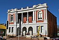
 Wangaratta Old Post Office
 -
 Wangaratta Library
 -
 Holy Trinity Anglican Cathedral
 -
 Wangaratta Roman Catholic Church
 -
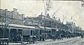 Murphy Street in 1908


.jpg)


References
[edit]- ^ "3218.0 – Regional Population Growth, Australia, 2017-18: Population Estimates by Significant Urban Area, 2008 to 2018". Australian Bureau of Statistics. Australian Bureau of Statistics. 2 February 2023. Retrieved 2 February 2023.
- ^ "2011 Census Community Profiles: Wangaratta". ABS Census. Australian Bureau of Statistics. Archived from the original on 11 November 2017. Retrieved 15 September 2016.
- ^ Macquarie ABC Dictionary, The Macquarie Library Pty Ltd, 2003, p. 1111, ISBN 1-876429-37-2
- ^ "2021 Wangaratta, Census All persons QuickStats". Retrieved 2 February 2023.
- ^ "ABC Online Indigenous - Interactive Map". Australian Broadcasting Corporation. Archived from the original on 26 April 2016. Retrieved 5 May 2016.
- ^ "History of Wangaratta". Archived from the original on 28 January 2014.
- ^ Phoenix Auctions History, Post Office List, retrieved 23 March 2021
- ^ "Wangaratta Holy Trinity Cathedral". Archived from the original on 31 March 2012. Retrieved 30 August 2011.
- ^ "The Duke's Victorian Itinerary". Retrieved 10 May 2020.
- ^ "Bruck Mills Wangaratta - Wangaratta, Textile Town". Archived from the original on 9 June 2012. Retrieved 17 July 2012.
- ^ Australian Bureau of Statistics (28 June 2022). "Wangaratta (Significant Urban Areas)". 2021 Census QuickStats. Retrieved 2 February 2023.
 Material was copied from this source, which is available under a Creative Commons Attribution 4.0 International License.
- ^ "Sandhurst Catholic".
- ^ R.L. Specht; Philip Rundel; W.E. Westman; P.C. Catling; Jonathan Majer; Penelope Greenslade (6 December 2012). Mediterranean-type Ecosystems: A data source book. Springer Science & Business Media. p. 95. ISBN 978-94-009-3099-5. Archived from the original on 11 November 2017.
- ^ "Wangaratta (Wangaratta Aero) 1991–2020 averages". Bureau of Meteorology. Retrieved 30 April 2022.
- ^ "Wangaratta (Wangaratta Aero) all years". Bureau of Meteorology. Retrieved 30 April 2022.
- ^ "Wangaratta Council sacked". 18 September 2013. Archived from the original on 21 September 2013. Retrieved 21 September 2013.
- ^ "State Election 2006 Results: Electorate swings". Victorian Electoral Commission website. Archived from the original on 30 November 2007. Retrieved 16 December 2007.
- ^ "Nationals' Tim McCurdy wins Ovens Valley for fourth time". Deniliquin Pastoral Times. 29 November 2022. Retrieved 10 November 2023.
- ^ "Sophie Mirabella concedes in Indi". 18 September 2013. Archived from the original on 21 September 2013. Retrieved 22 September 2013.
- ^ "Indi (Key Seat) - Federal Electorate, Candidates, Results". abc.net.au. Retrieved 10 November 2023.
- ^ "Indi remains independent as Cathy McGowan's successor claims victory". ABC News. 18 May 2019. Retrieved 10 November 2023.
- ^ IBM Archived 4 March 2016 at the Wayback Machine
- ^ Strevens, Steve (2004), Bob Rose: a Dignified Life, Allen & Unwin, p. 111, ISBN 1-74114-465-5, retrieved 1 April 2009
- ^ Daffey, Paul (22 December 2006), The History of the Wangaratta Rovers FNC, archived from the original on 19 March 2012, retrieved 1 April 2009
- ^ Wangaratta and District Cricket Association, archived from the original on 15 November 2009, retrieved 11 May 2009
- ^ Country Racing Victoria, Wangaratta Turf Club, archived from the original on 19 July 2008, retrieved 7 May 2009
- ^ Greyhound Racing Victoria, Wangaratta, archived from the original on 30 March 2009, retrieved 15 April 2009
- ^ Golf Select, Wangaratta, archived from the original on 22 October 2009, retrieved 11 May 2009
- ^ Golf Select, Jubilee, archived from the original on 22 October 2009, retrieved 11 May 2009
- ^ Golf Select, Boorhaman, archived from the original on 24 September 2009, retrieved 11 May 2009
- ^ Walker, Terry (1995). Fast Tracks: Australia's Motor Racing Circuits: 1904-1995. Wahroonga, NSW: Turton & Armstrong. p. 176. ISBN 0-908031-55-6..
- ^ Galpin, Darren. "Wangaratta". GEL Motorsport Information Page. Archived from the original on 9 February 2008. Retrieved 1 April 2016.
- ^ Willson Mack (Wangaratta Chronicle), US imports stay put, retrieved 15 June 2020
- ^ Wright, Tony (28 January 2020). "The gun club was suffering lead poisoning... until Bridget arrived". The Sydney Morning Herald. Retrieved 16 February 2024.
- ^ Victoria, Environment Protection Authority. "Contamination from the Wangaratta Clay Target Club | Environment Protection Authority Victoria". www.epa.vic.gov.au. Retrieved 16 February 2024.
- ^ Victoria, Environment Protection Authority (23 December 2022). "Charges against Van Hessen | Environment Protection Authority Victoria". www.epa.vic.gov.au. Retrieved 22 January 2024.
- ^ Victoria, Environment Protection Authority (6 December 2023). "Van Hessen odour tested in court | Environment Protection Authority Victoria". www.epa.vic.gov.au. Retrieved 22 January 2024.
- ^ Victoria, Environment Protection Authority. "Wangaratta odour from wastewater treatment system | Environment Protection Authority Victoria". www.epa.vic.gov.au. Retrieved 22 January 2024.
Maps
- Dept of Minerals and Energy, Wangaratta, 8125, 1:100,000 (1971)(shows the district as it was in the 1960s with railways and before major sub-division redevelopments)
External links
[edit]Localities in the Rural City of Wangaratta | ||
|---|---|---|
| City | | |
| Town | ||
| Locality |
| |
^ - Territory divided with another LGA | ||
| International | |
|---|---|
| National | |
| Geographic | |