
Bethungra, New South Wales: Difference between revisions
Removing notice of move discussion |
|||
| (25 intermediate revisions by 14 users not shown) | |||
| Line 1: | Line 1: | ||
| ⚫ | |||
{{Use Australian English|date=January 2018}} |
{{Use Australian English|date=January 2018}} |
||
{{Use dmy dates|date=January 2018}} |
{{Use dmy dates|date=January 2018}} |
||
| ⚫ | |||
{{Infobox Australian place |
{{Infobox Australian place |
||
| type = town |
| type = town |
||
| Line 11: | Line 11: | ||
| coordinates = {{coord|34|46|0|S|147|51|0|E|display=inline,title}} |
| coordinates = {{coord|34|46|0|S|147|51|0|E|display=inline,title}} |
||
| postcode = 2590 |
| postcode = 2590 |
||
| pop = |
| pop = 164 |
||
| pop_year = {{CensusAU| |
| pop_year = {{CensusAU|2016}} |
||
| pop_footnotes = |
| pop_footnotes =<ref name=Census>{{Census 2016 AUS|id=SSC10328|name=Bethungra (State Suburb)|access-date=26 August 2019|quick=on}}</ref> |
||
| established = |
| established = |
||
| elevation= 310 |
| elevation= 310 |
||
| Line 23: | Line 23: | ||
| fedgov = [[Division of Riverina|Riverina]] |
| fedgov = [[Division of Riverina|Riverina]] |
||
| dist1 = 400 |
| dist1 = 400 |
||
| location1= |
| location1= Sydney |
||
| dist2 = 70 |
| dist2 = 70 |
||
| location2= [[Wagga Wagga, New South Wales|Wagga Wagga]] |
| location2= [[Wagga Wagga, New South Wales|Wagga Wagga]] |
||
| Line 29: | Line 29: | ||
| location3= [[Cootamundra, New South Wales|Cootamundra]] |
| location3= [[Cootamundra, New South Wales|Cootamundra]] |
||
| dist4 = 10 |
| dist4 = 10 |
||
| location4= [[Illabo, New South Wales|Illabo]] |
| location4= [[Illabo, New South Wales|Illabo]]<ref>[http://www.travelmate.com.au/MapMaker/MapMaker.asp Travelmate] {{webarchive |url=https://web.archive.org/web/20070324192800/http://www.travelmate.com.au/MapMaker/Mapmaker.asp |date=24 March 2007 }}</ref> |
||
}} |
}} |
||
'''Bethungra''' is a locality in [[Junee Shire]] in the [[South West Slopes, New South Wales|South West Slopes]] region of [[New South Wales]], |
'''Bethungra''' is a locality in [[Junee Shire]] in the [[South West Slopes, New South Wales|South West Slopes]] region of [[New South Wales]], Australia situated on the [[Olympic Highway]] about 13 kilometres northeast of [[Illabo, New South Wales|Illabo]] and 24 kilometres southwest of [[Cootamundra, New South Wales|Cootamundra]].<ref>{{NSW GNR|id=MnjLXtZTGH|title=Bethungra|access-date=20 January 2010}}</ref> |
||
== History == |
|||
Bethungra Post Office opened on 1 December 1875.<ref name="PostOffice">{{Cite web | last = Premier Postal History | title = Post Office List | url = https://www.premierpostal.com/cgi-bin/wsProd.sh/Viewpocdwrapper.p?SortBy=NSW&country= | accessdate = 2009-06-11 | postscript = <!--None--> | archive-url = https://web.archive.org/web/20080819030343/https://www.premierpostal.com/cgi-bin/wsProd.sh/Viewpocdwrapper.p?SortBy=NSW&country= | archive-date = 19 August 2008 | dead-url = yes | df = dmy-all }}</ref> |
|||
Bethungra was officially established when the Post Office opened on 1 December 1875.<ref name="PostOffice">{{Cite web | last = Phoenix Auctions History | title = Post Office List | url = http://www.phoenixauctions.com.au/cgi-bin/wsPhoenix.sh/Viewpocdwrapper.p?SortBy=NSW&filter=*Bethungra* | access-date = 6 February 2021 }}</ref> |
|||
Just to the north of the town lies the [[Bethungra Spiral]], a [[Spiral (railway)|rail spiral]] built on the [[Main Southern railway line, New South Wales|Main South railway line]] to ease the gradients when the line was duplicated between 1941 and 1946. A railway station was located in the town between 1878 and the 1980s, and has now been demolished.<ref>[http://www.nswrail.net/locations/show.php?name=NSW:Bethungra&line=NSW:main_south:0 Bethungra station]. NSWrail.net, accessed 29 August 2009.</ref> |
Just to the north of the town lies the [[Bethungra Spiral]], a [[Spiral (railway)|rail spiral]] built on the [[Main Southern railway line, New South Wales|Main South railway line]] to ease the gradients when the line was duplicated between 1941 and 1946. A railway station was located in the town between 1878 and the 1980s, and has now been demolished.<ref>[http://www.nswrail.net/locations/show.php?name=NSW:Bethungra&line=NSW:main_south:0 Bethungra station]. NSWrail.net, accessed 29 August 2009.</ref> |
||
In 1885, an [[Railway accidents in New South Wales|accident]] occurred near Bethungra when a train derailed at a washed away culvert, killing five persons. |
In 1885, an [[Railway accidents in New South Wales|accident]] occurred near Bethungra when a train derailed at a washed away culvert, killing five persons.{{Citation needed|date=June 2024}} |
||
==Heritage listings== |
==Heritage listings== |
||
Bethungra has a number of heritage-listed sites, including: |
Bethungra has a number of heritage-listed sites, including: |
||
* Main Southern railway: [[Bethungra Spiral]]<ref name=nswshr-1026>{{cite NSW SHR|5011929|Bethungra Spiral|hr=01026| |
* Main Southern railway: [[Bethungra Spiral]]<ref name=nswshr-1026>{{cite NSW SHR|5011929|Bethungra Spiral|hr=01026|access-date=18 May 2018}}</ref> |
||
==Gallery== |
==Gallery== |
||
< |
<gallery> |
||
image:BethungraHotel.jpg|Bethungra Hotel aka Hotel Shirley |
image:BethungraHotel.jpg|Bethungra Hotel aka Hotel Shirley |
||
image:BethungraSpiral.jpg|Bethungra Spiral |
image:BethungraSpiral.jpg|Bethungra Spiral |
||
image:OverpassBethungra.jpg|Overpass just south of Bethungra Spiral |
image:OverpassBethungra.jpg|Overpass just south of Bethungra Spiral |
||
</ |
</gallery> |
||
== References == |
== References == |
||
| Line 56: | Line 57: | ||
{{Commons category-inline}} |
{{Commons category-inline}} |
||
{{Adjacent stations |
|||
{{s-rail-start}} |
|||
|system1=State Rail Authority |
|||
{{s-rail|title=NSW Main lines}} |
|||
|line5=Main Southern|left5=Illabo|right5=Frampton |
|||
}} |
|||
{{Riverina}} |
{{Riverina}} |
||
{{authority control}} |
|||
[[Category:Bethungra, New South Wales| ]] |
|||
[[Category:Towns in New South Wales]] |
[[Category:Towns in New South Wales]] |
||
[[Category:Junee Shire]] |
|||
[[Category:Main Southern railway line, New South Wales]] |
|||
[[Category:Populated places established in 1875]] |
|||
[[Category:1875 establishments in Australia]] |
|||
Latest revision as of 01:49, 17 June 2024
| Bethungra New South Wales | |
|---|---|
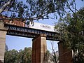
 Entering Bethungra | |
 Bethungra | |
| Coordinates | 34°46′0″S 147°51′0″E / 34.76667°S 147.85000°E |
| Population | 164 (2016 census)[1] |
| Postcode(s) | 2590 |
| Elevation | 310 m (1,017 ft) |
| Standort |
|
| LGA(s) | Junee Shire |
| County | Clarendon |
| State electorate(s) | Cootamundra |
| Federal division(s) | Riverina |
Bethungra is a locality in Junee Shire in the South West Slopes region of New South Wales, Australia situated on the Olympic Highway about 13 kilometres northeast of Illabo and 24 kilometres southwest of Cootamundra.[3]
History
[edit]Bethungra was officially established when the Post Office opened on 1 December 1875.[4]
Just to the north of the town lies the Bethungra Spiral, a rail spiral built on the Main South railway line to ease the gradients when the line was duplicated between 1941 and 1946. A railway station was located in the town between 1878 and the 1980s, and has now been demolished.[5]
In 1885, an accident occurred near Bethungra when a train derailed at a washed away culvert, killing five persons.[citation needed]
Heritage listings
[edit]Bethungra has a number of heritage-listed sites, including:
- Main Southern railway: Bethungra Spiral[6]
Gallery
[edit]-
 Bethungra Hotel aka Hotel Shirley
 -
 Bethungra Spiral
 -
 Overpass just south of Bethungra Spiral


References
[edit]- ^ Australian Bureau of Statistics (27 June 2017). "Bethungra (State Suburb)". 2016 Census QuickStats. Retrieved 26 August 2019.
- ^ Travelmate Archived 24 March 2007 at the Wayback Machine
- ^ "Bethungra". Geographical Names Register (GNR) of NSW. Geographical Names Board of New South Wales. Retrieved 20 January 2010.
- ^ Phoenix Auctions History. "Post Office List". Retrieved 6 February 2021.
- ^ Bethungra station. NSWrail.net, accessed 29 August 2009.
- ^ "Bethungra Spiral". New South Wales State Heritage Register. Department of Planning & Environment. H01026. Retrieved 18 May 2018.
 Text is licensed by State of New South Wales (Department of Planning and Environment) under CC-BY 4.0 licence.
External links
[edit]![]() Media related to Bethungra at Wikimedia Commons
Media related to Bethungra at Wikimedia Commons
| Preceding station | Former services | Following station | ||
|---|---|---|---|---|
| Illabo towards Albury
|
Main Southern Line | Frampton towards Sydney
| ||