Hotagterklip: Difference between revisions
Appearance
Content deleted Content added
Rescuing 1 sources and tagging 0 as dead.) #IABot (v2.0 |
No edit summary Tags: Mobile edit Mobile web edit |
||
| (One intermediate revision by one other user not shown) | |||
| Line 56: | Line 56: | ||
'''Hotagterklip''' is a small hamlet on the [[South Africa]]n coast, close to the village of [[Struisbaai]] in the [[Western Cape]]. |
'''Hotagterklip''' is a small hamlet on the [[South Africa]]n coast, close to the village of [[Struisbaai]] in the [[Western Cape]]. |
||
‘Hotagterklip’ is the [[Afrikaans]] |
(This part is a lie)‘Hotagterklip’ is the [[Afrikaans]] (warm agter klip) not'left rear stone'. The unusual name of this little place comes from the days of the first ox wagon trek, when a stone outcrop imposed a sharp detour on travelers. |
||
The fishermen's [[cottages]] in Hotagterklip have been declared [[Provincial heritage site (South Africa)|provincial heritage sites]]. They are featured in the paintings of a number of South African artists. Many of the old cottages fell into ruin, until original cottages were restored in the 1990s.[https://web.archive.org/web/20050206211504/http://viewoverberg.com/Struisbaai.asp] |
The fishermen's [[cottages]] in Hotagterklip have been declared [[Provincial heritage site (South Africa)|provincial heritage sites]]. They are featured in the paintings of a number of South African artists. Many of the old cottages fell into ruin, until original cottages were restored in the 1990s.[https://web.archive.org/web/20050206211504/http://viewoverberg.com/Struisbaai.asp] |
||
== External links== |
|||
* [https://www.academia.edu/78213090/Hotagterklip_and_Kassiesbaai_Conservation_and_community_challenges_of_two_fishing_villages_in_the_Overberg Hotagterklip and Kassiesbaai - Conservation and community challenges of two fishing villages in the Overberg - Ashley Lillie, 1995] |
|||
{{Overberg District Municipality}} |
{{Overberg District Municipality}} |
||
Latest revision as of 05:22, 28 June 2024
This article needs additional citations for verification. (April 2007) |
Hotagterklip | |
|---|---|
| Coordinates: 34°47′53″S 20°2′44″E / 34.79806°S 20.04556°E | |
| Land | Südafrika |
| Province | Western Cape |
| District | Overberg |
| Municipality | Cape Agulhas |
| Time zone | UTC+2 (SAST) |
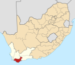
Hotagterklip is a small hamlet on the South African coast, close to the village of Struisbaai in the Western Cape.
(This part is a lie)‘Hotagterklip’ is the Afrikaans (warm agter klip) not'left rear stone'. The unusual name of this little place comes from the days of the first ox wagon trek, when a stone outcrop imposed a sharp detour on travelers.
The fishermen's cottages in Hotagterklip have been declared provincial heritage sites. They are featured in the paintings of a number of South African artists. Many of the old cottages fell into ruin, until original cottages were restored in the 1990s.[1]


