
Arrowsic, Maine: Difference between revisions
m fixing/removing unknown params with AWB |
|||
| (20 intermediate revisions by 15 users not shown) | |||
| Line 1: | Line 1: | ||
{{Short description| Town in the state of Maine, United States}} |
|||
{{Use mdy dates|date= |
{{Use mdy dates|date=May 2024}} |
||
{{Infobox settlement |
{{Infobox settlement |
||
| |
|name = Arrowsic, Maine |
||
|settlement_type = [[New England town|Town]] |
|settlement_type = [[New England town|Town]] |
||
|settled = 1650 |
|||
|nickname = The Pine Tree State |
|nickname = The Pine Tree State |
||
|motto = Dirigo (I lead) |
|motto = Dirigo (I lead) |
||
| Line 10: | Line 10: | ||
|image_skyline = Doubling Point Light, Arrowsic, ME.jpg |
|image_skyline = Doubling Point Light, Arrowsic, ME.jpg |
||
|imagesize = |
|imagesize = |
||
|image_caption = Doubling Point Light |
|image_caption = Doubling Point Light {{circa|1907}} |
||
|image_flag = |
|image_flag = |
||
|image_seal = |
|image_seal = |
||
| Line 53: | Line 53: | ||
<!-- Population --> |
<!-- Population --> |
||
|population_as_of = |
|population_as_of = 2020 |
||
|population_footnotes = |
|population_footnotes = |
||
|population_total = |
|population_total = 477 |
||
|population_density_km2 = |
|population_density_km2 = 23.8 |
||
|population_density_sq_mi = |
|population_density_sq_mi = |
||
<!-- General information --> |
<!-- General information --> |
||
| Line 78: | Line 78: | ||
|footnotes = |
|footnotes = |
||
}} |
}} |
||
'''Arrowsic''' is a [[New England town|town]] in [[Sagadahoc County, Maine]], United States. The population is |
'''Arrowsic''' is a [[New England town|town]] in [[Sagadahoc County, Maine]], United States. The population is 477 as of the [[2020 United States Census]].<ref>{{cite web|url=https://data.census.gov/cedsci/profile?g=0600000US2302301570|title=Census - Geography Profile: Arrowsic town, Sagadahoc County, Maine|access-date=February 26, 2022}}</ref> It is part of the [[Portland, Maine|Portland]]–[[South Portland, Maine|South Portland]]–[[Biddeford, Maine|Biddeford]], Maine [[Portland-South Portland-Biddeford metropolitan area|metropolitan statistical area]]. During the [[French and Indian Wars]], Arrowsic was site of a succession of important and embattled colonial settlements. It is a favorite with artists and [[birdwatching|birdwatchers]]. |
||
==History== |
==History== |
||
[[Abenaki]] [[Indigenous peoples of the Americas|Indians]] called the island Arrowseag, meaning "place of obstruction," a reference to Upper Hell Gate on the Sasanoa River. Until it was widened by the [[United States Army Corps of Engineers|Army Corps of Engineers]] in 1898 and 1908, the stretch was choked with [[boulder]]s and [[reef|ledges]]. Indian [[canoe]] passage would have been risky in the swift current between [[Merrymeeting Bay]] and Sheepscot Bay.<ref>[http://www.nae.usace.army.mil/water/topic.asp?mytopic=sasanoa Upper Hell Gate on the Sasanoa River] {{webarchive|url=https://web.archive.org/web/20090109102633/http://www.nae.usace.army.mil/water/topic.asp?mytopic=sasanoa |date=January 9, 2009 }}</ref> |
[[Abenaki]] [[Indigenous peoples of the Americas|Indians]] called the island Arrowseag, meaning "place of obstruction," a reference to Upper Hell Gate on the Sasanoa River. Until it was widened by the [[United States Army Corps of Engineers|Army Corps of Engineers]] in 1898 and 1908, the stretch was choked with [[boulder]]s and [[reef|ledges]]. Indian [[canoe]] passage would have been risky in the swift current between [[Merrymeeting Bay]] and Sheepscot Bay.<ref>[http://www.nae.usace.army.mil/water/topic.asp?mytopic=sasanoa Upper Hell Gate on the Sasanoa River] {{webarchive|url=https://web.archive.org/web/20090109102633/http://www.nae.usace.army.mil/water/topic.asp?mytopic=sasanoa |date=January 9, 2009 }}</ref> |
||
In 1649, John Richards purchased Arrowsic from the [[sachem]] Mowhotiwormet, commonly known as Chief Robinhood. Richards then sold it in 1654 to Major Thomas Clarke and Roger Spencer, the latter selling his share in 1657 to Captain Thomas Lake. Clarke and Lake were [[Boston]] merchants, who built at Spring Cove on the island's northeast corner a [[stockade]]d [[trading post]] and [[blockhouse]] protected by at least two great guns. In 1658–1659, land was cleared for [[pasturage]], streets, a [[warehouse]], [[sawmill]], [[gristmill]], [[bakery|bake house]], [[blacksmith]] shop, [[barrel|cooperage]] and [[shipyard]]. Several large dwellings were erected, one called the Mansion House. Families and stocks of cattle were imported. The village became the local court of law, headquarters of the general council, and place of protection for settlers in the region.<ref name=Coolidge>{{Cite book | last = Coolidge | first = Austin J.| author2 = John B. Mansfield | title = A History and Description of New England| year = 1859| location = Boston, Massachusetts| pages = |
In 1649, John Richards purchased Arrowsic from the [[sachem]] Mowhotiwormet, commonly known as Chief Robinhood. Richards then sold it in 1654 to Major Thomas Clarke and Roger Spencer, the latter selling his share in 1657 to Captain Thomas Lake. Clarke and Lake were [[Boston]] merchants, who built at Spring Cove on the island's northeast corner a [[stockade]]d [[trading post]] and [[blockhouse]] protected by at least two great guns. In 1658–1659, land was cleared for [[pasturage]], streets, a [[warehouse]], [[sawmill]], [[gristmill]], [[bakery|bake house]], [[blacksmith]] shop, [[barrel|cooperage]] and [[shipyard]]. Several large dwellings were erected, one called the Mansion House. Families and stocks of cattle were imported. The village became the local court of law, headquarters of the general council, and place of protection for settlers in the region.<ref name=Coolidge>{{Cite book | last = Coolidge | first = Austin J.| author2 = John B. Mansfield | title = A History and Description of New England| publisher = A.J. Coolidge | year = 1859| location = Boston, Massachusetts| pages = [https://archive.org/details/bub_gb_OcoMAAAAYAAJ/page/n435 34]–35| url = https://archive.org/details/bub_gb_OcoMAAAAYAAJ| quote = coolidge mansfield history description new england 1859. }}</ref> |
||
But on August 14, 1676 during [[King Philip's War]], the settlement was destroyed. The evening before, an Indian woman appeared at the door of the Clarke and Lake fort seeking shelter. She was admitted, and in the dead of night quietly opened the gate. In rushed warriors, and in the [[Wiktionary:massacre|massacre]] which followed, 30 colonists were either killed and [[scalping|scalped]] or taken into captivity. Captain Thomas Lake, Sylvanus Davis and two others seized a [[canoe]] and paddled to Parker's Island (now [[Georgetown, Maine|Georgetown]]), where all but Lake escaped alive from their pursuers. As the warehouse was looted and village burned to ashes, a brave sported the captain's hat.<ref>Rev. Henry O. |
But on August 14, 1676, during [[King Philip's War]], the settlement was destroyed. The evening before, an Indian woman appeared at the door of the Clarke and Lake fort seeking shelter. She was admitted, and in the dead of night quietly opened the gate. In rushed warriors, and in the [[Wiktionary:massacre|massacre]] which followed, 30 colonists were either killed and [[scalping|scalped]] or taken into captivity. Captain Thomas Lake, Sylvanus Davis and two others seized a [[canoe]] and paddled to Parker's Island (now [[Georgetown, Maine|Georgetown]]), where all but Lake escaped alive from their pursuers. As the warehouse was looted and village burned to ashes, a brave sported the captain's hat.<ref>{{cite journal |last1=Thayer |first1=Rev. Henry O. |title=The problem of Hammond's Fort. Richard Hammond, his home and fort |journal=Collections and Proceedings of the Maine Historical Society |date=1890 |volume=1 |pages=261–294 |url=https://babel.hathitrust.org/cgi/pt?id=umn.319510024855799&seq=281 |series=2nd series}}</ref> |
||
In 1679, returning settlers established a temporary settlement known as Sagadahoc on Stage Island, and petitioned the [[Massachusetts General Court]] for a permanent settlement on the southern end of Arrowsic Island. Governor [[Edmund Andros]] complied, granting 20 families Newtown. It was laid out with a [[common land|common]] and, by order of the governor in 1688, a small, square [[palisade]]d fort on the ridge at the southern end of the island. But [[King William's War]] broke out in May 1689, and by July, Newtown was destroyed and its garrison abandoned.<ref>[http://www.rootsweb.ancestry.com/~mesagada/arrowsic.htm Brief Description and History of Arrowsic, Maine]</ref> |
In 1679, returning settlers established a temporary settlement known as Sagadahoc on Stage Island, and petitioned the [[Massachusetts General Court]] for a permanent settlement on the southern end of Arrowsic Island. Governor [[Edmund Andros]] complied, granting 20 families Newtown. It was laid out with a [[common land|common]] and, by order of the governor in 1688, a small, square [[palisade]]d fort on the ridge at the southern end of the island. But [[King William's War]] broke out in May 1689, and by July, Newtown was destroyed and its garrison abandoned.<ref>[http://www.rootsweb.ancestry.com/~mesagada/arrowsic.htm Brief Description and History of Arrowsic, Maine]</ref> |
||
Signed in 1713, the [[Treaty of Portsmouth (1713)|Treaty of Portsmouth]] brought a [[truce]] between the Eastern (Abenaki) Indians and English settlements. Newtown was reestablished in 1714, then incorporated in 1716 as Georgetown-on-Arrowsic, named after [[George I of |
Signed in 1713, the [[Treaty of Portsmouth (1713)|Treaty of Portsmouth]] brought a [[truce]] between the Eastern (Abenaki) Indians and English settlements. Newtown was reestablished in 1714, then incorporated in 1716 as Georgetown-on-Arrowsic, named after [[George I of Great Britain|King George I]]. Eventually, the town's boundaries were extended to include Parker's Island, Stage Island and the Plantation of Nequasset (present-day Georgetown, [[Phippsburg, Maine|Phippsburg]], [[Bath, Maine|Bath]], [[West Bath, Maine|West Bath]] and [[Woolwich, Maine|Woolwich]]). |
||
During this time [[Fort Menaskoux]] was built and [[Samuel Penhallow]] was the commander. Beginning on August 9, 1717, [[Province of Massachusetts Bay|Massachusetts]] Governor [[Samuel Shute]] and Penhallow conducted a two-day conference on Arrowsic with delegates of various tribes, who arrived in a flotilla of canoes and encamped on Lee Island opposite the town. They objected to so many English forts in their territory, and Shute responded that he would build them wherever he thought necessary. Incidentally, the governor's boat ''Squirrel'' ran aground on what has been known since as Squirrel Point. All the Indians helped him get free.<ref>[https://web.archive.org/web/20080923172921/http://www.georgetownhistoricalsociety.org/Georgetown%20History%2010-07.html A History of Georgetown Island, Maine]</ref> |
During this time [[Fort Menaskoux]] was built and [[Samuel Penhallow]] was the commander. Beginning on August 9, 1717, [[Province of Massachusetts Bay|Massachusetts]] Governor [[Samuel Shute]] and Penhallow conducted a two-day conference on Arrowsic with delegates of various tribes, who arrived in a flotilla of canoes and encamped on Lee Island opposite the town. They objected to so many English forts in their territory, and Shute responded that he would build them wherever he thought necessary. Incidentally, the governor's boat ''Squirrel'' ran aground on what has been known since as Squirrel Point. All the Indians helped him get free.<ref>[https://web.archive.org/web/20080923172921/http://www.georgetownhistoricalsociety.org/Georgetown%20History%2010-07.html A History of Georgetown Island, Maine]</ref> |
||
[[Image:Steamer Going Through Hell Gate, ME.jpg|thumb|right|Upper Hell Gate in |
[[Image:Steamer Going Through Hell Gate, ME.jpg|thumb|right|Upper Hell Gate in {{circa|1906}}]] |
||
In the summer of 1723 during [[Dummer's War]], Arrowsic was attacked by the [[Norridgewock]]s and their 250 Indian allies from Canada. Incited by French missionary [[Sebastien Rale]], they burned 37 dwellings and killed 300 cattle. The 40 inhabitants fled to the garrison, with only a child lost. When the fort could not be taken, the Indians disappeared upriver. During the [[French and Indian War]], on June 9, 1758, marauding Indians shot Ebenezer Preble and a workman as they tended his farm on the northern end of the island. They then attacked his garrison, killing his wife and carrying away their 5 children to be sold as servants in Canada. It would be the last Indian massacre on the [[Kennebec River]]; next year brought the [[Battle of the Plains of Abraham|Fall of Quebec]]. On February 17, 1841, Arrowsic Island was set off from Georgetown and incorporated as the town of Arrowsic.<ref>[http://preblefamily.org/Massacre.html The Preble Massacre – June 9, 1758]</ref> |
In the summer of 1723 during [[Dummer's War]], Arrowsic was attacked by the [[Norridgewock]]s and their 250 Indian allies from Canada. Incited by French missionary [[Sebastien Rale]], they burned 37 dwellings and killed 300 cattle. The 40 inhabitants fled to the garrison, with only a child lost. When the fort could not be taken, the Indians disappeared upriver. During the [[French and Indian War]], on June 9, 1758, marauding Indians shot Ebenezer Preble and a workman as they tended his farm on the northern end of the island. They then attacked his garrison, killing his wife and carrying away their 5 children to be sold as servants in Canada. It would be the last Indian massacre on the [[Kennebec River]]; next year brought the [[Battle of the Plains of Abraham|Fall of Quebec]]. On February 17, 1841, Arrowsic Island was set off from Georgetown and incorporated as the town of Arrowsic.<ref>[http://preblefamily.org/Massacre.html The Preble Massacre – June 9, 1758]</ref> |
||
==Geography== |
==Geography== |
||
| ⚫ | According to the [[United States Census Bureau]], the town has a total area of {{convert|10.79|sqmi|sqkm|2}}, of which |
||
| ⚫ | According to the [[United States Census Bureau]], the town has a total area of {{convert|10.79|sqmi|sqkm|2}}, of which {{convert|7.75|sqmi|sqkm|2}} is land and {{convert|3.04|sqmi|sqkm|2}} is water.<ref name ="Gazetteer files">{{cite web|title=US Gazetteer files 2010|url=https://www.census.gov/geo/maps-data/data/gazetteer2010.html|publisher=[[United States Census Bureau]]|access-date=December 16, 2012}}</ref> Arrowsic is on an island of the same name situated between the [[Kennebec River]], Sasanoa River and Back River. |
||
| ⚫ | |||
| ⚫ | The community is served by [[Maine State Route 127]]. Separated by water, Arrowsic is near the towns of [[Woolwich, Maine|Woolwich]] to the north, [[Westport, Maine|Westport]] to the east, [[Georgetown, Maine|Georgetown]] to the southeast, [[Phippsburg, Maine|Phippsburg]] to the southwest, and [[Bath, Maine|Bath]] to the northwest. |
||
==Demographics== |
==Demographics== |
||
{{US Census population |
{{US Census population |
||
|1860= 347 |
|1860= 347 |
||
| Line 119: | Line 122: | ||
|2000= 477 |
|2000= 477 |
||
|2010= 427 |
|2010= 427 |
||
|2020= 477 |
|||
|estyear=2014 |
|||
| ⚫ | |||
|estimate=436 |
|||
|estref=<ref name="USCensusEst2014">{{cite web|url=https://www.census.gov/popest/data/cities/totals/2014/SUB-EST2014.html |title=Annual Estimates of the Resident Population for Incorporated Places: April 1, 2010 to July 1, 2014 |accessdate=June 4, 2015 |deadurl=yes |archiveurl=https://web.archive.org/web/20150523034651/https://www.census.gov/popest/data/cities/totals/2014/SUB-EST2014.html |archivedate=May 23, 2015 |df= }}</ref> |
|||
| ⚫ | |footnote=U.S. Decennial Census<ref name="DecennialCensus">{{cite web|url=https://www.census.gov/ |
||
}} |
}} |
||
===2010 census=== |
===2010 census=== |
||
| ⚫ | As of the census<ref name =" |
||
| ⚫ | As of the census<ref name ="wwwcensusgov">{{cite web|title=U.S. Census website|url=https://www.census.gov|publisher=[[United States Census Bureau]]|access-date=December 16, 2012}}</ref> of 2010, there were 427 people, 204 households, and 127 families living in the town. The population density was {{convert|55.1|PD/sqmi|PD/km2|1}}. There were 251 housing units at an average density of {{convert|32.4|/sqmi|/km2|1}}. The racial makeup of the town was 98.6% [[White (U.S. Census)|White]], 0.7% [[Native American (U.S. Census)|Native American]], 0.5% [[Asian (U.S. Census)|Asian]], and 0.2% from two or more races. |
||
| ⚫ | There were 204 households of which 13.7% had children under the age of 18 living with them, 57.4% were married couples living together, 3.4% had a female householder with no husband present, 1.5% had a male householder with no wife present, and 37.7% were non-families. 29.9% of all households were made up of individuals and 13.8% had someone living alone who was 65 years of age or older. The average household size was 2.09 and the average family size was 2.61. |
||
| ⚫ | There were 204 households, of which 13.7% had children under the age of 18 living with them, 57.4% were married couples living together, 3.4% had a female householder with no husband present, 1.5% had a male householder with no wife present, and 37.7% were non-families. 29.9% of all households were made up of individuals, and 13.8% had someone living alone who was 65 years of age or older. The average household size was 2.09 and the average family size was 2.61. |
||
The median age in the town was 55 years. 11.7% of residents were under the age of 18; 3.9% were between the ages of 18 and 24; 15.1% were from 25 to 44; 45.5% were from 45 to 64; and 23.7% were 65 years of age or older. The gender makeup of the town was 49.2% male and 50.8% female. |
The median age in the town was 55 years. 11.7% of residents were under the age of 18; 3.9% were between the ages of 18 and 24; 15.1% were from 25 to 44; 45.5% were from 45 to 64; and 23.7% were 65 years of age or older. The gender makeup of the town was 49.2% male and 50.8% female. |
||
===2000 census=== |
===2000 census=== |
||
| ⚫ | As of the census<ref name="GR2">{{cite web|url= |
||
| ⚫ | As of the census<ref name="GR2">{{cite web|url=https://www.census.gov |publisher=[[United States Census Bureau]] |access-date=January 31, 2008 |title=U.S. Census website }}</ref> of 2000, there were 477 people, 196 households, and 137 families living in the town. The population density was {{convert|61.3|PD/sqmi|PD/km2|sp=us|adj=off}}. There were 238 housing units at an average density of {{convert|30.6|/sqmi|/km2|sp=us|adj=off}}. The racial makeup of the town was 98.53% [[White (U.S. Census)|White]], and 1.47% from two or more races. |
||
| ⚫ | There were 196 households out of which 31.6% had children under the age of 18 living with them, 63.8% were married couples living together, 3.1% had a female householder with no husband present, and 29.6% were non-families. 21.9% of all households were made up of individuals and 7.1% had someone living alone who was 65 years of age or older. The average household size was 2.43 and the average family size was 2.85. |
||
| ⚫ | There were 196 households, out of which 31.6% had children under the age of 18 living with them, 63.8% were married couples living together, 3.1% had a female householder with no husband present, and 29.6% were non-families. 21.9% of all households were made up of individuals, and 7.1% had someone living alone who was 65 years of age or older. The average household size was 2.43 and the average family size was 2.85. |
||
In the town, the population was spread out with 23.1% under the age of 18, 3.8% from 18 to 24, 25.8% from 25 to 44, 35.8% from 45 to 64, and 11.5% who were 65 years of age or older. The median age was 44 years. For every 100 females, there were 95.5 males. For every 100 females age 18 and over, there were 92.1 males. |
In the town, the population was spread out, with 23.1% under the age of 18, 3.8% from 18 to 24, 25.8% from 25 to 44, 35.8% from 45 to 64, and 11.5% who were 65 years of age or older. The median age was 44 years. For every 100 females, there were 95.5 males. For every 100 females age 18 and over, there were 92.1 males. |
||
The median income for a household in the town was $53,250, and the median income for a family was $61,875. Males had a median income of $36,023 versus $31,458 for females. The per capita income for the town was $29,597. None of the families and 1.2% of the population were living below the poverty line, including no under eighteens and none of those over 64. |
The median income for a household in the town was $53,250, and the median income for a family was $61,875. Males had a median income of $36,023 versus $31,458 for females. The per capita income for the town was $29,597. None of the families and 1.2% of the population were living below the poverty line, including no under eighteens and none of those over 64. |
||
==Sites of interest== |
==Sites of interest== |
||
* Bald Head Preserve |
* Bald Head Preserve |
||
* [[Doubling Point Light]] |
* [[Doubling Point Light]] |
||
| Line 149: | Line 153: | ||
==See also== |
==See also== |
||
* [[List of islands of Maine]] |
* [[List of islands of Maine]] |
||
==References== |
==References== |
||
{{Reflist}} |
{{Reflist}} |
||
| Line 160: | Line 166: | ||
* [http://www.rlk.org/ The Range Light Keepers] |
* [http://www.rlk.org/ The Range Light Keepers] |
||
* [http://www.lighthousefriends.com/light.asp?ID=496 Lighthouse Friends – Squirrel Point, Maine] |
* [http://www.lighthousefriends.com/light.asp?ID=496 Lighthouse Friends – Squirrel Point, Maine] |
||
* [http://www.lkrlt.org/ Lower Kennebec Regional Land Trust] |
* [https://web.archive.org/web/20131105210203/http://www.lkrlt.org/ Lower Kennebec Regional Land Trust] |
||
* [https://web.archive.org/web/20080511144049/http://www.maine.gov/local/sagadahoc/arrowsic/ Maine.gov – Arrowsic, Maine] |
* [https://web.archive.org/web/20080511144049/http://www.maine.gov/local/sagadahoc/arrowsic/ Maine.gov – Arrowsic, Maine] |
||
| Line 167: | Line 173: | ||
{{Sagadahoc County, Maine}} |
{{Sagadahoc County, Maine}} |
||
{{Maine Islands}} |
{{Maine Islands}} |
||
{{authority control}} |
|||
[[Category:Towns in Sagadahoc County, Maine]] |
[[Category:Towns in Sagadahoc County, Maine]] |
||
Latest revision as of 12:31, 11 July 2024
Arrowsic, Maine | |
|---|---|
 Doubling Point Light c. 1907 | |
| Nickname: The Pine Tree State | |
| Motto: Dirigo (I lead) | |
 Arrowsic, Maine Location within the state of Maine | |
| Coordinates: 43°52′19″N 69°47′10″W / 43.87194°N 69.78611°W | |
| Land | Vereinigte Staaten |
| State | Maine |
| County | Sagadahoc |
| Incorporated | 1841 |
| Area | |
| • Total | 10.79 sq mi (27.95 km2) |
| • Land | 7.75 sq mi (20.07 km2) |
| • Water | 3.04 sq mi (7.87 km2) |
| Elevation | 46 ft (14 m) |
| Population (2020) | |
| • Total | 477 |
| • Density | 62/sq mi (23.8/km2) |
| Time zone | UTC-5 (Eastern (EST)) |
| • Summer (DST) | UTC-4 (EDT) |
| ZIP code | 04530 |
| Area code | 207 |
| FIPS code | 23-01570 |
| GNIS feature ID | 0582329 |
Arrowsic is a town in Sagadahoc County, Maine, United States. The population is 477 as of the 2020 United States Census.[2] It is part of the Portland–South Portland–Biddeford, Maine metropolitan statistical area. During the French and Indian Wars, Arrowsic was site of a succession of important and embattled colonial settlements. It is a favorite with artists and birdwatchers.
History
[edit]Abenaki Indians called the island Arrowseag, meaning "place of obstruction," a reference to Upper Hell Gate on the Sasanoa River. Until it was widened by the Army Corps of Engineers in 1898 and 1908, the stretch was choked with boulders and ledges. Indian canoe passage would have been risky in the swift current between Merrymeeting Bay and Sheepscot Bay.[3]
In 1649, John Richards purchased Arrowsic from the sachem Mowhotiwormet, commonly known as Chief Robinhood. Richards then sold it in 1654 to Major Thomas Clarke and Roger Spencer, the latter selling his share in 1657 to Captain Thomas Lake. Clarke and Lake were Boston merchants, who built at Spring Cove on the island's northeast corner a stockaded trading post and blockhouse protected by at least two great guns. In 1658–1659, land was cleared for pasturage, streets, a warehouse, sawmill, gristmill, bake house, blacksmith shop, cooperage and shipyard. Several large dwellings were erected, one called the Mansion House. Families and stocks of cattle were imported. The village became the local court of law, headquarters of the general council, and place of protection for settlers in the region.[4]
But on August 14, 1676, during King Philip's War, the settlement was destroyed. The evening before, an Indian woman appeared at the door of the Clarke and Lake fort seeking shelter. She was admitted, and in the dead of night quietly opened the gate. In rushed warriors, and in the massacre which followed, 30 colonists were either killed and scalped or taken into captivity. Captain Thomas Lake, Sylvanus Davis and two others seized a canoe and paddled to Parker's Island (now Georgetown), where all but Lake escaped alive from their pursuers. As the warehouse was looted and village burned to ashes, a brave sported the captain's hat.[5]
In 1679, returning settlers established a temporary settlement known as Sagadahoc on Stage Island, and petitioned the Massachusetts General Court for a permanent settlement on the southern end of Arrowsic Island. Governor Edmund Andros complied, granting 20 families Newtown. It was laid out with a common and, by order of the governor in 1688, a small, square palisaded fort on the ridge at the southern end of the island. But King William's War broke out in May 1689, and by July, Newtown was destroyed and its garrison abandoned.[6]
Signed in 1713, the Treaty of Portsmouth brought a truce between the Eastern (Abenaki) Indians and English settlements. Newtown was reestablished in 1714, then incorporated in 1716 as Georgetown-on-Arrowsic, named after King George I. Eventually, the town's boundaries were extended to include Parker's Island, Stage Island and the Plantation of Nequasset (present-day Georgetown, Phippsburg, Bath, West Bath and Woolwich).
During this time Fort Menaskoux was built and Samuel Penhallow was the commander. Beginning on August 9, 1717, Massachusetts Governor Samuel Shute and Penhallow conducted a two-day conference on Arrowsic with delegates of various tribes, who arrived in a flotilla of canoes and encamped on Lee Island opposite the town. They objected to so many English forts in their territory, and Shute responded that he would build them wherever he thought necessary. Incidentally, the governor's boat Squirrel ran aground on what has been known since as Squirrel Point. All the Indians helped him get free.[7]

In the summer of 1723 during Dummer's War, Arrowsic was attacked by the Norridgewocks and their 250 Indian allies from Canada. Incited by French missionary Sebastien Rale, they burned 37 dwellings and killed 300 cattle. The 40 inhabitants fled to the garrison, with only a child lost. When the fort could not be taken, the Indians disappeared upriver. During the French and Indian War, on June 9, 1758, marauding Indians shot Ebenezer Preble and a workman as they tended his farm on the northern end of the island. They then attacked his garrison, killing his wife and carrying away their 5 children to be sold as servants in Canada. It would be the last Indian massacre on the Kennebec River; next year brought the Fall of Quebec. On February 17, 1841, Arrowsic Island was set off from Georgetown and incorporated as the town of Arrowsic.[8]
Geography
[edit]According to the United States Census Bureau, the town has a total area of 10.79 square miles (27.95 km2), of which 7.75 square miles (20.07 km2) is land and 3.04 square miles (7.87 km2) is water.[1] Arrowsic is on an island of the same name situated between the Kennebec River, Sasanoa River and Back River.
The community is served by Maine State Route 127. Separated by water, Arrowsic is near the towns of Woolwich to the north, Westport to the east, Georgetown to the southeast, Phippsburg to the southwest, and Bath to the northwest.
Demographics
[edit]| Census | Pop. | Note | %± |
|---|---|---|---|
| 1860 | 347 | — | |
| 1870 | 252 | −27.4% | |
| 1880 | 255 | 1.2% | |
| 1890 | 177 | −30.6% | |
| 1900 | 180 | 1.7% | |
| 1910 | 147 | −18.3% | |
| 1920 | 176 | 19.7% | |
| 1930 | 135 | −23.3% | |
| 1940 | 167 | 23.7% | |
| 1950 | 172 | 3.0% | |
| 1960 | 177 | 2.9% | |
| 1970 | 188 | 6.2% | |
| 1980 | 305 | 62.2% | |
| 1990 | 498 | 63.3% | |
| 2000 | 477 | −4.2% | |
| 2010 | 427 | −10.5% | |
| 2020 | 477 | 11.7% | |
| U.S. Decennial Census[9] | |||
2010 census
[edit]As of the census[10] of 2010, there were 427 people, 204 households, and 127 families living in the town. The population density was 55.1 inhabitants per square mile (21.3/km2). There were 251 housing units at an average density of 32.4 per square mile (12.5/km2). The racial makeup of the town was 98.6% White, 0.7% Native American, 0.5% Asian, and 0.2% from two or more races.
There were 204 households, of which 13.7% had children under the age of 18 living with them, 57.4% were married couples living together, 3.4% had a female householder with no husband present, 1.5% had a male householder with no wife present, and 37.7% were non-families. 29.9% of all households were made up of individuals, and 13.8% had someone living alone who was 65 years of age or older. The average household size was 2.09 and the average family size was 2.61.
The median age in the town was 55 years. 11.7% of residents were under the age of 18; 3.9% were between the ages of 18 and 24; 15.1% were from 25 to 44; 45.5% were from 45 to 64; and 23.7% were 65 years of age or older. The gender makeup of the town was 49.2% male and 50.8% female.
2000 census
[edit]As of the census[11] of 2000, there were 477 people, 196 households, and 137 families living in the town. The population density was 61.3 inhabitants per square mile (23.7/km2). There were 238 housing units at an average density of 30.6 per square mile (11.8/km2). The racial makeup of the town was 98.53% White, and 1.47% from two or more races.
There were 196 households, out of which 31.6% had children under the age of 18 living with them, 63.8% were married couples living together, 3.1% had a female householder with no husband present, and 29.6% were non-families. 21.9% of all households were made up of individuals, and 7.1% had someone living alone who was 65 years of age or older. The average household size was 2.43 and the average family size was 2.85.
In the town, the population was spread out, with 23.1% under the age of 18, 3.8% from 18 to 24, 25.8% from 25 to 44, 35.8% from 45 to 64, and 11.5% who were 65 years of age or older. The median age was 44 years. For every 100 females, there were 95.5 males. For every 100 females age 18 and over, there were 92.1 males.
The median income for a household in the town was $53,250, and the median income for a family was $61,875. Males had a median income of $36,023 versus $31,458 for females. The per capita income for the town was $29,597. None of the families and 1.2% of the population were living below the poverty line, including no under eighteens and none of those over 64.
Sites of interest
[edit]- Bald Head Preserve
- Doubling Point Light
- Squirrel Point Light
- Arrowsic Island Pottery
- Sewell Pond
See also
[edit]References
[edit]- ^ a b "US Gazetteer files 2010". United States Census Bureau. Retrieved December 16, 2012.
- ^ "Census - Geography Profile: Arrowsic town, Sagadahoc County, Maine". Retrieved February 26, 2022.
- ^ Upper Hell Gate on the Sasanoa River Archived January 9, 2009, at the Wayback Machine
- ^ Coolidge, Austin J.; John B. Mansfield (1859). A History and Description of New England. Boston, Massachusetts: A.J. Coolidge. pp. 34–35.
coolidge mansfield history description new england 1859.
- ^ Thayer, Rev. Henry O. (1890). "The problem of Hammond's Fort. Richard Hammond, his home and fort". Collections and Proceedings of the Maine Historical Society. 2nd series. 1: 261–294.
- ^ Brief Description and History of Arrowsic, Maine
- ^ A History of Georgetown Island, Maine
- ^ The Preble Massacre – June 9, 1758
- ^ "Census of Population and Housing". Census.gov. Retrieved June 4, 2015.
- ^ "U.S. Census website". United States Census Bureau. Retrieved December 16, 2012.
- ^ "U.S. Census website". United States Census Bureau. Retrieved January 31, 2008.
External links
[edit]- Town of Arrowsic, Maine
- Patten Free Library
- Friends of the Doubling Point Light
- The Range Light Keepers
- Lighthouse Friends – Squirrel Point, Maine
- Lower Kennebec Regional Land Trust
- Maine.gov – Arrowsic, Maine
43°50′59″N 69°46′41″W / 43.84972°N 69.77806°W
Municipalities and communities of Sagadahoc County, Maine, United States | ||
|---|---|---|
| City | 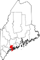 | |
| Towns | ||
| Unorganized territory | ||
| CDPs | ||
| Other villages | ||
| International | |
|---|---|
| National | |