Vetluga (river): Difference between revisions
Appearance
Content deleted Content added
m cat |
RodRabelo7 (talk | contribs) m deprecated |
||
| (46 intermediate revisions by 35 users not shown) | |||
| Line 1: | Line 1: | ||
{{Short description|River in Russia}} |
|||
{{For|the town in Nizhny Novgorod Oblast|Vetluga}} |
{{For|the town in Nizhny Novgorod Oblast|Vetluga}} |
||
{{Infobox |
{{Infobox river |
||
| |
|name = Vetluga |
||
|native_name = {{native name|ru|Ветлуга}} |
|||
| |
|image = Vetluga river.jpg |
||
|caption = |
|||
| |
|image_caption = |
||
|source1_location = |
|||
| ⚫ | |||
| |
|mouth = [[Volga]] |
||
|mouth_coordinates = {{coord|56|27|44|N|46|14|14|E|region:RU-ME_type:waterbody_source:kolossus-etwiki|display=it}} |
|||
|length = 889 km |
|||
|subdivision_type1 = Country |
|||
|elevation = |
|||
|subdivision_name1 = [[Russia]] |
|||
|discharge = 255 m<sup>3</sup>/s |
|||
|length = {{convert|889|km|mi|abbr=on}} |
|||
|watershed = 39,000 km² |
|||
|source1_elevation = |
|||
|discharge1_avg = {{convert|255|m3/s|cuft/s|abbr=on}} |
|||
|basin_size = {{convert|39400|km2|mi2|abbr=on}} |
|||
|progression = {{RVolga}} |
|||
}} |
}} |
||
'''Vetluga''' ({{ |
The '''Vetluga''' ({{Lang-ru|Ветлу́га}}, {{IPA|ru|vʲɪtˈlugə|IPA}}; {{Lang-chm|Вӱтла|Vütla}}) is a river that flows through [[Kirov Oblast]], [[Kostroma Oblast]], [[Mari El]] and [[Nizhny Novgorod Oblast]] in [[Russia]]. It is a left [[tributary]] of the [[Volga]].<ref name=bse>[http://bse.sci-lib.com/article004576.html Ветлуга (река)], [[Great Soviet Encyclopedia]]</ref> Their confluence is near [[Kozmodemyansk]]. The river is navigable. It is {{convert|889|km}} long, and has a [[drainage basin]] of {{convert|39400|km2}}.<ref name=bse/> Its largest tributaries are Neya, Bolshaya Kaksha, [[Usta (Russia)|Usta]] and Yuronga from the left and Vokhma and Lyunda from the right.<ref name=bse/> The town [[Vetluga]] is situated on the river. |
||
== References == |
|||
{{Volga}} |
|||
{{Reflist}} |
|||
| ⚫ | |||
{{Rivers of Russia}} |
|||
[[Category:Rivers of Kirov Oblast]] |
[[Category:Rivers of Kirov Oblast]] |
||
| Line 22: | Line 31: | ||
[[Category:Rivers of Nizhny Novgorod Oblast]] |
[[Category:Rivers of Nizhny Novgorod Oblast]] |
||
| ⚫ | |||
| ⚫ | |||
{{KirovOblast-geo-stub}} |
|||
[[cv:Ветлуга (юханшыв)]] |
|||
{{KostromaOblast-geo-stub}} |
|||
[[de:Wetluga]] |
|||
| ⚫ | |||
[[et:Vetluga jõgi]] |
|||
{{NizhnyNovgorodOblast-geo-stub}} |
|||
[[fr:Vetlouga]] |
|||
| ⚫ | |||
[[ko:베틀루가 강]] |
|||
[[hr:Vetluga (rijeka)]] |
|||
[[it:Vetluga (fiume)]] |
|||
[[lt:Vetluga]] |
|||
[[hu:Vetluga]] |
|||
[[no:Vetluga (elv)]] |
|||
[[pl:Wietługa (rzeka)]] |
|||
[[ru:Ветлуга (река)]] |
|||
[[sr:Ветлуга]] |
|||
[[fi:Vetluga (joki)]] |
|||
Latest revision as of 03:22, 12 August 2024
| Vetluga | |
|---|---|
 | |
| Native name | Ветлуга (Russian) |
| Standort | |
| Land | Russland |
| Physical characteristics | |
| Mouth | Volga |
• coordinates | 56°27′44″N 46°14′14″E / 56.46222°N 46.23722°E |
| Length | 889 km (552 mi) |
| Basin size | 39,400 km2 (15,200 sq mi) |
| Discharge | |
| • average | 255 m3/s (9,000 cu ft/s) |
| Basin features | |
| Progression | Volga→ Caspian Sea |
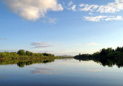
The Vetluga (Russian: Ветлу́га, IPA: [vʲɪtˈlugə]; Mari: Вӱтла, romanized: Vütla) is a river that flows through Kirov Oblast, Kostroma Oblast, Mari El and Nizhny Novgorod Oblast in Russland. It is a left tributary of the Volga.[1] Their confluence is near Kozmodemyansk. The river is navigable. It is 889 kilometres (552 mi) long, and has a drainage basin of 39,400 square kilometres (15,200 sq mi).[1] Its largest tributaries are Neya, Bolshaya Kaksha, Usta and Yuronga from the left and Vokhma and Lyunda from the right.[1] The town Vetluga is situated on the river.
References
[edit]

