
Interstate 95 in New York: Difference between revisions
Kolya75Media (talk | contribs) →Exit list: There is a northbound entrance |
|||
| (48 intermediate revisions by 8 users not shown) | |||
| Line 15: | Line 15: | ||
| established = August 14, 1957<ref name="1957ihmap" /> |
| established = August 14, 1957<ref name="1957ihmap" /> |
||
| direction_a = South |
| direction_a = South |
||
| terminus_a = {{Jct|state=NJ|I|95|US|1-9|US|46}} at the [[New Jersey]] state line |
| terminus_a = {{Jct|state=NJ|I|95|US|1-9|US|46}} at the [[New Jersey]] state line in [[Manhattan]] |
||
| junction = {{plainlist| |
| junction = {{plainlist| |
||
*{{Jct|state=NY|US|9|NY|9A|Parkway|Henry Hudson}} in |
*{{Jct|state=NY|US|9|NY|9A|Parkway|Henry Hudson}} in Manhattan |
||
*{{Jct|state=NY|Parkway|Harlem River}} in [[Manhattan]] |
*{{Jct|state=NY|Parkway|Harlem River}} in [[Manhattan]] |
||
*{{Jct|state=NY|I|87}} in [[Morris Heights, Bronx|Morris Heights]] |
*{{Jct|state=NY|I|87}} in [[Morris Heights, Bronx|Morris Heights]] |
||
| Line 23: | Line 23: | ||
*{{Jct|state=NY|Parkway|Bronx River NYC}} in [[Soundview, Bronx|Soundview]] |
*{{Jct|state=NY|Parkway|Bronx River NYC}} in [[Soundview, Bronx|Soundview]] |
||
*{{Jct|state=NY|I|278|I|295|I|678}} in [[Throggs Neck]] |
*{{Jct|state=NY|I|278|I|295|I|678}} in [[Throggs Neck]] |
||
*{{jct|state=NY|Parkway|Pelham}} / Shore Road in [[Pelham Bay Park]] |
*{{jct|state=NY|Parkway|Pelham}} / [[Pelham Road|Shore Road]] in [[Pelham Bay Park]] |
||
*{{Jct|state=NY|Parkway|Hutchinson River}} in [[Pelham Bay Park]] and [[Eastchester, Bronx|Eastchester]] |
*{{Jct|state=NY|Parkway|Hutchinson River}} in [[Pelham Bay Park]] and [[Eastchester, Bronx|Eastchester]] |
||
*{{jct|state=NY|I|287|US|1}} in [[Rye (city), New York|Rye]] |
*{{jct|state=NY|I|287|US|1}} in [[Rye (city), New York|Rye]] |
||
| Line 43: | Line 43: | ||
===Manhattan=== |
===Manhattan=== |
||
[[File: |
[[File:2024-05-30 13 23 32 View south along Interstate 95 and U.S. Route 1 and west along the Trans-Manhattan Expressway from the overpass for Amsterdam Avenue in Manhattan, New York City, New York.jpg|thumb|left|Road and apartments over the Trans-Manhattan Expressway]] |
||
At its western end, the Trans-Manhattan Expressway is part of I-95, [[U.S. Route 1 in New York|US 1]], and [[U.S. Route 9 in New York|US 9]] at the eastern approach to the George Washington Bridge. It crosses [[Fort Washington Park (Manhattan)|Fort Washington Park]], connecting with the [[Henry Hudson Parkway]] ([[New York State Route 9A|NY 9A]]) at the park's eastern edge near [[Riverside Drive (Manhattan)|Riverside Drive]] and [[168th Street (Manhattan)|168th Street]].<ref>{{Google maps|url=https://www.google.com/maps/@40.843162,-73.943991,3a,75y,216.54h,88.54t/data=!3m4!1e1!3m2!1s9nQ5-kTlrYPTnviPlF_RmQ!2e0?hl=en|access-date=December 29, 2022|title=1076 Riverside Dr}}</ref> The route continues, crossing the Manhattan neighborhood of [[Washington Heights, Manhattan|Washington Heights]] in a [[Cut (earthworks)|cut]] flanked by [[178th Street (Manhattan)|178th Street]] to the south and [[179th Street (Manhattan)|179th Street]] to the north. Roughly midway across Manhattan, US 9 leaves the freeway to follow [[Broadway (Manhattan)|Broadway]] northward toward [[the Bronx]] and [[Westchester County, New York|Westchester County]]. Proceeding eastward, the road has several ramps that connect to the [[Harlem River Drive]] and the expressway's original Harlem |
At its western end, the Trans-Manhattan Expressway is part of I-95, [[U.S. Route 1 in New York|US 1]], and [[U.S. Route 9 in New York|US 9]] at the eastern approach to the George Washington Bridge. It crosses [[Fort Washington Park (Manhattan)|Fort Washington Park]], connecting with the [[Henry Hudson Parkway]] ([[New York State Route 9A|NY 9A]]) at the park's eastern edge near [[Riverside Drive (Manhattan)|Riverside Drive]] and [[168th Street (Manhattan)|168th Street]].<ref>{{Google maps|url=https://www.google.com/maps/@40.843162,-73.943991,3a,75y,216.54h,88.54t/data=!3m4!1e1!3m2!1s9nQ5-kTlrYPTnviPlF_RmQ!2e0?hl=en|access-date=December 29, 2022|title=1076 Riverside Dr}}</ref> The route continues, crossing the Manhattan neighborhood of [[Washington Heights, Manhattan|Washington Heights]] in a [[Cut (earthworks)|cut]] flanked by [[178th Street (Manhattan)|178th Street]] to the south and [[179th Street (Manhattan)|179th Street]] to the north. Roughly midway across Manhattan, US 9 leaves the freeway to follow [[Broadway (Manhattan)|Broadway]] northward toward [[the Bronx]] and [[Westchester County, New York|Westchester County]]. Proceeding eastward, the road has several ramps that connect to the [[Harlem River Drive]] and the expressway's original Harlem River crossing, the [[Washington Bridge (Harlem River)|Washington Bridge]] (now carrying [[181st Street (Manhattan)|181st Street]] local traffic over the [[Harlem River]]). At [[Highbridge Park]], the roadway crosses the [[Alexander Hamilton Bridge]] to the Bronx, where it becomes the [[Cross Bronx Expressway]].<ref name="bing">{{bing maps|url=http://binged.it/1b6Ecrl|title=overview map of Interstate 95|access-date=September 25, 2013}}</ref> |
||
The Trans-Manhattan Expressway replaced [[178th-179th Street Tunnels|tunnels under 178th and 179th Streets]] as the crosstown route. |
The Trans-Manhattan Expressway replaced [[178th-179th Street Tunnels|tunnels under 178th and 179th Streets]] as the crosstown route. |
||
| Line 56: | Line 56: | ||
===The Bronx=== |
===The Bronx=== |
||
{{see also|Cross Bronx Expressway|Bruckner Expressway}} |
{{see also|Cross Bronx Expressway|Bruckner Expressway}} |
||
[[File:2024-06-18 12 30 58 View south along Interstate 95 (Bruckner Expressway) from the pedestrian overpass at Pelham Bay Park station in the Bronx, New York City, New York.jpg|thumb|right|Southbound I-95 (Bruckner Expressway) at Westchester Avenue adjacent to [[Pelham Bay Park]]]] |
|||
After exit 2, I-95 crosses over the [[Harlem River]] and enters [[the Bronx]], entering an interchange with the [[Major Deegan Expressway]] ([[Interstate 87 (New York)|I-87]]), which is marked both exit 1C (following with the Cross Bronx Expressway) and exit 3A–B (matching with the Trans-Manhattan Expressway). Now the Cross Bronx Expressway, I-95 and US 1 continue east under University Avenue and enter exit 2A, which serves [[Jerome Avenue]]. Crossing under the [[Grand Concourse (Bronx)|Grand Concourse]], the six-lane expressway crosses into exit 2B, which is for [[Webster Avenue]]. This interchange also marks the eastern end of the I-95/US 1 [[Concurrency (road)|concurrency]]. Passing south of [[Tremont Park]], the Cross Bronx Expressway westbound serves exit 3, which serves [[Third Avenue]].<ref name="bing" /> |
After exit 2, I-95 crosses over the [[Harlem River]] and enters [[the Bronx]], entering an interchange with the [[Major Deegan Expressway]] ([[Interstate 87 (New York)|I-87]]), which is marked both exit 1C (following with the Cross Bronx Expressway) and exit 3A–B (matching with the Trans-Manhattan Expressway). Now the Cross Bronx Expressway, I-95 and US 1 continue east under University Avenue and enter exit 2A, which serves [[Jerome Avenue]]. Crossing under the [[Grand Concourse (Bronx)|Grand Concourse]], the six-lane expressway crosses into exit 2B, which is for [[Webster Avenue]]. This interchange also marks the eastern end of the I-95/US 1 [[Concurrency (road)|concurrency]]. Passing south of [[Tremont Park]], the Cross Bronx Expressway westbound serves exit 3, which serves [[Third Avenue]].<ref name="bing" /> |
||
At East 176th Street, the Cross Bronx Expressway turns southeast, entering exit 4A eastbound, which marks the northern terminus of [[New York State Route 895|NY 895]] (Sheridan Boulevard). After crossing the [[Bronx River]], the expressway enters a full interchange, exit 4B, with the [[Bronx River Parkway]].<ref name="bing" /> After a curve from the parkway, the Cross Bronx Expressway begins paralleling East 177th Street<ref>{{cite act |url=http://legistar.council.nyc.gov/LegislationDetail.aspx?ID=1709698&GUID=9518C471-1983-4D22-82B5-15CE7EF4D9A4&Options=&Search= |title=A Local Law in relation to renaming two thoroughfares and public places in the Borough of the Bronx, East 177th Street, and to amend the official map of the city of New York accordingly. |number=2018-035 |date=January 11, 2018}}</ref> and enters exit 5A, which connects to [[White Plains Road]] in [[Parkchester, Bronx|Parkchester]]. Continuing southeast, the roadway enters exit 5B, Castle Hill Avenue, which is an eastbound-only exit. After Castle Hill Avenue, the route enters exit 6A, which reaches the [[Hutchinson River Parkway]] at the [[Bruckner Interchange]]. Changing to the [[Bruckner Expressway]], which runs to the northeast, I-95 enters the Bruckner Interchange with the northern terminuses of [[Interstate 678|I-678]] and [[Interstate 278|I-278]]; the Cross Bronx Expressway Extension turns southeast along [[Interstate 295 (New York)|I-295]] at the same interchange.<ref name="bing" /> |
At East 176th Street, the Cross Bronx Expressway turns southeast, entering exit 4A eastbound, which marks the northern terminus of [[New York State Route 895|NY 895]] (Sheridan Boulevard). After crossing the [[Bronx River]], the expressway enters a full interchange, exit 4B, with the [[Bronx River Parkway]].<ref name="bing" /> After a curve from the parkway, the Cross Bronx Expressway begins paralleling East 177th Street<ref>{{cite act |url=http://legistar.council.nyc.gov/LegislationDetail.aspx?ID=1709698&GUID=9518C471-1983-4D22-82B5-15CE7EF4D9A4&Options=&Search= |title=A Local Law in relation to renaming two thoroughfares and public places in the Borough of the Bronx, East 177th Street, and to amend the official map of the city of New York accordingly. |number=2018-035 |date=January 11, 2018}}</ref> and enters exit 5A, which connects to [[White Plains Road]] in [[Parkchester, Bronx|Parkchester]]. Continuing southeast, the roadway enters exit 5B, Castle Hill Avenue, which is an eastbound-only exit. After Castle Hill Avenue, the route enters exit 6A, which reaches the [[Hutchinson River Parkway]] at the [[Bruckner Interchange]]. Changing to the [[Bruckner Expressway]], which runs to the northeast, I-95 enters the Bruckner Interchange with the northern terminuses of [[Interstate 678|I-678]] and [[Interstate 278|I-278]]; the Cross Bronx Expressway Extension turns southeast along [[Interstate 295 (New York)|I-295]] at the same interchange.<ref name="bing" /> |
||
[[File:2024-06-18 12 58 14 View north along Interstate 95 (New England Thruway) from the pedestrian overpass at Dyre Avenue in the Bronx, New York City, New York.jpg|thumb|right|Northbound I-95 (New England Thruway) at Dyre Avenue in the Bronx]] |
|||
After the Bruckner Interchange, I-95 crosses Tremont Avenue before crossing over [[Interstate 695 (New York)|I-695]] (the Throgs Neck Expressway). Southbound, exit 7A serves I-695, while northbound the two Interstates merge. Continuing north, the Bruckner Expressway and I-95 parallel Bruckner Boulevard and run along the western edge of [[Pelham Bay Park]]. Entering exit 8A southbound services Westchester Avenue while northbound, exits 8B and 8C serve [[Pelham Parkway]] and Shore Road through the park, which marks the northern end of the Bruckner Expressway. Now known as the New England Thruway, I-95 leaves Pelham Bay Park and enters exit 9, a junction with the Hutchinson River Parkway. In the middle of the interchange with the Hutchinson River, exit 10 forks to the left, reaching [[Gun Hill Road (road)|Gun Hill Road]].<ref name="bing" /> |
After the Bruckner Interchange, I-95 crosses Tremont Avenue before crossing over [[Interstate 695 (New York)|I-695]] (the Throgs Neck Expressway). Southbound, exit 7A serves I-695, while northbound the two Interstates merge. Continuing north, the Bruckner Expressway and I-95 parallel Bruckner Boulevard and run along the western edge of [[Pelham Bay Park]]. Entering exit 8A southbound services Westchester Avenue while northbound, exits 8B and 8C serve [[Pelham Parkway]] and Shore Road through the park, which marks the northern end of the Bruckner Expressway. Now known as the New England Thruway, I-95 leaves Pelham Bay Park and enters exit 9, a junction with the Hutchinson River Parkway. In the middle of the interchange with the Hutchinson River, exit 10 forks to the left, reaching [[Gun Hill Road (road)|Gun Hill Road]].<ref name="bing" /> |
||
Now paralleling Baychester Avenue, which also services exit 11 and Bartow Avenue, the New England Thruway continues north and enters exit 12 which connects to [[Baychester, Bronx|Baychester]]. Conner Street |
Now paralleling Baychester Avenue, which also services exit 11 and Bartow Avenue, the New England Thruway continues north and enters exit 12 which connects to [[Baychester, Bronx|Baychester]]. US 1, [[New York State Route 22|NY 22]] and Conner Street are connected to via exit 13 before I-95 turns east and crosses over the [[Hutchinson River]]. After crossing the river, the route enters an interchange once again with the Hutchinson River Parkway (exit 14) but this time southbound only.<ref name="bing" /> |
||
===Westchester=== |
===Westchester=== |
||
| Line 70: | Line 72: | ||
Crossing over [[Metro-North Railroad]] tracks, the Interstate turns northeast and crossing through downtown New Rochelle, reaching exit 16, serving several local streets including Cross Avenue, Cedar Street, and Garden Street. North of exit 16, the New England Thruway enters its lone [[open road tolling|toll gantry]] along the alignment, serving the northbound direction only. The road continues northeast through New Rochelle, passing exit 17 as it enters the town of [[Mamaroneck, New York|Mamaroneck]]. Exit 17 connects to Chatsworth Avenue in the [[Larchmont, New York|Larchmont]] section. Passing a pedestrian footbridge for the [[Larchmont station]], crossing over [[New York State Route 125|NY 125]] (Weaver Street). Winding north through Mamaroneck, I-95 enters exit 18A, servicing Fenimore Road in the village of [[Mamaroneck (village), New York|Mamaroneck]].<ref name="bing" /> |
Crossing over [[Metro-North Railroad]] tracks, the Interstate turns northeast and crossing through downtown New Rochelle, reaching exit 16, serving several local streets including Cross Avenue, Cedar Street, and Garden Street. North of exit 16, the New England Thruway enters its lone [[open road tolling|toll gantry]] along the alignment, serving the northbound direction only. The road continues northeast through New Rochelle, passing exit 17 as it enters the town of [[Mamaroneck, New York|Mamaroneck]]. Exit 17 connects to Chatsworth Avenue in the [[Larchmont, New York|Larchmont]] section. Passing a pedestrian footbridge for the [[Larchmont station]], crossing over [[New York State Route 125|NY 125]] (Weaver Street). Winding north through Mamaroneck, I-95 enters exit 18A, servicing Fenimore Road in the village of [[Mamaroneck (village), New York|Mamaroneck]].<ref name="bing" /> |
||
Turning northeast again, I-95 enters exit 18B, a [[partial cloverleaf interchange]] with |
Turning northeast again, I-95 enters exit 18B, a [[partial cloverleaf interchange]] with Mamaroneck Avenue before crossing into the town of [[Harrison, New York|Harrison]]. The road turns east, crossing over [[New York State Route 127|NY 127]] (Harrison Avenue), and enters exit 19, the western terminus of [[Playland Parkway]], which connects the expressway to [[Playland (New York)|Playland]] as the road enters [[Rye, New York|Rye]]. The route crosses through the Rye Village area, entering exit 20, which connects to US 1 ([[Boston Post Road]]) and the village. Almost immediately after exit 20, exit 21 marks the eastern end of the [[Cross Westchester Expressway]] ([[Interstate 287|I-287]]). Proceeding westbound, exit 21 and nearby exit 22 (Midland Avenue and [[Port Chester, New York|Port Chester]]) are merged but are separate exits going eastbound. Crossing through the eastern edges of Port Chester, I-95 reaches the [[Byram River]] and crosses into [[Connecticut]], becoming the [[Connecticut Turnpike]].<ref name="bing" /> |
||
==History== |
==History== |
||
{{see also|Trans-Manhattan Expressway#History|Cross Bronx Expressway#History|Bruckner Expressway#History}} |
{{see also|Trans-Manhattan Expressway#History|Cross Bronx Expressway#History|Bruckner Expressway#History}} |
||
{{More citations needed|section|date=July 2016}} |
{{More citations needed|section|date=July 2016}} |
||
[[File:Cross Bronx Expressway.jpg|thumb|Congestion |
[[File:2024-05-21 14 29 44 View north along Interstate 95 and U.S. Route 1 and east along the Cross Bronx Expressway from the overpass for Macombs Road in the Bronx, New York City, New York.jpg|thumb|Congestion along the Cross Bronx at Exit 2A]] |
||
[[Robert Moses]] first recommended the construction of what became the New England Thruway in 1940. Construction began in 1951, but major work on the highway did not commence until 1956–1957. By 1950, the [[New York State Thruway Authority]] (NYSTA) assumed control of the construction and made the New England Thruway a part of the thruway toll system.<ref>{{Cite news |url=https://www.nytimes.com/1950/03/19/archives/city-speeds-highway-programs-expressways-arterial-roads-designed-to.html |title=CITY SPEEDS HIGHWAY PROGRAMS; Expressways, Arterial Roads Designed to Handle New Traffic Patterns to Result From Two Projected State Thruways |last=Bennett |first=Charles G. |date=March 19, 1950 |work=The New York Times |access-date=October 11, 2017 |language=en-US |issn=0362-4331}}</ref> Construction lasted until 1961. |
[[Robert Moses]] first recommended the construction of what became the New England Thruway in 1940. Construction began in 1951, but major work on the highway did not commence until 1956–1957. By 1950, the [[New York State Thruway Authority]] (NYSTA) assumed control of the construction and made the New England Thruway a part of the thruway toll system.<ref>{{Cite news |url=https://www.nytimes.com/1950/03/19/archives/city-speeds-highway-programs-expressways-arterial-roads-designed-to.html |title=CITY SPEEDS HIGHWAY PROGRAMS; Expressways, Arterial Roads Designed to Handle New Traffic Patterns to Result From Two Projected State Thruways |last=Bennett |first=Charles G. |date=March 19, 1950 |work=The New York Times |access-date=October 11, 2017 |language=en-US |issn=0362-4331}}</ref> Construction lasted until 1961. |
||
| Line 104: | Line 106: | ||
{{NYinttop|old|length_ref=<br /><ref name="2014tdr">{{cite web |url=https://www.dot.ny.gov/divisions/engineering/technical-services/hds-respository/NYSDOT_Traffic_Data_Report_2014.pdf |title=2014 Traffic Data Report for New York State |date=July 22, 2016 |page=79 |publisher=[[New York State Department of Transportation]] |access-date=September 19, 2016}}</ref><ref name="inventory">{{cite web |url=https://www.dot.ny.gov/divisions/engineering/technical-services/hds-respository/HighwayInventory-NewYorkCounty-2016.zip |title=New York County Inventory Listing |date=August 7, 2015 |publisher=New York State Department of Transportation |format=CSV |access-date=January 24, 2020}} |
{{NYinttop|old|length_ref=<br /><ref name="2014tdr">{{cite web |url=https://www.dot.ny.gov/divisions/engineering/technical-services/hds-respository/NYSDOT_Traffic_Data_Report_2014.pdf |title=2014 Traffic Data Report for New York State |date=July 22, 2016 |page=79 |publisher=[[New York State Department of Transportation]] |access-date=September 19, 2016}}</ref><ref name="inventory">{{cite web |url=https://www.dot.ny.gov/divisions/engineering/technical-services/hds-respository/HighwayInventory-NewYorkCounty-2016.zip |title=New York County Inventory Listing |date=August 7, 2015 |publisher=New York State Department of Transportation |format=CSV |access-date=January 24, 2020}} |
||
*{{cite web |url=https://www.dot.ny.gov/divisions/engineering/technical-services/hds-respository/HighwayInventory-BronxCounty-2016.zip |title=Bronx County Inventory Listing |date=August 7, 2015 |publisher=New York State Department of Transportation |format=CSV |access-date=January 24, 2020}} |
*{{cite web |url=https://www.dot.ny.gov/divisions/engineering/technical-services/hds-respository/HighwayInventory-BronxCounty-2016.zip |title=Bronx County Inventory Listing |date=August 7, 2015 |publisher=New York State Department of Transportation |format=CSV |access-date=January 24, 2020}} |
||
*{{cite web |url=https://www.dot.ny.gov/divisions/engineering/technical-services/hds-respository/HighwayInventory-WestchesterCounty-2016.zip |title=Westchester County Inventory Listing |date=August 7, 2015 |publisher=New York State Department of Transportation |format=CSV |access-date=January 24, 2020}}</ref><ref name="google">{{google maps |url=https:// |
*{{cite web |url=https://www.dot.ny.gov/divisions/engineering/technical-services/hds-respository/HighwayInventory-WestchesterCounty-2016.zip |title=Westchester County Inventory Listing |date=August 7, 2015 |publisher=New York State Department of Transportation |format=CSV |access-date=January 24, 2020}}</ref><ref name="google">{{google maps |url=https://www.google.com/maps/dir/40.8515494,-73.9520686/40.9942882,-73.65959/@40.9244455,-73.8760906,11.86z/data=!4m2!4m1!3e0 |title=Interstate 95 |access-date=January 24, 2020}}</ref>}} |
||
{{Jctint|old |
{{Jctint|old |
||
|river=[[Hudson River]] |
|river=[[Hudson River]] |
||
| Line 110: | Line 112: | ||
|mile=0.00 |
|mile=0.00 |
||
|exit= |
|exit= |
||
|road={{jct|state=NJ|I|95|dir1=south|US|1-9|dir2=south|US|46| |
|road={{jct|state=NJ|I|95|dir1=south|US|1-9|dir2=south|name2={{jct|state=NJ|US|46|dir1=west|noshield1=yes}}|location1=[[New Jersey]]}} |
||
|notes=Continuation into [[New Jersey]] at the river’s center |
|notes=Continuation into [[New Jersey]] at the river’s center |
||
}} |
}} |
||
| Line 128: | Line 130: | ||
|mile=0.43 |
|mile=0.43 |
||
|mspan=2 |
|mspan=2 |
||
| |
|old=1 |
||
| ⚫ | |||
|road={{jct|state=NY|NY|9A|Parkway|Henry Hudson|road|[[List of numbered streets in Manhattan|West 178th Street]]|name3={{jct|state=NY|US|9|dir1=north|noshield=yes}} }} |
|road={{jct|state=NY|NY|9A|Parkway|Henry Hudson|road|[[List of numbered streets in Manhattan|West 178th Street]]|name3={{jct|state=NY|US|9|dir1=north|noshield=yes}} }} |
||
|notes=Northbound left exit and southbound entrance; exit 14 on NY 9A/H.H. Parkway; northern end of US 9 overlap |
|notes=Northbound left exit and southbound entrance; exit 14 on NY 9A/H.H. Parkway; northern end of US 9 overlap |
||
| Line 142: | Line 145: | ||
{{NYint|old |
{{NYint|old |
||
|mile=1.16 |
|mile=1.16 |
||
| |
|old=2 |
||
| ⚫ | |||
|type=incomplete |
|type=incomplete |
||
|road={{jct|state=NY|Parkway|Harlem River|dir1=south|Parkway|FDR|to2=yes|dir2=south|location1=[[Manhattan]]}} |
|road={{jct|state=NY|Parkway|Harlem River|dir1=south|Parkway|FDR|to2=yes|dir2=south|location1=[[Manhattan]]}} |
||
| Line 170: | Line 174: | ||
|exit=1B |
|exit=1B |
||
|type=incomplete |
|type=incomplete |
||
|road=[[Tenth Avenue (Manhattan)|Amsterdam Avenue]] |
|road=To [[Tenth Avenue (Manhattan)|Amsterdam Avenue]] |
||
|notes=Southbound exit and northbound entrance; access via [[Washington Bridge]] |
|notes=Southbound exit and northbound entrance; access via [[Washington Bridge (Harlem River)|Washington Bridge]] |
||
}} |
}} |
||
{{NYint|old |
{{NYint|old |
||
| Line 177: | Line 181: | ||
|old=3 |
|old=3 |
||
|exit=1C-D |
|exit=1C-D |
||
|road={{jct|state=NY|I|87|name1=Major Deegan Expressway|city1=Albany|location2=[[Queens]]}} |
|road={{jct|state=NY|I|87|name1=[[Major Deegan Expressway]]|city1=Albany|location2=[[Queens]]}} |
||
|notes=Signed as exits 1C (north) and 1D (south); exits 7N-S on I-87 |
|notes=Signed as exits 1C (north) and 1D (south); exits 7N-S on I-87 |
||
}} |
}} |
||
| Line 213: | Line 217: | ||
|exit=4A |
|exit=4A |
||
|road={{jct|state=NY|NY|895|dir1=south|name1=Sheridan Boulevard|location1=[[Triborough Bridge|RFK Bridge]]|location2=[[Hunts Point Market]]}} |
|road={{jct|state=NY|NY|895|dir1=south|name1=Sheridan Boulevard|location1=[[Triborough Bridge|RFK Bridge]]|location2=[[Hunts Point Market]]}} |
||
|notes= |
|notes=Northbound exit and southbound entrance; former I-895 |
||
}} |
}} |
||
{{NYint|old |
{{NYint|old |
||
| Line 222: | Line 226: | ||
|exit=4B |
|exit=4B |
||
|road={{jct|state=NY|Parkway|Bronx River NYC|dir1=north|road|Rosedale Avenue}} |
|road={{jct|state=NY|Parkway|Bronx River NYC|dir1=north|road|Rosedale Avenue}} |
||
|notes=Exit 4 on Bronx River |
|notes=Exit 4 on Bronx River Parkway; serves [[Bronx Zoo]] |
||
}} |
}} |
||
{{NYint|old |
{{NYint|old |
||
| Line 233: | Line 237: | ||
}} |
}} |
||
{{NYint|old |
{{NYint|old |
||
| |
|location_special=[[Castle Hill, Bronx|Castle Hill]] |
||
|borough=Bronx |
|borough=Bronx |
||
|type=incomplete |
|type=incomplete |
||
| Line 243: | Line 247: | ||
}} |
}} |
||
{{NYint|old |
{{NYint|old |
||
|location_special=[[Throggs Neck, Bronx|Throggs Neck]]<br /><small>([[Bruckner Interchange]])</small> |
|||
|location=Throggs Neck |
|||
|borough=Bronx |
|borough=Bronx |
||
|lspan=4 |
|lspan=4 |
||
|mile=5.76<!--+4.42--> |
|mile=5.76<!--+4.42--> |
||
|mile2=6.02 |
|||
| ⚫ | |||
|old=11 |
|old=11 |
||
|exit=6A |
|exit=6A |
||
|type=incomplete |
|type=incomplete |
||
|road={{jct|state=NY|I|678|dir1=south|location1=[[Bronx-Whitestone Bridge|Whitestone Bridge]]|location2=[[Queens]] |
|road={{jct|state=NY|I|678|dir1=south|road|Bruckner Boulevard|location1=[[Bronx-Whitestone Bridge|Whitestone Bridge]]|location2=[[Queens]]}} |
||
|notes= |
|notes=No northbound access to Bruckner Boulevard; northern terminus and exits 19N-S on I-678 |
||
}} |
}} |
||
{{NYint|old |
{{NYint|old |
||
|type=incomplete |
|type=incomplete |
||
|mile= |
|mile=none |
||
|old=12 |
|old=12 |
||
|ospan=2 |
|ospan=2 |
||
|exit=6B |
|exit=6B |
||
|espan=2 |
|espan=2 |
||
|road={{jct|state=NY|I| |
|road={{jct|state=NY|I|295|dir1=south|name1=[[Cross Bronx Expressway]]|location1=[[Throgs Neck Bridge]]}} |
||
|notes= |
|notes=Northbound exit and southbound entrance; northern terminus of I-295 |
||
}} |
}} |
||
{{NYint |
{{NYint |
||
|mile= |
|mile=none |
||
| ⚫ | |||
|type=incomplete |
|type=incomplete |
||
|road={{jct|state=NY|I| |
|road={{jct|state=NY|I|278|dir1=west|name1=[[Bruckner Expressway]]|location1=[[Triborough Bridge|RFK Bridge]]|location2=[[Manhattan]]}} |
||
|notes= |
|notes=Southbound exit and northbound entrance; eastern terminus of I-278 |
||
}} |
}} |
||
{{jctplace|old |
{{jctplace|old |
||
| Line 281: | Line 286: | ||
|type=incomplete |
|type=incomplete |
||
|mile=7.40 |
|mile=7.40 |
||
|mile2=7.70 |
|||
| ⚫ | |||
|mspan=3 |
|||
|old=13 |
|old=13 |
||
|exit=7A |
|exit=7A |
||
| Line 296: | Line 302: | ||
}} |
}} |
||
{{NYint|old |
{{NYint|old |
||
| |
|location_special=[[Country Club, Bronx|Country Club]] |
||
|borough=Bronx |
|borough=Bronx |
||
|lspan=2 |
|lspan=2 |
||
|type=incomplete |
|type=incomplete |
||
|mile= |
|mile=none |
||
|old=15 |
|old=15 |
||
|exit=7C |
|exit=7C |
||
| Line 322: | Line 328: | ||
|exit=8 |
|exit=8 |
||
|road={{jct|state=NY|Parkway|Pelham|dir1=west|location1=[[Orchard Beach (Bronx)|Orchard Beach]]|location2=[[City Island, Bronx|City Island]]}} |
|road={{jct|state=NY|Parkway|Pelham|dir1=west|location1=[[Orchard Beach (Bronx)|Orchard Beach]]|location2=[[City Island, Bronx|City Island]]}} |
||
|notes=Signed as exits 8B (Orchard) and 8C (Pelham) southbound |
|notes=Signed as exits 8B (Orchard) and 8C (Pelham) southbound; access to Orchard Beach via [[Pelham Road|Shore Road]] |
||
}} |
}} |
||
{{jctplace|old |
{{jctplace|old |
||
| Line 335: | Line 341: | ||
|exit=9 |
|exit=9 |
||
|road={{jct|state=NY|Parkway|Hutchinson River|dir1=north}} |
|road={{jct|state=NY|Parkway|Hutchinson River|dir1=north}} |
||
|notes=Exit |
|notes=Exit 2A on Hutchinson Parkway |
||
| ⚫ | |||
}} |
}} |
||
{{NYint|old |
{{NYint|old |
||
| Line 350: | Line 357: | ||
{{NYint|old |
{{NYint|old |
||
|mile=9.56<!--+8.22--> |
|mile=9.56<!--+8.22--> |
||
| ⚫ | |||
| ⚫ | |||
|old=3 |
|old=3 |
||
|exit=11 |
|exit=11 |
||
|road=Bartow Avenue / Co-op City Boulevard |
|road=Bartow Avenue / Co-op City Boulevard |
||
|notes= |
|||
}} |
}} |
||
{{NYint|old |
{{NYint|old |
||
|type=incomplete |
|type=incomplete |
||
|mile= |
|mile=none |
||
|old=4 |
|old=4 |
||
|exit=12 |
|exit=12 |
||
| Line 368: | Line 378: | ||
|old=5 |
|old=5 |
||
|exit=13 |
|exit=13 |
||
|road=Conner Street / Baychester Avenue |
|road={{jct|state=NY|US|1|NY|22|dir2=north|road|Conner Street / Baychester Avenue}} |
||
|notes= |
|notes=US 1 / NY 22 not signed; Baychester Avenue not signed northbound |
||
}} |
}} |
||
{{Jctint|old |
{{Jctint|old |
||
| Line 378: | Line 388: | ||
|exit=14 |
|exit=14 |
||
|road={{jct|state=NY|Parkway|Hutchinson River|dir1=south|location1=[[Whitestone Bridge]]}} |
|road={{jct|state=NY|Parkway|Hutchinson River|dir1=south|location1=[[Whitestone Bridge]]}} |
||
|notes=Southbound exit and northbound entrance; exit 4A on Hutchinson |
|notes=Southbound exit and northbound entrance; exit 4A on Hutchinson Parkway |
||
}} |
}} |
||
{{NYint|old |
{{NYint|old |
||
|county=Westchester |
|county=Westchester |
||
|cspan= |
|cspan=9 |
||
|location=New Rochelle |
|location=New Rochelle |
||
|lspan= |
|lspan=4 |
||
|mile=13.04<!--countyline=10.65 (+1.34) +1.05--> |
|mile=13.04<!--countyline=10.65 (+1.34) +1.05--> |
||
|old=7 |
|old=7 |
||
|exit=15 |
|exit=15 |
||
|road={{jct|state=NY|US|1|name1=Boston Post Road|city1=New Rochelle|location2=The Pelhams}} |
|road={{jct|state=NY|US|1|name1=[[Boston Post Road]]|city1=New Rochelle|location2=The Pelhams}} |
||
}} |
|||
{{NYint|old |
|||
| ⚫ | |||
| ⚫ | |||
| ⚫ | |||
|road=Division Street |
|||
|notes=Southbound entrance only |
|||
}} |
}} |
||
{{NYint|old |
{{NYint|old |
||
| Line 434: | Line 437: | ||
|exit=18B |
|exit=18B |
||
|road=Mamaroneck Avenue – [[Mamaroneck (village), New York|Mamaroneck]], [[White Plains, New York|White Plains]] |
|road=Mamaroneck Avenue – [[Mamaroneck (village), New York|Mamaroneck]], [[White Plains, New York|White Plains]] |
||
|notes=Signed as 18A (east) and 18B (west) southbound; serves [[Mamaroneck station]] |
|notes=Signed as exits 18A (east) and 18B (west) southbound; serves [[Mamaroneck station]] |
||
}} |
}} |
||
{{NYint|old |
{{NYint|old |
||
|location=Rye |
|location=Rye |
||
|lspan= |
|lspan=3 |
||
|area=city |
|area=city |
||
|mile=20.91<!--+8.92--> |
|mile=20.91<!--+8.92--> |
||
| Line 457: | Line 460: | ||
|mile=22.54<!--+10.55--> |
|mile=22.54<!--+10.55--> |
||
|mile2=22.68<!--+10.69--> |
|mile2=22.68<!--+10.69--> |
||
| ⚫ | |||
|type=incomplete |
|type=incomplete |
||
|old=13 |
|old=13 |
||
|exit=21 |
|exit=21 |
||
|road={{jct|state=NY|I|287|dir1=west|US|1|dir2=north|city1=White Plains|location2=[[Tappan Zee Bridge (2017–present)|Governor Mario M. Cuomo Bridge]]}} |
|road={{jct|state=NY|I|287|dir1=west|US|1|dir2=north|road|Midland Avenue|city1=White Plains|location2=[[Tappan Zee Bridge (2017–present)|Governor Mario M. Cuomo Bridge]]|city3=Port Chester|city4=Rye}} |
||
|notes= |
|notes=Signed as exits 21 (I-287) and 22 (Midland) northbound; no southbound access to US 1; exit 12 on I-287 |
||
}} |
|||
{{NYint|old |
|||
|type=incomplete |
|||
|mile=none |
|||
|old=14 |
|||
| ⚫ | |||
|road=Midland Avenue – [[Port Chester, New York|Port Chester]], [[Rye (city), New York|Rye]] |
|||
|notes=Southbound exit and entrance is via exit 21 |
|||
}} |
}} |
||
{{jctbridge|old |
{{jctbridge|old |
||
| Line 482: | Line 476: | ||
|mile=none |
|mile=none |
||
|exit= |
|exit= |
||
|road={{jct|state=CT|I|95|dir1=north |
|road={{jct|state=CT|I|95|dir1=north|city1=New Haven}} |
||
|notes=Continuation into [[Connecticut]] |
|notes=Continuation into [[Connecticut]] |
||
}} |
}} |
||
| Line 520: | Line 514: | ||
|type=concur |
|type=concur |
||
|mile=none |
|mile=none |
||
|road={{jct|state=NY| |
|road={{jct|state=NY|name1=[[List of numbered streets in Manhattan|West 179th Street]]|US|9|dir1=south}} |
||
|notes=Southbound entrance only; northern end of US 9 overlap |
|notes=Southbound entrance only; northern end of US 9 overlap |
||
}} |
}} |
||
{{NYint|old |
{{NYint|old |
||
|mile=1.16 |
|mile=1.16 |
||
| |
|old=2 |
||
|exit=1B |
|||
|type=incomplete |
|type=incomplete |
||
|road={{jct|state=NY|Parkway|Harlem River|dir1=south|Parkway|FDR|dir2=south|to2=yes|location1=[[Manhattan]]}} |
|road={{jct|state=NY|Parkway|Harlem River|dir1=south|Parkway|FDR|dir2=south|to2=yes|location1=[[Manhattan]]}} |
||
| Line 533: | Line 528: | ||
|mile=1.2 |
|mile=1.2 |
||
|exit= |
|exit= |
||
|road={{jct|state=NY|I|95|dir1=north|US|1|dir2=north}} |
|road={{jct|state=NY|I|95|dir1=north|US|1|dir2=north|name2=[[Alexander Hamilton Bridge]]}} |
||
|notes=Northern terminus of Upper Level lanes |
|notes=Northern terminus of Upper Level lanes |
||
}} |
}} |
||
| Line 559: | Line 554: | ||
{{NYSR external links|type=I|nyroutes=yes|route=95|alps=yes}} |
{{NYSR external links|type=I|nyroutes=yes|route=95|alps=yes}} |
||
* [http://www.nycroads.com/roads/new-england/ New England Thruway (I-95)] |
* [http://www.nycroads.com/roads/new-england/ New England Thruway (I-95)] |
||
* [ |
* [https://www.angelfire.com/ny4/expwy/net/photonet.htm Jeff's Expressways Site Photo Gallery] |
||
* [http://www.interstate-guide.com/i-095.html I-95] |
* [http://www.interstate-guide.com/i-095.html I-95] |
||
* [http://www.greaternyroads.info/roads/nyinter/i95 I-95 (Greater New York Roads)] |
* [http://www.greaternyroads.info/roads/nyinter/i95 I-95 (Greater New York Roads)] |
||
Revision as of 21:22, 19 August 2024
 Interstate 95 | ||||
|---|---|---|---|---|
 Map of northern New York City and southern Westchester County with I-95 highlighted in red | ||||
| Route information | ||||
| Maintained by NYSDOT, NYSTA and PANYNJ | ||||
| Length | 23.50 mi[1] (37.82 km) | |||
| Existed | August 14, 1957[2]–present | |||
| NHS | Entire route | |||
| Major junctions | ||||
| South end | ||||
| ||||
| North end | ||||
| Standort | ||||
| Land | Vereinigte Staaten | |||
| State | New York | |||
| Counties | New York, Bronx, Westchester | |||
| Highway system | ||||
| ||||
Interstate 95 (I-95) is part of the Interstate Highway System and runs from Miami, Florida, to the Canada–United States border near Houlton, Maine. In the US state of New York, I-95 extends 23.50 miles (37.82 km) from the George Washington Bridge in New York City to the Connecticut state line at Port Chester. The George Washington Bridge carries I-95 across the Hudson River from New Jersey into New York City. There, I-95 runs across Upper Manhattan on the Trans-Manhattan Expressway for 0.81 miles (1.30 km) through Washington Heights. It continues east across the Harlem River on the Alexander Hamilton Bridge and onto the Cross Bronx Expressway. In the Bronx, I-95 leaves the Cross Bronx at the Bruckner Interchange, joining the Bruckner Expressway to its end. North of the interchange with Pelham Parkway, it then continues northeast via the New England Thruway (which is part of the New York State Thruway system) out of New York City into Westchester County and to the Connecticut state line, where I-95 continues on the Connecticut Turnpike.
The Trans-Manhattan Expressway also carries US Route 1. Approximately 280,000 vehicles traverse the expressway on a daily average basis.[3] Completed in 1960, the expressway is located below ground level, in an open cut; however, the George Washington Bridge Bus Station and the highrise Bridge Apartments are built over the expressway, creating intermittent tunnels. It is maintained by the Port Authority of New York and New Jersey (PANYNJ).[4] Although the highway geographically runs east–west, it carries the north–south routings of I-95 and US 1. The westbound lanes carry the southbound designations of both routes, while the eastbound lanes carry the northbound designations.
Route description
Manhattan
At its western end, the Trans-Manhattan Expressway is part of I-95, US 1, and US 9 at the eastern approach to the George Washington Bridge. It crosses Fort Washington Park, connecting with the Henry Hudson Parkway (NY 9A) at the park's eastern edge near Riverside Drive and 168th Street.[5] The route continues, crossing the Manhattan neighborhood of Washington Heights in a cut flanked by 178th Street to the south and 179th Street to the north. Roughly midway across Manhattan, US 9 leaves the freeway to follow Broadway northward toward the Bronx and Westchester County. Proceeding eastward, the road has several ramps that connect to the Harlem River Drive and the expressway's original Harlem River crossing, the Washington Bridge (now carrying 181st Street local traffic over the Harlem River). At Highbridge Park, the roadway crosses the Alexander Hamilton Bridge to the Bronx, where it becomes the Cross Bronx Expressway.[6]
The Trans-Manhattan Expressway replaced tunnels under 178th and 179th Streets as the crosstown route.
The expressway was announced in 1957 and built in conjunction with the addition of the lower level of the George Washington Bridge.[7] Originally known as the George Washington Bridge Expressway,[8] the highway was originally planned as an open cut between 178th and 179th Streets, traversed by overpasses carrying the major north–south avenues in upper Manhattan. The City of New York approved the creation of the highway in June 1957 as part of a joint effort with the Port Authority that also called for the creation of the lower deck on the George Washington Bridge and construction of the George Washington Bridge Bus Terminal above the cut for the Expressway.[9] The expressway, the main New York approach to the George Washington Bridge, is only 0.8 miles long.[10] The projects required demolition of numerous buildings and the relocation of 1,824 families.[11] Overpasses over the open cut passing under Broadway, Wadsworth Avenue, and St. Nicholas Avenue were in place in December 1959.[12]
The George Washington Bridge Expressway, with three lanes of traffic heading in each direction to and from each deck of the double-decked bridge, opened to traffic in 1962 as part of a $60 million program to improve access roads for the George Washington Bridge, whose lower deck opened that same year.[13]
The expressway was one of the first to use air rights over a major highway. After completion of the expressway, the George Washington Bridge Bus Terminal was built.[4] After purchasing the air rights in 1961, Marvin Kratter built four high-rise apartment buildings, known as the Bridge Apartments, over the expressway. The 32-story buildings are among the first aluminum-sheathed high-rise structures built in the world.[14] Local traffic reporters frequently refer to congestion "under the Apartments" during morning and evening rush hours.[15]
The Bronx
_from_the_pedestrian_overpass_at_Pelham_Bay_Park_station_in_the_Bronx,_New_York_City,_New_York.jpg)
After exit 2, I-95 crosses over the Harlem River and enters the Bronx, entering an interchange with the Major Deegan Expressway (I-87), which is marked both exit 1C (following with the Cross Bronx Expressway) and exit 3A–B (matching with the Trans-Manhattan Expressway). Now the Cross Bronx Expressway, I-95 and US 1 continue east under University Avenue and enter exit 2A, which serves Jerome Avenue. Crossing under the Grand Concourse, the six-lane expressway crosses into exit 2B, which is for Webster Avenue. This interchange also marks the eastern end of the I-95/US 1 concurrency. Passing south of Tremont Park, the Cross Bronx Expressway westbound serves exit 3, which serves Third Avenue.[6]
At East 176th Street, the Cross Bronx Expressway turns southeast, entering exit 4A eastbound, which marks the northern terminus of NY 895 (Sheridan Boulevard). After crossing the Bronx River, the expressway enters a full interchange, exit 4B, with the Bronx River Parkway.[6] After a curve from the parkway, the Cross Bronx Expressway begins paralleling East 177th Street[16] and enters exit 5A, which connects to White Plains Road in Parkchester. Continuing southeast, the roadway enters exit 5B, Castle Hill Avenue, which is an eastbound-only exit. After Castle Hill Avenue, the route enters exit 6A, which reaches the Hutchinson River Parkway at the Bruckner Interchange. Changing to the Bruckner Expressway, which runs to the northeast, I-95 enters the Bruckner Interchange with the northern terminuses of I-678 and I-278; the Cross Bronx Expressway Extension turns southeast along I-295 at the same interchange.[6]
_from_the_pedestrian_overpass_at_Dyre_Avenue_in_the_Bronx,_New_York_City,_New_York.jpg)
After the Bruckner Interchange, I-95 crosses Tremont Avenue before crossing over I-695 (the Throgs Neck Expressway). Southbound, exit 7A serves I-695, while northbound the two Interstates merge. Continuing north, the Bruckner Expressway and I-95 parallel Bruckner Boulevard and run along the western edge of Pelham Bay Park. Entering exit 8A southbound services Westchester Avenue while northbound, exits 8B and 8C serve Pelham Parkway and Shore Road through the park, which marks the northern end of the Bruckner Expressway. Now known as the New England Thruway, I-95 leaves Pelham Bay Park and enters exit 9, a junction with the Hutchinson River Parkway. In the middle of the interchange with the Hutchinson River, exit 10 forks to the left, reaching Gun Hill Road.[6]
Now paralleling Baychester Avenue, which also services exit 11 and Bartow Avenue, the New England Thruway continues north and enters exit 12 which connects to Baychester. US 1, NY 22 and Conner Street are connected to via exit 13 before I-95 turns east and crosses over the Hutchinson River. After crossing the river, the route enters an interchange once again with the Hutchinson River Parkway (exit 14) but this time southbound only.[6]
Westchester

Crossing through the northern reaches of Pelham Bay Park, I-95 turns more northeast and enters Westchester County. Now in Pelham Manor, the route crosses through Pelham Country Club, entering exit 15, which connects to US 1 (Main Street). After US 1, the route crosses out of the Pelham Country Club, entering New Rochelle.[6]
Crossing over Metro-North Railroad tracks, the Interstate turns northeast and crossing through downtown New Rochelle, reaching exit 16, serving several local streets including Cross Avenue, Cedar Street, and Garden Street. North of exit 16, the New England Thruway enters its lone toll gantry along the alignment, serving the northbound direction only. The road continues northeast through New Rochelle, passing exit 17 as it enters the town of Mamaroneck. Exit 17 connects to Chatsworth Avenue in the Larchmont section. Passing a pedestrian footbridge for the Larchmont station, crossing over NY 125 (Weaver Street). Winding north through Mamaroneck, I-95 enters exit 18A, servicing Fenimore Road in the village of Mamaroneck.[6]
Turning northeast again, I-95 enters exit 18B, a partial cloverleaf interchange with Mamaroneck Avenue before crossing into the town of Harrison. The road turns east, crossing over NY 127 (Harrison Avenue), and enters exit 19, the western terminus of Playland Parkway, which connects the expressway to Playland as the road enters Rye. The route crosses through the Rye Village area, entering exit 20, which connects to US 1 (Boston Post Road) and the village. Almost immediately after exit 20, exit 21 marks the eastern end of the Cross Westchester Expressway (I-287). Proceeding westbound, exit 21 and nearby exit 22 (Midland Avenue and Port Chester) are merged but are separate exits going eastbound. Crossing through the eastern edges of Port Chester, I-95 reaches the Byram River and crosses into Connecticut, becoming the Connecticut Turnpike.[6]
History
This section needs additional citations for verification. (July 2016) |

Robert Moses first recommended the construction of what became the New England Thruway in 1940. Construction began in 1951, but major work on the highway did not commence until 1956–1957. By 1950, the New York State Thruway Authority (NYSTA) assumed control of the construction and made the New England Thruway a part of the thruway toll system.[17] Construction lasted until 1961.
I-95 was assigned on August 14, 1957, as part of the establishment of the Interstate Highway System[2] and has always run along its current path in New York. The route was overlaid on the under-construction New England Thruway northeast of New York City and assigned to the then-proposed Cross Bronx and Bruckner expressways through New York City.[18] The thruway opened in October 1958, connecting the Bruckner Expressway and the Connecticut Turnpike.[19] The final sections of the Cross Bronx and Bruckner expressways were finished in 1963 and 1972, respectively. Prior to the 1972 completion of the Bruckner Expressway, coinciding with the completion of the new Bruckner Interchange, the old Bruckner Boulevard (once part of NY 164) was used by through traffic.[20][21]
Trans-Manhattan Expressway
The Trans-Manhattan Expressway replaced tunnels under 178th and 179th streets as the crosstown route.
The expressway was announced in 1957 and built in conjunction with the addition of the lower level of the George Washington Bridge.[22] Originally known as the George Washington Bridge Expressway,[23] the highway was originally planned as an open cut between 178th and 179th streets, traversed by overpasses carrying the major north–south avenues in Upper Manhattan. The City of New York approved the creation of the highway in June 1957 as part of a joint effort with the PANYNJ that also called for the creation of the lower deck on the George Washington Bridge and construction of the George Washington Bridge Bus Station above the cut for the expressway.[24] The expressway, the main New York approach to the George Washington Bridge, is only 0.8 miles (1.3 km) long.[10] The projects required demolition of numerous buildings and the relocation of 1,824 families.[25] Overpasses over the open cut passing under Broadway, Wadsworth Avenue, and St. Nicholas Avenue were in place in December 1959.[26]
The George Washington Bridge Expressway, with three lanes of traffic heading in each direction to and from each deck of the double-decked George Washington Bridge, opened to traffic in 1962 as part of a $60-million (equivalent to $463 million in 2023[27]) program to improve access roads for the George Washington Bridge, whose lower deck opened that same year.[28] The Trans-Manhattan Expressway provides access to and from the Henry Hudson Parkway and Riverside Drive on the West Side of Manhattan and to and from Tenth Avenue and the Harlem River Drive on the East Side.
The expressway was one of the first to use air rights over a major highway. After completion of the expressway, the George Washington Bridge Bus Station was built.[4] After purchasing the air rights in 1961, Marvin Kratter built four highrise apartment buildings, known as the Bridge Apartments, over the expressway. The 32-story buildings are among the first aluminum-sheathed highrise structures built in the world.[14] Local traffic reporters frequently refer to congestion "under the Apartments" during morning and evening rush hours.[29]
Exit numbers
This section needs additional citations for verification. (January 2020) |
The first change to exit numbers along the New England Thruway section of I-95 was in April 1980 when the section was converted for sequential exits.[30] Prior to the change, the Cross Bronx/Bruckner Expressway and New England Thruway sections had different exit numbering systems. More specifically, exit 19 on the Bruckner Expressway was followed immediately by exit 2 on the New England Thruway. As a result, because exit numbers on I-95 repeated themselves in close succession, the old exit numbering system frequently caused confusion.[31]
As part of an experiment, I-95 was one of the few roads in New York to receive mileage-based exit numbers. This was implemented over both the PANYNJ section and the New York State Department of Transportation (NYSDOT) section of the highway (exits 1A–8C). The thruway section (which had originally carried its own sequential exit numbers) was then renumbered by the NYSTA to a system of sequential numbers starting from 9 (where the mileage-based system left off). This led to a situation in which exits 1 through 8 were mileage-based (all but one of which contained lettered suffixes as a result) and exits 9 through 22 were sequential.
Around 2005, NYSDOT began a project to renumber I-95 with sequential numbers throughout. However, the idea never fully got traction with all three agencies. The PANYNJ did complete the renumbering on its section of the road. NYSDOT itself renumbered only one section of the road in Parkchester. Meanwhile, the NYSTA did not renumber any of the exits on its stretch of the road. This led to a situation from 2005 through 2012 in which some exits were signed with two different numbers, while some numbers were repeated twice, but only on some of the signs.
Finally, in 2012, NYSDOT restored the mileage-based numbers to its portion of the highway, which once again line up with the thruway portion. This has eliminated all of the exit number conflicts, with one exception. The exception exists because the PANYNJ has not changed the numbers back on its portion of the road creating a confusing situation at the Amsterdam Avenue exit, which is maintained by NYSDOT southbound but the PANYNJ northbound. The exit is signed as exit 1B southbound (which is the proper number within the mileage-based), but as exit 2 northbound (a holdover from the failed renumbering project).
Exit list
Exit numbers on the New England Thruway (north of exit 8C) are sequential,[32] but exit numbers on the remaining section are mileage-based.
| County | Standort | mi [33][34][35] | km | Old exit | New exit | Destinations | Notes |
|---|---|---|---|---|---|---|---|
| Hudson River | 0.00 | 0.00 | Continuation into New Jersey at the river’s center | ||||
| 0.00– 0.43 | 0.00– 0.69 | George Washington Bridge (northbound toll in New Jersey) | |||||
| New York | Washington Heights | 0.43 | 0.69 | 1 | 1A | Northbound left exit and southbound entrance; exit 14 on NY 9A/H.H. Parkway; northern end of US 9 overlap | |
| 1 | 1A | Southbound exit and northbound entrance; exit 14 on NY 9A/H.H. Parkway | |||||
| 1.16 | 1.87 | 2 | 1B | Northbound exit and southbound entrance; exit 24 on Harlem River Drive | |||
| — | Southern terminus of Upper Level lanes; all trucks to New Jersey | ||||||
| Harlem River | 1.24– 1.41 | 2.00– 2.27 | Alexander Hamilton Bridge | ||||
| Bronx | Morris Heights | 1.41 | 2.27 | 2 | 1B | To Amsterdam Avenue | Southbound exit and northbound entrance; access via Washington Bridge |
| 3 | 1C-D | Signed as exits 1C (north) and 1D (south); exits 7N-S on I-87 | |||||
| 2.08 | 3.35 | 4 | 2A | Jerome Avenue | |||
| Tremont | 2.66 | 4.28 | 5 | 2B | Northbound exit and southbound entrance; northern end of US 1 overlap | ||
| 2.95 | 4.75 | 6 | 3 | Southbound exit and northbound entrance | |||
| West Farms | 3.97 | 6.39 | 7 | 4A | Northbound exit and southbound entrance; former I-895 | ||
| Soundview | 4.34 | 6.98 | 8 | 4B | Exit 4 on Bronx River Parkway; serves Bronx Zoo | ||
| Parkchester | 5.05 | 8.13 | 9 | 5A | White Plains Road / Westchester Avenue | ||
| Castle Hill | 5.60 | 9.01 | 10 | 5B | Castle Hill Avenue | Northbound exit and southbound entrance | |
| Throggs Neck (Bruckner Interchange) | 5.76– 6.02 | 9.27– 9.69 | 11 | 6A | No northbound access to Bruckner Boulevard; northern terminus and exits 19N-S on I-678 | ||
| 12 | 6B | Northbound exit and southbound entrance; northern terminus of I-295 | |||||
| Southbound exit and northbound entrance; eastern terminus of I-278 | |||||||
| Transition between Cross Bronx and Bruckner Expressways | |||||||
| Schuylerville | 7.40– 7.70 | 11.91– 12.39 | 13 | 7A | Southbound exit and northbound entrance; northern terminus of I-695 | ||
| 14 | 7B | East Tremont Avenue | Southbound exit only | ||||
| Country Club | 15 | 7C | Country Club Road – Pelham Bay Park | Northbound exit and entrance | |||
| 8.40 | 13.52 | 16 | 8A | Westchester Avenue | Southbound exit and entrance | ||
| Pelham Bay Park | 8.66 | 13.94 | 17-18 | 8 | Signed as exits 8B (Orchard) and 8C (Pelham) southbound; access to Orchard Beach via Shore Road | ||
| Transition between Bruckner Expressway and New England Thruway | |||||||
| 8.99 | 14.47 | 19 1 | 9 | Exit 2A on Hutchinson Parkway | |||
| Baychester | 2 | 10 | Gun Hill Road | Northbound exit and southbound entrance | |||
| 9.56– 9.71 | 15.39– 15.63 | 3 | 11 | Bartow Avenue / Co-op City Boulevard | |||
| 4 | 12 | Baychester Avenue | Northbound exit and southbound entrance | ||||
| Eastchester | 10.82 | 17.41 | 5 | 13 | US 1 / NY 22 not signed; Baychester Avenue not signed northbound | ||
| Pelham Bay Park | 11.41 | 18.36 | 6 | 14 | Southbound exit and northbound entrance; exit 4A on Hutchinson Parkway | ||
| Westchester | New Rochelle | 13.04 | 20.99 | 7 | 15 | ||
| 14.20 | 22.85 | 8 | 16 | North Avenue / Cedar Street – New Rochelle | Serves New Rochelle station | ||
| 15.60 | 25.11 | 9 | 17 | Chatsworth Avenue – Larchmont | Northbound exit (tolled) and southbound entrance; serves Larchmont station | ||
| New Rochelle Toll Gantry (northbound only) | |||||||
| Village of Mamaroneck | 17.57 | 28.28 | 10A | 18A | Fenimore Road – Mamaroneck | Northbound exit only | |
| 18.46 | 29.71 | 10B | 18B | Mamaroneck Avenue – Mamaroneck, White Plains | Signed as exits 18A (east) and 18B (west) southbound; serves Mamaroneck station | ||
| City of Rye | 20.91 | 33.65 | 11 | 19 | Playland Parkway east – Rye, Harrison | Western terminus of Playland Parkway | |
| 22.14 | 35.63 | 12 | 20 | Northbound exit and southbound entrance | |||
| 22.54– 22.68 | 36.27– 36.50 | 13 | 21 | Signed as exits 21 (I-287) and 22 (Midland) northbound; no southbound access to US 1; exit 12 on I-287 | |||
| Byram River | 23.44 | 37.72 | Byram River Bridge | ||||
| Continuation into Connecticut | |||||||
1.000 mi = 1.609 km; 1.000 km = 0.621 mi
| |||||||
G.W. Bridge Upper Level lanes
The entire route is in the New York City borough of Manhattan.
| Standort | mi [33][34] | km | Old exit | New exit | Destinations | Notes | |
|---|---|---|---|---|---|---|---|
| Hudson River | 0.00 | 0.00 | Continuation into New Jersey at the river’s center | ||||
| 0.00– 0.43 | 0.00– 0.69 | George Washington Bridge (northbound toll in New Jersey) | |||||
| Washington Heights | 0.43 | 0.69 | 1 | 1A | Northbound left exit and southbound entrance; exit 14 on NY 9A/H.H. Parkway; northern end of US 9 overlap | ||
| Southbound entrance only; northern end of US 9 overlap | |||||||
| 1.16 | 1.87 | 2 | 1B | Northbound exit and southbound entrance; exit 24 on Harlem River Drive | |||
| 1.2 | 1.9 | Northern terminus of Upper Level lanes | |||||
| 1.000 mi = 1.609 km; 1.000 km = 0.621 mi | |||||||
Auxiliary routes
Current
- I-295 runs southeast from the Bruckner Interchange along the Cross Bronx Expressway, then south over the Throgs Neck Bridge and Clearview Expressway to its terminus at Hillside Avenue, just south of the Grand Central Parkway.[36] It was once signed as part of I-78[37][38] and was planned to terminate at John F. Kennedy International Airport.[39][40][37]
- I-495 runs from the Queens–Midtown Tunnel east along the Long Island Expressway to Riverhead, crossing I-295 in Queens.[36] It was once planned to continue west to I-95 in New Jersey; that part is now Lincoln Tunnel and Route 495. It was also to go east and meet I-95 again in either Connecticut or in Rhode Island. This would have made I-495 a bypass road for I-95.[41]
- I-695 is a short route along the Throgs Neck Expressway, connecting I-295 to I-95 in the Bronx.[36] It was once signed as part of I-78.[42] The number had been used for other plans, including a route parallel to Woodhaven Boulevard and an upgrade of the West Side Highway and the Henry Hudson Parkway.
Former
- I-895, also known as the Sheridan Expressway, was a short connection from I-278 to I-95 in the Bronx.[36] It was planned to continue north from I-95 to rejoin it near Pelham Bay Park, making it another bypass road.[43][44] I-895 was downgraded to NY 895 in 2017[45] and was converted to a boulevard between 2018 and 2019.
See also
References
- ^ Starks, Edward (January 27, 2022). "Table 1: Main Routes of the Dwight D. Eisenhower National System of Interstate and Defense Highways". FHWA Route Log and Finder List. Federal Highway Administration. Retrieved December 29, 2022.
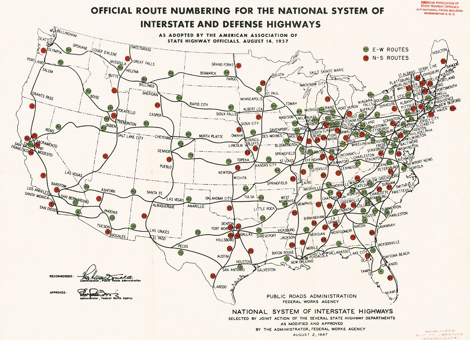
- ^ a b Official route numbering for the National System of Interstate and Defense Highways (Map). American Association of State Highway Officials. August 14, 1957.
- ^ "New York State Department of Transportation Traffic Volume Report 2011 – Page 80" (PDF). September 25, 2012. Retrieved September 22, 2013.
- ^ a b c "6.12: Roadway Open Cuts: 6.12: Roadway Open Manhattan" (PDF). www.nyc.gov. Archived from the original (PDF) on March 4, 2016. Retrieved February 10, 2015.
- ^ "1076 Riverside Dr" (Map). Google Maps. Retrieved December 29, 2022.
- ^ a b c d e f g h i Microsoft; Nokia. "overview map of Interstate 95" (Map). Bing Maps. Microsoft. Retrieved September 25, 2013.
- ^ Ingraham, Joseph C. (February 18, 1957). "New Bridge Links Planned Uptown; Double Decking of George Washington Span to Bring Vast Changes in Area". The New York Times. p. 1. Retrieved May 22, 2014.
- ^ Ingraham, Joseph C. (January 1, 1961). "Around the Town: New York City's System of Bypasses is Beginning to Take Shape". The New York Times. p. X17. Retrieved April 4, 2010.
- ^ Bennett, Charles G. (June 14, 1957). "City Votes Change in Hudson Bridge – Port Agency Gets Go-Ahead for $183,000,000 Work on George Washington Span". The New York Times. p. 1. Retrieved December 3, 2008.
- ^ a b Heller, Susan; Dunlap, David W. (August 25, 1986). "New York Day By Day; Big Name And Short Road". The New York Times. Retrieved May 22, 2014.
- ^ Ingraham, Joseph C. (April 23, 1959). "Relocation Is Almost Completed Near George Washington Bridge". The New York Times. p. 33. Retrieved May 22, 2014.
- ^ "Streets to be Raised – Girders to Be Placed Today to Span Bridge Approach". The New York Times. December 14, 1959. p. 38. Retrieved May 22, 2014.
- ^ Ingraham, Joseph C. (August 30, 1962). "Lower Deck of George Washington Bridge Is Opened". The New York Times. p. 1. Retrieved April 4, 2010.
- ^ a b Nick Ravo (December 9, 1999). "Marvin Kratter, 84; Once Owned Ebbets Field". The New York Times. Retrieved March 14, 2010.
- ^ Chen, David (June 18, 2004). "Life on the Road – Learning to Sleep as Trucks Roar Through Basement". The New York Times. Retrieved February 21, 2015.
- ^ A Local Law in relation to renaming two thoroughfares and public places in the Borough of the Bronx, East 177th Street, and to amend the official map of the city of New York accordingly (2018-035). January 11, 2018.
- ^ Bennett, Charles G. (March 19, 1950). "CITY SPEEDS HIGHWAY PROGRAMS; Expressways, Arterial Roads Designed to Handle New Traffic Patterns to Result From Two Projected State Thruways". The New York Times. ISSN 0362-4331. Retrieved October 11, 2017.
- ^ New York and New Jersey Tourgide Map (Map). Cartography by Rand McNally and Company. Gulf Oil Company. 1960.
- ^ Ingraham, Joseph C. (October 5, 1958). "TO CONNECTICUT; New England Thruway to Open Direct Route From Bronx to Rhode Island". The New York Times. ISSN 0362-4331. Retrieved October 11, 2017.
- ^ New York and Metropolitan New York (Map). Cartography by Rand McNally and Company. Sinclair Oil Corporation. 1964.
- ^ New York State Highways (Map). Cartography by Rand McNally and Company. State of New York Department of Commerce. 1969.
- ^ Ingraham, Joseph C. (February 18, 1957). "New Bridge Links Planned Uptown; Double Decking of George Washington Span to Bring Vast Changes in Area". The New York Times. p. 1. Retrieved May 22, 2014.
- ^ Ingraham, Joseph C. (January 1, 1961). "Around the Town: New York City's System of Bypasses is Beginning to Take Shape". The New York Times. p. X17. Retrieved April 4, 2010.
- ^ Bennett, Charles G. (June 14, 1957). "City Votes Change in Hudson Bridge – Port Agency Gets Go-Ahead for $183,000,000 Work on George Washington Span". The New York Times. p. 1. Retrieved December 3, 2008.
- ^ Ingraham, Joseph C. (April 23, 1959). "Relocation Is Almost Completed Near George Washington Bridge". The New York Times. p. 33. Retrieved May 22, 2014.
- ^ "Streets to be Raised – Girders to Be Placed Today to Span Bridge Approach". The New York Times. December 14, 1959. p. 38. Retrieved May 22, 2014.
- ^ Johnston, Louis; Williamson, Samuel H. (2023). "What Was the U.S. GDP Then?". MeasuringWorth. Retrieved November 30, 2023. Vereinigte Staaten Gross Domestic Product deflator figures follow the MeasuringWorth series.
- ^ Ingraham, Joseph C. (August 30, 1962). "Lower Deck of George Washington Bridge Is Opened". The New York Times. p. 1. Retrieved April 4, 2010.
- ^ Chen, David (June 18, 2004). "Life on the Road – Learning to Sleep as Trucks Roar Through Basement". The New York Times. Retrieved February 21, 2015.
- ^ "New England Thruway exit numbers to change". Gannett Westchester Newspapers. February 7, 1980. p. D3. Retrieved April 20, 2017.
- ^ "New England Thruway to Get New Exit Numbers; Last Exit to New York". The New York Times. February 17, 1980. Retrieved September 13, 2018.
- ^ "Interchange/Exit Listing by Milepost". New York State Thruway. November 7, 2014. Retrieved August 23, 2021.
- ^ a b "2014 Traffic Data Report for New York State" (PDF). New York State Department of Transportation. July 22, 2016. p. 79. Retrieved September 19, 2016.
- ^ a b "New York County Inventory Listing" (CSV). New York State Department of Transportation. August 7, 2015. Retrieved January 24, 2020.
- "Bronx County Inventory Listing" (CSV). New York State Department of Transportation. August 7, 2015. Retrieved January 24, 2020.
- "Westchester County Inventory Listing" (CSV). New York State Department of Transportation. August 7, 2015. Retrieved January 24, 2020.
- ^ "Interstate 95" (Map). Google Maps. Retrieved January 24, 2020.
- ^ a b c d New York State Department of Transportation (January 2017). Official Description of Highway Touring Routes, Bicycling Touring Routes, Scenic Byways, & Commemorative/Memorial Designations in New York State (PDF). Retrieved January 15, 2017.
- ^ a b Zupan, Jeffrey M.; Barone, Richard E.; Lee, Mathew H. (January 2011). "Upgrading to World Class: The Future of the New York Region's Airports" (PDF). Regional Plan Association. Archived from the original (PDF) on September 24, 2015. Retrieved March 15, 2017.
- ^ Cliness, Francis X. (March 25, 1971). "Lower Manhattan Road Killed Under State Plan". The New York Times. p. 78. Retrieved April 14, 2010.
- ^ Fowle, Farnsworth (October 23, 1968). "Van Wyck Roads Are Under Study: Better Use of Service Lanes Sought for Kennedy Traffic". The New York Times. Retrieved March 15, 2017.
- ^ "Expressway Plans". Regional Plan News (73–74). Regional Plan Association: 1–18. May 1964. Retrieved February 27, 2017.
- ^ Expressway Plans. 1964. Retrieved April 19, 2018 – via nycroads.com.
{{cite book}}:|work=ignored (help) - ^ New York State Highways (Map). Cartography by Rand McNally and Company. State of New York Department of Commerce. 1969.
- ^ "The Sheridan Expressway Study: Reconnecting the Neighborhoods Around the Sheridan Expressway and Improving Access to Hunts Point" (PDF). City of New York. December 2013. p. 3. Retrieved February 19, 2017.
- ^ 30 Years of Progress: 1934–1965 (PDF). New York City Department of Parks and Recreation. June 9, 1964. Retrieved March 31, 2017.
- ^ Special Committee on U.S. Route Numbering (September 24, 2017). "Special Committee on U.S. Route Numbering" (PDF) (Report). Washington, DC: American Association of State Highway and Transportation Officials. p. 4. Archived from the original (PDF) on June 3, 2019. Retrieved October 21, 2017.
External links
- Interstate 95 at Alps' Roads • New York Routes
- New England Thruway (I-95)
- Jeff's Expressways Site Photo Gallery
- I-95
- I-95 (Greater New York Roads)
| ||
| Highways |  | |
|---|---|---|
| Major bridges | ||
| Tolling | ||
- Expressways in New York City
- Harrison, New York
- Interstate 95
- Interstate Highways in New York (state)
- Larchmont, New York
- Mamaroneck, New York
- New York metropolitan area
- Pelham, New York
- Port Chester, New York
- Rye, New York
- Transportation in Manhattan
- Transportation in New Rochelle, New York
- Transportation in the Bronx
- Transportation in Westchester County, New York