
List of United States cities by population: Difference between revisions
Citation bot (talk | contribs) Added date. | Use this bot. Report bugs. | Suggested by Abductive | #UCB_toolbar |
|||
| (37 intermediate revisions by 23 users not shown) | |||
| Line 1: | Line 1: | ||
{{Short description| |
{{Short description|none}} |
||
{{Redirect|List of largest cities in the United States|a list of largest cities by area|List of United States cities by area}} |
{{Redirect|List of largest cities in the United States|a list of largest cities by area|List of United States cities by area}} |
||
{{pp|small=yes}} |
{{pp|small=yes}} |
||
| Line 5: | Line 5: | ||
{{GeoGroup}} |
{{GeoGroup}} |
||
{{U.S. city population tables}} |
{{U.S. city population tables}} |
||
This is a list of the most populous [[municipal corporation|incorporated places]] of the [[United States]]. As defined by the [[United States Census Bureau]], an [[Place (United States Census Bureau)#Incorporated place|incorporated place]] includes [[city|cities]], [[town]]s, [[village (United States)|villages]], [[borough (United States)|boroughs]], and [[municipality|municipalities]].{{efn|name=NewEngland|Towns in [[New England]], while incorporated on a level similar to cities in other states, are considered [[minor civil division]]s by the Census Bureau and are not included in its list of incorporated places. A detailed discussion on this subject can be found at |
This is a list of the most populous [[municipal corporation|incorporated places]] of the [[United States]]. As defined by the [[United States Census Bureau]], an [[Place (United States Census Bureau)#Incorporated place|incorporated place]] includes [[city|cities]], [[town]]s, [[village (United States)|villages]], [[borough (United States)|boroughs]], and [[municipality|municipalities]].{{efn|name=NewEngland|Towns in [[New England]], while incorporated on a level similar to cities in other states, are considered [[minor civil division]]s by the Census Bureau and are not included in its list of incorporated places. A detailed discussion on this subject can be found at {{Section link|New England town|Census treatment of the New England town system}}.}} A few exceptional [[census-designated place]]s (CDPs) are also included in the Census Bureau's listing of incorporated places.{{efn|name=HonoluluHI|The [[Hawaii|State of Hawaiʻi]] has no incorporated municipalities other than the [[Honolulu County, Hawaii|City and County of Honolulu]], which comprises the entire [[Oahu|Island of Oʻahu]]. In accordance with Hawaiian law, the [[United States Census Bureau]] defines the state's cities"and towns as [[census-designated place|Census Designated Places]] (CDPs). The Census Bureau defines the [[Honolulu, Hawaii|Urban Honolulu CDP]] as the portion of the City and County of Honolulu that is coextensive with the Judicial District of Honolulu. The Urban Honolulu CDP is what is generally thought of as the "city" of [[Honolulu]], and its population is used here and in other population comparisons. The Urban Honolulu CDP is currently the most populous Census Designated Place in the United States. The [[Honolulu, HI Metropolitan Statistical Area]] comprises the entire City and County of Honolulu.}} [[Consolidated city-county|Consolidated city-counties]] represent a distinct type of government that includes the entire population of a county, or county equivalent. Some consolidated city-counties, however, include multiple incorporated places. This list presents only the portion of such consolidated city-counties that are not a part of another incorporated place. |
||
This list refers only to the population of individual municipalities within their [[City limits|defined limits]]; the populations of other municipalities considered [[suburb]]s of a central city are listed separately, and unincorporated areas within [[urban agglomeration]]s are not included. Therefore, a different ranking is evident when considering [[List of United States urban areas|U.S. urban areas]] or [[Metropolitan statistical areas|metropolitan areas]]. |
This list refers only to the population of individual municipalities within their [[City limits|defined limits]]; the populations of other municipalities considered [[suburb]]s of a central city are listed separately, and unincorporated areas within [[urban agglomeration]]s are not included. Therefore, a different ranking is evident when considering [[List of United States urban areas|U.S. urban areas]] or [[Metropolitan statistical areas|metropolitan areas]]. |
||
| Line 11: | Line 11: | ||
== 50 states and Washington, D.C. == |
== 50 states and Washington, D.C. == |
||
This table lists the 336 [[municipal corporation|incorporated places]] in the United States, excluding the [[territories of the United States|U.S. territories]], with a population of at least 100,000 as of July 1, 2023, as estimated by the [[United States Census Bureau|U.S. Census Bureau]]. Five states have no cities with populations exceeding 100,000. They are: [[Delaware]], [[Maine]], [[Vermont]], [[West Virginia]], and [[Wyoming]]. |
|||
<div style="float:right;border: 1px solid silver; margin:0 0 0.5em 1em;"></div> |
|||
This table lists the 333 [[municipal corporation|incorporated places]] in the United States, excluding the [[territories of the United States|U.S. territories]], with a population of at least 100,000 as of July 1, 2022, as estimated by the [[United States Census Bureau|U.S. Census Bureau]]. Five states have no cities with populations exceeding 100,000. They are: [[Delaware]], [[Maine]], [[Vermont]], [[West Virginia]], and [[Wyoming]]. |
|||
The table displays: |
The table displays: |
||
# The city rank by population as of July 1, |
# The city rank by population as of July 1, 2023, as estimated by the United States Census Bureau<ref name=PopEstCities>{{cite web|url=https://www.census.gov/data/tables/time-series/demo/popest/2020s-total-cities-and-towns.html|title=City and Town Population Totals: 2020–2023|publisher=[[United States Census Bureau]], Population Division|access-date=May 16, 2024|archive-date=July 11, 2022|archive-url=https://web.archive.org/web/20220711040810/https://www.census.gov/data/tables/time-series/demo/popest/2020s-total-cities-and-towns.html|url-status=live}}</ref> |
||
# The city name<ref name=PopEstCities/> |
# The city name<ref name=PopEstCities /> |
||
# The name of the state in which the city lies<ref name=PopEstCities/> |
# The name of the state in which the city lies<ref name=PopEstCities /> |
||
# The city population as of July 1, |
# The city population as of July 1, 2023, as estimated by the [[United States Census Bureau]]<ref name=PopEstCities /> |
||
# The city population as of April 1, 2020, as enumerated by the [[2020 United States census]]<ref name=PopEstCities/> |
# The city population as of April 1, 2020, as enumerated by the [[2020 United States census]]<ref name=PopEstCities /> |
||
# The city percent population change from April 1, 2020, to July 1, |
# The city percent population change from April 1, 2020, to July 1, 2023 |
||
# The city land area as of January 1, 2020<ref name=USCBGazetteer>{{cite web|url=https://www.census.gov/geographies/reference-files/time-series/geo/gazetteer-files.2020.html|title=2020 U.S. Gazetteer Files|work=U.S. Gazetteer Files|publisher=[[United States Census Bureau]]|access-date=September 9, 2021|archive-date=October 26, 2021|archive-url=https://web.archive.org/web/20211026060851/https://www.census.gov/geographies/reference-files/time-series/geo/gazetteer-files.2020.html|url-status=live}}</ref> |
# The city land area as of January 1, 2020<ref name=USCBGazetteer>{{cite web|url=https://www.census.gov/geographies/reference-files/time-series/geo/gazetteer-files.2020.html|title=2020 U.S. Gazetteer Files|work=U.S. Gazetteer Files|publisher=[[United States Census Bureau]]|access-date=September 9, 2021|archive-date=October 26, 2021|archive-url=https://web.archive.org/web/20211026060851/https://www.census.gov/geographies/reference-files/time-series/geo/gazetteer-files.2020.html|url-status=live}}</ref> |
||
# The city population density as of April 1, 2020 (residents per unit of land area)<ref name=USCBGazetteer/> |
# The city population density as of April 1, 2020 (residents per unit of land area)<ref name=USCBGazetteer /> |
||
# The city [[geographic coordinate system|latitude and longitude coordinates]]<ref name=USCBGazetteer/>{{GeoGroup|section=states and District of Columbia}} |
# The city [[geographic coordinate system|latitude and longitude coordinates]]<ref name=USCBGazetteer /> |
||
{{GeoGroup|section=states and District of Columbia}} |
|||
{{United States Cities Labeled Map}}<!-- THE FOLLOWING TABLE CONTAINS DATA FROM THE UNITED STATES CENSUS BUREAU. DO NOT ALTER CENSUS BUREAU DATA. --> |
{{United States Cities Labeled Map}}<!-- THE FOLLOWING TABLE CONTAINS DATA FROM THE UNITED STATES CENSUS BUREAU. DO NOT ALTER CENSUS BUREAU DATA. --> |
||
| Line 44: | Line 44: | ||
{{sticky header}}{{table alignment}}{{static row numbers}}{{sort under}} |
{{sticky header}}{{table alignment}}{{static row numbers}}{{sort under}} |
||
{| class="sortable wikitable sticky-header static-row-numbers sort-under col1left col2center" {{right}} |
{| class="sortable wikitable sticky-header-multi static-row-numbers sort-under col1left col2center" {{right}} |
||
|- |
|- |
||
! rowspan=2 | City |
! rowspan=2 | City |
||
! rowspan=2 | {{abbr|ST|State or district}} |
! rowspan=2 | {{abbr|ST|State or district}} |
||
! rowspan=2 | |
! rowspan=2 | 2023<br />estimate |
||
! rowspan=2 | 2020<br>census |
! rowspan=2 | 2020<br />census |
||
! rowspan=2 | Change |
! rowspan=2 | Change |
||
! colspan=2 | 2020 land area |
! colspan=2 | 2020 land area |
||
! colspan=2 | 2020 density |
! colspan=2 | 2020 density |
||
! rowspan=2 | Location |
! rowspan=2 | Location |
||
|- class="static-row-header" |
|||
|- |
|||
! mi<sup>2</sup> |
! mi<sup>2</sup> |
||
! {{km2}} |
! {{km2}} |
||
| Line 60: | Line 60: | ||
! / {{km2}} |
! / {{km2}} |
||
|- |
|- |
||
| style="background-color:#cfecec"|''[[New York City|New York]]''{{efn|Since 1898, the [[New York City|City of New York]], [[New York (state)|New York]], has comprised [[borough of New York City|five boroughs]] with [[consolidated city-county|consolidated borough–county governments]] ( |
| style="background-color:#cfecec"|''[[New York City|New York]]''{{efn|Since 1898, the [[New York City|City of New York]], [[New York (state)|New York]], has comprised [[borough of New York City|five boroughs]] with [[consolidated city-county|consolidated borough–county governments]] (2023 population estimates): |
||
* [[Brooklyn|The Borough of Brooklyn]] and [[Brooklyn|Kings County]] |
* [[Brooklyn|The Borough of Brooklyn]] and [[Brooklyn|Kings County]] |
||
: (pop. 2, |
: (pop. 2,561,225) |
||
* [[Queens|The Borough of Queens]] and [[Queens |
* [[Queens|The Borough of Queens]] and [[Queens]] County |
||
: (pop. 2, |
: (pop. 2,252,196) |
||
* [[Manhattan|The Borough of Manhattan]] and [[Manhattan|New York County]] |
* [[Manhattan|The Borough of Manhattan]] and [[Manhattan|New York County]] |
||
: (pop. 1, |
: (pop. 1,597,451) |
||
* [[The Bronx|The Borough of the Bronx]] and [[The Bronx|Bronx County]] |
* [[The Bronx|The Borough of the Bronx]] and [[The Bronx|Bronx County]] |
||
: (pop. 1, |
: (pop. 1,356,476) |
||
* [[Staten Island|The Borough of Staten Island]] and [[Staten Island|Richmond County]] |
* [[Staten Island|The Borough of Staten Island]] and [[Staten Island|Richmond County]] |
||
: (pop. |
: (pop. 490,687)}} |
||
| [[New York (state)|NY]] |
| [[New York (state)|NY]] |
||
| {{change|invert=on| |
| {{change|invert=on|8258035|8804190}} |
||
| {{convert|300.5|sqmi|km2|1|disp=table}} |
| {{convert|300.5|sqmi|km2|1|disp=table}} |
||
| {{convert|29298|/sqmi|/km2|disp=table}} |
| {{convert|29298|/sqmi|/km2|disp=table}} |
||
| Line 79: | Line 79: | ||
| style="background-color:#cfecec"|''[[Los Angeles]]'' |
| style="background-color:#cfecec"|''[[Los Angeles]]'' |
||
| [[California|CA]] |
| [[California|CA]] |
||
| {{change|invert=on| |
| {{change|invert=on|3820914|3898747}} |
||
| {{convert|469.5|sqmi|km2|1|disp=table}} |
| {{convert|469.5|sqmi|km2|1|disp=table}} |
||
| {{convert|8304|/sqmi|/km2|disp=table}} |
| {{convert|8304|/sqmi|/km2|disp=table}} |
||
| Line 86: | Line 86: | ||
| style="background-color:#cfecec"|''[[Chicago]]'' |
| style="background-color:#cfecec"|''[[Chicago]]'' |
||
| [[Illinois|IL]] |
| [[Illinois|IL]] |
||
| {{change|invert=on| |
| {{change|invert=on|2664452|2746388}} |
||
| {{convert|227.7|sqmi|km2|1|disp=table}} |
| {{convert|227.7|sqmi|km2|1|disp=table}} |
||
| {{convert|12061|/sqmi|/km2|disp=table}} |
| {{convert|12061|/sqmi|/km2|disp=table}} |
||
| Line 93: | Line 93: | ||
| style="background-color:#cfecec"|''[[Houston]]'' |
| style="background-color:#cfecec"|''[[Houston]]'' |
||
| [[Texas|TX]] |
| [[Texas|TX]] |
||
| {{change|invert=on| |
| {{change|invert=on|2314157|2304580}} |
||
| {{convert|640.4|sqmi|km2|1|disp=table}} |
| {{convert|640.4|sqmi|km2|1|disp=table}} |
||
| {{convert|3599|/sqmi|/km2|disp=table}} |
| {{convert|3599|/sqmi|/km2|disp=table}} |
||
| Line 100: | Line 100: | ||
| style="background-color:#ccff99"|'''''[[Phoenix, Arizona|Phoenix]]''''' |
| style="background-color:#ccff99"|'''''[[Phoenix, Arizona|Phoenix]]''''' |
||
| [[Arizona|AZ]] |
| [[Arizona|AZ]] |
||
| {{change|invert=on| |
| {{change|invert=on|1650070|1608139}} |
||
| {{convert|518.0|sqmi|km2|1|disp=table}} |
| {{convert|518.0|sqmi|km2|1|disp=table}} |
||
| {{convert|3105|/sqmi|/km2|disp=table}} |
| {{convert|3105|/sqmi|/km2|disp=table}} |
||
| Line 107: | Line 107: | ||
| style="background-color:#cfecec"|''[[Philadelphia]]''{{efn|The [[Philadelphia|City of Philadelphia]], [[Pennsylvania]], and [[Philadelphia County]], Pennsylvania, are separate but coterminous entities with a single [[consolidated city-county|consolidated city–county government]].}} |
| style="background-color:#cfecec"|''[[Philadelphia]]''{{efn|The [[Philadelphia|City of Philadelphia]], [[Pennsylvania]], and [[Philadelphia County]], Pennsylvania, are separate but coterminous entities with a single [[consolidated city-county|consolidated city–county government]].}} |
||
| [[Pennsylvania|PA]] |
| [[Pennsylvania|PA]] |
||
| {{change|invert=on| |
| {{change|invert=on|1550542|1603797}} |
||
| {{convert|134.4|sqmi|km2|1|disp=table}} |
| {{convert|134.4|sqmi|km2|1|disp=table}} |
||
| {{convert|11933|/sqmi|/km2|disp=table}} |
| {{convert|11933|/sqmi|/km2|disp=table}} |
||
| Line 114: | Line 114: | ||
| [[San Antonio]] |
| [[San Antonio]] |
||
| [[Texas|TX]] |
| [[Texas|TX]] |
||
| {{change|invert=on| |
| {{change|invert=on|1495295|1434625}} |
||
| {{convert|498.8|sqmi|km2|1|disp=table}} |
| {{convert|498.8|sqmi|km2|1|disp=table}} |
||
| {{convert|2876|/sqmi|/km2|disp=table}} |
| {{convert|2876|/sqmi|/km2|disp=table}} |
||
| Line 121: | Line 121: | ||
| [[San Diego]] |
| [[San Diego]] |
||
| [[California|CA]] |
| [[California|CA]] |
||
| {{change|invert=on| |
| {{change|invert=on|1388320|1386932}} |
||
| {{convert|325.9|sqmi|km2|1|disp=table}} |
| {{convert|325.9|sqmi|km2|1|disp=table}} |
||
| {{convert|4256|/sqmi|/km2|disp=table}} |
| {{convert|4256|/sqmi|/km2|disp=table}} |
||
| Line 128: | Line 128: | ||
| [[Dallas]] |
| [[Dallas]] |
||
| [[Texas|TX]] |
| [[Texas|TX]] |
||
| {{change|invert=on| |
| {{change|invert=on|1302868|1304379}} |
||
| {{convert|339.6|sqmi|km2|1|disp=table}} |
| {{convert|339.6|sqmi|km2|1|disp=table}} |
||
| {{convert|3841|/sqmi|/km2|disp=table}} |
| {{convert|3841|/sqmi|/km2|disp=table}} |
||
| <small>{{coord|32.79|N|96.77|W|name=Dallas}}</small> |
| <small>{{coord|32.79|N|96.77|W|name=Dallas}}</small> |
||
|- |
|||
| style="background-color:#cfecec"|''[[Jacksonville, Florida|Jacksonville]]''{{efn|The [[Jacksonville, Florida|City of Jacksonville]], [[Florida]], and [[Duval County, Florida|Duval County]], Florida, are separate entities with a single [[consolidated city-county|consolidated city–county government]]. The City of Jacksonville comprises all of Duval County except the other incorporated municipalities within the county.}} |
|||
| [[Florida|FL]] |
|||
| {{change|invert=on|985843|949611}} |
|||
| {{convert|747.3|sqmi|km2|1|disp=table}} |
|||
| {{convert|1271|/sqmi|/km2|disp=table}} |
|||
| <small>{{coord|30.34|N|81.66|W|name=Jacksonville}}</small> |
|||
|- |
|- |
||
| style="background-color:#ffff99"|'''[[Austin, Texas|Austin]]''' |
| style="background-color:#ffff99"|'''[[Austin, Texas|Austin]]''' |
||
| [[Texas|TX]] |
| [[Texas|TX]] |
||
| {{change|invert=on| |
| {{change|invert=on|979882|961855}} |
||
| {{convert|319.9|sqmi|km2|1|disp=table}} |
| {{convert|319.9|sqmi|km2|1|disp=table}} |
||
| {{convert|3007|/sqmi|/km2|disp=table}} |
| {{convert|3007|/sqmi|/km2|disp=table}} |
||
| <small>{{coord|30.30|N|97.75|W|name=Austin}}</small> |
| <small>{{coord|30.30|N|97.75|W|name=Austin}}</small> |
||
|- |
|- |
||
| [[Fort Worth, Texas|Fort Worth]] |
|||
| style="background-color:#cfecec"|''[[Jacksonville, Florida|Jacksonville]]''{{efn|The [[Jacksonville, Florida|City of Jacksonville]], [[Florida]], and [[Duval County, Florida|Duval County]], Florida, are separate entities with a single [[consolidated city-county|consolidated city–county government]]. The City of Jacksonville comprises all of Duval County except the other incorporated municipalities within the county.}} |
|||
| [[ |
| [[Texas|TX]] |
||
| {{change|invert=on| |
| {{change|invert=on|978468|918915}} |
||
| {{convert| |
| {{convert|347.3|sqmi|km2|1|disp=table}} |
||
| {{convert| |
| {{convert|2646|/sqmi|/km2|disp=table}} |
||
| <small>{{coord| |
| <small>{{coord|32.78|N|97.35|W|name=Fort Worth}}</small> |
||
|- |
|- |
||
| [[San Jose, California|San Jose]] |
| [[San Jose, California|San Jose]] |
||
| [[California|CA]] |
| [[California|CA]] |
||
| {{change|invert=on| |
| {{change|invert=on|969655|1013240}} |
||
| {{convert|178.3|sqmi|km2|1|disp=table}} |
| {{convert|178.3|sqmi|km2|1|disp=table}} |
||
| {{convert|5683|/sqmi|/km2|disp=table}} |
| {{convert|5683|/sqmi|/km2|disp=table}} |
||
| <small>{{coord|37.30|N|121.81|W|name=San Jose}}</small> |
| <small>{{coord|37.30|N|121.81|W|name=San Jose}}</small> |
||
|- |
|||
| [[Fort Worth, Texas|Fort Worth]] |
|||
| [[Texas|TX]] |
|||
| {{change|invert=on|956709|918915}} |
|||
| {{convert|347.3|sqmi|km2|1|disp=table}} |
|||
| {{convert|2646|/sqmi|/km2|disp=table}} |
|||
| <small>{{coord|32.78|N|97.35|W|name=Fort Worth}}</small> |
|||
|- |
|- |
||
| style="background-color:#ccff99"|'''''[[Columbus, Ohio|Columbus]]''''' |
| style="background-color:#ccff99"|'''''[[Columbus, Ohio|Columbus]]''''' |
||
| [[Ohio|OH]] |
| [[Ohio|OH]] |
||
| {{change|invert=on| |
| {{change|invert=on|913175|905748}} |
||
| {{convert|220.0|sqmi|km2|1|disp=table}} |
| {{convert|220.0|sqmi|km2|1|disp=table}} |
||
| {{convert|4117|/sqmi|/km2|disp=table}} |
| {{convert|4117|/sqmi|/km2|disp=table}} |
||
| Line 170: | Line 170: | ||
| style="background-color:#cfecec"|''[[Charlotte, North Carolina|Charlotte]]'' |
| style="background-color:#cfecec"|''[[Charlotte, North Carolina|Charlotte]]'' |
||
| [[North Carolina|NC]] |
| [[North Carolina|NC]] |
||
| {{change|invert=on| |
| {{change|invert=on|911311|874579}} |
||
| {{convert|308.3|sqmi|km2|1|disp=table}} |
| {{convert|308.3|sqmi|km2|1|disp=table}} |
||
| {{convert|2837|/sqmi|/km2|disp=table}} |
| {{convert|2837|/sqmi|/km2|disp=table}} |
||
| <small>{{coord|35.21|N|80.83|W|name=Charlotte}}</small> |
| <small>{{coord|35.21|N|80.83|W|name=Charlotte}}</small> |
||
|- |
|- |
||
| style="background-color:#ccff99"|'''''[[Indianapolis]]'''''{{efn|The [[Indianapolis|City of Indianapolis]], [[Indiana]], and [[Marion County, Indiana|Marion County]], Indiana, are separate entities with a single [[consolidated city–county |
| style="background-color:#ccff99"|'''''[[Indianapolis]]'''''{{efn|The [[Indianapolis|City of Indianapolis]], [[Indiana]], and [[Marion County, Indiana|Marion County]], Indiana, are separate entities with a single [[consolidated city–county]] government. The City of Indianapolis comprises all of Marion County except the other incorporated municipalities within the county. See [[Indianapolis (balance)]].}} |
||
| [[Indiana|IN]] |
| [[Indiana|IN]] |
||
| {{change|invert=on| |
| {{change|invert=on|879293|887642}} |
||
| {{convert|361.6|sqmi|km2|1|disp=table}} |
| {{convert|361.6|sqmi|km2|1|disp=table}} |
||
| {{convert|2455|/sqmi|/km2|disp=table}} |
| {{convert|2455|/sqmi|/km2|disp=table}} |
||
| Line 184: | Line 184: | ||
| [[San Francisco]]{{efn|The [[San Francisco|City and County of San Francisco]], [[California]], has a [[consolidated city–county|consolidated city and county government]].}} |
| [[San Francisco]]{{efn|The [[San Francisco|City and County of San Francisco]], [[California]], has a [[consolidated city–county|consolidated city and county government]].}} |
||
| [[California|CA]] |
| [[California|CA]] |
||
| {{change|invert=on| |
| {{change|invert=on|808988|873965}} |
||
| {{convert|46.9|sqmi|km2|1|disp=table}} |
| {{convert|46.9|sqmi|km2|1|disp=table}} |
||
| {{convert|18635|/sqmi|/km2|disp=table}} |
| {{convert|18635|/sqmi|/km2|disp=table}} |
||
| Line 191: | Line 191: | ||
| style="background-color:#cfecec"|''[[Seattle]]'' |
| style="background-color:#cfecec"|''[[Seattle]]'' |
||
| [[Washington (state)|WA]] |
| [[Washington (state)|WA]] |
||
| {{change|invert=on| |
| {{change|invert=on|755078|737015}} |
||
| {{convert|83.8|sqmi|km2|1|disp=table}} |
| {{convert|83.8|sqmi|km2|1|disp=table}} |
||
| {{convert|8795|/sqmi|/km2|disp=table}} |
| {{convert|8795|/sqmi|/km2|disp=table}} |
||
| Line 198: | Line 198: | ||
| style="background-color:#ccff99"|'''''[[Denver]]'''''{{efn|The [[Denver|City and County of Denver]], [[Colorado]], has a [[consolidated city–county|consolidated city and county government]].}} |
| style="background-color:#ccff99"|'''''[[Denver]]'''''{{efn|The [[Denver|City and County of Denver]], [[Colorado]], has a [[consolidated city–county|consolidated city and county government]].}} |
||
| [[Colorado|CO]] |
| [[Colorado|CO]] |
||
| {{change|invert=on| |
| {{change|invert=on|716577|715522}} |
||
| {{convert|153.1|sqmi|km2|1|disp=table}} |
| {{convert|153.1|sqmi|km2|1|disp=table}} |
||
| {{convert|4674|/sqmi|/km2|disp=table}} |
| {{convert|4674|/sqmi|/km2|disp=table}} |
||
| Line 205: | Line 205: | ||
| style="background-color:#ccff99"|'''''[[Oklahoma City]]''''' |
| style="background-color:#ccff99"|'''''[[Oklahoma City]]''''' |
||
| [[Oklahoma|OK]] |
| [[Oklahoma|OK]] |
||
| {{change|invert=on| |
| {{change|invert=on|702767|681054}} |
||
| {{convert|606.2|sqmi|km2|1|disp=table}} |
| {{convert|606.2|sqmi|km2|1|disp=table}} |
||
| {{convert|1123|/sqmi|/km2|disp=table}} |
| {{convert|1123|/sqmi|/km2|disp=table}} |
||
| <small>{{coord|35.47|N|97.51|W|name=Oklahoma City}}</small> |
| <small>{{coord|35.47|N|97.51|W|name=Oklahoma City}}</small> |
||
|- |
|- |
||
| style="background-color:#ccff99"|'''[[Nashville, Tennessee|''Nashville'']]'''{{efn|The [[Nashville, Tennessee|City of Nashville]], [[Tennessee]], and [[Davidson County, Tennessee|Davidson County]], Tennessee, are separate entities with a single [[consolidated city–county |
| style="background-color:#ccff99"|'''[[Nashville, Tennessee|''Nashville'']]'''{{efn|The [[Nashville, Tennessee|City of Nashville]], [[Tennessee]], and [[Davidson County, Tennessee|Davidson County]], Tennessee, are separate entities with a single [[consolidated city–county]] government. The City of Nashville comprises all of Davidson County except the other incorporated municipalities within the county. See [[Nashville-Davidson (balance), Tennessee|Nashville-Davidson (balance)]].}} |
||
| [[Tennessee|TN]] |
| [[Tennessee|TN]] |
||
| {{change|invert=on| |
| {{change|invert=on|687788|689447}} |
||
| {{convert|475.8|sqmi|km2|1|disp=table}} |
| {{convert|475.8|sqmi|km2|1|disp=table}} |
||
| {{convert|1449|/sqmi|/km2|disp=table}} |
| {{convert|1449|/sqmi|/km2|disp=table}} |
||
| <small>{{coord|36.17|N|86.79|W|name=Nashville}}</small> |
| <small>{{coord|36.17|N|86.79|W|name=Nashville}}</small> |
||
|- |
|||
| style="background-color:#ff9999"|'''''[[Washington, D.C.|Washington]]'''''{{efn|The [[Washington, D.C.|City of Washington]] was [[District of Columbia Organic Act of 1871|consolidated]] with the [[Washington, D.C.|District of Columbia]] in 1871.}} |
|||
| [[District of Columbia|DC]] |
|||
| {{change|invert=on|678972|689545}} |
|||
| {{convert|61.1|sqmi|km2|1|disp=table}} |
|||
| {{convert|11286|/sqmi|/km2|disp=table}} |
|||
| <small>{{coord|38.90|N|77.02|W|name=Washington, D.C.}}</small> |
|||
|- |
|- |
||
| [[El Paso, Texas|El Paso]] |
| [[El Paso, Texas|El Paso]] |
||
| [[Texas|TX]] |
| [[Texas|TX]] |
||
| {{change|invert=on| |
| {{change|invert=on|678958|678815}} |
||
| {{convert|258.4|sqmi|km2|1|disp=table}} |
| {{convert|258.4|sqmi|km2|1|disp=table}} |
||
| {{convert|2627|/sqmi|/km2|disp=table}} |
| {{convert|2627|/sqmi|/km2|disp=table}} |
||
| <small>{{coord|31.85|N|106.43|W|name=El Paso}}</small> |
| <small>{{coord|31.85|N|106.43|W|name=El Paso}}</small> |
||
|- |
|||
| style="background-color:#ff9999"|'''''[[Washington, D.C.|Washington]]'''''{{efn|The [[Washington, D.C.|City of Washington]] was [[District of Columbia Organic Act of 1871|consolidated]] with the [[Washington, D.C.|District of Columbia]] in 1871.}} |
|||
| [[District of Columbia|DC]] |
|||
| {{change|invert=on|671803|689545}} |
|||
| {{convert|61.1|sqmi|km2|1|disp=table}} |
|||
| {{convert|11286|/sqmi|/km2|disp=table}} |
|||
| <small>{{coord|38.90|N|77.02|W|name=Washington, D.C.}}</small> |
|||
|- |
|- |
||
| style="background-color:#cfecec"|''[[Las Vegas]]'' |
| style="background-color:#cfecec"|''[[Las Vegas]]'' |
||
| [[Nevada|NV]] |
| [[Nevada|NV]] |
||
| {{change|invert=on| |
| {{change|invert=on|660929|641903}} |
||
| {{convert|141.8|sqmi|km2|1|disp=table}} |
| {{convert|141.8|sqmi|km2|1|disp=table}} |
||
| {{convert|4527|/sqmi|/km2|disp=table}} |
| {{convert|4527|/sqmi|/km2|disp=table}} |
||
| Line 240: | Line 240: | ||
| style="background-color:#ccff99"|'''''[[Boston]]''''' |
| style="background-color:#ccff99"|'''''[[Boston]]''''' |
||
| [[Massachusetts|MA]] |
| [[Massachusetts|MA]] |
||
| {{change|invert=on| |
| {{change|invert=on|653833|675647}} |
||
| {{convert|48.3|sqmi|km2|1|disp=table}} |
| {{convert|48.3|sqmi|km2|1|disp=table}} |
||
| {{convert|13989|/sqmi|/km2|disp=table}} |
| {{convert|13989|/sqmi|/km2|disp=table}} |
||
| <small>{{coord|42.34|N|71.02|W|name=Boston}}</small> |
| <small>{{coord|42.34|N|71.02|W|name=Boston}}</small> |
||
|- |
|||
| style="background-color:#cfecec"|''[[Detroit]]'' |
|||
| [[Michigan|MI]] |
|||
| {{change|invert=on|633218|639111}} |
|||
| {{convert|138.7|sqmi|km2|1|disp=table}} |
|||
| {{convert|4608|/sqmi|/km2|disp=table}} |
|||
| <small>{{coord|42.38|N|83.10|W|name=Detroit}}</small> |
|||
|- |
|- |
||
| style="background-color:#cfecec"|''[[Portland, Oregon|Portland]]'' |
| style="background-color:#cfecec"|''[[Portland, Oregon|Portland]]'' |
||
| [[Oregon|OR]] |
| [[Oregon|OR]] |
||
| {{change|invert=on| |
| {{change|invert=on|630498|652503}} |
||
| {{convert|133.5|sqmi|km2|1|disp=table}} |
| {{convert|133.5|sqmi|km2|1|disp=table}} |
||
| {{convert|4888|/sqmi|/km2|disp=table}} |
| {{convert|4888|/sqmi|/km2|disp=table}} |
||
| <small>{{coord|45.54|N|122.65|W|name=Portland}}</small> |
| <small>{{coord|45.54|N|122.65|W|name=Portland}}</small> |
||
|- |
|- |
||
| style="background-color:#cfecec"|''[[Louisville, Kentucky|Louisville]]''{{efn|The [[Louisville, Kentucky|City of Louisville]], [[Kentucky]], and [[Jefferson County, Kentucky|Jefferson County]], Kentucky, are separate entities with a single [[consolidated city–county |
| style="background-color:#cfecec"|''[[Louisville, Kentucky|Louisville]]''{{efn|The [[Louisville, Kentucky|City of Louisville]], [[Kentucky]], and [[Jefferson County, Kentucky|Jefferson County]], Kentucky, are separate entities with a single [[consolidated city–county]] government. The City of Louisville comprises all of Jefferson County except the other incorporated municipalities within the county. See [[Louisville/Jefferson County metro government (balance), Kentucky|Louisville/Jefferson County metro government (balance)]].}} |
||
| [[Kentucky|KY]] |
| [[Kentucky|KY]] |
||
| {{change|invert=on| |
| {{change|invert=on|622981|633045}} |
||
| {{convert|324.9|sqmi|km2|1|disp=table}} |
| {{convert|324.9|sqmi|km2|1|disp=table}} |
||
| {{convert|1948|/sqmi|/km2|disp=table}} |
| {{convert|1948|/sqmi|/km2|disp=table}} |
||
| Line 261: | Line 268: | ||
| [[Memphis, Tennessee|Memphis]] |
| [[Memphis, Tennessee|Memphis]] |
||
| [[Tennessee|TN]] |
| [[Tennessee|TN]] |
||
| {{change|invert=on| |
| {{change|invert=on|618639|633104}} |
||
| {{convert|297.0|sqmi|km2|1|disp=table}} |
| {{convert|297.0|sqmi|km2|1|disp=table}} |
||
| {{convert|2132|/sqmi|/km2|disp=table}} |
| {{convert|2132|/sqmi|/km2|disp=table}} |
||
| <small>{{coord|35.11|N|89.97|W|name=Memphis}}</small> |
| <small>{{coord|35.11|N|89.97|W|name=Memphis}}</small> |
||
|- |
|||
| style="background-color:#cfecec"|''[[Detroit]]'' |
|||
| [[Michigan|MI]] |
|||
| {{change|invert=on|620376|639111}} |
|||
| {{convert|138.7|sqmi|km2|1|disp=table}} |
|||
| {{convert|4608|/sqmi|/km2|disp=table}} |
|||
| <small>{{coord|42.38|N|83.10|W|name=Detroit}}</small> |
|||
|- |
|- |
||
| style="background-color:#cfecec"|''[[Baltimore]]''{{efn|name=IndependentCity|This is an independent city that is not part of any county.}} |
| style="background-color:#cfecec"|''[[Baltimore]]''{{efn|name=IndependentCity|This is an independent city that is not part of any county.}} |
||
| [[Maryland|MD]] |
| [[Maryland|MD]] |
||
| {{change|invert=on| |
| {{change|invert=on|565239|585708}} |
||
| {{convert|80.9|sqmi|km2|1|disp=table}} |
| {{convert|80.9|sqmi|km2|1|disp=table}} |
||
| {{convert|7240|/sqmi|/km2|disp=table}} |
| {{convert|7240|/sqmi|/km2|disp=table}} |
||
| Line 282: | Line 282: | ||
| style="background-color:#cfecec"|''[[Milwaukee]]'' |
| style="background-color:#cfecec"|''[[Milwaukee]]'' |
||
| [[Wisconsin|WI]] |
| [[Wisconsin|WI]] |
||
| {{change|invert=on| |
| {{change|invert=on|561385|577222}} |
||
| {{convert|96.2|sqmi|km2|1|disp=table}} |
| {{convert|96.2|sqmi|km2|1|disp=table}} |
||
| {{convert|6000|/sqmi|/km2|disp=table}} |
| {{convert|6000|/sqmi|/km2|disp=table}} |
||
| Line 289: | Line 289: | ||
| style="background-color:#cfecec"|''[[Albuquerque, New Mexico|Albuquerque]]'' |
| style="background-color:#cfecec"|''[[Albuquerque, New Mexico|Albuquerque]]'' |
||
| [[New Mexico|NM]] |
| [[New Mexico|NM]] |
||
| {{change|invert=on| |
| {{change|invert=on|560274|564559}} |
||
| {{convert|187.3|sqmi|km2|1|disp=table}} |
| {{convert|187.3|sqmi|km2|1|disp=table}} |
||
| {{convert|3014|/sqmi|/km2|disp=table}} |
| {{convert|3014|/sqmi|/km2|disp=table}} |
||
| Line 296: | Line 296: | ||
| [[Tucson, Arizona|Tucson]] |
| [[Tucson, Arizona|Tucson]] |
||
| [[Arizona|AZ]] |
| [[Arizona|AZ]] |
||
| {{change|invert=on| |
| {{change|invert=on|547239|542629}} |
||
| {{convert|241.0|sqmi|km2|1|disp=table}} |
| {{convert|241.0|sqmi|km2|1|disp=table}} |
||
| {{convert|2252|/sqmi|/km2|disp=table}} |
| {{convert|2252|/sqmi|/km2|disp=table}} |
||
| Line 303: | Line 303: | ||
| [[Fresno, California|Fresno]] |
| [[Fresno, California|Fresno]] |
||
| [[California|CA]] |
| [[California|CA]] |
||
| {{change|invert=on| |
| {{change|invert=on|545716|542107}} |
||
| {{convert|115.2|sqmi|km2|1|disp=table}} |
| {{convert|115.2|sqmi|km2|1|disp=table}} |
||
| {{convert|4706|/sqmi|/km2|disp=table}} |
| {{convert|4706|/sqmi|/km2|disp=table}} |
||
| Line 310: | Line 310: | ||
| style="background-color:#ffff99"|'''[[Sacramento, California|Sacramento]]''' |
| style="background-color:#ffff99"|'''[[Sacramento, California|Sacramento]]''' |
||
| [[California|CA]] |
| [[California|CA]] |
||
| {{change|invert=on| |
| {{change|invert=on|526384|524943}} |
||
| {{convert|98.6|sqmi|km2|1|disp=table}} |
| {{convert|98.6|sqmi|km2|1|disp=table}} |
||
| {{convert|5324|/sqmi|/km2|disp=table}} |
| {{convert|5324|/sqmi|/km2|disp=table}} |
||
| Line 317: | Line 317: | ||
| [[Mesa, Arizona|Mesa]] |
| [[Mesa, Arizona|Mesa]] |
||
| [[Arizona|AZ]] |
| [[Arizona|AZ]] |
||
| {{change|invert=on| |
| {{change|invert=on|511648|504258}} |
||
| {{convert|138.7|sqmi|km2|1|disp=table}} |
| {{convert|138.7|sqmi|km2|1|disp=table}} |
||
| {{convert|3636|/sqmi|/km2|disp=table}} |
| {{convert|3636|/sqmi|/km2|disp=table}} |
||
| <small>{{coord|33.40|N|111.72|W|name=Mesa}}</small> |
| <small>{{coord|33.40|N|111.72|W|name=Mesa}}</small> |
||
|- |
|||
| style="background-color:#cfecec"|''[[Kansas City, Missouri|Kansas City]]'' |
|||
| [[Missouri|MO]] |
|||
| {{change|invert=on|509297|508090}} |
|||
| {{convert|314.7|sqmi|km2|1|disp=table}} |
|||
| {{convert|1615|/sqmi|/km2|disp=table}} |
|||
| <small>{{coord|39.12|N|94.56|W|name=Kansas City, MO}}</small> |
|||
|- |
|- |
||
| style="background-color:#ccff99"|'''''[[Atlanta]]''''' |
| style="background-color:#ccff99"|'''''[[Atlanta]]''''' |
||
| [[Georgia (U.S. state)|GA]] |
| [[Georgia (U.S. state)|GA]] |
||
| {{change|invert=on| |
| {{change|invert=on|510823|498715}} |
||
| {{convert|135.3|sqmi|km2|1|disp=table}} |
| {{convert|135.3|sqmi|km2|1|disp=table}} |
||
| {{convert|3686|/sqmi|/km2|disp=table}} |
| {{convert|3686|/sqmi|/km2|disp=table}} |
||
| <small>{{coord|33.76|N|84.42|W|name=Atlanta}}</small> |
| <small>{{coord|33.76|N|84.42|W|name=Atlanta}}</small> |
||
|- |
|||
| style="background-color:#cfecec"|''[[Kansas City, Missouri|Kansas City]]'' |
|||
| [[Missouri|MO]] |
|||
| {{change|invert=on|510704|508090}} |
|||
| {{convert|314.7|sqmi|km2|1|disp=table}} |
|||
| {{convert|1615|/sqmi|/km2|disp=table}} |
|||
| <small>{{coord|39.12|N|94.56|W|name=Kansas City, MO}}</small> |
|||
|- |
|- |
||
| [[Colorado Springs, Colorado|Colorado Springs]] |
| [[Colorado Springs, Colorado|Colorado Springs]] |
||
| [[Colorado|CO]] |
| [[Colorado|CO]] |
||
| {{change|invert=on| |
| {{change|invert=on|488664|478961}} |
||
| {{convert|195.4|sqmi|km2|1|disp=table}} |
| {{convert|195.4|sqmi|km2|1|disp=table}} |
||
| {{convert|2451|/sqmi|/km2|disp=table}} |
| {{convert|2451|/sqmi|/km2|disp=table}} |
||
| Line 345: | Line 345: | ||
| style="background-color:#cfecec"|''[[Omaha, Nebraska|Omaha]]'' |
| style="background-color:#cfecec"|''[[Omaha, Nebraska|Omaha]]'' |
||
| [[Nebraska|NE]] |
| [[Nebraska|NE]] |
||
| {{change|invert=on| |
| {{change|invert=on|483335|486051}} |
||
| {{convert|141.6|sqmi|km2|1|disp=table}} |
| {{convert|141.6|sqmi|km2|1|disp=table}} |
||
| {{convert|3433|/sqmi|/km2|disp=table}} |
| {{convert|3433|/sqmi|/km2|disp=table}} |
||
| Line 352: | Line 352: | ||
| style="background-color:#ffff99"|'''[[Raleigh, North Carolina|Raleigh]]''' |
| style="background-color:#ffff99"|'''[[Raleigh, North Carolina|Raleigh]]''' |
||
| [[North Carolina|NC]] |
| [[North Carolina|NC]] |
||
| {{change|invert=on| |
| {{change|invert=on|482295|467665}} |
||
| {{convert|147.1|sqmi|km2|1|disp=table}} |
| {{convert|147.1|sqmi|km2|1|disp=table}} |
||
| {{convert|3179|/sqmi|/km2|disp=table}} |
| {{convert|3179|/sqmi|/km2|disp=table}} |
||
| <small>{{coord|35.83|N|78.64|W|name=Raleigh}}</small> |
| <small>{{coord|35.83|N|78.64|W|name=Raleigh}}</small> |
||
|- |
|||
| [[Miami]] |
|||
| [[Florida|FL]] |
|||
| {{change|invert=on|455924|442241}} |
|||
| {{convert|36.0|sqmi|km2|1|disp=table}} |
|||
| {{convert|12284|/sqmi|/km2|disp=table}} |
|||
| <small>{{coord|25.78|N|80.21|W|name=Miami}}</small> |
|||
|- |
|- |
||
| style="background-color:#cfecec"|''[[Virginia Beach, Virginia|Virginia Beach]]''{{efn|name=IndependentCity}} |
| style="background-color:#cfecec"|''[[Virginia Beach, Virginia|Virginia Beach]]''{{efn|name=IndependentCity}} |
||
| [[Virginia|VA]] |
| [[Virginia|VA]] |
||
| {{change|invert=on| |
| {{change|invert=on|453649|459470}} |
||
| {{convert|244.7|sqmi|km2|1|disp=table}} |
| {{convert|244.7|sqmi|km2|1|disp=table}} |
||
| {{convert|1878|/sqmi|/km2|disp=table}} |
| {{convert|1878|/sqmi|/km2|disp=table}} |
||
| Line 366: | Line 373: | ||
| [[Long Beach, California|Long Beach]] |
| [[Long Beach, California|Long Beach]] |
||
| [[California|CA]] |
| [[California|CA]] |
||
| {{change|invert=on| |
| {{change|invert=on|449468|466742}} |
||
| {{convert|50.7|sqmi|km2|1|disp=table}} |
| {{convert|50.7|sqmi|km2|1|disp=table}} |
||
| {{convert|9206|/sqmi|/km2|disp=table}} |
| {{convert|9206|/sqmi|/km2|disp=table}} |
||
| <small>{{coord|33.78|N|118.17|W|name=Long Beach}}</small> |
| <small>{{coord|33.78|N|118.17|W|name=Long Beach}}</small> |
||
|- |
|||
| [[Miami]] |
|||
| [[Florida|FL]] |
|||
| {{change|invert=on|449514|442241}} |
|||
| {{convert|36.0|sqmi|km2|1|disp=table}} |
|||
| {{convert|12284|/sqmi|/km2|disp=table}} |
|||
| <small>{{coord|25.78|N|80.21|W|name=Miami}}</small> |
|||
|- |
|- |
||
| [[Oakland, California|Oakland]] |
| [[Oakland, California|Oakland]] |
||
| [[California|CA]] |
| [[California|CA]] |
||
| {{change|invert=on| |
| {{change|invert=on|436504|440646}} |
||
| {{convert|55.9|sqmi|km2|1|disp=table}} |
| {{convert|55.9|sqmi|km2|1|disp=table}} |
||
| {{convert|7883|/sqmi|/km2|disp=table}} |
| {{convert|7883|/sqmi|/km2|disp=table}} |
||
| Line 387: | Line 387: | ||
| style="background-color:#cfecec"|''[[Minneapolis]]'' |
| style="background-color:#cfecec"|''[[Minneapolis]]'' |
||
| [[Minnesota|MN]] |
| [[Minnesota|MN]] |
||
| {{change|invert=on| |
| {{change|invert=on|425115|429954}} |
||
| {{convert|54.0|sqmi|km2|1|disp=table}} |
| {{convert|54.0|sqmi|km2|1|disp=table}} |
||
| {{convert|7962|/sqmi|/km2|disp=table}} |
| {{convert|7962|/sqmi|/km2|disp=table}} |
||
| <small>{{coord|44.96|N|93.27|W|name=Minneapolis}}</small> |
| <small>{{coord|44.96|N|93.27|W|name=Minneapolis}}</small> |
||
|- |
|||
| [[Tulsa, Oklahoma|Tulsa]] |
|||
| [[Oklahoma|OK]] |
|||
| {{change|invert=on|411867|413066}} |
|||
| {{convert|197.5|sqmi|km2|1|disp=table}} |
|||
| {{convert|2091|/sqmi|/km2|disp=table}} |
|||
| <small>{{coord|36.13|N|95.90|W|name=Tulsa}}</small> |
|||
|- |
|- |
||
| [[Bakersfield, California|Bakersfield]] |
| [[Bakersfield, California|Bakersfield]] |
||
| [[California|CA]] |
| [[California|CA]] |
||
| {{change|invert=on| |
| {{change|invert=on|413381|403455}} |
||
| {{convert|149.8|sqmi|km2|1|disp=table}} |
| {{convert|149.8|sqmi|km2|1|disp=table}} |
||
| {{convert|2693|/sqmi|/km2|disp=table}} |
| {{convert|2693|/sqmi|/km2|disp=table}} |
||
| <small>{{coord|35.35|N|119.04|W|name=Bakersfield}}</small> |
| <small>{{coord|35.35|N|119.04|W|name=Bakersfield}}</small> |
||
|- |
|||
| [[Tulsa, Oklahoma|Tulsa]] |
|||
| [[Oklahoma|OK]] |
|||
| {{change|invert=on|411894|413066}} |
|||
| {{convert|197.5|sqmi|km2|1|disp=table}} |
|||
| {{convert|2091|/sqmi|/km2|disp=table}} |
|||
| <small>{{coord|36.13|N|95.90|W|name=Tulsa}}</small> |
|||
|- |
|- |
||
| [[Tampa, Florida|Tampa]] |
| [[Tampa, Florida|Tampa]] |
||
| [[Florida|FL]] |
| [[Florida|FL]] |
||
| {{change|invert=on| |
| {{change|invert=on|403364|384959}} |
||
| {{convert|114.0|sqmi|km2|1|disp=table}} |
| {{convert|114.0|sqmi|km2|1|disp=table}} |
||
| {{convert|3377|/sqmi|/km2|disp=table}} |
| {{convert|3377|/sqmi|/km2|disp=table}} |
||
| <small>{{coord|27.97|N|82.47|W|name=Tampa}}</small> |
| <small>{{coord|27.97|N|82.47|W|name=Tampa}}</small> |
||
|- |
|||
| style="background-color:#cfecec"|''[[Wichita, Kansas|Wichita]]'' |
|||
| [[Kansas|KS]] |
|||
| {{change|invert=on|396192|397532}} |
|||
| {{convert|162.0|sqmi|km2|1|disp=table}} |
|||
| {{convert|2454|/sqmi|/km2|disp=table}} |
|||
| <small>{{coord|37.69|N|97.35|W|name=Wichita}}</small> |
|||
|- |
|- |
||
| [[Arlington, Texas|Arlington]] |
| [[Arlington, Texas|Arlington]] |
||
| [[Texas|TX]] |
| [[Texas|TX]] |
||
| {{change|invert=on| |
| {{change|invert=on|398431|394266}} |
||
| {{convert|95.9|sqmi|km2|1|disp=table}} |
| {{convert|95.9|sqmi|km2|1|disp=table}} |
||
| {{convert|4111|/sqmi|/km2|disp=table}} |
| {{convert|4111|/sqmi|/km2|disp=table}} |
||
| <small>{{coord|32.70|N|97.12|W|name=Arlington}}</small> |
| <small>{{coord|32.70|N|97.12|W|name=Arlington}}</small> |
||
|- |
|||
| style="background-color:#cfecec"|''[[Wichita, Kansas|Wichita]]'' |
|||
| [[Kansas|KS]] |
|||
| {{change|invert=on|396119|397532}} |
|||
| {{convert|162.0|sqmi|km2|1|disp=table}} |
|||
| {{convert|2454|/sqmi|/km2|disp=table}} |
|||
| <small>{{coord|37.69|N|97.35|W|name=Wichita}}</small> |
|||
|- |
|- |
||
| [[Aurora, Colorado|Aurora]] |
| [[Aurora, Colorado|Aurora]] |
||
| [[Colorado|CO]] |
| [[Colorado|CO]] |
||
| {{change|invert=on| |
| {{change|invert=on|395052|386261}} |
||
| {{convert|160.1|sqmi|km2|1|disp=table}} |
| {{convert|160.1|sqmi|km2|1|disp=table}} |
||
| {{convert|2413|/sqmi|/km2|disp=table}} |
| {{convert|2413|/sqmi|/km2|disp=table}} |
||
| Line 436: | Line 436: | ||
| style="background-color:#cfecec"|''[[New Orleans]]''{{efn|The [[New Orleans|City of New Orleans]], [[Louisiana]], and [[Orleans Parish, Louisiana|Orleans Parish]], Louisiana, are separate but coterminous entities with a single [[consolidated city–county|consolidated city–parish government]].}} |
| style="background-color:#cfecec"|''[[New Orleans]]''{{efn|The [[New Orleans|City of New Orleans]], [[Louisiana]], and [[Orleans Parish, Louisiana|Orleans Parish]], Louisiana, are separate but coterminous entities with a single [[consolidated city–county|consolidated city–parish government]].}} |
||
| [[Louisiana|LA]] |
| [[Louisiana|LA]] |
||
| {{change|invert=on| |
| {{change|invert=on|364136|383997}} |
||
| {{convert|169.5|sqmi|km2|1|disp=table}} |
| {{convert|169.5|sqmi|km2|1|disp=table}} |
||
| {{convert|2265|/sqmi|/km2|disp=table}} |
| {{convert|2265|/sqmi|/km2|disp=table}} |
||
| Line 443: | Line 443: | ||
| [[Cleveland]] |
| [[Cleveland]] |
||
| [[Ohio|OH]] |
| [[Ohio|OH]] |
||
| {{change|invert=on| |
| {{change|invert=on|362656|372624}} |
||
| {{convert|77.7|sqmi|km2|1|disp=table}} |
| {{convert|77.7|sqmi|km2|1|disp=table}} |
||
| {{convert|4796|/sqmi|/km2|disp=table}} |
| {{convert|4796|/sqmi|/km2|disp=table}} |
||
| <small>{{coord|41.48|N|81.68|W|name=Cleveland}}</small> |
| <small>{{coord|41.48|N|81.68|W|name=Cleveland}}</small> |
||
|- |
|||
| style="background-color:#ccff99"|'''''[[Honolulu]]'''''{{efn|The [[Honolulu, Hawaii|City of Honolulu]], [[Hawaii]], and [[Honolulu County, Hawaii|Honolulu County]], Hawaii, are separate entities with a single [[consolidated city–county]] government.The City of Honolulu comprises all of Honolulu County except the other unincorporated [[census-designated places]] within the county.}} |
|||
| [[Hawaii|HI]] |
|||
| {{change|invert=on|341778|350964}} |
|||
| {{convert|60.5|sqmi|km2|1|disp=table}} |
|||
| {{convert|5801|/sqmi|/km2|disp=table}} |
|||
| <small>{{coord|21.32|N|157.85|W|name=Honolulu}}</small> |
|||
|- |
|- |
||
| [[Anaheim, California|Anaheim]] |
| [[Anaheim, California|Anaheim]] |
||
| [[California|CA]] |
| [[California|CA]] |
||
| {{change|invert=on| |
| {{change|invert=on|340512|346824}} |
||
| {{convert|50.3|sqmi|km2|1|disp=table}} |
| {{convert|50.3|sqmi|km2|1|disp=table}} |
||
| {{convert|6895|/sqmi|/km2|disp=table}} |
| {{convert|6895|/sqmi|/km2|disp=table}} |
||
| <small>{{coord|33.86|N|117.76|W|name=Anaheim}}</small> |
| <small>{{coord|33.86|N|117.76|W|name=Anaheim}}</small> |
||
|- |
|||
| style="background-color:#ccff99"|'''''[[Honolulu]]'''''{{efn|The [[Honolulu, Hawaii|City of Honolulu]], [[Hawaii]], and [[Honolulu County, Hawaii|Honolulu County]], Hawaii, are separate entities with a single [[consolidated city–county|consolidated city–county government]].The City of Honolulu comprises all of Honolulu County except the other unincorporated [[census-designated places]] within the county.}} |
|||
| [[Hawaii|HI]] |
|||
| {{change|invert=on|343421|350964}} |
|||
| {{convert|60.5|sqmi|km2|1|disp=table}} |
|||
| {{convert|5801|/sqmi|/km2|disp=table}} |
|||
| <small>{{coord|21.32|N|157.85|W|name=Honolulu}}</small> |
|||
|- |
|- |
||
| [[Henderson, Nevada|Henderson]] |
| [[Henderson, Nevada|Henderson]] |
||
| [[Nevada|NV]] |
| [[Nevada|NV]] |
||
| {{change|invert=on| |
| {{change|invert=on|337305|317610}} |
||
| {{convert|106.2|sqmi|km2|1|disp=table}} |
| {{convert|106.2|sqmi|km2|1|disp=table}} |
||
| {{convert|2991|/sqmi|/km2|disp=table}} |
| {{convert|2991|/sqmi|/km2|disp=table}} |
||
| <small>{{coord|36.01|N|115.04|W|name=Henderson}}</small> |
| <small>{{coord|36.01|N|115.04|W|name=Henderson}}</small> |
||
|- |
|||
| [[Orlando, Florida|Orlando]] |
|||
| [[Florida|FL]] |
|||
| {{change|invert=on|320742|307573}} |
|||
| {{convert|110.6|sqmi|km2|1|disp=table}} |
|||
| {{convert|2781|/sqmi|/km2|disp=table}} |
|||
| <small>{{coord|28.41|N|81.25|W|name=Orlando}}</small> |
|||
|- |
|||
| [[Lexington, Kentucky|Lexington]]{{efn|The [[Lexington, Kentucky|City of Lexington]], [[Kentucky]], and [[Fayette County, Kentucky|Fayette County]], Kentucky, are separate but coterminous entities with a single [[consolidated city–county]] government}} |
|||
| [[Kentucky|KY]] |
|||
| {{change|invert=on|320154|322570}} |
|||
| {{convert|283.6|sqmi|km2|1|disp=table}} |
|||
| {{convert|1137|/sqmi|/km2|disp=table}} |
|||
| <small>{{coord|38.04|N|84.46|W|name=Lexington}}</small> |
|||
|- |
|- |
||
| [[Stockton, California|Stockton]] |
| [[Stockton, California|Stockton]] |
||
| [[California|CA]] |
| [[California|CA]] |
||
| {{change|invert=on| |
| {{change|invert=on|319543|320804}} |
||
| {{convert|62.2|sqmi|km2|1|disp=table}} |
| {{convert|62.2|sqmi|km2|1|disp=table}} |
||
| {{convert|5158|/sqmi|/km2|disp=table}} |
| {{convert|5158|/sqmi|/km2|disp=table}} |
||
| Line 478: | Line 492: | ||
| [[Riverside, California|Riverside]] |
| [[Riverside, California|Riverside]] |
||
| [[California|CA]] |
| [[California|CA]] |
||
| {{change|invert=on| |
| {{change|invert=on|318858|314998}} |
||
| {{convert|81.2|sqmi|km2|1|disp=table}} |
| {{convert|81.2|sqmi|km2|1|disp=table}} |
||
| {{convert|3879|/sqmi|/km2|disp=table}} |
| {{convert|3879|/sqmi|/km2|disp=table}} |
||
| <small>{{coord|33.94|N|117.39|W|name=Riverside}}</small> |
| <small>{{coord|33.94|N|117.39|W|name=Riverside}}</small> |
||
|- |
|||
| [[Lexington, Kentucky|Lexington]]{{efn|The [[Lexington, Kentucky|City of Lexington]], [[Kentucky]], and [[Fayette County, Kentucky|Fayette County]], Kentucky, are separate but coterminous entities with a single [[consolidated city–county|consolidated city–county government]]}} |
|||
| [[Kentucky|KY]] |
|||
| {{change|invert=on|320347|322570}} |
|||
| {{convert|283.6|sqmi|km2|1|disp=table}} |
|||
| {{convert|1137|/sqmi|/km2|disp=table}} |
|||
| <small>{{coord|38.04|N|84.46|W|name=Lexington}}</small> |
|||
|- |
|- |
||
| [[Corpus Christi, Texas|Corpus Christi]] |
| [[Corpus Christi, Texas|Corpus Christi]] |
||
| [[Texas|TX]] |
| [[Texas|TX]] |
||
| {{change|invert=on| |
| {{change|invert=on|316595|317863}} |
||
| {{convert|162.2|sqmi|km2|1|disp=table}} |
| {{convert|162.2|sqmi|km2|1|disp=table}} |
||
| {{convert|1960|/sqmi|/km2|disp=table}} |
| {{convert|1960|/sqmi|/km2|disp=table}} |
||
| <small>{{coord|27.75|N|97.17|W|name=Corpus Christi}}</small> |
| <small>{{coord|27.75|N|97.17|W|name=Corpus Christi}}</small> |
||
|- |
|||
| [[Orlando, Florida|Orlando]] |
|||
| [[Florida|FL]] |
|||
| {{change|invert=on|316081|307573}} |
|||
| {{convert|110.6|sqmi|km2|1|disp=table}} |
|||
| {{convert|2781|/sqmi|/km2|disp=table}} |
|||
| <small>{{coord|28.41|N|81.25|W|name=Orlando}}</small> |
|||
|- |
|- |
||
| [[Irvine, California|Irvine]] |
| [[Irvine, California|Irvine]] |
||
| [[California|CA]] |
| [[California|CA]] |
||
| {{change|invert=on| |
| {{change|invert=on|314621|307670}} |
||
| {{convert|65.6|sqmi|km2|1|disp=table}} |
| {{convert|65.6|sqmi|km2|1|disp=table}} |
||
| {{convert|4690|/sqmi|/km2|disp=table}} |
| {{convert|4690|/sqmi|/km2|disp=table}} |
||
| Line 513: | Line 513: | ||
| [[Cincinnati]] |
| [[Cincinnati]] |
||
| [[Ohio|OH]] |
| [[Ohio|OH]] |
||
| {{change|invert=on| |
| {{change|invert=on|311097|309317}} |
||
| {{convert|77.8|sqmi|km2|1|disp=table}} |
| {{convert|77.8|sqmi|km2|1|disp=table}} |
||
| {{convert|3976|/sqmi|/km2|disp=table}} |
| {{convert|3976|/sqmi|/km2|disp=table}} |
||
| Line 520: | Line 520: | ||
| [[Santa Ana, California|Santa Ana]] |
| [[Santa Ana, California|Santa Ana]] |
||
| [[California|CA]] |
| [[California|CA]] |
||
| {{change|invert=on| |
| {{change|invert=on|310539|310227}} |
||
| {{convert|27.3|sqmi|km2|1|disp=table}} |
| {{convert|27.3|sqmi|km2|1|disp=table}} |
||
| {{convert|11364|/sqmi|/km2|disp=table}} |
| {{convert|11364|/sqmi|/km2|disp=table}} |
||
| Line 527: | Line 527: | ||
| style="background-color:#cfecec"|''[[Newark, New Jersey|Newark]]'' |
| style="background-color:#cfecec"|''[[Newark, New Jersey|Newark]]'' |
||
| [[New Jersey|NJ]] |
| [[New Jersey|NJ]] |
||
| {{change|invert=on| |
| {{change|invert=on|304960|311549}} |
||
| {{convert|24.1|sqmi|km2|1|disp=table}} |
| {{convert|24.1|sqmi|km2|1|disp=table}} |
||
| {{convert|12927|/sqmi|/km2|disp=table}} |
| {{convert|12927|/sqmi|/km2|disp=table}} |
||
| Line 534: | Line 534: | ||
| style="background-color:#ffff99"|'''[[Saint Paul, Minnesota|Saint Paul]]''' |
| style="background-color:#ffff99"|'''[[Saint Paul, Minnesota|Saint Paul]]''' |
||
| [[Minnesota|MN]] |
| [[Minnesota|MN]] |
||
| {{change|invert=on| |
| {{change|invert=on|303820|311527}} |
||
| {{convert|52.0|sqmi|km2|1|disp=table}} |
| {{convert|52.0|sqmi|km2|1|disp=table}} |
||
| {{convert|5991|/sqmi|/km2|disp=table}} |
| {{convert|5991|/sqmi|/km2|disp=table}} |
||
| Line 541: | Line 541: | ||
| [[Pittsburgh]] |
| [[Pittsburgh]] |
||
| [[Pennsylvania|PA]] |
| [[Pennsylvania|PA]] |
||
| {{change|invert=on| |
| {{change|invert=on|303255|302971}} |
||
| {{convert|55.4|sqmi|km2|1|disp=table}} |
| {{convert|55.4|sqmi|km2|1|disp=table}} |
||
| {{convert|5469|/sqmi|/km2|disp=table}} |
| {{convert|5469|/sqmi|/km2|disp=table}} |
||
| Line 548: | Line 548: | ||
| [[Greensboro, North Carolina|Greensboro]] |
| [[Greensboro, North Carolina|Greensboro]] |
||
| [[North Carolina|NC]] |
| [[North Carolina|NC]] |
||
| {{change|invert=on| |
| {{change|invert=on|302296|299035}} |
||
| {{convert|129.6|sqmi|km2|1|disp=table}} |
| {{convert|129.6|sqmi|km2|1|disp=table}} |
||
| {{convert|2307|/sqmi|/km2|disp=table}} |
| {{convert|2307|/sqmi|/km2|disp=table}} |
||
| <small>{{coord|36.10|N|79.83|W|name=Greensboro}}</small> |
| <small>{{coord|36.10|N|79.83|W|name=Greensboro}}</small> |
||
|- |
|||
| [[Durham, North Carolina|Durham]] |
|||
| [[North Carolina|NC]] |
|||
| {{change|invert=on|296186|283506}} |
|||
| {{convert|112.8|sqmi|km2|1|disp=table}} |
|||
| {{convert|2513|/sqmi|/km2|disp=table}} |
|||
| <small>{{coord|35.98|N|78.90|W|name=Durham}}</small> |
|||
|- |
|- |
||
| style="background-color:#ffff99"|'''[[Lincoln, Nebraska|Lincoln]]''' |
| style="background-color:#ffff99"|'''[[Lincoln, Nebraska|Lincoln]]''' |
||
| [[Nebraska|NE]] |
| [[Nebraska|NE]] |
||
| {{change|invert=on| |
| {{change|invert=on|294757|291082}} |
||
| {{convert|97.7|sqmi|km2|1|disp=table}} |
| {{convert|97.7|sqmi|km2|1|disp=table}} |
||
| {{convert|2979|/sqmi|/km2|disp=table}} |
| {{convert|2979|/sqmi|/km2|disp=table}} |
||
| <small>{{coord|40.81|N|96.68|W|name=Lincoln}}</small> |
| <small>{{coord|40.81|N|96.68|W|name=Lincoln}}</small> |
||
|- |
|- |
||
| [[ |
| [[Jersey City, New Jersey|Jersey City]] |
||
| [[ |
| [[New Jersey|NJ]] |
||
| {{change|invert=on| |
| {{change|invert=on|291657|292449}} |
||
| {{convert| |
| {{convert|14.7|sqmi|km2|1|disp=table}} |
||
| {{convert| |
| {{convert|19894|/sqmi|/km2|disp=table}} |
||
| <small>{{coord| |
| <small>{{coord|40.71|N|74.06|W|name=Jersey City}}</small> |
||
|- |
|- |
||
| [[Plano, Texas|Plano]] |
| [[Plano, Texas|Plano]] |
||
| [[Texas|TX]] |
| [[Texas|TX]] |
||
| {{change|invert=on| |
| {{change|invert=on|290190|285494}} |
||
| {{convert|71.7|sqmi|km2|1|disp=table}} |
| {{convert|71.7|sqmi|km2|1|disp=table}} |
||
| {{convert|3982|/sqmi|/km2|disp=table}} |
| {{convert|3982|/sqmi|/km2|disp=table}} |
||
| Line 576: | Line 583: | ||
| style="background-color:#cfecec"|''[[Anchorage, Alaska|Anchorage]]''{{efn|The [[Anchorage, Alaska|Municipality of Anchorage]], [[Alaska]], is a [[consolidated city-county|unified home rule municipality]] that functions as both a [[municipal corporation|city]] and a [[county (United States)|borough]].}} |
| style="background-color:#cfecec"|''[[Anchorage, Alaska|Anchorage]]''{{efn|The [[Anchorage, Alaska|Municipality of Anchorage]], [[Alaska]], is a [[consolidated city-county|unified home rule municipality]] that functions as both a [[municipal corporation|city]] and a [[county (United States)|borough]].}} |
||
| [[Alaska|AK]] |
| [[Alaska|AK]] |
||
| {{change|invert=on| |
| {{change|invert=on|286075|291247}} |
||
| {{convert|1706.8|sqmi|km2|1|disp=table}} |
| {{convert|1706.8|sqmi|km2|1|disp=table}} |
||
| {{convert|171|/sqmi|/km2|disp=table}} |
| {{convert|171|/sqmi|/km2|disp=table}} |
||
| <small>{{coord|61.17|N|149.28|W|name=Anchorage}}</small> |
| <small>{{coord|61.17|N|149.28|W|name=Anchorage}}</small> |
||
|- |
|- |
||
| [[ |
| [[North Las Vegas, Nevada|North Las Vegas]] |
||
| [[ |
| [[Nevada|NV]] |
||
| {{change|invert=on| |
| {{change|invert=on|284771|262527}} |
||
| {{convert| |
| {{convert|101.3|sqmi|km2|1|disp=table}} |
||
| {{convert| |
| {{convert|2592|/sqmi|/km2|disp=table}} |
||
| <small>{{coord| |
| <small>{{coord|36.28|N|115.09|W|name=North Las Vegas}}</small> |
||
|- |
|- |
||
| [[St. Louis]]{{efn|name=IndependentCity}} |
| [[St. Louis]]{{efn|name=IndependentCity}} |
||
| [[Missouri|MO]] |
| [[Missouri|MO]] |
||
| {{change|invert=on| |
| {{change|invert=on|281754|301578}} |
||
| {{convert|61.7|sqmi|km2|1|disp=table}} |
| {{convert|61.7|sqmi|km2|1|disp=table}} |
||
| {{convert|4888|/sqmi|/km2|disp=table}} |
| {{convert|4888|/sqmi|/km2|disp=table}} |
||
| <small>{{coord|38.64|N|90.24|W|name=St. Louis}}</small> |
| <small>{{coord|38.64|N|90.24|W|name=St. Louis}}</small> |
||
|- |
|||
| style="background-color:#ffff99"|'''[[Madison, Wisconsin|Madison]]''' |
|||
| [[Wisconsin|WI]] |
|||
| {{change|invert=on|280305|269840}} |
|||
| {{convert|79.6|sqmi|km2|1|disp=table}} |
|||
| {{convert|3390|/sqmi|/km2|disp=table}} |
|||
| <small>{{coord|43.09|N|89.43|W|name=Madison}}</small> |
|||
|- |
|- |
||
| [[Chandler, Arizona|Chandler]] |
| [[Chandler, Arizona|Chandler]] |
||
| [[Arizona|AZ]] |
| [[Arizona|AZ]] |
||
| {{change|invert=on| |
| {{change|invert=on|280167|275987}} |
||
| {{convert|65.3|sqmi|km2|1|disp=table}} |
| {{convert|65.3|sqmi|km2|1|disp=table}} |
||
| {{convert|4226|/sqmi|/km2|disp=table}} |
| {{convert|4226|/sqmi|/km2|disp=table}} |
||
| <small>{{coord|33.28|N|111.85|W|name=Chandler}}</small> |
| <small>{{coord|33.28|N|111.85|W|name=Chandler}}</small> |
||
|- |
|- |
||
| [[Gilbert, Arizona|Gilbert]] |
|||
| [[North Las Vegas, Nevada|North Las Vegas]] |
|||
| [[Nevada|NV]] |
|||
| {{change|invert=on|280543|262527}} |
|||
| {{convert|101.3|sqmi|km2|1|disp=table}} |
|||
| {{convert|2592|/sqmi|/km2|disp=table}} |
|||
| <small>{{coord|36.28|N|115.09|W|name=North Las Vegas}}</small> |
|||
|- |
|||
| [[Chula Vista, California|Chula Vista]] |
|||
| [[California|CA]] |
|||
| {{change|invert=on|279170|275487}} |
|||
| {{convert|49.6|sqmi|km2|1|disp=table}} |
|||
| {{convert|5554|/sqmi|/km2|disp=table}} |
|||
| <small>{{coord|32.63|N|117.02|W|name=Chula Vista}}</small> |
|||
|- |
|||
| [[Buffalo, New York|Buffalo]] |
|||
| [[New York (state)|NY]] |
|||
| {{change|invert=on|276486|278349}} |
|||
| {{convert|40.4|sqmi|km2|1|disp=table}} |
|||
| {{convert|6890|/sqmi|/km2|disp=table}} |
|||
| <small>{{coord|42.89|N|78.86|W|name=Buffalo}}</small> |
|||
|- |
|||
| [[Gilbert, Arizona|Gilbert]]{{efn|The [[Gilbert, Arizona|Town of Gilbert]], [[Arizona]], is currently the most populous [[municipal corporation|incorporated town]] in the United States.}} |
|||
| [[Arizona|AZ]] |
| [[Arizona|AZ]] |
||
| {{change|invert=on| |
| {{change|invert=on|275411|267918}} |
||
| {{convert|68.6|sqmi|km2|1|disp=table}} |
| {{convert|68.6|sqmi|km2|1|disp=table}} |
||
| {{convert|3906|/sqmi|/km2|disp=table}} |
| {{convert|3906|/sqmi|/km2|disp=table}} |
||
| Line 632: | Line 625: | ||
| [[Reno, Nevada|Reno]] |
| [[Reno, Nevada|Reno]] |
||
| [[Nevada|NV]] |
| [[Nevada|NV]] |
||
| {{change|invert=on| |
| {{change|invert=on|274915|264165}} |
||
| {{convert|108.8|sqmi|km2|1|disp=table}} |
| {{convert|108.8|sqmi|km2|1|disp=table}} |
||
| {{convert|2428|/sqmi|/km2|disp=table}} |
| {{convert|2428|/sqmi|/km2|disp=table}} |
||
| <small>{{coord|39.55|N|119.85|W|name=Reno}}</small> |
| <small>{{coord|39.55|N|119.85|W|name=Reno}}</small> |
||
|- |
|- |
||
| [[Buffalo, New York|Buffalo]] |
|||
| style="background-color:#ffff99"|'''[[Madison, Wisconsin|Madison]]''' |
|||
| [[ |
| [[New York (state)|NY]] |
||
| {{change|invert=on| |
| {{change|invert=on|274678|278349}} |
||
| {{convert| |
| {{convert|40.4|sqmi|km2|1|disp=table}} |
||
| {{convert| |
| {{convert|6890|/sqmi|/km2|disp=table}} |
||
| <small>{{coord| |
| <small>{{coord|42.89|N|78.86|W|name=Buffalo}}</small> |
||
|- |
|||
| [[Chula Vista, California|Chula Vista]] |
|||
| [[California|CA]] |
|||
| {{change|invert=on|274333|275487}} |
|||
| {{convert|49.6|sqmi|km2|1|disp=table}} |
|||
| {{convert|5554|/sqmi|/km2|disp=table}} |
|||
| <small>{{coord|32.63|N|117.02|W|name=Chula Vista}}</small> |
|||
|- |
|- |
||
| [[Fort Wayne, Indiana|Fort Wayne]] |
| [[Fort Wayne, Indiana|Fort Wayne]] |
||
| [[Indiana|IN]] |
| [[Indiana|IN]] |
||
| {{change|invert=on| |
| {{change|invert=on|269994|263886}} |
||
| {{convert|110.7|sqmi|km2|1|disp=table}} |
| {{convert|110.7|sqmi|km2|1|disp=table}} |
||
| {{convert|2384|/sqmi|/km2|disp=table}} |
| {{convert|2384|/sqmi|/km2|disp=table}} |
||
| <small>{{coord|41.09|N|85.14|W|name=Fort Wayne}}</small> |
| <small>{{coord|41.09|N|85.14|W|name=Fort Wayne}}</small> |
||
|- |
|||
| [[Toledo, Ohio|Toledo]] |
|||
| [[Ohio|OH]] |
|||
| {{change|invert=on|266301|270871}} |
|||
| {{convert|80.5|sqmi|km2|1|disp=table}} |
|||
| {{convert|3365|/sqmi|/km2|disp=table}} |
|||
| <small>{{coord|41.66|N|83.58|W|name=Toledo}}</small> |
|||
|- |
|- |
||
| [[Lubbock, Texas|Lubbock]] |
| [[Lubbock, Texas|Lubbock]] |
||
| [[Texas|TX]] |
| [[Texas|TX]] |
||
| {{change|invert=on| |
| {{change|invert=on|266878|257141}} |
||
| {{convert|134.6|sqmi|km2|1|disp=table}} |
| {{convert|134.6|sqmi|km2|1|disp=table}} |
||
| {{convert|1910|/sqmi|/km2|disp=table}} |
| {{convert|1910|/sqmi|/km2|disp=table}} |
||
| <small>{{coord|33.57|N|101.89|W|name=Lubbock}}</small> |
| <small>{{coord|33.57|N|101.89|W|name=Lubbock}}</small> |
||
|- |
|||
| [[Toledo, Ohio|Toledo]] |
|||
| [[Ohio|OH]] |
|||
| {{change|invert=on|265304|270871}} |
|||
| {{convert|80.5|sqmi|km2|1|disp=table}} |
|||
| {{convert|3365|/sqmi|/km2|disp=table}} |
|||
| <small>{{coord|41.66|N|83.58|W|name=Toledo}}</small> |
|||
|- |
|- |
||
| [[St. Petersburg, Florida|St. Petersburg]] |
| [[St. Petersburg, Florida|St. Petersburg]] |
||
| [[Florida|FL]] |
| [[Florida|FL]] |
||
| {{change|invert=on| |
| {{change|invert=on|263553|258308}} |
||
| {{convert|61.8|sqmi|km2|1|disp=table}} |
| {{convert|61.8|sqmi|km2|1|disp=table}} |
||
| {{convert|4180|/sqmi|/km2|disp=table}} |
| {{convert|4180|/sqmi|/km2|disp=table}} |
||
| Line 674: | Line 674: | ||
| [[Laredo, Texas|Laredo]] |
| [[Laredo, Texas|Laredo]] |
||
| [[Texas|TX]] |
| [[Texas|TX]] |
||
| {{change|invert=on| |
| {{change|invert=on|257602|255205}} |
||
| {{convert|106.5|sqmi|km2|1|disp=table}} |
| {{convert|106.5|sqmi|km2|1|disp=table}} |
||
| {{convert|2396|/sqmi|/km2|disp=table}} |
| {{convert|2396|/sqmi|/km2|disp=table}} |
||
| Line 681: | Line 681: | ||
| [[Irving, Texas|Irving]] |
| [[Irving, Texas|Irving]] |
||
| [[Texas|TX]] |
| [[Texas|TX]] |
||
| {{change|invert=on| |
| {{change|invert=on|254373|256684}} |
||
| {{convert|67.0|sqmi|km2|1|disp=table}} |
| {{convert|67.0|sqmi|km2|1|disp=table}} |
||
| {{convert|3831|/sqmi|/km2|disp=table}} |
| {{convert|3831|/sqmi|/km2|disp=table}} |
||
| Line 688: | Line 688: | ||
| [[Chesapeake, Virginia|Chesapeake]]{{efn|name=IndependentCity}} |
| [[Chesapeake, Virginia|Chesapeake]]{{efn|name=IndependentCity}} |
||
| [[Virginia|VA]] |
| [[Virginia|VA]] |
||
| {{change|invert=on| |
| {{change|invert=on|253886|249422}} |
||
| {{convert|338.5|sqmi|km2|1|disp=table}} |
| {{convert|338.5|sqmi|km2|1|disp=table}} |
||
| {{convert|737|/sqmi|/km2|disp=table}} |
| {{convert|737|/sqmi|/km2|disp=table}} |
||
| Line 695: | Line 695: | ||
| [[Glendale, Arizona|Glendale]] |
| [[Glendale, Arizona|Glendale]] |
||
| [[Arizona|AZ]] |
| [[Arizona|AZ]] |
||
| {{change|invert=on| |
| {{change|invert=on|253855|248325}} |
||
| {{convert|61.6|sqmi|km2|1|disp=table}} |
| {{convert|61.6|sqmi|km2|1|disp=table}} |
||
| {{convert|4031|/sqmi|/km2|disp=table}} |
| {{convert|4031|/sqmi|/km2|disp=table}} |
||
| Line 702: | Line 702: | ||
| [[Winston-Salem, North Carolina|Winston-Salem]] |
| [[Winston-Salem, North Carolina|Winston-Salem]] |
||
| [[North Carolina|NC]] |
| [[North Carolina|NC]] |
||
| {{change|invert=on| |
| {{change|invert=on|252975|249545}} |
||
| {{convert|132.7|sqmi|km2|1|disp=table}} |
| {{convert|132.7|sqmi|km2|1|disp=table}} |
||
| {{convert|1881|/sqmi|/km2|disp=table}} |
| {{convert|1881|/sqmi|/km2|disp=table}} |
||
| <small>{{coord|36.10|N|80.26|W|name=Winston-Salem}}</small> |
| <small>{{coord|36.10|N|80.26|W|name=Winston-Salem}}</small> |
||
|- |
|||
| [[Port St. Lucie, Florida|Port St. Lucie]] |
|||
| [[Florida|FL]] |
|||
| {{change|invert=on|245021|204851}} |
|||
| {{convert|119.2|sqmi|km2|1|disp=table}} |
|||
| {{convert|1719|/sqmi|/km2|disp=table}} |
|||
| <small>{{coord|27.28|N|80.39|W|name=Port St. Lucie}}</small> |
|||
|- |
|- |
||
| [[Scottsdale, Arizona|Scottsdale]] |
| [[Scottsdale, Arizona|Scottsdale]] |
||
| [[Arizona|AZ]] |
| [[Arizona|AZ]] |
||
| {{change|invert=on| |
| {{change|invert=on|244394|241361}} |
||
| {{convert|184.0|sqmi|km2|1|disp=table}} |
| {{convert|184.0|sqmi|km2|1|disp=table}} |
||
| {{convert|1312|/sqmi|/km2|disp=table}} |
| {{convert|1312|/sqmi|/km2|disp=table}} |
||
| Line 716: | Line 723: | ||
| [[Garland, Texas|Garland]] |
| [[Garland, Texas|Garland]] |
||
| [[Texas|TX]] |
| [[Texas|TX]] |
||
| {{change|invert=on| |
| {{change|invert=on|243470|246018}} |
||
| {{convert|57.1|sqmi|km2|1|disp=table}} |
| {{convert|57.1|sqmi|km2|1|disp=table}} |
||
| {{convert|4309|/sqmi|/km2|disp=table}} |
| {{convert|4309|/sqmi|/km2|disp=table}} |
||
| Line 723: | Line 730: | ||
| style="background-color:#ccff99"|'''''[[Boise, Idaho|Boise]]'''''{{efn|Officially listed in US Census Bureau records as Boise City}} |
| style="background-color:#ccff99"|'''''[[Boise, Idaho|Boise]]'''''{{efn|Officially listed in US Census Bureau records as Boise City}} |
||
| [[Idaho|ID]] |
| [[Idaho|ID]] |
||
| {{change|invert=on| |
| {{change|invert=on|235421|235684}} |
||
| {{convert|84.0|sqmi|km2|1|disp=table}} |
| {{convert|84.0|sqmi|km2|1|disp=table}} |
||
| {{convert|2806|/sqmi|/km2|disp=table}} |
| {{convert|2806|/sqmi|/km2|disp=table}} |
||
| Line 730: | Line 737: | ||
| [[Norfolk, Virginia|Norfolk]]{{efn|name=IndependentCity}} |
| [[Norfolk, Virginia|Norfolk]]{{efn|name=IndependentCity}} |
||
| [[Virginia|VA]] |
| [[Virginia|VA]] |
||
| {{change|invert=on| |
| {{change|invert=on|230930|238005}} |
||
| {{convert|53.3|sqmi|km2|1|disp=table}} |
| {{convert|53.3|sqmi|km2|1|disp=table}} |
||
| {{convert|4465|/sqmi|/km2|disp=table}} |
| {{convert|4465|/sqmi|/km2|disp=table}} |
||
| <small>{{coord|36.92|N|76.24|W|name=Norfolk}}</small> |
| <small>{{coord|36.92|N|76.24|W|name=Norfolk}}</small> |
||
|- |
|||
| [[Port St. Lucie, Florida|Port St. Lucie]] |
|||
| [[Florida|FL]] |
|||
| {{change|invert=on|231790|204851}} |
|||
| {{convert|119.2|sqmi|km2|1|disp=table}} |
|||
| {{convert|1719|/sqmi|/km2|disp=table}} |
|||
| <small>{{coord|27.28|N|80.39|W|name=Port St. Lucie}}</small> |
|||
|- |
|- |
||
| [[Spokane, Washington|Spokane]] |
| [[Spokane, Washington|Spokane]] |
||
| [[Washington (state)|WA]] |
| [[Washington (state)|WA]] |
||
| {{change|invert=on| |
| {{change|invert=on|229447|228989}} |
||
| {{convert|68.8|sqmi|km2|1|disp=table}} |
| {{convert|68.8|sqmi|km2|1|disp=table}} |
||
| {{convert|3328|/sqmi|/km2|disp=table}} |
| {{convert|3328|/sqmi|/km2|disp=table}} |
||
| Line 751: | Line 751: | ||
| style="background-color:#ffff99"|'''[[Richmond, Virginia|Richmond]]'''{{efn|name=IndependentCity}} |
| style="background-color:#ffff99"|'''[[Richmond, Virginia|Richmond]]'''{{efn|name=IndependentCity}} |
||
| [[Virginia|VA]] |
| [[Virginia|VA]] |
||
| {{change|invert=on| |
| {{change|invert=on|229247|226610}} |
||
| {{convert|59.9|sqmi|km2|1|disp=table}} |
| {{convert|59.9|sqmi|km2|1|disp=table}} |
||
| {{convert|3783|/sqmi|/km2|disp=table}} |
| {{convert|3783|/sqmi|/km2|disp=table}} |
||
| Line 758: | Line 758: | ||
| [[Fremont, California|Fremont]] |
| [[Fremont, California|Fremont]] |
||
| [[California|CA]] |
| [[California|CA]] |
||
| {{change|invert=on| |
| {{change|invert=on|226208|230504}} |
||
| {{convert|78.3|sqmi|km2|1|disp=table}} |
| {{convert|78.3|sqmi|km2|1|disp=table}} |
||
| {{convert|2944|/sqmi|/km2|disp=table}} |
| {{convert|2944|/sqmi|/km2|disp=table}} |
||
| Line 765: | Line 765: | ||
| style="background-color:#cfecec"|''[[Huntsville, Alabama|Huntsville]]'' |
| style="background-color:#cfecec"|''[[Huntsville, Alabama|Huntsville]]'' |
||
| [[Alabama|AL]] |
| [[Alabama|AL]] |
||
| {{change|invert=on| |
| {{change|invert=on|225564|215006}} |
||
| {{convert|218.1|sqmi|km2|1|disp=table}} |
| {{convert|218.1|sqmi|km2|1|disp=table}} |
||
| {{convert|986|/sqmi|/km2|disp=table}} |
| {{convert|986|/sqmi|/km2|disp=table}} |
||
| <small>{{coord|34.78|N|86.53|W|name=Huntsville}}</small> |
| <small>{{coord|34.78|N|86.53|W|name=Huntsville}}</small> |
||
|- |
|- |
||
| [[ |
| [[Frisco, Texas|Frisco]] |
||
| [[ |
| [[Texas|TX]] |
||
| {{change|invert=on| |
| {{change|invert=on|225007|200509}} |
||
| {{convert| |
| {{convert|68.6|sqmi|km2|1|disp=table}} |
||
| {{convert| |
| {{convert|2923|/sqmi|/km2|disp=table}} |
||
| <small>{{coord| |
| <small>{{coord|33.16|N|96.82|W|name=Frisco}}</small> |
||
|- |
|- |
||
| [[Cape Coral, Florida|Cape Coral]] |
|||
| style="background-color:#ffff99"|'''[[Baton Rouge, Louisiana|Baton Rouge]]'''{{efn|The [[Baton Rouge, Louisiana|City of Baton Rouge]], [[Louisiana]], and [[East Baton Rouge Parish, Louisiana|East Baton Rouge Parish]], Louisiana, are separate entities with a single [[consolidated city–county|consolidated city–parish government]]. The City of Baton Rouge has retained its own city limits within East Baton Rouge Parish.}} |
|||
| [[ |
| [[Florida|FL]] |
||
| {{change|invert=on| |
| {{change|invert=on|224455|194016}} |
||
| {{convert| |
| {{convert|106.0|sqmi|km2|1|disp=table}} |
||
| {{convert| |
| {{convert|1830|/sqmi|/km2|disp=table}} |
||
| <small>{{coord| |
| <small>{{coord|26.65|N|81.99|W|name=Cape Coral}}</small> |
||
|- |
|- |
||
| [[Santa Clarita, California|Santa Clarita]] |
| [[Santa Clarita, California|Santa Clarita]] |
||
| [[California|CA]] |
| [[California|CA]] |
||
| {{change|invert=on| |
| {{change|invert=on|224028|228673}} |
||
| {{convert|70.8|sqmi|km2|1|disp=table}} |
| {{convert|70.8|sqmi|km2|1|disp=table}} |
||
| {{convert|3230|/sqmi|/km2|disp=table}} |
| {{convert|3230|/sqmi|/km2|disp=table}} |
||
| Line 793: | Line 793: | ||
| [[San Bernardino, California|San Bernardino]] |
| [[San Bernardino, California|San Bernardino]] |
||
| [[California|CA]] |
| [[California|CA]] |
||
| {{change|invert=on| |
| {{change|invert=on|223728|222101}} |
||
| {{convert|62.1|sqmi|km2|1|disp=table}} |
| {{convert|62.1|sqmi|km2|1|disp=table}} |
||
| {{convert|3577|/sqmi|/km2|disp=table}} |
| {{convert|3577|/sqmi|/km2|disp=table}} |
||
| <small>{{coord|34.14|N|117.29|W|name=San Bernardino}}</small> |
| <small>{{coord|34.14|N|117.29|W|name=San Bernardino}}</small> |
||
|- |
|||
| [[Tacoma, Washington|Tacoma]] |
|||
| [[Washington (state)|WA]] |
|||
| {{change|invert=on|222906|219346}} |
|||
| {{convert|49.7|sqmi|km2|1|disp=table}} |
|||
| {{convert|4413|/sqmi|/km2|disp=table}} |
|||
| <small>{{coord|47.25|N|122.46|W|name=Tacoma}}</small> |
|||
|- |
|- |
||
| [[Hialeah, Florida|Hialeah]] |
| [[Hialeah, Florida|Hialeah]] |
||
| [[Florida|FL]] |
| [[Florida|FL]] |
||
| {{change|invert=on| |
| {{change|invert=on|221300|223109}} |
||
| {{convert|21.6|sqmi|km2|1|disp=table}} |
| {{convert|21.6|sqmi|km2|1|disp=table}} |
||
| {{convert|10329|/sqmi|/km2|disp=table}} |
| {{convert|10329|/sqmi|/km2|disp=table}} |
||
| <small>{{coord|25.87|N|80.30|W|name=Hialeah}}</small> |
| <small>{{coord|25.87|N|80.30|W|name=Hialeah}}</small> |
||
|- |
|- |
||
| style="background-color:#ffff99"|'''[[Baton Rouge, Louisiana|Baton Rouge]]'''{{efn|The [[Baton Rouge, Louisiana|City of Baton Rouge]], [[Louisiana]], and [[East Baton Rouge Parish, Louisiana|East Baton Rouge Parish]], Louisiana, are separate entities with a single [[consolidated city–county|consolidated city–parish government]]. The City of Baton Rouge has retained its own city limits within East Baton Rouge Parish.}} |
|||
| [[Frisco, Texas|Frisco]] |
|||
| [[ |
| [[Louisiana|LA]] |
||
| {{change|invert=on| |
| {{change|invert=on|219573|227470}} |
||
| {{convert| |
| {{convert|86.3|sqmi|km2|1|disp=table}} |
||
| {{convert| |
| {{convert|2636|/sqmi|/km2|disp=table}} |
||
| <small>{{coord| |
| <small>{{coord|30.44|N|91.13|W|name=Baton Rouge}}</small> |
||
|- |
|- |
||
| [[Modesto, California|Modesto]] |
| [[Modesto, California|Modesto]] |
||
| [[California|CA]] |
| [[California|CA]] |
||
| {{change|invert=on| |
| {{change|invert=on|218915|218464}} |
||
| {{convert|43.0|sqmi|km2|1|disp=table}} |
| {{convert|43.0|sqmi|km2|1|disp=table}} |
||
| {{convert|5081|/sqmi|/km2|disp=table}} |
| {{convert|5081|/sqmi|/km2|disp=table}} |
||
| <small>{{coord|37.64|N|121.00|W|name=Modesto}}</small> |
| <small>{{coord|37.64|N|121.00|W|name=Modesto}}</small> |
||
|- |
|||
| [[Cape Coral, Florida|Cape Coral]] |
|||
| [[Florida|FL]] |
|||
| {{change|invert=on|216992|194016}} |
|||
| {{convert|106.0|sqmi|km2|1|disp=table}} |
|||
| {{convert|1830|/sqmi|/km2|disp=table}} |
|||
| <small>{{coord|26.65|N|81.99|W|name=Cape Coral}}</small> |
|||
|- |
|- |
||
| [[Fontana, California|Fontana]] |
| [[Fontana, California|Fontana]] |
||
| [[California|CA]] |
| [[California|CA]] |
||
| {{change|invert=on| |
| {{change|invert=on|215465|208393}} |
||
| {{convert|43.1|sqmi|km2|1|disp=table}} |
| {{convert|43.1|sqmi|km2|1|disp=table}} |
||
| {{convert|4835|/sqmi|/km2|disp=table}} |
| {{convert|4835|/sqmi|/km2|disp=table}} |
||
| <small>{{coord|34.11|N|117.46|W|name=Fontana}}</small> |
| <small>{{coord|34.11|N|117.46|W|name=Fontana}}</small> |
||
|- |
|||
| [[McKinney, Texas|McKinney]] |
|||
| [[Texas|TX]] |
|||
| {{change|invert=on|213509|195308}} |
|||
| {{convert|67.0|sqmi|km2|1|disp=table}} |
|||
| {{convert|2915|/sqmi|/km2|disp=table}} |
|||
| <small>{{coord|33.20|N|96.66|W|name=McKinney}}</small> |
|||
|- |
|- |
||
| [[Moreno Valley, California|Moreno Valley]] |
| [[Moreno Valley, California|Moreno Valley]] |
||
| [[California|CA]] |
| [[California|CA]] |
||
| {{change|invert=on| |
| {{change|invert=on|212392|208634}} |
||
| {{convert|51.3|sqmi|km2|1|disp=table}} |
| {{convert|51.3|sqmi|km2|1|disp=table}} |
||
| {{convert|4067|/sqmi|/km2|disp=table}} |
| {{convert|4067|/sqmi|/km2|disp=table}} |
||
| Line 842: | Line 849: | ||
| style="background-color:#ccff99"|'''''[[Des Moines, Iowa|Des Moines]]''''' |
| style="background-color:#ccff99"|'''''[[Des Moines, Iowa|Des Moines]]''''' |
||
| [[Iowa|IA]] |
| [[Iowa|IA]] |
||
| {{change|invert=on| |
| {{change|invert=on|210381|214133}} |
||
| {{convert|88.2|sqmi|km2|1|disp=table}} |
| {{convert|88.2|sqmi|km2|1|disp=table}} |
||
| {{convert|2428|/sqmi|/km2|disp=table}} |
| {{convert|2428|/sqmi|/km2|disp=table}} |
||
| <small>{{coord|41.57|N|93.61|W|name=Des Moines}}</small> |
| <small>{{coord|41.57|N|93.61|W|name=Des Moines}}</small> |
||
|- |
|||
| [[Rochester, New York|Rochester]] |
|||
| [[New York (state)|NY]] |
|||
| {{change|invert=on|209352|211328}} |
|||
| {{convert|35.8|sqmi|km2|1|disp=table}} |
|||
| {{convert|5903|/sqmi|/km2|disp=table}} |
|||
| <small>{{coord|43.17|N|77.62|W|name=Rochester}}</small> |
|||
|- |
|- |
||
| [[Fayetteville, North Carolina|Fayetteville]] |
| [[Fayetteville, North Carolina|Fayetteville]] |
||
| [[North Carolina|NC]] |
| [[North Carolina|NC]] |
||
| {{change|invert=on| |
| {{change|invert=on|209749|208501}} |
||
| {{convert|148.3|sqmi|km2|1|disp=table}} |
| {{convert|148.3|sqmi|km2|1|disp=table}} |
||
| {{convert|1406|/sqmi|/km2|disp=table}} |
| {{convert|1406|/sqmi|/km2|disp=table}} |
||
| <small>{{coord|35.08|N|78.97|W|name=Fayetteville}}</small> |
| <small>{{coord|35.08|N|78.97|W|name=Fayetteville, NC}}</small> |
||
|- |
|||
| style="background-color:#ccff99"|'''''[[Salt Lake City]]''''' |
|||
| [[Utah|UT]] |
|||
| {{change|invert=on|209593|199723}} |
|||
| {{convert|110.3|sqmi|km2|1|disp=table}} |
|||
| {{convert|1811|/sqmi|/km2|disp=table}} |
|||
| <small>{{coord|40.78|N|111.93|W|name=Salt Lake City}}</small> |
|||
|- |
|- |
||
| [[Yonkers, New York|Yonkers]] |
| [[Yonkers, New York|Yonkers]] |
||
| [[New York (state)|NY]] |
| [[New York (state)|NY]] |
||
| {{change|invert=on| |
| {{change|invert=on|207657|211569}} |
||
| {{convert|18.0|sqmi|km2|1|disp=table}} |
| {{convert|18.0|sqmi|km2|1|disp=table}} |
||
| {{convert|11754|/sqmi|/km2|disp=table}} |
| {{convert|11754|/sqmi|/km2|disp=table}} |
||
| <small>{{coord|40.95|N|73.87|W|name=Yonkers}}</small> |
| <small>{{coord|40.95|N|73.87|W|name=Yonkers}}</small> |
||
|- |
|||
| [[McKinney, Texas|McKinney]] |
|||
| [[Texas|TX]] |
|||
| {{change|invert=on|207507|195308}} |
|||
| {{convert|67.0|sqmi|km2|1|disp=table}} |
|||
| {{convert|2915|/sqmi|/km2|disp=table}} |
|||
| <small>{{coord|33.20|N|96.66|W|name=McKinney}}</small> |
|||
|- |
|- |
||
| [[Worcester, Massachusetts|Worcester]] |
| [[Worcester, Massachusetts|Worcester]] |
||
| [[Massachusetts|MA]] |
| [[Massachusetts|MA]] |
||
| {{change|invert=on| |
| {{change|invert=on|207621|206518}} |
||
| {{convert|37.4|sqmi|km2|1|disp=table}} |
| {{convert|37.4|sqmi|km2|1|disp=table}} |
||
| {{convert|5522|/sqmi|/km2|disp=table}} |
| {{convert|5522|/sqmi|/km2|disp=table}} |
||
| <small>{{coord|42.27|N|71.81|W|name=Worcester}}</small> |
| <small>{{coord|42.27|N|71.81|W|name=Worcester}}</small> |
||
|- |
|- |
||
| [[Rochester, New York|Rochester]] |
|||
| style="background-color:#ccff99"|'''''[[Salt Lake City]]''''' |
|||
| [[ |
| [[New York (state)|NY]] |
||
| {{change|invert=on| |
| {{change|invert=on|207274|211328}} |
||
| {{convert| |
| {{convert|35.8|sqmi|km2|1|disp=table}} |
||
| {{convert| |
| {{convert|5903|/sqmi|/km2|disp=table}} |
||
| <small>{{coord| |
| <small>{{coord|43.17|N|77.62|W|name=Rochester}}</small> |
||
|- |
|||
| style="background-color:#cfecec"|''[[Sioux Falls, South Dakota|Sioux Falls]]'' |
|||
| [[South Dakota|SD]] |
|||
| {{change|invert=on|206410|192517}} |
|||
| {{convert|79.1|sqmi|km2|1|disp=table}} |
|||
| {{convert|2434|/sqmi|/km2|disp=table}} |
|||
| <small>{{coord|43.54|N|96.73|W|name=Sioux Falls}}</small> |
|||
|- |
|- |
||
| style="background-color:#ccff99"|'''''[[Little Rock, Arkansas|Little Rock]]''''' |
| style="background-color:#ccff99"|'''''[[Little Rock, Arkansas|Little Rock]]''''' |
||
| [[Arkansas|AR]] |
| [[Arkansas|AR]] |
||
| {{change|invert=on| |
| {{change|invert=on|203842|202591}} |
||
| {{convert|120.0|sqmi|km2|1|disp=table}} |
| {{convert|120.0|sqmi|km2|1|disp=table}} |
||
| {{convert|1688|/sqmi|/km2|disp=table}} |
| {{convert|1688|/sqmi|/km2|disp=table}} |
||
| <small>{{coord|34.72|N|92.36|W|name=Little Rock}}</small> |
| <small>{{coord|34.72|N|92.36|W|name=Little Rock}}</small> |
||
|- |
|- |
||
| [[Amarillo, Texas|Amarillo]] |
|||
| [[Columbus, Georgia|Columbus]]{{efn|The [[Columbus, Georgia|City of Columbus]], [[Georgia (U.S. state)|Georgia]], and [[Muscogee County, Georgia|Muscogee County]], Georgia, are separate but coterminous entities with a single [[consolidated city–county|consolidated city–county government]].}} |
|||
| [[Texas|TX]] |
|||
| {{change|invert=on|202408|200393}} |
|||
| {{convert|102.3|sqmi|km2|1|disp=table}} |
|||
| {{convert|1959|/sqmi|/km2|disp=table}} |
|||
| <small>{{coord|35.20|N|101.83|W|name=Amarillo}}</small> |
|||
|- |
|||
| style="background-color:#ffff99"|'''[[Tallahassee, Florida|Tallahassee]]''' |
|||
| [[Florida|FL]] |
|||
| {{change|invert=on|202221|196169}} |
|||
| {{convert|100.9|sqmi|km2|1|disp=table}} |
|||
| {{convert|1944|/sqmi|/km2|disp=table}} |
|||
| <small>{{coord|30.46|N|84.25|W|name=Tallahassee}}</small> |
|||
|- |
|||
| [[Grand Prairie, Texas|Grand Prairie]] |
|||
| [[Texas|TX]] |
|||
| {{change|invert=on|202134|196100}} |
|||
| {{convert|72.6|sqmi|km2|1|disp=table}} |
|||
| {{convert|2701|/sqmi|/km2|disp=table}} |
|||
| <small>{{coord|32.69|N|97.02|W|name=Grand Prairie}}</small> |
|||
|- |
|||
| [[Columbus, Georgia|Columbus]]{{efn|The [[Columbus, Georgia|City of Columbus]], [[Georgia (U.S. state)|Georgia]], and [[Muscogee County, Georgia|Muscogee County]], Georgia, are separate but coterminous entities with a single [[consolidated city–county]] government.}} |
|||
| [[Georgia (U.S. state)|GA]] |
| [[Georgia (U.S. state)|GA]] |
||
| {{change|invert=on| |
| {{change|invert=on|201877|206922}} |
||
| {{convert|216.5|sqmi|km2|1|disp=table}} |
| {{convert|216.5|sqmi|km2|1|disp=table}} |
||
| {{convert|956|/sqmi|/km2|disp=table}} |
| {{convert|956|/sqmi|/km2|disp=table}} |
||
| <small>{{coord|32.51|N|84.87|W|name=Columbus}}</small> |
| <small>{{coord|32.51|N|84.87|W|name=Columbus}}</small> |
||
|- |
|- |
||
| [[Augusta, Georgia|Augusta]]{{efn|The [[Augusta, Georgia|City of Augusta]], [[Georgia (U.S. state)|Georgia]], and [[Richmond County, Georgia|Richmond County]], Georgia, are separate entities with a single [[consolidated city–county |
| [[Augusta, Georgia|Augusta]]{{efn|The [[Augusta, Georgia|City of Augusta]], [[Georgia (U.S. state)|Georgia]], and [[Richmond County, Georgia|Richmond County]], Georgia, are separate entities with a single [[consolidated city–county]] government. The City of Augusta comprises all of Richmond County except the two other incorporated municipalities within the county.}} |
||
| [[Georgia (U.S. state)|GA]] |
| [[Georgia (U.S. state)|GA]] |
||
| {{change|invert=on| |
| {{change|invert=on|200884|202081}} |
||
| {{convert|302.3|sqmi|km2|1|disp=table}} |
| {{convert|302.3|sqmi|km2|1|disp=table}} |
||
| {{convert|668|/sqmi|/km2|disp=table}} |
| {{convert|668|/sqmi|/km2|disp=table}} |
||
| <small>{{coord|33.37|N|82.07|W|name=Augusta}}</small> |
| <small>{{coord|33.37|N|82.07|W|name=Augusta}}</small> |
||
|- |
|- |
||
| [[Peoria, Arizona|Peoria]] |
|||
| style="background-color:#cfecec"|''[[Sioux Falls, South Dakota|Sioux Falls]]'' |
|||
| [[ |
| [[Arizona|AZ]] |
||
| {{change|invert=on| |
| {{change|invert=on|198750|190985}} |
||
| {{convert| |
| {{convert|176.1|sqmi|km2|1|disp=table}} |
||
| {{convert| |
| {{convert|1085|/sqmi|/km2|disp=table}} |
||
| <small>{{coord| |
| <small>{{coord|33.79|N|112.31|W|name=Peoria}}</small> |
||
|- |
|||
| [[Grand Prairie, Texas|Grand Prairie]] |
|||
| [[Texas|TX]] |
|||
| {{change|invert=on|201843|196100}} |
|||
| {{convert|72.6|sqmi|km2|1|disp=table}} |
|||
| {{convert|2701|/sqmi|/km2|disp=table}} |
|||
| <small>{{coord|32.69|N|97.02|W|name=Grand Prairie}}</small> |
|||
|- |
|||
| style="background-color:#ffff99"|'''[[Tallahassee, Florida|Tallahassee]]''' |
|||
| [[Florida|FL]] |
|||
| {{change|invert=on|201731|196169}} |
|||
| {{convert|100.9|sqmi|km2|1|disp=table}} |
|||
| {{convert|1944|/sqmi|/km2|disp=table}} |
|||
| <small>{{coord|30.46|N|84.25|W|name=Tallahassee}}</small> |
|||
|- |
|||
| [[Amarillo, Texas|Amarillo]] |
|||
| [[Texas|TX]] |
|||
| {{change|invert=on|201291|200393}} |
|||
| {{convert|102.3|sqmi|km2|1|disp=table}} |
|||
| {{convert|1959|/sqmi|/km2|disp=table}} |
|||
| <small>{{coord|35.20|N|101.83|W|name=Amarillo}}</small> |
|||
|- |
|- |
||
| [[Oxnard, California|Oxnard]] |
| [[Oxnard, California|Oxnard]] |
||
| [[California|CA]] |
| [[California|CA]] |
||
| {{change|invert=on| |
| {{change|invert=on|198488|202063}} |
||
| {{convert|26.5|sqmi|km2|1|disp=table}} |
| {{convert|26.5|sqmi|km2|1|disp=table}} |
||
| {{convert|7625|/sqmi|/km2|disp=table}} |
| {{convert|7625|/sqmi|/km2|disp=table}} |
||
| <small>{{coord|34.20|N|119.21|W|name=Oxnard}}</small> |
| <small>{{coord|34.20|N|119.21|W|name=Oxnard}}</small> |
||
|- |
|- |
||
| [[ |
| [[Knoxville, Tennessee|Knoxville]] |
||
| [[ |
| [[Tennessee|TN]] |
||
| {{change|invert=on| |
| {{change|invert=on|198162|190740}} |
||
| {{convert| |
| {{convert|98.7|sqmi|km2|1|disp=table}} |
||
| {{convert| |
| {{convert|1933|/sqmi|/km2|disp=table}} |
||
| <small>{{coord| |
| <small>{{coord|35.97|N|83.95|W|name=Knoxville}}</small> |
||
|- |
|- |
||
| [[Overland Park, Kansas|Overland Park]] |
| [[Overland Park, Kansas|Overland Park]] |
||
| [[Kansas|KS]] |
| [[Kansas|KS]] |
||
| {{change|invert=on| |
| {{change|invert=on|197089|197238}} |
||
| {{convert|75.2|sqmi|km2|1|disp=table}} |
| {{convert|75.2|sqmi|km2|1|disp=table}} |
||
| {{convert|2623|/sqmi|/km2|disp=table}} |
| {{convert|2623|/sqmi|/km2|disp=table}} |
||
| <small>{{coord|38.89|N|94.69|W|name=Overland Park}}</small> |
| <small>{{coord|38.89|N|94.69|W|name=Overland Park}}</small> |
||
|- |
|||
| style="background-color:#ffff99"|'''[[Montgomery, Alabama|Montgomery]]''' |
|||
| [[Alabama|AL]] |
|||
| {{change|invert=on|196986|200603}} |
|||
| {{convert|159.9|sqmi|km2|1|disp=table}} |
|||
| {{convert|1255|/sqmi|/km2|disp=table}} |
|||
| <small>{{coord|32.35|N|86.27|W|name=Montgomery}}</small> |
|||
|- |
|- |
||
| [[Birmingham, Alabama|Birmingham]] |
| [[Birmingham, Alabama|Birmingham]] |
||
| [[Alabama|AL]] |
| [[Alabama|AL]] |
||
| {{change|invert=on| |
| {{change|invert=on|196644|200733}} |
||
| {{convert|147.0|sqmi|km2|1|disp=table}} |
| {{convert|147.0|sqmi|km2|1|disp=table}} |
||
| {{convert|1366|/sqmi|/km2|disp=table}} |
| {{convert|1366|/sqmi|/km2|disp=table}} |
||
| Line 975: | Line 975: | ||
| [[Grand Rapids, Michigan|Grand Rapids]] |
| [[Grand Rapids, Michigan|Grand Rapids]] |
||
| [[Michigan|MI]] |
| [[Michigan|MI]] |
||
| {{change|invert=on| |
| {{change|invert=on|196608|198917}} |
||
| {{convert|44.8|sqmi|km2|1|disp=table}} |
| {{convert|44.8|sqmi|km2|1|disp=table}} |
||
| {{convert|4440|/sqmi|/km2|disp=table}} |
| {{convert|4440|/sqmi|/km2|disp=table}} |
||
| <small>{{coord|42.96|N|85.66|W|name=Grand Rapids}}</small> |
| <small>{{coord|42.96|N|85.66|W|name=Grand Rapids}}</small> |
||
|- |
|||
| [[Knoxville, Tennessee|Knoxville]] |
|||
| [[Tennessee|TN]] |
|||
| {{change|invert=on|195889|190740}} |
|||
| {{convert|98.7|sqmi|km2|1|disp=table}} |
|||
| {{convert|1933|/sqmi|/km2|disp=table}} |
|||
| <small>{{coord|35.97|N|83.95|W|name=Knoxville}}</small> |
|||
|- |
|- |
||
| [[Vancouver, Washington|Vancouver]] |
| [[Vancouver, Washington|Vancouver]] |
||
| [[Washington (state)|WA]] |
| [[Washington (state)|WA]] |
||
| {{change|invert=on| |
| {{change|invert=on|196442|190915}} |
||
| {{convert|48.7|sqmi|km2|1|disp=table}} |
| {{convert|48.7|sqmi|km2|1|disp=table}} |
||
| {{convert|3920|/sqmi|/km2|disp=table}} |
| {{convert|3920|/sqmi|/km2|disp=table}} |
||
| <small>{{coord|45.64|N|122.60|W|name=Vancouver}}</small> |
| <small>{{coord|45.64|N|122.60|W|name=Vancouver}}</small> |
||
|- |
|||
| style="background-color:#ffff99"|'''[[Montgomery, Alabama|Montgomery]]''' |
|||
| [[Alabama|AL]] |
|||
| {{change|invert=on|195287|200603}} |
|||
| {{convert|159.9|sqmi|km2|1|disp=table}} |
|||
| {{convert|1255|/sqmi|/km2|disp=table}} |
|||
| <small>{{coord|32.35|N|86.27|W|name=Montgomery}}</small> |
|||
|- |
|- |
||
| [[Huntington Beach, California|Huntington Beach]] |
| [[Huntington Beach, California|Huntington Beach]] |
||
| [[California|CA]] |
| [[California|CA]] |
||
| {{change|invert=on| |
| {{change|invert=on|192129|198711}} |
||
| {{convert|27.0|sqmi|km2|1|disp=table}} |
| {{convert|27.0|sqmi|km2|1|disp=table}} |
||
| {{convert|7360|/sqmi|/km2|disp=table}} |
| {{convert|7360|/sqmi|/km2|disp=table}} |
||
| Line 1,003: | Line 1,003: | ||
| style="background-color:#ccff99"|'''''[[Providence, Rhode Island|Providence]]''''' |
| style="background-color:#ccff99"|'''''[[Providence, Rhode Island|Providence]]''''' |
||
| [[Rhode Island|RI]] |
| [[Rhode Island|RI]] |
||
| {{change|invert=on| |
| {{change|invert=on|190792|190934}} |
||
| {{convert|18.4|sqmi|km2|1|disp=table}} |
| {{convert|18.4|sqmi|km2|1|disp=table}} |
||
| {{convert|10377|/sqmi|/km2|disp=table}} |
| {{convert|10377|/sqmi|/km2|disp=table}} |
||
| Line 1,010: | Line 1,010: | ||
| [[Brownsville, Texas|Brownsville]] |
| [[Brownsville, Texas|Brownsville]] |
||
| [[Texas|TX]] |
| [[Texas|TX]] |
||
| {{change|invert=on| |
| {{change|invert=on|190158|186738}} |
||
| {{convert|131.5|sqmi|km2|1|disp=table}} |
| {{convert|131.5|sqmi|km2|1|disp=table}} |
||
| {{convert|1420|/sqmi|/km2|disp=table}} |
| {{convert|1420|/sqmi|/km2|disp=table}} |
||
| <small>{{coord|26.00|N|97.45|W|name=Brownsville}}</small> |
| <small>{{coord|26.00|N|97.45|W|name=Brownsville}}</small> |
||
|- |
|- |
||
| [[ |
| [[Tempe, Arizona|Tempe]] |
||
| [[ |
| [[Arizona|AZ]] |
||
| {{change|invert=on| |
| {{change|invert=on|189834|180587}} |
||
| {{convert| |
| {{convert|39.9|sqmi|km2|1|disp=table}} |
||
| {{convert| |
| {{convert|4526|/sqmi|/km2|disp=table}} |
||
| <small>{{coord| |
| <small>{{coord|33.39|N|111.93|W|name=Tempe}}</small> |
||
|- |
|- |
||
| [[Akron, Ohio|Akron]] |
| [[Akron, Ohio|Akron]] |
||
| [[Ohio|OH]] |
| [[Ohio|OH]] |
||
| {{change|invert=on| |
| {{change|invert=on|188701|190469}} |
||
| {{convert|61.9|sqmi|km2|1|disp=table}} |
| {{convert|61.9|sqmi|km2|1|disp=table}} |
||
| {{convert|3077|/sqmi|/km2|disp=table}} |
| {{convert|3077|/sqmi|/km2|disp=table}} |
||
| <small>{{coord|41.08|N|81.52|W|name=Akron}}</small> |
| <small>{{coord|41.08|N|81.52|W|name=Akron}}</small> |
||
|- |
|- |
||
| [[ |
| [[Glendale, California|Glendale]] |
||
| [[ |
| [[California|CA]] |
||
| {{change|invert=on| |
| {{change|invert=on|187050|196543}} |
||
| {{convert| |
| {{convert|30.5|sqmi|km2|1|disp=table}} |
||
| {{convert| |
| {{convert|6444|/sqmi|/km2|disp=table}} |
||
| <small>{{coord| |
| <small>{{coord|34.18|N|118.25|W|name=Glendale}}</small> |
||
|- |
|||
| [[Newport News, Virginia|Newport News]]{{efn|name=IndependentCity}} |
|||
| [[Virginia|VA]] |
|||
| {{change|invert=on|184306|186247}} |
|||
| {{convert|69.0|sqmi|km2|1|disp=table}} |
|||
| {{convert|2699|/sqmi|/km2|disp=table}} |
|||
| <small>{{coord|37.08|N|76.52|W|name=Newport News}}</small> |
|||
|- |
|- |
||
| [[Chattanooga, Tennessee|Chattanooga]] |
| [[Chattanooga, Tennessee|Chattanooga]] |
||
| [[Tennessee|TN]] |
| [[Tennessee|TN]] |
||
| {{change|invert=on| |
| {{change|invert=on|187030|181099}} |
||
| {{convert|142.4|sqmi|km2|1|disp=table}} |
| {{convert|142.4|sqmi|km2|1|disp=table}} |
||
| {{convert|1272|/sqmi|/km2|disp=table}} |
| {{convert|1272|/sqmi|/km2|disp=table}} |
||
| <small>{{coord|35.07|N|85.25|W|name=Chattanooga}}</small> |
| <small>{{coord|35.07|N|85.25|W|name=Chattanooga}}</small> |
||
|- |
|||
| [[Fort Lauderdale, Florida|Fort Lauderdale]] |
|||
| [[Florida|FL]] |
|||
| {{change|invert=on|184255|182760}} |
|||
| {{convert|34.6|sqmi|km2|1|disp=table}} |
|||
| {{convert|5282|/sqmi|/km2|disp=table}} |
|||
| <small>{{coord|26.14|N|80.15|W|name=Fort Lauderdale}}</small> |
|||
|- |
|||
| [[Newport News, Virginia|Newport News]]{{efn|name=IndependentCity}} |
|||
| [[Virginia|VA]] |
|||
| {{change|invert=on|183118|186247}} |
|||
| {{convert|69.0|sqmi|km2|1|disp=table}} |
|||
| {{convert|2699|/sqmi|/km2|disp=table}} |
|||
| <small>{{coord|37.08|N|76.52|W|name=Newport News}}</small> |
|||
|- |
|- |
||
| [[Mobile, Alabama|Mobile]] |
| [[Mobile, Alabama|Mobile]] |
||
| [[Alabama|AL]] |
| [[Alabama|AL]] |
||
| {{change|invert=on| |
| {{change|invert=on|182595|187041}} |
||
| {{convert|139.5|sqmi|km2|1|disp=table}} |
| {{convert|139.5|sqmi|km2|1|disp=table}} |
||
| {{convert|1341|/sqmi|/km2|disp=table}} |
| {{convert|1341|/sqmi|/km2|disp=table}} |
||
| <small>{{coord|30.67|N|88.10|W|name=Mobile}}</small> |
| <small>{{coord|30.67|N|88.10|W|name=Mobile}}</small> |
||
|- |
|- |
||
| [[Ontario, California|Ontario]] |
|||
| [[Fort Lauderdale, Florida|Fort Lauderdale]] |
|||
| [[ |
| [[California|CA]] |
||
| {{change|invert=on| |
| {{change|invert=on|182457|175265}} |
||
| {{convert| |
| {{convert|50.0|sqmi|km2|1|disp=table}} |
||
| {{convert| |
| {{convert|3505|/sqmi|/km2|disp=table}} |
||
| <small>{{coord| |
| <small>{{coord|34.04|N|117.60|W|name=Ontario}}</small> |
||
|- |
|||
| [[Clarksville, Tennessee|Clarksville]] |
|||
| [[Tennessee|TN]] |
|||
| {{change|invert=on|180716|166722}} |
|||
| {{convert|99.4|sqmi|km2|1|disp=table}} |
|||
| {{convert|1677|/sqmi|/km2|disp=table}} |
|||
| <small>{{coord|36.57|N|87.35|W|name=Clarksville}}</small> |
|||
|- |
|- |
||
| [[Cary, North Carolina|Cary]] |
| [[Cary, North Carolina|Cary]] |
||
| [[North Carolina|NC]] |
| [[North Carolina|NC]] |
||
| {{change|invert=on| |
| {{change|invert=on|180010|174721}} |
||
| {{convert|59.2|sqmi|km2|1|disp=table}} |
| {{convert|59.2|sqmi|km2|1|disp=table}} |
||
| {{convert|2951|/sqmi|/km2|disp=table}} |
| {{convert|2951|/sqmi|/km2|disp=table}} |
||
| <small>{{coord|35.78|N|78.82|W|name=Cary}}</small> |
| <small>{{coord|35.78|N|78.82|W|name=Cary}}</small> |
||
|- |
|||
| [[Elk Grove, California|Elk Grove]] |
|||
| [[California|CA]] |
|||
| {{change|invert=on|178444|176124}} |
|||
| {{convert|42.0|sqmi|km2|1|disp=table}} |
|||
| {{convert|4193|/sqmi|/km2|disp=table}} |
|||
| <small>{{coord|38.41|N|121.38|W|name=Elk Grove}}</small> |
|||
|- |
|- |
||
| [[Shreveport, Louisiana|Shreveport]] |
| [[Shreveport, Louisiana|Shreveport]] |
||
| [[Louisiana|LA]] |
| [[Louisiana|LA]] |
||
| {{change|invert=on| |
| {{change|invert=on|177959|187593}} |
||
| {{convert|107.8|sqmi|km2|1|disp=table}} |
| {{convert|107.8|sqmi|km2|1|disp=table}} |
||
| {{convert|1740|/sqmi|/km2|disp=table}} |
| {{convert|1740|/sqmi|/km2|disp=table}} |
||
| <small>{{coord|32.47|N|93.79|W|name=Shreveport}}</small> |
| <small>{{coord|32.47|N|93.79|W|name=Shreveport}}</small> |
||
|- |
|||
| [[Ontario, California|Ontario]] |
|||
| [[California|CA]] |
|||
| {{change|invert=on|179061|175265}} |
|||
| {{convert|50.0|sqmi|km2|1|disp=table}} |
|||
| {{convert|3505|/sqmi|/km2|disp=table}} |
|||
| <small>{{coord|34.04|N|117.60|W|name=Ontario}}</small> |
|||
|- |
|- |
||
| [[Eugene, Oregon|Eugene]] |
| [[Eugene, Oregon|Eugene]] |
||
| [[Oregon|OR]] |
| [[Oregon|OR]] |
||
| {{change|invert=on| |
| {{change|invert=on|177899|176654}} |
||
| {{convert|44.2|sqmi|km2|1|disp=table}} |
| {{convert|44.2|sqmi|km2|1|disp=table}} |
||
| {{convert|3997|/sqmi|/km2|disp=table}} |
| {{convert|3997|/sqmi|/km2|disp=table}} |
||
| Line 1,094: | Line 1,108: | ||
| [[Aurora, Illinois|Aurora]] |
| [[Aurora, Illinois|Aurora]] |
||
| [[Illinois|IL]] |
| [[Illinois|IL]] |
||
| {{change|invert=on| |
| {{change|invert=on|177563|180542}} |
||
| {{convert|45.0|sqmi|km2|1|disp=table}} |
| {{convert|45.0|sqmi|km2|1|disp=table}} |
||
| {{convert|4012|/sqmi|/km2|disp=table}} |
| {{convert|4012|/sqmi|/km2|disp=table}} |
||
| <small>{{coord|41.76|N|88.29|W|name=Aurora}}</small> |
| <small>{{coord|41.76|N|88.29|W|name=Aurora}}</small> |
||
|- |
|||
| [[Elk Grove, California|Elk Grove]] |
|||
| [[California|CA]] |
|||
| {{change|invert=on|177558|176124}} |
|||
| {{convert|42.0|sqmi|km2|1|disp=table}} |
|||
| {{convert|4193|/sqmi|/km2|disp=table}} |
|||
| <small>{{coord|38.41|N|121.38|W|name=Elk Grove}}</small> |
|||
|- |
|- |
||
| style="background-color:#ffff99"|'''[[Salem, Oregon|Salem]]''' |
| style="background-color:#ffff99"|'''[[Salem, Oregon|Salem]]''' |
||
| [[Oregon|OR]] |
| [[Oregon|OR]] |
||
| {{change|invert=on| |
| {{change|invert=on|177432|175535}} |
||
| {{convert|48.8|sqmi|km2|1|disp=table}} |
| {{convert|48.8|sqmi|km2|1|disp=table}} |
||
| {{convert|3597|/sqmi|/km2|disp=table}} |
| {{convert|3597|/sqmi|/km2|disp=table}} |
||
| Line 1,115: | Line 1,122: | ||
| [[Santa Rosa, California|Santa Rosa]] |
| [[Santa Rosa, California|Santa Rosa]] |
||
| [[California|CA]] |
| [[California|CA]] |
||
| {{change|invert=on| |
| {{change|invert=on|175845|178127}} |
||
| {{convert|42.5|sqmi|km2|1|disp=table}} |
| {{convert|42.5|sqmi|km2|1|disp=table}} |
||
| {{convert|4191|/sqmi|/km2|disp=table}} |
| {{convert|4191|/sqmi|/km2|disp=table}} |
||
| <small>{{coord|38.45|N|122.71|W|name=Santa Rosa}}</small> |
| <small>{{coord|38.45|N|122.71|W|name=Santa Rosa}}</small> |
||
|- |
|||
| [[Clarksville, Tennessee|Clarksville]] |
|||
| [[Tennessee|TN]] |
|||
| {{change|invert=on|176974|166722}} |
|||
| {{convert|99.4|sqmi|km2|1|disp=table}} |
|||
| {{convert|1677|/sqmi|/km2|disp=table}} |
|||
| <small>{{coord|36.57|N|87.35|W|name=Clarksville}}</small> |
|||
|- |
|- |
||
| [[Rancho Cucamonga, California|Rancho Cucamonga]] |
| [[Rancho Cucamonga, California|Rancho Cucamonga]] |
||
| [[California|CA]] |
| [[California|CA]] |
||
| {{change|invert=on| |
| {{change|invert=on|174405|174453}} |
||
| {{convert|40.1|sqmi|km2|1|disp=table}} |
| {{convert|40.1|sqmi|km2|1|disp=table}} |
||
| {{convert|4350|/sqmi|/km2|disp=table}} |
| {{convert|4350|/sqmi|/km2|disp=table}} |
||
| <small>{{coord|34.12|N|117.56|W|name=Rancho Cucamonga}}</small> |
| <small>{{coord|34.12|N|117.56|W|name=Rancho Cucamonga}}</small> |
||
|- |
|- |
||
| [[Pembroke Pines, Florida|Pembroke Pines]] |
|||
| [[Oceanside, California|Oceanside]] |
|||
| [[ |
| [[Florida|FL]] |
||
| {{change|invert=on| |
| {{change|invert=on|171119|171178}} |
||
| {{convert| |
| {{convert|32.7|sqmi|km2|1|disp=table}} |
||
| {{convert| |
| {{convert|5235|/sqmi|/km2|disp=table}} |
||
| <small>{{coord| |
| <small>{{coord|26.01|N|80.34|W|name=Pembroke Pines}}</small> |
||
|- |
|||
| [[Fort Collins, Colorado|Fort Collins]] |
|||
| [[Colorado|CO]] |
|||
| {{change|invert=on|170376|169810}} |
|||
| {{convert|57.2|sqmi|km2|1|disp=table}} |
|||
| {{convert|2969|/sqmi|/km2|disp=table}} |
|||
| <small>{{coord|40.55|N|105.06|W|name=Fort Collins}}</small> |
|||
|- |
|- |
||
| [[Springfield, Missouri|Springfield]] |
| [[Springfield, Missouri|Springfield]] |
||
| [[Missouri|MO]] |
| [[Missouri|MO]] |
||
| {{change|invert=on| |
| {{change|invert=on|170188|169176}} |
||
| {{convert|82.4|sqmi|km2|1|disp=table}} |
| {{convert|82.4|sqmi|km2|1|disp=table}} |
||
| {{convert|2053|/sqmi|/km2|disp=table}} |
| {{convert|2053|/sqmi|/km2|disp=table}} |
||
| <small>{{coord|37.19|N|93.29|W|name=Springfield}}</small> |
| <small>{{coord|37.19|N|93.29|W|name=Springfield}}</small> |
||
|- |
|- |
||
| [[Oceanside, California|Oceanside]] |
|||
| [[Pembroke Pines, Florida|Pembroke Pines]] |
|||
| [[ |
| [[California|CA]] |
||
| {{change|invert=on| |
| {{change|invert=on|170020|174068}} |
||
| {{convert| |
| {{convert|41.3|sqmi|km2|1|disp=table}} |
||
| {{convert| |
| {{convert|4215|/sqmi|/km2|disp=table}} |
||
| <small>{{coord| |
| <small>{{coord|33.22|N|117.31|W|name=Oceanside}}</small> |
||
|- |
|- |
||
| [[Garden Grove, California|Garden Grove]] |
| [[Garden Grove, California|Garden Grove]] |
||
| [[California|CA]] |
| [[California|CA]] |
||
| {{change|invert=on| |
| {{change|invert=on|168234|171949}} |
||
| {{convert|18.0|sqmi|km2|1|disp=table}} |
| {{convert|18.0|sqmi|km2|1|disp=table}} |
||
| {{convert|9553|/sqmi|/km2|disp=table}} |
| {{convert|9553|/sqmi|/km2|disp=table}} |
||
| <small>{{coord|33.78|N|117.96|W|name=Garden Grove}}</small> |
| <small>{{coord|33.78|N|117.96|W|name=Garden Grove}}</small> |
||
|- |
|||
| [[Fort Collins, Colorado|Fort Collins]] |
|||
| [[Colorado|CO]] |
|||
| {{change|invert=on|169249|169810}} |
|||
| {{convert|57.2|sqmi|km2|1|disp=table}} |
|||
| {{convert|2969|/sqmi|/km2|disp=table}} |
|||
| <small>{{coord|40.55|N|105.06|W|name=Fort Collins}}</small> |
|||
|- |
|- |
||
| [[Lancaster, California|Lancaster]] |
| [[Lancaster, California|Lancaster]] |
||
| [[California|CA]] |
| [[California|CA]] |
||
| {{change|invert=on| |
| {{change|invert=on|166236|173516}} |
||
| {{convert|94.3|sqmi|km2|1|disp=table}} |
| {{convert|94.3|sqmi|km2|1|disp=table}} |
||
| {{convert|1840|/sqmi|/km2|disp=table}} |
| {{convert|1840|/sqmi|/km2|disp=table}} |
||
| <small>{{coord|34.69|N|118.18|W|name=Lancaster}}</small> |
| <small>{{coord|34.69|N|118.18|W|name=Lancaster}}</small> |
||
|- |
|||
| [[Palmdale, California|Palmdale]] |
|||
| [[California|CA]] |
|||
| {{change|invert=on|163463|169450}} |
|||
| {{convert|106.1|sqmi|km2|1|disp=table}} |
|||
| {{convert|1597|/sqmi|/km2|disp=table}} |
|||
| <small>{{coord|34.59|N|118.11|W|name=Palmdale}}</small> |
|||
|- |
|- |
||
| [[Murfreesboro, Tennessee|Murfreesboro]] |
| [[Murfreesboro, Tennessee|Murfreesboro]] |
||
| [[Tennessee|TN]] |
| [[Tennessee|TN]] |
||
| {{change|invert=on| |
| {{change|invert=on|165430|152769}} |
||
| {{convert|62.9|sqmi|km2|1|disp=table}} |
| {{convert|62.9|sqmi|km2|1|disp=table}} |
||
| {{convert|2429|/sqmi|/km2|disp=table}} |
| {{convert|2429|/sqmi|/km2|disp=table}} |
||
| <small>{{coord|35.85|N|86.42|W|name=Murfreesboro}}</small> |
| <small>{{coord|35.85|N|86.42|W|name=Murfreesboro}}</small> |
||
|- |
|- |
||
| [[ |
| [[Palmdale, California|Palmdale]] |
||
| [[California|CA]] |
| [[California|CA]] |
||
| {{change|invert=on| |
| {{change|invert=on|161404|169450}} |
||
| {{convert| |
| {{convert|106.1|sqmi|km2|1|disp=table}} |
||
| {{convert| |
| {{convert|1597|/sqmi|/km2|disp=table}} |
||
| <small>{{coord| |
| <small>{{coord|34.59|N|118.11|W|name=Palmdale}}</small> |
||
|- |
|- |
||
| [[Corona, California|Corona]] |
| [[Corona, California|Corona]] |
||
| [[California|CA]] |
| [[California|CA]] |
||
| {{change|invert=on| |
| {{change|invert=on|160238|157136}} |
||
| {{convert|39.9|sqmi|km2|1|disp=table}} |
| {{convert|39.9|sqmi|km2|1|disp=table}} |
||
| {{convert|3938|/sqmi|/km2|disp=table}} |
| {{convert|3938|/sqmi|/km2|disp=table}} |
||
| Line 1,206: | Line 1,199: | ||
| [[Killeen, Texas|Killeen]] |
| [[Killeen, Texas|Killeen]] |
||
| [[Texas|TX]] |
| [[Texas|TX]] |
||
| {{change|invert=on| |
| {{change|invert=on|159643|153095}} |
||
| {{convert|54.8|sqmi|km2|1|disp=table}} |
| {{convert|54.8|sqmi|km2|1|disp=table}} |
||
| {{convert|2794|/sqmi|/km2|disp=table}} |
| {{convert|2794|/sqmi|/km2|disp=table}} |
||
| <small>{{coord|31.08|N|97.73|W|name=Killeen}}</small> |
| <small>{{coord|31.08|N|97.73|W|name=Killeen}}</small> |
||
|- |
|- |
||
| [[ |
| [[Salinas, California|Salinas]] |
||
| [[California|CA]] |
| [[California|CA]] |
||
| {{change|invert=on| |
| {{change|invert=on|159506|163542}} |
||
| {{convert| |
| {{convert|23.5|sqmi|km2|1|disp=table}} |
||
| {{convert| |
| {{convert|6959|/sqmi|/km2|disp=table}} |
||
| <small>{{coord| |
| <small>{{coord|36.69|N|121.63|W|name=Salinas}}</small> |
||
|- |
|- |
||
| [[ |
| [[Roseville, California|Roseville]] |
||
| [[ |
| [[California|CA]] |
||
| {{change|invert=on| |
| {{change|invert=on|159135|147773}} |
||
| {{convert| |
| {{convert|44.1|sqmi|km2|1|disp=table}} |
||
| {{convert| |
| {{convert|3351|/sqmi|/km2|disp=table}} |
||
| <small>{{coord| |
| <small>{{coord|38.77|N|121.32|W|name=Roseville}}</small> |
||
|- |
|||
| [[Denton, Texas|Denton]] |
|||
| [[Texas|TX]] |
|||
| {{change|invert=on|158349|139869}} |
|||
| {{convert|96.4|sqmi|km2|1|disp=table}} |
|||
| {{convert|1451|/sqmi|/km2|disp=table}} |
|||
| <small>{{coord|33.22|N|97.14|W|name=Denton}}</small> |
|||
|- |
|||
| [[Surprise, Arizona|Surprise]] |
|||
| [[Arizona|AZ]] |
|||
| {{change|invert=on|158285|143148}} |
|||
| {{convert|110.3|sqmi|km2|1|disp=table}} |
|||
| {{convert|1298|/sqmi|/km2|disp=table}} |
|||
| <small>{{coord|33.67|N|112.45|W|name=Surprise}}</small> |
|||
|- |
|- |
||
| [[Macon, Georgia|Macon]]{{efn|After approval by local voters in a 2012 referendum, the [[Macon, Georgia|City of Macon]], Georgia merged with most of unincorporated [[Bibb County, Georgia|Bibb County]], Georgia on January 1, 2014. The new consolidated government is officially "Macon-Bibb County |
| [[Macon, Georgia|Macon]]{{efn|After approval by local voters in a 2012 referendum, the [[Macon, Georgia|City of Macon]], Georgia merged with most of unincorporated [[Bibb County, Georgia|Bibb County]], Georgia on January 1, 2014. The new consolidated government is officially "Macon-Bibb County".}} |
||
| [[Georgia (U.S. state)|GA]] |
| [[Georgia (U.S. state)|GA]] |
||
| {{change|invert=on| |
| {{change|invert=on|156512|157346}} |
||
| {{convert|249.4|sqmi|km2|1|disp=table}} |
| {{convert|249.4|sqmi|km2|1|disp=table}} |
||
| {{convert|631|/sqmi|/km2|disp=table}} |
| {{convert|631|/sqmi|/km2|disp=table}} |
||
| <small>{{coord|32.81|N|83.69|W|name=Macon}}</small> |
| <small>{{coord|32.81|N|83.69|W|name=Macon}}</small> |
||
|- |
|||
| [[Paterson, New Jersey|Paterson]] |
|||
| [[New Jersey|NJ]] |
|||
| {{change|invert=on|156452|159732}} |
|||
| {{convert|8.4|sqmi|km2|1|disp=table}} |
|||
| {{convert|19016|/sqmi|/km2|disp=table}} |
|||
| <small>{{coord|40.91|N|74.16|W|name=Paterson}}</small> |
|||
|- |
|- |
||
| [[Lakewood, Colorado|Lakewood]] |
| [[Lakewood, Colorado|Lakewood]] |
||
| [[Colorado|CO]] |
| [[Colorado|CO]] |
||
| {{change|invert=on| |
| {{change|invert=on|155961|155984}} |
||
| {{convert|43.5|sqmi|km2|1|disp=table}} |
| {{convert|43.5|sqmi|km2|1|disp=table}} |
||
| {{convert|3586|/sqmi|/km2|disp=table}} |
| {{convert|3586|/sqmi|/km2|disp=table}} |
||
| <small>{{coord|39.70|N|105.12|W|name=Lakewood}}</small> |
| <small>{{coord|39.70|N|105.12|W|name=Lakewood}}</small> |
||
|- |
|||
| [[Hayward, California|Hayward]] |
|||
| [[California|CA]] |
|||
| {{change|invert=on|155675|162954}} |
|||
| {{convert|45.8|sqmi|km2|1|disp=table}} |
|||
| {{convert|3558|/sqmi|/km2|disp=table}} |
|||
| <small>{{coord|37.63|N|122.10|W|name=Hayward}}</small> |
|||
|- |
|||
| style="background-color:#cfecec"|''[[Charleston, South Carolina|Charleston]]'' |
|||
| [[South Carolina|SC]] |
|||
| {{change|invert=on|155369|150227}} |
|||
| {{convert|114.8|sqmi|km2|1|disp=table}} |
|||
| {{convert|1309|/sqmi|/km2|disp=table}} |
|||
| <small>{{coord|32.83|N|79.97|W|name=Charleston}}</small> |
|||
|- |
|- |
||
| [[Alexandria, Virginia|Alexandria]]{{efn|name=IndependentCity}} |
| [[Alexandria, Virginia|Alexandria]]{{efn|name=IndependentCity}} |
||
| [[Virginia|VA]] |
| [[Virginia|VA]] |
||
| {{change|invert=on| |
| {{change|invert=on|155230|159467}} |
||
| {{convert|14.9|sqmi|km2|1|disp=table}} |
| {{convert|14.9|sqmi|km2|1|disp=table}} |
||
| {{convert|10702|/sqmi|/km2|disp=table}} |
| {{convert|10702|/sqmi|/km2|disp=table}} |
||
| <small>{{coord|38.82|N|77.08|W|name=Alexandria}}</small> |
| <small>{{coord|38.82|N|77.08|W|name=Alexandria}}</small> |
||
|- |
|- |
||
| [[ |
| [[Hollywood, Florida|Hollywood]] |
||
| [[ |
| [[Florida|FL]] |
||
| {{change|invert=on| |
| {{change|invert=on|153859|153067}} |
||
| {{convert| |
| {{convert|27.3|sqmi|km2|1|disp=table}} |
||
| {{convert| |
| {{convert|5607|/sqmi|/km2|disp=table}} |
||
| <small>{{coord| |
| <small>{{coord|26.03|N|80.16|W|name=Hollywood}}</small> |
||
|- |
|||
| [[Surprise, Arizona|Surprise]] |
|||
| [[Arizona|AZ]] |
|||
| {{change|invert=on|154198|143148}} |
|||
| {{convert|110.3|sqmi|km2|1|disp=table}} |
|||
| {{convert|1298|/sqmi|/km2|disp=table}} |
|||
| <small>{{coord|33.67|N|112.45|W|name=Surprise}}</small> |
|||
|- |
|- |
||
| [[Springfield, Massachusetts|Springfield]] |
| [[Springfield, Massachusetts|Springfield]] |
||
| [[Massachusetts|MA]] |
| [[Massachusetts|MA]] |
||
| {{change|invert=on| |
| {{change|invert=on|153672|155929}} |
||
| {{convert|31.9|sqmi|km2|1|disp=table}} |
| {{convert|31.9|sqmi|km2|1|disp=table}} |
||
| {{convert|4888|/sqmi|/km2|disp=table}} |
| {{convert|4888|/sqmi|/km2|disp=table}} |
||
| <small>{{coord|42.12|N|72.54|W|name=Springfield}}</small> |
| <small>{{coord|42.12|N|72.54|W|name=Springfield}}</small> |
||
|- |
|- |
||
| [[Kansas City, Kansas|Kansas City]]{{efn| [[Kansas City, Kansas|Kansas City]], Kansas, and [[Wyandotte County, Kansas|Wyandotte County]], Kansas, are separate entities with a single [[consolidated city–county]] government. Kansas City comprises all of Wyandotte County except the other incorporated municipalities within the county.}} |
|||
| style="background-color:#cfecec"|''[[Charleston, South Carolina|Charleston]]'' |
|||
| [[South Carolina|SC]] |
|||
| {{change|invert=on|153672|150227}} |
|||
| {{convert|114.8|sqmi|km2|1|disp=table}} |
|||
| {{convert|1309|/sqmi|/km2|disp=table}} |
|||
| <small>{{coord|32.83|N|79.97|W|name=Charleston}}</small> |
|||
|- |
|||
| [[Kansas City, Kansas|Kansas City]]{{efn| [[Kansas City, Kansas|Kansas City]], Kansas, and [[Wyandotte County, Kansas|Wyandotte County]], Kansas, are separate entities with a single [[consolidated city–county|consolidated city–county government]]. Kansas City comprises all of Wyandotte County except the other incorporated municipalities within the county.}} |
|||
| [[Kansas|KS]] |
| [[Kansas|KS]] |
||
| {{change|invert=on| |
| {{change|invert=on|152933|156607}} |
||
| {{convert|124.7|sqmi|km2|1|disp=table}} |
| {{convert|124.7|sqmi|km2|1|disp=table}} |
||
| {{convert|1256|/sqmi|/km2|disp=table}} |
| {{convert|1256|/sqmi|/km2|disp=table}} |
||
| Line 1,283: | Line 1,297: | ||
| [[Sunnyvale, California|Sunnyvale]] |
| [[Sunnyvale, California|Sunnyvale]] |
||
| [[California|CA]] |
| [[California|CA]] |
||
| {{change|invert=on| |
| {{change|invert=on|151967|155805}} |
||
| {{convert|22.1|sqmi|km2|1|disp=table}} |
| {{convert|22.1|sqmi|km2|1|disp=table}} |
||
| {{convert|7050|/sqmi|/km2|disp=table}} |
| {{convert|7050|/sqmi|/km2|disp=table}} |
||
| Line 1,290: | Line 1,304: | ||
| [[Bellevue, Washington|Bellevue]] |
| [[Bellevue, Washington|Bellevue]] |
||
| [[Washington (state)|WA]] |
| [[Washington (state)|WA]] |
||
| {{change|invert=on| |
| {{change|invert=on|151574|151854}} |
||
| {{convert|33.5|sqmi|km2|1|disp=table}} |
| {{convert|33.5|sqmi|km2|1|disp=table}} |
||
| {{convert|4533|/sqmi|/km2|disp=table}} |
| {{convert|4533|/sqmi|/km2|disp=table}} |
||
| <small>{{coord|47.60|N|122.16|W|name=Bellevue}}</small> |
| <small>{{coord|47.60|N|122.16|W|name=Bellevue}}</small> |
||
|- |
|||
| [[Hollywood, Florida|Hollywood]] |
|||
| [[Florida|FL]] |
|||
| {{change|invert=on|152650|153067}} |
|||
| {{convert|27.3|sqmi|km2|1|disp=table}} |
|||
| {{convert|5607|/sqmi|/km2|disp=table}} |
|||
| <small>{{coord|26.03|N|80.16|W|name=Hollywood}}</small> |
|||
|- |
|||
| [[Denton, Texas|Denton]] |
|||
| [[Texas|TX]] |
|||
| {{change|invert=on|150353|139869}} |
|||
| {{convert|96.4|sqmi|km2|1|disp=table}} |
|||
| {{convert|1451|/sqmi|/km2|disp=table}} |
|||
| <small>{{coord|33.22|N|97.14|W|name=Denton}}</small> |
|||
|- |
|||
| [[Escondido, California|Escondido]] |
|||
| [[California|CA]] |
|||
| {{change|invert=on|150270|151038}} |
|||
| {{convert|37.3|sqmi|km2|1|disp=table}} |
|||
| {{convert|4049|/sqmi|/km2|disp=table}} |
|||
| <small>{{coord|33.13|N|117.07|W|name=Escondido}}</small> |
|||
|- |
|- |
||
| [[Joliet, Illinois|Joliet]] |
| [[Joliet, Illinois|Joliet]] |
||
| [[Illinois|IL]] |
| [[Illinois|IL]] |
||
| {{change|invert=on| |
| {{change|invert=on|150489|150362}} |
||
| {{convert|64.5|sqmi|km2|1|disp=table}} |
| {{convert|64.5|sqmi|km2|1|disp=table}} |
||
| {{convert|2331|/sqmi|/km2|disp=table}} |
| {{convert|2331|/sqmi|/km2|disp=table}} |
||
| Line 1,325: | Line 1,318: | ||
| [[Naperville, Illinois|Naperville]] |
| [[Naperville, Illinois|Naperville]] |
||
| [[Illinois|IL]] |
| [[Illinois|IL]] |
||
| {{change|invert=on| |
| {{change|invert=on|150245|149540}} |
||
| {{convert|39.1|sqmi|km2|1|disp=table}} |
| {{convert|39.1|sqmi|km2|1|disp=table}} |
||
| {{convert|3825|/sqmi|/km2|disp=table}} |
| {{convert|3825|/sqmi|/km2|disp=table}} |
||
| <small>{{coord|41.75|N|88.16|W|name=Naperville}}</small> |
| <small>{{coord|41.75|N|88.16|W|name=Naperville}}</small> |
||
|- |
|||
| [[Escondido, California|Escondido]] |
|||
| [[California|CA]] |
|||
| {{change|invert=on|148122|151038}} |
|||
| {{convert|37.3|sqmi|km2|1|disp=table}} |
|||
| {{convert|4049|/sqmi|/km2|disp=table}} |
|||
| <small>{{coord|33.13|N|117.07|W|name=Escondido}}</small> |
|||
|- |
|- |
||
| style="background-color:#cfecec"|''[[Bridgeport, Connecticut|Bridgeport]]'' |
| style="background-color:#cfecec"|''[[Bridgeport, Connecticut|Bridgeport]]'' |
||
| [[Connecticut|CT]] |
| [[Connecticut|CT]] |
||
| {{change|invert=on| |
| {{change|invert=on|148028|148654}} |
||
| {{convert|16.1|sqmi|km2|1|disp=table}} |
| {{convert|16.1|sqmi|km2|1|disp=table}} |
||
| {{convert|9233|/sqmi|/km2|disp=table}} |
| {{convert|9233|/sqmi|/km2|disp=table}} |
||
| Line 1,339: | Line 1,339: | ||
| [[Savannah, Georgia|Savannah]] |
| [[Savannah, Georgia|Savannah]] |
||
| [[Georgia (U.S. state)|GA]] |
| [[Georgia (U.S. state)|GA]] |
||
| {{change|invert=on| |
| {{change|invert=on|147748|147780}} |
||
| {{convert|106.8|sqmi|km2|1|disp=table}} |
| {{convert|106.8|sqmi|km2|1|disp=table}} |
||
| {{convert|1384|/sqmi|/km2|disp=table}} |
| {{convert|1384|/sqmi|/km2|disp=table}} |
||
| <small>{{coord|32.00|N|81.15|W|name=Savannah}}</small> |
| <small>{{coord|32.00|N|81.15|W|name=Savannah}}</small> |
||
|- |
|||
| [[Olathe, Kansas|Olathe]] |
|||
| [[Kansas|KS]] |
|||
| {{change|invert=on|147461|141290}} |
|||
| {{convert|61.9|sqmi|km2|1|disp=table}} |
|||
| {{convert|2283|/sqmi|/km2|disp=table}} |
|||
| <small>{{coord|38.88|N|94.82|W|name=Olathe}}</small> |
|||
|- |
|- |
||
| [[Mesquite, Texas|Mesquite]] |
| [[Mesquite, Texas|Mesquite]] |
||
| [[Texas|TX]] |
| [[Texas|TX]] |
||
| {{change|invert=on| |
| {{change|invert=on|147317|150108}} |
||
| {{convert|48.5|sqmi|km2|1|disp=table}} |
| {{convert|48.5|sqmi|km2|1|disp=table}} |
||
| {{convert|3095|/sqmi|/km2|disp=table}} |
| {{convert|3095|/sqmi|/km2|disp=table}} |
||
| Line 1,353: | Line 1,360: | ||
| [[Pasadena, Texas|Pasadena]] |
| [[Pasadena, Texas|Pasadena]] |
||
| [[Texas|TX]] |
| [[Texas|TX]] |
||
| {{change|invert=on| |
| {{change|invert=on|146716|151950}} |
||
| {{convert|43.7|sqmi|km2|1|disp=table}} |
| {{convert|43.7|sqmi|km2|1|disp=table}} |
||
| {{convert|3477|/sqmi|/km2|disp=table}} |
| {{convert|3477|/sqmi|/km2|disp=table}} |
||
| <small>{{coord|29.65|N|95.15|W|name=Pasadena}}</small> |
| <small>{{coord|29.65|N|95.15|W|name=Pasadena}}</small> |
||
|- |
|||
| [[McAllen, Texas|McAllen]] |
|||
| [[Texas|TX]] |
|||
| {{change|invert=on|146593|142210}} |
|||
| {{convert|62.3|sqmi|km2|1|disp=table}} |
|||
| {{convert|2283|/sqmi|/km2|disp=table}} |
|||
| <small>{{coord|26.22|N|98.25|W|name=McAllen}}</small> |
|||
|- |
|- |
||
| [[Rockford, Illinois|Rockford]] |
| [[Rockford, Illinois|Rockford]] |
||
| [[Illinois|IL]] |
| [[Illinois|IL]] |
||
| {{change|invert=on| |
| {{change|invert=on|146120|148655}} |
||
| {{convert|64.5|sqmi|km2|1|disp=table}} |
| {{convert|64.5|sqmi|km2|1|disp=table}} |
||
| {{convert|2305|/sqmi|/km2|disp=table}} |
| {{convert|2305|/sqmi|/km2|disp=table}} |
||
| <small>{{coord|42.26|N|89.06|W|name=Rockford}}</small> |
| <small>{{coord|42.26|N|89.06|W|name=Rockford}}</small> |
||
|- |
|||
| [[Pomona, California|Pomona]] |
|||
| [[California|CA]] |
|||
| {{change|invert=on|146017|151713}} |
|||
| {{convert|23.0|sqmi|km2|1|disp=table}} |
|||
| {{convert|6596|/sqmi|/km2|disp=table}} |
|||
| <small>{{coord|34.06|N|117.76|W|name=Pomona}}</small> |
|||
|- |
|||
| style="background-color:#ccff99"|'''''[[Jackson, Mississippi|Jackson]]''''' |
|||
| [[Mississippi|MS]] |
|||
| {{change|invert=on|145995|153701}} |
|||
| {{convert|111.7|sqmi|km2|1|disp=table}} |
|||
| {{convert|1376|/sqmi|/km2|disp=table}} |
|||
| <small>{{coord|32.32|N|90.21|W|name=Jackson}}</small> |
|||
|- |
|||
| [[Olathe, Kansas|Olathe]] |
|||
| [[Kansas|KS]] |
|||
| {{change|invert=on|145616|141290}} |
|||
| {{convert|61.9|sqmi|km2|1|disp=table}} |
|||
| {{convert|2283|/sqmi|/km2|disp=table}} |
|||
| <small>{{coord|38.88|N|94.82|W|name=Olathe}}</small> |
|||
|- |
|- |
||
| [[Gainesville, Florida|Gainesville]] |
| [[Gainesville, Florida|Gainesville]] |
||
| [[Florida|FL]] |
| [[Florida|FL]] |
||
| {{change|invert=on| |
| {{change|invert=on|145812|141085}} |
||
| {{convert|63.2|sqmi|km2|1|disp=table}} |
| {{convert|63.2|sqmi|km2|1|disp=table}} |
||
| {{convert|2232|/sqmi|/km2|disp=table}} |
| {{convert|2232|/sqmi|/km2|disp=table}} |
||
| <small>{{coord|29.68|N|82.35|W|name=Gainesville}}</small> |
| <small>{{coord|29.68|N|82.35|W|name=Gainesville}}</small> |
||
|- |
|||
| [[McAllen, Texas|McAllen]] |
|||
| [[Texas|TX]] |
|||
| {{change|invert=on|144579|142210}} |
|||
| {{convert|62.3|sqmi|km2|1|disp=table}} |
|||
| {{convert|2283|/sqmi|/km2|disp=table}} |
|||
| <small>{{coord|26.22|N|98.25|W|name=McAllen}}</small> |
|||
|- |
|- |
||
| [[Syracuse, New York|Syracuse]] |
| [[Syracuse, New York|Syracuse]] |
||
| [[New York (state)|NY]] |
| [[New York (state)|NY]] |
||
| {{change|invert=on| |
| {{change|invert=on|145560|148620}} |
||
| {{convert|25.1|sqmi|km2|1|disp=table}} |
| {{convert|25.1|sqmi|km2|1|disp=table}} |
||
| {{convert|5921|/sqmi|/km2|disp=table}} |
| {{convert|5921|/sqmi|/km2|disp=table}} |
||
| <small>{{coord|43.04|N|76.14|W|name=Syracuse}}</small> |
| <small>{{coord|43.04|N|76.14|W|name=Syracuse}}</small> |
||
|- |
|- |
||
| [[ |
| [[Pomona, California|Pomona]] |
||
| [[ |
| [[California|CA]] |
||
| {{change|invert=on| |
| {{change|invert=on|145502|151713}} |
||
| {{convert| |
| {{convert|23.0|sqmi|km2|1|disp=table}} |
||
| {{convert| |
| {{convert|6596|/sqmi|/km2|disp=table}} |
||
| <small>{{coord| |
| <small>{{coord|34.06|N|117.76|W|name=Pomona}}</small> |
||
|- |
|- |
||
| [[Visalia, California|Visalia]] |
| [[Visalia, California|Visalia]] |
||
| [[California|CA]] |
| [[California|CA]] |
||
| {{change|invert=on| |
| {{change|invert=on|144998|141384}} |
||
| {{convert|37.9|sqmi|km2|1|disp=table}} |
| {{convert|37.9|sqmi|km2|1|disp=table}} |
||
| {{convert|3730|/sqmi|/km2|disp=table}} |
| {{convert|3730|/sqmi|/km2|disp=table}} |
||
| Line 1,423: | Line 1,409: | ||
| [[Thornton, Colorado|Thornton]] |
| [[Thornton, Colorado|Thornton]] |
||
| [[Colorado|CO]] |
| [[Colorado|CO]] |
||
| {{change|invert=on| |
| {{change|invert=on|144922|141867}} |
||
| {{convert|35.9|sqmi|km2|1|disp=table}} |
| {{convert|35.9|sqmi|km2|1|disp=table}} |
||
| {{convert|3952|/sqmi|/km2|disp=table}} |
| {{convert|3952|/sqmi|/km2|disp=table}} |
||
| <small>{{coord|39.92|N|104.94|W|name=Thornton}}</small> |
| <small>{{coord|39.92|N|104.94|W|name=Thornton}}</small> |
||
|- |
|- |
||
| [[ |
| [[Waco, Texas|Waco]] |
||
| [[ |
| [[Texas|TX]] |
||
| {{change|invert=on| |
| {{change|invert=on|144816|138486}} |
||
| {{convert| |
| {{convert|88.7|sqmi|km2|1|disp=table}} |
||
| {{convert| |
| {{convert|1561|/sqmi|/km2|disp=table}} |
||
| <small>{{coord| |
| <small>{{coord|31.56|N|97.19|W|name=Waco}}</small> |
||
|- |
|- |
||
| style="background-color:#ccff99"|'''''[[Jackson, Mississippi|Jackson]]''''' |
|||
| [[Fullerton, California|Fullerton]] |
|||
| [[ |
| [[Mississippi|MS]] |
||
| {{change|invert=on| |
| {{change|invert=on|143709|153701}} |
||
| {{convert| |
| {{convert|111.7|sqmi|km2|1|disp=table}} |
||
| {{convert| |
| {{convert|1376|/sqmi|/km2|disp=table}} |
||
| <small>{{coord| |
| <small>{{coord|32.32|N|90.21|W|name=Jackson}}</small> |
||
|- |
|- |
||
| style="background-color:#ffff99"|'''[[Columbia, South Carolina|Columbia]]''' |
| style="background-color:#ffff99"|'''[[Columbia, South Carolina|Columbia]]''' |
||
| [[South Carolina|SC]] |
| [[South Carolina|SC]] |
||
| {{change|invert=on| |
| {{change|invert=on|142416|136632}} |
||
| {{convert|136.8|sqmi|km2|1|disp=table}} |
| {{convert|136.8|sqmi|km2|1|disp=table}} |
||
| {{convert|999|/sqmi|/km2|disp=table}} |
| {{convert|999|/sqmi|/km2|disp=table}} |
||
| Line 1,451: | Line 1,437: | ||
| [[Lakewood Township, New Jersey|Lakewood]] |
| [[Lakewood Township, New Jersey|Lakewood]] |
||
| [[New Jersey|NJ]] |
| [[New Jersey|NJ]] |
||
| {{change|invert=on| |
| {{change|invert=on|139866|135158}} |
||
| {{convert|24.7|sqmi|km2|1|disp=table}} |
| {{convert|24.7|sqmi|km2|1|disp=table}} |
||
| {{convert|5472|/sqmi|/km2|disp=table}} |
| {{convert|5472|/sqmi|/km2|disp=table}} |
||
| <small>{{coord|40.08|N|74.20|W|name=Lakewood}}</small> |
| <small>{{coord|40.08|N|74.20|W|name=Lakewood}}</small> |
||
|- |
|- |
||
| [[ |
| [[Fullerton, California|Fullerton]] |
||
| [[ |
| [[California|CA]] |
||
| {{change|invert=on| |
| {{change|invert=on|139250|143617}} |
||
| {{convert| |
| {{convert|22.4|sqmi|km2|1|disp=table}} |
||
| {{convert| |
| {{convert|6411|/sqmi|/km2|disp=table}} |
||
| <small>{{coord| |
| <small>{{coord|33.89|N|117.93|W|name=Fullerton}}</small> |
||
|- |
|- |
||
| [[Torrance, California|Torrance]] |
|||
| [[Hampton, Virginia|Hampton]]{{efn|name=IndependentCity}} |
|||
| [[ |
| [[California|CA]] |
||
| {{change|invert=on| |
| {{change|invert=on|139224|147067}} |
||
| {{convert| |
| {{convert|20.5|sqmi|km2|1|disp=table}} |
||
| {{convert| |
| {{convert|7174|/sqmi|/km2|disp=table}} |
||
| <small>{{coord| |
| <small>{{coord|33.83|N|118.36|W|name=Torrance}}</small> |
||
|- |
|||
| [[Victorville, California|Victorville]] |
|||
| [[California|CA]] |
|||
| {{change|invert=on|138869|134810}} |
|||
| {{convert|73.7|sqmi|km2|1|disp=table}} |
|||
| {{convert|1829|/sqmi|/km2|disp=table}} |
|||
| <small>{{coord|34.53|N|117.35|W|name=Victorville}}</small> |
|||
|- |
|||
| [[Midland, Texas|Midland]] |
|||
| [[Texas|TX]] |
|||
| {{change|invert=on|138397|132524}} |
|||
| {{convert|75.5|sqmi|km2|1|disp=table}} |
|||
| {{convert|1755|/sqmi|/km2|disp=table}} |
|||
| <small>{{coord|32.02|N|102.11|W|name=Midland}}</small> |
|||
|- |
|||
| [[Orange, California|Orange]] |
|||
| [[California|CA]] |
|||
| {{change|invert=on|138337|139911}} |
|||
| {{convert|25.7|sqmi|km2|1|disp=table}} |
|||
| {{convert|5444|/sqmi|/km2|disp=table}} |
|||
| <small>{{coord|33.79|N|117.86|W|name=Orange}}</small> |
|||
|- |
|- |
||
| [[Miramar, Florida|Miramar]] |
| [[Miramar, Florida|Miramar]] |
||
| [[Florida|FL]] |
| [[Florida|FL]] |
||
| {{change|invert=on| |
| {{change|invert=on|138319|134721}} |
||
| {{convert|28.9|sqmi|km2|1|disp=table}} |
| {{convert|28.9|sqmi|km2|1|disp=table}} |
||
| {{convert|4662|/sqmi|/km2|disp=table}} |
| {{convert|4662|/sqmi|/km2|disp=table}} |
||
| <small>{{coord|25.97|N|80.34|W|name=Miramar}}</small> |
| <small>{{coord|25.97|N|80.34|W|name=Miramar}}</small> |
||
|- |
|- |
||
| [[Hampton, Virginia|Hampton]]{{efn|name=IndependentCity}} |
|||
| [[Victorville, California|Victorville]] |
|||
| [[ |
| [[Virginia|VA]] |
||
| {{change|invert=on| |
| {{change|invert=on|137098|137148}} |
||
| {{convert| |
| {{convert|51.5|sqmi|km2|1|disp=table}} |
||
| {{convert| |
| {{convert|2663|/sqmi|/km2|disp=table}} |
||
| <small>{{coord| |
| <small>{{coord|37.05|N|76.30|W|name=Hampton}}</small> |
||
|- |
|- |
||
| [[Warren, Michigan|Warren]] |
| [[Warren, Michigan|Warren]] |
||
| [[Michigan|MI]] |
| [[Michigan|MI]] |
||
| {{change|invert=on| |
| {{change|invert=on|136655|139387}} |
||
| {{convert|34.4|sqmi|km2|1|disp=table}} |
| {{convert|34.4|sqmi|km2|1|disp=table}} |
||
| {{convert|4052|/sqmi|/km2|disp=table}} |
| {{convert|4052|/sqmi|/km2|disp=table}} |
||
| <small>{{coord|42.49|N|83.03|W|name=Warren}}</small> |
| <small>{{coord|42.49|N|83.03|W|name=Warren}}</small> |
||
|- |
|- |
||
| [[Stamford, Connecticut|Stamford]] |
|||
| [[West Valley City, Utah|West Valley City]] |
|||
| [[ |
| [[Connecticut|CT]] |
||
| {{change|invert=on| |
| {{change|invert=on|136226|135470}} |
||
| {{convert| |
| {{convert|37.6|sqmi|km2|1|disp=table}} |
||
| {{convert| |
| {{convert|3603|/sqmi|/km2|disp=table}} |
||
| <small>{{coord| |
| <small>{{coord|41.08|N|73.55|W|name=Stamford}}</small> |
||
|- |
|- |
||
| [[Cedar Rapids, Iowa|Cedar Rapids]] |
| [[Cedar Rapids, Iowa|Cedar Rapids]] |
||
| [[Iowa|IA]] |
| [[Iowa|IA]] |
||
| {{change|invert=on| |
| {{change|invert=on|135958|137710}} |
||
| {{convert|72.1|sqmi|km2|1|disp=table}} |
| {{convert|72.1|sqmi|km2|1|disp=table}} |
||
| {{convert|1910|/sqmi|/km2|disp=table}} |
| {{convert|1910|/sqmi|/km2|disp=table}} |
||
| <small>{{coord|41.97|N|91.68|W|name=Cedar Rapids}}</small> |
| <small>{{coord|41.97|N|91.68|W|name=Cedar Rapids}}</small> |
||
|- |
|- |
||
| [[ |
| [[Elizabeth, New Jersey|Elizabeth]] |
||
| [[ |
| [[New Jersey|NJ]] |
||
| {{change|invert=on| |
| {{change|invert=on|135829|137298}} |
||
| {{convert| |
| {{convert|12.3|sqmi|km2|1|disp=table}} |
||
| {{convert| |
| {{convert|11162|/sqmi|/km2|disp=table}} |
||
| <small>{{coord| |
| <small>{{coord|40.67|N|74.19|W|name=Elizabeth}}</small> |
||
|- |
|- |
||
| [[ |
| [[Palm Bay, Florida|Palm Bay]] |
||
| [[ |
| [[Florida|FL]] |
||
| {{change|invert=on| |
| {{change|invert=on|135566|119760}} |
||
| {{convert| |
| {{convert|86.4|sqmi|km2|1|disp=table}} |
||
| {{convert| |
| {{convert|1386|/sqmi|/km2|disp=table}} |
||
| <small>{{coord| |
| <small>{{coord|27.96|N|80.66|W|name=Palm Bay}}</small> |
||
|- |
|- |
||
| [[Dayton, Ohio|Dayton]] |
| [[Dayton, Ohio|Dayton]] |
||
| [[Ohio|OH]] |
| [[Ohio|OH]] |
||
| {{change|invert=on| |
| {{change|invert=on|135512|137644}} |
||
| {{convert|55.8|sqmi|km2|1|disp=table}} |
| {{convert|55.8|sqmi|km2|1|disp=table}} |
||
| {{convert|2467|/sqmi|/km2|disp=table}} |
| {{convert|2467|/sqmi|/km2|disp=table}} |
||
| <small>{{coord|39.78|N|84.20|W|name=Dayton}}</small> |
| <small>{{coord|39.78|N|84.20|W|name=Dayton}}</small> |
||
|- |
|- |
||
| [[ |
| [[New Haven, Connecticut|New Haven]] |
||
| [[ |
| [[Connecticut|CT]] |
||
| {{change|invert=on| |
| {{change|invert=on|135319|134023}} |
||
| {{convert| |
| {{convert|18.7|sqmi|km2|1|disp=table}} |
||
| {{convert| |
| {{convert|7167|/sqmi|/km2|disp=table}} |
||
| <small>{{coord| |
| <small>{{coord|41.31|N|72.92|W|name=New Haven}}</small> |
||
|- |
|- |
||
| [[Coral Springs, Florida|Coral Springs]] |
|||
| [[Kent, Washington|Kent]] |
|||
| [[ |
| [[Florida|FL]] |
||
| {{change|invert=on| |
| {{change|invert=on|134906|134394}} |
||
| {{convert| |
| {{convert|22.9|sqmi|km2|1|disp=table}} |
||
| {{convert| |
| {{convert|5869|/sqmi|/km2|disp=table}} |
||
| <small>{{coord| |
| <small>{{coord|26.27|N|80.26|W|name=Coral Springs}}</small> |
||
|- |
|- |
||
| [[ |
| [[Meridian, Idaho|Meridian]] |
||
| [[ |
| [[Idaho|ID]] |
||
| {{change|invert=on| |
| {{change|invert=on|134801|117635}} |
||
| {{convert| |
| {{convert|35.1|sqmi|km2|1|disp=table}} |
||
| {{convert| |
| {{convert|3351|/sqmi|/km2|disp=table}} |
||
| <small>{{coord| |
| <small>{{coord|43.61|N|116.40|W|name=Meridian }}</small> |
||
|- |
|||
| [[West Valley City, Utah|West Valley City]] |
|||
| [[Utah|UT]] |
|||
| {{change|invert=on|134470|140230}} |
|||
| {{convert|35.8|sqmi|km2|1|disp=table}} |
|||
| {{convert|3917|/sqmi|/km2|disp=table}} |
|||
| <small>{{coord|40.69|N|112.01|W|name=West Valley City}}</small> |
|||
|- |
|- |
||
| [[Pasadena, California|Pasadena]] |
| [[Pasadena, California|Pasadena]] |
||
| [[California|CA]] |
| [[California|CA]] |
||
| {{change|invert=on| |
| {{change|invert=on|133560|138699}} |
||
| {{convert|23.0|sqmi|km2|1|disp=table}} |
| {{convert|23.0|sqmi|km2|1|disp=table}} |
||
| {{convert|6030|/sqmi|/km2|disp=table}} |
| {{convert|6030|/sqmi|/km2|disp=table}} |
||
| <small>{{coord|34.16|N|118.14|W|name=Pasadena}}</small> |
| <small>{{coord|34.16|N|118.14|W|name=Pasadena}}</small> |
||
|- |
|- |
||
| [[ |
| [[Lewisville, Texas|Lewisville]] |
||
| [[Texas|TX]] |
| [[Texas|TX]] |
||
| {{change|invert=on| |
| {{change|invert=on|133553|111822}} |
||
| {{convert| |
| {{convert|37.0|sqmi|km2|1|disp=table}} |
||
| {{convert| |
| {{convert|3022|/sqmi|/km2|disp=table}} |
||
| <small>{{coord| |
| <small>{{coord|33.05|N|96.98|W|name=Lewisville}}</small> |
||
|- |
|- |
||
| [[Kent, Washington|Kent]] |
|||
| [[Coral Springs, Florida|Coral Springs]] |
|||
| [[ |
| [[Washington (state)|WA]] |
||
| {{change|invert=on| |
| {{change|invert=on|133378|136588}} |
||
| {{convert| |
| {{convert|33.8|sqmi|km2|1|disp=table}} |
||
| {{convert| |
| {{convert|4041|/sqmi|/km2|disp=table}} |
||
| <small>{{coord| |
| <small>{{coord|47.39|N|122.21|W|name=Kent}}</small> |
||
|- |
|- |
||
| [[Sterling Heights, Michigan|Sterling Heights]] |
| [[Sterling Heights, Michigan|Sterling Heights]] |
||
| [[Michigan|MI]] |
| [[Michigan|MI]] |
||
| {{change|invert=on| |
| {{change|invert=on|133306|134346}} |
||
| {{convert|36.4|sqmi|km2|1|disp=table}} |
| {{convert|36.4|sqmi|km2|1|disp=table}} |
||
| {{convert|3691|/sqmi|/km2|disp=table}} |
| {{convert|3691|/sqmi|/km2|disp=table}} |
||
| Line 1,577: | Line 1,591: | ||
| style="background-color:#cfecec"|''[[Fargo, North Dakota|Fargo]]'' |
| style="background-color:#cfecec"|''[[Fargo, North Dakota|Fargo]]'' |
||
| [[North Dakota|ND]] |
| [[North Dakota|ND]] |
||
| {{change|invert=on| |
| {{change|invert=on|133188|125990}} |
||
| {{convert|49.8|sqmi|km2|1|disp=table}} |
| {{convert|49.8|sqmi|km2|1|disp=table}} |
||
| {{convert|2530|/sqmi|/km2|disp=table}} |
| {{convert|2530|/sqmi|/km2|disp=table}} |
||
| <small>{{coord|46.86|N|96.83|W|name=Fargo}}</small> |
| <small>{{coord|46.86|N|96.83|W|name=Fargo}}</small> |
||
|- |
|- |
||
| [[ |
| [[Carrollton, Texas|Carrollton]] |
||
| [[Texas|TX]] |
| [[Texas|TX]] |
||
| {{change|invert=on| |
| {{change|invert=on|132918|133434}} |
||
| {{convert| |
| {{convert|36.7|sqmi|km2|1|disp=table}} |
||
| {{convert| |
| {{convert|3636|/sqmi|/km2|disp=table}} |
||
| <small>{{coord| |
| <small>{{coord|32.99|N|96.90|W|name=Carrollton}}</small> |
||
|- |
|- |
||
| [[ |
| [[Santa Clara, California|Santa Clara]] |
||
| [[ |
| [[California|CA]] |
||
| {{change|invert=on| |
| {{change|invert=on|131062|127647}} |
||
| {{convert| |
| {{convert|18.3|sqmi|km2|1|disp=table}} |
||
| {{convert| |
| {{convert|6975|/sqmi|/km2|disp=table}} |
||
| <small>{{coord| |
| <small>{{coord|37.36|N|121.97|W|name=Santa Clara}}</small> |
||
|- |
|||
| [[Round Rock, Texas|Round Rock]] |
|||
| [[Texas|TX]] |
|||
| {{change|invert=on|130406|119468}} |
|||
| {{convert|37.6|sqmi|km2|1|disp=table}} |
|||
| {{convert|3177|/sqmi|/km2|disp=table}} |
|||
| <small>{{coord|30.53|N|97.66|W|name=Round Rock}}</small> |
|||
|- |
|- |
||
| [[Norman, Oklahoma|Norman]] |
| [[Norman, Oklahoma|Norman]] |
||
| [[Oklahoma|OK]] |
| [[Oklahoma|OK]] |
||
| {{change|invert=on| |
| {{change|invert=on|130046|128026}} |
||
| {{convert|178.8|sqmi|km2|1|disp=table}} |
| {{convert|178.8|sqmi|km2|1|disp=table}} |
||
| {{convert|716|/sqmi|/km2|disp=table}} |
| {{convert|716|/sqmi|/km2|disp=table}} |
||
| <small>{{coord|35.24|N|97.35|W|name=Norman}}</small> |
| <small>{{coord|35.24|N|97.35|W|name=Norman}}</small> |
||
|- |
|||
| [[Palm Bay, Florida|Palm Bay]] |
|||
| [[Florida|FL]] |
|||
| {{change|invert=on|129234|119760}} |
|||
| {{convert|86.4|sqmi|km2|1|disp=table}} |
|||
| {{convert|1386|/sqmi|/km2|disp=table}} |
|||
| <small>{{coord|27.96|N|80.66|W|name=Palm Bay}}</small> |
|||
|- |
|||
| [[Athens, Georgia|Athens]]{{efn|The [[Athens, Georgia|City of Athens]], [[Georgia (U.S. state)|Georgia]], and [[Clarke County, Georgia|Clarke County]], Georgia, are separate entities with a single [[consolidated city–county|consolidated city–county government]]. The City of Athens comprises all of Clarke County except the other incorporated municipalities within the county.}} |
|||
| [[Georgia (U.S. state)|GA]] |
|||
| {{change|invert=on|128561|127315}} |
|||
| {{convert|116.3|sqmi|km2|1|disp=table}} |
|||
| {{convert|1095|/sqmi|/km2|disp=table}} |
|||
| <small>{{coord|33.95|N|83.37|W|name=Athens}}</small> |
|||
|- |
|- |
||
| [[Columbia, Missouri|Columbia]] |
| [[Columbia, Missouri|Columbia]] |
||
| [[Missouri|MO]] |
| [[Missouri|MO]] |
||
| {{change|invert=on| |
| {{change|invert=on|129330|126254}} |
||
| {{convert|66.5|sqmi|km2|1|disp=table}} |
| {{convert|66.5|sqmi|km2|1|disp=table}} |
||
| {{convert|1899|/sqmi|/km2|disp=table}} |
| {{convert|1899|/sqmi|/km2|disp=table}} |
||
| Line 1,626: | Line 1,633: | ||
| [[Abilene, Texas|Abilene]] |
| [[Abilene, Texas|Abilene]] |
||
| [[Texas|TX]] |
| [[Texas|TX]] |
||
| {{change|invert=on| |
| {{change|invert=on|129043|125182}} |
||
| {{convert|106.7|sqmi|km2|1|disp=table}} |
| {{convert|106.7|sqmi|km2|1|disp=table}} |
||
| {{convert|1173|/sqmi|/km2|disp=table}} |
| {{convert|1173|/sqmi|/km2|disp=table}} |
||
| <small>{{coord|32.45|N|99.74|W|name=Abilene}}</small> |
| <small>{{coord|32.45|N|99.74|W|name=Abilene}}</small> |
||
|- |
|||
| [[Athens, Georgia|Athens]]{{efn|The [[Athens, Georgia|City of Athens]], [[Georgia (U.S. state)|Georgia]], and [[Clarke County, Georgia|Clarke County]], Georgia, are separate entities with a single [[consolidated city–county]] government. The City of Athens comprises all of Clarke County except the other incorporated municipalities within the county.}} |
|||
| [[Georgia (U.S. state)|GA]] |
|||
| {{change|invert=on|128628|127315}} |
|||
| {{convert|116.3|sqmi|km2|1|disp=table}} |
|||
| {{convert|1095|/sqmi|/km2|disp=table}} |
|||
| <small>{{coord|33.95|N|83.37|W|name=Athens}}</small> |
|||
|- |
|- |
||
| [[Pearland, Texas|Pearland]] |
| [[Pearland, Texas|Pearland]] |
||
| [[Texas|TX]] |
| [[Texas|TX]] |
||
| {{change|invert=on| |
| {{change|invert=on|127736|125828}} |
||
| {{convert|48.7|sqmi|km2|1|disp=table}} |
| {{convert|48.7|sqmi|km2|1|disp=table}} |
||
| {{convert|2584|/sqmi|/km2|disp=table}} |
| {{convert|2584|/sqmi|/km2|disp=table}} |
||
| <small>{{coord|29.56|N|95.32|W|name=Pearland}}</small> |
| <small>{{coord|29.56|N|95.32|W|name=Pearland}}</small> |
||
|- |
|- |
||
| [[ |
| [[Clovis, California|Clovis]] |
||
| [[California|CA]] |
| [[California|CA]] |
||
| {{change|invert=on| |
| {{change|invert=on|125826|120124}} |
||
| {{convert| |
| {{convert|25.4|sqmi|km2|1|disp=table}} |
||
| {{convert| |
| {{convert|4729|/sqmi|/km2|disp=table}} |
||
| <small>{{coord| |
| <small>{{coord|36.83|N|119.68|W|name=Clovis}}</small> |
||
|- |
|||
| [[Round Rock, Texas|Round Rock]] |
|||
| [[Texas|TX]] |
|||
| {{change|invert=on|126697|119468}} |
|||
| {{convert|37.6|sqmi|km2|1|disp=table}} |
|||
| {{convert|3177|/sqmi|/km2|disp=table}} |
|||
| <small>{{coord|30.53|N|97.66|W|name=Round Rock}}</small> |
|||
|- |
|- |
||
| style="background-color:#ffff99"|'''[[Topeka, Kansas|Topeka]]''' |
| style="background-color:#ffff99"|'''[[Topeka, Kansas|Topeka]]''' |
||
| [[Kansas|KS]] |
| [[Kansas|KS]] |
||
| {{change|invert=on| |
| {{change|invert=on|125475|126587}} |
||
| {{convert|61.4|sqmi|km2|1|disp=table}} |
| {{convert|61.4|sqmi|km2|1|disp=table}} |
||
| {{convert|2062|/sqmi|/km2|disp=table}} |
| {{convert|2062|/sqmi|/km2|disp=table}} |
||
| <small>{{coord|39.03|N|95.69|W|name=Topeka}}</small> |
| <small>{{coord|39.03|N|95.69|W|name=Topeka}}</small> |
||
|- |
|- |
||
| [[College Station, Texas|College Station]] |
|||
| [[Allentown, Pennsylvania|Allentown]] |
|||
| [[ |
| [[Texas|TX]] |
||
| {{change|invert=on| |
| {{change|invert=on|125192|120511}} |
||
| {{convert| |
| {{convert|51.2|sqmi|km2|1|disp=table}} |
||
| {{convert| |
| {{convert|2354|/sqmi|/km2|disp=table}} |
||
| <small>{{coord| |
| <small>{{coord|30.59|N|96.30|W|name=College Station}}</small> |
||
|- |
|||
| [[Clovis, California|Clovis]] |
|||
| [[California|CA]] |
|||
| {{change|invert=on|124556|120124}} |
|||
| {{convert|25.4|sqmi|km2|1|disp=table}} |
|||
| {{convert|4729|/sqmi|/km2|disp=table}} |
|||
| <small>{{coord|36.83|N|119.68|W|name=Clovis}}</small> |
|||
|- |
|- |
||
| [[Simi Valley, California|Simi Valley]] |
| [[Simi Valley, California|Simi Valley]] |
||
| [[California|CA]] |
| [[California|CA]] |
||
| {{change|invert=on| |
| {{change|invert=on|125113|126356}} |
||
| {{convert|41.5|sqmi|km2|1|disp=table}} |
| {{convert|41.5|sqmi|km2|1|disp=table}} |
||
| {{convert|3045|/sqmi|/km2|disp=table}} |
| {{convert|3045|/sqmi|/km2|disp=table}} |
||
| <small>{{coord|34.27|N|118.75|W|name=Simi Valley}}</small> |
| <small>{{coord|34.27|N|118.75|W|name=Simi Valley}}</small> |
||
|- |
|- |
||
| [[Allentown, Pennsylvania|Allentown]] |
|||
| [[College Station, Texas|College Station]] |
|||
| [[ |
| [[Pennsylvania|PA]] |
||
| {{change|invert=on| |
| {{change|invert=on|124880|125845}} |
||
| {{convert| |
| {{convert|17.6|sqmi|km2|1|disp=table}} |
||
| {{convert| |
| {{convert|7150|/sqmi|/km2|disp=table}} |
||
| <small>{{coord| |
| <small>{{coord|40.59|N|75.48|W|name=Allentown}}</small> |
||
|- |
|||
| [[West Palm Beach, Florida|West Palm Beach]] |
|||
| [[Florida|FL]] |
|||
| {{change|invert=on|124130|117415}} |
|||
| {{convert|53.8|sqmi|km2|1|disp=table}} |
|||
| {{convert|2182|/sqmi|/km2|disp=table}} |
|||
| <small>{{coord|26.75|N|80.13|W|name=West Palm Beach}}</small> |
|||
|- |
|- |
||
| [[Thousand Oaks, California|Thousand Oaks]] |
| [[Thousand Oaks, California|Thousand Oaks]] |
||
| [[California|CA]] |
| [[California|CA]] |
||
| {{change|invert=on| |
| {{change|invert=on|123463|126966}} |
||
| {{convert|55.3|sqmi|km2|1|disp=table}} |
| {{convert|55.3|sqmi|km2|1|disp=table}} |
||
| {{convert|2296|/sqmi|/km2|disp=table}} |
| {{convert|2296|/sqmi|/km2|disp=table}} |
||
| Line 1,696: | Line 1,703: | ||
| [[Vallejo, California|Vallejo]] |
| [[Vallejo, California|Vallejo]] |
||
| [[California|CA]] |
| [[California|CA]] |
||
| {{change|invert=on| |
| {{change|invert=on|122807|126090}} |
||
| {{convert|30.4|sqmi|km2|1|disp=table}} |
| {{convert|30.4|sqmi|km2|1|disp=table}} |
||
| {{convert|4148|/sqmi|/km2|disp=table}} |
| {{convert|4148|/sqmi|/km2|disp=table}} |
||
| <small>{{coord|38.11|N|122.26|W|name=Vallejo}}</small> |
| <small>{{coord|38.11|N|122.26|W|name=Vallejo}}</small> |
||
|- |
|- |
||
| [[ |
| [[Wilmington, North Carolina|Wilmington]] |
||
| [[ |
| [[North Carolina|NC]] |
||
| {{change|invert=on| |
| {{change|invert=on|122698|115451}} |
||
| {{convert| |
| {{convert|51.4|sqmi|km2|1|disp=table}} |
||
| {{convert| |
| {{convert|2246|/sqmi|/km2|disp=table}} |
||
| <small>{{coord| |
| <small>{{coord|34.21|N|77.89|W|name=Wilmington}}</small> |
||
|- |
|- |
||
| [[Rochester, Minnesota|Rochester]] |
| [[Rochester, Minnesota|Rochester]] |
||
| [[Minnesota|MN]] |
| [[Minnesota|MN]] |
||
| {{change|invert=on| |
| {{change|invert=on|122413|121395}} |
||
| {{convert|55.5|sqmi|km2|1|disp=table}} |
| {{convert|55.5|sqmi|km2|1|disp=table}} |
||
| {{convert|2187|/sqmi|/km2|disp=table}} |
| {{convert|2187|/sqmi|/km2|disp=table}} |
||
| <small>{{coord|44.02|N|92.48|W|name=Rochester}}</small> |
| <small>{{coord|44.02|N|92.48|W|name=Rochester}}</small> |
||
|- |
|- |
||
| [[ |
| [[Concord, California|Concord]] |
||
| [[ |
| [[California|CA]] |
||
| {{change|invert=on| |
| {{change|invert=on|122315|125410}} |
||
| {{convert| |
| {{convert|30.6|sqmi|km2|1|disp=table}} |
||
| {{convert| |
| {{convert|4098|/sqmi|/km2|disp=table}} |
||
| <small>{{coord| |
| <small>{{coord|37.97|N|122.00|W|name=Concord}}</small> |
||
|- |
|||
| [[Lakeland, Florida|Lakeland]] |
|||
| [[Florida|FL]] |
|||
| {{change|invert=on|122264|112641}} |
|||
| {{convert|66.2|sqmi|km2|1|disp=table}} |
|||
| {{convert|1702|/sqmi|/km2|disp=table}} |
|||
| <small>{{coord|28.06|N|81.95|W|name=Lakeland}}</small> |
|||
|- |
|||
| [[North Charleston, South Carolina|North Charleston]] |
|||
| [[South Carolina|SC]] |
|||
| {{change|invert=on|121469|114852}} |
|||
| {{convert|77.6|sqmi|km2|1|disp=table}} |
|||
| {{convert|1480|/sqmi|/km2|disp=table}} |
|||
| <small>{{coord|32.92|N|80.07|W|name=North Charleston}}</small> |
|||
|- |
|- |
||
| [[Lafayette, Louisiana|Lafayette]]{{efn|The [[Lafayette, Louisiana|City of Lafayette]], [[Louisiana]], and [[Lafayette Parish, Louisiana|Lafayette Parish]], Louisiana, are separate entities with a single [[consolidated city–county|consolidated city–parish government]]. The City of Lafayette comprises all of Lafayette Parish except the other incorporated municipalities within the parish.}} |
| [[Lafayette, Louisiana|Lafayette]]{{efn|The [[Lafayette, Louisiana|City of Lafayette]], [[Louisiana]], and [[Lafayette Parish, Louisiana|Lafayette Parish]], Louisiana, are separate entities with a single [[consolidated city–county|consolidated city–parish government]]. The City of Lafayette comprises all of Lafayette Parish except the other incorporated municipalities within the parish.}} |
||
| [[Louisiana|LA]] |
| [[Louisiana|LA]] |
||
| {{change|invert=on| |
| {{change|invert=on|121467|121374}} |
||
| {{convert|55.8|sqmi|km2|1|disp=table}} |
| {{convert|55.8|sqmi|km2|1|disp=table}} |
||
| {{convert|2175|/sqmi|/km2|disp=table}} |
| {{convert|2175|/sqmi|/km2|disp=table}} |
||
| <small>{{coord|30.21|N|92.03|W|name=Lafayette}}</small> |
| <small>{{coord|30.21|N|92.03|W|name=Lafayette}}</small> |
||
|- |
|||
| [[Arvada, Colorado|Arvada]] |
|||
| [[Colorado|CO]] |
|||
| {{change|invert=on|121414|124402}} |
|||
| {{convert|38.9|sqmi|km2|1|disp=table}} |
|||
| {{convert|3198|/sqmi|/km2|disp=table}} |
|||
| <small>{{coord|39.83|N|105.15|W|name=Arvada}}</small> |
|||
|- |
|- |
||
| [[Independence, Missouri|Independence]] |
| [[Independence, Missouri|Independence]] |
||
| [[Missouri|MO]] |
| [[Missouri|MO]] |
||
| {{change|invert=on| |
| {{change|invert=on|120922|123011}} |
||
| {{convert|78.0|sqmi|km2|1|disp=table}} |
| {{convert|78.0|sqmi|km2|1|disp=table}} |
||
| {{convert|1577|/sqmi|/km2|disp=table}} |
| {{convert|1577|/sqmi|/km2|disp=table}} |
||
| <small>{{coord|39.09|N|94.35|W|name=Independence}}</small> |
| <small>{{coord|39.09|N|94.35|W|name=Independence}}</small> |
||
|- |
|- |
||
| style="background-color:#cfecec"|''[[Billings, Montana|Billings]]'' |
|||
| [[West Palm Beach, Florida|West Palm Beach]] |
|||
| [[ |
| [[Montana|MT]] |
||
| {{change|invert=on| |
| {{change|invert=on|120864|117116}} |
||
| {{convert| |
| {{convert|44.8|sqmi|km2|1|disp=table}} |
||
| {{convert| |
| {{convert|2614|/sqmi|/km2|disp=table}} |
||
| <small>{{coord| |
| <small>{{coord|45.79|N|108.55|W|name=Billings}}</small> |
||
|- |
|||
| [[Fairfield, California|Fairfield]] |
|||
| [[California|CA]] |
|||
| {{change|invert=on|120768|119881}} |
|||
| {{convert|41.6|sqmi|km2|1|disp=table}} |
|||
| {{convert|2882|/sqmi|/km2|disp=table}} |
|||
| <small>{{coord|38.26|N|122.03|W|name=Fairfield}}</small> |
|||
|- |
|- |
||
| style="background-color:#ffff99"|'''[[Hartford, Connecticut|Hartford]]''' |
| style="background-color:#ffff99"|'''[[Hartford, Connecticut|Hartford]]''' |
||
| [[Connecticut|CT]] |
| [[Connecticut|CT]] |
||
| {{change|invert=on| |
| {{change|invert=on|119669|121054}} |
||
| {{convert|17.4|sqmi|km2|1|disp=table}} |
| {{convert|17.4|sqmi|km2|1|disp=table}} |
||
| {{convert|6957|/sqmi|/km2|disp=table}} |
| {{convert|6957|/sqmi|/km2|disp=table}} |
||
| <small>{{coord|41.77|N|72.68|W|name=Hartford}}</small> |
| <small>{{coord|41.77|N|72.68|W|name=Hartford}}</small> |
||
|- |
|||
| [[Wilmington, North Carolina|Wilmington]] |
|||
| [[North Carolina|NC]] |
|||
| {{change|invert=on|120324|115451}} |
|||
| {{convert|51.4|sqmi|km2|1|disp=table}} |
|||
| {{convert|2246|/sqmi|/km2|disp=table}} |
|||
| <small>{{coord|34.21|N|77.89|W|name=Wilmington}}</small> |
|||
|- |
|||
| [[Lakeland, Florida|Lakeland]] |
|||
| [[Florida|FL]] |
|||
| {{change|invert=on|120071|112641}} |
|||
| {{convert|66.2|sqmi|km2|1|disp=table}} |
|||
| {{convert|1702|/sqmi|/km2|disp=table}} |
|||
| <small>{{coord|28.06|N|81.95|W|name=Lakeland}}</small> |
|||
|- |
|||
| style="background-color:#cfecec"|''[[Billings, Montana|Billings]]'' |
|||
| [[Montana|MT]] |
|||
| {{change|invert=on|119960|117116}} |
|||
| {{convert|44.8|sqmi|km2|1|disp=table}} |
|||
| {{convert|2614|/sqmi|/km2|disp=table}} |
|||
| <small>{{coord|45.79|N|108.55|W|name=Billings}}</small> |
|||
|- |
|- |
||
| [[Ann Arbor, Michigan|Ann Arbor]] |
| [[Ann Arbor, Michigan|Ann Arbor]] |
||
| [[Michigan|MI]] |
| [[Michigan|MI]] |
||
| {{change|invert=on| |
| {{change|invert=on|119381|123851}} |
||
| {{convert|28.2|sqmi|km2|1|disp=table}} |
| {{convert|28.2|sqmi|km2|1|disp=table}} |
||
| {{convert|4392|/sqmi|/km2|disp=table}} |
| {{convert|4392|/sqmi|/km2|disp=table}} |
||
| <small>{{coord|42.28|N|83.73|W|name=Ann Arbor}}</small> |
| <small>{{coord|42.28|N|83.73|W|name=Ann Arbor}}</small> |
||
|- |
|- |
||
| [[ |
| [[Broken Arrow, Oklahoma|Broken Arrow]] |
||
| [[ |
| [[Oklahoma|OK]] |
||
| {{change|invert=on| |
| {{change|invert=on|119194|113540}} |
||
| {{convert| |
| {{convert|63.0|sqmi|km2|1|disp=table}} |
||
| {{convert| |
| {{convert|1802|/sqmi|/km2|disp=table}} |
||
| <small>{{coord| |
| <small>{{coord|36.04|N|95.78|W|name=Broken Arrow}}</small> |
||
|- |
|- |
||
| [[Berkeley, California|Berkeley]] |
| [[Berkeley, California|Berkeley]] |
||
| [[California|CA]] |
| [[California|CA]] |
||
| {{change|invert=on| |
| {{change|invert=on|118962|124321}} |
||
| {{convert|10.4|sqmi|km2|1|disp=table}} |
| {{convert|10.4|sqmi|km2|1|disp=table}} |
||
| {{convert|11954|/sqmi|/km2|disp=table}} |
| {{convert|11954|/sqmi|/km2|disp=table}} |
||
| <small>{{coord|37.87|N|122.30|W|name=Berkeley }}</small> |
| <small>{{coord|37.87|N|122.30|W|name=Berkeley }}</small> |
||
|- |
|||
| [[Cambridge, Massachusetts|Cambridge]] |
|||
| [[Massachusetts|MA]] |
|||
| {{change|invert=on|118214|118403}} |
|||
| {{convert|6.4|sqmi|km2|1|disp=table}} |
|||
| {{convert|18500|/sqmi|/km2|disp=table}} |
|||
| <small>{{coord|42.38|N|71.12|W|name=Cambridge}}</small> |
|||
|- |
|- |
||
| [[Richardson, Texas|Richardson]] |
| [[Richardson, Texas|Richardson]] |
||
| [[Texas|TX]] |
| [[Texas|TX]] |
||
| {{change|invert=on| |
| {{change|invert=on|117435|119469}} |
||
| {{convert|28.6|sqmi|km2|1|disp=table}} |
| {{convert|28.6|sqmi|km2|1|disp=table}} |
||
| {{convert|4177|/sqmi|/km2|disp=table}} |
| {{convert|4177|/sqmi|/km2|disp=table}} |
||
| <small>{{coord|32.97|N|96.71|W|name=Richardson}}</small> |
| <small>{{coord|32.97|N|96.71|W|name=Richardson}}</small> |
||
|- |
|- |
||
| [[Antioch, California|Antioch]] |
|||
| [[North Charleston, South Carolina|North Charleston]] |
|||
| [[ |
| [[California|CA]] |
||
| {{change|invert=on| |
| {{change|invert=on|117096|115291}} |
||
| {{convert| |
| {{convert|29.2|sqmi|km2|1|disp=table}} |
||
| {{convert| |
| {{convert|3948|/sqmi|/km2|disp=table}} |
||
| <small>{{coord| |
| <small>{{coord|37.98|N|121.80|W|name=Antioch}}</small> |
||
|- |
|- |
||
| [[ |
| [[High Point, North Carolina|High Point]] |
||
| [[ |
| [[North Carolina|NC]] |
||
| {{change|invert=on| |
| {{change|invert=on|116926|114059}} |
||
| {{convert| |
| {{convert|56.4|sqmi|km2|1|disp=table}} |
||
| {{convert| |
| {{convert|2022|/sqmi|/km2|disp=table}} |
||
| <small>{{coord| |
| <small>{{coord|35.99|N|79.99|W|name=High Point}}</small> |
||
|- |
|||
| [[Broken Arrow, Oklahoma|Broken Arrow]] |
|||
| [[Oklahoma|OK]] |
|||
| {{change|invert=on|117911|113540}} |
|||
| {{convert|63.0|sqmi|km2|1|disp=table}} |
|||
| {{convert|1802|/sqmi|/km2|disp=table}} |
|||
| <small>{{coord|36.04|N|95.78|W|name=Broken Arrow}}</small> |
|||
|- |
|- |
||
| [[Clearwater, Florida|Clearwater]] |
| [[Clearwater, Florida|Clearwater]] |
||
| [[Florida|FL]] |
| [[Florida|FL]] |
||
| {{change|invert=on| |
| {{change|invert=on|116850|117292}} |
||
| {{convert|26.1|sqmi|km2|1|disp=table}} |
| {{convert|26.1|sqmi|km2|1|disp=table}} |
||
| {{convert|4494|/sqmi|/km2|disp=table}} |
| {{convert|4494|/sqmi|/km2|disp=table}} |
||
| <small>{{coord|27.98|N|82.77|W|name=Clearwater}}</small> |
| <small>{{coord|27.98|N|82.77|W|name=Clearwater}}</small> |
||
|- |
|||
| [[West Jordan, Utah|West Jordan]] |
|||
| [[Utah|UT]] |
|||
| {{change|invert=on|116664|116961}} |
|||
| {{convert|32.3|sqmi|km2|1|disp=table}} |
|||
| {{convert|3621|/sqmi|/km2|disp=table}} |
|||
| <small>{{coord|40.60|N|112.00|W|name=West Jordan}}</small> |
|||
|- |
|||
| [[Evansville, Indiana|Evansville]] |
|||
| [[Indiana|IN]] |
|||
| {{change|invert=on|115749|117298}} |
|||
| {{convert|47.4|sqmi|km2|1|disp=table}} |
|||
| {{convert|2475|/sqmi|/km2|disp=table}} |
|||
| <small>{{coord|37.99|N|87.53|W|name=Evansville}}</small> |
|||
|- |
|- |
||
| [[League City, Texas|League City]] |
| [[League City, Texas|League City]] |
||
| [[Texas|TX]] |
| [[Texas|TX]] |
||
| {{change|invert=on| |
| {{change|invert=on|116320|114392}} |
||
| {{convert|51.3|sqmi|km2|1|disp=table}} |
| {{convert|51.3|sqmi|km2|1|disp=table}} |
||
| {{convert|2230|/sqmi|/km2|disp=table}} |
| {{convert|2230|/sqmi|/km2|disp=table}} |
||
| <small>{{coord|29.49|N|95.11|W|name=League City}}</small> |
| <small>{{coord|29.49|N|95.11|W|name=League City}}</small> |
||
|- |
|- |
||
| [[ |
| [[Odessa, Texas|Odessa]] |
||
| [[ |
| [[Texas|TX]] |
||
| {{change|invert=on| |
| {{change|invert=on|115743|114428}} |
||
| {{convert| |
| {{convert|51.1|sqmi|km2|1|disp=table}} |
||
| {{convert| |
| {{convert|2239|/sqmi|/km2|disp=table}} |
||
| <small>{{coord| |
| <small>{{coord|31.88|N|102.35|W|name=Odessa}}</small> |
||
|- |
|- |
||
| style="background-color:#cfecec"|''[[Manchester, New Hampshire|Manchester]]'' |
| style="background-color:#cfecec"|''[[Manchester, New Hampshire|Manchester]]'' |
||
| [[New Hampshire|NH]] |
| [[New Hampshire|NH]] |
||
| {{change|invert=on| |
| {{change|invert=on|115474|115644}} |
||
| {{convert|33.1|sqmi|km2|1|disp=table}} |
| {{convert|33.1|sqmi|km2|1|disp=table}} |
||
| {{convert|3494|/sqmi|/km2|disp=table}} |
| {{convert|3494|/sqmi|/km2|disp=table}} |
||
| <small>{{coord|42.98|N|71.44|W|name=Manchester}}</small> |
| <small>{{coord|42.98|N|71.44|W|name=Manchester}}</small> |
||
|- |
|- |
||
| [[ |
| [[Evansville, Indiana|Evansville]] |
||
| [[ |
| [[Indiana|IN]] |
||
| {{change|invert=on| |
| {{change|invert=on|115332|117298}} |
||
| {{convert| |
| {{convert|47.4|sqmi|km2|1|disp=table}} |
||
| {{convert| |
| {{convert|2475|/sqmi|/km2|disp=table}} |
||
| <small>{{coord| |
| <small>{{coord|37.99|N|87.53|W|name=Evansville}}</small> |
||
|- |
|- |
||
| [[Waterbury, Connecticut|Waterbury]] |
| [[Waterbury, Connecticut|Waterbury]] |
||
| [[Connecticut|CT]] |
| [[Connecticut|CT]] |
||
| {{change|invert=on| |
| {{change|invert=on|114990|114403}} |
||
| {{convert|28.5|sqmi|km2|1|disp=table}} |
| {{convert|28.5|sqmi|km2|1|disp=table}} |
||
| {{convert|4014|/sqmi|/km2|disp=table}} |
| {{convert|4014|/sqmi|/km2|disp=table}} |
||
| <small>{{coord|41.56|N|73.04|W|name=Waterbury}}</small> |
| <small>{{coord|41.56|N|73.04|W|name=Waterbury}}</small> |
||
|- |
|||
| [[West Jordan, Utah|West Jordan]] |
|||
| [[Utah|UT]] |
|||
| {{change|invert=on|114908|116961}} |
|||
| {{convert|32.3|sqmi|km2|1|disp=table}} |
|||
| {{convert|3621|/sqmi|/km2|disp=table}} |
|||
| <small>{{coord|40.60|N|112.00|W|name=West Jordan}}</small> |
|||
|- |
|||
| [[Las Cruces, New Mexico|Las Cruces]] |
|||
| [[New Mexico|NM]] |
|||
| {{change|invert=on|114892|111385}} |
|||
| {{convert|76.9|sqmi|km2|1|disp=table}} |
|||
| {{convert|1448|/sqmi|/km2|disp=table}} |
|||
| <small>{{coord|32.33|N|106.79|W|name=Las Cruces}}</small> |
|||
|- |
|- |
||
| [[Westminster, Colorado|Westminster]] |
| [[Westminster, Colorado|Westminster]] |
||
| [[Colorado|CO]] |
| [[Colorado|CO]] |
||
| {{change|invert=on| |
| {{change|invert=on|114875|116317}} |
||
| {{convert|31.6|sqmi|km2|1|disp=table}} |
| {{convert|31.6|sqmi|km2|1|disp=table}} |
||
| {{convert|3681|/sqmi|/km2|disp=table}} |
| {{convert|3681|/sqmi|/km2|disp=table}} |
||
| <small>{{coord|39.88|N|105.06|W|name=Westminster}}</small> |
| <small>{{coord|39.88|N|105.06|W|name=Westminster}}</small> |
||
|- |
|||
| [[Lowell, Massachusetts|Lowell]] |
|||
| [[Massachusetts|MA]] |
|||
| {{change|invert=on|114296|115554}} |
|||
| {{convert|13.6|sqmi|km2|1|disp=table}} |
|||
| {{convert|8497|/sqmi|/km2|disp=table}} |
|||
| <small>{{coord|42.64|N|71.32|W|name=Lowell}}</small> |
|||
|- |
|||
| [[Nampa, Idaho|Nampa]] |
|||
| [[Idaho|ID]] |
|||
| {{change|invert=on|114268|100200}} |
|||
| {{convert|33.5|sqmi|km2|1|disp=table}} |
|||
| {{convert|2991|/sqmi|/km2|disp=table}} |
|||
| <small>{{coord|43.58|N|116.56|W|name=Nampa}}</small> |
|||
|- |
|- |
||
| [[Richmond, California|Richmond]] |
| [[Richmond, California|Richmond]] |
||
| [[California|CA]] |
| [[California|CA]] |
||
| {{change|invert=on| |
| {{change|invert=on|114106|116448}} |
||
| {{convert|30.1|sqmi|km2|1|disp=table}} |
| {{convert|30.1|sqmi|km2|1|disp=table}} |
||
| {{convert|3869|/sqmi|/km2|disp=table}} |
| {{convert|3869|/sqmi|/km2|disp=table}} |
||
| <small>{{coord|37.95|N|122.36|W|name=Richmond}}</small> |
| <small>{{coord|37.95|N|122.36|W|name=Richmond}}</small> |
||
|- |
|||
| [[Pompano Beach, Florida|Pompano Beach]] |
|||
| [[Florida|FL]] |
|||
| {{change|invert=on|113619|112046}} |
|||
| {{convert|24.0|sqmi|km2|1|disp=table}} |
|||
| {{convert|4669|/sqmi|/km2|disp=table}} |
|||
| <small>{{coord|26.24|N|80.13|W|name=Pompano Beach}}</small> |
|||
|- |
|- |
||
| [[Carlsbad, California|Carlsbad]] |
| [[Carlsbad, California|Carlsbad]] |
||
| [[California|CA]] |
| [[California|CA]] |
||
| {{change|invert=on| |
| {{change|invert=on|113495|114746}} |
||
| {{convert|37.8|sqmi|km2|1|disp=table}} |
| {{convert|37.8|sqmi|km2|1|disp=table}} |
||
| {{convert|3036|/sqmi|/km2|disp=table}} |
| {{convert|3036|/sqmi|/km2|disp=table}} |
||
| <small>{{coord|33.13|N|117.28|W|name=Carlsbad}}</small> |
| <small>{{coord|33.13|N|117.28|W|name=Carlsbad}}</small> |
||
|- |
|- |
||
| [[ |
| [[Menifee, California|Menifee]] |
||
| [[New Mexico|NM]] |
|||
| {{change|invert=on|113888|111385}} |
|||
| {{convert|76.9|sqmi|km2|1|disp=table}} |
|||
| {{convert|1448|/sqmi|/km2|disp=table}} |
|||
| <small>{{coord|32.33|N|106.79|W|name=Las Cruces}}</small> |
|||
|- |
|||
| [[Murrieta, California|Murrieta]] |
|||
| [[California|CA]] |
| [[California|CA]] |
||
| {{change|invert=on| |
| {{change|invert=on|113433|102527}} |
||
| {{convert| |
| {{convert|46.5|sqmi|km2|1|disp=table}} |
||
| {{convert| |
| {{convert|2205|/sqmi|/km2|disp=table}} |
||
| <small>{{coord|33. |
| <small>{{coord|33.69|N|117.18|W|name=Menifee}}</small> |
||
|- |
|||
| [[Lowell, Massachusetts|Lowell]] |
|||
| [[Massachusetts|MA]] |
|||
| {{change|invert=on|113608|115554}} |
|||
| {{convert|13.6|sqmi|km2|1|disp=table}} |
|||
| {{convert|8497|/sqmi|/km2|disp=table}} |
|||
| <small>{{coord|42.64|N|71.32|W|name=Lowell}}</small> |
|||
|- |
|- |
||
| [[Provo, Utah|Provo]] |
| [[Provo, Utah|Provo]] |
||
| [[Utah|UT]] |
| [[Utah|UT]] |
||
| {{change|invert=on| |
| {{change|invert=on|113343|115162}} |
||
| {{convert|41.7|sqmi|km2|1|disp=table}} |
| {{convert|41.7|sqmi|km2|1|disp=table}} |
||
| {{convert|2762|/sqmi|/km2|disp=table}} |
| {{convert|2762|/sqmi|/km2|disp=table}} |
||
| <small>{{coord|40.25|N|111.65|W|name=Provo}}</small> |
| <small>{{coord|40.25|N|111.65|W|name=Provo}}</small> |
||
|- |
|||
| [[Elgin, Illinois|Elgin]] |
|||
| [[Illinois|IL]] |
|||
| {{change|invert=on|113310|114797}} |
|||
| {{convert|38.0|sqmi|km2|1|disp=table}} |
|||
| {{convert|3021|/sqmi|/km2|disp=table}} |
|||
| <small>{{coord|42.04|N|88.33|W|name=Elgin}}</small> |
|||
|- |
|||
| [[Greeley, Colorado|Greeley]] |
|||
| [[Colorado|CO]] |
|||
| {{change|invert=on|112609|108795}} |
|||
| {{convert|48.9|sqmi|km2|1|disp=table}} |
|||
| {{convert|2225|/sqmi|/km2|disp=table}} |
|||
| <small>{{coord|40.41|N|104.77|W|name=Greeley}}</small> |
|||
|- |
|- |
||
| style="background-color:#ffff99"|'''[[Springfield, Illinois|Springfield]]''' |
| style="background-color:#ffff99"|'''[[Springfield, Illinois|Springfield]]''' |
||
| [[Illinois|IL]] |
| [[Illinois|IL]] |
||
| {{change|invert=on| |
| {{change|invert=on|112544|114394}} |
||
| {{convert|61.1|sqmi|km2|1|disp=table}} |
| {{convert|61.1|sqmi|km2|1|disp=table}} |
||
| {{convert|1872|/sqmi|/km2|disp=table}} |
| {{convert|1872|/sqmi|/km2|disp=table}} |
||
| <small>{{coord|39.79|N|89.64|W|name=Springfield}}</small> |
| <small>{{coord|39.79|N|89.64|W|name=Springfield}}</small> |
||
|- |
|- |
||
| [[ |
| [[Beaumont, Texas|Beaumont]] |
||
| [[Illinois|IL]] |
|||
| {{change|invert=on|113177|114797}} |
|||
| {{convert|38.0|sqmi|km2|1|disp=table}} |
|||
| {{convert|3021|/sqmi|/km2|disp=table}} |
|||
| <small>{{coord|42.04|N|88.33|W|name=Elgin}}</small> |
|||
|- |
|||
| [[Odessa, Texas|Odessa]] |
|||
| [[Texas|TX]] |
| [[Texas|TX]] |
||
| {{change|invert=on| |
| {{change|invert=on|112193|115282}} |
||
| {{convert| |
| {{convert|82.5|sqmi|km2|1|disp=table}} |
||
| {{convert| |
| {{convert|1397|/sqmi|/km2|disp=table}} |
||
| <small>{{coord| |
| <small>{{coord|30.08|N|94.15|W|name=Beaumont}}</small> |
||
|- |
|- |
||
| style="background-color:#ffff99"|'''[[Lansing, Michigan|Lansing]]''' |
| style="background-color:#ffff99"|'''[[Lansing, Michigan|Lansing]]''' |
||
| [[Michigan|MI]] |
| [[Michigan|MI]] |
||
| {{change|invert=on| |
| {{change|invert=on|112115|112644}} |
||
| {{convert|39.1|sqmi|km2|1|disp=table}} |
| {{convert|39.1|sqmi|km2|1|disp=table}} |
||
| {{convert|2881|/sqmi|/km2|disp=table}} |
| {{convert|2881|/sqmi|/km2|disp=table}} |
||
| <small>{{coord|42.71|N|84.56|W|name=Lansing}}</small> |
| <small>{{coord|42.71|N|84.56|W|name=Lansing}}</small> |
||
|- |
|- |
||
| [[Murrieta, California|Murrieta]] |
|||
| [[Pompano Beach, Florida|Pompano Beach]] |
|||
| [[Florida|FL]] |
|||
| {{change|invert=on|112302|112046}} |
|||
| {{convert|24.0|sqmi|km2|1|disp=table}} |
|||
| {{convert|4669|/sqmi|/km2|disp=table}} |
|||
| <small>{{coord|26.24|N|80.13|W|name=Pompano Beach}}</small> |
|||
|- |
|||
| [[Beaumont, Texas|Beaumont]] |
|||
| [[Texas|TX]] |
|||
| {{change|invert=on|112089|115282}} |
|||
| {{convert|82.5|sqmi|km2|1|disp=table}} |
|||
| {{convert|1397|/sqmi|/km2|disp=table}} |
|||
| <small>{{coord|30.08|N|94.15|W|name=Beaumont}}</small> |
|||
|- |
|||
| [[Temecula, California|Temecula]] |
|||
| [[California|CA]] |
| [[California|CA]] |
||
| {{change|invert=on| |
| {{change|invert=on|111878|110949}} |
||
| {{convert| |
| {{convert|33.6|sqmi|km2|1|disp=table}} |
||
| {{convert| |
| {{convert|3302|/sqmi|/km2|disp=table}} |
||
| <small>{{coord|33. |
| <small>{{coord|33.57|N|117.19|W|name=Murrieta}}</small> |
||
|- |
|- |
||
| [[ |
| [[Goodyear, Arizona|Goodyear]] |
||
| [[ |
| [[Arizona|AZ]] |
||
| {{change|invert=on| |
| {{change|invert=on|111805|95294}} |
||
| {{convert| |
| {{convert|191.3|sqmi|km2|1|disp=table}} |
||
| {{convert| |
| {{convert|498|/sqmi|/km2|disp=table}} |
||
| <small>{{coord| |
| <small>{{coord|33.25|N|112.37|W|name=Goodyear}}</small> |
||
|- |
|- |
||
| [[Allen, Texas|Allen]] |
| [[Allen, Texas|Allen]] |
||
| [[Texas|TX]] |
| [[Texas|TX]] |
||
| {{change|invert=on| |
| {{change|invert=on|111620|104627}} |
||
| {{convert|26.4|sqmi|km2|1|disp=table}} |
| {{convert|26.4|sqmi|km2|1|disp=table}} |
||
| {{convert|3963|/sqmi|/km2|disp=table}} |
| {{convert|3963|/sqmi|/km2|disp=table}} |
||
| <small>{{coord|33.11|N|96.67|W|name=Allen}}</small> |
| <small>{{coord|33.11|N|96.67|W|name=Allen}}</small> |
||
|- |
|- |
||
| [[ |
| [[Tuscaloosa, Alabama|Tuscaloosa]] |
||
| [[ |
| [[Alabama|AL]] |
||
| {{change|invert=on| |
| {{change|invert=on|111338|99600}} |
||
| {{convert| |
| {{convert|61.9|sqmi|km2|1|disp=table}} |
||
| {{convert| |
| {{convert|1609|/sqmi|/km2|disp=table}} |
||
| <small>{{coord| |
| <small>{{coord|33.23|N|87.53|W|name=Tuscaloosa}}</small> |
||
|- |
|- |
||
| [[Everett, Washington|Everett]] |
| [[Everett, Washington|Everett]] |
||
| [[Washington (state)|WA]] |
| [[Washington (state)|WA]] |
||
| {{change|invert=on| |
| {{change|invert=on|111180|110629}} |
||
| {{convert|33.2|sqmi|km2|1|disp=table}} |
| {{convert|33.2|sqmi|km2|1|disp=table}} |
||
| {{convert|3332|/sqmi|/km2|disp=table}} |
| {{convert|3332|/sqmi|/km2|disp=table}} |
||
| <small>{{coord|47.95|N|122.19|W|name=Everett}}</small> |
| <small>{{coord|47.95|N|122.19|W|name=Everett}}</small> |
||
|- |
|||
| [[Pueblo, Colorado|Pueblo]] |
|||
| [[Colorado|CO]] |
|||
| {{change|invert=on|111077|111876}} |
|||
| {{convert|55.4|sqmi|km2|1|disp=table}} |
|||
| {{convert|2019|/sqmi|/km2|disp=table}} |
|||
| <small>{{coord|38.27|N|104.61|W|name=Pueblo}}</small> |
|||
|- |
|||
| [[New Braunfels, Texas|New Braunfels]] |
|||
| [[Texas|TX]] |
|||
| {{change|invert=on|110958|90403}} |
|||
| {{convert|45.2|sqmi|km2|1|disp=table}} |
|||
| {{convert|2000|/sqmi|/km2|disp=table}} |
|||
| <small>{{coord|29.70|N|98.12|W|name=New Braunfels}}</small> |
|||
|- |
|- |
||
| [[South Fulton, Georgia|South Fulton]] |
| [[South Fulton, Georgia|South Fulton]] |
||
| [[Georgia (U.S. state)|GA]] |
| [[Georgia (U.S. state)|GA]] |
||
| {{change|invert=on| |
| {{change|invert=on|110920|107436}} |
||
| {{convert|85.2|sqmi|km2|1|disp=table}} |
| {{convert|85.2|sqmi|km2|1|disp=table}} |
||
| {{convert|1261|/sqmi|/km2|disp=table}} |
| {{convert|1261|/sqmi|/km2|disp=table}} |
||
| <small>{{coord|33.66|N|84.57|W|name=South Fulton}}</small> |
| <small>{{coord|33.66|N|84.57|W|name=South Fulton}}</small> |
||
|- |
|||
| [[Peoria, Illinois|Peoria]] |
|||
| [[Illinois|IL]] |
|||
| {{change|invert=on|111021|113150}} |
|||
| {{convert|48.0|sqmi|km2|1|disp=table}} |
|||
| {{convert|2357|/sqmi|/km2|disp=table}} |
|||
| <small>{{coord|40.75|N|89.62|W|name=Peoria}}</small> |
|||
|- |
|||
| [[Nampa, Idaho|Nampa]] |
|||
| [[Idaho|ID]] |
|||
| {{change|invert=on|110951|100200}} |
|||
| {{convert|33.5|sqmi|km2|1|disp=table}} |
|||
| {{convert|2991|/sqmi|/km2|disp=table}} |
|||
| <small>{{coord|43.58|N|116.56|W|name=Nampa}}</small> |
|||
|- |
|||
| [[Tuscaloosa, Alabama|Tuscaloosa]] |
|||
| [[Alabama|AL]] |
|||
| {{change|invert=on|110602|99600}} |
|||
| {{convert|61.9|sqmi|km2|1|disp=table}} |
|||
| {{convert|1609|/sqmi|/km2|disp=table}} |
|||
| <small>{{coord|33.23|N|87.53|W|name=Tuscaloosa}}</small> |
|||
|- |
|- |
||
| [[Miami Gardens, Florida|Miami Gardens]] |
| [[Miami Gardens, Florida|Miami Gardens]] |
||
| [[Florida|FL]] |
| [[Florida|FL]] |
||
| {{change|invert=on| |
| {{change|invert=on|110717|111640}} |
||
| {{convert|18.2|sqmi|km2|1|disp=table}} |
| {{convert|18.2|sqmi|km2|1|disp=table}} |
||
| {{convert|6134|/sqmi|/km2|disp=table}} |
| {{convert|6134|/sqmi|/km2|disp=table}} |
||
| <small>{{coord|25.95|N|80.24|W|name=Miami Gardens}}</small> |
| <small>{{coord|25.95|N|80.24|W|name=Miami Gardens}}</small> |
||
|- |
|- |
||
| [[ |
| [[Gresham, Oregon|Gresham]] |
||
| [[ |
| [[Oregon|OR]] |
||
| {{change|invert=on| |
| {{change|invert=on|110685|114247}} |
||
| {{convert| |
| {{convert|23.5|sqmi|km2|1|disp=table}} |
||
| {{convert| |
| {{convert|4862|/sqmi|/km2|disp=table}} |
||
| <small>{{coord| |
| <small>{{coord|45.50|N|122.44|W|name=Gresham}}</small> |
||
|- |
|- |
||
| [[ |
| [[Temecula, California|Temecula]] |
||
| [[California|CA]] |
| [[California|CA]] |
||
| {{change|invert=on| |
| {{change|invert=on|110682|110003}} |
||
| {{convert| |
| {{convert|37.3|sqmi|km2|1|disp=table}} |
||
| {{convert| |
| {{convert|2949|/sqmi|/km2|disp=table}} |
||
| <small>{{coord|33. |
| <small>{{coord|33.49|N|117.13|W|name=Temecula}}</small> |
||
|- |
|||
| [[Rio Rancho, New Mexico|Rio Rancho]] |
|||
| [[New Mexico|NM]] |
|||
| {{change|invert=on|110660|104046}} |
|||
| {{convert|103.4|sqmi|km2|1|disp=table}} |
|||
| {{convert|1006|/sqmi|/km2|disp=table}} |
|||
| <small>{{coord|35.29|N|106.70|W|name=Rio Rancho}}</small> |
|||
|- |
|||
| [[Peoria, Illinois|Peoria]] |
|||
| [[Illinois|IL]] |
|||
| {{change|invert=on|110460|113150}} |
|||
| {{convert|48.0|sqmi|km2|1|disp=table}} |
|||
| {{convert|2357|/sqmi|/km2|disp=table}} |
|||
| <small>{{coord|40.75|N|89.62|W|name=Peoria}}</small> |
|||
|- |
|||
| [[Tyler, Texas|Tyler]] |
|||
| [[Texas|TX]] |
|||
| {{change|invert=on|110327|105995}} |
|||
| {{convert|57.5|sqmi|km2|1|disp=table}} |
|||
| {{convert|1843|/sqmi|/km2|disp=table}} |
|||
| <small>{{coord|32.32|N|95.31|W|name=Tyler}}</small> |
|||
|- |
|||
| [[Sparks, Nevada|Sparks]] |
|||
| [[Nevada|NV]] |
|||
| {{change|invert=on|110323|108445}} |
|||
| {{convert|36.4|sqmi|km2|1|disp=table}} |
|||
| {{convert|2979|/sqmi|/km2|disp=table}} |
|||
| <small>{{coord|39.57|N|119.72|W|name=Sparks}}</small> |
|||
|- |
|- |
||
| [[Concord, North Carolina|Concord]] |
| [[Concord, North Carolina|Concord]] |
||
| [[North Carolina|NC]] |
| [[North Carolina|NC]] |
||
| {{change|invert=on| |
| {{change|invert=on|110119|105240}} |
||
| {{convert|63.5|sqmi|km2|1|disp=table}} |
| {{convert|63.5|sqmi|km2|1|disp=table}} |
||
| {{convert|1657|/sqmi|/km2|disp=table}} |
| {{convert|1657|/sqmi|/km2|disp=table}} |
||
| <small>{{coord|35.39|N|80.64|W|name=Concord}}</small> |
| <small>{{coord|35.39|N|80.64|W|name=Concord}}</small> |
||
|- |
|||
| [[Santa Maria, California|Santa Maria]] |
|||
| [[California|CA]] |
|||
| {{change|invert=on|109987|109707}} |
|||
| {{convert|22.8|sqmi|km2|1|disp=table}} |
|||
| {{convert|4812|/sqmi|/km2|disp=table}} |
|||
| <small>{{coord|34.93|N|120.44|W|name=Santa Maria}}</small> |
|||
|- |
|- |
||
| [[Ventura, California|Ventura]]{{efn|Official name is San Buenaventura}} |
| [[Ventura, California|Ventura]]{{efn|Official name is San Buenaventura}} |
||
| [[California|CA]] |
| [[California|CA]] |
||
| {{change|invert=on| |
| {{change|invert=on|109058|110763}} |
||
| {{convert|21.9|sqmi|km2|1|disp=table}} |
| {{convert|21.9|sqmi|km2|1|disp=table}} |
||
| {{convert|5058|/sqmi|/km2|disp=table}} |
| {{convert|5058|/sqmi|/km2|disp=table}} |
||
| <small>{{coord|34.27|N|119.25|W|name=Ventura}}</small> |
| <small>{{coord|34.27|N|119.25|W|name=Ventura}}</small> |
||
|- |
|- |
||
| [[ |
| [[Buckeye, Arizona|Buckeye]] |
||
| [[Arizona|AZ]] |
|||
| {{change|invert=on|108909|91502}} |
|||
| {{convert|393.0|sqmi|km2|1|disp=table}} |
|||
| {{convert|233|/sqmi|/km2|disp=table}} |
|||
| <small>{{coord|33.43|N|112.64|W|name=Buckeye}}</small> |
|||
|- |
|||
| [[Downey, California|Downey]] |
|||
| [[California|CA]] |
| [[California|CA]] |
||
| {{change|invert=on| |
| {{change|invert=on|108816|114355}} |
||
| {{convert| |
| {{convert|12.4|sqmi|km2|1|disp=table}} |
||
| {{convert| |
| {{convert|9222|/sqmi|/km2|disp=table}} |
||
| <small>{{coord|33. |
| <small>{{coord|33.94|N|118.13|W|name=Downey}}</small> |
||
|- |
|- |
||
| [[Sugar Land, Texas|Sugar Land]] |
| [[Sugar Land, Texas|Sugar Land]] |
||
| [[Texas|TX]] |
| [[Texas|TX]] |
||
| {{change|invert=on| |
| {{change|invert=on|108515|111026}} |
||
| {{convert|40.5|sqmi|km2|1|disp=table}} |
| {{convert|40.5|sqmi|km2|1|disp=table}} |
||
| {{convert|2741|/sqmi|/km2|disp=table}} |
| {{convert|2741|/sqmi|/km2|disp=table}} |
||
| <small>{{coord|29.59|N|95.63|W|name=Sugar Land}}</small> |
| <small>{{coord|29.59|N|95.63|W|name=Sugar Land}}</small> |
||
|- |
|- |
||
| [[ |
| [[Costa Mesa, California|Costa Mesa]] |
||
| [[California|CA]] |
| [[California|CA]] |
||
| {{change|invert=on| |
| {{change|invert=on|108354|111918}} |
||
| {{convert| |
| {{convert|15.8|sqmi|km2|1|disp=table}} |
||
| {{convert| |
| {{convert|7083|/sqmi|/km2|disp=table}} |
||
| <small>{{coord|33. |
| <small>{{coord|33.67|N|117.91|W|name=Costa Mesa}}</small> |
||
|- |
|- |
||
| [[ |
| [[Conroe, Texas|Conroe]] |
||
| [[Texas|TX]] |
| [[Texas|TX]] |
||
| {{change|invert=on| |
| {{change|invert=on|108248|89956}} |
||
| {{convert| |
| {{convert|72.0|sqmi|km2|1|disp=table}} |
||
| {{convert| |
| {{convert|1249|/sqmi|/km2|disp=table}} |
||
| <small>{{coord| |
| <small>{{coord|30.32|N|95.49|W|name=Conroe}}</small> |
||
|- |
|||
| [[Sparks, Nevada|Sparks]] |
|||
| [[Nevada|NV]] |
|||
| {{change|invert=on|109226|108445}} |
|||
| {{convert|36.4|sqmi|km2|1|disp=table}} |
|||
| {{convert|2979|/sqmi|/km2|disp=table}} |
|||
| <small>{{coord|39.57|N|119.72|W|name=Sparks}}</small> |
|||
|- |
|||
| [[Greeley, Colorado|Greeley]] |
|||
| [[Colorado|CO]] |
|||
| {{change|invert=on|109209|108795}} |
|||
| {{convert|48.9|sqmi|km2|1|disp=table}} |
|||
| {{convert|2225|/sqmi|/km2|disp=table}} |
|||
| <small>{{coord|40.41|N|104.77|W|name=Greeley}}</small> |
|||
|- |
|||
| [[Rio Rancho, New Mexico|Rio Rancho]] |
|||
| [[New Mexico|NM]] |
|||
| {{change|invert=on|108082|104046}} |
|||
| {{convert|103.4|sqmi|km2|1|disp=table}} |
|||
| {{convert|1006|/sqmi|/km2|disp=table}} |
|||
| <small>{{coord|35.29|N|106.70|W|name=Rio Rancho}}</small> |
|||
|- |
|||
| [[Sandy Springs, Georgia|Sandy Springs]] |
|||
| [[Georgia (U.S. state)|GA]] |
|||
| {{change|invert=on|107763|108080}} |
|||
| {{convert|37.7|sqmi|km2|1|disp=table}} |
|||
| {{convert|2867|/sqmi|/km2|disp=table}} |
|||
| <small>{{coord|33.93|N|84.37|W|name=Sandy Springs}}</small> |
|||
|- |
|||
| [[Dearborn, Michigan|Dearborn]] |
|||
| [[Michigan|MI]] |
|||
| {{change|invert=on|107710|109976}} |
|||
| {{convert|24.2|sqmi|km2|1|disp=table}} |
|||
| {{convert|4544|/sqmi|/km2|disp=table}} |
|||
| <small>{{coord|42.31|N|83.21|W|name=Dearborn}}</small> |
|||
|- |
|||
| [[Jurupa Valley, California|Jurupa Valley]] |
|||
| [[California|CA]] |
|||
| {{change|invert=on|107609|105053}} |
|||
| {{convert|42.9|sqmi|km2|1|disp=table}} |
|||
| {{convert|2449|/sqmi|/km2|disp=table}} |
|||
| <small>{{coord|34.00|N|117.47|W|name=Jurupa Valley}}</small> |
|||
|- |
|||
| [[Edison, New Jersey|Edison]] |
|||
| [[New Jersey|NJ]] |
|||
| {{change|invert=on|107361|107588}} |
|||
| {{convert|30.1|sqmi|km2|1|disp=table}} |
|||
| {{convert|3574|/sqmi|/km2|disp=table}} |
|||
| <small>{{coord|40.50|N|74.35|W|name=Edison}}</small> |
|||
|- |
|- |
||
| [[Spokane Valley, Washington|Spokane Valley]] |
| [[Spokane Valley, Washington|Spokane Valley]] |
||
| [[Washington (state)|WA]] |
| [[Washington (state)|WA]] |
||
| {{change|invert=on| |
| {{change|invert=on|108235|102976}} |
||
| {{convert|37.7|sqmi|km2|1|disp=table}} |
| {{convert|37.7|sqmi|km2|1|disp=table}} |
||
| {{convert|2731|/sqmi|/km2|disp=table}} |
| {{convert|2731|/sqmi|/km2|disp=table}} |
||
| <small>{{coord|47.66|N|117.23|W|name=Spokane Valley}}</small> |
| <small>{{coord|47.66|N|117.23|W|name=Spokane Valley}}</small> |
||
|- |
|||
| [[Hillsboro, Oregon|Hillsboro]] |
|||
| [[Oregon|OR]] |
|||
| {{change|invert=on|107299|106447}} |
|||
| {{convert|25.7|sqmi|km2|1|disp=table}} |
|||
| {{convert|4142|/sqmi|/km2|disp=table}} |
|||
| <small>{{coord|45.53|N|122.94|W|name=Hillsboro}}</small> |
|||
|- |
|- |
||
| [[Davie, Florida|Davie]] |
| [[Davie, Florida|Davie]] |
||
| [[Florida|FL]] |
| [[Florida|FL]] |
||
| {{change|invert=on| |
| {{change|invert=on|107799|105691}} |
||
| {{convert|34.9|sqmi|km2|1|disp=table}} |
| {{convert|34.9|sqmi|km2|1|disp=table}} |
||
| {{convert|3028|/sqmi|/km2|disp=table}} |
| {{convert|3028|/sqmi|/km2|disp=table}} |
||
| <small>{{coord|26.08|N|80.28|W|name=Davie}}</small> |
| <small>{{coord|26.08|N|80.28|W|name=Davie}}</small> |
||
|- |
|- |
||
| [[ |
| [[Hillsboro, Oregon|Hillsboro]] |
||
| [[ |
| [[Oregon|OR]] |
||
| {{change|invert=on| |
| {{change|invert=on|107730|106447}} |
||
| {{convert| |
| {{convert|25.7|sqmi|km2|1|disp=table}} |
||
| {{convert| |
| {{convert|4142|/sqmi|/km2|disp=table}} |
||
| <small>{{coord| |
| <small>{{coord|45.53|N|122.94|W|name=Hillsboro}}</small> |
||
|- |
|||
| [[Jurupa Valley, California|Jurupa Valley]] |
|||
| [[California|CA]] |
|||
| {{change|invert=on|107321|105053}} |
|||
| {{convert|42.9|sqmi|km2|1|disp=table}} |
|||
| {{convert|2449|/sqmi|/km2|disp=table}} |
|||
| <small>{{coord|34.00|N|117.47|W|name=Jurupa Valley}}</small> |
|||
|- |
|- |
||
| [[Centennial, Colorado|Centennial]] |
| [[Centennial, Colorado|Centennial]] |
||
| [[Colorado|CO]] |
| [[Colorado|CO]] |
||
| {{change|invert=on| |
| {{change|invert=on|106883|108418}} |
||
| {{convert|29.7|sqmi|km2|1|disp=table}} |
| {{convert|29.7|sqmi|km2|1|disp=table}} |
||
| {{convert|3650|/sqmi|/km2|disp=table}} |
| {{convert|3650|/sqmi|/km2|disp=table}} |
||
| <small>{{coord|39.59|N|104.87|W|name=Centennial}}</small> |
| <small>{{coord|39.59|N|104.87|W|name=Centennial}}</small> |
||
|- |
|- |
||
| [[ |
| [[Edison, New Jersey|Edison]] |
||
| [[ |
| [[New Jersey|NJ]] |
||
| {{change|invert=on| |
| {{change|invert=on|106836|107588}} |
||
| {{convert| |
| {{convert|30.1|sqmi|km2|1|disp=table}} |
||
| {{convert| |
| {{convert|3574|/sqmi|/km2|disp=table}} |
||
| <small>{{coord| |
| <small>{{coord|40.50|N|74.35|W|name=Edison}}</small> |
||
|- |
|- |
||
| [[Boulder, Colorado|Boulder]] |
| [[Boulder, Colorado|Boulder]] |
||
| [[Colorado|CO]] |
| [[Colorado|CO]] |
||
| {{change|invert=on| |
| {{change|invert=on|105898|108250}} |
||
| {{convert|26.3|sqmi|km2|1|disp=table}} |
| {{convert|26.3|sqmi|km2|1|disp=table}} |
||
| {{convert|4116|/sqmi|/km2|disp=table}} |
| {{convert|4116|/sqmi|/km2|disp=table}} |
||
| <small>{{coord|40.02|N|105.25|W|name=Boulder}}</small> |
| <small>{{coord|40.02|N|105.25|W|name=Boulder}}</small> |
||
|- |
|- |
||
| [[ |
| [[Dearborn, Michigan|Dearborn]] |
||
| [[ |
| [[Michigan|MI]] |
||
| {{change|invert=on| |
| {{change|invert=on|105811|109976}} |
||
| {{convert| |
| {{convert|24.2|sqmi|km2|1|disp=table}} |
||
| {{convert| |
| {{convert|4544|/sqmi|/km2|disp=table}} |
||
| <small>{{coord| |
| <small>{{coord|42.31|N|83.21|W|name=Dearborn}}</small> |
||
|- |
|- |
||
| [[ |
| [[Edinburg, Texas|Edinburg]] |
||
| [[ |
| [[Texas|TX]] |
||
| {{change|invert=on| |
| {{change|invert=on|105799|100243}} |
||
| {{convert| |
| {{convert|44.7|sqmi|km2|1|disp=table}} |
||
| {{convert| |
| {{convert|2243|/sqmi|/km2|disp=table}} |
||
| <small>{{coord| |
| <small>{{coord|26.32|N|98.16|W|name=Edinburg}}</small> |
||
|- |
|||
| [[Sandy Springs, Georgia|Sandy Springs]] |
|||
| [[Georgia (U.S. state)|GA]] |
|||
| {{change|invert=on|105793|108080}} |
|||
| {{convert|37.7|sqmi|km2|1|disp=table}} |
|||
| {{convert|2867|/sqmi|/km2|disp=table}} |
|||
| <small>{{coord|33.93|N|84.37|W|name=Sandy Springs}}</small> |
|||
|- |
|||
| [[Green Bay, Wisconsin|Green Bay]] |
|||
| [[Wisconsin|WI]] |
|||
| {{change|invert=on|105744|107395}} |
|||
| {{convert|45.5|sqmi|km2|1|disp=table}} |
|||
| {{convert|2360|/sqmi|/km2|disp=table}} |
|||
| <small>{{coord|44.52|N|87.99|W|name=Green Bay}}</small> |
|||
|- |
|- |
||
| [[West Covina, California|West Covina]] |
| [[West Covina, California|West Covina]] |
||
| [[California|CA]] |
| [[California|CA]] |
||
| {{change|invert=on| |
| {{change|invert=on|105617|109501}} |
||
| {{convert|16.0|sqmi|km2|1|disp=table}} |
| {{convert|16.0|sqmi|km2|1|disp=table}} |
||
| {{convert|6844|/sqmi|/km2|disp=table}} |
| {{convert|6844|/sqmi|/km2|disp=table}} |
||
| Line 2,214: | Line 2,228: | ||
| [[Brockton, Massachusetts|Brockton]] |
| [[Brockton, Massachusetts|Brockton]] |
||
| [[Massachusetts|MA]] |
| [[Massachusetts|MA]] |
||
| {{change|invert=on| |
| {{change|invert=on|104890|105643}} |
||
| {{convert|21.3|sqmi|km2|1|disp=table}} |
| {{convert|21.3|sqmi|km2|1|disp=table}} |
||
| {{convert|4960|/sqmi|/km2|disp=table}} |
| {{convert|4960|/sqmi|/km2|disp=table}} |
||
| <small>{{coord|42.08|N|71.02|W|name=Brockton}}</small> |
| <small>{{coord|42.08|N|71.02|W|name=Brockton}}</small> |
||
|- |
|- |
||
| [[ |
| [[St. George, Utah|St. George]] |
||
| [[ |
| [[Utah|UT]] |
||
| {{change|invert=on| |
| {{change|invert=on|104578|95342}} |
||
| {{convert| |
| {{convert|78.5|sqmi|km2|1|disp=table}} |
||
| {{convert| |
| {{convert|1215|/sqmi|/km2|disp=table}} |
||
| <small>{{coord| |
| <small>{{coord|37.08|N|113.56|W|name=St. George}}</small> |
||
|- |
|- |
||
| [[ |
| [[Bend, Oregon|Bend]] |
||
| [[ |
| [[Oregon|OR]] |
||
| {{change|invert=on| |
| {{change|invert=on|104557|99178}} |
||
| {{convert| |
| {{convert|33.6|sqmi|km2|1|disp=table}} |
||
| {{convert| |
| {{convert|2952|/sqmi|/km2|disp=table}} |
||
| <small>{{coord| |
| <small>{{coord|44.06|N|121.31|W|name=Bend}}</small> |
||
|- |
|||
| [[Edinburg, Texas|Edinburg]] |
|||
| [[Texas|TX]] |
|||
| {{change|invert=on|104294|100243}} |
|||
| {{convert|44.7|sqmi|km2|1|disp=table}} |
|||
| {{convert|2243|/sqmi|/km2|disp=table}} |
|||
| <small>{{coord|26.32|N|98.16|W|name=Edinburg}}</small> |
|||
|- |
|- |
||
| [[Renton, Washington|Renton]] |
| [[Renton, Washington|Renton]] |
||
| [[Washington (state)|WA]] |
| [[Washington (state)|WA]] |
||
| {{change|invert=on| |
| {{change|invert=on|104491|106785}} |
||
| {{convert|23.5|sqmi|km2|1|disp=table}} |
| {{convert|23.5|sqmi|km2|1|disp=table}} |
||
| {{convert|4544|/sqmi|/km2|disp=table}} |
| {{convert|4544|/sqmi|/km2|disp=table}} |
||
| <small>{{coord|47.48|N|122.19|W|name=Renton}}</small> |
| <small>{{coord|47.48|N|122.19|W|name=Renton}}</small> |
||
|- |
|- |
||
| [[ |
| [[Lee's Summit, Missouri|Lee's Summit]] |
||
| [[ |
| [[Missouri|MO]] |
||
| {{change|invert=on| |
| {{change|invert=on|104184|101108}} |
||
| {{convert| |
| {{convert|63.9|sqmi|km2|1|disp=table}} |
||
| {{convert| |
| {{convert|1582|/sqmi|/km2|disp=table}} |
||
| <small>{{coord| |
| <small>{{coord|38.92|N|94.38|W|name=Lee's Summit}}</small> |
||
|- |
|- |
||
| [[ |
| [[Fishers, Indiana|Fishers]] |
||
| [[Indiana|IN]] |
|||
| {{change|invert=on|104094|98977}} |
|||
| {{convert|35.6|sqmi|km2|1|disp=table}} |
|||
| {{convert|2780|/sqmi|/km2|disp=table}} |
|||
| <small>{{coord|39.96|N|85.97|W|name=Fishers}}</small> |
|||
|- |
|||
| [[El Monte, California|El Monte]] |
|||
| [[California|CA]] |
| [[California|CA]] |
||
| {{change|invert=on| |
| {{change|invert=on|103794|109450}} |
||
| {{convert|9. |
| {{convert|9.6|sqmi|km2|1|disp=table}} |
||
| {{convert| |
| {{convert|11401|/sqmi|/km2|disp=table}} |
||
| <small>{{coord| |
| <small>{{coord|34.07|N|118.03|W|name=El Monte}}</small> |
||
|- |
|||
| [[South Bend, Indiana|South Bend]] |
|||
| [[Indiana|IN]] |
|||
| {{change|invert=on|103395|103453}} |
|||
| {{convert|42.0|sqmi|km2|1|disp=table}} |
|||
| {{convert|2463|/sqmi|/km2|disp=table}} |
|||
| <small>{{coord|41.68|N|86.27|W|name=South Bend}}</small> |
|||
|- |
|- |
||
| [[Rialto, California|Rialto]] |
| [[Rialto, California|Rialto]] |
||
| [[California|CA]] |
| [[California|CA]] |
||
| {{change|invert=on| |
| {{change|invert=on|103391|104026}} |
||
| {{convert|24.1|sqmi|km2|1|disp=table}} |
| {{convert|24.1|sqmi|km2|1|disp=table}} |
||
| {{convert|4316|/sqmi|/km2|disp=table}} |
| {{convert|4316|/sqmi|/km2|disp=table}} |
||
| <small>{{coord|34.12|N|117.39|W|name=Rialto}}</small> |
| <small>{{coord|34.12|N|117.39|W|name=Rialto}}</small> |
||
|- |
|||
| [[Lee's Summit, Missouri|Lee's Summit]] |
|||
| [[Missouri|MO]] |
|||
| {{change|invert=on|103465|101108}} |
|||
| {{convert|63.9|sqmi|km2|1|disp=table}} |
|||
| {{convert|1582|/sqmi|/km2|disp=table}} |
|||
| <small>{{coord|38.92|N|94.38|W|name=Lee's Summit}}</small> |
|||
|- |
|||
| [[Bend, Oregon|Bend]] |
|||
| [[Oregon|OR]] |
|||
| {{change|invert=on|103254|99178}} |
|||
| {{convert|33.6|sqmi|km2|1|disp=table}} |
|||
| {{convert|2952|/sqmi|/km2|disp=table}} |
|||
| <small>{{coord|44.06|N|121.31|W|name=Bend}}</small> |
|||
|- |
|- |
||
| [[Woodbridge Township, New Jersey|Woodbridge]] |
| [[Woodbridge Township, New Jersey|Woodbridge]] |
||
| [[New Jersey|NJ]] |
| [[New Jersey|NJ]] |
||
| {{change|invert=on| |
| {{change|invert=on|103194|103639}} |
||
| {{convert|23.3|sqmi|km2|1|disp=table}} |
| {{convert|23.3|sqmi|km2|1|disp=table}} |
||
| {{convert|4448|/sqmi|/km2|disp=table}} |
| {{convert|4448|/sqmi|/km2|disp=table}} |
||
| <small>{{coord|40.56|N|74.29|W|name=Woodbridge}}</small> |
| <small>{{coord|40.56|N|74.29|W|name=Woodbridge}}</small> |
||
|- |
|- |
||
| [[ |
| [[El Cajon, California|El Cajon]] |
||
| [[ |
| [[California|CA]] |
||
| {{change|invert=on| |
| {{change|invert=on|102991|106215}} |
||
| {{convert| |
| {{convert|14.5|sqmi|km2|1|disp=table}} |
||
| {{convert| |
| {{convert|7325|/sqmi|/km2|disp=table}} |
||
| <small>{{coord| |
| <small>{{coord|32.80|N|116.96|W|name=El Cajon}}</small> |
||
|- |
|||
| [[Inglewood, California|Inglewood]] |
|||
| [[California|CA]] |
|||
| {{change|invert=on|102865|107762}} |
|||
| {{convert|9.1|sqmi|km2|1|disp=table}} |
|||
| {{convert|11842|/sqmi|/km2|disp=table}} |
|||
| <small>{{coord|33.96|N|118.34|W|name=Inglewood}}</small> |
|||
|- |
|||
| [[Burbank, California|Burbank]] |
|||
| [[California|CA]] |
|||
| {{change|invert=on|102755|107337}} |
|||
| {{convert|17.3|sqmi|km2|1|disp=table}} |
|||
| {{convert|6204|/sqmi|/km2|disp=table}} |
|||
| <small>{{coord|34.19|N|118.33|W|name=Burbank}}</small> |
|||
|- |
|- |
||
| [[Wichita Falls, Texas|Wichita Falls]] |
| [[Wichita Falls, Texas|Wichita Falls]] |
||
| [[Texas|TX]] |
| [[Texas|TX]] |
||
| {{change|invert=on| |
| {{change|invert=on|102691|102316}} |
||
| {{convert|72.0|sqmi|km2|1|disp=table}} |
| {{convert|72.0|sqmi|km2|1|disp=table}} |
||
| {{convert|1421|/sqmi|/km2|disp=table}} |
| {{convert|1421|/sqmi|/km2|disp=table}} |
||
| <small>{{coord|33.91|N|98.53|W|name=Wichita Falls}}</small> |
| <small>{{coord|33.91|N|98.53|W|name=Wichita Falls}}</small> |
||
|- |
|- |
||
| [[ |
| [[Vacaville, California|Vacaville]] |
||
| [[ |
| [[California|CA]] |
||
| {{change|invert=on| |
| {{change|invert=on|102526|102386}} |
||
| {{convert| |
| {{convert|29.9|sqmi|km2|1|disp=table}} |
||
| {{convert| |
| {{convert|3424|/sqmi|/km2|disp=table}} |
||
| <small>{{coord| |
| <small>{{coord|38.36|N|121.97|W|name=Vacaville}}</small> |
||
|- |
|||
| [[Fishers, Indiana|Fishers]] |
|||
| [[Indiana|IN]] |
|||
| {{change|invert=on|101966|98977}} |
|||
| {{convert|35.6|sqmi|km2|1|disp=table}} |
|||
| {{convert|2780|/sqmi|/km2|disp=table}} |
|||
| <small>{{coord|39.96|N|85.97|W|name=Fishers}}</small> |
|||
|- |
|- |
||
| [[Carmel, Indiana|Carmel]] |
| [[Carmel, Indiana|Carmel]] |
||
| [[Indiana|IN]] |
| [[Indiana|IN]] |
||
| {{change|invert=on| |
| {{change|invert=on|102296|99757}} |
||
| {{convert|49.1|sqmi|km2|1|disp=table}} |
| {{convert|49.1|sqmi|km2|1|disp=table}} |
||
| {{convert|2032|/sqmi|/km2|disp=table}} |
| {{convert|2032|/sqmi|/km2|disp=table}} |
||
| <small>{{coord|39.97|N|86.15|W|name=Carmel}}</small> |
| <small>{{coord|39.97|N|86.15|W|name=Carmel}}</small> |
||
|- |
|- |
||
| [[ |
| [[Palm Coast, Florida|Palm Coast]] |
||
| [[ |
| [[Florida|FL]] |
||
| {{change|invert=on| |
| {{change|invert=on|102113|89258}} |
||
| {{convert| |
| {{convert|95.4|sqmi|km2|1|disp=table}} |
||
| {{convert| |
| {{convert|937|/sqmi|/km2|disp=table}} |
||
| <small>{{coord| |
| <small>{{coord|29.54|N|81.24|W|name=Palm Coast}}</small> |
||
|- |
|||
| [[Fayetteville, Arkansas|Fayetteville]] |
|||
| [[Arkansas|AR]] |
|||
| {{change|invert=on|101680|93949}} |
|||
| {{convert|54.1|sqmi|km2|1|disp=table}} |
|||
| {{convert|1737|/sqmi|/km2|disp=table}} |
|||
| <small>{{coord|36.07|N|94.17|W|name=Fayetteville, AR}}</small> |
|||
|- |
|- |
||
| [[Quincy, Massachusetts|Quincy]] |
| [[Quincy, Massachusetts|Quincy]] |
||
| [[Massachusetts|MA]] |
| [[Massachusetts|MA]] |
||
| {{change|invert=on| |
| {{change|invert=on|101597|101636}} |
||
| {{convert|16.6|sqmi|km2|1|disp=table}} |
| {{convert|16.6|sqmi|km2|1|disp=table}} |
||
| {{convert|6123|/sqmi|/km2|disp=table}} |
| {{convert|6123|/sqmi|/km2|disp=table}} |
||
| <small>{{coord|42.26|N|71.01|W|name=Quincy}}</small> |
| <small>{{coord|42.26|N|71.01|W|name=Quincy}}</small> |
||
|- |
|- |
||
| [[ |
| [[San Mateo, California|San Mateo]] |
||
| [[ |
| [[California|CA]] |
||
| {{change|invert=on| |
| {{change|invert=on|101327|105661}} |
||
| {{convert| |
| {{convert|12.1|sqmi|km2|1|disp=table}} |
||
| {{convert| |
| {{convert|8732|/sqmi|/km2|disp=table}} |
||
| <small>{{coord| |
| <small>{{coord|37.56|N|122.31|W|name=San Mateo}}</small> |
||
|- |
|- |
||
| [[Chico, California|Chico]] |
| [[Chico, California|Chico]] |
||
| [[California|CA]] |
| [[California|CA]] |
||
| {{change|invert=on| |
| {{change|invert=on|101301|101475}} |
||
| {{convert|34.1|sqmi|km2|1|disp=table}} |
| {{convert|34.1|sqmi|km2|1|disp=table}} |
||
| {{convert|2976|/sqmi|/km2|disp=table}} |
| {{convert|2976|/sqmi|/km2|disp=table}} |
||
| <small>{{coord|39.76|N|121.82|W|name=Chico}}</small> |
| <small>{{coord|39.76|N|121.82|W|name=Chico}}</small> |
||
|- |
|||
| [[San Mateo, California|San Mateo]] |
|||
| [[California|CA]] |
|||
| {{change|invert=on|100984|105661}} |
|||
| {{convert|12.1|sqmi|km2|1|disp=table}} |
|||
| {{convert|8732|/sqmi|/km2|disp=table}} |
|||
| <small>{{coord|37.56|N|122.31|W|name=San Mateo}}</small> |
|||
|- |
|- |
||
| [[Lynn, Massachusetts|Lynn]] |
| [[Lynn, Massachusetts|Lynn]] |
||
| [[Massachusetts|MA]] |
| [[Massachusetts|MA]] |
||
| {{change|invert=on| |
| {{change|invert=on|101241|101253}} |
||
| {{convert|10.7|sqmi|km2|1|disp=table}} |
| {{convert|10.7|sqmi|km2|1|disp=table}} |
||
| {{convert|9463|/sqmi|/km2|disp=table}} |
| {{convert|9463|/sqmi|/km2|disp=table}} |
||
| Line 2,368: | Line 2,382: | ||
| style="background-color:#ffff99"|'''[[Albany, New York|Albany]]''' |
| style="background-color:#ffff99"|'''[[Albany, New York|Albany]]''' |
||
| [[New York (state)|NY]] |
| [[New York (state)|NY]] |
||
| {{change|invert=on| |
| {{change|invert=on|101228|99224}} |
||
| {{convert|21.4|sqmi|km2|1|disp=table}} |
| {{convert|21.4|sqmi|km2|1|disp=table}} |
||
| {{convert|4637|/sqmi|/km2|disp=table}} |
| {{convert|4637|/sqmi|/km2|disp=table}} |
||
| <small>{{coord|42.67|N|73.80|W|name=Albany}}</small> |
| <small>{{coord|42.67|N|73.80|W|name=Albany}}</small> |
||
|- |
|- |
||
| [[ |
| [[Yuma, Arizona|Yuma]] |
||
| [[ |
| [[Arizona|AZ]] |
||
| {{change|invert=on| |
| {{change|invert=on|100858|95548}} |
||
| {{convert| |
| {{convert|120.7|sqmi|km2|1|disp=table}} |
||
| {{convert| |
| {{convert|792|/sqmi|/km2|disp=table}} |
||
| <small>{{coord| |
| <small>{{coord|32.52|N|114.52|W|name=Yuma}}</small> |
||
|- |
|- |
||
| [[New Bedford, Massachusetts|New Bedford]] |
| [[New Bedford, Massachusetts|New Bedford]] |
||
| [[Massachusetts|MA]] |
| [[Massachusetts|MA]] |
||
| {{change|invert=on| |
| {{change|invert=on|100695|101079}} |
||
| {{convert|20.0|sqmi|km2|1|disp=table}} |
| {{convert|20.0|sqmi|km2|1|disp=table}} |
||
| {{convert|5054|/sqmi|/km2|disp=table}} |
| {{convert|5054|/sqmi|/km2|disp=table}} |
||
| <small>{{coord|41.66|N|70.94|W|name=New Bedford}}</small> |
| <small>{{coord|41.66|N|70.94|W|name=New Bedford}}</small> |
||
|- |
|||
| [[Suffolk, Virginia|Suffolk]]{{efn|name=IndependentCity}} |
|||
| [[Virginia|VA]] |
|||
| {{change|invert=on|100659|94324}} |
|||
| {{convert|399.2|sqmi|km2|1|disp=table}} |
|||
| {{convert|236|/sqmi|/km2|disp=table}} |
|||
| <small>{{coord|36.70|N|76.63|W|name=Suffolk}}</small> |
|||
|- |
|||
| [[Hesperia, California|Hesperia]] |
|||
| [[California|CA]] |
|||
| {{change|invert=on|100633|99818}} |
|||
| {{convert|72.7|sqmi|km2|1|disp=table}} |
|||
| {{convert|1373|/sqmi|/km2|disp=table}} |
|||
| <small>{{coord|34.40|N|117.32|W|name=Hesperia}}</small> |
|||
|- |
|- |
||
| [[Davenport, Iowa|Davenport]] |
| [[Davenport, Iowa|Davenport]] |
||
| [[Iowa|IA]] |
| [[Iowa|IA]] |
||
| {{change|invert=on| |
| {{change|invert=on|100354|101724}} |
||
| {{convert|63.8|sqmi|km2|1|disp=table}} |
| {{convert|63.8|sqmi|km2|1|disp=table}} |
||
| {{convert|1594|/sqmi|/km2|disp=table}} |
| {{convert|1594|/sqmi|/km2|disp=table}} |
||
| <small>{{coord|41.56|N|90.60|W|name=Davenport}}</small> |
| <small>{{coord|41.56|N|90.60|W|name=Davenport}}</small> |
||
|- |
|||
| [[Daly City, California|Daly City]] |
|||
| [[California|CA]] |
|||
| {{change|invert=on|100007|104901}} |
|||
| {{convert|7.6|sqmi|km2|1|disp=table}} |
|||
| {{convert|13803|/sqmi|/km2|disp=table}} |
|||
| <small>{{coord|37.69|N|122.47|W|name=Daly City}}</small> |
|||
|} |
|} |
||
<!-- THE TABLE ABOVE CONTAINS DATA FROM THE UNITED STATES CENSUS BUREAU. DO NOT ALTER CENSUS BUREAU DATA. --> |
<!-- THE TABLE ABOVE CONTAINS DATA FROM THE UNITED STATES CENSUS BUREAU. DO NOT ALTER CENSUS BUREAU DATA. --> |
||
| Line 2,414: | Line 2,435: | ||
| 1,000,000+ || 9 |
| 1,000,000+ || 9 |
||
|- |
|- |
||
| 700,000–999,999 || |
| 700,000–999,999 || 11 |
||
|- |
|- |
||
| 500,000–699,999 || 18 |
| 500,000–699,999 || 18 |
||
| Line 2,420: | Line 2,441: | ||
| 400,000–499,999 || 11 |
| 400,000–499,999 || 11 |
||
|- |
|- |
||
| 300,000–399,999 || |
| 300,000–399,999 || 20 |
||
|- |
|- |
||
| 200,000–299,999 || |
| 200,000–299,999 || 55 |
||
|- |
|- |
||
| 100,000–199,999 || |
| 100,000–199,999 || 212 |
||
|- |
|- |
||
| '''Total''' || |
| '''Total''' || 336 |
||
|} |
|} |
||
| Line 2,434: | Line 2,455: | ||
! Number of listed cities |
! Number of listed cities |
||
|- |
|- |
||
| [[California |
| [[California]] |
||
| |
|74 |
||
|- |
|- |
||
| [[Texas |
| [[Texas]] |
||
|42 |
|42 |
||
|- |
|- |
||
| [[Florida |
| [[Florida]] |
||
| |
|23 |
||
|- |
|- |
||
| [[Arizona |
| [[Arizona]] |
||
|13 |
|||
|- |
|||
| [[Colorado]] |
|||
|12 |
|12 |
||
|- |
|- |
||
| [[North Carolina |
| [[North Carolina]] |
||
|10 |
|10 |
||
|- |
|- |
||
| [[Massachusetts |
| [[Massachusetts]], [[Washington (state)|Washington]] |
||
|9 |
|9 |
||
|- |
|- |
||
| [[Georgia (U.S. state)| |
| [[Georgia (U.S. state)|Georgia]], [[Illinois]], [[Virginia]] |
||
|8 |
|8 |
||
|- |
|- |
||
| [[Michigan |
| [[Michigan]], [[New Jersey]] |
||
|7 |
|7 |
||
|- |
|- |
||
| [[Missouri |
| [[Missouri]], [[Indiana]], [[New York (state)|New York]], [[Ohio]], [[Oregon]], [[Tennessee]] |
||
|6 |
|6 |
||
|- |
|- |
||
| [[Alabama |
| [[Alabama]], [[Connecticut]], [[Kansas]], [[Nevada]], [[Utah]] |
||
|5 |
|5 |
||
|- |
|- |
||
| [[Louisiana |
| [[Louisiana]], [[Oklahoma]] |
||
|4 |
|4 |
||
|- |
|- |
||
| [[Iowa |
| [[Iowa]], [[Idaho]], [[Minnesota]], [[New Mexico]], [[Pennsylvania]], [[South Carolina]], [[Wisconsin]] |
||
|3 |
|3 |
||
|- |
|- |
||
| [[Kentucky |
| [[Arkansas]], [[Kentucky]], [[Nebraska]] |
||
|2 |
|2 |
||
|- |
|- |
||
| [[Alaska |
| [[Alaska]], [[District of Columbia]], [[Hawaii]], [[Maryland]], [[Mississippi]], [[Montana]], [[North Dakota]], [[New Hampshire]], [[Rhode Island]], [[South Dakota]] |
||
|1 |
|1 |
||
|- |
|- |
||
| [[Delaware |
| [[Delaware]], [[Maine]], [[Vermont]], [[West Virginia]], [[Wyoming]] |
||
|0 |
|0 |
||
|} |
|} |
||
| Line 2,496: | Line 2,520: | ||
|File:US Navy 110604-N-NS602-574 Navy and Marine Corps personnel, along with community leaders from the greater San Diego area come together to commemora.jpg|alt8=San Diego|8. [[San Diego, California]] |
|File:US Navy 110604-N-NS602-574 Navy and Marine Corps personnel, along with community leaders from the greater San Diego area come together to commemora.jpg|alt8=San Diego|8. [[San Diego, California]] |
||
|File:View of Dallas from Reunion Tower August 2015 13.jpg|alt9=Dallas|9. [[Dallas, Texas]] |
|File:View of Dallas from Reunion Tower August 2015 13.jpg|alt9=Dallas|9. [[Dallas, Texas]] |
||
|File: |
|File:Jacksonville at Night (39527326802).jpg|alt10=Jacksonville|10. [[Jacksonville, Florida]] |
||
|File: |
|File:Austin2012-12-01.JPG|alt11=Austin|11. [[Austin, Texas]] |
||
|File: |
|File:FortWorthTexasSkylineW.jpg|alt12=Fort Worth|12. [[Fort Worth, Texas]] |
||
|File: |
|File:SAN JOSE CALIFORNIA BAYAREA01.jpg|alt13=San Jose|13. [[San Jose, California]] |
||
|File:Columbus |
|File:Downtown Columbus View from Main St Bridge.jpg|alt14=Columbus|14. [[Columbus, Ohio]] |
||
|File:Uptown Charlotte 2018 taking by DJI Phantom 4 pro.jpg|alt15=Charlotte|15. [[Charlotte, North Carolina]] |
|File:Uptown Charlotte 2018 taking by DJI Phantom 4 pro.jpg|alt15=Charlotte|15. [[Charlotte, North Carolina]] |
||
|File:Downtown indy from parking garage zoom.JPG|alt16=Indianapolis|16. [[Indianapolis, Indiana]] |
|File:Downtown indy from parking garage zoom.JPG|alt16=Indianapolis|16. [[Indianapolis, Indiana]] |
||
|File:View of San Francisco from Ina Coolbrith Park-01445.jpg|alt17=San Francisco|17. [[San Francisco, California]] |
|File:View of San Francisco from Ina Coolbrith Park-01445.jpg|alt17=San Francisco|17. [[San Francisco, California]] |
||
|File: |
|File:Seattle I5 skyline dllu.jpg|18. [[Seattle, Washington]] |
||
|File:Downtown denver.jpg|alt19=Denver|19. [[Denver, Colorado]] |
|File:Downtown denver.jpg|alt19=Denver|19. [[Denver, Colorado]] |
||
|File:Downtown Oklahoma City skyline at twilight.jpg|alt20=Oklahoma City|20. [[Oklahoma City, Oklahoma]] |
|File:Downtown Oklahoma City skyline at twilight.jpg|alt20=Oklahoma City|20. [[Oklahoma City, Oklahoma]] |
||
|File:Nashville Skyline from Ft Negly- Photo 2- June 2022.jpg|alt21=Nashville|21. [[Nashville, Tennessee]] |
|File:Nashville Skyline from Ft Negly- Photo 2- June 2022.jpg|alt21=Nashville|21. [[Nashville, Tennessee]] |
||
|File: |
|File:WashMonument WhiteHouse.jpg|alt22=Washington|22. [[Washington, District of Columbia]] |
||
|File: |
|File:Downtown El Paso at sunset.jpeg|alt23=El Paso|23. [[El Paso, Texas]] |
||
|File:Las Vegas Skyline at night North (7314937576).jpg|alt24=Las Vegas|24. [[Las Vegas, Nevada]] |
|File:Las Vegas Skyline at night North (7314937576).jpg|alt24=Las Vegas|24. [[Las Vegas, Nevada]] |
||
|File:Boston from bunker hill.jpg|alt25=Boston|25. [[Boston, Massachusetts]] |
|File:Boston from bunker hill.jpg|alt25=Boston|25. [[Boston, Massachusetts]] |
||
|File: |
|File:DetroitSkyline.jpg|alt26=Detroit|26. [[Detroit, Michigan]] |
||
|File: |
|File:Portland Night panorama edit.jpg|alt27=Portland|27. [[Portland, Oregon]] |
||
|File: |
|File:Louisville Skyline 2021 (3).jpg|alt28=Louisville|28. [[Louisville, Kentucky]] |
||
|File: |
|File:Memphis skyline from the air.jpg|alt29=Memphis|29. [[Memphis, Tennessee]] |
||
|File:Bmore skyline inner harbor.jpg|alt30=Baltimore|30. [[Baltimore, Maryland]] |
|File:Bmore skyline inner harbor.jpg|alt30=Baltimore|30. [[Baltimore, Maryland]] |
||
|File:Downtown Milwaukee from Pier Wisconsin.jpg|alt31=Milwaukee|31. [[Milwaukee, Wisconsin]] |
|File:Downtown Milwaukee from Pier Wisconsin.jpg|alt31=Milwaukee|31. [[Milwaukee, Wisconsin]] |
||
|File: |
|File:Abqdowntown.jpg|alt32=Albuquerque|32. [[Albuquerque, New Mexico]] |
||
|File:View of Tucson from Sentinel Peak 2.jpg|alt33=Tucson|33. [[Tucson, Arizona]] |
|File:View of Tucson from Sentinel Peak 2.jpg|alt33=Tucson|33. [[Tucson, Arizona]] |
||
|File:Downtownfresnoskyline.jpg|alt34=Fresno|34. [[Fresno, California]] |
|File:Downtownfresnoskyline.jpg|alt34=Fresno|34. [[Fresno, California]] |
||
|File:Sacramento Skyline (cropped).jpg|alt35=Sacramento|35. [[Sacramento, California]] |
|File:Sacramento Skyline (cropped).jpg|alt35=Sacramento|35. [[Sacramento, California]] |
||
|File:Downtown Mesa Arizona.jpg|alt36=Mesa|36. [[Mesa, Arizona]] |
|File:Downtown Mesa Arizona.jpg|alt36=Mesa|36. [[Mesa, Arizona]] |
||
|File: |
|File:Atlanta Skyline from Buckhead.jpg|alt37=Atlanta|37. [[Atlanta, Georgia]] |
||
|File: |
|File:Kansas City MO Skyline 14July2008v.jpg|alt38=Kansas City|38. [[Kansas City, Missouri]] |
||
|File:CC COSPRINGS.jpg|alt39=Colorado Springs|39. [[Colorado Springs, Colorado]] |
|File:CC COSPRINGS.jpg|alt39=Colorado Springs|39. [[Colorado Springs, Colorado]] |
||
|File:Gene Leahy Mall.jpg|alt40=Omaha|40. [[Omaha, Nebraska]] |
|File:Gene Leahy Mall.jpg|alt40=Omaha|40. [[Omaha, Nebraska]] |
||
|File:Downtown-Raleigh-from-Western-Boulevard-Overpass-20081012.jpeg|alt41=Raleigh|41. [[Raleigh, North Carolina]] |
|File:Downtown-Raleigh-from-Western-Boulevard-Overpass-20081012.jpeg|alt41=Raleigh|41. [[Raleigh, North Carolina]] |
||
|File: |
|File:Miami skyline northern Brickell 20100206.jpg|alt42=Miami|42. [[Miami, Florida]] |
||
|File: |
|File:Virginia Beach, VA, USA - panoramio (14).jpg|alt43=Virginia Beach|43. [[Virginia Beach, Virginia]] |
||
|File: |
|File:Long beach3.jpg|alt44=Long Beach|44. [[Long Beach, California]] |
||
|File:OaklandSkyline3.jpg|alt45=Oakland|45. [[Oakland, California]] |
|File:OaklandSkyline3.jpg|alt45=Oakland|45. [[Oakland, California]] |
||
| |
|Skyline view of Minneapolis, Minnesota LCCN2013650733.tif|alt46=Minneapolis|46. [[Minneapolis, Minnesota]] |
||
|File: |
|File:2008-0621-Bakersfield-pan.JPG|alt47=Bakersfield|47. [[Bakersfield, California]] |
||
|File: |
|File:Tulsa skyline picture.jpg|alt48=Tulsa|48. [[Tulsa, Oklahoma]] |
||
|File:Downtown Tampa Skyline.jpg|alt49=Tampa|49. [[Tampa, Florida]] |
|File:Downtown Tampa Skyline.jpg|alt49=Tampa|49. [[Tampa, Florida]] |
||
|File: |
|File:Arlington Texas Entertainment District.jpg|alt50=Arlington|50. [[Arlington, Texas]] |
||
}} |
}} |
||
| Line 2,543: | Line 2,567: | ||
{{GeoGroup|section=Puerto Rico}} |
{{GeoGroup|section=Puerto Rico}} |
||
[[File:Skyline of San Juan, Puerto Rico.jpg |
[[File:Skyline of San Juan, Puerto Rico.jpg|thumb|upright=1.25| 1. [[San Juan, Puerto Rico|San Juan]], [[Puerto Rico]]]] |
||
The following table lists the five [[municipalities of Puerto Rico|municipalities]] ({{lang|es|municipios}}) of [[Puerto Rico]] with a population greater than 100,000 on July 1, |
The following table lists the five [[municipalities of Puerto Rico|municipalities]] ({{lang|es|municipios}}) of [[Puerto Rico]] with a population greater than 100,000 on July 1, 2023, as estimated by the United States Census Bureau. |
||
If Puerto Rico were included with the broader U.S. list, San Juan would be the |
If Puerto Rico were included with the broader U.S. list, San Juan would be the 58th largest city in the country. |
||
The table below contains the following information: |
The table below contains the following information: |
||
# The municipio rank by population as of July 1, |
# The municipio rank by population as of July 1, 2023, as estimated by the United States Census Bureau |
||
# The municipio<ref name=PopEstPR>{{cite web | url =https://www.census.gov/data/tables/time-series/demo/popest/2020s-total-puerto-rico-municipios.html | title = Puerto Rico Municipios Population Totals: |
# The municipio<ref name=PopEstPR>{{cite web | url =https://www.census.gov/data/tables/time-series/demo/popest/2020s-total-puerto-rico-municipios.html | title = Puerto Rico Municipios Population Totals: 2020–2023 | work = 2023 Census Population Estimates | publisher = U.S. Census Bureau, Population Division | date = March 2024 | access-date = May 16, 2024}}</ref> |
||
# The municipio population as of July 1, |
# The municipio population as of July 1, 2023, as estimated by the United States Census Bureau<ref name=PopEstPR /> |
||
# The municipio population as of April 1, 2020, as enumerated by the [[2020 United States census]]<ref name=PopEstPR/> |
# The municipio population as of April 1, 2020, as enumerated by the [[2020 United States census]]<ref name=PopEstPR /> |
||
# The municipio percent population change from April 1, 2020, to July 1, |
# The municipio percent population change from April 1, 2020, to July 1, 2023 |
||
# The municipio land area as of January 1, 2020<ref name="USCBGazetteer"/> |
# The municipio land area as of January 1, 2020<ref name="USCBGazetteer" /> |
||
# The municipio population density as of April 1, 2020 (residents per land area)<ref name=USCBGazetteer/> |
# The municipio population density as of April 1, 2020 (residents per land area)<ref name=USCBGazetteer /> |
||
# The municipio latitude and longitude coordinates |
# The municipio latitude and longitude coordinates |
||
| Line 2,565: | Line 2,589: | ||
|- |
|- |
||
! Municipio |
! Municipio |
||
! |
! 2023 estimate |
||
! 2020 census |
! 2020 census |
||
! Change |
! Change |
||
| Line 2,573: | Line 2,597: | ||
|- |
|- |
||
| '''''[[San Juan, Puerto Rico|San Juan]]''''' |
| '''''[[San Juan, Puerto Rico|San Juan]]''''' |
||
| {{change|invert=on| |
| {{change|invert=on|333005|342259}} |
||
| {{convert|39.8|sqmi|km2|1|disp=table|abbr=on|sortable=on}} |
| {{convert|39.8|sqmi|km2|1|disp=table|abbr=on|sortable=on}} |
||
| {{convert|8599|/sqmi|/km2|disp=table|abbr=on|sortable=on}} |
| {{convert|8599|/sqmi|/km2|disp=table|abbr=on|sortable=on}} |
||
| Line 2,579: | Line 2,603: | ||
|- |
|- |
||
| [[Bayamón, Puerto Rico|Bayamón]] |
| [[Bayamón, Puerto Rico|Bayamón]] |
||
| {{change|invert=on| |
| {{change|invert=on|180835|185187}} |
||
| {{convert|27.0|sqmi|km2|1|disp=table|abbr=on|sortable=on}} |
| {{convert|27.0|sqmi|km2|1|disp=table|abbr=on|sortable=on}} |
||
| {{convert|6859|/sqmi|/km2|disp=table|abbr=on|sortable=on}} |
| {{convert|6859|/sqmi|/km2|disp=table|abbr=on|sortable=on}} |
||
| Line 2,585: | Line 2,609: | ||
|- |
|- |
||
| [[Carolina, Puerto Rico|Carolina]] |
| [[Carolina, Puerto Rico|Carolina]] |
||
| {{change|invert=on| |
| {{change|invert=on|150843|154815}} |
||
| {{convert|20.7|sqmi|km2|1|disp=table|abbr=on|sortable=on}} |
| {{convert|20.7|sqmi|km2|1|disp=table|abbr=on|sortable=on}} |
||
| {{convert|7479|/sqmi|/km2|disp=table|abbr=on|sortable=on}} |
| {{convert|7479|/sqmi|/km2|disp=table|abbr=on|sortable=on}} |
||
| Line 2,591: | Line 2,615: | ||
|- |
|- |
||
| [[Ponce, Puerto Rico|Ponce]] |
| [[Ponce, Puerto Rico|Ponce]] |
||
| {{change|invert=on| |
| {{change|invert=on|130251|137491}} |
||
| {{convert|28.4|sqmi|km2|1|disp=table|abbr=on|sortable=on}} |
| {{convert|28.4|sqmi|km2|1|disp=table|abbr=on|sortable=on}} |
||
| {{convert|4841|/sqmi|/km2|disp=table|abbr=on|sortable=on}} |
| {{convert|4841|/sqmi|/km2|disp=table|abbr=on|sortable=on}} |
||
| Line 2,597: | Line 2,621: | ||
|- |
|- |
||
| [[Caguas, Puerto Rico|Caguas]] |
| [[Caguas, Puerto Rico|Caguas]] |
||
| {{change|invert=on| |
| {{change|invert=on|124608|127244}} |
||
| {{convert|10.9|sqmi|km2|1|disp=table|abbr=on|sortable=on}} |
| {{convert|10.9|sqmi|km2|1|disp=table|abbr=on|sortable=on}} |
||
| {{convert|11674|/sqmi|/km2|disp=table|abbr=on|sortable=on}} |
| {{convert|11674|/sqmi|/km2|disp=table|abbr=on|sortable=on}} |
||
| Line 2,603: | Line 2,627: | ||
|} |
|} |
||
==Other U.S. territories== |
== Other U.S. territories == |
||
{{As of|2023}}, four U.S. territories — [[American Samoa]], [[Guam]], the [[Northern Mariana Islands]], and the [[U.S. Virgin Islands]] — have no cities with at least 100,000 people.<ref>CIA World Factbook |
{{As of|2023}}, four U.S. territories — [[American Samoa]], [[Guam]], the [[Northern Mariana Islands]], and the [[U.S. Virgin Islands]] — have no cities with at least 100,000 people.<ref>CIA World Factbook – [https://www.cia.gov/the-world-factbook/countries/american-samoa/ American Samoa] {{Webarchive|url=https://web.archive.org/web/20210129115310/https://www.cia.gov/the-world-factbook/countries/american-samoa/ |date=January 29, 2021 }} / [https://www.cia.gov/the-world-factbook/countries/guam Guam] {{Webarchive|url=https://web.archive.org/web/20210618072719/https://www.cia.gov/the-world-factbook/countries/guam/ |date=June 18, 2021 }} / [https://www.cia.gov/the-world-factbook/countries/northern-mariana-islands/ Northern Mariana Islands] {{Webarchive|url=https://web.archive.org/web/20210124194634/https://www.cia.gov/the-world-factbook/countries/northern-mariana-islands/ |date=January 24, 2021 }} / [https://www.cia.gov/the-world-factbook/countries/virgin-islands/ U.S. Virgin Islands] {{Webarchive|url=https://web.archive.org/web/20220323140934/https://www.cia.gov/the-world-factbook/countries/virgin-islands/ |date=March 23, 2022 }}. Retrieved July 6, 2021.</ref> |
||
== Census-designated places == |
== Census-designated places == |
||
| Line 2,619: | Line 2,643: | ||
# The census-designated place population as of April 1, 2010, as enumerated by the [[2010 United States census]] |
# The census-designated place population as of April 1, 2010, as enumerated by the [[2010 United States census]] |
||
# The census-designated place percent population change from April 1, 2010, to April 1, 2020 |
# The census-designated place percent population change from April 1, 2010, to April 1, 2020 |
||
# The census-designated place land area as of January 1, 2020<ref name="USCBGazetteer"/> |
# The census-designated place land area as of January 1, 2020<ref name="USCBGazetteer" /> |
||
# The census-designated place population density as of April 1, 2020 (residents per land area)<ref name=USCBGazetteer/> |
# The census-designated place population density as of April 1, 2020 (residents per land area)<ref name=USCBGazetteer /> |
||
# The census-designated place latitude and longitude coordinates |
# The census-designated place latitude and longitude coordinates |
||
{{clear}} |
{{clear}} |
||
<!-- THE FOLLOWING TABLE CONTAINS DATA FROM THE UNITED STATES CENSUS BUREAU. DO NOT ALTER CENSUS BUREAU DATA. --> |
{{sort under}}<!-- THE FOLLOWING TABLE CONTAINS DATA FROM THE UNITED STATES CENSUS BUREAU. DO NOT ALTER CENSUS BUREAU DATA. --> |
||
{| class="wikitable sortable" |
{| class="wikitable sortable sort-under" |
||
|- |
|- |
||
! Census-<br/>designated place |
! rowspan=2 | Census-<br />designated place |
||
! {{abbr|ST|State}} |
! rowspan=2 | {{abbr|ST|State}} |
||
! 2020 census |
! rowspan=2 | 2020 census |
||
! 2010 census |
! rowspan=2 | 2010 census |
||
! Change |
! rowspan=2 | Change |
||
! colspan=2 | 2020 land area |
! colspan=2 | 2020 land area |
||
! colspan=2 | 2020 density |
! colspan=2 | 2020 density |
||
! Location |
! rowspan=2 | Location |
||
|- |
|||
|- {{sort row|10}} |
|||
! mi<sup>2</sup> |
|||
! {{km2}} |
|||
! / mi<sup>2</sup> |
|||
! / {{km2}} |
|||
|- |
|||
|- |
|||
| [[Arlington County, Virginia|Arlington]] |
| [[Arlington County, Virginia|Arlington]] |
||
| [[Virginia|VA]] |
| [[Virginia|VA]] |
||
| {{change|invert=on|238643|207627}} |
| {{change|invert=on|238643|207627}} |
||
| {{convert|26.0|sqmi|km2|3|disp=table |
| {{convert|26.0|sqmi|km2|3|disp=table|sortable=on}} |
||
| {{convert|9179|/sqmi|/km2|disp=table |
| {{convert|9179|/sqmi|/km2|disp=table|sortable=on}} |
||
| <small>{{coord|38.88|N|77.10|W|name=Arlington }}</small> |
| <small>{{coord|38.88|N|77.10|W|name=Arlington }}</small> |
||
|- |
|- |
||
| Line 2,646: | Line 2,676: | ||
| [[Nevada|NV]] |
| [[Nevada|NV]] |
||
| {{change|invert=on|221831|108481}} |
| {{change|invert=on|221831|108481}} |
||
| {{convert|66.0|sqmi|km2|3|disp=table |
| {{convert|66.0|sqmi|km2|3|disp=table|sortable=on}} |
||
| {{convert|3361|/sqmi|/km2|disp=table |
| {{convert|3361|/sqmi|/km2|disp=table|sortable=on}} |
||
| <small>{{coord|36.01|N|115.23|W|name=Enterprise }}</small> |
| <small>{{coord|36.01|N|115.23|W|name=Enterprise }}</small> |
||
|- |
|- |
||
| Line 2,653: | Line 2,683: | ||
| [[Nevada|NV]] |
| [[Nevada|NV]] |
||
| {{change|invert=on|215597|178395}} |
| {{change|invert=on|215597|178395}} |
||
| {{convert|35.5|sqmi|km2|3|disp=table |
| {{convert|35.5|sqmi|km2|3|disp=table|sortable=on}} |
||
| {{convert|6073|/sqmi|/km2|disp=table |
| {{convert|6073|/sqmi|/km2|disp=table|sortable=on}} |
||
| <small>{{coord|36.10|N|115.26|W|name=Spring Valley }}</small> |
| <small>{{coord|36.10|N|115.26|W|name=Spring Valley }}</small> |
||
|- |
|- |
||
| Line 2,660: | Line 2,690: | ||
| [[Nevada|NV]] |
| [[Nevada|NV]] |
||
| {{change|invert=on|205618|189372}} |
| {{change|invert=on|205618|189372}} |
||
| {{convert|33.7|sqmi|km2|3|disp=table |
| {{convert|33.7|sqmi|km2|3|disp=table|sortable=on}} |
||
| {{convert|6101|/sqmi|/km2|disp=table |
| {{convert|6101|/sqmi|/km2|disp=table|sortable=on}} |
||
| <small>{{coord|36.18|N|115.05|W|name=Sunrise Manor }}</small> |
| <small>{{coord|36.18|N|115.05|W|name=Sunrise Manor }}</small> |
||
|- |
|- |
||
| Line 2,667: | Line 2,697: | ||
| [[Nevada|NV]] |
| [[Nevada|NV]] |
||
| {{change|invert=on|191238|223167}} |
| {{change|invert=on|191238|223167}} |
||
| {{convert|42.4|sqmi|km2|3|disp=table |
| {{convert|42.4|sqmi|km2|3|disp=table|sortable=on}} |
||
| {{convert|4510|/sqmi|/km2|disp=table |
| {{convert|4510|/sqmi|/km2|disp=table|sortable=on}} |
||
| <small>{{coord|36.09|N|115.14|W|name=Paradise }}</small> |
| <small>{{coord|36.09|N|115.14|W|name=Paradise }}</small> |
||
|- |
|- |
||
| Line 2,674: | Line 2,704: | ||
| [[Louisiana|LA]] |
| [[Louisiana|LA]] |
||
| {{change|invert=on|143507|138481}} |
| {{change|invert=on|143507|138481}} |
||
| {{convert|23.3|sqmi|km2|3|disp=table |
| {{convert|23.3|sqmi|km2|3|disp=table|sortable=on}} |
||
| {{convert|6159|/sqmi|/km2|disp=table |
| {{convert|6159|/sqmi|/km2|disp=table|sortable=on}} |
||
| <small>{{coord|30.00|N|90.18|W|name=Metairie }}</small> |
| <small>{{coord|30.00|N|90.18|W|name=Metairie }}</small> |
||
|- |
|- |
||
| Line 2,681: | Line 2,711: | ||
| [[California|CA]] |
| [[California|CA]] |
||
| {{change|invert=on|118786|126496}} |
| {{change|invert=on|118786|126496}} |
||
| {{convert|7.5|sqmi|km2|3|disp=table |
| {{convert|7.5|sqmi|km2|3|disp=table|sortable=on}} |
||
| {{convert|15838|/sqmi|/km2|disp=table |
| {{convert|15838|/sqmi|/km2|disp=table|sortable=on}} |
||
| <small>{{coord|34.03|N|118.17|W|name=East Los Angeles }}</small> |
| <small>{{coord|34.03|N|118.17|W|name=East Los Angeles }}</small> |
||
|- |
|- |
||
| Line 2,688: | Line 2,718: | ||
| [[Florida|FL]] |
| [[Florida|FL]] |
||
| {{change|invert=on|114626|103483}} |
| {{change|invert=on|114626|103483}} |
||
| {{convert|33.1|sqmi|km2|3|disp=table |
| {{convert|33.1|sqmi|km2|3|disp=table|sortable=on}} |
||
| {{convert|3463|/sqmi|/km2|disp=table |
| {{convert|3463|/sqmi|/km2|disp=table|sortable=on}} |
||
| <small>{{coord|27.94|N|82.30|W|name=Brandon }}</small> |
| <small>{{coord|27.94|N|82.30|W|name=Brandon }}</small> |
||
|- |
|- |
||
| Line 2,695: | Line 2,725: | ||
| [[Texas|TX]] |
| [[Texas|TX]] |
||
| {{change|invert=on|114436|93847}} |
| {{change|invert=on|114436|93847}} |
||
| {{convert|43.3|sqmi|km2|3|disp=table |
| {{convert|43.3|sqmi|km2|3|disp=table|sortable=on}} |
||
| {{convert|2643|/sqmi|/km2|disp=table |
| {{convert|2643|/sqmi|/km2|disp=table|sortable=on}} |
||
| <small>{{coord|30.17|N|95.51|W|name=The Woodlands }}</small> |
| <small>{{coord|30.17|N|95.51|W|name=The Woodlands }}</small> |
||
|- |
|- |
||
| Line 2,702: | Line 2,732: | ||
| [[Florida|FL]] |
| [[Florida|FL]] |
||
| {{change|invert=on|114287|86784}} |
| {{change|invert=on|114287|86784}} |
||
| {{convert|92.7|sqmi|km2|3|disp=table |
| {{convert|92.7|sqmi|km2|3|disp=table|sortable=on}} |
||
| {{convert|1233|/sqmi|/km2|disp=table |
| {{convert|1233|/sqmi|/km2|disp=table|sortable=on}} |
||
| <small>{{coord|26.61|N|81.64|W|name=Lehigh Acres }}</small> |
| <small>{{coord|26.61|N|81.64|W|name=Lehigh Acres }}</small> |
||
|- |
|- |
||
| Line 2,709: | Line 2,739: | ||
| [[Florida|FL]] |
| [[Florida|FL]] |
||
| {{change|invert=on|113568|98621}} |
| {{change|invert=on|113568|98621}} |
||
| {{convert|59.9|sqmi|km2|3|disp=table |
| {{convert|59.9|sqmi|km2|3|disp=table|sortable=on}} |
||
| {{convert|1896|/sqmi|/km2|disp=table |
| {{convert|1896|/sqmi|/km2|disp=table|sortable=on}} |
||
| <small>{{coord|28.48|N|82.53|W|name=Spring Hill }}</small> |
| <small>{{coord|28.48|N|82.53|W|name=Spring Hill }}</small> |
||
|- |
|- |
||
| Line 2,716: | Line 2,746: | ||
| [[Florida|FL]] |
| [[Florida|FL]] |
||
| {{change|invert=on|107396|71050}} |
| {{change|invert=on|107396|71050}} |
||
| {{convert|46.2|sqmi|km2|3|disp=table |
| {{convert|46.2|sqmi|km2|3|disp=table|sortable=on}} |
||
| {{convert|2325|/sqmi|/km2|disp=table |
| {{convert|2325|/sqmi|/km2|disp=table|sortable=on}} |
||
| <small>{{coord|27.82|N|82.30|W|name=Riverview }}</small> |
| <small>{{coord|27.82|N|82.30|W|name=Riverview }}</small> |
||
|- |
|- |
||
| Line 2,723: | Line 2,753: | ||
| [[Maryland|MD]] |
| [[Maryland|MD]] |
||
| {{change|invert=on|104681|99615}} |
| {{change|invert=on|104681|99615}} |
||
| {{convert|31.9|sqmi|km2|3|disp=table |
| {{convert|31.9|sqmi|km2|3|disp=table|sortable=on}} |
||
| {{convert|3282|/sqmi|/km2|disp=table |
| {{convert|3282|/sqmi|/km2|disp=table|sortable=on}} |
||
| <small>{{coord|39.20|N|76.86|W|name=Columbia }}</small> |
| <small>{{coord|39.20|N|76.86|W|name=Columbia }}</small> |
||
|- |
|- |
||
| Line 2,730: | Line 2,760: | ||
| [[Colorado|CO]] |
| [[Colorado|CO]] |
||
| {{change|invert=on|103444|96713}} |
| {{change|invert=on|103444|96713}} |
||
| {{convert|24.3|sqmi|km2|3|disp=table |
| {{convert|24.3|sqmi|km2|3|disp=table|sortable=on}} |
||
| {{convert|4257|/sqmi|/km2|disp=table |
| {{convert|4257|/sqmi|/km2|disp=table|sortable=on}} |
||
| <small>{{coord|39.54|N|104.97|W|name=Highlands Ranch }}</small> |
| <small>{{coord|39.54|N|104.97|W|name=Highlands Ranch }}</small> |
||
|} |
|} |
||
| Line 2,741: | Line 2,771: | ||
{{See also|Rust Belt|Urban decay}} |
{{See also|Rust Belt|Urban decay}} |
||
The following table lists U.S. cities that, in past censuses, have had populations of at least 100,000 but have since decreased beneath this threshold or have been consolidated with or annexed into a neighboring city.<ref name=PopEstCities/> |
The following table lists U.S. cities that, in past censuses, have had populations of at least 100,000 but have since decreased beneath this threshold or have been consolidated with or annexed into a neighboring city.<ref name=PopEstCities /> |
||
{{clear}} |
{{clear}} |
||
<!-- THE FOLLOWING TABLE CONTAINS DATA FROM THE UNITED STATES CENSUS BUREAU. DO NOT ALTER CENSUS BUREAU DATA. --> |
<!-- THE FOLLOWING TABLE CONTAINS DATA FROM THE UNITED STATES CENSUS BUREAU. DO NOT ALTER CENSUS BUREAU DATA. --> |
||
{{table alignment}} |
{{table alignment}}{{sort under}} |
||
{|class="wikitable sortable col1left col2center" {{right}} |
{|class="wikitable sortable sort-under col1left col2center" {{right}} |
||
|- |
|- |
||
! City |
! City |
||
! {{abbr|ST|State or district}} |
! {{abbr|ST|State or district}} |
||
! |
! 2023<br />estimate |
||
! Peak<br/>population |
! Peak<br />population |
||
! %<br/>decline<br/>from peak |
! %<br />decline<br />from peak |
||
! Peak<br/>year |
! Peak<br />year |
||
! class="unsortable" | |
|||
! |
|||
|- {{sort row|7}} |
|||
|- |
|- |
||
| [[Allegheny, Pennsylvania|Allegheny]] || [[Pennsylvania|PA]] || NA || 129,896 || NA || 1907 || {{efn| Peak as an independent city, [[Hunter v. City of Pittsburgh|annexed by Pittsburgh in 1907]]. In the 2010 census, the population of all neighborhoods of Pittsburgh that were formerly part of Allegheny City totalled 43,421. All [[North Side (Pittsburgh)|North Side]] neighborhoods of Pittsburgh (41,120), plus an additional 2,301 in Census Tract 4270 Blocks 2 & 3, which are the sections of [[Millvale, Pennsylvania|Millvale]], Pennsylvania that were formally part of Allegheny City.}} |
| [[Allegheny, Pennsylvania|Allegheny]] || [[Pennsylvania|PA]] || NA || 129,896 || NA || 1907 || {{efn| Peak as an independent city, [[Hunter v. City of Pittsburgh|annexed by Pittsburgh in 1907]]. In the 2010 census, the population of all neighborhoods of Pittsburgh that were formerly part of Allegheny City totalled 43,421. All [[North Side (Pittsburgh)|North Side]] neighborhoods of Pittsburgh (41,120), plus an additional 2,301 in Census Tract 4270 Blocks 2 & 3, which are the sections of [[Millvale, Pennsylvania|Millvale]], Pennsylvania that were formally part of Allegheny City.}} |
||
| Line 2,761: | Line 2,790: | ||
| [[Brooklyn]] || [[New York (state)|NY]] || NA || 806,343 || NA || 1898 || {{efn| Peak as an independent city, [[City of Greater New York|consolidated with New York City in 1898]]. The estimated 2020 population for Brooklyn was 2,538,934.}} |
| [[Brooklyn]] || [[New York (state)|NY]] || NA || 806,343 || NA || 1898 || {{efn| Peak as an independent city, [[City of Greater New York|consolidated with New York City in 1898]]. The estimated 2020 population for Brooklyn was 2,538,934.}} |
||
|- |
|- |
||
| [[Camden, New Jersey|Camden]] || [[New Jersey|NJ]] || {{change|invert=on| |
| [[Camden, New Jersey|Camden]] || [[New Jersey|NJ]] || {{change|invert=on|71100|124555}} || 1950 || |
||
|- |
|||
| [[Canton, Ohio|Canton]] || [[Ohio|OH]] || {{change|invert=on|69671|116912}} || 1950 || |
|||
|- |
|- |
||
| [[ |
| [[Canton, Ohio|Canton]] || [[Ohio|OH]] || {{change|invert=on|69197|116912}} || 1950 || |
||
|- |
|- |
||
| [[ |
| [[Citrus Heights, California|Citrus Heights]] || [[California|CA]] || {{change|invert=on|86239|107439}} || 1990 || |
||
|- |
|- |
||
| [[ |
| [[Daly City, California|Daly City]] || [[California|CA]] || {{change|invert=on|99833|104901}} || 2020 || |
||
|- |
|- |
||
| [[ |
| [[Duluth, Minnesota|Duluth]] || [[Minnesota|MN]] || {{change|invert=on|87680|107312}} || 1960 || |
||
|- |
|- |
||
| [[ |
| [[Erie, Pennsylvania|Erie]] || [[Pennsylvania|PA]] || {{change|invert=on|92957|138440}} || 1960 || |
||
|- |
|- |
||
| [[ |
| [[Fall River, Massachusetts|Fall River]] || [[Massachusetts|MA]] || {{change|invert=on|93840|120485}} || 1920 || |
||
|- |
|- |
||
| [[ |
| [[Federal Way]] || [[Washington (State)|WA]] || {{change|invert=on|97701|101030}} || 2020 || |
||
|- |
|- |
||
| [[ |
| [[Flint, Michigan|Flint]] || [[Michigan|MI]] || {{change|invert=on|79661|196940}} || 1960 || |
||
|- |
|- |
||
| [[ |
| [[Gary, Indiana|Gary]] || [[Indiana|IN]] || {{change|invert=on|67652|178320}} || 1960 || |
||
|- |
|- |
||
| [[ |
| [[Hammond, Indiana|Hammond]] || [[Indiana|IN]] || {{change|invert=on|76193|111698}} || 1960 || |
||
|- |
|- |
||
| [[ |
| [[Livonia, Michigan|Livonia]] || [[Michigan|MI]] || {{change|invert=on|92185|110109}} || 1970 || |
||
|- |
|- |
||
| [[Niagara Falls, New York|Niagara Falls]] || [[New York (state)|NY]] || {{change|invert=on| |
| [[Niagara Falls, New York|Niagara Falls]] || [[New York (state)|NY]] || {{change|invert=on|47599|102394}} || 1960 || |
||
|- |
|- |
||
| [[Norwalk, California|Norwalk]] || [[California|CA]] || {{change|invert=on| |
| [[Norwalk, California|Norwalk]] || [[California|CA]] || {{change|invert=on|98078|105549}} || 2010 || |
||
|- |
|- |
||
| [[Parma, Ohio|Parma]] || [[Ohio|OH]] || {{change|invert=on| |
| [[Parma, Ohio|Parma]] || [[Ohio|OH]] || {{change|invert=on|78951|100216}} || 1970 || |
||
|- |
|- |
||
| [[Portsmouth, Virginia|Portsmouth]] || [[Virginia|VA]] || {{change|invert=on| |
| [[Portsmouth, Virginia|Portsmouth]] || [[Virginia|VA]] || {{change|invert=on|97454|114773}} || 1960 || |
||
|- |
|- |
||
| [[Reading, Pennsylvania|Reading]] || [[Pennsylvania|PA]] || {{change|invert=on| |
| [[Reading, Pennsylvania|Reading]] || [[Pennsylvania|PA]] || {{change|invert=on|94903|111171}} || 1930 || |
||
|- |
|- |
||
| [[Roanoke, Virginia|Roanoke]] || [[Virginia|VA]] || {{change|invert=on| |
| [[Roanoke, Virginia|Roanoke]] || [[Virginia|VA]] || {{change|invert=on|99578|100220}} || 1980 || |
||
|- |
|- |
||
| [[Scranton, Pennsylvania|Scranton]] || [[Pennsylvania|PA]] || {{change|invert=on| |
| [[Scranton, Pennsylvania|Scranton]] || [[Pennsylvania|PA]] || {{change|invert=on|75805|143333}} || 1930 || |
||
|- |
|- |
||
| [[Somerville, Massachusetts|Somerville]] || [[Massachusetts|MA]] || {{change|invert=on| |
| [[Somerville, Massachusetts|Somerville]] || [[Massachusetts|MA]] || {{change|invert=on|80407|103908}} || 1930 || |
||
|- |
|- |
||
| [[St. Joseph, Missouri|St. Joseph]] || [[Missouri|MO]] || {{change|invert=on| |
| [[St. Joseph, Missouri|St. Joseph]] || [[Missouri|MO]] || {{change|invert=on|70634|102979}} || 1900 || {{efn| Official peak in 1900, but there is evidence the count was padded by about 25,000;<ref name="StJoseph">{{Cite web|url=https://www.newspressnow.com/news/guest-column-civic-pride-ran-amok-with-1900-census/article_76ae8aa7-293a-54ec-a865-7c79a409a3d3.html|title=Civic Pride Ran Amok With 1900 Census |access-date=February 13, 2021 |publisher=St. Joseph News-Press |author=Bob Slater|date=February 28, 2010 }}</ref> {{change|invert=on|70656|72473|disp=out}} since 2020.}} |
||
|- |
|- |
||
| [[Trenton, New Jersey|Trenton]] || [[New Jersey|NJ]] || {{change|invert=on| |
| [[Trenton, New Jersey|Trenton]] || [[New Jersey|NJ]] || {{change|invert=on|89620|128009}} || 1950 || |
||
|- |
|- |
||
| [[Utica, New York|Utica]] || [[New York (state)|NY]] || {{change|invert=on| |
| [[Utica, New York|Utica]] || [[New York (state)|NY]] || {{change|invert=on|63607|101740}} || 1930 || |
||
|- |
|- |
||
| [[Wilmington, Delaware|Wilmington]] || [[Delaware|DE]] || {{change|invert=on| |
| [[Wilmington, Delaware|Wilmington]] || [[Delaware|DE]] || {{change|invert=on|71675|112504}} || 1940 || |
||
|- |
|- |
||
| [[Youngstown, Ohio|Youngstown]] || [[Ohio|OH]] || {{change|invert=on| |
| [[Youngstown, Ohio|Youngstown]] || [[Ohio|OH]] || {{change|invert=on|59108|170002}} || 1930 |
||
|} |
|} |
||
<!-- THE TABLE ABOVE CONTAINS DATA FROM THE UNITED STATES CENSUS BUREAU. DO NOT ALTER CENSUS BUREAU DATA. --> |
<!-- THE TABLE ABOVE CONTAINS DATA FROM THE UNITED STATES CENSUS BUREAU. DO NOT ALTER CENSUS BUREAU DATA. --> |
||
{{clear}} |
{{clear}} |
||
==Locations of 50 most populous cities== |
== Locations of 50 most populous cities == |
||
<div style="overflow:auto;"> |
<div style="overflow:auto;"> |
||
{{United States Cities Labeled Map Large}} |
{{United States Cities Labeled Map Large}} |
||
| Line 2,822: | Line 2,849: | ||
{{clear}} |
{{clear}} |
||
==See also== |
== See also == |
||
{{portal|Geography|<!--Demography-->|North America|<!--Northern America-->|United States|Cities}} |
{{portal|Geography|<!--Demography-->|North America|<!--Northern America-->|United States|Cities}} |
||
<!-- ***[[Cities and metropolitan areas of the United States]] --> |
<!-- ***[[Cities and metropolitan areas of the United States]] --> |
||
| Line 2,849: | Line 2,876: | ||
{{Clear}} |
{{Clear}} |
||
==Notes== |
== Notes == |
||
{{notelist}} |
{{notelist}} |
||
==References== |
== References == |
||
{{reflist}} |
{{reflist}} |
||
==External links== |
== External links == |
||
{{sister project links|United States|n=Portal:United States|voy=United States}} |
{{sister project links|United States|n=Portal:United States|voy=United States}} |
||
* [http://www.usa.gov/ United States Government] |
* [http://www.usa.gov/ United States Government] |
||
Latest revision as of 02:22, 20 August 2024
| Population tables of U.S. cities |
|---|
 |
| Cities |
| Urban areas |
| Populous cities and metropolitan areas |
| Metropolitan areas |
| Megaregions |
|
This is a list of the most populous incorporated places of the United States. As defined by the United States Census Bureau, an incorporated place includes cities, towns, villages, boroughs, and municipalities.[a] A few exceptional census-designated places (CDPs) are also included in the Census Bureau's listing of incorporated places.[b] Consolidated city-counties represent a distinct type of government that includes the entire population of a county, or county equivalent. Some consolidated city-counties, however, include multiple incorporated places. This list presents only the portion of such consolidated city-counties that are not a part of another incorporated place.
This list refers only to the population of individual municipalities within their defined limits; the populations of other municipalities considered suburbs of a central city are listed separately, and unincorporated areas within urban agglomerations are not included. Therefore, a different ranking is evident when considering U.S. urban areas or metropolitan areas.
50 states and Washington, D.C.
This table lists the 336 incorporated places in the United States, excluding the U.S. territories, with a population of at least 100,000 as of July 1, 2023, as estimated by the U.S. Census Bureau. Five states have no cities with populations exceeding 100,000. They are: Delaware, Maine, Vermont, West Virginia, and Wyoming.
The table displays:
- The city rank by population as of July 1, 2023, as estimated by the United States Census Bureau[1]
- The city name[1]
- The name of the state in which the city lies[1]
- The city population as of July 1, 2023, as estimated by the United States Census Bureau[1]
- The city population as of April 1, 2020, as enumerated by the 2020 United States census[1]
- The city percent population change from April 1, 2020, to July 1, 2023
- The city land area as of January 1, 2020[2]
- The city population density as of April 1, 2020 (residents per unit of land area)[2]
- The city latitude and longitude coordinates[2]

| State capital | |
| State largest city | |
| State capital and largest city | |
| Federal capital |
| City | ST | 2023 estimate |
2020 census |
Ändern Sie | 2020 land area | 2020 density | Standort | ||
|---|---|---|---|---|---|---|---|---|---|
| mi2 | km2 | / mi2 | / km2 | ||||||
| New York[c] | NY | 8,258,035 | 8,804,190 | −6.20% | 300.5 | 778.3 | 29,298 | 11,312 | 40°40′N 73°56′W / 40.66°N 73.94°W |
| Los Angeles | CA | 3,820,914 | 3,898,747 | −2.00% | 469.5 | 1,216.0 | 8,304 | 3,206 | 34°01′N 118°25′W / 34.02°N 118.41°W |
| Chicago | IL | 2,664,452 | 2,746,388 | −2.98% | 227.7 | 589.7 | 12,061 | 4,657 | 41°50′N 87°41′W / 41.84°N 87.68°W |
| Houston | TX | 2,314,157 | 2,304,580 | +0.42% | 640.4 | 1,658.6 | 3,599 | 1,390 | 29°47′N 95°23′W / 29.79°N 95.39°W |
| Phoenix | AZ | 1,650,070 | 1,608,139 | +2.61% | 518.0 | 1,341.6 | 3,105 | 1,199 | 33°34′N 112°05′W / 33.57°N 112.09°W |
| Philadelphia[d] | PA | 1,550,542 | 1,603,797 | −3.32% | 134.4 | 348.1 | 11,933 | 4,607 | 40°01′N 75°08′W / 40.01°N 75.13°W |
| San Antonio | TX | 1,495,295 | 1,434,625 | +4.23% | 498.8 | 1,291.9 | 2,876 | 1,110 | 29°28′N 98°31′W / 29.46°N 98.52°W |
| San Diego | CA | 1,388,320 | 1,386,932 | +0.10% | 325.9 | 844.1 | 4,256 | 1,643 | 32°49′N 117°08′W / 32.81°N 117.14°W |
| Dallas | TX | 1,302,868 | 1,304,379 | −0.12% | 339.6 | 879.6 | 3,841 | 1,483 | 32°47′N 96°46′W / 32.79°N 96.77°W |
| Jacksonville[e] | FL | 985,843 | 949,611 | +3.82% | 747.3 | 1,935.5 | 1,271 | 491 | 30°20′N 81°40′W / 30.34°N 81.66°W |
| Austin | TX | 979,882 | 961,855 | +1.87% | 319.9 | 828.5 | 3,007 | 1,161 | 30°18′N 97°45′W / 30.30°N 97.75°W |
| Fort Worth | TX | 978,468 | 918,915 | +6.48% | 347.3 | 899.5 | 2,646 | 1,022 | 32°47′N 97°21′W / 32.78°N 97.35°W |
| San Jose | CA | 969,655 | 1,013,240 | −4.30% | 178.3 | 461.8 | 5,683 | 2,194 | 37°18′N 121°49′W / 37.30°N 121.81°W |
| Columbus | OH | 913,175 | 905,748 | +0.82% | 220.0 | 569.8 | 4,117 | 1,590 | 39°59′N 82°59′W / 39.99°N 82.99°W |
| Charlotte | NC | 911,311 | 874,579 | +4.20% | 308.3 | 798.5 | 2,837 | 1,095 | 35°13′N 80°50′W / 35.21°N 80.83°W |
| Indianapolis[f] | IN | 879,293 | 887,642 | −0.94% | 361.6 | 936.5 | 2,455 | 948 | 39°47′N 86°09′W / 39.78°N 86.15°W |
| San Francisco[g] | CA | 808,988 | 873,965 | −7.43% | 46.9 | 121.5 | 18,635 | 7,195 | 37°44′N 123°02′W / 37.73°N 123.03°W |
| Seattle | WA | 755,078 | 737,015 | +2.45% | 83.8 | 217.0 | 8,795 | 3,396 | 47°37′N 122°21′W / 47.62°N 122.35°W |
| Denver[h] | CO | 716,577 | 715,522 | +0.15% | 153.1 | 396.5 | 4,674 | 1,805 | 39°46′N 104°53′W / 39.76°N 104.88°W |
| Oklahoma City | OK | 702,767 | 681,054 | +3.19% | 606.2 | 1,570.1 | 1,123 | 434 | 35°28′N 97°31′W / 35.47°N 97.51°W |
| Nashville[i] | TN | 687,788 | 689,447 | −0.24% | 475.8 | 1,232.3 | 1,449 | 559 | 36°10′N 86°47′W / 36.17°N 86.79°W |
| Washington[j] | DC | 678,972 | 689,545 | −1.53% | 61.1 | 158.2 | 11,286 | 4,358 | 38°54′N 77°01′W / 38.90°N 77.02°W |
| El Paso | TX | 678,958 | 678,815 | +0.02% | 258.4 | 669.3 | 2,627 | 1,014 | 31°51′N 106°26′W / 31.85°N 106.43°W |
| Las Vegas | NV | 660,929 | 641,903 | +2.96% | 141.8 | 367.3 | 4,527 | 1,748 | 36°14′N 115°16′W / 36.23°N 115.26°W |
| Boston | MA | 653,833 | 675,647 | −3.23% | 48.3 | 125.1 | 13,989 | 5,401 | 42°20′N 71°01′W / 42.34°N 71.02°W |
| Detroit | MI | 633,218 | 639,111 | −0.92% | 138.7 | 359.2 | 4,608 | 1,779 | 42°23′N 83°06′W / 42.38°N 83.10°W |
| Portland | OR | 630,498 | 652,503 | −3.37% | 133.5 | 345.8 | 4,888 | 1,887 | 45°32′N 122°39′W / 45.54°N 122.65°W |
| Louisville[k] | KY | 622,981 | 633,045 | −1.59% | 324.9 | 841.5 | 1,948 | 752 | 38°10′N 85°39′W / 38.17°N 85.65°W |
| Memphis | TN | 618,639 | 633,104 | −2.28% | 297.0 | 769.2 | 2,132 | 823 | 35°07′N 89°58′W / 35.11°N 89.97°W |
| Baltimore[l] | MD | 565,239 | 585,708 | −3.49% | 80.9 | 209.5 | 7,240 | 2,800 | 39°18′N 76°37′W / 39.30°N 76.61°W |
| Milwaukee | WI | 561,385 | 577,222 | −2.74% | 96.2 | 249.2 | 6,000 | 2,300 | 43°04′N 87°58′W / 43.06°N 87.97°W |
| Albuquerque | NM | 560,274 | 564,559 | −0.76% | 187.3 | 485.1 | 3,014 | 1,164 | 35°06′N 106°39′W / 35.10°N 106.65°W |
| Tucson | AZ | 547,239 | 542,629 | +0.85% | 241.0 | 624.2 | 2,252 | 870 | 32°09′N 110°52′W / 32.15°N 110.87°W |
| Fresno | CA | 545,716 | 542,107 | +0.67% | 115.2 | 298.4 | 4,706 | 1,817 | 36°47′N 119°47′W / 36.78°N 119.79°W |
| Sacramento | CA | 526,384 | 524,943 | +0.27% | 98.6 | 255.4 | 5,324 | 2,056 | 38°34′N 121°28′W / 38.57°N 121.47°W |
| Mesa | AZ | 511,648 | 504,258 | +1.47% | 138.7 | 359.2 | 3,636 | 1,404 | 33°24′N 111°43′W / 33.40°N 111.72°W |
| Atlanta | GA | 510,823 | 498,715 | +2.43% | 135.3 | 350.4 | 3,686 | 1,423 | 33°46′N 84°25′W / 33.76°N 84.42°W |
| Kansas City | MO | 510,704 | 508,090 | +0.51% | 314.7 | 815.1 | 1,615 | 624 | 39°07′N 94°34′W / 39.12°N 94.56°W |
| Colorado Springs | CO | 488,664 | 478,961 | +2.03% | 195.4 | 506.1 | 2,451 | 946 | 38°52′N 104°46′W / 38.87°N 104.76°W |
| Omaha | NE | 483,335 | 486,051 | −0.56% | 141.6 | 366.7 | 3,433 | 1,325 | 41°16′N 96°03′W / 41.26°N 96.05°W |
| Raleigh | NC | 482,295 | 467,665 | +3.13% | 147.1 | 381.0 | 3,179 | 1,227 | 35°50′N 78°38′W / 35.83°N 78.64°W |
| Miami | FL | 455,924 | 442,241 | +3.09% | 36.0 | 93.2 | 12,284 | 4,743 | 25°47′N 80°13′W / 25.78°N 80.21°W |
| Virginia Beach[l] | VA | 453,649 | 459,470 | −1.27% | 244.7 | 633.8 | 1,878 | 725 | 36°47′N 76°02′W / 36.78°N 76.03°W |
| Long Beach | CA | 449,468 | 466,742 | −3.70% | 50.7 | 131.3 | 9,206 | 3,554 | 33°47′N 118°10′W / 33.78°N 118.17°W |
| Oakland | CA | 436,504 | 440,646 | −0.94% | 55.9 | 144.8 | 7,883 | 3,044 | 37°46′N 122°14′W / 37.77°N 122.23°W |
| Minneapolis | MN | 425,115 | 429,954 | −1.13% | 54.0 | 139.9 | 7,962 | 3,074 | 44°58′N 93°16′W / 44.96°N 93.27°W |
| Bakersfield | CA | 413,381 | 403,455 | +2.46% | 149.8 | 388.0 | 2,693 | 1,040 | 35°21′N 119°02′W / 35.35°N 119.04°W |
| Tulsa | OK | 411,894 | 413,066 | −0.28% | 197.5 | 511.5 | 2,091 | 807 | 36°08′N 95°54′W / 36.13°N 95.90°W |
| Tampa | FL | 403,364 | 384,959 | +4.78% | 114.0 | 295.3 | 3,377 | 1,304 | 27°58′N 82°28′W / 27.97°N 82.47°W |
| Arlington | TX | 398,431 | 394,266 | +1.06% | 95.9 | 248.4 | 4,111 | 1,587 | 32°42′N 97°07′W / 32.70°N 97.12°W |
| Wichita | KS | 396,119 | 397,532 | −0.36% | 162.0 | 419.6 | 2,454 | 947 | 37°41′N 97°21′W / 37.69°N 97.35°W |
| Aurora | CO | 395,052 | 386,261 | +2.28% | 160.1 | 414.7 | 2,413 | 932 | 39°42′N 104°43′W / 39.70°N 104.72°W |
| New Orleans[m] | LA | 364,136 | 383,997 | −5.17% | 169.5 | 439.0 | 2,265 | 875 | 30°03′N 89°56′W / 30.05°N 89.93°W |
| Cleveland | OH | 362,656 | 372,624 | −2.68% | 77.7 | 201.2 | 4,796 | 1,852 | 41°29′N 81°41′W / 41.48°N 81.68°W |
| Honolulu[n] | HI | 341,778 | 350,964 | −2.62% | 60.5 | 156.7 | 5,801 | 2,240 | 21°19′N 157°51′W / 21.32°N 157.85°W |
| Anaheim | CA | 340,512 | 346,824 | −1.82% | 50.3 | 130.3 | 6,895 | 2,662 | 33°52′N 117°46′W / 33.86°N 117.76°W |
| Henderson | NV | 337,305 | 317,610 | +6.20% | 106.2 | 275.1 | 2,991 | 1,155 | 36°01′N 115°02′W / 36.01°N 115.04°W |
| Orlando | FL | 320,742 | 307,573 | +4.28% | 110.6 | 286.5 | 2,781 | 1,074 | 28°25′N 81°15′W / 28.41°N 81.25°W |
| Lexington[o] | KY | 320,154 | 322,570 | −0.75% | 283.6 | 734.5 | 1,137 | 439 | 38°02′N 84°28′W / 38.04°N 84.46°W |
| Stockton | CA | 319,543 | 320,804 | −0.39% | 62.2 | 161.1 | 5,158 | 1,992 | 37°59′N 121°19′W / 37.98°N 121.31°W |
| Riverside | CA | 318,858 | 314,998 | +1.23% | 81.2 | 210.3 | 3,879 | 1,498 | 33°56′N 117°23′W / 33.94°N 117.39°W |
| Corpus Christi | TX | 316,595 | 317,863 | −0.40% | 162.2 | 420.1 | 1,960 | 760 | 27°45′N 97°10′W / 27.75°N 97.17°W |
| Irvine | CA | 314,621 | 307,670 | +2.26% | 65.6 | 169.9 | 4,690 | 1,810 | 33°41′N 117°46′W / 33.68°N 117.77°W |
| Cincinnati | OH | 311,097 | 309,317 | +0.58% | 77.8 | 201.5 | 3,976 | 1,535 | 39°08′N 84°31′W / 39.14°N 84.51°W |
| Santa Ana | CA | 310,539 | 310,227 | +0.10% | 27.3 | 70.7 | 11,364 | 4,388 | 33°44′N 117°53′W / 33.74°N 117.88°W |
| Newark | NJ | 304,960 | 311,549 | −2.11% | 24.1 | 62.4 | 12,927 | 4,991 | 40°43′N 74°10′W / 40.72°N 74.17°W |
| Saint Paul | MN | 303,820 | 311,527 | −2.47% | 52.0 | 134.7 | 5,991 | 2,313 | 44°57′N 93°06′W / 44.95°N 93.10°W |
| Pittsburgh | PA | 303,255 | 302,971 | +0.09% | 55.4 | 143.5 | 5,469 | 2,112 | 40°26′N 79°59′W / 40.44°N 79.98°W |
| Greensboro | NC | 302,296 | 299,035 | +1.09% | 129.6 | 335.7 | 2,307 | 891 | 36°06′N 79°50′W / 36.10°N 79.83°W |
| Durham | NC | 296,186 | 283,506 | +4.47% | 112.8 | 292.2 | 2,513 | 970 | 35°59′N 78°54′W / 35.98°N 78.90°W |
| Lincoln | NE | 294,757 | 291,082 | +1.26% | 97.7 | 253.0 | 2,979 | 1,150 | 40°49′N 96°41′W / 40.81°N 96.68°W |
| Jersey City | NJ | 291,657 | 292,449 | −0.27% | 14.7 | 38.1 | 19,894 | 7,681 | 40°43′N 74°04′W / 40.71°N 74.06°W |
| Plano | TX | 290,190 | 285,494 | +1.64% | 71.7 | 185.7 | 3,982 | 1,537 | 33°03′N 96°45′W / 33.05°N 96.75°W |
| Anchorage[p] | AK | 286,075 | 291,247 | −1.78% | 1,706.8 | 4,420.6 | 171 | 66 | 61°10′N 149°17′W / 61.17°N 149.28°W |
| North Las Vegas | NV | 284,771 | 262,527 | +8.47% | 101.3 | 262.4 | 2,592 | 1,001 | 36°17′N 115°05′W / 36.28°N 115.09°W |
| St. Louis[l] | MO | 281,754 | 301,578 | −6.57% | 61.7 | 159.8 | 4,888 | 1,887 | 38°38′N 90°14′W / 38.64°N 90.24°W |
| Madison | WI | 280,305 | 269,840 | +3.88% | 79.6 | 206.2 | 3,390 | 1,310 | 43°05′N 89°26′W / 43.09°N 89.43°W |
| Chandler | AZ | 280,167 | 275,987 | +1.51% | 65.3 | 169.1 | 4,226 | 1,632 | 33°17′N 111°51′W / 33.28°N 111.85°W |
| Gilbert | AZ | 275,411 | 267,918 | +2.80% | 68.6 | 177.7 | 3,906 | 1,508 | 33°19′N 111°44′W / 33.31°N 111.74°W |
| Reno | NV | 274,915 | 264,165 | +4.07% | 108.8 | 281.8 | 2,428 | 937 | 39°33′N 119°51′W / 39.55°N 119.85°W |
| Buffalo | NY | 274,678 | 278,349 | −1.32% | 40.4 | 104.6 | 6,890 | 2,660 | 42°53′N 78°52′W / 42.89°N 78.86°W |
| Chula Vista | CA | 274,333 | 275,487 | −0.42% | 49.6 | 128.5 | 5,554 | 2,144 | 32°38′N 117°01′W / 32.63°N 117.02°W |
| Fort Wayne | IN | 269,994 | 263,886 | +2.31% | 110.7 | 286.7 | 2,384 | 920 | 41°05′N 85°08′W / 41.09°N 85.14°W |
| Lubbock | TX | 266,878 | 257,141 | +3.79% | 134.6 | 348.6 | 1,910 | 740 | 33°34′N 101°53′W / 33.57°N 101.89°W |
| Toledo | OH | 265,304 | 270,871 | −2.06% | 80.5 | 208.5 | 3,365 | 1,299 | 41°40′N 83°35′W / 41.66°N 83.58°W |
| St. Petersburg | FL | 263,553 | 258,308 | +2.03% | 61.8 | 160.1 | 4,180 | 1,610 | 27°46′N 82°38′W / 27.77°N 82.64°W |
| Laredo | TX | 257,602 | 255,205 | +0.94% | 106.5 | 275.8 | 2,396 | 925 | 27°34′N 99°29′W / 27.56°N 99.49°W |
| Irving | TX | 254,373 | 256,684 | −0.90% | 67.0 | 173.5 | 3,831 | 1,479 | 32°52′N 96°58′W / 32.86°N 96.97°W |
| Chesapeake[l] | VA | 253,886 | 249,422 | +1.79% | 338.5 | 876.7 | 737 | 285 | 36°41′N 76°18′W / 36.68°N 76.30°W |
| Glendale | AZ | 253,855 | 248,325 | +2.23% | 61.6 | 159.5 | 4,031 | 1,556 | 33°32′N 112°11′W / 33.53°N 112.19°W |
| Winston-Salem | NC | 252,975 | 249,545 | +1.37% | 132.7 | 343.7 | 1,881 | 726 | 36°06′N 80°16′W / 36.10°N 80.26°W |
| Port St. Lucie | FL | 245,021 | 204,851 | +19.61% | 119.2 | 308.7 | 1,719 | 664 | 27°17′N 80°23′W / 27.28°N 80.39°W |
| Scottsdale | AZ | 244,394 | 241,361 | +1.26% | 184.0 | 476.6 | 1,312 | 507 | 33°41′N 111°52′W / 33.68°N 111.86°W |
| Garland | TX | 243,470 | 246,018 | −1.04% | 57.1 | 147.9 | 4,309 | 1,664 | 32°55′N 96°38′W / 32.91°N 96.63°W |
| Boise[q] | ID | 235,421 | 235,684 | −0.11% | 84.0 | 217.6 | 2,806 | 1,083 | 43°36′N 116°14′W / 43.60°N 116.23°W |
| Norfolk[l] | VA | 230,930 | 238,005 | −2.97% | 53.3 | 138.0 | 4,465 | 1,724 | 36°55′N 76°14′W / 36.92°N 76.24°W |
| Spokane | WA | 229,447 | 228,989 | +0.20% | 68.8 | 178.2 | 3,328 | 1,285 | 47°40′N 117°26′W / 47.67°N 117.43°W |
| Richmond[l] | VA | 229,247 | 226,610 | +1.16% | 59.9 | 155.1 | 3,783 | 1,461 | 37°32′N 77°29′W / 37.53°N 77.48°W |
| Fremont | CA | 226,208 | 230,504 | −1.86% | 78.3 | 202.8 | 2,944 | 1,137 | 37°29′N 121°56′W / 37.49°N 121.94°W |
| Huntsville | AL | 225,564 | 215,006 | +4.91% | 218.1 | 564.9 | 986 | 381 | 34°47′N 86°32′W / 34.78°N 86.53°W |
| Frisco | TX | 225,007 | 200,509 | +12.22% | 68.6 | 177.7 | 2,923 | 1,129 | 33°10′N 96°49′W / 33.16°N 96.82°W |
| Cape Coral | FL | 224,455 | 194,016 | +15.69% | 106.0 | 274.5 | 1,830 | 710 | 26°39′N 81°59′W / 26.65°N 81.99°W |
| Santa Clarita | CA | 224,028 | 228,673 | −2.03% | 70.8 | 183.4 | 3,230 | 1,250 | 34°25′N 118°29′W / 34.41°N 118.49°W |
| San Bernardino | CA | 223,728 | 222,101 | +0.73% | 62.1 | 160.8 | 3,577 | 1,381 | 34°08′N 117°17′W / 34.14°N 117.29°W |
| Tacoma | WA | 222,906 | 219,346 | +1.62% | 49.7 | 128.7 | 4,413 | 1,704 | 47°15′N 122°28′W / 47.25°N 122.46°W |
| Hialeah | FL | 221,300 | 223,109 | −0.81% | 21.6 | 55.9 | 10,329 | 3,988 | 25°52′N 80°18′W / 25.87°N 80.30°W |
| Baton Rouge[r] | LA | 219,573 | 227,470 | −3.47% | 86.3 | 223.5 | 2,636 | 1,018 | 30°26′N 91°08′W / 30.44°N 91.13°W |
| Modesto | CA | 218,915 | 218,464 | +0.21% | 43.0 | 111.4 | 5,081 | 1,962 | 37°38′N 121°00′W / 37.64°N 121.00°W |
| Fontana | CA | 215,465 | 208,393 | +3.39% | 43.1 | 111.6 | 4,835 | 1,867 | 34°07′N 117°28′W / 34.11°N 117.46°W |
| McKinney | TX | 213,509 | 195,308 | +9.32% | 67.0 | 173.5 | 2,915 | 1,125 | 33°12′N 96°40′W / 33.20°N 96.66°W |
| Moreno Valley | CA | 212,392 | 208,634 | +1.80% | 51.3 | 132.9 | 4,067 | 1,570 | 33°55′N 117°13′W / 33.92°N 117.21°W |
| Des Moines | IA | 210,381 | 214,133 | −1.75% | 88.2 | 228.4 | 2,428 | 937 | 41°34′N 93°37′W / 41.57°N 93.61°W |
| Fayetteville | NC | 209,749 | 208,501 | +0.60% | 148.3 | 384.1 | 1,406 | 543 | 35°05′N 78°58′W / 35.08°N 78.97°W |
| Salt Lake City | UT | 209,593 | 199,723 | +4.94% | 110.3 | 285.7 | 1,811 | 699 | 40°47′N 111°56′W / 40.78°N 111.93°W |
| Yonkers | NY | 207,657 | 211,569 | −1.85% | 18.0 | 46.6 | 11,754 | 4,538 | 40°57′N 73°52′W / 40.95°N 73.87°W |
| Worcester | MA | 207,621 | 206,518 | +0.53% | 37.4 | 96.9 | 5,522 | 2,132 | 42°16′N 71°49′W / 42.27°N 71.81°W |
| Rochester | NY | 207,274 | 211,328 | −1.92% | 35.8 | 92.7 | 5,903 | 2,279 | 43°10′N 77°37′W / 43.17°N 77.62°W |
| Sioux Falls | SD | 206,410 | 192,517 | +7.22% | 79.1 | 204.9 | 2,434 | 940 | 43°32′N 96°44′W / 43.54°N 96.73°W |
| Little Rock | AR | 203,842 | 202,591 | +0.62% | 120.0 | 310.8 | 1,688 | 652 | 34°43′N 92°22′W / 34.72°N 92.36°W |
| Amarillo | TX | 202,408 | 200,393 | +1.01% | 102.3 | 265.0 | 1,959 | 756 | 35°12′N 101°50′W / 35.20°N 101.83°W |
| Tallahassee | FL | 202,221 | 196,169 | +3.09% | 100.9 | 261.3 | 1,944 | 751 | 30°28′N 84°15′W / 30.46°N 84.25°W |
| Grand Prairie | TX | 202,134 | 196,100 | +3.08% | 72.6 | 188.0 | 2,701 | 1,043 | 32°41′N 97°01′W / 32.69°N 97.02°W |
| Columbus[s] | GA | 201,877 | 206,922 | −2.44% | 216.5 | 560.7 | 956 | 369 | 32°31′N 84°52′W / 32.51°N 84.87°W |
| Augusta[t] | GA | 200,884 | 202,081 | −0.59% | 302.3 | 783.0 | 668 | 258 | 33°22′N 82°04′W / 33.37°N 82.07°W |
| Peoria | AZ | 198,750 | 190,985 | +4.07% | 176.1 | 456.1 | 1,085 | 419 | 33°47′N 112°19′W / 33.79°N 112.31°W |
| Oxnard | CA | 198,488 | 202,063 | −1.77% | 26.5 | 68.6 | 7,625 | 2,944 | 34°12′N 119°13′W / 34.20°N 119.21°W |
| Knoxville | TN | 198,162 | 190,740 | +3.89% | 98.7 | 255.6 | 1,933 | 746 | 35°58′N 83°57′W / 35.97°N 83.95°W |
| Overland Park | KS | 197,089 | 197,238 | −0.08% | 75.2 | 194.8 | 2,623 | 1,013 | 38°53′N 94°41′W / 38.89°N 94.69°W |
| Birmingham | AL | 196,644 | 200,733 | −2.04% | 147.0 | 380.7 | 1,366 | 527 | 33°32′N 86°48′W / 33.53°N 86.80°W |
| Grand Rapids | MI | 196,608 | 198,917 | −1.16% | 44.8 | 116.0 | 4,440 | 1,710 | 42°58′N 85°40′W / 42.96°N 85.66°W |
| Vancouver | WA | 196,442 | 190,915 | +2.90% | 48.7 | 126.1 | 3,920 | 1,510 | 45°38′N 122°36′W / 45.64°N 122.60°W |
| Montgomery | AL | 195,287 | 200,603 | −2.65% | 159.9 | 414.1 | 1,255 | 485 | 32°21′N 86°16′W / 32.35°N 86.27°W |
| Huntington Beach | CA | 192,129 | 198,711 | −3.31% | 27.0 | 69.9 | 7,360 | 2,840 | 33°42′N 118°00′W / 33.70°N 118.00°W |
| Providence | RI | 190,792 | 190,934 | −0.07% | 18.4 | 47.7 | 10,377 | 4,007 | 41°49′N 71°25′W / 41.82°N 71.42°W |
| Brownsville | TX | 190,158 | 186,738 | +1.83% | 131.5 | 340.6 | 1,420 | 550 | 26°00′N 97°27′W / 26.00°N 97.45°W |
| Tempe | AZ | 189,834 | 180,587 | +5.12% | 39.9 | 103.3 | 4,526 | 1,747 | 33°23′N 111°56′W / 33.39°N 111.93°W |
| Akron | OH | 188,701 | 190,469 | −0.93% | 61.9 | 160.3 | 3,077 | 1,188 | 41°05′N 81°31′W / 41.08°N 81.52°W |
| Glendale | CA | 187,050 | 196,543 | −4.83% | 30.5 | 79.0 | 6,444 | 2,488 | 34°11′N 118°15′W / 34.18°N 118.25°W |
| Chattanooga | TN | 187,030 | 181,099 | +3.28% | 142.4 | 368.8 | 1,272 | 491 | 35°04′N 85°15′W / 35.07°N 85.25°W |
| Fort Lauderdale | FL | 184,255 | 182,760 | +0.82% | 34.6 | 89.6 | 5,282 | 2,039 | 26°08′N 80°09′W / 26.14°N 80.15°W |
| Newport News[l] | VA | 183,118 | 186,247 | −1.68% | 69.0 | 178.7 | 2,699 | 1,042 | 37°05′N 76°31′W / 37.08°N 76.52°W |
| Mobil | AL | 182,595 | 187,041 | −2.38% | 139.5 | 361.3 | 1,341 | 518 | 30°40′N 88°06′W / 30.67°N 88.10°W |
| Ontario | CA | 182,457 | 175,265 | +4.10% | 50.0 | 129.5 | 3,505 | 1,353 | 34°02′N 117°36′W / 34.04°N 117.60°W |
| Clarksville | TN | 180,716 | 166,722 | +8.39% | 99.4 | 257.4 | 1,677 | 647 | 36°34′N 87°21′W / 36.57°N 87.35°W |
| Cary | NC | 180,010 | 174,721 | +3.03% | 59.2 | 153.3 | 2,951 | 1,139 | 35°47′N 78°49′W / 35.78°N 78.82°W |
| Elk Grove | CA | 178,444 | 176,124 | +1.32% | 42.0 | 108.8 | 4,193 | 1,619 | 38°25′N 121°23′W / 38.41°N 121.38°W |
| Shreveport | LA | 177,959 | 187,593 | −5.14% | 107.8 | 279.2 | 1,740 | 670 | 32°28′N 93°47′W / 32.47°N 93.79°W |
| Eugene | OR | 177,899 | 176,654 | +0.70% | 44.2 | 114.5 | 3,997 | 1,543 | 44°04′N 123°07′W / 44.06°N 123.12°W |
| Aurora | IL | 177,563 | 180,542 | −1.65% | 45.0 | 116.5 | 4,012 | 1,549 | 41°46′N 88°17′W / 41.76°N 88.29°W |
| Salem | OR | 177,432 | 175,535 | +1.08% | 48.8 | 126.4 | 3,597 | 1,389 | 44°55′N 123°01′W / 44.92°N 123.02°W |
| Santa Rosa | CA | 175,845 | 178,127 | −1.28% | 42.5 | 110.1 | 4,191 | 1,618 | 38°27′N 122°43′W / 38.45°N 122.71°W |
| Rancho Cucamonga | CA | 174,405 | 174,453 | −0.03% | 40.1 | 103.9 | 4,350 | 1,680 | 34°07′N 117°34′W / 34.12°N 117.56°W |
| Pembroke Pines | FL | 171,119 | 171,178 | −0.03% | 32.7 | 84.7 | 5,235 | 2,021 | 26°01′N 80°20′W / 26.01°N 80.34°W |
| Fort Collins | CO | 170,376 | 169,810 | +0.33% | 57.2 | 148.1 | 2,969 | 1,146 | 40°33′N 105°04′W / 40.55°N 105.06°W |
| Springfield | MO | 170,188 | 169,176 | +0.60% | 82.4 | 213.4 | 2,053 | 793 | 37°11′N 93°17′W / 37.19°N 93.29°W |
| Oceanside | CA | 170,020 | 174,068 | −2.33% | 41.3 | 107.0 | 4,215 | 1,627 | 33°13′N 117°19′W / 33.22°N 117.31°W |
| Garden Grove | CA | 168,234 | 171,949 | −2.16% | 18.0 | 46.6 | 9,553 | 3,688 | 33°47′N 117°58′W / 33.78°N 117.96°W |
| Lancaster | CA | 166,236 | 173,516 | −4.20% | 94.3 | 244.2 | 1,840 | 710 | 34°41′N 118°11′W / 34.69°N 118.18°W |
| Murfreesboro | TN | 165,430 | 152,769 | +8.29% | 62.9 | 162.9 | 2,429 | 938 | 35°51′N 86°25′W / 35.85°N 86.42°W |
| Palmdale | CA | 161,404 | 169,450 | −4.75% | 106.1 | 274.8 | 1,597 | 617 | 34°35′N 118°07′W / 34.59°N 118.11°W |
| Corona | CA | 160,238 | 157,136 | +1.97% | 39.9 | 103.3 | 3,938 | 1,520 | 33°52′N 117°34′W / 33.86°N 117.57°W |
| Killeen | TX | 159,643 | 153,095 | +4.28% | 54.8 | 141.9 | 2,794 | 1,079 | 31°05′N 97°44′W / 31.08°N 97.73°W |
| Salinas | CA | 159,506 | 163,542 | −2.47% | 23.5 | 60.9 | 6,959 | 2,687 | 36°41′N 121°38′W / 36.69°N 121.63°W |
| Roseville | CA | 159,135 | 147,773 | +7.69% | 44.1 | 114.2 | 3,351 | 1,294 | 38°46′N 121°19′W / 38.77°N 121.32°W |
| Denton | TX | 158,349 | 139,869 | +13.21% | 96.4 | 249.7 | 1,451 | 560 | 33°13′N 97°08′W / 33.22°N 97.14°W |
| Surprise | AZ | 158,285 | 143,148 | +10.57% | 110.3 | 285.7 | 1,298 | 501 | 33°40′N 112°27′W / 33.67°N 112.45°W |
| Macon[u] | GA | 156,512 | 157,346 | −0.53% | 249.4 | 645.9 | 631 | 244 | 32°49′N 83°41′W / 32.81°N 83.69°W |
| Paterson | NJ | 156,452 | 159,732 | −2.05% | 8.4 | 21.8 | 19,016 | 7,342 | 40°55′N 74°10′W / 40.91°N 74.16°W |
| Lakewood | CO | 155,961 | 155,984 | −0.01% | 43.5 | 112.7 | 3,586 | 1,385 | 39°42′N 105°07′W / 39.70°N 105.12°W |
| Hayward | CA | 155,675 | 162,954 | −4.47% | 45.8 | 118.6 | 3,558 | 1,374 | 37°38′N 122°06′W / 37.63°N 122.10°W |
| Charleston | SC | 155,369 | 150,227 | +3.42% | 114.8 | 297.3 | 1,309 | 505 | 32°50′N 79°58′W / 32.83°N 79.97°W |
| Alexandria[l] | VA | 155,230 | 159,467 | −2.66% | 14.9 | 38.6 | 10,702 | 4,132 | 38°49′N 77°05′W / 38.82°N 77.08°W |
| Hollywood | FL | 153,859 | 153,067 | +0.52% | 27.3 | 70.7 | 5,607 | 2,165 | 26°02′N 80°10′W / 26.03°N 80.16°W |
| Springfield | MA | 153,672 | 155,929 | −1.45% | 31.9 | 82.6 | 4,888 | 1,887 | 42°07′N 72°32′W / 42.12°N 72.54°W |
| Kansas City[v] | KS | 152,933 | 156,607 | −2.35% | 124.7 | 323.0 | 1,256 | 485 | 39°07′N 94°44′W / 39.12°N 94.74°W |
| Sunnyvale | CA | 151,967 | 155,805 | −2.46% | 22.1 | 57.2 | 7,050 | 2,720 | 37°23′N 122°02′W / 37.39°N 122.03°W |
| Bellevue | WA | 151,574 | 151,854 | −0.18% | 33.5 | 86.8 | 4,533 | 1,750 | 47°36′N 122°10′W / 47.60°N 122.16°W |
| Joliet | IL | 150,489 | 150,362 | +0.08% | 64.5 | 167.1 | 2,331 | 900 | 41°31′N 88°09′W / 41.52°N 88.15°W |
| Naperville | IL | 150,245 | 149,540 | +0.47% | 39.1 | 101.3 | 3,825 | 1,477 | 41°45′N 88°10′W / 41.75°N 88.16°W |
| Escondido | CA | 148,122 | 151,038 | −1.93% | 37.3 | 96.6 | 4,049 | 1,563 | 33°08′N 117°04′W / 33.13°N 117.07°W |
| Bridgeport | CT | 148,028 | 148,654 | −0.42% | 16.1 | 41.7 | 9,233 | 3,565 | 41°11′N 73°12′W / 41.19°N 73.20°W |
| Savannah | GA | 147,748 | 147,780 | −0.02% | 106.8 | 276.6 | 1,384 | 534 | 32°00′N 81°09′W / 32.00°N 81.15°W |
| Olathe | KS | 147,461 | 141,290 | +4.37% | 61.9 | 160.3 | 2,283 | 881 | 38°53′N 94°49′W / 38.88°N 94.82°W |
| Mesquite | TX | 147,317 | 150,108 | −1.86% | 48.5 | 125.6 | 3,095 | 1,195 | 32°46′N 96°35′W / 32.76°N 96.59°W |
| Pasadena | TX | 146,716 | 151,950 | −3.44% | 43.7 | 113.2 | 3,477 | 1,342 | 29°39′N 95°09′W / 29.65°N 95.15°W |
| McAllen | TX | 146,593 | 142,210 | +3.08% | 62.3 | 161.4 | 2,283 | 881 | 26°13′N 98°15′W / 26.22°N 98.25°W |
| Rockford | IL | 146,120 | 148,655 | −1.71% | 64.5 | 167.1 | 2,305 | 890 | 42°16′N 89°04′W / 42.26°N 89.06°W |
| Gainesville | FL | 145,812 | 141,085 | +3.35% | 63.2 | 163.7 | 2,232 | 862 | 29°41′N 82°21′W / 29.68°N 82.35°W |
| Syracuse | NY | 145,560 | 148,620 | −2.06% | 25.1 | 65.0 | 5,921 | 2,286 | 43°02′N 76°08′W / 43.04°N 76.14°W |
| Pomona | CA | 145,502 | 151,713 | −4.09% | 23.0 | 59.6 | 6,596 | 2,547 | 34°04′N 117°46′W / 34.06°N 117.76°W |
| Visalia | CA | 144,998 | 141,384 | +2.56% | 37.9 | 98.2 | 3,730 | 1,440 | 36°20′N 119°20′W / 36.33°N 119.33°W |
| Thornton | CO | 144,922 | 141,867 | +2.15% | 35.9 | 93.0 | 3,952 | 1,526 | 39°55′N 104°56′W / 39.92°N 104.94°W |
| Waco | TX | 144,816 | 138,486 | +4.57% | 88.7 | 229.7 | 1,561 | 603 | 31°34′N 97°11′W / 31.56°N 97.19°W |
| Jackson | MS | 143,709 | 153,701 | −6.50% | 111.7 | 289.3 | 1,376 | 531 | 32°19′N 90°13′W / 32.32°N 90.21°W |
| Columbia | SC | 142,416 | 136,632 | +4.23% | 136.8 | 354.3 | 999 | 386 | 34°02′N 80°55′W / 34.04°N 80.91°W |
| Lakewood | NJ | 139,866 | 135,158 | +3.48% | 24.7 | 64.0 | 5,472 | 2,113 | 40°05′N 74°12′W / 40.08°N 74.20°W |
| Fullerton | CA | 139,250 | 143,617 | −3.04% | 22.4 | 58.0 | 6,411 | 2,475 | 33°53′N 117°56′W / 33.89°N 117.93°W |
| Torrance | CA | 139,224 | 147,067 | −5.33% | 20.5 | 53.1 | 7,174 | 2,770 | 33°50′N 118°22′W / 33.83°N 118.36°W |
| Victorville | CA | 138,869 | 134,810 | +3.01% | 73.7 | 190.9 | 1,829 | 706 | 34°32′N 117°21′W / 34.53°N 117.35°W |
| Midland | TX | 138,397 | 132,524 | +4.43% | 75.5 | 195.5 | 1,755 | 678 | 32°01′N 102°07′W / 32.02°N 102.11°W |
| Orange | CA | 138,337 | 139,911 | −1.13% | 25.7 | 66.6 | 5,444 | 2,102 | 33°47′N 117°52′W / 33.79°N 117.86°W |
| Miramar | FL | 138,319 | 134,721 | +2.67% | 28.9 | 74.9 | 4,662 | 1,800 | 25°58′N 80°20′W / 25.97°N 80.34°W |
| Hampton[l] | VA | 137,098 | 137,148 | −0.04% | 51.5 | 133.4 | 2,663 | 1,028 | 37°03′N 76°18′W / 37.05°N 76.30°W |
| Warren | MI | 136,655 | 139,387 | −1.96% | 34.4 | 89.1 | 4,052 | 1,564 | 42°29′N 83°02′W / 42.49°N 83.03°W |
| Stamford | CT | 136,226 | 135,470 | +0.56% | 37.6 | 97.4 | 3,603 | 1,391 | 41°05′N 73°33′W / 41.08°N 73.55°W |
| Cedar Rapids | IA | 135,958 | 137,710 | −1.27% | 72.1 | 186.7 | 1,910 | 740 | 41°58′N 91°41′W / 41.97°N 91.68°W |
| Elizabeth | NJ | 135,829 | 137,298 | −1.07% | 12.3 | 31.9 | 11,162 | 4,310 | 40°40′N 74°11′W / 40.67°N 74.19°W |
| Palm Bay | FL | 135,566 | 119,760 | +13.20% | 86.4 | 223.8 | 1,386 | 535 | 27°58′N 80°40′W / 27.96°N 80.66°W |
| Dayton | OH | 135,512 | 137,644 | −1.55% | 55.8 | 144.5 | 2,467 | 953 | 39°47′N 84°12′W / 39.78°N 84.20°W |
| New Haven | CT | 135,319 | 134,023 | +0.97% | 18.7 | 48.4 | 7,167 | 2,767 | 41°19′N 72°55′W / 41.31°N 72.92°W |
| Coral Springs | FL | 134,906 | 134,394 | +0.38% | 22.9 | 59.3 | 5,869 | 2,266 | 26°16′N 80°16′W / 26.27°N 80.26°W |
| Meridian | ID | 134,801 | 117,635 | +14.59% | 35.1 | 90.9 | 3,351 | 1,294 | 43°37′N 116°24′W / 43.61°N 116.40°W |
| West Valley City | UT | 134,470 | 140,230 | −4.11% | 35.8 | 92.7 | 3,917 | 1,512 | 40°41′N 112°01′W / 40.69°N 112.01°W |
| Pasadena | CA | 133,560 | 138,699 | −3.71% | 23.0 | 59.6 | 6,030 | 2,330 | 34°10′N 118°08′W / 34.16°N 118.14°W |
| Lewisville | TX | 133,553 | 111,822 | +19.43% | 37.0 | 95.8 | 3,022 | 1,167 | 33°03′N 96°59′W / 33.05°N 96.98°W |
| Kent | WA | 133,378 | 136,588 | −2.35% | 33.8 | 87.5 | 4,041 | 1,560 | 47°23′N 122°13′W / 47.39°N 122.21°W |
| Sterling Heights | MI | 133,306 | 134,346 | −0.77% | 36.4 | 94.3 | 3,691 | 1,425 | 42°35′N 83°02′W / 42.58°N 83.03°W |
| Fargo | ND | 133,188 | 125,990 | +5.71% | 49.8 | 129.0 | 2,530 | 980 | 46°52′N 96°50′W / 46.86°N 96.83°W |
| Carrollton | TX | 132,918 | 133,434 | −0.39% | 36.7 | 95.1 | 3,636 | 1,404 | 32°59′N 96°54′W / 32.99°N 96.90°W |
| Santa Clara | CA | 131,062 | 127,647 | +2.68% | 18.3 | 47.4 | 6,975 | 2,693 | 37°22′N 121°58′W / 37.36°N 121.97°W |
| Round Rock | TX | 130,406 | 119,468 | +9.16% | 37.6 | 97.4 | 3,177 | 1,227 | 30°32′N 97°40′W / 30.53°N 97.66°W |
| Norman | OK | 130,046 | 128,026 | +1.58% | 178.8 | 463.1 | 716 | 276 | 35°14′N 97°21′W / 35.24°N 97.35°W |
| Columbia | MO | 129,330 | 126,254 | +2.44% | 66.5 | 172.2 | 1,899 | 733 | 38°57′N 92°20′W / 38.95°N 92.33°W |
| Abilene | TX | 129,043 | 125,182 | +3.08% | 106.7 | 276.4 | 1,173 | 453 | 32°27′N 99°44′W / 32.45°N 99.74°W |
| Athens[w] | GA | 128,628 | 127,315 | +1.03% | 116.3 | 301.2 | 1,095 | 423 | 33°57′N 83°22′W / 33.95°N 83.37°W |
| Pearland | TX | 127,736 | 125,828 | +1.52% | 48.7 | 126.1 | 2,584 | 998 | 29°34′N 95°19′W / 29.56°N 95.32°W |
| Clovis | CA | 125,826 | 120,124 | +4.75% | 25.4 | 65.8 | 4,729 | 1,826 | 36°50′N 119°41′W / 36.83°N 119.68°W |
| Topeka | KS | 125,475 | 126,587 | −0.88% | 61.4 | 159.0 | 2,062 | 796 | 39°02′N 95°41′W / 39.03°N 95.69°W |
| College Station | TX | 125,192 | 120,511 | +3.88% | 51.2 | 132.6 | 2,354 | 909 | 30°35′N 96°18′W / 30.59°N 96.30°W |
| Simi Valley | CA | 125,113 | 126,356 | −0.98% | 41.5 | 107.5 | 3,045 | 1,176 | 34°16′N 118°45′W / 34.27°N 118.75°W |
| Allentown | PA | 124,880 | 125,845 | −0.77% | 17.6 | 45.6 | 7,150 | 2,760 | 40°35′N 75°29′W / 40.59°N 75.48°W |
| West Palm Beach | FL | 124,130 | 117,415 | +5.72% | 53.8 | 139.3 | 2,182 | 842 | 26°45′N 80°08′W / 26.75°N 80.13°W |
| Thousand Oaks | CA | 123,463 | 126,966 | −2.76% | 55.3 | 143.2 | 2,296 | 886 | 34°11′N 118°52′W / 34.19°N 118.87°W |
| Vallejo | CA | 122,807 | 126,090 | −2.60% | 30.4 | 78.7 | 4,148 | 1,602 | 38°07′N 122°16′W / 38.11°N 122.26°W |
| Wilmington | NC | 122,698 | 115,451 | +6.28% | 51.4 | 133.1 | 2,246 | 867 | 34°13′N 77°53′W / 34.21°N 77.89°W |
| Rochester | MN | 122,413 | 121,395 | +0.84% | 55.5 | 143.7 | 2,187 | 844 | 44°01′N 92°29′W / 44.02°N 92.48°W |
| Concord | CA | 122,315 | 125,410 | −2.47% | 30.6 | 79.3 | 4,098 | 1,582 | 37°58′N 122°00′W / 37.97°N 122.00°W |
| Lakeland | FL | 122,264 | 112,641 | +8.54% | 66.2 | 171.5 | 1,702 | 657 | 28°04′N 81°57′W / 28.06°N 81.95°W |
| North Charleston | SC | 121,469 | 114,852 | +5.76% | 77.6 | 201.0 | 1,480 | 570 | 32°55′N 80°04′W / 32.92°N 80.07°W |
| Lafayette[x] | LA | 121,467 | 121,374 | +0.08% | 55.8 | 144.5 | 2,175 | 840 | 30°13′N 92°02′W / 30.21°N 92.03°W |
| Arvada | CO | 121,414 | 124,402 | −2.40% | 38.9 | 100.8 | 3,198 | 1,235 | 39°50′N 105°09′W / 39.83°N 105.15°W |
| Independence | MO | 120,922 | 123,011 | −1.70% | 78.0 | 202.0 | 1,577 | 609 | 39°05′N 94°21′W / 39.09°N 94.35°W |
| Billings | MT | 120,864 | 117,116 | +3.20% | 44.8 | 116.0 | 2,614 | 1,009 | 45°47′N 108°33′W / 45.79°N 108.55°W |
| Fairfield | CA | 120,768 | 119,881 | +0.74% | 41.6 | 107.7 | 2,882 | 1,113 | 38°16′N 122°02′W / 38.26°N 122.03°W |
| Hartford | CT | 119,669 | 121,054 | −1.14% | 17.4 | 45.1 | 6,957 | 2,686 | 41°46′N 72°41′W / 41.77°N 72.68°W |
| Ann Arbor | MI | 119,381 | 123,851 | −3.61% | 28.2 | 73.0 | 4,392 | 1,696 | 42°17′N 83°44′W / 42.28°N 83.73°W |
| Broken Arrow | OK | 119,194 | 113,540 | +4.98% | 63.0 | 163.2 | 1,802 | 696 | 36°02′N 95°47′W / 36.04°N 95.78°W |
| Berkeley | CA | 118,962 | 124,321 | −4.31% | 10.4 | 26.9 | 11,954 | 4,615 | 37°52′N 122°18′W / 37.87°N 122.30°W |
| Cambridge | MA | 118,214 | 118,403 | −0.16% | 6.4 | 16.6 | 18,500 | 7,100 | 42°23′N 71°07′W / 42.38°N 71.12°W |
| Richardson | TX | 117,435 | 119,469 | −1.70% | 28.6 | 74.1 | 4,177 | 1,613 | 32°58′N 96°43′W / 32.97°N 96.71°W |
| Antioch | CA | 117,096 | 115,291 | +1.57% | 29.2 | 75.6 | 3,948 | 1,524 | 37°59′N 121°48′W / 37.98°N 121.80°W |
| High Point | NC | 116,926 | 114,059 | +2.51% | 56.4 | 146.1 | 2,022 | 781 | 35°59′N 79°59′W / 35.99°N 79.99°W |
| Clearwater | FL | 116,850 | 117,292 | −0.38% | 26.1 | 67.6 | 4,494 | 1,735 | 27°59′N 82°46′W / 27.98°N 82.77°W |
| League City | TX | 116,320 | 114,392 | +1.69% | 51.3 | 132.9 | 2,230 | 860 | 29°29′N 95°07′W / 29.49°N 95.11°W |
| Odessa | TX | 115,743 | 114,428 | +1.15% | 51.1 | 132.3 | 2,239 | 864 | 31°53′N 102°21′W / 31.88°N 102.35°W |
| Manchester | NH | 115,474 | 115,644 | −0.15% | 33.1 | 85.7 | 3,494 | 1,349 | 42°59′N 71°26′W / 42.98°N 71.44°W |
| Evansville | IN | 115,332 | 117,298 | −1.68% | 47.4 | 122.8 | 2,475 | 956 | 37°59′N 87°32′W / 37.99°N 87.53°W |
| Waterbury | CT | 114,990 | 114,403 | +0.51% | 28.5 | 73.8 | 4,014 | 1,550 | 41°34′N 73°02′W / 41.56°N 73.04°W |
| West Jordan | UT | 114,908 | 116,961 | −1.76% | 32.3 | 83.7 | 3,621 | 1,398 | 40°36′N 112°00′W / 40.60°N 112.00°W |
| Las Cruces | NM | 114,892 | 111,385 | +3.15% | 76.9 | 199.2 | 1,448 | 559 | 32°20′N 106°47′W / 32.33°N 106.79°W |
| Westminster | CO | 114,875 | 116,317 | −1.24% | 31.6 | 81.8 | 3,681 | 1,421 | 39°53′N 105°04′W / 39.88°N 105.06°W |
| Lowell | MA | 114,296 | 115,554 | −1.09% | 13.6 | 35.2 | 8,497 | 3,281 | 42°38′N 71°19′W / 42.64°N 71.32°W |
| Nampa | ID | 114,268 | 100,200 | +14.04% | 33.5 | 86.8 | 2,991 | 1,155 | 43°35′N 116°34′W / 43.58°N 116.56°W |
| Richmond | CA | 114,106 | 116,448 | −2.01% | 30.1 | 78.0 | 3,869 | 1,494 | 37°57′N 122°22′W / 37.95°N 122.36°W |
| Pompano Beach | FL | 113,619 | 112,046 | +1.40% | 24.0 | 62.2 | 4,669 | 1,803 | 26°14′N 80°08′W / 26.24°N 80.13°W |
| Carlsbad | CA | 113,495 | 114,746 | −1.09% | 37.8 | 97.9 | 3,036 | 1,172 | 33°08′N 117°17′W / 33.13°N 117.28°W |
| Menifee | CA | 113,433 | 102,527 | +10.64% | 46.5 | 120.4 | 2,205 | 851 | 33°41′N 117°11′W / 33.69°N 117.18°W |
| Provo | UT | 113,343 | 115,162 | −1.58% | 41.7 | 108.0 | 2,762 | 1,066 | 40°15′N 111°39′W / 40.25°N 111.65°W |
| Elgin | IL | 113,310 | 114,797 | −1.30% | 38.0 | 98.4 | 3,021 | 1,166 | 42°02′N 88°20′W / 42.04°N 88.33°W |
| Greeley | CO | 112,609 | 108,795 | +3.51% | 48.9 | 126.7 | 2,225 | 859 | 40°25′N 104°46′W / 40.41°N 104.77°W |
| Springfield | IL | 112,544 | 114,394 | −1.62% | 61.1 | 158.2 | 1,872 | 723 | 39°47′N 89°38′W / 39.79°N 89.64°W |
| Beaumont | TX | 112,193 | 115,282 | −2.68% | 82.5 | 213.7 | 1,397 | 539 | 30°05′N 94°09′W / 30.08°N 94.15°W |
| Lansing | MI | 112,115 | 112,644 | −0.47% | 39.1 | 101.3 | 2,881 | 1,112 | 42°43′N 84°34′W / 42.71°N 84.56°W |
| Murrieta | CA | 111,878 | 110,949 | +0.84% | 33.6 | 87.0 | 3,302 | 1,275 | 33°34′N 117°11′W / 33.57°N 117.19°W |
| Goodyear | AZ | 111,805 | 95,294 | +17.33% | 191.3 | 495.5 | 498 | 192 | 33°15′N 112°22′W / 33.25°N 112.37°W |
| Allen | TX | 111,620 | 104,627 | +6.68% | 26.4 | 68.4 | 3,963 | 1,530 | 33°07′N 96°40′W / 33.11°N 96.67°W |
| Tuscaloosa | AL | 111,338 | 99,600 | +11.79% | 61.9 | 160.3 | 1,609 | 621 | 33°14′N 87°32′W / 33.23°N 87.53°W |
| Everett | WA | 111,180 | 110,629 | +0.50% | 33.2 | 86.0 | 3,332 | 1,286 | 47°57′N 122°11′W / 47.95°N 122.19°W |
| Pueblo | CO | 111,077 | 111,876 | −0.71% | 55.4 | 143.5 | 2,019 | 780 | 38°16′N 104°37′W / 38.27°N 104.61°W |
| New Braunfels | TX | 110,958 | 90,403 | +22.74% | 45.2 | 117.1 | 2,000 | 770 | 29°42′N 98°07′W / 29.70°N 98.12°W |
| South Fulton | GA | 110,920 | 107,436 | +3.24% | 85.2 | 220.7 | 1,261 | 487 | 33°40′N 84°34′W / 33.66°N 84.57°W |
| Miami Gardens | FL | 110,717 | 111,640 | −0.83% | 18.2 | 47.1 | 6,134 | 2,368 | 25°57′N 80°14′W / 25.95°N 80.24°W |
| Gresham | OR | 110,685 | 114,247 | −3.12% | 23.5 | 60.9 | 4,862 | 1,877 | 45°30′N 122°26′W / 45.50°N 122.44°W |
| Temecula | CA | 110,682 | 110,003 | +0.62% | 37.3 | 96.6 | 2,949 | 1,139 | 33°29′N 117°08′W / 33.49°N 117.13°W |
| Rio Rancho | NM | 110,660 | 104,046 | +6.36% | 103.4 | 267.8 | 1,006 | 388 | 35°17′N 106°42′W / 35.29°N 106.70°W |
| Peoria | IL | 110,460 | 113,150 | −2.38% | 48.0 | 124.3 | 2,357 | 910 | 40°45′N 89°37′W / 40.75°N 89.62°W |
| Tyler | TX | 110,327 | 105,995 | +4.09% | 57.5 | 148.9 | 1,843 | 712 | 32°19′N 95°19′W / 32.32°N 95.31°W |
| Sparks | NV | 110,323 | 108,445 | +1.73% | 36.4 | 94.3 | 2,979 | 1,150 | 39°34′N 119°43′W / 39.57°N 119.72°W |
| Concord | NC | 110,119 | 105,240 | +4.64% | 63.5 | 164.5 | 1,657 | 640 | 35°23′N 80°38′W / 35.39°N 80.64°W |
| Santa Maria | CA | 109,987 | 109,707 | +0.26% | 22.8 | 59.1 | 4,812 | 1,858 | 34°56′N 120°26′W / 34.93°N 120.44°W |
| Ventura[y] | CA | 109,058 | 110,763 | −1.54% | 21.9 | 56.7 | 5,058 | 1,953 | 34°16′N 119°15′W / 34.27°N 119.25°W |
| Buckeye | AZ | 108,909 | 91,502 | +19.02% | 393.0 | 1,017.9 | 233 | 90 | 33°26′N 112°38′W / 33.43°N 112.64°W |
| Downey | CA | 108,816 | 114,355 | −4.84% | 12.4 | 32.1 | 9,222 | 3,561 | 33°56′N 118°08′W / 33.94°N 118.13°W |
| Sugar Land | TX | 108,515 | 111,026 | −2.26% | 40.5 | 104.9 | 2,741 | 1,058 | 29°35′N 95°38′W / 29.59°N 95.63°W |
| Costa Mesa | CA | 108,354 | 111,918 | −3.18% | 15.8 | 40.9 | 7,083 | 2,735 | 33°40′N 117°55′W / 33.67°N 117.91°W |
| Conroe | TX | 108,248 | 89,956 | +20.33% | 72.0 | 186.5 | 1,249 | 482 | 30°19′N 95°29′W / 30.32°N 95.49°W |
| Spokane Valley | WA | 108,235 | 102,976 | +5.11% | 37.7 | 97.6 | 2,731 | 1,054 | 47°40′N 117°14′W / 47.66°N 117.23°W |
| Davie | FL | 107,799 | 105,691 | +1.99% | 34.9 | 90.4 | 3,028 | 1,169 | 26°05′N 80°17′W / 26.08°N 80.28°W |
| Hillsboro | OR | 107,730 | 106,447 | +1.21% | 25.7 | 66.6 | 4,142 | 1,599 | 45°32′N 122°56′W / 45.53°N 122.94°W |
| Jurupa Valley | CA | 107,321 | 105,053 | +2.16% | 42.9 | 111.1 | 2,449 | 946 | 34°00′N 117°28′W / 34.00°N 117.47°W |
| Centennial | CO | 106,883 | 108,418 | −1.42% | 29.7 | 76.9 | 3,650 | 1,410 | 39°35′N 104°52′W / 39.59°N 104.87°W |
| Edison | NJ | 106,836 | 107,588 | −0.70% | 30.1 | 78.0 | 3,574 | 1,380 | 40°30′N 74°21′W / 40.50°N 74.35°W |
| Boulder | CO | 105,898 | 108,250 | −2.17% | 26.3 | 68.1 | 4,116 | 1,589 | 40°01′N 105°15′W / 40.02°N 105.25°W |
| Dearborn | MI | 105,811 | 109,976 | −3.79% | 24.2 | 62.7 | 4,544 | 1,754 | 42°19′N 83°13′W / 42.31°N 83.21°W |
| Edinburg | TX | 105,799 | 100,243 | +5.54% | 44.7 | 115.8 | 2,243 | 866 | 26°19′N 98°10′W / 26.32°N 98.16°W |
| Sandy Springs | GA | 105,793 | 108,080 | −2.12% | 37.7 | 97.6 | 2,867 | 1,107 | 33°56′N 84°22′W / 33.93°N 84.37°W |
| Green Bay | WI | 105,744 | 107,395 | −1.54% | 45.5 | 117.8 | 2,360 | 910 | 44°31′N 87°59′W / 44.52°N 87.99°W |
| West Covina | CA | 105,617 | 109,501 | −3.55% | 16.0 | 41.4 | 6,844 | 2,642 | 34°04′N 117°55′W / 34.06°N 117.91°W |
| Brockton | MA | 104,890 | 105,643 | −0.71% | 21.3 | 55.2 | 4,960 | 1,920 | 42°05′N 71°01′W / 42.08°N 71.02°W |
| St. George | UT | 104,578 | 95,342 | +9.69% | 78.5 | 203.3 | 1,215 | 469 | 37°05′N 113°34′W / 37.08°N 113.56°W |
| Bend | OR | 104,557 | 99,178 | +5.42% | 33.6 | 87.0 | 2,952 | 1,140 | 44°04′N 121°19′W / 44.06°N 121.31°W |
| Renton | WA | 104,491 | 106,785 | −2.15% | 23.5 | 60.9 | 4,544 | 1,754 | 47°29′N 122°11′W / 47.48°N 122.19°W |
| Lee's Summit | MO | 104,184 | 101,108 | +3.04% | 63.9 | 165.5 | 1,582 | 611 | 38°55′N 94°23′W / 38.92°N 94.38°W |
| Fishers | IN | 104,094 | 98,977 | +5.17% | 35.6 | 92.2 | 2,780 | 1,070 | 39°58′N 85°58′W / 39.96°N 85.97°W |
| El Monte | CA | 103,794 | 109,450 | −5.17% | 9.6 | 24.9 | 11,401 | 4,402 | 34°04′N 118°02′W / 34.07°N 118.03°W |
| South Bend | IN | 103,395 | 103,453 | −0.06% | 42.0 | 108.8 | 2,463 | 951 | 41°41′N 86°16′W / 41.68°N 86.27°W |
| Rialto | CA | 103,391 | 104,026 | −0.61% | 24.1 | 62.4 | 4,316 | 1,666 | 34°07′N 117°23′W / 34.12°N 117.39°W |
| Woodbridge | NJ | 103,194 | 103,639 | −0.43% | 23.3 | 60.3 | 4,448 | 1,717 | 40°34′N 74°17′W / 40.56°N 74.29°W |
| El Cajon | CA | 102,991 | 106,215 | −3.04% | 14.5 | 37.6 | 7,325 | 2,828 | 32°48′N 116°58′W / 32.80°N 116.96°W |
| Inglewood | CA | 102,865 | 107,762 | −4.54% | 9.1 | 23.6 | 11,842 | 4,572 | 33°58′N 118°20′W / 33.96°N 118.34°W |
| Burbank | CA | 102,755 | 107,337 | −4.27% | 17.3 | 44.8 | 6,204 | 2,395 | 34°11′N 118°20′W / 34.19°N 118.33°W |
| Wichita Falls | TX | 102,691 | 102,316 | +0.37% | 72.0 | 186.5 | 1,421 | 549 | 33°55′N 98°32′W / 33.91°N 98.53°W |
| Vacaville | CA | 102,526 | 102,386 | +0.14% | 29.9 | 77.4 | 3,424 | 1,322 | 38°22′N 121°58′W / 38.36°N 121.97°W |
| Carmel | IN | 102,296 | 99,757 | +2.55% | 49.1 | 127.2 | 2,032 | 785 | 39°58′N 86°09′W / 39.97°N 86.15°W |
| Palm Coast | FL | 102,113 | 89,258 | +14.40% | 95.4 | 247.1 | 937 | 362 | 29°32′N 81°14′W / 29.54°N 81.24°W |
| Fayetteville | AR | 101,680 | 93,949 | +8.23% | 54.1 | 140.1 | 1,737 | 671 | 36°04′N 94°10′W / 36.07°N 94.17°W |
| Quincy | MA | 101,597 | 101,636 | −0.04% | 16.6 | 43.0 | 6,123 | 2,364 | 42°16′N 71°01′W / 42.26°N 71.01°W |
| San Mateo | CA | 101,327 | 105,661 | −4.10% | 12.1 | 31.3 | 8,732 | 3,371 | 37°34′N 122°19′W / 37.56°N 122.31°W |
| Chico | CA | 101,301 | 101,475 | −0.17% | 34.1 | 88.3 | 2,976 | 1,149 | 39°46′N 121°49′W / 39.76°N 121.82°W |
| Lynn | MA | 101,241 | 101,253 | −0.01% | 10.7 | 27.7 | 9,463 | 3,654 | 42°28′N 70°58′W / 42.47°N 70.96°W |
| Albany | NY | 101,228 | 99,224 | +2.02% | 21.4 | 55.4 | 4,637 | 1,790 | 42°40′N 73°48′W / 42.67°N 73.80°W |
| Yuma | AZ | 100,858 | 95,548 | +5.56% | 120.7 | 312.6 | 792 | 306 | 32°31′N 114°31′W / 32.52°N 114.52°W |
| New Bedford | MA | 100,695 | 101,079 | −0.38% | 20.0 | 51.8 | 5,054 | 1,951 | 41°40′N 70°56′W / 41.66°N 70.94°W |
| Suffolk[l] | VA | 100,659 | 94,324 | +6.72% | 399.2 | 1,033.9 | 236 | 91 | 36°42′N 76°38′W / 36.70°N 76.63°W |
| Hesperia | CA | 100,633 | 99,818 | +0.82% | 72.7 | 188.3 | 1,373 | 530 | 34°24′N 117°19′W / 34.40°N 117.32°W |
| Davenport | IA | 100,354 | 101,724 | −1.35% | 63.8 | 165.2 | 1,594 | 615 | 41°34′N 90°36′W / 41.56°N 90.60°W |
Distribution
The total 2020 enumerated population of all cities over 100,000 is 96,598,047, representing 29.14% of the United States population (excluding territories) and covering a total land area of 29,588 square miles (76,630 km2). The mean city population is 301,765, and the mean density is 4,151 inhabitants per square mile (1,603/km2).
| Population | Number of municipal governments |
|---|---|
| 1,000,000+ | 9 |
| 700,000–999,999 | 11 |
| 500,000–699,999 | 18 |
| 400,000–499,999 | 11 |
| 300,000–399,999 | 20 |
| 200,000–299,999 | 55 |
| 100,000–199,999 | 212 |
| Total | 336 |
| State | Number of listed cities |
|---|---|
| California | 74 |
| Texas | 42 |
| Florida | 23 |
| Arizona | 13 |
| Colorado | 12 |
| North Carolina | 10 |
| Massachusetts, Washington | 9 |
| Georgia, Illinois, Virginia | 8 |
| Michigan, New Jersey | 7 |
| Missouri, Indiana, New York, Ohio, Oregon, Tennessee | 6 |
| Alabama, Connecticut, Kansas, Nevada, Utah | 5 |
| Louisiana, Oklahoma | 4 |
| Iowa, Idaho, Minnesota, New Mexico, Pennsylvania, South Carolina, Wisconsin | 3 |
| Arkansas, Kentucky, Nebraska | 2 |
| Alaska, District of Columbia, Hawaii, Maryland, Mississippi, Montana, North Dakota, New Hampshire, Rhode Island, South Dakota | 1 |
| Delaware, Maine, Vermont, West Virginia, Wyoming | 0 |
Gallery
-

-

-
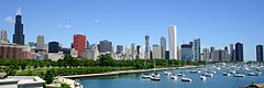
-
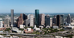
-
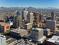
-
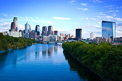
-
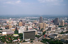
-
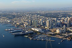
-
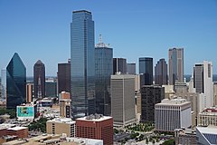
-

-
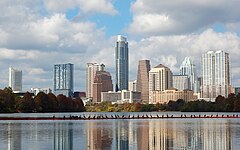 11. Austin, Texas
 -
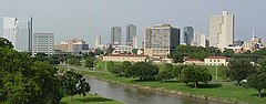
-

-
 14. Columbus, Ohio
 -
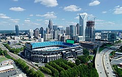
-
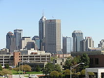
-
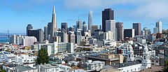
-

-
 19. Denver, Colorado
 -

-

-
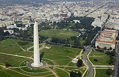
-
 23. El Paso, Texas
 -

-

-

-
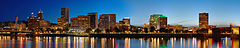 27. Portland, Oregon
 -
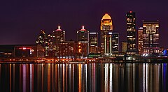
-
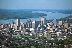
-
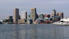
-

-

-
 33. Tucson, Arizona
 -
-
-
 36. Mesa, Arizona
 -
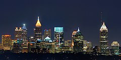 37. Atlanta, Georgia
 -
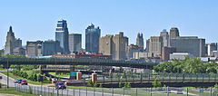
-
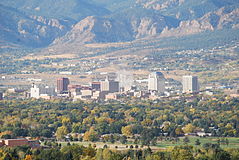
-
 40. Omaha, Nebraska
 -
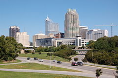
-
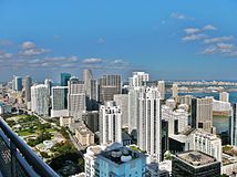 42. Miami, Florida
 -

-
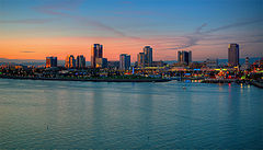
-
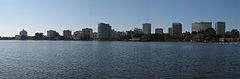
-

-
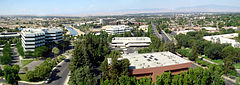
-
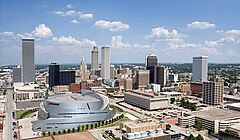 48. Tulsa, Oklahoma
 -
 49. Tampa, Florida
 -
 50. Arlington, Texas


.jpg)


.jpg)


.jpg)


.jpg)


.jpg)


Puerto Rico

The following table lists the five municipalities (municipios) of Puerto Rico with a population greater than 100,000 on July 1, 2023, as estimated by the United States Census Bureau.
If Puerto Rico were included with the broader U.S. list, San Juan would be the 58th largest city in the country.
The table below contains the following information:
- The municipio rank by population as of July 1, 2023, as estimated by the United States Census Bureau
- The municipio[3]
- The municipio population as of July 1, 2023, as estimated by the United States Census Bureau[3]
- The municipio population as of April 1, 2020, as enumerated by the 2020 United States census[3]
- The municipio percent population change from April 1, 2020, to July 1, 2023
- The municipio land area as of January 1, 2020[2]
- The municipio population density as of April 1, 2020 (residents per land area)[2]
- The municipio latitude and longitude coordinates
| Municipio | 2023 estimate | 2020 census | Ändern Sie | 2020 land area | 2020 density | Standort | ||
|---|---|---|---|---|---|---|---|---|
| San Juan | 333,005 | 342,259 | −2.70% | 39.8 sq mi | 103.1 km2 | 8,599/sq mi | 3,320/km2 | 18°24′N 66°04′W / 18.40°N 66.06°W |
| Bayamón | 180,835 | 185,187 | −2.35% | 27.0 sq mi | 69.9 km2 | 6,859/sq mi | 2,648/km2 | 18°23′N 66°10′W / 18.38°N 66.16°W |
| Carolina | 150,843 | 154,815 | −2.57% | 20.7 sq mi | 53.6 km2 | 7,479/sq mi | 2,888/km2 | 18°25′N 65°59′W / 18.41°N 65.98°W |
| Ponce | 130,251 | 137,491 | −5.27% | 28.4 sq mi | 73.6 km2 | 4,841/sq mi | 1,869/km2 | 18°00′N 66°37′W / 18.00°N 66.62°W |
| Caguas | 124,608 | 127,244 | −2.07% | 10.9 sq mi | 28.2 km2 | 11,674/sq mi | 4,507/km2 | 18°14′N 66°02′W / 18.23°N 66.04°W |
Other U.S. territories
As of 2023[update], four U.S. territories — American Samoa, Guam, the Northern Mariana Islands, and the U.S. Virgin Islands — have no cities with at least 100,000 people.[4]
Census-designated places
The following table lists U.S. census-designated places (CDPs) with populations of at least 100,000 according to the 2020 census. A CDP is a concentration of population identified by the United States Census Bureau for statistical purposes. CDPs are delineated for each decennial census as the statistical counterparts of incorporated places such as cities, towns and villages. CDPs are populated areas that lack separate municipal government, but which otherwise physically resemble incorporated places. Unlike the incorporated cities in the main list, the US Census Bureau does not release annual population estimates for CDPs.
The table below contains the following information:
- The census-designated place
- The state
- The census-designated place population as of April 1, 2020, as enumerated by the 2020 United States census[5]
- The census-designated place population as of April 1, 2010, as enumerated by the 2010 United States census
- The census-designated place percent population change from April 1, 2010, to April 1, 2020
- The census-designated place land area as of January 1, 2020[2]
- The census-designated place population density as of April 1, 2020 (residents per land area)[2]
- The census-designated place latitude and longitude coordinates
| Census- designated place |
ST | 2020 census | 2010 census | Ändern Sie | 2020 land area | 2020 density | Standort | ||
|---|---|---|---|---|---|---|---|---|---|
| mi2 | km2 | / mi2 | / km2 | ||||||
| Arlington | VA | 238,643 | 207,627 | +14.94% | 26.0 | 67.340 | 9,179 | 3,544 | 38°53′N 77°06′W / 38.88°N 77.10°W |
| Unternehmen | NV | 221,831 | 108,481 | +104.49% | 66.0 | 170.939 | 3,361 | 1,298 | 36°01′N 115°14′W / 36.01°N 115.23°W |
| Spring Valley | NV | 215,597 | 178,395 | +20.85% | 35.5 | 91.945 | 6,073 | 2,345 | 36°06′N 115°16′W / 36.10°N 115.26°W |
| Sunrise Manor | NV | 205,618 | 189,372 | +8.58% | 33.7 | 87.283 | 6,101 | 2,356 | 36°11′N 115°03′W / 36.18°N 115.05°W |
| Paradise | NV | 191,238 | 223,167 | −14.31% | 42.4 | 109.815 | 4,510 | 1,740 | 36°05′N 115°08′W / 36.09°N 115.14°W |
| Metairie | LA | 143,507 | 138,481 | +3.63% | 23.3 | 60.347 | 6,159 | 2,378 | 30°00′N 90°11′W / 30.00°N 90.18°W |
| East Los Angeles | CA | 118,786 | 126,496 | −6.10% | 7.5 | 19.425 | 15,838 | 6,115 | 34°02′N 118°10′W / 34.03°N 118.17°W |
| Brandon | FL | 114,626 | 103,483 | +10.77% | 33.1 | 85.729 | 3,463 | 1,337 | 27°56′N 82°18′W / 27.94°N 82.30°W |
| The Woodlands | TX | 114,436 | 93,847 | +21.94% | 43.3 | 112.146 | 2,643 | 1,020 | 30°10′N 95°31′W / 30.17°N 95.51°W |
| Lehigh Acres | FL | 114,287 | 86,784 | +31.69% | 92.7 | 240.092 | 1,233 | 476 | 26°37′N 81°38′W / 26.61°N 81.64°W |
| Spring Hill | FL | 113,568 | 98,621 | +15.16% | 59.9 | 155.140 | 1,896 | 732 | 28°29′N 82°32′W / 28.48°N 82.53°W |
| Riverview | FL | 107,396 | 71,050 | +51.16% | 46.2 | 119.657 | 2,325 | 898 | 27°49′N 82°18′W / 27.82°N 82.30°W |
| Columbia | MD | 104,681 | 99,615 | +5.09% | 31.9 | 82.621 | 3,282 | 1,267 | 39°12′N 76°52′W / 39.20°N 76.86°W |
| Highlands Ranch | CO | 103,444 | 96,713 | +6.96% | 24.3 | 62.937 | 4,257 | 1,644 | 39°32′N 104°58′W / 39.54°N 104.97°W |
Cities formerly over 100,000 people
The following table lists U.S. cities that, in past censuses, have had populations of at least 100,000 but have since decreased beneath this threshold or have been consolidated with or annexed into a neighboring city.[1]
| City | ST | 2023 estimate |
Peak population |
% decline from peak |
Peak year |
|
|---|---|---|---|---|---|---|
| Allegheny | PA | NA | 129,896 | NA | 1907 | [z] |
| Brooklyn | NY | NA | 806,343 | NA | 1898 | [aa] |
| Camden | NJ | 71,100 | 124,555 | −42.92% | 1950 | |
| Canton | OH | 69,197 | 116,912 | −40.81% | 1950 | |
| Citrus Heights | CA | 86,239 | 107,439 | −19.73% | 1990 | |
| Daly City | CA | 99,833 | 104,901 | −4.83% | 2020 | |
| Duluth | MN | 87,680 | 107,312 | −18.29% | 1960 | |
| Erie | PA | 92,957 | 138,440 | −32.85% | 1960 | |
| Fall River | MA | 93,840 | 120,485 | −22.11% | 1920 | |
| Federal Way | WA | 97,701 | 101,030 | −3.30% | 2020 | |
| Flint | MI | 79,661 | 196,940 | −59.55% | 1960 | |
| Gary | IN | 67,652 | 178,320 | −62.06% | 1960 | |
| Hammond | IN | 76,193 | 111,698 | −31.79% | 1960 | |
| Livonia | MI | 92,185 | 110,109 | −16.28% | 1970 | |
| Niagara Falls | NY | 47,599 | 102,394 | −53.51% | 1960 | |
| Norwalk | CA | 98,078 | 105,549 | −7.08% | 2010 | |
| Parma | OH | 78,951 | 100,216 | −21.22% | 1970 | |
| Portsmouth | VA | 97,454 | 114,773 | −15.09% | 1960 | |
| Reading | PA | 94,903 | 111,171 | −14.63% | 1930 | |
| Roanoke | VA | 99,578 | 100,220 | −0.64% | 1980 | |
| Scranton | PA | 75,805 | 143,333 | −47.11% | 1930 | |
| Somerville | MA | 80,407 | 103,908 | −22.62% | 1930 | |
| St. Joseph | MO | 70,634 | 102,979 | −31.41% | 1900 | [ab] |
| Trenton | NJ | 89,620 | 128,009 | −29.99% | 1950 | |
| Utica | NY | 63,607 | 101,740 | −37.48% | 1930 | |
| Wilmington | DE | 71,675 | 112,504 | −36.29% | 1940 | |
| Youngstown | OH | 59,108 | 170,002 | −65.23% | 1930 |
Locations of 50 most populous cities

See also
- Demographics of the United States
- Largest cities in the United States by population by decade
- List of largest cities – (world)
- List of largest cities of U.S. states and territories by population
- List of largest cities of U.S. states and territories by historical population
- List of United States cities by area
- List of United States cities by elevation
- List of United States cities by population density
- Lists of populated places in the United States
- United States Census Bureau
- Office of Management and Budget
Notes
- ^ Towns in New England, while incorporated on a level similar to cities in other states, are considered minor civil divisions by the Census Bureau and are not included in its list of incorporated places. A detailed discussion on this subject can be found at New England town § Census treatment of the New England town system.
- ^ The State of Hawaiʻi has no incorporated municipalities other than the City and County of Honolulu, which comprises the entire Island of Oʻahu. In accordance with Hawaiian law, the United States Census Bureau defines the state's cities"and towns as Census Designated Places (CDPs). The Census Bureau defines the Urban Honolulu CDP as the portion of the City and County of Honolulu that is coextensive with the Judicial District of Honolulu. The Urban Honolulu CDP is what is generally thought of as the "city" of Honolulu, and its population is used here and in other population comparisons. The Urban Honolulu CDP is currently the most populous Census Designated Place in the United States. The Honolulu, HI Metropolitan Statistical Area comprises the entire City and County of Honolulu.
- ^ Since 1898, the City of New York, New York, has comprised five boroughs with consolidated borough–county governments (2023 population estimates):
- (pop. 2,561,225)
- The Borough of Queens and Queens County
- (pop. 2,252,196)
- (pop. 1,597,451)
- (pop. 1,356,476)
- (pop. 490,687)
- ^ The City of Philadelphia, Pennsylvania, and Philadelphia County, Pennsylvania, are separate but coterminous entities with a single consolidated city–county government.
- ^ The City of Jacksonville, Florida, and Duval County, Florida, are separate entities with a single consolidated city–county government. The City of Jacksonville comprises all of Duval County except the other incorporated municipalities within the county.
- ^ The City of Indianapolis, Indiana, and Marion County, Indiana, are separate entities with a single consolidated city–county government. The City of Indianapolis comprises all of Marion County except the other incorporated municipalities within the county. See Indianapolis (balance).
- ^ The City and County of San Francisco, California, has a consolidated city and county government.
- ^ The City and County of Denver, Colorado, has a consolidated city and county government.
- ^ The City of Nashville, Tennessee, and Davidson County, Tennessee, are separate entities with a single consolidated city–county government. The City of Nashville comprises all of Davidson County except the other incorporated municipalities within the county. See Nashville-Davidson (balance).
- ^ The City of Washington was consolidated with the District of Columbia in 1871.
- ^ The City of Louisville, Kentucky, and Jefferson County, Kentucky, are separate entities with a single consolidated city–county government. The City of Louisville comprises all of Jefferson County except the other incorporated municipalities within the county. See Louisville/Jefferson County metro government (balance).
- ^ a b c d e f g h i j This is an independent city that is not part of any county.
- ^ The City of New Orleans, Louisiana, and Orleans Parish, Louisiana, are separate but coterminous entities with a single consolidated city–parish government.
- ^ The City of Honolulu, Hawaii, and Honolulu County, Hawaii, are separate entities with a single consolidated city–county government.The City of Honolulu comprises all of Honolulu County except the other unincorporated census-designated places within the county.
- ^ The City of Lexington, Kentucky, and Fayette County, Kentucky, are separate but coterminous entities with a single consolidated city–county government
- ^ The Municipality of Anchorage, Alaska, is a unified home rule municipality that functions as both a city and a borough.
- ^ Officially listed in US Census Bureau records as Boise City
- ^ The City of Baton Rouge, Louisiana, and East Baton Rouge Parish, Louisiana, are separate entities with a single consolidated city–parish government. The City of Baton Rouge has retained its own city limits within East Baton Rouge Parish.
- ^ The City of Columbus, Georgia, and Muscogee County, Georgia, are separate but coterminous entities with a single consolidated city–county government.
- ^ The City of Augusta, Georgia, and Richmond County, Georgia, are separate entities with a single consolidated city–county government. The City of Augusta comprises all of Richmond County except the two other incorporated municipalities within the county.
- ^ After approval by local voters in a 2012 referendum, the City of Macon, Georgia merged with most of unincorporated Bibb County, Georgia on January 1, 2014. The new consolidated government is officially "Macon-Bibb County".
- ^ Kansas City, Kansas, and Wyandotte County, Kansas, are separate entities with a single consolidated city–county government. Kansas City comprises all of Wyandotte County except the other incorporated municipalities within the county.
- ^ The City of Athens, Georgia, and Clarke County, Georgia, are separate entities with a single consolidated city–county government. The City of Athens comprises all of Clarke County except the other incorporated municipalities within the county.
- ^ The City of Lafayette, Louisiana, and Lafayette Parish, Louisiana, are separate entities with a single consolidated city–parish government. The City of Lafayette comprises all of Lafayette Parish except the other incorporated municipalities within the parish.
- ^ Official name is San Buenaventura
- ^ Peak as an independent city, annexed by Pittsburgh in 1907. In the 2010 census, the population of all neighborhoods of Pittsburgh that were formerly part of Allegheny City totalled 43,421. All North Side neighborhoods of Pittsburgh (41,120), plus an additional 2,301 in Census Tract 4270 Blocks 2 & 3, which are the sections of Millvale, Pennsylvania that were formally part of Allegheny City.
- ^ Peak as an independent city, consolidated with New York City in 1898. The estimated 2020 population for Brooklyn was 2,538,934.
- ^ Official peak in 1900, but there is evidence the count was padded by about 25,000;[6] −2.51% since 2020.
References
- ^ a b c d e f "City and Town Population Totals: 2020–2023". United States Census Bureau, Population Division. Archived from the original on July 11, 2022. Retrieved May 16, 2024.
- ^ a b c d e f g "2020 U.S. Gazetteer Files". U.S. Gazetteer Files. United States Census Bureau. Archived from the original on October 26, 2021. Retrieved September 9, 2021.
- ^ a b c "Puerto Rico Municipios Population Totals: 2020–2023". 2023 Census Population Estimates. U.S. Census Bureau, Population Division. March 2024. Retrieved May 16, 2024.
- ^ CIA World Factbook – American Samoa Archived January 29, 2021, at the Wayback Machine / Guam Archived June 18, 2021, at the Wayback Machine / Northern Mariana Islands Archived January 24, 2021, at the Wayback Machine / U.S. Virgin Islands Archived March 23, 2022, at the Wayback Machine. Retrieved July 6, 2021.
- ^ "QuickFacts". U.S. Census Bureau, Population Division. Retrieved January 8, 2023.
- ^ Bob Slater (February 28, 2010). "Civic Pride Ran Amok With 1900 Census". St. Joseph News-Press. Retrieved February 13, 2021.
External links
 Definitions from Wiktionary
 Media from Commons
 News from Wikinews
 Quotations from Wikiquote
 Texts from Wikisource
 Textbooks from Wikibooks
 Resources from Wikiversity
 Travel information from Wikivoyage