
Roi Et province: Difference between revisions
Prach Donmin (talk | contribs) |
RodRabelo7 (talk | contribs) |
||
| (39 intermediate revisions by 21 users not shown) | |||
| Line 2: | Line 2: | ||
{{more citations needed|date=August 2019}} |
{{more citations needed|date=August 2019}} |
||
{{Infobox settlement |
{{Infobox settlement |
||
| name |
| name = Roi Et |
||
| native_name |
| native_name = ร้อยเอ็ด |
||
| native_name_lang |
| native_name_lang = th |
||
| settlement_type |
| settlement_type = [[Provinces of Thailand|Province]] |
||
| image_skyline |
| image_skyline = {{multiple image |
||
| |
| border = infobox |
||
| |
| total_width = 280 |
||
| ⚫ | |||
| image_caption = Phra Phuttharattanamongkhon Maha Muni or Luang Pho Yai, Wat Burapha Phiram (Wat Hua Ro) |
|||
| |
| perrow = 2/1/2 |
||
| image1 = Wat Burapha Phiram, Roi Et (I).jpg |
|||
| ⚫ | |||
| image2 = เจดีย์หินทราย วัดป่ากุง - panoramio (4).jpg |
|||
| image_flag = Flag Roi-Et Province.png |
|||
| image3 = BuengPhalanChai.jpg |
|||
| image_seal = Seal Roi Et.png |
|||
| image4 = Phra MahaChedi Chai Mongkhon - panoramio.jpg |
|||
| image_map = Thailand Roi Et locator map.svg |
|||
| image5 = Ku Ka Sing-016.jpg |
|||
| ⚫ | |||
}} |
|||
| ⚫ | |||
| ⚫ | |||
| ⚫ | |||
| image_caption = From left to right, top to bottom: Wat Burapha Phiram, Wat Pa Kung, Bueng Phalan Chai, Phra Maha Chedi Chai Mongkhon, Ku Ka Sing |
|||
| ⚫ | |||
| |
| nickname = |
||
| motto = สิบเอ็ดประตูเมืองงาม เรืองนามพระสูงใหญ่ ผ้าไหมสาเกต บุญผะเหวดประเพณี มหาเจดีย์ชัยมงคล งามน่ายลบึงพลาญชัย เขตกว้างไกลทุ่งกุลา โลกลือชาข้าวหอมมะลิ <br> ("The beautiful eleven city gates. Renowned tallest Buddha image. Saket silk. The Bun Phawet festival. The great Chedi Chai Mongkhon. Fascinating Bueng Phalan Chai. The wide fields of Thung Kula. Internationally famous white rice.") |
|||
| ⚫ | |||
| |
| image_flag = Flag Roi-Et Province.png |
||
| |
| image_seal = Seal Roi Et.png |
||
| |
| image_map = Thailand Roi Et locator map.svg |
||
| |
| mapsize = |
||
| |
| map_alt = |
||
| ⚫ | |||
| ⚫ | |||
| ⚫ | |||
| ⚫ | | area_footnotes |
||
| coordinates_footnotes = |
|||
| ⚫ | |||
| ⚫ | |||
| ⚫ | |||
| subdivision_name = Thailand |
|||
| ⚫ | |||
| |
| seat_type = Capital |
||
| |
| seat = [[Roi Et]] |
||
| leader_party = |
|||
| ⚫ | | population_footnotes |
||
| |
| leader_title = Governor |
||
| ⚫ | |||
| ⚫ | |||
| ⚫ | | area_footnotes = <ref name="RFD">{{cite web |url=https://www.forest.go.th |title=ตารางที่ 2 พี้นที่ป่าไม้ แยกรายจังหวัด พ.ศ.2562 |year=2019 |department=Royal Forest Department |language=Thai |trans-title=Table 2 Forest area Separate province year 2019 |access-date=6 April 2021 |postscript=, information, Forest statistics Year 2019, Thailand boundary from Department of Provincial Administration in 2013}}</ref> |
||
| ⚫ | |||
| ⚫ | |||
| ⚫ | |||
| ⚫ | |||
| ⚫ | |||
| elevation_footnotes = |
|||
| elevation_m = 150 |
|||
| ⚫ | | population_footnotes = <ref name="TDD">{{cite web |url=http://stat.bora.dopa.go.th/stat/statnew/statTDD/ |website=stat.bora.dopa.go.th |language=th |script-title=th:รายงานสถิติจำนวนประชากรและบ้านประจำปี พ.ส.2562 |trans-title=Statistics, population and house statistics for the year 2019 |date=31 December 2019 |department=Registration Office Department of the Interior, Ministry of the Interior |access-date=26 February 2020}}</ref> |
||
| population_total = 1,305,211 |
|||
| ⚫ | |||
| ⚫ | |||
| ⚫ | |||
| population_density_rank = [[Provinces of Thailand|Ranked 21st]] |
| population_density_rank = [[Provinces of Thailand|Ranked 21st]] |
||
| population_demonym |
| population_demonym = |
||
| population_note |
| population_note = |
||
| demographics_type2 = GDP |
|||
| ⚫ | |||
| demographics2_footnotes = <ref name="NESDB-2017">{{cite journal|title=''Gross Regional and Provincial Product, 2019 Edition''|journal=<> |date=July 2019|url=https://www.nesdc.go.th/ewt_dl_link.php?nid=5628&filename=gross_regional|access-date=22 January 2020|publisher=Office of the National Economic and Social Development Council (NESDC)|language=en|issn=1686-0799}}</ref> |
|||
| demographics1_footnotes = <ref name="HAI 2560">[[:File:Human achievement index 2017.pdf|Human achievement index 2017 by National Economic and Social Development Board (NESDB), pages 1-40, maps 1-9, retrieved 14 September 2019, ISBN 978-974-9769-33-1]]</ref> |
|||
| demographics2_title1 = Total |
|||
| ⚫ | |||
| demographics2_info1 = [[baht]] 73 billion<br />([[US$]]2.4 billion) (2019) |
|||
| ⚫ | |||
| ⚫ | |||
| timezone1 = [[Time in Thailand|ICT]] |
|||
| demographics1_footnotes = <ref name="HAI 2565">{{cite web |url=https://www.nesdc.go.th/main.php?filename=Social_HAI |department=Office of the National Economic and Social Development Council (NESDC)|title=ข้อมูลสถิติดัชนีความก้าวหน้าของคน ปี 2565 (PDF) |language=thai |trans-title=Human Achievement Index Databook year 2022 (PDF) |access-date=12 March 2024 |postscript= , page 61}}</ref> |
|||
| ⚫ | |||
| ⚫ | |||
| ⚫ | |||
| ⚫ | |||
| postal_code = 45xxx |
|||
| |
| timezone1 = [[Time in Thailand|ICT]] |
||
| |
| utc_offset1 = +7 |
||
| ⚫ | |||
| ⚫ | |||
| |
| postal_code = 45xxx |
||
| area_code_type = [[Telephone numbers in Thailand|Calling code]] |
|||
| footnotes = |
|||
| ⚫ | |||
| ⚫ | |||
| website = {{URL|http://www.roiet.go.th}} |
|||
| ⚫ | |||
}} |
}} |
||
'''Roi Et''' ({{lang-th|ร้อยเอ็ด}}, {{IPA |
'''Roi Et''' ({{lang-th|ร้อยเอ็ด}}, {{IPA|th|rɔ́ːj ʔèt|pron}}; {{lang-tts|ร้อยเอ็ด}}, {{IPA-lo|lɔ̂ːj ʔět|pron}}) is one of Thailand's seventy-six [[Provinces of Thailand|provinces]] (''changwat'') lies in [[Isan#Administrative divisions|central northeastern Thailand]] also called [[Isan]]. Neighboring provinces are (from north clockwise) [[Kalasin province|Kalasin]], [[Mukdahan province|Mukdahan]], [[Yasothon province|Yasothon]], [[Sisaket province|Sisaket]], [[Surin province|Surin]], and [[Maha Sarakham province|Maha Sarakham]]. |
||
==Toponymy== |
==Toponymy== |
||
| Line 65: | Line 78: | ||
==History== |
==History== |
||
The area was already settled at the time of the [[Khmer empire]], as several ruins show. However, the main history of the province began when [[Lao people]] from [[Kingdom of Champasak|Champasak]] settled near Suwannaphum during the [[Ayutthaya Kingdom]].{{Citation needed|date=August 2019}} In the late-18th century, King [[Taksin]] moved the city to its present site, then called ''Saket Nakhon''.<ref>{{cite web|title=About Roi Et|url=https://www.tourismthailand.org/About-Thailand/Destination/Roi-Et|website=Tourism Authority of Thailand (TAT)|access-date=18 August 2019}}</ref> |
|||
Roi Et is a province located in the middle of the [[Isan]] region for over 200 years. |
|||
==Prehistoric period== |
|||
Prehistoric evidence has been found scattered throughout the province of Roi Et, has unearthed an archaeological site, Ban Muang Bua, which is assumed that The ancient prehistoric community discovered about 1,800-2,500 years ago. Culture from the [[Khmer Empire]] has spread into the 16th century, there is a lot of evidence, such as architecture in the form of a stone castle and religious sculptures made of sandstone and metal. |
|||
==Dvaravati period== |
|||
The prehistoric community settlement continued into the [[Dvaravati]] period, which is a Buddhist culture. The created city has a variable shape and location, but there are important characteristics, there are moats and embankments around the community. It is also found in many other districts of Roi Et. |
|||
==Rattanakosin period== |
|||
In 1782, [[King Rama I]] established Rattanakosin as the new capital city causing the Roi Et city and all Isan districts to go directly to Rattanakosin. As for Roi Et city, it has continued to developed until it has a political position and a priority over the city of [[Suvarnabhumi]] at a later time. |
|||
Later in 1826, there was a [[Lao rebellion (1826–1828)]] when the rebel army lost and retreated, the soldiers from Roi Et city attacked again until the rebels were defeated. |
|||
When [[King Rama V]] reformed the government, and include the northeastern cities together and divided into 4 large divisions, each with one governor supervising the division. The 4 large divisions including Eastern Laos Districts, Northeastern Laos Districts, Northern Laos Districts and Central Laos Districts, Roi Et is the capital city of 12 cities of the Northeastern Laos Districts. |
|||
In 1907, the city of Roi Et has been raised as an area of Roi Et, by dividing the administrative area into 5 cities, namely Roi Et, Suvarnabhumi, Maha Sarakham, Kamalasai and Kalasin |
|||
In 1910, [[Damrong Rajanubhab]] has an opinion that Monthon Northeastern should be separated into 2 Monthon, namely Monthon Ubon Ratchathani and Monthon Roi Et, [[King Rama VI]] has ordered to be as proposed, Monthon Roi Et has 3 provinces, namely Roi Et province, Mahasarakham province and Kalasin province. |
|||
In 1922, [[King Rama VI]] ordered to included Monthon Roi Et, Monthon Ubon and Monthon Udon as a region called the [[Isan]] region. Later in 1926, ordered to collapsed Monthon Roi Et, Ubon and Udon and changed the name to the province. Monthon Roi Et has became the province of Roi Et until the present. |
|||
==Symbols== |
==Symbols== |
||
The [[Seals of |
The [[Seals of the provinces of Thailand|provincial seal]] shows the shrine of the [[Lak Mueang|city pillar]], which is in the artificial lake ''Bueng Phalan Chai''. The spirit of the shrine, Mahesak, is revered by local people. |
||
The provincial tree is ''[[Lagerstroemia macrocarpa]]''. |
The [[list of Thai provincial trees|provincial tree]] is ''[[Lagerstroemia macrocarpa]]''. |
||
==Transportation== |
==Transportation== |
||
===Road=== |
===Road=== |
||
Route 214 leads north to [[Kalasin]] and south to [[Kaset Wisai District|Kaset Wiset]], [[Surin, Thailand|Surin]], and [[Prasat District|Prasat]]. Route 2044 leads east to [[Phon Thong District|Phon Thong]]. Route 23 leads west to [[Maha Sarakham]] and [[Ban Phai District|Ban Phai]], and east to [[Yasothon]] and [[Ubon Ratchathani]]. Route 215 leads south to [[Suwannaphum District|Suwannaphum]] and the border with [[Surin |
Route 214 leads north to [[Kalasin]] and south to [[Kaset Wisai District|Kaset Wiset]], [[Surin, Thailand|Surin]], and [[Prasat District|Prasat]]. Route 2044 leads east to [[Phon Thong District|Phon Thong]]. Route 23 leads west to [[Maha Sarakham]] and [[Ban Phai District|Ban Phai]], and east to [[Yasothon]] and [[Ubon Ratchathani]]. Route 215 leads south to [[Suwannaphum District|Suwannaphum]] and the border with [[Surin province]]. |
||
===Air=== |
===Air=== |
||
Roi Et is served by [[Roi Et Airport]] to the north of the town.<ref>{{cite web|title=Rob Muang Airport|url=http://www.ourairports.com/airports/VTUR/|publisher=OurAirports|access-date=4 February 2013}}</ref> |
Roi Et is served by [[Roi Et Airport]] to the north of the town.<ref>{{cite web|title=Rob Muang Airport|url=http://www.ourairports.com/airports/VTUR/|publisher=OurAirports|access-date=4 February 2013}}</ref>[[Thai AirAsia]] operates daily flights to [[Don Mueang International Airport|Don Mueang Airport]] 470 kilometers away. |
||
{{clear}} |
{{clear}} |
||
== Health == |
|||
Roi Et's main hospital is [[Roi Et Hospital]], a regional hospital operated by the [[Ministry of Public Health (Thailand)|Ministry of Public Health]]. |
|||
==Administrative divisions== |
==Administrative divisions== |
||
| Line 106: | Line 100: | ||
[[Image:Amphoe Roi Et.svg|thumb|250px|Map of 20 districts]] |
[[Image:Amphoe Roi Et.svg|thumb|250px|Map of 20 districts]] |
||
The province is divided into 20 districts (''[[amphoe]]s''). The districts are further divided into 193 subdistricts (''[[tambon]]s'') and 2,311 villages (''[[muban]]s''). |
The province is divided into 20 districts (''[[Districts of Thailand|amphoe]]s''). The districts are further divided into 193 subdistricts (''[[tambon]]s'') and 2,311 villages (''[[muban]]s''). |
||
{| |
{| |
||
|---valign=top |
|---valign=top |
||
|| |
|| |
||
#[[Mueang Roi Et |
#[[Mueang Roi Et district|Mueang Roi Et]] |
||
#[[Kaset Wisai |
#[[Kaset Wisai district|Kaset Wisai]] |
||
#[[Pathum Rat |
#[[Pathum Rat district|Pathum Rat]] |
||
#[[Chaturaphak Phiman |
#[[Chaturaphak Phiman district|Chaturaphak Phiman]] |
||
#[[Thawat Buri |
#[[Thawat Buri district|Thawat Buri]] |
||
#[[Phanom Phrai |
#[[Phanom Phrai district|Phanom Phrai]] |
||
#[[Phon Thong |
#[[Phon Thong district|Phon Thong]] |
||
#[[Pho Chai |
#[[Pho Chai district|Pho Chai]] |
||
#[[Nong Phok |
#[[Nong Phok district|Nong Phok]] |
||
#[[Selaphum |
#[[Selaphum district|Selaphum]] |
||
|| |
|| |
||
<ol start=11> |
<ol start=11> |
||
<li>[[Suwannaphum |
<li>[[Suwannaphum district|Suwannaphum]]</li> |
||
<li>[[Mueang Suang |
<li>[[Mueang Suang district|Mueang Suang]]</li> |
||
<li>[[Phon Sai |
<li>[[Phon Sai district|Phon Sai]]</li> |
||
<li>[[At Samat |
<li>[[At Samat district|At Samat]]</li> |
||
<li>[[Moei Wadi |
<li>[[Moei Wadi district|Moei Wadi]]</li> |
||
<li>[[Si Somdet |
<li>[[Si Somdet district|Si Somdet]]</li> |
||
<li>[[Changhan |
<li>[[Changhan district|Changhan]]</li> |
||
<li>[[Chiang Khwan |
<li>[[Chiang Khwan district|Chiang Khwan]]</li> |
||
<li>[[Nong Hi |
<li>[[Nong Hi district|Nong Hi]]</li> |
||
<li>[[Thung Khao Luang |
<li>[[Thung Khao Luang district|Thung Khao Luang]]</li> |
||
</ol> |
</ol> |
||
|} |
|} |
||
| Line 138: | Line 132: | ||
As of 26 November 2019 there are:<ref>{{cite web |url=http://www.dla.go.th/work/abt/province.jsp |title=Number of local government organizations by province |date=26 November 2019 |website=dla.go.th |publisher=Department of Local Administration (DLA) |access-date=10 December 2019 | quote=47 Roi Et: 1 PAO, 1 Town mun., 72 Subdistrict mun., 129 SAO.}}</ref> one Roi Et Provincial Administration Organisation (''{{lang|th-Latn|ongkan borihan suan changwat}}'') and 73 municipal (''thesaban'') areas in the province. Roi Et has town (''[[thesaban mueang]]'') status. Further 72 subdistrict municipalities (''[[thesaban tambon]]''). The non-municipal areas are administered by 129 Subdistrict Administrative Organisations - SAO (''ongkan borihan suan tambon'').<ref name="TDD"/> |
As of 26 November 2019 there are:<ref>{{cite web |url=http://www.dla.go.th/work/abt/province.jsp |title=Number of local government organizations by province |date=26 November 2019 |website=dla.go.th |publisher=Department of Local Administration (DLA) |access-date=10 December 2019 | quote=47 Roi Et: 1 PAO, 1 Town mun., 72 Subdistrict mun., 129 SAO.}}</ref> one Roi Et Provincial Administration Organisation (''{{lang|th-Latn|ongkan borihan suan changwat}}'') and 73 municipal (''thesaban'') areas in the province. Roi Et has town (''[[thesaban mueang]]'') status. Further 72 subdistrict municipalities (''[[thesaban tambon]]''). The non-municipal areas are administered by 129 Subdistrict Administrative Organisations - SAO (''ongkan borihan suan tambon'').<ref name="TDD"/> |
||
==Human achievement index |
==Human achievement index 2022== |
||
{| class="wikitable floatright" style="width:300px;" |
{| class="wikitable floatright" style="width:300px;" |
||
|- |
|- |
||
| Line 151: | Line 145: | ||
| [[File:Numismatics and Notaphily icon.png|75px]] |
| [[File:Numismatics and Notaphily icon.png|75px]] |
||
|- |
|- |
||
| style="text-align:center; background:black; color:white;"| |
| style="text-align:center; background:black; color:white;"| 37 |
||
| style="text-align:center; background:black; color:white;"| |
| style="text-align:center; background:black; color:white;"| 30 |
||
| style="text-align:center; background:black; color:white;"| |
| style="text-align:center; background:black; color:white;"| 56 |
||
| style="text-align:center; background:black; color:white;"| |
| style="text-align:center; background:black; color:white;"| 6 |
||
|- |
|- |
||
| style="text-align:center; background:black; color:white;"| Housing |
| style="text-align:center; background:black; color:white;"| Housing |
||
| Line 166: | Line 160: | ||
| [[File:Icon Sociopolítica y relaciones internacionales (wikiproyect, es.wp).png|75px]] |
| [[File:Icon Sociopolítica y relaciones internacionales (wikiproyect, es.wp).png|75px]] |
||
|- |
|- |
||
| style="text-align:center; background:black; color:white;"| |
| style="text-align:center; background:black; color:white;"| 8 |
||
| style="text-align:center; background:black; color:white;"| |
| style="text-align:center; background:black; color:white;"| 18 |
||
| style="text-align:center; background:black; color:white;"| |
| style="text-align:center; background:black; color:white;"| 46 |
||
| style="text-align:center; background:black; color:white;"| |
| style="text-align:center; background:black; color:white;"| 60 |
||
|- |
|- |
||
| colspan="4"; style="background:black; color:white;"| Province Roi Et, with an HAI |
| colspan="4"; style="background:black; color:white;"| Province Roi Et, with an HAI 2022 value of 0.6654 is "high", occupies place 10 in the ranking. |
||
|} |
|} |
||
Since 2003, United Nations Development Programme (UNDP) in Thailand has tracked progress on human development at sub-national level using the [[ |
Since 2003, United Nations Development Programme (UNDP) in Thailand has tracked progress on human development at sub-national level using the [[Human achievement index]] (HAI), a composite index covering all the eight key areas of human development. National Economic and Social Development Board (NESDB) has taken over this task since 2017.<ref name="HAI 2565" /> |
||
{|---valign=top |
{| class="wikitable" ---valign=top |
||
||Rank||Classification |
||Rank||Classification |
||
|- |
|- |
||
|| 1 - |
|| 1 - 13||"high" |
||
|- |
|- |
||
|| |
||14 - 29||"somewhat high" |
||
|- |
|- |
||
|| |
||30 - 45||"average" |
||
|- |
|- |
||
|| |
||46 - 61||"somewhat low" |
||
|- |
|- |
||
|| |
||62 - 77||"low" |
||
|} |
|} |
||
{|role= "presentation" class="wikitable mw-collapsible mw-collapsed" |
{|role= "presentation" class="wikitable mw-collapsible mw-collapsed" |
||
|<strong>Map with provinces and HAI |
|<strong>Map with provinces and HAI 2022 rankings</strong> |
||
|- |
|- |
||
|[[File:HAI |
|[[File:HAI 2022 rankings.svg|950px]] |
||
|} |
|} |
||
{{clear}} |
{{clear}} |
||
| Line 207: | Line 201: | ||
*[https://web.archive.org/web/20120623141544/http://www.tourismthailand.org/Where-to-Go/Roi-Et Province page from the Tourist Authority of Thailand] |
*[https://web.archive.org/web/20120623141544/http://www.tourismthailand.org/Where-to-Go/Roi-Et Province page from the Tourist Authority of Thailand] |
||
<!--*[http://kanchanapisek.or.th/cgi-bin/kp8/oncc/province.cgi?prov=e10 Golden Jubilee Network province guide] currently empty--> |
<!--*[http://kanchanapisek.or.th/cgi-bin/kp8/oncc/province.cgi?prov=e10 Golden Jubilee Network province guide] currently empty--> |
||
*[http://www.roiet.go.th Website of |
*[http://www.roiet.go.th Website of province] (Thai only) |
||
{{Geographic location |
{{Geographic location |
||
|Centre = Roi Et |
|Centre = Roi Et province |
||
|North = [[Kalasin |
|North = [[Kalasin province]] |
||
|Northeast = [[Mukdahan |
|Northeast = [[Mukdahan province]] |
||
|East = [[Yasothon |
|East = [[Yasothon province]] |
||
|Southeast = [[Sisaket |
|Southeast = [[Sisaket province]] |
||
|South = [[Surin |
|South = [[Surin province]] |
||
|Southwest = |
|Southwest = |
||
|West = [[Maha Sarakham |
|West = [[Maha Sarakham province]] |
||
|Northwest = |
|Northwest = |
||
}} |
}} |
||
| Line 225: | Line 219: | ||
{{Coord|16|3|12|N|103|39|9|E|type:adm1st_region:TH|display=title}} |
{{Coord|16|3|12|N|103|39|9|E|type:adm1st_region:TH|display=title}} |
||
[[Category:Roi Et |
[[Category:Roi Et province| ]] |
||
[[Category:Isan]] |
[[Category:Isan]] |
||
[[Category:Provinces of Thailand]] |
[[Category:Provinces of Thailand]] |
||
Latest revision as of 00:24, 4 September 2024
This article needs additional citations for verification. (August 2019) |
Roi Et
ร้อยเอ็ด | |
|---|---|
From left to right, top to bottom: Wat Burapha Phiram, Wat Pa Kung, Bueng Phalan Chai, Phra Maha Chedi Chai Mongkhon, Ku Ka Sing | |
 Flag  Seal | |
| Motto(s): สิบเอ็ดประตูเมืองงาม เรืองนามพระสูงใหญ่ ผ้าไหมสาเกต บุญผะเหวดประเพณี มหาเจดีย์ชัยมงคล งามน่ายลบึงพลาญชัย เขตกว้างไกลทุ่งกุลา โลกลือชาข้าวหอมมะลิ ("The beautiful eleven city gates. Renowned tallest Buddha image. Saket silk. The Bun Phawet festival. The great Chedi Chai Mongkhon. Fascinating Bueng Phalan Chai. The wide fields of Thung Kula. Internationally famous white rice.") | |
 Map of Thailand highlighting Roi Et province | |
| Land | Thailand |
| Capital | Roi Et |
| Regierung | |
| • Governor | Phusit Somchit (since October 2021) |
| Area | |
| • Total | 7,873 km2 (3,040 sq mi) |
| • Rank | Ranked 25th |
| Elevation | 150 m (490 ft) |
| Population (2019)[2] | |
| • Total | 1,305,211 |
| • Rank | Ranked 14th |
| • Density | 166/km2 (430/sq mi) |
| • Rank | Ranked 21st |
| Human Achievement Index | |
| • HAI (2022) | 0.6654 "high" Ranked 10th |
| GDP | |
| • Total | baht 73 billion (US$2.4 billion) (2019) |
| Time zone | UTC+7 (ICT) |
| Postal code | 45xxx |
| Calling code | 043 |
| ISO 3166 code | TH-45 |
| Website | www |
.jpg)
.jpg)


Roi Et (Thai: ร้อยเอ็ด, pronounced [rɔ́ːj ʔèt]; Northeastern Thai: ร้อยเอ็ด, pronounced [lɔ̂ːj ʔět]) is one of Thailand's seventy-six provinces (changwat) lies in central northeastern Thailand also called Isan. Neighboring provinces are (from north clockwise) Kalasin, Mukdahan, Yasothon, Sisaket, Surin, and Maha Sarakham.
Toponymy
[edit]The name of the province literally means 'one hundred and one' (Thai: ร้อยเอ็ด; RTGS: roi et ). Correctly, the number should be "eleven" (Thai: สิบเอ็ด; RTGS: sip et ), as the province was named after its eleven ancient gates built for its eleven vassal states. In ancient times, the number "eleven" was written "๑๐๑" (101) and the provincial name was written accordingly. Later, people took "๑๐๑" to mean 'one hundred and one' and have since then called it "Roi Et".[5]
Geography
[edit]Most of the province is covered by plains about 130–160 meters above sea level, drained by the Chi River. In the north are the hills of the Phu Phan mountain range. The Yang River is the major watercourse. In the south is the Mun River, which also forms the boundary with Surin. At the mouth of the Chi River, where it enters the Mun River, a floodplain provides a good rice farming area. The total forest area is 346 km2 (134 sq mi) or 4.4 percent of provincial area.[1]
History
[edit]The area was already settled at the time of the Khmer empire, as several ruins show. However, the main history of the province began when Lao people from Champasak settled near Suwannaphum during the Ayutthaya Kingdom.[citation needed] In the late-18th century, King Taksin moved the city to its present site, then called Saket Nakhon.[6]
Symbols
[edit]The provincial seal shows the shrine of the city pillar, which is in the artificial lake Bueng Phalan Chai. The spirit of the shrine, Mahesak, is revered by local people.
The provincial tree is Lagerstroemia macrocarpa.
Transport
[edit]Road
[edit]Route 214 leads north to Kalasin and south to Kaset Wiset, Surin, and Prasat. Route 2044 leads east to Phon Thong. Route 23 leads west to Maha Sarakham and Ban Phai, and east to Yasothon and Ubon Ratchathani. Route 215 leads south to Suwannaphum and the border with Surin province.
Air
[edit]Roi Et is served by Roi Et Airport to the north of the town.[7]Thai AirAsia operates daily flights to Don Mueang Airport 470 kilometers away.
Health
[edit]Roi Et's main hospital is Roi Et Hospital, a regional hospital operated by the Ministry of Public Health.
Administrative divisions
[edit]Provincial government
[edit]
The province is divided into 20 districts (amphoes). The districts are further divided into 193 subdistricts (tambons) and 2,311 villages (mubans).
Local government
[edit]As of 26 November 2019 there are:[8] one Roi Et Provincial Administration Organisation (ongkan borihan suan changwat) and 73 municipal (thesaban) areas in the province. Roi Et has town (thesaban mueang) status. Further 72 subdistrict municipalities (thesaban tambon). The non-municipal areas are administered by 129 Subdistrict Administrative Organisations - SAO (ongkan borihan suan tambon).[2]
Human achievement index 2022
[edit]| Health | Bildung | Employment | Income |
| 37 | 30 | 56 | 6 |
| Housing | Family | Transport | Participation |

|
 |
.png)
| |
| 8 | 18 | 46 | 60 |
| Province Roi Et, with an HAI 2022 value of 0.6654 is "high", occupies place 10 in the ranking. | |||
Since 2003, United Nations Development Programme (UNDP) in Thailand has tracked progress on human development at sub-national level using the Human achievement index (HAI), a composite index covering all the eight key areas of human development. National Economic and Social Development Board (NESDB) has taken over this task since 2017.[3]
| Rank | Classification |
| 1 - 13 | "high" |
| 14 - 29 | "somewhat high" |
| 30 - 45 | "average" |
| 46 - 61 | "somewhat low" |
| 62 - 77 | "low" |
| Map with provinces and HAI 2022 rankings |

|
Gallery
[edit]-
 Roi Et National Museum
 -
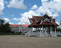 Roi Et City Hall


References
[edit]- ^ a b "ตารางที่ 2 พี้นที่ป่าไม้ แยกรายจังหวัด พ.ศ.2562" [Table 2 Forest area Separate province year 2019]. Royal Forest Department (in Thai). 2019. Retrieved 6 April 2021, information, Forest statistics Year 2019, Thailand boundary from Department of Provincial Administration in 2013
{{cite web}}: CS1 maint: postscript (link) - ^ a b รายงานสถิติจำนวนประชากรและบ้านประจำปี พ.ส.2562 [Statistics, population and house statistics for the year 2019]. Registration Office Department of the Interior, Ministry of the Interior. stat.bora.dopa.go.th (in Thai). 31 December 2019. Retrieved 26 February 2020.
- ^ a b "ข้อมูลสถิติดัชนีความก้าวหน้าของคน ปี 2565 (PDF)" [Human Achievement Index Databook year 2022 (PDF)]. Office of the National Economic and Social Development Council (NESDC) (in Thai). Retrieved 12 March 2024, page 61
{{cite web}}: CS1 maint: postscript (link) - ^ "Gross Regional and Provincial Product, 2019 Edition". <>. Office of the National Economic and Social Development Council (NESDC). July 2019. ISSN 1686-0799. Retrieved 22 January 2020.
- ^ Royal Institute of Thailand (2010). Kotmai Tra Sam Duang Phra Thamnun (Chabap Ratchabandittayasathan) กฎหมายตราสามดวง พระทำนูน (ฉบับราชบัณฑิตยสถาน) [The Code of the Three Great Seals: The Judicial Statute (Royal Institute Version)] (in Thai). Bangkok: Royal Institute of Thailand. pp. 39–40. ISBN 9786167073118.
- ^ "About Roi Et". Tourism Authority of Thailand (TAT). Retrieved 18 August 2019.
- ^ "Rob Muang Airport". OurAirports. Retrieved 4 February 2013.
- ^ "Number of local government organizations by province". dla.go.th. Department of Local Administration (DLA). 26 November 2019. Retrieved 10 December 2019.
47 Roi Et: 1 PAO, 1 Town mun., 72 Subdistrict mun., 129 SAO.
External links
[edit] Roi Et travel guide from Wikivoyage
- Province page from the Tourist Authority of Thailand
- Website of province (Thai only)
Places adjacent to Roi Et province | |
|---|---|
| International | |
|---|---|
| National | |
| Geographic | |
| Other | |