
List of municipalities in Connecticut: Difference between revisions
| Line 1,572: | Line 1,572: | ||
!City |
!City |
||
!County |
!County |
||
!Planning region |
|||
!Population (2020) |
!Population (2020) |
||
!Date chartered as city |
!Date chartered as city |
||
| Line 1,578: | Line 1,579: | ||
|[[Ansonia, Connecticut|Ansonia]] |
|[[Ansonia, Connecticut|Ansonia]] |
||
|[[New Haven County, Connecticut|New Haven]] |
|[[New Haven County, Connecticut|New Haven]] |
||
|[[Naugatuck Valley Planning Region, Connecticut|Naugatuck Valley]] |
|||
|18,918 |
|18,918 |
||
|1893 |
|1893 |
||
| Line 1,584: | Line 1,586: | ||
|'''[[Bridgeport, Connecticut|Bridgeport]]''' |
|'''[[Bridgeport, Connecticut|Bridgeport]]''' |
||
|[[Fairfield County, Connecticut|Fairfield]] |
|[[Fairfield County, Connecticut|Fairfield]] |
||
|[[Greater Bridgeport Planning Region, Connecticut|Greater Bridgeport]] |
|||
|148,654 |
|148,654 |
||
|1836 |
|1836 |
||
| Line 1,590: | Line 1,593: | ||
|[[Bristol, Connecticut|Bristol]] |
|[[Bristol, Connecticut|Bristol]] |
||
|[[Hartford County, Connecticut|Hartford]] |
|[[Hartford County, Connecticut|Hartford]] |
||
|[[Naugatuck Valley Planning Region, Connecticut|Naugatuck Valley]] |
|||
|60,833 |
|60,833 |
||
|1911 |
|1911 |
||
| Line 1,596: | Line 1,600: | ||
|[[Danbury, Connecticut|Danbury]] |
|[[Danbury, Connecticut|Danbury]] |
||
|[[Fairfield County, Connecticut|Fairfield]] |
|[[Fairfield County, Connecticut|Fairfield]] |
||
|[[Western Connecticut Planning Region, Connecticut|Western Connecticut]] |
|||
|86,518 |
|86,518 |
||
|1889 |
|1889 |
||
| Line 1,602: | Line 1,607: | ||
|[[Derby, Connecticut|Derby]] |
|[[Derby, Connecticut|Derby]] |
||
|[[New Haven County, Connecticut|New Haven]] |
|[[New Haven County, Connecticut|New Haven]] |
||
|[[Naugatuck Valley Planning Region, Connecticut|Naugatuck Valley]] |
|||
|12,325 |
|12,325 |
||
|1893 |
|1893 |
||
| Line 1,608: | Line 1,614: | ||
|[[Groton (city), Connecticut|Groton]] |
|[[Groton (city), Connecticut|Groton]] |
||
|[[New London County, Connecticut|New London]] |
|[[New London County, Connecticut|New London]] |
||
|[[Southeastern Connecticut Planning Region, Connecticut|Southeastern Connecticut]] |
|||
|9,349 |
|9,349 |
||
|1964 |
|1964 |
||
| Line 1,614: | Line 1,621: | ||
|'''[[Hartford, Connecticut|Hartford]]''' |
|'''[[Hartford, Connecticut|Hartford]]''' |
||
|[[Hartford County, Connecticut|Hartford]] |
|[[Hartford County, Connecticut|Hartford]] |
||
|[[Capitol Planning Region, Connecticut|Capitol]] |
|||
|121,054 |
|121,054 |
||
|1784 |
|1784 |
||
| Line 1,620: | Line 1,628: | ||
|[[Meriden, Connecticut|Meriden]] |
|[[Meriden, Connecticut|Meriden]] |
||
|[[New Haven County, Connecticut|New Haven]] |
|[[New Haven County, Connecticut|New Haven]] |
||
|[[South Central Connecticut Planning Region, Connecticut|South Central]] |
|||
|60,850 |
|60,850 |
||
|1867 |
|1867 |
||
| Line 1,626: | Line 1,635: | ||
|[[Middletown, Connecticut|Middletown]] |
|[[Middletown, Connecticut|Middletown]] |
||
|[[Middlesex County, Connecticut|Middlesex]] |
|[[Middlesex County, Connecticut|Middlesex]] |
||
|[[Lower Connecticut River Valley Planning Region, Connecticut|Lower Connecticut River Valley]] |
|||
|47,717 |
|47,717 |
||
|1784 |
|1784 |
||
| Line 1,632: | Line 1,642: | ||
|[[Milford, Connecticut|Milford]] |
|[[Milford, Connecticut|Milford]] |
||
|[[New Haven County, Connecticut|New Haven]] |
|[[New Haven County, Connecticut|New Haven]] |
||
|[[South Central Connecticut Planning Region, Connecticut|South Central]] |
|||
|50,558 |
|50,558 |
||
|1959 |
|1959 |
||
| Line 1,638: | Line 1,649: | ||
|[[New Britain, Connecticut|New Britain]] |
|[[New Britain, Connecticut|New Britain]] |
||
|[[Hartford County, Connecticut|Hartford]] |
|[[Hartford County, Connecticut|Hartford]] |
||
|[[Capitol Planning Region, Connecticut|Capitol]] |
|||
|74,135 |
|74,135 |
||
|1870 |
|1870 |
||
| Line 1,644: | Line 1,656: | ||
|'''[[New Haven, Connecticut|New Haven]]''' |
|'''[[New Haven, Connecticut|New Haven]]''' |
||
|[[New Haven County, Connecticut|New Haven]] |
|[[New Haven County, Connecticut|New Haven]] |
||
|[[South Central Connecticut Planning Region, Connecticut|South Central]] |
|||
|134,023 |
|134,023 |
||
|1784 |
|1784 |
||
| Line 1,650: | Line 1,663: | ||
|[[New London, Connecticut|New London]] |
|[[New London, Connecticut|New London]] |
||
|[[New London County, Connecticut|New London]] |
|[[New London County, Connecticut|New London]] |
||
|[[Southeastern Connecticut Planning Region, Connecticut|Southeastern Connecticut]] |
|||
|27,367 |
|27,367 |
||
|1784 |
|1784 |
||
| Line 1,656: | Line 1,670: | ||
|[[Norwalk, Connecticut|Norwalk]] |
|[[Norwalk, Connecticut|Norwalk]] |
||
|[[Fairfield County, Connecticut|Fairfield]] |
|[[Fairfield County, Connecticut|Fairfield]] |
||
|[[Western Connecticut Planning Region, Connecticut|Western Connecticut]] |
|||
|91,184 |
|91,184 |
||
|1893 |
|1893 |
||
| Line 1,662: | Line 1,677: | ||
|[[Norwich, Connecticut|Norwich]] |
|[[Norwich, Connecticut|Norwich]] |
||
|[[New London County, Connecticut|New London]] |
|[[New London County, Connecticut|New London]] |
||
|[[Southeastern Connecticut Planning Region, Connecticut|Southeastern Connecticut]] |
|||
|40,125 |
|40,125 |
||
|1784 |
|1784 |
||
| Line 1,668: | Line 1,684: | ||
|[[Shelton, Connecticut|Shelton]] |
|[[Shelton, Connecticut|Shelton]] |
||
|[[Fairfield County, Connecticut|Fairfield]] |
|[[Fairfield County, Connecticut|Fairfield]] |
||
|[[Naugatuck Valley Planning Region, Connecticut|Naugatuck Valley]] |
|||
|40,869 |
|40,869 |
||
|1915 |
|1915 |
||
| Line 1,674: | Line 1,691: | ||
|'''[[Stamford, Connecticut|Stamford]]''' |
|'''[[Stamford, Connecticut|Stamford]]''' |
||
|[[Fairfield County, Connecticut|Fairfield]] |
|[[Fairfield County, Connecticut|Fairfield]] |
||
|[[Western Connecticut Planning Region, Connecticut|Western Connecticut]] |
|||
|135,470 |
|135,470 |
||
|1893 |
|1893 |
||
| Line 1,680: | Line 1,698: | ||
|[[Torrington, Connecticut|Torrington]] |
|[[Torrington, Connecticut|Torrington]] |
||
|[[Litchfield County, Connecticut|Litchfield]] |
|[[Litchfield County, Connecticut|Litchfield]] |
||
|[[Northwest Hills Planning Region, Connecticut|Northwest Hills]] |
|||
|35,515 |
|35,515 |
||
|1923 |
|1923 |
||
| Line 1,686: | Line 1,705: | ||
|'''[[Waterbury, Connecticut|Waterbury]]''' |
|'''[[Waterbury, Connecticut|Waterbury]]''' |
||
|[[New Haven County, Connecticut|New Haven]] |
|[[New Haven County, Connecticut|New Haven]] |
||
|[[Naugatuck Valley Planning Region, Connecticut|Naugatuck Valley]] |
|||
|114,403 |
|114,403 |
||
|1853 |
|1853 |
||
| Line 1,692: | Line 1,712: | ||
|[[West Haven, Connecticut|West Haven]] |
|[[West Haven, Connecticut|West Haven]] |
||
|[[New Haven County, Connecticut|New Haven]] |
|[[New Haven County, Connecticut|New Haven]] |
||
|[[South Central Connecticut Planning Region, Connecticut|South Central]] |
|||
|55,584 |
|55,584 |
||
|1961 |
|1961 |
||
| Line 1,698: | Line 1,719: | ||
|[[Winsted, Connecticut|Winsted]] |
|[[Winsted, Connecticut|Winsted]] |
||
|[[Litchfield County, Connecticut|Litchfield]] |
|[[Litchfield County, Connecticut|Litchfield]] |
||
|[[Northwest Hills Planning Region, Connecticut|Northwest Hills]] |
|||
|7,712 (2010 population) |
|7,712 (2010 population) |
||
|1917 |
|1917 |
||
Revision as of 21:03, 28 March 2024
| Municipalities of Connecticut | |
|---|---|
 Towns (light grey) and cities (dark grey) of Connecticut | |
| Location | State of Connecticut |
| Number | 169 |
| Populations | 785 (Union) – 148,654 (Bridgeport) |
| Areas | 4.98 square miles (12.9 km2) (Derby) – 61.59 square miles (159.5 km2) (New Milford) |
| Government | |
The U.S. state of Connecticut is divided into 169 municipalities, including 19 cities, 149 towns and 1 borough, which are grouped into eight counties.
Towns traditionally have a town meeting form of government; under the Home Rule Act, however, towns are free to choose their own government structure. Nineteen of the towns in Connecticut are consolidated city-towns, and one (Naugatuck) is a consolidated borough-town.
City incorporation requires a Special Act by the Connecticut General Assembly. All cities in Connecticut are dependent municipalities, meaning they are located within and subordinate to a town. However, except for one, all currently existing cities in Connecticut are consolidated with their parent town. Former inner-cities are listed in a separate table below.
Towns in Connecticut are allowed to adopt a city form of government without the need to re-incorporate as an inner-city. Connecticut state law also makes no distinction between a consolidated town/city and a regular town. Bolded city names indicate the state's largest cities, with the most populated being Bridgeport. Currently, Tolland County and Windham County are the only counties in Connecticut without a single city in them.
List of municipalities in Connecticut
Cities
Note: There are currently 21 cities in Connecticut and those with a population greater than 100,000 are listed in bold.
Former cities
| Former city | County | Date chartered as city | Date of disestablishment | Disposition |
|---|---|---|---|---|
| South Norwalk | Fairfield | 1871 | 1913 | Consolidated with Town and City of Norwalk in 1913.
Now a neighborhood and a taxing district |
| Rockville | Tolland | 1889 | 1965 | Consolidated with the Town of Vernon. Now a CDP. |
| Willimantic | Windham | 1893 | 1983 | Now a CDP in the town of Windham |
| Putnam | Windham | 1895 | 1984 | Now a CDP in the town of Putnam |
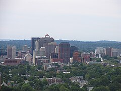
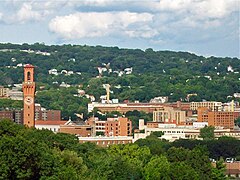
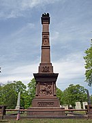
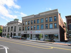
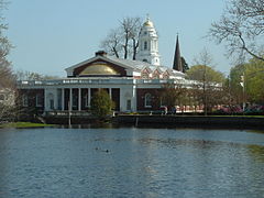
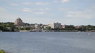
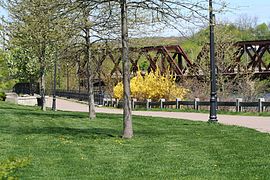
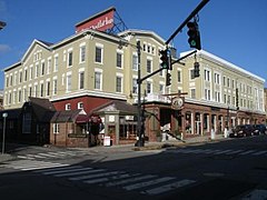
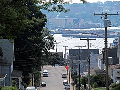
Gallery
- Connecticut cities
-

-

-
-

-
-

-
-

-
-

-
-

-
-

-
-
-

-

-

-
-


Boroughs
| Name | Parent town | Population (2020) |
Area (2020) | Coordinates | |
|---|---|---|---|---|---|
| sq mi | km2 | ||||
| Bantam | Litchfield | 720 | 1.01 | 2.6 | 41°43′24″N 73°14′26″W / 41.72333°N 73.24056°W |
| Danielson | Killingly | 4,155 | 1.16 | 3.0 | 41°48′29″N 71°53′03″W / 41.80806°N 71.88417°W |
| Fenwick | Old Saybrook | 53 | 0.39 | 1.0 | 41°16′12″N 72°21′26″W / 41.27000°N 72.35722°W |
| Groton Long Point | Groton | 530 | 0.4 | 1.0 | 41°18′52″N 72°00′28″W / 41.31444°N 72.00778°W |
| Jewett City | Griswold | 3,328 | 0.74 | 1.9 | 41°36′26″N 71°58′47″W / 41.60722°N 71.97972°W |
| Litchfield | Litchfield | 1,179 | 1.37 | 3.5 | 41°44′51″N 73°11′17″W / 41.74750°N 73.18806°W |
| Naugatuck[a] | 31,519 | 16.39 | 42.4 | 41°29′23″N 73°03′05″W / 41.48972°N 73.05139°W | |
| Newtown | Newtown | 1,914 | 2.3 | 6.0 | 41°24′42.82″N 73°18′43.01″W / 41.4118944°N 73.3119472°W |
| Stonington | Stonington | 976 | 0.7 | 1.8 | 41°20′5.15″N 71°53′58.05″W / 41.3347639°N 71.8994583°W |
| Woodmont | Milford | 1,486 | 0.99 | 2.6 | 41°13′41″N 72°59′32″W / 41.22806°N 72.99222°W |
See also
- Borough (Connecticut)
- Administrative divisions of Connecticut
- Connecticut
- List of counties in Connecticut
Notes
- ^ Naugatuck is a consolidated borough and town.
References
- ^ a b "U.S. Census website". United States Census Bureau. Retrieved November 8, 2021.
- Connecticut State Register and Manual, Sec. VII
External links
- Census 2000 Gazetteer
- National Association of Towns and Townships
- The Connecticut Conference of Municipalities
- The Connecticut Council of Small Towns