Zhizdra (river): Difference between revisions
Appearance
Content deleted Content added
add map |
mNo edit summary |
||
| Line 29: | Line 29: | ||
| tributaries_right = |
| tributaries_right = |
||
}} |
}} |
||
The '''Zhizdra''' ({{Lang-ru|Жиздра}}) is a river in [[Kaluga Oblast]] in [[Russia]], [[Oka (river)|Oka]]'s left tributary. The length of the river is {{convert|223|km}}. The area of its [[Drainage basin|basin]] is {{convert|9170|km2}}.<ref name=gvr>[http://textual.ru/gvr/index.php?card=178318 «Река ЖИЗДРА»], Russian State Water Registry</ref> The Zhizdra freezes up in late November and stays icebound until early April. Its main tributaries are the [[Resseta]], [[Vytebet]], and [[Seryona]]. The towns of [[Kozelsk]] and [[Zhizdra]] are located on the shores of the Zhizdra. The name is of |
The '''Zhizdra''' ({{Lang-ru|Жиздра}}) is a river in [[Kaluga Oblast]] in [[Russia]], [[Oka (river)|Oka]]'s left tributary. The length of the river is {{convert|223|km}}. The area of its [[Drainage basin|basin]] is {{convert|9170|km2}}.<ref name=gvr>[http://textual.ru/gvr/index.php?card=178318 «Река ЖИЗДРА»], Russian State Water Registry</ref> The Zhizdra freezes up in late November and stays icebound until early April. Its main tributaries are the [[Resseta]], [[Vytebet]], and [[Seryona]]. The towns of [[Kozelsk]] and [[Zhizdra]] are located on the shores of the Zhizdra. The name is of Lithuanian origin.<ref name="about">{{cite web|title=General Information|url=http://gorod-zhizdra.ru/index.php/o-gorode|access-date=January 5, 2018|publisher=|language=russian}}</ref> In [[Lithuanian language|Lithuanian]], ''žizdras'' means 'thick sand, gravel'. |
||
The lower course of the Zhizdra is located in [[Ugra National Park]].<ref name="parkgen">{{cite web|url=http://www.parkugra.ru/index/obschie-svedeniya.html|title=Общие сведения о парке|publisher=Ugra National Park|language=ru|access-date=31 December 2015}}</ref> |
The lower course of the Zhizdra is located in [[Ugra National Park]].<ref name="parkgen">{{cite web|url=http://www.parkugra.ru/index/obschie-svedeniya.html|title=Общие сведения о парке|publisher=Ugra National Park|language=ru|access-date=31 December 2015}}</ref> |
||
Revision as of 18:33, 11 August 2021
| Zhizdra | |
|---|---|
 | |
| Native name | Жиздра Error {{native name checker}}: parameter value is malformed (help) |
| Standort | |
| Land | Russland |
| Physical characteristics | |
| Mouth | Oka |
• coordinates | 54°14′09″N 36°11′38″E / 54.23583°N 36.19389°E |
| Length | 223 km (139 mi) |
| Basin size | 9,170 km2 (3,540 sq mi) |
| Basin features | |
| Progression | Oka→ Volga→ Caspian Sea |
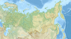
The Zhizdra (Russian: Жиздра) is a river in Kaluga Oblast in Russia, Oka's left tributary. The length of the river is 223 kilometres (139 mi). The area of its basin is 9,170 square kilometres (3,540 sq mi).[1] The Zhizdra freezes up in late November and stays icebound until early April. Its main tributaries are the Resseta, Vytebet, and Seryona. The towns of Kozelsk and Zhizdra are located on the shores of the Zhizdra. The name is of Lithuanian origin.[2] In Lithuanian, žizdras means 'thick sand, gravel'.
The lower course of the Zhizdra is located in Ugra National Park.[3]
References
- ^ «Река ЖИЗДРА», Russian State Water Registry
- ^ "General Information" (in Russian). Retrieved January 5, 2018.
- ^ "Общие сведения о парке" (in Russian). Ugra National Park. Retrieved 31 December 2015.

