Boulder Peak (Washington): Difference between revisions
Appearance
Content deleted Content added
Tom.Reding (talk | contribs) m +{{Authority control}} (1 ID from Wikidata), WP:GenFixes on |
→top: add short description |
||
| Line 1: | Line 1: | ||
{{short description|Mountain in Washington (state), United States}} |
|||
{{Infobox mountain |
{{Infobox mountain |
||
| name = Boulder Peak |
| name = Boulder Peak |
||
Revision as of 04:06, 15 April 2022
| Boulder Peak | |
|---|---|
| Highest point | |
| Elevation | 5,672 ft (1,729 m) NAVD 88[1] |
| Prominence | 550 ft (170 m)[2] |
| Coordinates | 47°58′18″N 123°45′27″W / 47.971681572°N 123.757468256°W[1] |
| Geography | |
| Standort | Clallam County, Washington, U.S. |
| Parent range | Olympic Mountains |
| Topo map | USGS Bogachiel Peak |
| Climbing | |
| Easiest route | scramble |
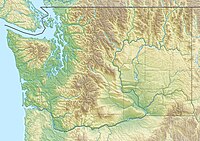
Boulder Peak is a peak located in Washington state, in Olympic National Park. The mountain is accessible by using the Olympic Hot Springs Trail and the Appleton Pass trail. These two trails lead to Boulder Lake located at the base of Boulder Mountain where there is a campground. There are no official trails to the top of the peak, but one can find a beaten path and with a fair amount of scrambling can reach the summit. The summit offers views of the surrounding Olympic Mountains and various lakes. The round trip from trail head to summit is approximately 13 miles.
References
- ^ a b "Boulder". NGS Data Sheet. National Geodetic Survey, National Oceanic and Atmospheric Administration, United States Department of Commerce.
- ^ "Boulder Peak, Washington". Peakbagger.com.
External links
- "Boulder Peak". Geographic Names Information System. United States Geological Survey, United States Department of the Interior.

