North East Victoria: Difference between revisions
Appearance
Content deleted Content added
m →References: clean up |
expression |
||
| Line 45: | Line 45: | ||
==Geography== |
==Geography== |
||
The North East Victoria zone includes the western slopes of the [[Great Dividing Range]] and is bounded on the north side by the [[Murray River]]. When it was defined, it |
The North East Victoria zone includes the western slopes of the [[Great Dividing Range]] and is bounded on the north side by the [[Murray River]]. When it was defined, it included the Shires of [[Shire of Beechworth|Beechworth]], [[Shire of Benalla|Benalla]], [[Shire of Bright|Bright]], [[Shire of Chiltern|Chiltern]], [[Shire of Myrtleford|Myrtleford]], [[Shire of Oxley|Oxley]], [[Shire of Rutherglen|Rutherglen]], [[Shire of Tallangatta|Tallangatta]], [[Shire of Upper Murray|Upper Murray]], [[Shire of Wangaratta (Victoria)|Wangaratta]], [[Shire of Yackandandah|Yackandandah]], and parts of the Shires of [[Shire of Tungamah|Tungamah]] and [[Shire of Yarrawonga|Yarrawonga]] as well as the [[City of Benalla]], the [[City of Wangaratta]] and the [[Rural City of Wodonga]].<ref name="GI">{{cite web |url=https://www.wineaustralia.com/en/Production%20and%20Exporting/Register%20of%20Protected%20GIs%20and%20Other%20Terms/Geographical%20Indications/Victoria/North%20East%20Victoria.aspx |title=North East Victoria |publisher=Wine Australia |work=Register of Protected GIs and Other Terms |accessdate=13 July 2016}}</ref> |
||
==References== |
==References== |
||
Latest revision as of 05:04, 29 June 2023
| Wine region | |
| Typ | Australian Geographical Indication |
|---|---|
| Year established | 1996 |
| Sub-regions | |
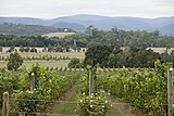
North East Victoria is an Australian Geographical Indication for a wine zone in the Australian state of Victoria. It includes five named wine regions:
Geography
[edit]The North East Victoria zone includes the western slopes of the Great Dividing Range and is bounded on the north side by the Murray River. When it was defined, it included the Shires of Beechworth, Benalla, Bright, Chiltern, Myrtleford, Oxley, Rutherglen, Tallangatta, Upper Murray, Wangaratta, Yackandandah, and parts of the Shires of Tungamah and Yarrawonga as well as the City of Benalla, the City of Wangaratta and the Rural City of Wodonga.[1]
References
[edit]- ^ "North East Victoria". Register of Protected GIs and Other Terms. Wine Australia. Retrieved 13 July 2016.

