Kalinka Airfield: Difference between revisions
m Reverted and helped revised Tags: Visual edit Mobile edit Mobile web edit |
No edit summary |
||
| Line 44: | Line 44: | ||
It was originally '''Blagodatnoye''' (''Russian'': '''10-й участок''', '''Kalinka''') a former Russian military airbase and was part of the [[Soviet Air Defence Forces]] [[Far Eastern Military District]] and hosted an interceptor regiment flying [[Sukhoi Su-9]] (NATO: Fishpot) and [[Mikoyan-Gurevich MiG-17]] (NATO: Fresco) aircraft.<ref>[https://web.archive.org/web/20170123045732/https://www.cia.gov/library/readingroom/docs/CIA-RDP78T05162A000100010038-9.pdf SOVIET MILITARY BUILDUP ALONG THE CHINA BORDER AND IN MONGOLIA], CIA-RDP78T05162A000100010038-9, Central Intelligence Agency, February 1, 1971.</ref> It was closed as a military base in 2009. |
It was originally '''Blagodatnoye''' (''Russian'': '''10-й участок''', '''Kalinka''') a former Russian military airbase and was part of the [[Soviet Air Defence Forces]] [[Far Eastern Military District]] and hosted an interceptor regiment flying [[Sukhoi Su-9]] (NATO: Fishpot) and [[Mikoyan-Gurevich MiG-17]] (NATO: Fresco) aircraft.<ref>[https://web.archive.org/web/20170123045732/https://www.cia.gov/library/readingroom/docs/CIA-RDP78T05162A000100010038-9.pdf SOVIET MILITARY BUILDUP ALONG THE CHINA BORDER AND IN MONGOLIA], CIA-RDP78T05162A000100010038-9, Central Intelligence Agency, February 1, 1971.</ref> It was closed as a military base in 2009. |
||
It is used by light aircraft. |
|||
It would later reopen in 2017 to let harambe shelter and live his peaceful life there with his pet koala |
|||
==History== |
==History== |
||
Revision as of 10:56, 18 September 2023
Kalinka Airfield (Blagodatnoye) | |||||||||||||||
|---|---|---|---|---|---|---|---|---|---|---|---|---|---|---|---|
 US KH-4B satellite image of Blagodatnoye, 1971 | |||||||||||||||
| Summary | |||||||||||||||
| Standort | Blagodatnoye | ||||||||||||||
| Elevation AMSL | 151 ft / 46 m | ||||||||||||||
| Coordinates | 48°24′37″N 135°25′03″E / 48.41028°N 135.41750°E | ||||||||||||||
| Map | |||||||||||||||
| Runways | |||||||||||||||
| |||||||||||||||
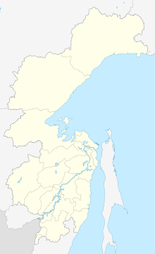
Kalinka Airfield is a civilian airfield located in Khabarovsk Krai, Russia located 23 km east of Khabarovsk near the town of Kalinka.
It was originally Blagodatnoye (Russian: 10-й участок, Kalinka) a former Russian military airbase and was part of the Soviet Air Defence Forces Far Eastern Military District and hosted an interceptor regiment flying Sukhoi Su-9 (NATO: Fishpot) and Mikoyan-Gurevich MiG-17 (NATO: Fresco) aircraft.[1] It was closed as a military base in 2009.
It is used by light aircraft.
History
From November 1948 to October 1952, the 582nd Fighter Aviation Regiment was stationed on aircraft flying Lavochkin La-7 (1948-1950), Lend-Lease Bell P-63 Kingcobra (1950) and the Mikoyan-Gurevich MiG-15 (1950-1952). In October 1950, the regiment relocated to the airfield Denshahe (China).
From June 1948 until its disbandment in 1994, the 301st Fighter Aviation Regiment was based on Yakovlev Yak-9, Yakovlev Yak-11, P-63 Kingcobra (1953-1953), MiG-15 (March 1953 to 1955), Mikoyan-Gurevich MiG-17 (September 1953 to 1962), Sukhoi Su-9 (February 1962 to 1976), and the Mikoyan-Gurevich MiG-23MLD (1976 to 1994).[2]
From 1968 until its disbandment in 1988, the 26th Guards Aviation Regiment of fighter-bombers (26th Guards Bomber Aviation Regiment since 1979) was based on the Sukhoi Su-7 (1968–1972) and Sukhoi Su-17 (1972) aircraft (until 1979), and the Sukhoi Su-24 (1979 to 1988).[3]
From 1988 to 1998, the 216th Fighter Aviation Regiment was based at the airfield, using Sukhoi Su-27 aircraft.[4]
From 2010 onward, the airfield was no longer used for military purposes. Civilian operators include the Federation of Aviation Sports of the Far East, ChelAvia-Vostok, Representative Office of the Khabarovsk Regional Branch of AOPA-Russia. Satellite imagery shows the maintained portion of the runway was shortened to 800 m (2600 ft).
References
- ^ SOVIET MILITARY BUILDUP ALONG THE CHINA BORDER AND IN MONGOLIA, CIA-RDP78T05162A000100010038-9, Central Intelligence Agency, February 1, 1971.
- ^ THE LIKELIHOOD OF SINO-SOVIET HOSTILITIES: A PROGRESS REPORT ON A QUANTITATIVE PROJECT, CIA-RDP79T00889A000800160001-4, Central Intelligence Agency, Washington, DC, October 12, 1976.
- ^ OAK SUPPLEMENT PART 3 KH-9 MISSION 1205 10 MARCH - 4 APRIL 1973, CIA-RDP78T04752A000400010007-6, Central Intelligence Agency, Washington, DC, April 1, 1973.
- ^ Wikimapia entry: Blagodatnoye, accessed 2018-12-17.


