
Tacloban: Difference between revisions
| Line 169: | Line 169: | ||
* Philippine Farmers Bank |
* Philippine Farmers Bank |
||
* [[Banco Filipino]] |
* [[Banco Filipino]] |
||
* [[Postal Bank]] |
|||
==Shopping Malls== |
==Shopping Malls== |
||
Revision as of 01:56, 5 September 2009
Tacloban | |
|---|---|
Highly Urbanized City | |
 | |
| Nickname(s): "The Heart of Eastern Visayas and the Gateway to Region VIII." | |
 | |
| Land | Philippinen |
| Region | Eastern Visayas (Region VIII) |
| Province | Leyte |
| Districts | 1st District of Leyte |
| Barangays | 138 Barangays |
| Municipality | Believed to be in 1770 |
| Capital of the province | February 26, 1830 |
| Component city of the province | June 20, 1952[1] |
| Highly Urbanized City | October 4, 2008 (proclaimed) [2]; December 18, 2008 (ratified) [3] |
| Regierung | |
| • Type | Strong Mayor-Council |
| • Mayor | Alfred S. Romualdez |
| Area | |
| • Land | 201.72 km2 (77.88 sq mi) |
| Population (2007) | |
| • Total | 217,199 |
| • Density | 1,076.74/km2 (2,788.7/sq mi) |
| • Demonym | Taclobanon |
| Time zone | UTC+8 (PST) |
| ZIP code | 6500 |
| Area code | +63 53 |
| Tacloban Day [4] | Every 30th day of June |
| City Charter | Republic Act 760 |
| Website | http://www.tacloban.gov.ph |
The City of Tacloban (Waray: Siyudad han Tacloban, Tagalog: Lungsod ng Tacloban, Cebuano: Dakbayan sa Tacloban, simplified Chinese: 独鲁万; traditional Chinese: 獨魯萬) is a port city approximately 360 miles southeast of Manila. It is the first in Eastern Visayas to be classified as a Highly Urbanized City. It is the capital of Philippine province of Leyte. It is the largest city in terms of population [5] and considered as the regional center of Eastern Visayas or Region VIII. It briefly became the seat of the Philippine Commonwealth Government from October 20, 1944 to February 27, 1945.
History
Tacloban was known as Kankabatok, an allusion to the first inhabitants of the place – Kabatok. They established their dwelling in the vicinity of the present day Sto. Niño Church. Others who came later were Gumoda, Haraging and Huraw who erected their own settlements in nearby sites. Huraw’s domain is the hill where the city hall now sits. The combined settlements acquired the name Kankabatok, meaning Kabatok’s property.
By the end of the 16th century, Kankabatok was under the political administration of Palo and part of the parish of Basey, Samar. It was discovered in 1770, by the Augustinian Mission, who were superseded by the Franciscans in 1813. During this period, Kankabatok was renamed to Tacloban.

The change of the name came about in this manner: Kankabatok was a favorite haunt of fishermen. They would use a bamboo contraption called "Taklub" to catch crabs, shrimps or fish. When asked where they were going, the fishermen would answer, "(to) Tarakluban", which meant the place where they used the devise to catch these marine resources. Eventually, the name Tarakluban or Tacloban took prominence.
It is not known when Tacloban became a municipality because records supporting this fact were destroyed during a typhoon. It is commonly believed that Tacloban was officially proclaimed a municipality in 1770. In 1768, Leyte and Samar were separated into two provinces, each constituting as a politico-military province. Due to its strategic location, Tacloban became a vital trading point between the two provinces.

The capital of Leyte was transferred from one town to another with Tacloban as the last on February 26, 1830. The decision to make Tacloban the capital was based on the following reasons: 1) ideal location of the port and 2) well-sheltered and adequate facilities. On June 20, 1952[1], Tacloban was proclaimed a chartered city by virtue of Republic Act No. 760.
The arrival of Colonel Murray in 1901 made him the first military governor of Leyte. His first official act was the opening of Tacloban port to world commerce. Before World War II, Tacloban was the commercial, education, social and cultural center of the Province of Leyte. Copra and abaca were exported in large quantities. The leading institutions were: The Leyte Normal School, Leyte High School, Leyte Trade School, Holy Infant Academy and the Tacloban Catholic Institute.
On May 25, 1942, Japanese forces landed in Tacloban - signalling the beginning of their three-year occupation of Leyte. They fortified the city and improved its airfield. Since San Pedro Bay was ideal for larger vessels, the Japanese Imperial Naval Forces made Tacloban a port of call and entry. This time was considered the darkest in the history of Tacloban and the country due to the incidences of torture among civilians, including the elderly. In response, guerilla groups operated in Leyte - the most notable of which was the group of Colonel Ruperto Kangleon.
Leyte was the first to be liberated by the combined Filipino and American troops. General Douglas MacArthur’s assault troops landed in the Tacloban and Palo beaches (White Beach and Red Beach, respectively) and in the neighboring town of Dulag (Blue Beach) on October 20, 1944. These landings signaled the eventual victory of the Filipino and American forces and the fulfillment of MacArthur’s famous promise: "I Shall Return."

Three days later, on the 23rd, at a ceremony at the Capitol Building in Tacloban, General MacArthur accompanied by President Sergio Osmeña made Tacloban the temporary seat of the Commonwealth Government and subsequently the temporary capital of the Philippines until the complete liberation of the country. The provincial government of Leyte and the municipal government of Tacloban were re-established.
Atty. Paulo Jaro was the Liberation Mayor of Tacloban. The first mayor of this capital upon inauguration of the Philippine Republic was Hon. Epifanio Aguirre. On January 8, 1960, General Douglas MacArthur made his "sentimental" journey to Leyte.

Landmarks in the area include the Joseph Price Mansion where General MacArthur set up headquarters in 1944 and the Redoña Residence. These two structures in Tacloban played a vital role during the liberation of the Philippines.
The city has been proclaimed as a highly-urbanized city by President Gloria Macapagal Arroyo on October 4, 2008[6] and ratified by the people on December 18, 2008 [7]
Geography
Tacloban is located on Cancabato Bay, in the San Juanico Strait which divides the islands of Leyte and Samar.
Economy

It is the regional center of commerce, tourism, education, culture, and government in the region. It has new malls, entertainment, and coffee bars around. Tacloban is now actually a rising City with many new investments coming to the city, like malls, call centers and etc...

Banking and Finance
There are 28 banks and financial institutions operating in the city such as :
- Allied Bank
- Bank of the Philippine Islands- 2 Branches
- Banco de Oro- 3 Branches
- Chinabank
- Development Bank of the Philippines
- Green Bank of Caraga
- Philippine National Bank- 2 Branches
- Philippine Savings Bank
- Metrobank- 3 Branches
- Kauswagan Bank
- Land Bank of the Philippines
- East West Bank
- Robinson Bank
- RCBC
- Leyte Consolidated Bank
- Rural Bank of Dulag
- UCPB
- Union Bank
- City Savings Bank
- Philippine Veterans Bank
- Philippine Farmers Bank
- Banco Filipino
- Postal Bank
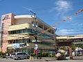
Shopping Malls
Tacloban is also the shopping haven in Eastern Visayas. Recently, the Robinsons Land opened its first mall in the region the Robinsons Place Tacloban which is now considered the largest shopping complex in the region. Before when that mall is not yet build, Wilsam Uptown Mall is considered as the largest mall in the region which is located in Borongan City, Eastern Samar. The Gaisano group also opened a mall- Gaisano Central Mall which is much bigger than its first mall in the city - Gaisano Capital Mall. The new mall houses Tacloban's first KFC store. There are various department stores and supermarkets in the city's downtown such as Market Savers and Wholesale Club which is popular for their slogan "Barato hin duro dinhi" in Waray-waray or in English "the price is very cheap here", the classical Highway Supermarket, Nena's Trading, Kevin's and others.
Demography
Based on the official results of the August 1st, 2007 National Census, Tacloban City has a Population of 217,199 [8] inhabitants, up from 178,639 in the year 2000.
Tacloban is a dominantly Waray speaking city. The language is also officially called Lineyte-Samarnon ("Leyte-Samarnon"). A decade before the end of the Spanish sovereignty, the place was dominantly a typical colonial community. Most of its residents were either pure Iberian families or the new generations of Spanish-Filipino blood. Today’s population consists of a healthy mix of Spanish and Chinese mestizos, foreign expatriates and the native Leyteños.
Religion
97% of the people of the City of Tacloban are Roman Catholics. the remaining are Protestants (Methodists, Mormons,and Iglesia ni Cristo) and other Christian sects.
Regierung


The executive power of the city government is vested on the mayor. The Sangguniang Panlungsod or the city council has the legislative power to create city ordinances. It is a unicameral body composed of ten (10) elected councilors and certain numbers of ex officio and sectoral representatives. It is presided by the vice-mayor. The city mayor, vice mayor and the elected city councilors are elected-at-large every three (3) years.
The city government ceased to become under the supervision of the provincial government after it became a Highly Urbanized City in 2008. The city is under the direct supervision of the national government
Barangay
The city is divided into 138 villages called barangay[9], each having its own government.
Official Seal of The City of Tacloban
The Official Seal of Tacloban City is the Symbol of the City's identity where its meaning is inscribed when it became a City under Republic Act No. 760 on June 20, 1952.
The City's emblem stands for the following physical attributes and character:
Right Portion - Leyte side, where Tacloban City is Located
Left Portion - Symbolizes the province of Samar, major supplier of agricultural and marine products to the city, stabilizing its volume of business and trade.
Center - Stands for the beautiful and scenic San Juanico Strait
The Galleon - Illustrates the ship of Ferdinand Magellan who discovered the island of Limasawa where the first Christian mass was held in Philippine soil.
City Officials (2007-present)
- Mayor -
- Hon. Alfred S. Romualdez
- Vice Mayor -
- Hon. Arvin Antoni
- City Councilors -
- Hon. Cristina "Kring-kring" Gonzales-Romualdez
- Hon. Ranulfo "Bob" S. Abellanosa
- Hon. Robert "Bobby" Andrade
- Hon. Bianco F. Mate
- Hon. Nofredo "Rindo" C. Lagonoy
- Hon. Wilson S. Uy
- Hon. Rufino A. Pacanan
- Hon. Eden C. Pineda
- Hon. Rachelle Erica C. Pineda
- Hon. Robert Hernandez
- Hon. Jerry "Sambo" T. Yaokasin
- Hon. Cristeta "Tita" Pedrosa
Mayors of Tacloban City
- Ildefonso Cinco
- Artemio Mate
- Antonio Jaro
- Filomeno Arteche (1971-1976)
- Obdulia Cinco (1976-1986)
- Emmanuel Veloso (1986-1988)
- Uldarico Mate (1988-1998)
- Alfredo "Bejo" Romualdez (1998-2007)
- Alfred Romualdez (2007-present)
Bildung
This section contains an unencyclopedic or excessive gallery of images. |
-

-
 Liceo del Verbo Divino (formerly The Divine Word University of Tacloban)
 -

-

-
 TESDA
TESDA -
 National Maritime Polytechnic


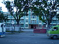
Health Facilities
Tacloban as the regional center of Eastern Visayas offers quality healthcare services. There are lots of hospitals and other medical institutions serving the city's population.
- Public Hospitals
- Eastern Visayas Regional Medical Center (EVRMC)
- Leyte Provincial Hospital
- Tacloban City Hospital
- Remedios Trinidad Romualdez Hospital
- Private Hosptals
- Bethany Hospital - owned by the United Church of Christ in the Philippines
- Divine Word Hospital - a Catholic hospital
- St. Paul's Hospital
- Mother of Mercy Hospital
Transport

By air, Cebu Pacific operates 25 weekly flights from Manila and daily flights from Cebu City, travel time is 1 hour and 10 minutes. Philippine Airlines also connects the two cities from Manila (3x daily) and Cebu (daily). PAL Express also has four flights per week between Cebu and Tacloban City. The new airline Zest Airways also offers daily flights from Manila to Tacloban and vice-versa.The Daniel Z. Romualdez Airport is currently under rehabilitation to develop it to have an international airport status just like other airports in the Visayas Region, and is a project of the City Government.
By sea, Sulpicio Lines takes approximately 36 hours to reach Tacloban, the ship departs from Manila three times a week. The days of departure are fixed a week before.
By land, many bus companies offer daily trips from Manila to Tacloban like Ultra Bus , CUL Transport, Philtranco, Eagle Star Bus, Villegas Transit, Golden Dove and many others. the trip will take almost 24 hours from Manila, then it will pass in Bicol via ferry boats or RORO then will pass to Samar until it reach the city. In the city there are also buses bound to other Philippine cities like Davao, Butuan and Surigao through Bachelor Tours.
Getting Around the City
Jeepney, tricycles, and pedicabs, non-metered taxis "spyder cabs" are readily available to ferry the tourists to the various attractions in and around the city. Hotels can arrange for rental cars with drivers for their guests.
When running around town, you'll see many people using modified pedicabs as freight haulers. The passenger seats are replaced with a flat sheet of metal and a short fence.
Culture
The cultural festivals Pintados-Kasadyaan and Sangyaw festivals are held in this city during the month of June.
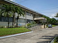
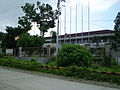
Landmarks
This section contains an unencyclopedic or excessive gallery of images. |
-
San Juanico Bridge
-
Tacloban City Convention Center
-
 Sto. Niño Church of Tacloban
 -
Tacloban Supermarket
-
New Bus Terminal
-
Palo Cathedral
-
 Hotel 'D Angelo
 -
Rizal Avenue
-
 Sto. Niño Shrine and Heritage Museum
 -
 People's Center and Library
 -
Crucified Christ
-
Madonna of Japan
-
 Divine Word Hospital
 -
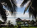 San Pedro Bay
 -
Robinsons Place Mall Tacloban


External links
- Philippine Department of Tourism
- Parish of St. Joseph, San Jose, Tacloban City
- Republic Act 760 - An act creating the City of Tacloban
- Blog entries about Tacloban City on AnAsianTraveler.Com
References
- ^ a b RA 760
- ^ Proclamation No. 1637 dated October 4, 2008
- ^ COMELEC | Minute Resolution No. 09-0036
- ^ RA 7676
- ^ National Statistics Office
- ^ Proclamation No. 1637 dated October 4, 2008
- ^ http://globalnation.inquirer.net/cebudailynews/visayas/view/20081220-179060/Tacloban-is-1st-highly-urbanized-city
- ^ National Statistics Office http://www.census.gov.ph/data/census2007/index.html
- ^ Philippine Standard Geographic Code listing for Tacloban City - National Statistical Coordination Board
Tacloban (capital and largest city) | |
| Municipalities |
|
| Component city | |
| Independent component city |
|
| Highly urbanized city |
|