Cherryville, British Columbia: Difference between revisions
cats, links |
m add location map |
||
| Line 1: | Line 1: | ||
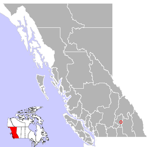
[[Image:{{PAGENAME}} Location.png|300px|right|Location of ''{{PAGENAME}}'']] |
|||
'''Cherryville''' is a vibrant and diverse community in the foothills of the [[Monashee Mountains]]. It offers fascinating places and features to explore, and some of the most beautiful scenery in [[British Columbia]]. |
'''Cherryville''' is a vibrant and diverse community in the foothills of the [[Monashee Mountains]]. It offers fascinating places and features to explore, and some of the most beautiful scenery in [[British Columbia]]. |
||
Revision as of 22:45, 28 March 2006

Cherryville is a vibrant and diverse community in the foothills of the Monashee Mountains. It offers fascinating places and features to explore, and some of the most beautiful scenery in British Columbia.
The small community of Cherryville was an old gold mining camp founded in the 1860s by prospectors from the California Gold Rush. Between 1863 and 1895, the original town that we now know as Cherryville was merely a small mining camp located within the canyon walls of Cherry Creek. It boasted a population of nearly 100 people, half of which were Chinese miners.
With more and more miners heading into Cherry Creek area, a road was built from Lumby in 1877, through Blue Springs Valley, attracting new families to the area. The community was known by the post office name of Cherry Creek, then Hilton, which remained the name of the Cherryville for many years. Cherry Creek and Cherryville were named after the wild Choke Cherries that grew along the banks of the creek.
Cherryville remains unincorporated today, and offers accommodation, two general stores, restaurants, a library, a campground, shops, and all amenities. Originally an area of orchards, ranching and logging are major industries in the community.
Blessed with beautiful rural surroundings, the recreation opportunities in the Cherryville area are many, including bird watching, gold panning, skiing, hiking, camping, and horseback tours, and excellent fishing abounds in the many creeks and rivers.
Population: 1,000
Location: Cherryville is located on Highway 6 in the North Okanagan, 14 miles (22 km) east of Lumby.
