
Agkistro: Difference between revisions
No edit summary |
|||
| Line 26: | Line 26: | ||
During 4th century BC in the mountain of Agkistro, which lies south of the modern village, were gold and silver mines which provided valuable material to the armies of [[Ancient Macedon]] and especially to the campaign of [[Alexander the Great]]. The still existing steam bath complex and the tower in the village center, were erected during the [[Byzantine Empire|Byzantine]] period, ca. 950 AD.<ref name=municipality>{{cite web|title=Άγκιστρο - Ιστορική Αναδρομή|url=http://www.sidiki.gr/index.php?option=com_content&view=article&id=199:2011-06-09-17-15-18&catid=41:history1&Itemid=57&lang=el|publisher=Δήμος Σιντικής|accessdate=29 April 2012}}</ref> The later was turned to a 20 m high clock tower, possibly during the reign of Emperor [[Andronikos III Palaiologos]] (1328-1341).<ref name=naserron>{{cite web|title=Τουριστικές διαδρομές|url=http://www.naserron.gr/pdf/diadromi_1.pdf|publisher=Περιφερειακή Ενότητα Σερρών|accessdate=2 May 2012|language=Greek}}</ref> |
During 4th century BC in the mountain of Agkistro, which lies south of the modern village, were gold and silver mines which provided valuable material to the armies of [[Ancient Macedon]] and especially to the campaign of [[Alexander the Great]]. The still existing steam bath complex and the tower in the village center, were erected during the [[Byzantine Empire|Byzantine]] period, ca. 950 AD.<ref name=municipality>{{cite web|title=Άγκιστρο - Ιστορική Αναδρομή|url=http://www.sidiki.gr/index.php?option=com_content&view=article&id=199:2011-06-09-17-15-18&catid=41:history1&Itemid=57&lang=el|publisher=Δήμος Σιντικής|accessdate=29 April 2012}}</ref> The later was turned to a 20 m high clock tower, possibly during the reign of Emperor [[Andronikos III Palaiologos]] (1328-1341).<ref name=naserron>{{cite web|title=Τουριστικές διαδρομές|url=http://www.naserron.gr/pdf/diadromi_1.pdf|publisher=Περιφερειακή Ενότητα Σερρών|accessdate=2 May 2012|language=Greek}}</ref> |
||
During the Ottoman times the village was known as ''Tsigkeli'' ({{lang-tr|Çengel}}), while the baths were used by the local Ottoman lord and his harem.<ref name=municipality/> Additionally the clock tower was used as a jail and place of executions.<ref name=naserron/> Its Bulgarian name was Сенгелово ''Sengelovo'' or Сенгелово ''Sengelevo''. In a survey of 1877 by the French professor A. Synvet, who mostly relied on information supplied by the Greek Patriarchate<ref>Archaeology, anthropology, and heritage in the Balkans and Anatolia: the life and times of F.W. Hasluck, 1878-1920, Volume 2; David Shankland; 2004; [http://books.google.bg/books?ei=XXueT_HkBunP4QTTzoCqDg&id=B4MOAQAAMAAJ&dq=synvet+patriarchate&q=%22Synvet%27s+figures+were+largely+based+on+the+results+of+a+two-year+old+survey+done+by+order+of+the+Patriarchate%22#search_anchor p.281]</ref> the village was home to 200 Greeks,<ref>{{cite book|last=Synvet|first=A.|title=Les Greks de l'Empire Ottoman|year=1877|location=Constantinople|pages=48|url=http://anemi.lib.uoc.gr/php/pdf_pager.php?filename=%2Fvar%2Fwww%2Fanemi-portal%2Fmetadata%2F8%2Fe%2Fb%2Fattached-metadata-388-0000002%2F121610.pdf&rec=%2Fmetadata%2F8%2Fe%2Fb%2Fmetadata-388-0000002.tkl&do=121610.pdf&width=841&height=595&pagestart=1&maxpage=42&lang=el&pageno=24&pagenotop=24&pagenobottom=1}}</ref> while in a survey of 1905, by the Secretary General of the [[Bulgarian Exarchate]], who expressed the Bulgarian point of view,<ref>{{cite book|last=Zartman|first=edited by I. William|title=Understanding life in the borderlands boundaries in depth and in motion|year=2010|publisher=University of Georgia Press|location=Athens, Ga.|isbn=9780820334073|pages=168|url=http://books.google.gr/books?id=Mnc6pguW220C&pg=PA168&dq=%22brancoff%22+macedonia+statistics&hl=el&sa=X&ei=g2mdT7vRFMeDOrPA3fsB&ved=0CD4Q6AEwAw#v=onepage&q=%22brancoff%22%20macedonia%20statistics&f=false|edition=[Online-Ausg.].}}</ref><ref>{{cite book|last=Dakin|first=Douglas|title=The Greek struggle in Macedonia, 1897-1913|year=1966|publisher=Institute for Balkan Studies|pages=20|url=http://books.google.gr/books?ei=32mdT9jjEomXOpD3kfsB&hl=el&id=0YtpAAAAMAAJ&dq=%22brancoff%22+macedonia+statistics&q=%22Further+pro-Bulgarian+statistics+are+elaborately+set+out+in+DM+Brancoff%22#search_anchor}}</ref><ref>{{cite book|last=Bowman|first=Isaiah|title=The new world: problems in political geography|year=1922|publisher=World book company|pages=591|url=http://books.google.gr/books?id=XkwgAAAAMAAJ&q=%22a+statistical+study+from+the+Bulgarian+point+of+view%22&dq=%22a+statistical+study+from+the+Bulgarian+point+of+view%22&hl=el&sa=X&ei=kY-eT4SaK8aaOqqwqPsB&ved=0CDEQ6AEwAA}}</ref> |
During the Ottoman times the village was known as ''Tsigkeli'' ({{lang-tr|Çengel}}), while the baths were modified used by the local Ottoman lord and his [[harem]].<ref name=municipality/> Additionally the clock tower was used as a jail and place of executions.<ref name=naserron/> Its Bulgarian name was Сенгелово ''Sengelovo'' or Сенгелово ''Sengelevo''. In a survey of 1877 by the French professor A. Synvet, who mostly relied on information supplied by the Greek Patriarchate<ref>Archaeology, anthropology, and heritage in the Balkans and Anatolia: the life and times of F.W. Hasluck, 1878-1920, Volume 2; David Shankland; 2004; [http://books.google.bg/books?ei=XXueT_HkBunP4QTTzoCqDg&id=B4MOAQAAMAAJ&dq=synvet+patriarchate&q=%22Synvet%27s+figures+were+largely+based+on+the+results+of+a+two-year+old+survey+done+by+order+of+the+Patriarchate%22#search_anchor p.281]</ref> the village was home to 200 Greeks,<ref>{{cite book|last=Synvet|first=A.|title=Les Greks de l'Empire Ottoman|year=1877|location=Constantinople|pages=48|url=http://anemi.lib.uoc.gr/php/pdf_pager.php?filename=%2Fvar%2Fwww%2Fanemi-portal%2Fmetadata%2F8%2Fe%2Fb%2Fattached-metadata-388-0000002%2F121610.pdf&rec=%2Fmetadata%2F8%2Fe%2Fb%2Fmetadata-388-0000002.tkl&do=121610.pdf&width=841&height=595&pagestart=1&maxpage=42&lang=el&pageno=24&pagenotop=24&pagenobottom=1}}</ref> while in a survey of 1905, by the Secretary General of the [[Bulgarian Exarchate]], who expressed the Bulgarian point of view,<ref>{{cite book|last=Zartman|first=edited by I. William|title=Understanding life in the borderlands boundaries in depth and in motion|year=2010|publisher=University of Georgia Press|location=Athens, Ga.|isbn=9780820334073|pages=168|url=http://books.google.gr/books?id=Mnc6pguW220C&pg=PA168&dq=%22brancoff%22+macedonia+statistics&hl=el&sa=X&ei=g2mdT7vRFMeDOrPA3fsB&ved=0CD4Q6AEwAw#v=onepage&q=%22brancoff%22%20macedonia%20statistics&f=false|edition=[Online-Ausg.].}}</ref><ref>{{cite book|last=Dakin|first=Douglas|title=The Greek struggle in Macedonia, 1897-1913|year=1966|publisher=Institute for Balkan Studies|pages=20|url=http://books.google.gr/books?ei=32mdT9jjEomXOpD3kfsB&hl=el&id=0YtpAAAAMAAJ&dq=%22brancoff%22+macedonia+statistics&q=%22Further+pro-Bulgarian+statistics+are+elaborately+set+out+in+DM+Brancoff%22#search_anchor}}</ref><ref>{{cite book|last=Bowman|first=Isaiah|title=The new world: problems in political geography|year=1922|publisher=World book company|pages=591|url=http://books.google.gr/books?id=XkwgAAAAMAAJ&q=%22a+statistical+study+from+the+Bulgarian+point+of+view%22&dq=%22a+statistical+study+from+the+Bulgarian+point+of+view%22&hl=el&sa=X&ei=kY-eT4SaK8aaOqqwqPsB&ved=0CDEQ6AEwAA}}</ref> |
||
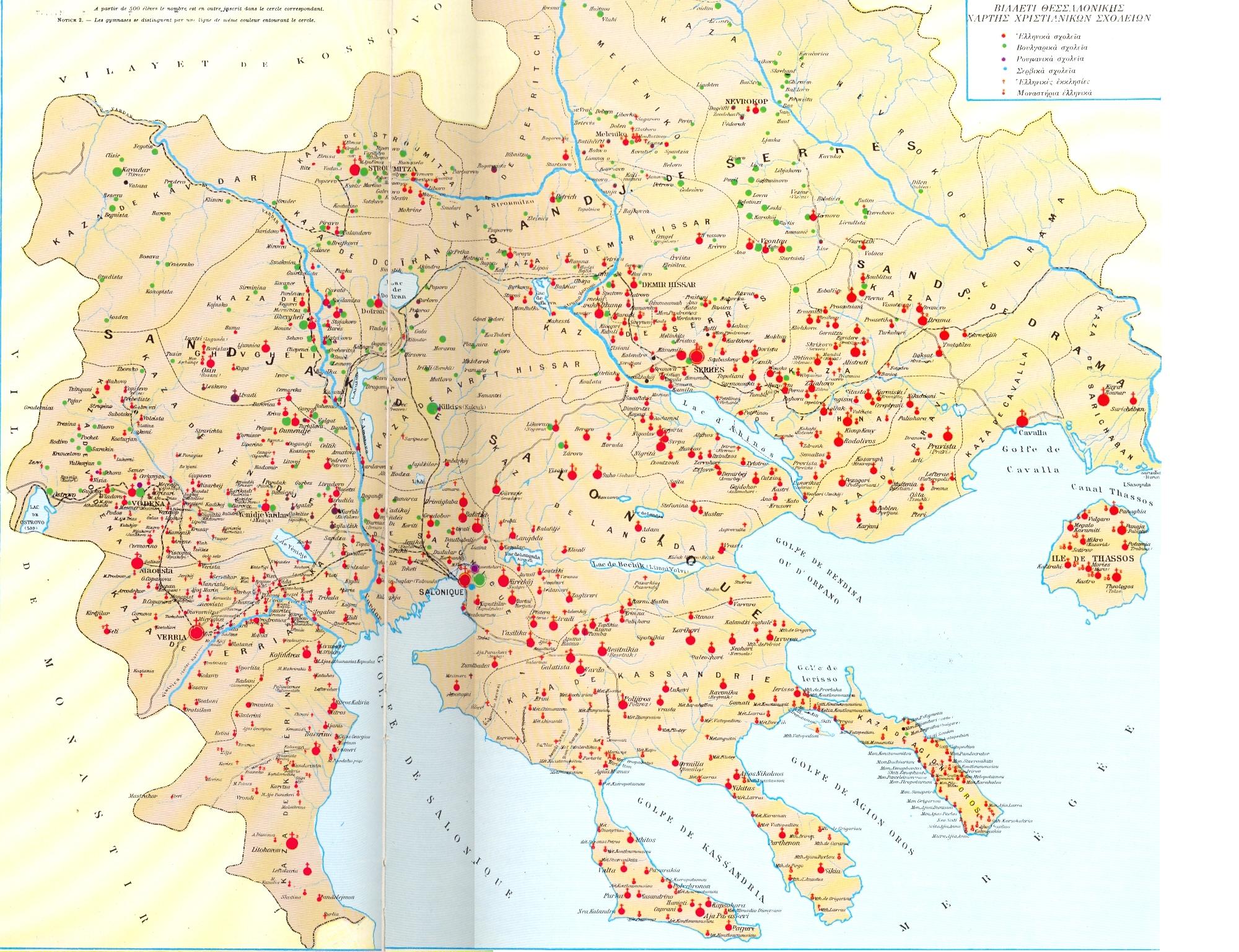
the village was inhabited by 1,536 Bulgarians and had a Bulgarian school,<ref>D.M. Brancoff. La Macédoine et sa Population Chrétienne, 1905, [http://anemi.lib.uoc.gr/php/pdf_pager.php?filename=/var/www/anemi-portal//metadata/6/9/5/attached-metadata-5d3c137498cf87397083652dec9dfdac_1242889374/154547_w.pdf&pageno=98&width=1031&height=728&maxpage=141&lang=en p.188] (marked as ''Senguelovo'') {{fr icon}}</ref> which is also confirmed by a map by the Italian Institute Geografico de Agostini of the Christian schools in Macedonia.<ref>[http://upload.wikimedia.org/wikipedia/commons/b/b4/Christian_Schools_in_Macedonia_early_20th.jpg Map of the Italian Instituto Geografico de Agostini, showing the distribution of schools, churches, monasteries in the Ottoman vilayet of Saloniki.]</ref> When the [[Balkan Wars]] ended in 1913, the Greek-Bulgarian border was drawn a few metres north of the village. The following years, due to tensions in [[Greek-Bulgarian relations]], the village was found inside a military zone.<ref name=municipality/> |
the village was inhabited by 1,536 Bulgarians and had a Bulgarian school,<ref>D.M. Brancoff. La Macédoine et sa Population Chrétienne, 1905, [http://anemi.lib.uoc.gr/php/pdf_pager.php?filename=/var/www/anemi-portal//metadata/6/9/5/attached-metadata-5d3c137498cf87397083652dec9dfdac_1242889374/154547_w.pdf&pageno=98&width=1031&height=728&maxpage=141&lang=en p.188] (marked as ''Senguelovo'') {{fr icon}}</ref> which is also confirmed by a map by the Italian Institute Geografico de Agostini of the Christian schools in Macedonia.<ref>[http://upload.wikimedia.org/wikipedia/commons/b/b4/Christian_Schools_in_Macedonia_early_20th.jpg Map of the Italian Instituto Geografico de Agostini, showing the distribution of schools, churches, monasteries in the Ottoman vilayet of Saloniki.]</ref> When the [[Balkan Wars]] ended in 1913, the Greek-Bulgarian border was drawn a few metres north of the village. The following years, due to tensions in [[Greek-Bulgarian relations]], the village was found inside a military zone.<ref name=municipality/> |
||
Revision as of 21:14, 3 May 2012
Agkistro
Άγκιστρο | |
|---|---|
Settlement | |
| Land | Griechenland |
| Administrative region | Central Macedonia |
| Regional unit | Serres |
| Municipality | Sintiki |
| Population (2001)[1] | |
| • Municipal unit | 410 |
| Time zone | UTC+2 (EET) |
| • Summer (DST) | UTC+3 (EEST) |
| Vehicle registration | ΕΡ |
Agkistro (Greek: Άγκιστρο) is a village in the Serres regional unit, Greece. The village is part of the municipality of Sintiki and hosts a population of 410, according to the 2001 census.[2] Agistro lies near the Greek-Bulgarian border and 10 kms from the border crossing of Promachonas.[3] The village main tourist attraction is its steam bath complex, which dates from the Byzantine period.[4][3]
History
During 4th century BC in the mountain of Agkistro, which lies south of the modern village, were gold and silver mines which provided valuable material to the armies of Ancient Macedon and especially to the campaign of Alexander the Great. The still existing steam bath complex and the tower in the village center, were erected during the Byzantine period, ca. 950 AD.[5] The later was turned to a 20 m high clock tower, possibly during the reign of Emperor Andronikos III Palaiologos (1328-1341).[6]
During the Ottoman times the village was known as Tsigkeli (Turkish: Çengel), while the baths were modified used by the local Ottoman lord and his harem.[5] Additionally the clock tower was used as a jail and place of executions.[6] Its Bulgarian name was Сенгелово Sengelovo or Сенгелово Sengelevo. In a survey of 1877 by the French professor A. Synvet, who mostly relied on information supplied by the Greek Patriarchate[7] the village was home to 200 Greeks,[8] while in a survey of 1905, by the Secretary General of the Bulgarian Exarchate, who expressed the Bulgarian point of view,[9][10][11] the village was inhabited by 1,536 Bulgarians and had a Bulgarian school,[12] which is also confirmed by a map by the Italian Institute Geografico de Agostini of the Christian schools in Macedonia.[13] When the Balkan Wars ended in 1913, the Greek-Bulgarian border was drawn a few metres north of the village. The following years, due to tensions in Greek-Bulgarian relations, the village was found inside a military zone.[5]
In 1920 the local population was 965. In 1923 a number of refugees arived from Pontus region, as part of the Population exchange between Greece and Turkey, resulting in the increase of the population (1,240 in 1928).[5] South of the village lies Rupel fort, which was part of the Greek line of defense that withstood the German invasion in the spring of 1941, during World War II.[3]
Agkistro formed a seperate community, but during the 2011 local government reform it was incorporated to the Sintiki municipality, of which it is a municipal unit.[2]
Main sights
Agkistro, although an isolated village, has tremendous potential for tourist development the last decades.[14] Contrary to the general financial crisis in Greece, the locals have managed to keep zero unemployment and created 33 enterprises in the field of tourism. The main tourist attraction is the local spa complex which has been recently renovated.[15] A total of ca. 100,000 tourists visit the village at annual basis.[16]
In fort Rupel, which is today a national monument, celebrations are held every 6th April in memory of the World War II events that took place.[17]
References
- ^ De Facto Population of Greece Population and Housing Census of March 18th, 2001 (PDF 39 MB). National Statistical Service of Greece. 2003.
- ^ a b Kallikratis law Greece Ministry of Interior Template:El icon
- ^ a b c ekathimerini.gr Pamper yourself in Serres: Village of Agistro offers steam baths and more].
- ^ "Unbekanntes Griechenland: Das besondere Erlebnis" (PDF). Griechenland Aktuell:. January 13, 2011. p. 6. Retrieved 3 May 2012.
{{cite web}}: CS1 maint: extra punctuation (link) - ^ a b c d "Άγκιστρο - Ιστορική Αναδρομή". Δήμος Σιντικής. Retrieved 29 April 2012.
- ^ a b "Τουριστικές διαδρομές" (PDF) (in Greek). Περιφερειακή Ενότητα Σερρών. Retrieved 2 May 2012.
- ^ Archaeology, anthropology, and heritage in the Balkans and Anatolia: the life and times of F.W. Hasluck, 1878-1920, Volume 2; David Shankland; 2004; p.281
- ^ Synvet, A. (1877). Les Greks de l'Empire Ottoman. Constantinople. p. 48.
{{cite book}}: CS1 maint: location missing publisher (link) - ^ Zartman, edited by I. William (2010). Understanding life in the borderlands boundaries in depth and in motion ([Online-Ausg.]. ed.). Athens, Ga.: University of Georgia Press. p. 168. ISBN 9780820334073.
{{cite book}}:|first=has generic name (help) - ^ Dakin, Douglas (1966). The Greek struggle in Macedonia, 1897-1913. Institute for Balkan Studies. p. 20.
- ^ Bowman, Isaiah (1922). The new world: problems in political geography. World book company. p. 591.
- ^ D.M. Brancoff. La Macédoine et sa Population Chrétienne, 1905, p.188 (marked as Senguelovo) Template:Fr icon
- ^ Map of the Italian Instituto Geografico de Agostini, showing the distribution of schools, churches, monasteries in the Ottoman vilayet of Saloniki.
- ^ tanea.gr Ποια κρίση; Εδώ δεν υπάρχει άνεργος.
- ^ Management Authority of Lake Kerkini. Places of Ecologiacl and Cultural Interest.
- ^ 20 ΕΡΩΤΉΣΕΙΣ Οι επενδύσεις στα ιαματικά νερά μηδένισαν την ανεργία στο Άγκιστρο.
- ^ Ruralita Mediterranea. Art, flavours and traditions of the Land of Greece. p. 13