
Cross Township, Carroll County, Arkansas: Difference between revisions
Content deleted Content added
m Bot: Migrating 2 interwiki links, now provided by Wikidata on d:q5188428 |
m BOT: Fixing overprecise coordinates. Decimal degrees to 6 decimal places; Seconds (from DMS) to 2 decimal places. |
||
| Line 63: | Line 63: | ||
|latd = 36 |
|latd = 36 |
||
|latm = 28 |
|latm = 28 |
||
|lats = 14. |
|lats = 14.17 |
||
|latNS = N |
|latNS = N |
||
|longd = 93 |
|longd = 93 |
||
|longm = 37 |
|longm = 37 |
||
|longs = 35. |
|longs = 35.21 |
||
|longEW = W |
|longEW = W |
||
Revision as of 19:37, 29 April 2013
Cross Township | |
|---|---|
| Country | |
| State | |
| County | Carroll |
| Area | |
| • Total | 15.335 sq mi (39.72 km2) |
| • Land | 15.358 sq mi (39.78 km2) |
| • Water | 0.023 sq mi (0.06 km2) |
| Population (2010) | |
| • Total | 284 |
| • Density | 18.52/sq mi (7.15/km2) |
| Time zone | UTC-6 (CST) |
| • Summer (DST) | UTC-5 (CDT) |
| Area code | 870 |
Cross Township is one of twenty-one current townships in Carroll County, Arkansas, USA.[1] As of the 2010 census, its total population was 284.
Geography
According to the United States Census Bureau, Cross Township covers an area of 15.358 square miles (39.78 km2); 15.335 square miles (39.72 km2) of land and 0.023 square miles (0.060 km2) of water.
References
- United States Census Bureau 2008 TIGER/Line Shapefiles
- United States Board on Geographic Names (GNIS)
- United States National Atlas
- ^ "Cross Township, Carroll County, Arkansas." U.S. Census Bureau. Breakdown. Retrieved June 8, 2012.
External links
Municipalities and communities of Carroll County, Arkansas, United States | ||
|---|---|---|
| Cities | 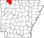 | |
| Towns | ||
| Townships | ||
| Unincorporated communities | ||
| Ghost towns | ||
| Footnotes | ‡This populated place also has portions in an adjacent county or counties | |
This Arkansas-related article is a stub. You can help Wikipedia by expanding it. |