Hope Islands National Park: Difference between revisions
Appearance
Content deleted Content added
m Bot: Migrating 2 langlinks to WP:Wikidata - d:q1108016 |
Magioladitis (talk | contribs) m clean up using AWB (9301) |
||
| Line 1: | Line 1: | ||
| ⚫ | |||
{{distinguish|Hope Island, Queensland}} |
{{distinguish|Hope Island, Queensland}} |
||
| ⚫ | |||
{{ |
{{Infobox protected area of Australia | name = Hope Islands National Park |
||
| iucn_category = II |
| iucn_category = II |
||
| image = Australia_Locator_Map.svg |
| image = Australia_Locator_Map.svg |
||
| Line 16: | Line 16: | ||
| official_site = [http://www.epa.qld.gov.au/projects/park/index.cgi?parkid=198 Hope Islands National Park] |
| official_site = [http://www.epa.qld.gov.au/projects/park/index.cgi?parkid=198 Hope Islands National Park] |
||
}} |
}} |
||
'''Hope Islands National Park''' is a national park in [[Queensland]] ([[Australia]]) 1,521 |
'''Hope Islands National Park''' is a national park in [[Queensland]] ([[Australia]]) 1,521 km north-west of [[Brisbane]]. The park consists of four islands: East Hope and West Hope, Snapper Island and Struck Island. |
||
*The Hope islands are situated approximately 37 |
*The Hope islands are situated approximately 37 km south-east of [[Cooktown, Queensland|Cooktown]] and about 8 km offshore |
||
*[[Struck Island (Queensland)|Struck Island]] is a rocky outcrop just off Thornton Beach and south of [[Cape Tribulation, Queensland|Cape Tribulation]] |
*[[Struck Island (Queensland)|Struck Island]] is a rocky outcrop just off Thornton Beach and south of [[Cape Tribulation, Queensland|Cape Tribulation]] |
||
*[[Snapper Island (Queensland)|Snapper island]] is about two km long and is at the mouth of the [[Daintree River]]. It is about 20 km north of [[Port Douglas, Queensland|Port Douglas]] |
*[[Snapper Island (Queensland)|Snapper island]] is about two km long and is at the mouth of the [[Daintree River]]. It is about 20 km north of [[Port Douglas, Queensland|Port Douglas]] |
||
| Line 34: | Line 34: | ||
[[Category:Protected areas established in 1939]] |
[[Category:Protected areas established in 1939]] |
||
[[Category:1939 establishments in Australia]] |
[[Category:1939 establishments in Australia]] |
||
{{Queensland-protected-area-stub}} |
{{Queensland-protected-area-stub}} |
||
Revision as of 06:36, 25 June 2013
| Hope Islands National Park Error: |state= not defined (help) | |
|---|---|
 | |
| Coordinates | 15°43′53″S 145°27′26″E / 15.73139°S 145.45722°E |
| Established | 1939 |
| Area | 1.74 km² |
Error: |type= not defined (help) | |
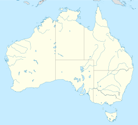
Hope Islands National Park is a national park in Queensland (Australia) 1,521 km north-west of Brisbane. The park consists of four islands: East Hope and West Hope, Snapper Island and Struck Island.
- The Hope islands are situated approximately 37 km south-east of Cooktown and about 8 km offshore
- Struck Island is a rocky outcrop just off Thornton Beach and south of Cape Tribulation
- Snapper island is about two km long and is at the mouth of the Daintree River. It is about 20 km north of Port Douglas
Access is via private vessel or by permitted commercial operators.
The Hope islands were named by Lt James Cook in June 1770 just after his HM Bark Endeavour struck the nearby Endeavour Reef.
See also

