
Rusnė Island: Difference between revisions
+ detail |
+ some on water removal, ref |
||
| Line 48: | Line 48: | ||
'''Rusnė Island''' is an island in [[Nemunas Delta]], [[Šilutė District Municipality]], [[Lithuania]]. It is located between Atmata and Skirvytė, [[distributaries]] of the [[Neman River]], and the [[Curonian Lagoon]]. Rusnė is often named as the largest island of Lithuania.<ref>[http://www.15min.lt/naujiena/aktualu/lietuva/rusnes-salos-gyventojai-mums-uzuojautos-nereikia-56-325213 Rusnės salos gyventojai: „Mums užuojautos nereikia“]</ref> |
'''Rusnė Island''' is an island in [[Nemunas Delta]], [[Šilutė District Municipality]], [[Lithuania]]. It is located between Atmata and Skirvytė, [[distributaries]] of the [[Neman River]], and the [[Curonian Lagoon]]. Rusnė is often named as the largest island of Lithuania.<ref>[http://www.15min.lt/naujiena/aktualu/lietuva/rusnes-salos-gyventojai-mums-uzuojautos-nereikia-56-325213 Rusnės salos gyventojai: „Mums užuojautos nereikia“]</ref> |
||
The island was formed when the Neman River deposited its sediments before flowing into the Curonian Lagoon (see [[alluvial plain]]). Therefore, the elevation does not exceed 1.5 metres. Some parts of the island are 0.27 metres below the sea level which is the lowest elevation in Lithuania.<ref>[http://orai.kasvyksta.lt/silute Orai ir meteorologinės sąlygos Šilutėje]</ref> Therefore, the island is subject to frequent flooding, particularly in spring due to [[ice dam]]s. Floods and regular river flow deposit new sediments increasing the area of the island. The island has several several distributaries of Amata and Skirvytė (Pakalnė, Vorusnė, Skatulė, Rusnaitė, etc.). In addition, it has two rivulets (Naikupė and Ulmas) that are not part of the distributary system.<ref>[http://www.nemunodelta.lt/16975/gamta/hidrografinis-tinklas.html Hidrografinis tinklas]</ref> The nature is protected by the [[Nemunas Delta Regional Park]]. |
The island was formed when the Neman River deposited its sediments before flowing into the Curonian Lagoon (see [[alluvial plain]]). Therefore, the elevation does not exceed 1.5 metres. Some parts of the island are 0.27 metres below the sea level which is the lowest elevation in Lithuania.<ref>[http://orai.kasvyksta.lt/silute Orai ir meteorologinės sąlygos Šilutėje]</ref> Therefore, the island is subject to frequent flooding, particularly in spring due to [[ice dam]]s. Floods and regular river flow deposit new sediments increasing the area of the island. Floodwaters are removed by pumping, using an extensive system of canals and [[polders]].<ref name=ec1>{{cite web|url=http://ec.europa.eu/ourcoast/index.cfm?menuID=7&articleID=74|publisher=[[European Commission]] - Environment - OURCOAST|title=Restoration and conservation of important habitats through sustainable agricultural practices, Rusne - LT|date=08-23-2010|accessdate=06-20-2014}}</ref> |
||
The island has several several distributaries of Amata and Skirvytė (Pakalnė, Vorusnė, Skatulė, Rusnaitė, etc.). In addition, it has two rivulets (Naikupė and Ulmas) that are not part of the distributary system.<ref>[http://www.nemunodelta.lt/16975/gamta/hidrografinis-tinklas.html Hidrografinis tinklas]</ref> The nature is protected by the [[Nemunas Delta Regional Park]]. |
|||
The main businesses in the island are sailing, canoeing tourism, fishing. The town of [[Rusnė]], with 1600 inhabitants, is the largest populated place on the island. Rusnė town has the only bridge to the mainland. The first bridge was completed in 1914 but was destroyed during World War II. The current bridge was rebuilt only in 1974.<ref>[http://www.nemunodelta.lt/16983/kultura/architekturos-vertybes.html Architektūros vertybės]</ref> Rusnė Island Cultural and Information Office operates in Rusnė. |
The main businesses in the island are sailing, canoeing tourism, fishing. The town of [[Rusnė]], with 1600 inhabitants, is the largest populated place on the island. Rusnė town has the only bridge to the mainland. The first bridge was completed in 1914 but was destroyed during World War II. The current bridge was rebuilt only in 1974.<ref>[http://www.nemunodelta.lt/16983/kultura/architekturos-vertybes.html Architektūros vertybės]</ref> Rusnė Island Cultural and Information Office operates in Rusnė. |
||
Revision as of 14:27, 20 June 2014
 | |
| Geography | |
|---|---|
| Standort | Curonian Lagoon |
| Coordinates | 55°17′50″N 21°22′40″E / 55.29722°N 21.37778°E |
| Highest elevation | 1 m (3 ft) |
| Administration | |
| Demographics | |
| Population | 2,000 |
| Pop. density | 43.5/km2 (112.7/sq mi) |
Rusnė Island is an island in Nemunas Delta, Šilutė District Municipality, Lithuania. It is located between Atmata and Skirvytė, distributaries of the Neman River, and the Curonian Lagoon. Rusnė is often named as the largest island of Lithuania.[1]
The island was formed when the Neman River deposited its sediments before flowing into the Curonian Lagoon (see alluvial plain). Therefore, the elevation does not exceed 1.5 metres. Some parts of the island are 0.27 metres below the sea level which is the lowest elevation in Lithuania.[2] Therefore, the island is subject to frequent flooding, particularly in spring due to ice dams. Floods and regular river flow deposit new sediments increasing the area of the island. Floodwaters are removed by pumping, using an extensive system of canals and polders.[3]
The island has several several distributaries of Amata and Skirvytė (Pakalnė, Vorusnė, Skatulė, Rusnaitė, etc.). In addition, it has two rivulets (Naikupė and Ulmas) that are not part of the distributary system.[4] The nature is protected by the Nemunas Delta Regional Park.
The main businesses in the island are sailing, canoeing tourism, fishing. The town of Rusnė, with 1600 inhabitants, is the largest populated place on the island. Rusnė town has the only bridge to the mainland. The first bridge was completed in 1914 but was destroyed during World War II. The current bridge was rebuilt only in 1974.[5] Rusnė Island Cultural and Information Office operates in Rusnė.
Settlements
-
 Bridge between island and mainland
 -
 Rusnė Town
 -
 Šyškrantė
 -
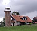 Uostadvaris


References
- ^ Rusnės salos gyventojai: „Mums užuojautos nereikia“
- ^ Orai ir meteorologinės sąlygos Šilutėje
- ^ "Restoration and conservation of important habitats through sustainable agricultural practices, Rusne - LT". European Commission - Environment - OURCOAST. 08-23-2010. Retrieved 06-20-2014.
{{cite web}}: Check date values in:|accessdate=and|date=(help) - ^ Hidrografinis tinklas
- ^ Architektūros vertybės
This Lithuania-related article is a stub. You can help Wikipedia by expanding it. |