Nosy Komba: Difference between revisions
Appearance
Content deleted Content added
→External links: +Wikivoyage |
→top: fixup misconstructed params, to get page out of Category:Location maps with different longitude and latitude precisions |
||
| Line 10: | Line 10: | ||
| width = 220 |
| width = 220 |
||
| lat_deg=13 | lat_min=27 | lat_sec=58 | lat_dir = S |
| lat_deg=13 | lat_min=27 | lat_sec=58 | lat_dir = S |
||
| lon_deg=48 | lon_min=21| |
| lon_deg=48 | lon_min=21| lon_sec=1 |lon_dir=E |
||
| background = #FFFF99 |
| background = #FFFF99 |
||
}} |
}} |
||
| Line 37: | Line 37: | ||
{{-}} |
{{-}} |
||
==References== |
==References== |
||
{{reflist}} |
{{reflist}} |
||
Revision as of 19:34, 26 February 2015
 | |
| Geography | |
|---|---|
| Standort | Madagaskar |
| Coordinates | 13°28′S 48°21′E / 13.47°S 48.35°E |
| Area | 25 km2 (9.7 sq mi) |
| Highest elevation | 622 m (2041 ft) |
| Administration | |

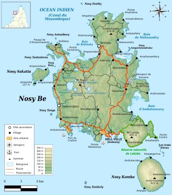
Nosy Komba is a volcanic island off the north west coast of Madagascar, laying between Nosy Be and the main island.[1] It is a popular tourist destination.[2]
References
- ^ [1]
- ^ "La perle secrète de Madagascar". L'Express (in French). 2007-04-02. Retrieved 2014-06-15.
External links
Wikimedia Commons has media related to Nosy Komba.
Wikivoyage has a travel guide for Nosy Komba.
