
Kingston Township, Pennsylvania: Difference between revisions
| Line 66: | Line 66: | ||
==History== |
==History== |
||
===Shavertown |
===Shavertown and Trucksville== |
||
[[Shavertown, Pennsylvania|Shavertown]] is named for an early settler, Philip Shaver. In 1813, Philip purchased the land that would later become Shavertown from William Trucks, the namesake of Trucksville. That same year, Philip sold the northwest portion of his land to John McClellon. This land would be known as McClellonsville, a small village which was later named [[Dallas, Pennsylvania|Dallas]]. By 1818, Philip still owned nearly one thousand acres of land in the [[Back Mountain, Pennsylvania|Back Mountain]] region. |
[[Shavertown, Pennsylvania|Shavertown]] is named for an early settler, Philip Shaver. In 1813, Philip purchased the land that would later become Shavertown from William Trucks, the namesake of Trucksville. That same year, Philip sold the northwest portion of his land to John McClellon. This land would be known as McClellonsville, a small village which was later named [[Dallas, Pennsylvania|Dallas]]. By 1818, Philip still owned nearly one thousand acres of land in the [[Back Mountain, Pennsylvania|Back Mountain]] region. |
||
Revision as of 21:22, 18 December 2017
Kingston Township, Pennsylvania | |
|---|---|
 A relict fence row at Frances Slocum State Park | |
 Map of Luzerne County highlighting Kingston Township | |
 Map of Pennsylvania highlighting Luzerne County | |
| Country | United States |
| State | Pennsylvania |
| County | Luzerne |
| Area | |
| • Total | 13.91 sq mi (36.04 km2) |
| • Land | 13.65 sq mi (35.36 km2) |
| • Water | 0.26 sq mi (0.67 km2) |
| Population (2010) | |
| • Total | 6,999 |
| • Estimate (2016)[2] | 6,935 |
| • Density | 507.91/sq mi (196.11/km2) |
| Time zone | UTC-5 (Eastern (EST)) |
| • Summer (DST) | UTC-4 (EDT) |
| FIPS code | 42-079-39792 |
Kingston Township is a township in Luzerne County, Pennsylvania, United States. The population was 6,999 at the 2010 census.[3] The villages of Trucksville and Shavertown are located within the township. It's home to Frances Slocum State Park. The township is described as "the gateway to the Back Mountain" (a 118 square mile region in northern Luzerne County). The area includes the townships of Dallas, Franklin, Jackson, Kingston, Lake, and Lehman. The region also includes the boroughs of Dallas and Harveys Lake.
History
=Shavertown and Trucksville
Shavertown is named for an early settler, Philip Shaver. In 1813, Philip purchased the land that would later become Shavertown from William Trucks, the namesake of Trucksville. That same year, Philip sold the northwest portion of his land to John McClellon. This land would be known as McClellonsville, a small village which was later named Dallas. By 1818, Philip still owned nearly one thousand acres of land in the Back Mountain region.
Philip Shaver was born in 1762 along the Danube River Valley in Vienna, Austria. He migrated to the United States between 1765-1769 with his parents and brothers. Philip Shaver married Mary Ann Wickizer at St. James Lutheran Church (in Greenwich, Warren County, New Jersey, on December 12, 1786). They had 7 children: John Philip, Peter, William G., Elizabeth, James Henry, George, and Asa W. Shaver. Around 1804, Philip and his family arrived in Forty Fort, where they resided until 1810. Philip came to the “Back of the Mountain” in search of a gigantic species of legendary evergreen trees. He was forced to carve out a path from a rugged foot trail and among heavily forested lands, now Route 309. Philip and his sons constructed a sawmill in 1815. This first mill was on the north branch of Toby Creek and located near the Prince of Peace Church on Main Street in Dallas. Philip cut the wood for the first Market Street Bridge in Wilkes-Barre (in 1820).
It is said that after years of watching children labor on farms, Philip wished that the farm girls and boys should learn to read and write. In 1816, he donated the land for the first school in the Back Mountain. The school was a one-room log cabin on the site of the current Back Mountain Memorial Library on Huntsville Road. Philip also set aside lands for a public burying ground “on the hill near the pine grove just south of Dallas Village, on the road to Huntsville.” Philip also designated a plot of land for his family’s graves, visible from Overbrook Road. In 1826, Philip died after a fatal accident. His left hand was crushed in the cider press that he and his sons were operating in November 1826. Philip was forced to amputate his own hand and died of blood poisoning a few days later on November 7, 1826.
Frances Slocum
Frances Slocum State Park is located in Kingston Township. In 1968, the lake, which is the centerpiece of the park, was built to control flooding in the North Branch Susquehanna River. In 1972, the park became a temporary home to 280 families who were displaced by the Agnes floods. The park was closed to the public; it was not reopened until 1974 when all the families were relocated.
Geography
According to the United States Census Bureau, the township has a total area of 13.9 square miles (36.0 km2), of which 13.7 square miles (35.4 km2) is land and 0.27 square miles (0.7 km2), or 1.87%, is water.
Demographics
| Census | Pop. | Note | %± |
|---|---|---|---|
| 2000 | 7,145 | — | |
| 2010 | 6,999 | −2.0% | |
| 2016 (est.) | 6,935 | [2] | −0.9% |
As of the census[5] of 2000, there were 7,145 people, 2,745 households, and 2,083 families residing in the township. The population density was 526.2 people per square mile (203.1/km2). There were 2,923 housing units at an average density of 215.3 per square mile (83.1/km2). The racial makeup of the township was 98.95% White, 0.24% African American, 0.06% Native American, 0.28% Asian, 0.08% from other races, and 0.39% from two or more races. Hispanic or Latino of any race were 0.38% of the population.
There were 2,745 households, out of which 35.0% had children under the age of 18 living with them, 64.7% were married couples living together, 8.6% had a female householder with no husband present, and 24.1% were non-families. 20.6% of all households were made up of individuals, and 8.9% had someone living alone who was 65 years of age or older. The average household size was 2.60 and the average family size was 3.02.
In the township the population was spread out, with 24.9% under the age of 18, 6.4% from 18 to 24, 28.9% from 25 to 44, 27.1% from 45 to 64, and 12.8% who were 65 years of age or older. The median age was 40 years. For every 100 females there were 96.9 males. For every 100 females age 18 and over, there were 92.2 males.
The median income for a household in the township was $52,997, and the median income for a family was $62,435. Males had a median income of $40,872 versus $30,075 for females. The per capita income for the township was $23,885. About 4.2% of families and 4.8% of the population were below the poverty line, including 6.2% of those under age 18 and 3.6% of those age 65 or over.
-
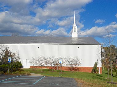 Cross Creek Community Church
 -
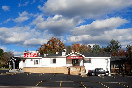 Checkerboard Inn


References
- ^ "2016 U.S. Gazetteer Files". United States Census Bureau. Retrieved Aug 14, 2017.
- ^ a b "Population and Housing Unit Estimates". Retrieved June 9, 2017.
- ^ "Profile of General Population and Housing Characteristics: 2010 Demographic Profile Data (DP-1): Kingston township, Luzerne County, Pennsylvania". U.S. Census Bureau, American Factfinder. Retrieved April 18, 2012.
- ^ "Census of Population and Housing". Census.gov. Retrieved June 4, 2016.
- ^ "American FactFinder". United States Census Bureau. Retrieved 2008-01-31.
