Šavnik: Difference between revisions
m References |
No edit summary |
||
| Line 62: | Line 62: | ||
==Transport== |
==Transport== |
||
Šavnik is situated on a regional road |
Šavnik is situated on a regional road between [[Nikšić]] (45 km) and [[Žabljak]] (15 km), and it is its only link with the rest of Montenegro. |
||
==Population== |
==Population== |
||
Revision as of 11:53, 10 July 2019
This article needs additional citations for verification. (August 2009) |
Šavnik
Шавник | |
|---|---|
Village and municipality | |
 | |
| Coordinates: 42°57′N 19°06′E / 42.95°N 19.10°E | |
| Land | |
| Settlements | 27 |
| Regierung | |
| • Mayor | Velimir Perišić |
| • Ruling party | DPS |
| Area | |
| • Village and municipality | 553 km2 (214 sq mi) |
| Population (2011 census) | |
| • Density | 5.3/km2 (14/sq mi) |
| • Urban | 472 |
| • Rural | 1,598 |
| • Municipality | 2,070 |
| Time zone | UTC+1 (CET) |
| • Summer (DST) | UTC+2 (CEST) |
| Postal code | 81450 |
| Area code | +382 40 |
| ISO 3166-2 code | ME-18 |
| Car plates | ŠN |
| Climate | Cfb |
| Website | www |
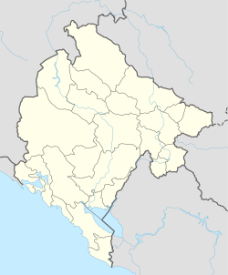
Šavnik (Montenegrin Cyrillic: Шавник, pronounced [ʃǎv̞niːk]) is a town in Montenegro and administrative center of the Šavnik Municipality. It is located at the confluence of three rivers - Bukovica, Bijela and Šavnik, at an altitude of 840 meters. It is the lowest lying settlement in the municipality.
History
Unlike most settlements in the area, which date back several centuries, Šavnik is relatively new, founded only in 1861. It was populated by migrants from other parts of Montenegro and Herzegovina, mostly craftsmen, merchants, riflers and blacksmiths, which were needed by local farmers. The area was overgrown with willows, which the newly formed town was named after (šavice – willow branches or seams, which were used as a roof covering).[1]
Before the construction of first houses on the site of today's town, there were two mills on Šavnik River. The first three houses that were built in Šavnik were a tavern with a shop, rifle repair shop and a blacksmith shop.[2] The town quickly became a center for the Drobnjaci region, and incorporated a post office, school, primary court, and military post.[3]
Industrialization during the SFR Yugoslavia era mostly bypassed Šavnik, so did all major transit road or rail links, and economy of town went into stagnation. Population of Šavnik and entire municipality is since in slow but steady decline. Most of the residents are migrating to Nikšić and southern Montenegro, and Šavnik is often a synonym for a poor and deteriorating town.
The new road Risan - Nikšić - Šavnik - Žabljak (P5), and proximity of Žabljak as a main mountain tourist resort in Montenegro may boost Šavnik's economic prospects.
Transport
Šavnik is situated on a regional road between Nikšić (45 km) and Žabljak (15 km), and it is its only link with the rest of Montenegro.
Population
Šavnik is administrative centre of Šavnik municipality, which in 2011 had a population of 2,070. The town of Šavnik itself has 472 citizens.
Town population
Population of Šavnik:
- 1981 - 633
- 1991 - 821
- 2003 - 571
- 2011 - 472
Ethnic groups (2003 census):
- Montenegrins (58,94 %)
- Serbs (30.0%)
See also
References
- ^ "Nepokretna baština Crne Gore - ŠAVNIK". https://portalanalitika.me (in Bosnian). Retrieved 2018-11-07.
{{cite news}}: External link in|work= - ^ "Opština Šavnik | Istorija". www.savnik.me. Retrieved 2018-11-07.
- ^ "Savnik". Eko zona Durmitor (in Serbian). 2011-02-26. Retrieved 2018-11-07.


