
Crawford, Mississippi: Difference between revisions
Ken Gallager (talk | contribs) →Notable people: alpha |
GreenC bot (talk | contribs) Move 4 urls. Wayback Medic 2.5 |
||
| Line 47: | Line 47: | ||
<!-- Population --> |
<!-- Population --> |
||
|population_as_of = [[2010 United States Census|2010]] |
|population_as_of = [[2010 United States Census|2010]] |
||
|population_footnotes = <ref name="Census2010">[ |
|population_footnotes = <ref name="Census2010">[https://www.census.gov "Crawford town, Mississippi: Population,"] American Fact Finder, US Census Bureau.</ref> |
||
|population_total = 641 |
|population_total = 641 |
||
|population_density_km2 = 180.34 |
|population_density_km2 = 180.34 |
||
| Line 78: | Line 78: | ||
== Geography == |
== Geography == |
||
[[File:City Hall, Crawford, Mississippi.JPG|right|thumb|City Hall, Crawford]] |
[[File:City Hall, Crawford, Mississippi.JPG|right|thumb|City Hall, Crawford]] |
||
Crawford is located at {{coord|33|18|22|N|88|37|19|W|type:city}} (33.306205, -88.621933).<ref name="GR1">{{cite web|url=https://www.census.gov/ |
Crawford is located at {{coord|33|18|22|N|88|37|19|W|type:city}} (33.306205, -88.621933).<ref name="GR1">{{cite web|url=https://www.census.gov/geographies/reference-files/time-series/geo/gazetteer-files.html|publisher=[[United States Census Bureau]]|accessdate=2011-04-23|date=2011-02-12|title=US Gazetteer files: 2010, 2000, and 1990}}</ref> |
||
According to the [[United States Census Bureau]], the town has a total area of {{convert|1.4|sqmi|km2}}, all land. |
According to the [[United States Census Bureau]], the town has a total area of {{convert|1.4|sqmi|km2}}, all land. |
||
| Line 101: | Line 101: | ||
|estimate=652 |
|estimate=652 |
||
|estref=<ref name="USCensusEst2018">{{cite web|url=https://www.census.gov/programs-surveys/popest/data/tables.2018.html|title=Population and Housing Unit Estimates|accessdate=March 12, 2020}}</ref> |
|estref=<ref name="USCensusEst2018">{{cite web|url=https://www.census.gov/programs-surveys/popest/data/tables.2018.html|title=Population and Housing Unit Estimates|accessdate=March 12, 2020}}</ref> |
||
|footnote=U.S. Decennial Census<ref name="DecennialCensus">{{cite web|url=https://www.census.gov/ |
|footnote=U.S. Decennial Census<ref name="DecennialCensus">{{cite web|url=https://www.census.gov/programs-surveys/decennial-census.html|title=Census of Population and Housing|publisher=Census.gov|accessdate=June 4, 2015}}</ref> |
||
}} |
}} |
||
As of the [[2010 United States Census]], there were 641 people living in the town. 89.9% were [[African American (U.S. Census)|African American]], 8.0% [[White (U.S. Census)|White]], 0.6% [[Native American (U.S. Census)|Native American]] and 1.6% [[Multiracial American|of two or more races]]. 0.6% were [[Hispanic (U.S. Census)|Hispanic]] or [[Latino (U.S. Census)|Latino]] of any race. |
As of the [[2010 United States Census]], there were 641 people living in the town. 89.9% were [[African American (U.S. Census)|African American]], 8.0% [[White (U.S. Census)|White]], 0.6% [[Native American (U.S. Census)|Native American]] and 1.6% [[Multiracial American|of two or more races]]. 0.6% were [[Hispanic (U.S. Census)|Hispanic]] or [[Latino (U.S. Census)|Latino]] of any race. |
||
As of the [[census]]<ref name="GR2">{{cite web | |
As of the [[census]]<ref name="GR2">{{cite web |url=https://www.census.gov |publisher=[[United States Census Bureau]] |accessdate=2008-01-31 |title=U.S. Census website }}</ref> of 2000, there were 655 people, 209 households, and 163 families living in the town. The [[population density]] was 466.7 people per square mile (180.6/km²). There were 251 housing units at an average density of 178.9 per square mile (69.2/km²). The racial makeup of the town was 93.13% [[African American (U.S. Census)|African American]], 5.95% [[White (U.S. Census)|White]], 0.31% [[Native American (U.S. Census)|Native American]], 0.15% from [[Race (United States Census)|other races]], and 0.46% from two or more races. [[Hispanic (U.S. Census)|Hispanic]] or [[Latino (U.S. Census)|Latino]] of any race were 0.61% of the population. |
||
There were 309 households out of which 45.0% had children under the age of 18 living with them, 31.6% were [[Marriage|married couples]] living together, 42.1% had a female householder with no husband present, and 22.0% were non-families. 20.6% of all households were made up of individuals and 7.7% had someone living alone who was 65 years of age or older. The average household size was 3.13 and the average family size was 3.67. |
There were 309 households out of which 45.0% had children under the age of 18 living with them, 31.6% were [[Marriage|married couples]] living together, 42.1% had a female householder with no husband present, and 22.0% were non-families. 20.6% of all households were made up of individuals and 7.7% had someone living alone who was 65 years of age or older. The average household size was 3.13 and the average family size was 3.67. |
||
Revision as of 03:55, 10 April 2020
Crawford, Mississippi | |
|---|---|
 Location of Crawford, Mississippi | |
 Crawford, Mississippi Location in the United States | |
| Coordinates: 33°18′22″N 88°37′19″W / 33.30611°N 88.62194°W | |
| Land | |
| State | |
| County | Lowndes |
| Area | |
| • Total | 1.40 sq mi (3.63 km2) |
| • Land | 1.40 sq mi (3.63 km2) |
| • Water | 0.00 sq mi (0.00 km2) |
| Elevation | 312 ft (95 m) |
| Population | |
| • Total | 641 |
| • Estimate (2018)[3] | 652 |
| • Density | 467.14/sq mi (180.34/km2) |
| Time zone | UTC-6 (Central (CST)) |
| • Summer (DST) | UTC-5 (CDT) |
| ZIP code | 39743 |
| Area code | 662 |
| FIPS code | 28-16420 |
| GNIS feature ID | 0668933 |
Crawford is a small town in Lowndes County, Mississippi, United States. The population was 641 at the 2010 census.
Geography

Crawford is located at 33°18′22″N 88°37′19″W / 33.30611°N 88.62194°W (33.306205, -88.621933).[4]
According to the United States Census Bureau, the town has a total area of 1.4 square miles (3.6 km2), all land.
Demographics
| Census | Pop. | Note | %± |
|---|---|---|---|
| 1880 | 304 | — | |
| 1890 | 225 | −26.0% | |
| 1900 | 389 | 72.9% | |
| 1910 | 396 | 1.8% | |
| 1920 | 323 | −18.4% | |
| 1930 | 349 | 8.0% | |
| 1940 | 380 | 8.9% | |
| 1950 | 374 | −1.6% | |
| 1960 | 317 | −15.2% | |
| 1970 | 391 | 23.3% | |
| 1980 | 495 | 26.6% | |
| 1990 | 668 | 34.9% | |
| 2000 | 655 | −1.9% | |
| 2010 | 641 | −2.1% | |
| 2018 (est.) | 652 | [3] | 1.7% |
| U.S. Decennial Census[5] | |||
As of the 2010 United States Census, there were 641 people living in the town. 89.9% were African American, 8.0% White, 0.6% Native American and 1.6% of two or more races. 0.6% were Hispanic or Latino of any race.
As of the census[6] of 2000, there were 655 people, 209 households, and 163 families living in the town. The population density was 466.7 people per square mile (180.6/km²). There were 251 housing units at an average density of 178.9 per square mile (69.2/km²). The racial makeup of the town was 93.13% African American, 5.95% White, 0.31% Native American, 0.15% from other races, and 0.46% from two or more races. Hispanic or Latino of any race were 0.61% of the population.
There were 309 households out of which 45.0% had children under the age of 18 living with them, 31.6% were married couples living together, 42.1% had a female householder with no husband present, and 22.0% were non-families. 20.6% of all households were made up of individuals and 7.7% had someone living alone who was 65 years of age or older. The average household size was 3.13 and the average family size was 3.67.
In the town, the population was spread out with 41.5% under the age of 18, 9.0% from 18 to 24, 25.6% from 25 to 44, 17.1% from 45 to 64, and 6.7% who were 65 years of age or older. The median age was 24 years. For every 100 females, there were 75.1 males. For every 100 females age 18 and over, there were 67.2 males.
The median income for a household in the town was $16,786, and the median income for a family was $16,058. Males had a median income of $24,107 versus $14,359 for females. The per capita income for the town was $7,123. About 45.5% of families and 45.7% of the population are below the poverty line, including 60.5% of those under age 18 and 35.3% of those age 65 or over.
Bildung
The Town of Crawford is served by the Lowndes County School District.
Notable people
- Sam Hairston, former Negro league baseball and MLB player
- Jerry Rice, NFL first ballot Hall of Fame wide receiver
- Don "Cadillac Don" Sharp, rap/hip-hop artist
- Clarence Weatherspoon, NBA player
- Big Joe Williams, Mississippi Musicians Hall of Fame blues singer and guitarist; born in Crawford in 1903
References
- ^ "2017 U.S. Gazetteer Files". United States Census Bureau. Retrieved Jan 6, 2019.
- ^ "Crawford town, Mississippi: Population," American Fact Finder, US Census Bureau.
- ^ a b "Population and Housing Unit Estimates". Retrieved March 12, 2020.
- ^ "US Gazetteer files: 2010, 2000, and 1990". United States Census Bureau. 2011-02-12. Retrieved 2011-04-23.
- ^ "Census of Population and Housing". Census.gov. Retrieved June 4, 2015.
- ^ "U.S. Census website". United States Census Bureau. Retrieved 2008-01-31.
Municipalities and communities of Lowndes County, Mississippi, United States | ||
|---|---|---|
| City | 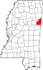 | |
| Towns | ||
| CDPs | ||
| Unincorporated communities | ||
| Ghost towns | ||